Lowdens Copse

Wood, Forest in Wiltshire

England

Lowdens Copse

The King's Head, Whiteparish
The King's Head, Whiteparish Credit: Roger Cornfoot

Lowdens Copse is a picturesque woodland located in the county of Wiltshire, England. Spanning over a vast area, this forest is a haven for nature enthusiasts and offers a tranquil escape from the hustle and bustle of everyday life.

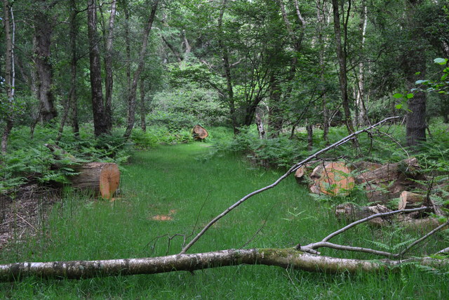
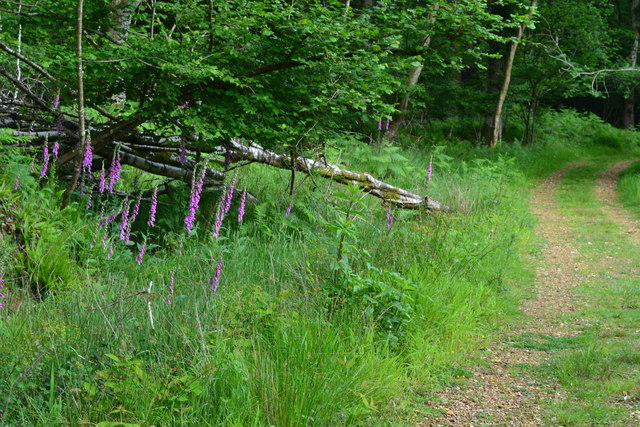
The copse is characterized by its diverse range of tree species, including oak, beech, and ash, which create a dense canopy and provide a habitat for a variety of wildlife. Walking through the forest, visitors can enjoy the sight of vibrant wildflowers, such as bluebells and primroses, which carpet the forest floor during the spring and summer months.

In addition to its natural beauty, Lowdens Copse boasts a network of well-maintained trails, making it a popular destination for hiking and cycling. The paths wind through the trees, offering glimpses of hidden clearings and small streams that meander through the forest. Along the way, visitors may encounter deer, foxes, and a wide array of bird species, making it a paradise for wildlife enthusiasts and birdwatchers.

The copse is also home to a variety of historical features, including the remnants of an ancient settlement and a traditional charcoal kiln. These relics serve as a testament to the area's rich history and provide a fascinating glimpse into the lives of those who once inhabited the forest.

Whether it's a leisurely stroll, a challenging hike, or simply a moment of tranquility amidst nature, Lowdens Copse offers something for everyone. With its natural beauty, abundant wildlife, and historical significance, it remains a beloved destination for locals and visitors alike.

If you have any feedback on the listing, please let us know in the comments section below.

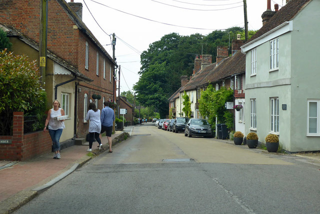
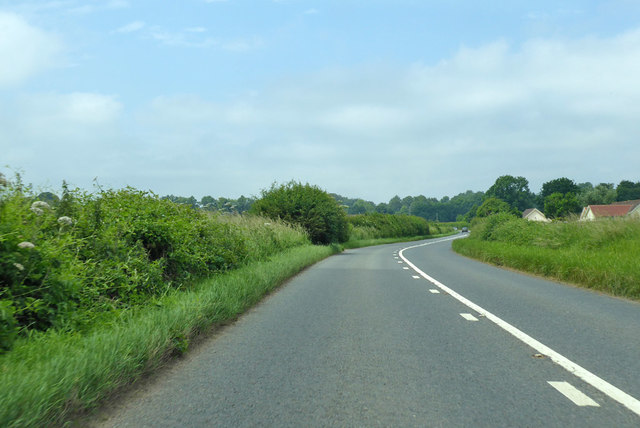
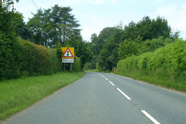
Lowdens Copse Images

Images are sourced within 2km of 51.002445/-1.6715795 or Grid Reference SU2322. Thanks to Geograph Open Source API. All images are credited.

The King's Head, Whiteparish
A36 Salisbury Road Towards Salisbury.
A36 Salisbury Road
Towards Salisbury.
A36 Salisbury Road Towards Salisbury.
A36 Salisbury Road
Towards Salisbury.
A36 Salisbury Road Towards Salisbury.
A36 Salisbury Road
Towards Salisbury.
Brickworth Corner Looking along the A36 towards Salisbury. The A27 is on the right, while the left turn is the entrance to Brickworth Quarry.
Brickworth Corner
Looking along the A36 towards Salisbury. The A27 is on the right, while the left turn is the entrance to Brickworth Quarry.
Old Milestone by the A27, Brickworth Road, Whiteparish Carved stone post by the A27, in parish of WHITEPARISH (SALISBURY District), Brickworth Road; 10m West of junction with Martins Rise (new housing development), on the verge, on North side of road. Erected by the Whiteparish, Romsey & Southampton turnpike trust in the 18th century.

Inscription reads:- : 8 / Miles To / Romsey / To / Sarum / 7 :
Carved benchmark front lower right.

Milestone Society National ID: WI_SARM07.
Old Milestone by the A27, Brickworth Road, Whiteparish
Carved stone post by the A27, in parish of WHITEPARISH (SALISBURY District), Brickworth Road; 10m West of junction with Martins Rise (new housing development), on the verge, on North side of road. Erected by the Whiteparish, Romsey & Southampton turnpike trust in the 18th century. Inscription reads:- : 8 / Miles To / Romsey / To / Sarum / 7 : Carved benchmark front lower right. Milestone Society National ID: WI_SARM07.
Brickworth Garage at junction of A27 and A36
Brickworth Road near Firlands
Fallen and sawn wood in Langley Wood
Foxgloves beside the path, Langley Wood
Whiteparish, All Saints
Whiteparish: red brick and flint At the time of taking the photograph I assumed that the building with flintwork panels was some sort of converted mill or maltings.  Examining the image on screen later, I have to say that the brickwork and roofing look so neat that I can only conclude that they are 'new build'.  Good, anyway, that local traditions have been respected.

The view is south-west along the main village street - which also happens to be the A27.
Whiteparish: red brick and flint
At the time of taking the photograph I assumed that the building with flintwork panels was some sort of converted mill or maltings. Examining the image on screen later, I have to say that the brickwork and roofing look so neat that I can only conclude that they are 'new build'. Good, anyway, that local traditions have been respected. The view is south-west along the main village street - which also happens to be the A27.
Whiteparish: the main village street View south-westward.  The pub is the 'Parish Lantern', the road is part of the A27.
Whiteparish: the main village street
View south-westward. The pub is the 'Parish Lantern', the road is part of the A27.
Whiteparish: the 'Parish Lantern' Pub by the A27.
Whiteparish: the 'Parish Lantern'
Pub by the A27.
The Street, Whiteparish The road is the A27, not resembling the important trunk road it is further east.
The Street, Whiteparish
The road is the A27, not resembling the important trunk road it is further east.
A27 towards Salisbury Nearly at the western end of the A27, the A36 takes the traveller the rest of the way to Salisbury.
A27 towards Salisbury
Nearly at the western end of the A27, the A36 takes the traveller the rest of the way to Salisbury.
Near the end of the A27 At the lights the road joins the A36. This is the western end of the A27, the eastern end is at Pevensey, East Sussex. In between the road takes a great many forms, sometimes adequate for the traffic and quite often inadequate. This end seems the least busy.
Near the end of the A27
At the lights the road joins the A36. This is the western end of the A27, the eastern end is at Pevensey, East Sussex. In between the road takes a great many forms, sometimes adequate for the traffic and quite often inadequate. This end seems the least busy.
A36 towards Salisbury A much busier route than the A27, which joins it somewhat south of this lay-by.
A36 towards Salisbury
A much busier route than the A27, which joins it somewhat south of this lay-by.
Show me another place!

Lowdens Copse is located at Grid Ref: SU2322 (Lat: 51.002445, Lng: -1.6715795)

Unitary Authority: Wiltshire

Police Authority: Wiltshire

What 3 Words

///broth.brass.drums. Near Whiteparish, Wiltshire

Related Wikis

Whiteparish

Whiteparish is a village and civil parish on the A27 about 7.5 miles (12.1 km) southeast of Salisbury in Wiltshire, England. The village is about 1.5...

Langley Wood and Homan's Copse

Langley Wood and Homan's Copse (grid reference SU230206) is a 219.28 hectare biological Site of Special Scientific Interest in Wiltshire, notified in 1985...

Whiteparish Common

Whiteparish Common (grid reference SU255233) is a 64.5 hectare biological Site of Special Scientific Interest near Whiteparish, Wiltshire, England, notified...

The Pepperbox

The Pepperbox, also known as Eyre's Folly, is a folly tower that stands near the highest point on Pepperbox Hill, the peak of a chalk ridge about 5 miles...

Nearby Amenities

Located within 500m of 51.002445,-1.6715795
Barrier: stile
Lat/Long: 50.999678/-1.6765846
Barrier: stile
Lat/Long: 51.0010395/-1.6734838
Post Box
Operator: Royal Mail
Post Box Type: lamp
Ref: SP5 135D
Royal Cypher: EIIR
Royal Cypher Wikidata: Q33102113
Lat/Long: 51.003473/-1.6652032
Barrier: stile
Lat/Long: 51.0057087/-1.6688558
Newton
Place: hamlet
Lat/Long: 51.0035203/-1.6647172
The data included in this document is from www.openstreetmap.org. The data is made available under ODbL.

Have you been to Lowdens Copse?

Leave your review of Lowdens Copse below (or comments, questions and feedback).