Wither Wood

Wood, Forest in Yorkshire

England

Wither Wood

The Foresters Arms Public house and restaurant in Lower Cumberworth
The Foresters Arms Credit: Graham Hogg

Wither Wood is a picturesque woodland located in the county of Yorkshire, England. Situated in the heart of the region, this enchanting forest is known for its natural beauty and tranquil atmosphere. Spanning over an area of approximately 100 acres, Wither Wood offers a diverse range of flora and fauna, making it a popular destination for nature lovers and outdoor enthusiasts.

The woodland is predominantly made up of deciduous trees, such as oak, beech, and ash, which provide a stunning display of vibrant colors during the autumn season. The forest floor is adorned with a variety of wildflowers, creating a vibrant and colorful carpet.

One of the main attractions of Wither Wood is its extensive network of walking trails. These well-maintained paths allow visitors to explore the forest at their own pace, taking in the sights and sounds of nature. Along the trails, you may encounter various wildlife species, including deer, rabbits, and a variety of birds.

Wither Wood also boasts a small, serene lake nestled within its boundaries. The tranquil waters reflect the surrounding trees, creating a peaceful and idyllic setting. The lake provides a perfect spot for picnics or simply unwinding amidst the beauty of nature.

In addition to its natural beauty, Wither Wood has historical significance as well. The forest is believed to have existed for hundreds of years and has witnessed the passage of time, making it an important part of the local heritage.

Overall, Wither Wood in Yorkshire offers a haven of tranquility and natural splendor. Its diverse ecosystem, picturesque trails, and serene lake make it a must-visit destination for those seeking a peaceful retreat in the heart of nature.

If you have any feedback on the listing, please let us know in the comments section below.
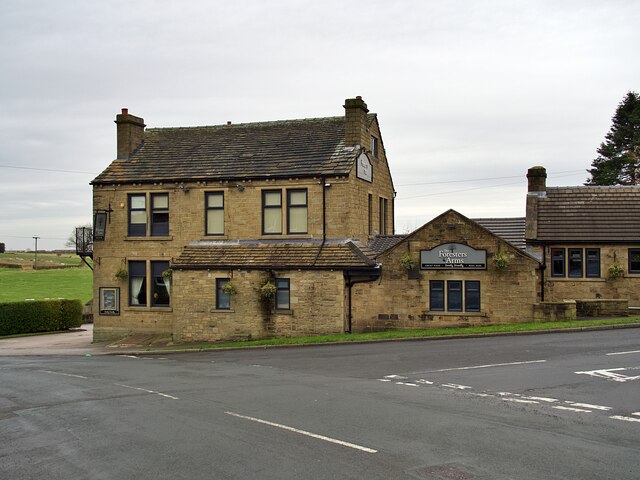
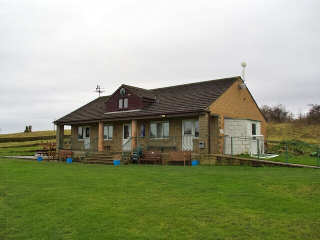
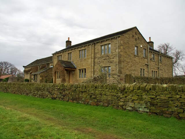
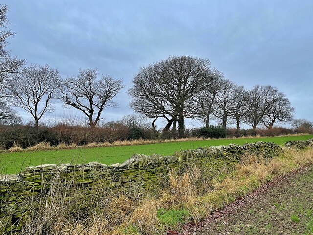
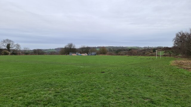
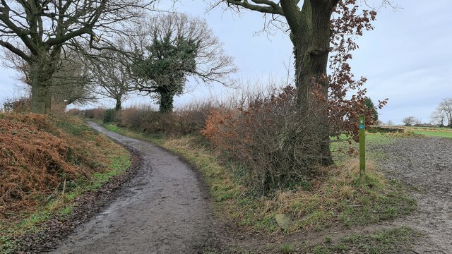
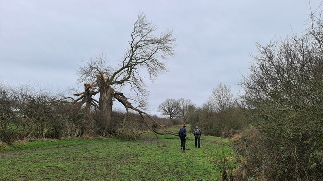
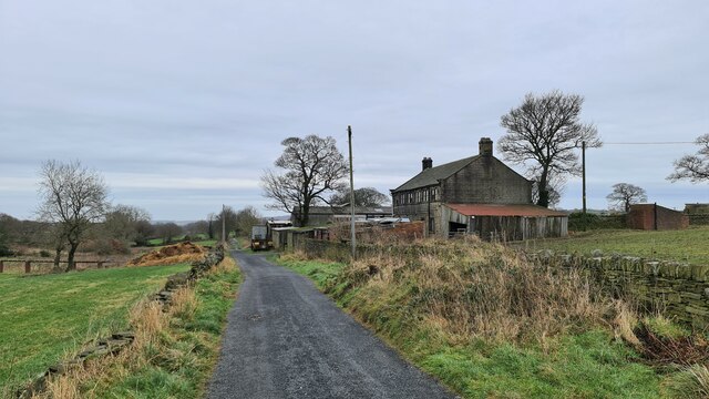
Wither Wood Images

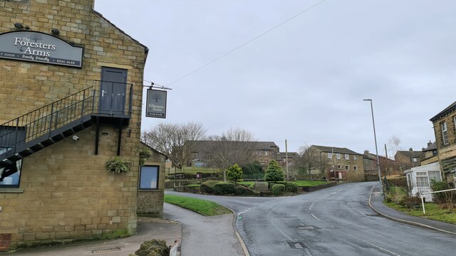
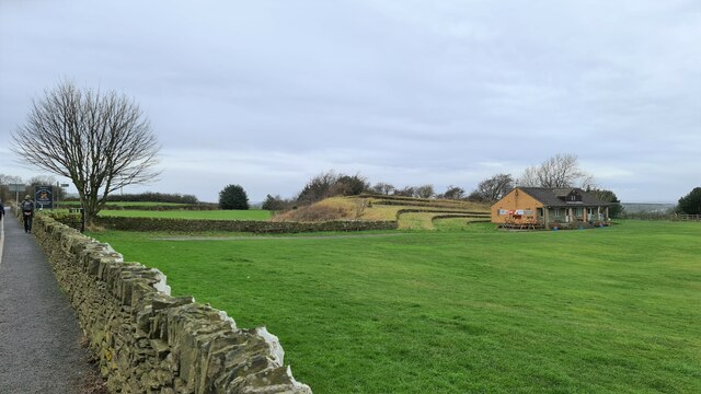
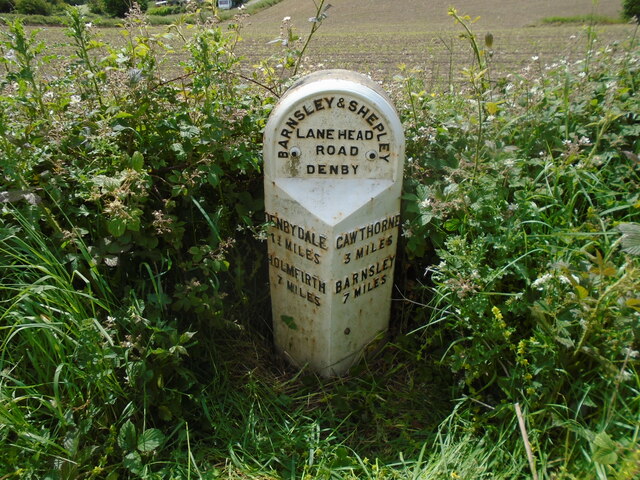
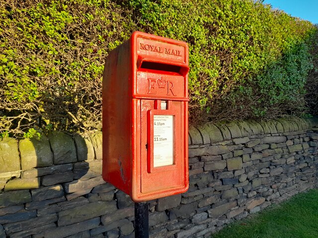
Images are sourced within 2km of 53.578588/-1.6565932 or Grid Reference SE2209. Thanks to Geograph Open Source API. All images are credited.

The Foresters Arms Public house and restaurant in Lower Cumberworth
The Foresters Arms
Public house and restaurant in Lower Cumberworth
Cumberworth United Cricket Club Pavilion
Long Royd Farm
Long Royd Farm
Drystone wall in need of repair
Recreation Ground, Skelmanthorpe
Gilthwaites Lane
Gilthwaites Lane
How the mighty have fallen Ash died back
How the mighty have fallen
Ash died back
Lane Hackings Green
Lane Hackings Green
Cumberworth Lane, Lower Cumberworth
Cumberworth United Cricket Club ground
Long Royd
Long Royd
Old milestone Vegetation had to be cleared to reveal this West Riding CC milestone.  It is one of 615 set up in 1893/94 for the newly formed West Riding Council all over its extensive 'territory' from Sedbergh in the north west to south of Rotherham and over the Pennines into Saddleworth.   Over half are still in situ.  It is on the south side of the A635 between Denby Lane and Lower Denby Lane.
Old milestone
Vegetation had to be cleared to reveal this West Riding CC milestone. It is one of 615 set up in 1893/94 for the newly formed West Riding Council all over its extensive 'territory' from Sedbergh in the north west to south of Rotherham and over the Pennines into Saddleworth. Over half are still in situ. It is on the south side of the A635 between Denby Lane and Lower Denby Lane.
Old milestone A view of the milestone on the A635 between Denby Lane and Low Denby Lane before the grass had been trodden down.  Grade II listed 1135324.
Old milestone
A view of the milestone on the A635 between Denby Lane and Low Denby Lane before the grass had been trodden down. Grade II listed 1135324.
Old milestone A view of the 8 miles from Barnsley milestone under the arch of the railway viaduct at Denby Dale.  Trains from Barnsley approach from the left and the station is a short distance to the right across the A636 Wakefield Road.
Old milestone
A view of the 8 miles from Barnsley milestone under the arch of the railway viaduct at Denby Dale. Trains from Barnsley approach from the left and the station is a short distance to the right across the A636 Wakefield Road.
Old milestone This is the last late 19C West Riding CC milestone between Barnsley and Shepley Lane Head.   There would have been two more but they are missing.   Many of the metal attachments had the foundry name on the bevel but the ones on this route haven't so we don't know where they were forged.   On this milestone the four fixing points for the attachment to the backing stone can be seen.  Grade II listed 1135325.
Old milestone
This is the last late 19C West Riding CC milestone between Barnsley and Shepley Lane Head. There would have been two more but they are missing. Many of the metal attachments had the foundry name on the bevel but the ones on this route haven't so we don't know where they were forged. On this milestone the four fixing points for the attachment to the backing stone can be seen. Grade II listed 1135325.
Post Box at Upper Denby HD8 236. Royal Mail list this box as 'Upper Denby'.
Post Box at Upper Denby
HD8 236. Royal Mail list this box as 'Upper Denby'.
Old milestone One of the five remaining West Riding CC milestones with a protruding attachment still to be seen on this route, A636, from Wakefield to Denby Dale.  It is at the northeastern end of Denby Dale, although apparently this area was in Skelmanthorpe parish.  It is close to the entrance to Putting Mill Walk.   Grade II listed 1185069.
Old milestone
One of the five remaining West Riding CC milestones with a protruding attachment still to be seen on this route, A636, from Wakefield to Denby Dale. It is at the northeastern end of Denby Dale, although apparently this area was in Skelmanthorpe parish. It is close to the entrance to Putting Mill Walk. Grade II listed 1185069.
Old milestone This West Riding CC milestone is seen when leaving Denby Dale just beyond the railway viaduct and before the junction with the A635 from Barnsley.   Only a few of these flat castings were made, usually where there was no space for the protruding style.  However this one is unique.   It is the only one of the surviving flat castings which is not divided by a central raised line.   This is because Denby Dale and Wakefield are in the same direction.  Another difference is that the foundry name is at the centre top instead of on the left side.   It is Grade II listed 1135309.
Old milestone
This West Riding CC milestone is seen when leaving Denby Dale just beyond the railway viaduct and before the junction with the A635 from Barnsley. Only a few of these flat castings were made, usually where there was no space for the protruding style. However this one is unique. It is the only one of the surviving flat castings which is not divided by a central raised line. This is because Denby Dale and Wakefield are in the same direction. Another difference is that the foundry name is at the centre top instead of on the left side. It is Grade II listed 1135309.
Show me another place!

Wither Wood is located at Grid Ref: SE2209 (Lat: 53.578588, Lng: -1.6565932)

Division: West Riding

Unitary Authority: Kirklees

Police Authority: West Yorkshire

What 3 Words

///watch.snappy.quaking. Near Denby Dale, West Yorkshire

Related Wikis

Denby Dale

Denby Dale is a village and civil parish in the metropolitan borough of Kirklees in West Yorkshire, England. It is 10 miles (17 km) to the south-east of...

Denby Dale railway station

Denby Dale railway station serves the village of Denby Dale, in West Yorkshire, England and the surrounding area. It lies on the Penistone Line 9.5 miles...

Denby Dale Viaduct

Denby Dale Viaduct is a grade II listed railway viaduct in Denby Dale, West Yorkshire, England. The curving viaduct carries the Penistone line over the...

Lower Cumberworth

Lower Cumberworth is a village in the borough of Kirklees, West Yorkshire, England. The village is situated 8 miles (13 km) to the south-east of Huddersfield...

Nearby Amenities

Located within 500m of 53.578588,-1.6565932
Bus Stop
Gilthwaites Crescent Gilthwaite Top
Bus: yes
Local Ref: 45020878
Naptan AtcoCode: 450020878
Naptan Bearing: SE
Naptan CommonName: Gilthwaites Crescent Gilthwaite Top
Naptan Crossing: Gilthwaites Top
Naptan Indicator: Stop 45020878
Naptan Landmark: School
Naptan PlusbusZoneRef: LEEDS
Naptan ShortCommonName: Gilthwaites Top
Naptan Street: Gilthwaites Crescent
Naptan Verified: no
Public Transport: platform
Shelter: yes
Source: naptan_import
Lat/Long: 53.5779529/-1.6492434
Bus Stop
Cumberworth Lane Bromley Park
Bus: yes
Local Ref: 45023670
Naptan AtcoCode: 450023670
Naptan Bearing: NW
Naptan CommonName: Cumberworth Lane Bromley Park
Naptan Crossing: Twixt Leak Hall Farm & Top Road
Naptan Indicator: Stop 45023670
Naptan PlusbusZoneRef: LEEDS
Naptan ShortCommonName: Park Lane
Naptan Street: Cumberworth Lane
Naptan Verified: no
Public Transport: platform
Source: naptan_import
Lat/Long: 53.5778183/-1.6622462
Bus Stop
Gilthwaites Lane Rockwood Rise
Bus: yes
Local Ref: 45025143
Naptan AtcoCode: 450025143
Naptan Bearing: NW
Naptan CommonName: Gilthwaites Lane Rockwood Rise
Naptan Crossing: Gilthwaites Top
Naptan Indicator: Stop 45025143
Naptan PlusbusZoneRef: LEEDS
Naptan ShortCommonName: Gilthwaites Top
Naptan Street: Gilthwaites Lane
Naptan Verified: no
Public Transport: platform
Source: naptan_import
Lat/Long: 53.5775606/-1.650785
Cumberworth Lane
Local Ref: 45051311
Naptan AtcoCode: 450051311
Naptan Bearing: SE
Naptan BusStopType: CUS
Naptan CommonName: Cumberworth Lane
Naptan Crossing: Twixt Top Road & Leak Hall Farm
Naptan Indicator: Stop 45051311
Naptan PlusbusZoneRef: LEEDS
Naptan ShortCommonName: Wither Wood
Naptan Street: Cumberworth Lane
Naptan Verified: no
Source: naptan_import
Lat/Long: 53.5778719/-1.6621552
Cumberworth Lane Wither Wood
Local Ref: 45051021
Naptan AtcoCode: 450051021
Naptan Bearing: S
Naptan BusStopType: CUS
Naptan CommonName: Cumberworth Lane Wither Wood
Naptan Crossing: Nr-Opp Top Road
Naptan Indicator: Stop 45051021
Naptan PlusbusZoneRef: LEEDS
Naptan ShortCommonName: Wither Wood
Naptan Street: Cumberworth Lane
Naptan Verified: no
Source: naptan_import
Lat/Long: 53.5793961/-1.6639706
Turning Circle
Leak Hall Crescent
Turning Circle: hammer
Lat/Long: 53.5753285/-1.6553202
Turning Circle
Lane Hackings
Lat/Long: 53.5808446/-1.6622967
Barrier: stile
Step Count: 4
Stile: ladder
Lat/Long: 53.5795137/-1.6564742
Barrier: kissing_gate
Lat/Long: 53.5826698/-1.6575558
Barrier: stile
Step Count: 1
Stile: stepover
Lat/Long: 53.5768136/-1.6601503
Barrier: stile
Stile: stepover
Lat/Long: 53.5772179/-1.6594392
Turning Circle
Lat/Long: 53.5793121/-1.6494795
Generator Method: photovoltaic
Generator Output Electricity: yes
Generator Source: solar
Generator Type: solar_photovoltaic_panel
Note: roof household
Power: generator
Lat/Long: 53.5780996/-1.6510949
Generator Method: photovoltaic
Generator Output Electricity: yes
Generator Source: solar
Generator Type: solar_photovoltaic_panel
Note: roof household
Power: generator
Lat/Long: 53.5781493/-1.6510175
Generator Method: photovoltaic
Generator Output Electricity: yes
Generator Source: solar
Generator Type: solar_photovoltaic_panel
Note: roof household
Power: generator
Lat/Long: 53.5782338/-1.6508794
Generator Method: photovoltaic
Generator Output Electricity: yes
Generator Source: solar
Generator Type: solar_photovoltaic_panel
Note: roof household
Power: generator
Lat/Long: 53.5782822/-1.6507999
Generator Method: photovoltaic
Generator Output Electricity: yes
Generator Source: solar
Generator Type: solar_photovoltaic_panel
Note: roof household
Power: generator
Lat/Long: 53.5784983/-1.6504003
Generator Method: photovoltaic
Generator Output Electricity: yes
Generator Source: solar
Generator Type: solar_photovoltaic_panel
Note: roof household
Power: generator
Lat/Long: 53.5785493/-1.6503146
Generator Method: photovoltaic
Generator Output Electricity: yes
Generator Source: solar
Generator Type: solar_photovoltaic_panel
Note: roof household
Power: generator
Lat/Long: 53.5779369/-1.6507894
Generator Method: photovoltaic
Generator Output Electricity: yes
Generator Source: solar
Generator Type: solar_photovoltaic_panel
Note: roof household
Power: generator
Lat/Long: 53.5780201/-1.6506472
Generator Method: photovoltaic
Generator Output Electricity: yes
Generator Source: solar
Generator Type: solar_photovoltaic_panel
Note: roof household
Power: generator
Lat/Long: 53.5781617/-1.6504045
Generator Method: photovoltaic
Generator Output Electricity: yes
Generator Source: solar
Generator Type: solar_photovoltaic_panel
Note: roof household
Power: generator
Lat/Long: 53.5782089/-1.6503187
Generator Method: photovoltaic
Generator Output Electricity: yes
Generator Source: solar
Generator Type: solar_photovoltaic_panel
Note: roof household
Power: generator
Lat/Long: 53.5781841/-1.6501556
Generator Method: photovoltaic
Generator Output Electricity: yes
Generator Source: solar
Generator Type: solar_photovoltaic_panel
Power: generator
Lat/Long: 53.5778177/-1.6508124
Generator Method: photovoltaic
Generator Output Electricity: yes
Generator Source: solar
Generator Type: solar_photovoltaic_panel
Power: generator
Lat/Long: 53.5777755/-1.6507267
Generator Method: photovoltaic
Generator Output Electricity: yes
Generator Source: solar
Generator Type: solar_photovoltaic_panel
Note: roof household
Power: generator
Lat/Long: 53.5777581/-1.6504505
Generator Method: photovoltaic
Generator Output Electricity: yes
Generator Source: solar
Generator Type: solar_photovoltaic_panel
Note: roof household
Power: generator
Lat/Long: 53.5778078/-1.6504024
Generator Method: photovoltaic
Generator Output Electricity: yes
Generator Source: solar
Generator Type: solar_photovoltaic_panel
Note: roof household
Power: generator
Lat/Long: 53.577881/-1.6503146
Generator Method: photovoltaic
Generator Output Electricity: yes
Generator Source: solar
Generator Type: solar_photovoltaic_panel
Note: roof household
Power: generator
Lat/Long: 53.5779295/-1.6502371
Generator Method: photovoltaic
Generator Output Electricity: yes
Generator Source: solar
Generator Type: solar_photovoltaic_panel
Note: roof household
Power: generator
Lat/Long: 53.5779903/-1.6501451
Generator Method: photovoltaic
Generator Output Electricity: yes
Generator Source: solar
Generator Type: solar_photovoltaic_panel
Note: roof household
Power: generator
Lat/Long: 53.5780363/-1.6500719
Generator Method: photovoltaic
Generator Output Electricity: small_installation
Generator Source: solar
Generator Type: solar_photovoltaic_panel
Note: roof household
Power: generator
Source: survey
Lat/Long: 53.5775453/-1.6538137
Generator Method: photovoltaic
Generator Output Electricity: small_installation
Generator Source: solar
Generator Type: solar_photovoltaic_panel
Note: roof household
Power: generator
Source: survey
Lat/Long: 53.578334/-1.6498168
Description: 8 panels
Generator Method: photovoltaic
Generator Output Electricity: small_installation
Generator Source: solar
Generator Type: solar_photovoltaic_panel
Note: roof household
Power: generator
Source: survey
Lat/Long: 53.5776672/-1.650046
Description: 8 panels
Generator Method: photovoltaic
Generator Output Electricity: small_installation
Generator Source: solar
Generator Type: solar_photovoltaic_panel
Note: roof household
Power: generator
Source: survey
Lat/Long: 53.5777535/-1.6499197
Generator Method: photovoltaic
Generator Output Electricity: small_installation
Generator Source: solar
Generator Type: solar_photovoltaic_panel
Note: roof household
Power: generator
Lat/Long: 53.576026/-1.6540227
Generator Method: photovoltaic
Generator Output Electricity: yes
Generator Source: solar
Generator Type: solar_photovoltaic_panel
Location: roof
Power: generator
Lat/Long: 53.5748497/-1.6546424
Generator Method: photovoltaic
Generator Output Electricity: yes
Generator Source: solar
Generator Type: solar_photovoltaic_panel
Location: roof
Power: generator
Lat/Long: 53.5749055/-1.6547443
Generator Method: photovoltaic
Generator Output Electricity: yes
Generator Source: solar
Generator Type: solar_photovoltaic_panel
Location: roof
Power: generator
Lat/Long: 53.5761493/-1.6553666
Generator Method: photovoltaic
Generator Output Electricity: yes
Generator Source: solar
Generator Type: solar_photovoltaic_panel
Location: roof
Power: generator
Lat/Long: 53.5783677/-1.65262
Generator Method: photovoltaic
Generator Output Electricity: yes
Generator Source: solar
Generator Type: solar_photovoltaic_panel
Location: roof
Power: generator
Lat/Long: 53.5774886/-1.6495931
Generator Method: photovoltaic
Generator Output Electricity: yes
Generator Source: solar
Generator Type: solar_photovoltaic_panel
Location: roof
Power: generator
Lat/Long: 53.57821/-1.6495502
Generator Method: photovoltaic
Generator Output Electricity: yes
Generator Source: solar
Generator Type: solar_photovoltaic_panel
Location: roof
Power: generator
Lat/Long: 53.5781543/-1.6494456
Generator Method: photovoltaic
Generator Output Electricity: yes
Generator Source: solar
Generator Type: solar_photovoltaic_panel
Location: roof
Power: generator
Lat/Long: 53.5781081/-1.6493517
Generator Method: photovoltaic
Generator Output Electricity: yes
Generator Source: solar
Generator Type: solar_photovoltaic_panel
Location: roof
Power: generator
Lat/Long: 53.579398/-1.6491452
Generator Method: photovoltaic
Generator Output Electricity: yes
Generator Source: solar
Generator Type: solar_photovoltaic_panel
Location: roof
Power: generator
Lat/Long: 53.5806518/-1.6621121
Bench
Backrest: yes
Lat/Long: 53.5767783/-1.6628056
Barrier: stile
Step Count: 2
Stile: stepover
Lat/Long: 53.5771141/-1.6586903
Bench
Backrest: no
Lat/Long: 53.577612/-1.6592162
Barrier: stile
Stile: squeezer
Lat/Long: 53.5779498/-1.6535367
Barrier: stile
Stile: squeezer
Lat/Long: 53.5827031/-1.6576219
The data included in this document is from www.openstreetmap.org. The data is made available under ODbL.

Have you been to Wither Wood?

Leave your review of Wither Wood below (or comments, questions and feedback).