Bleachgreen Plantation

Wood, Forest in Durham

England

Bleachgreen Plantation

Railway bridge over the Blackburn Beck This is just west of Langley Park village on the Lanchester Valley Walk. This was a branch line from Durham to Consett opened in 1862. It operated for just over 100 years until closed in the Beeching cuts in 1966. View is looking west up the walk.
Railway bridge over the Blackburn Beck Credit: Robert Graham

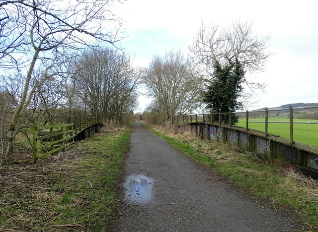
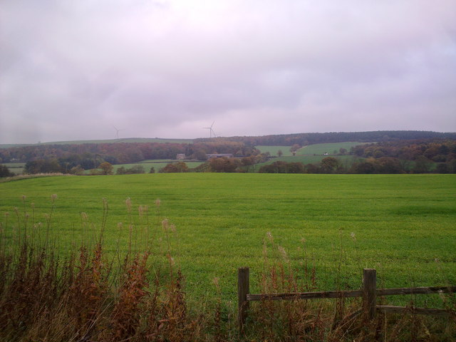
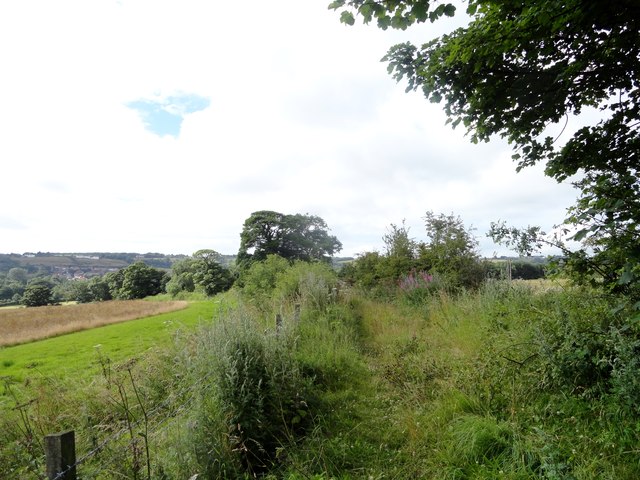
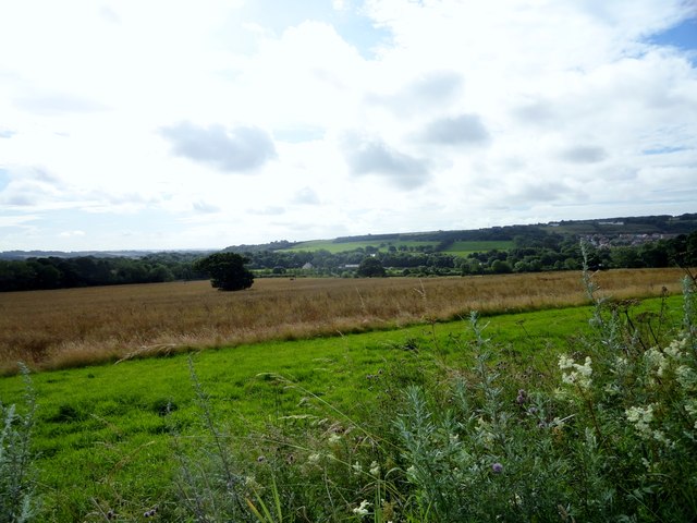
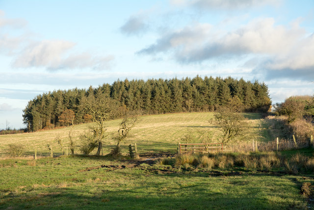
Bleachgreen Plantation, located in Durham, England, is a picturesque woodland area known for its natural beauty and historical significance. The plantation covers a vast area, comprising mainly wood and forest, making it a popular destination for nature enthusiasts and history buffs alike.

The woodland of Bleachgreen Plantation is characterized by a dense canopy of mature trees, including oak, beech, and ash, providing a serene and tranquil atmosphere. The forest floor is adorned with a diverse array of plant species, including bluebells, ferns, and mosses, creating a vibrant and colorful landscape, particularly during the spring and summer months.

The plantation has a rich history dating back several centuries. Originally used as a hunting ground for local nobility, Bleachgreen Plantation played a significant role in the region's timber industry during the Victorian era. The remnants of old sawmills and logging operations can still be found scattered throughout the woodland, serving as a reminder of its industrial past.

Today, Bleachgreen Plantation offers a variety of recreational activities for visitors to enjoy. The extensive network of walking trails provides opportunities for hiking and exploring the natural surroundings. The plantation is also home to a diverse range of wildlife, including deer, squirrels, and various bird species, making it an ideal spot for wildlife watching and photography.

With its serene ambiance, rich history, and abundance of natural beauty, Bleachgreen Plantation is a must-visit destination for anyone seeking a tranquil escape from the hustle and bustle of everyday life.

If you have any feedback on the listing, please let us know in the comments section below.

Bleachgreen Plantation Images

Images are sourced within 2km of 54.809265/-1.66462 or Grid Reference NZ2146. Thanks to Geograph Open Source API. All images are credited.

Railway bridge over the Blackburn Beck This is just west of Langley Park village on the Lanchester Valley Walk. This was a branch line from Durham to Consett opened in 1862. It operated for just over 100 years until closed in the Beeching cuts in 1966. View is looking west up the walk.
Railway bridge over the Blackburn Beck
This is just west of Langley Park village on the Lanchester Valley Walk. This was a branch line from Durham to Consett opened in 1862. It operated for just over 100 years until closed in the Beeching cuts in 1966. View is looking west up the walk.
Looking across the valley View north from the Lanchester Valley Walk from west of Langley Park. The big farm in the distance is Langley House, on the A691 Durham road.
Looking across the valley
View north from the Lanchester Valley Walk from west of Langley Park. The big farm in the distance is Langley House, on the A691 Durham road.
Looking North from the railway path View from the Lanchester Valley walk. The farm in the middle distance is Langley House.
Looking North from the railway path
View from the Lanchester Valley walk. The farm in the middle distance is Langley House.
Bridge carrying the Lanchester Valley Walk over Blackburn Beck
Bridge over Blackburn Beck Blackburn Beck is a tributary stream to the River Browney; the bridge carries the Lanchester Valley Walk - an old railway route -  over the flow. There are many other bridges in the same style along the route of the walk; a number of them serve purposes other than river crossings, for example as iron canvases for local graffiti artists. The supplementary purpose in this case is to provide shelter as a drinking den - there's a significant number of empty lager cans beneath!
Bridge over Blackburn Beck
Blackburn Beck is a tributary stream to the River Browney; the bridge carries the Lanchester Valley Walk - an old railway route - over the flow. There are many other bridges in the same style along the route of the walk; a number of them serve purposes other than river crossings, for example as iron canvases for local graffiti artists. The supplementary purpose in this case is to provide shelter as a drinking den - there's a significant number of empty lager cans beneath!
Path to Stobbilee Farm Footpath leading south from the A691, Durham to Consett road, to Stobbilee Farm at Langley Park.
Path to Stobbilee Farm
Footpath leading south from the A691, Durham to Consett road, to Stobbilee Farm at Langley Park.
View south from the A691 near Kaysburn View from beside the Durham to Consett road near Stobbilee House. Looking south over Langley Park to the south side of the Browney valley.
View south from the A691 near Kaysburn
View from beside the Durham to Consett road near Stobbilee House. Looking south over Langley Park to the south side of the Browney valley.
War memorial at Witton Gilbert The memorial is slightly elevated above the east side of the B6312 at the northern end of the village. 
The houses of Green Lea are seen behind the monument.
Remnants of the first snow of the winter are on the ground.
War memorial at Witton Gilbert
The memorial is slightly elevated above the east side of the B6312 at the northern end of the village. The houses of Green Lea are seen behind the monument. Remnants of the first snow of the winter are on the ground.
Taylorshill Plantation The plantation as seen from beside Long Edge - a minor road. Photographed in November 2015,the extent of the tree cover to the left appears to be less than OS mapping would suggest; it seems likely that there's been some felling.
Taylorshill Plantation
The plantation as seen from beside Long Edge - a minor road. Photographed in November 2015,the extent of the tree cover to the left appears to be less than OS mapping would suggest; it seems likely that there's been some felling.
Farm track, Langley  Heads south from Langley Lane.
Farm track, Langley
Heads south from Langley Lane.
Grazing, Langley Off Langley Lane.
Grazing, Langley
Off Langley Lane.
Field entrance off Langley Lane
Approaching a steep hill on Langley Lane Heading east towards Durham.
Approaching a steep hill on Langley Lane
Heading east towards Durham.
Drift Plantation View from Langley Lane.
Drift Plantation
View from Langley Lane.
Langley Lane Heading east towards Durham.
Langley Lane
Heading east towards Durham.
Field entrance off Langley Lane
Farm track (footpath) off Langley Lane Heads north towards Taylor's Hill.
Farm track (footpath) off Langley Lane
Heads north towards Taylor's Hill.
Fly tipped rubbish beside Langley Lane A discarded fridge freezer and some old furniture parts.
Fly tipped rubbish beside Langley Lane
A discarded fridge freezer and some old furniture parts.
Show me another place!

Bleachgreen Plantation is located at Grid Ref: NZ2146 (Lat: 54.809265, Lng: -1.66462)

Unitary Authority: County Durham

Police Authority: Durham

What 3 Words

///mediate.configure.latitudes. Near Langley Park, Co. Durham

Related Wikis

Witton Gilbert railway station

Witton Gilbert railway station served the village of Witton Gilbert, County Durham, England from 1862 to 1963 on the Lanchester Valley Line. == History... ==

Wall Nook

Wall Nook is a small village in County Durham, in England. It is situated to the south of Langley Park, to the north west of Durham. Wall Nook is known...

Langley Park, County Durham

Langley Park is a village in County Durham, England. The historic city of Durham lies 4 miles (6.4 km) to the east, and the larger city (and regional capital...

Langley Park Wind Farm

Langley Park Wind Farm is a wind farm near Langley Park, County Durham, England. It was developed by EDF Energy and is operated by Cumbria Wind Farms,...

Witton Gilbert

Witton Gilbert is a village and civil parish in County Durham, England. == Geography == Witton Gilbert is situated about 3.7 miles (6.0 km) to the north...

Ushaw College

Ushaw College (formally St Cuthbert's College, Ushaw) is a former Catholic seminary near the village of Ushaw Moor, County Durham, England, which is now...

Sacriston

Sacriston is a village and civil parish in County Durham, England, situated 3 miles (4.8 km) north of the city of Durham. Although the area has been populated...

Fyndoune Community College

Fyndoune Community College was a co-educational secondary school located in Sacriston, County Durham, England. Previous names have included Sacriston Secondary...

Nearby Amenities

Located within 500m of 54.809265,-1.66462
Bench
Lat/Long: 54.8068877/-1.6616643
Power: pole
Lat/Long: 54.8052626/-1.6668883
Power: pole
Lat/Long: 54.8053275/-1.6656491
Material: wood
Power: pole
Lat/Long: 54.8053824/-1.6646031
Material: wood
Power: pole
Lat/Long: 54.8055223/-1.6622762
Material: wood
Power: pole
Lat/Long: 54.8056019/-1.6606388
The data included in this document is from www.openstreetmap.org. The data is made available under ODbL.

Have you been to Bleachgreen Plantation?

Leave your review of Bleachgreen Plantation below (or comments, questions and feedback).