Bleach Green

Downs, Moorland in Durham

England

Bleach Green

Straw Bales Taken from the Lanchester Valley Walk with Burnhope TV Mast in the distance.
Straw Bales Credit: Mick Garratt

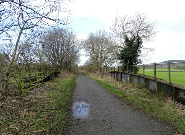
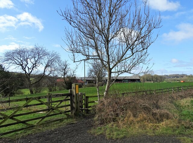
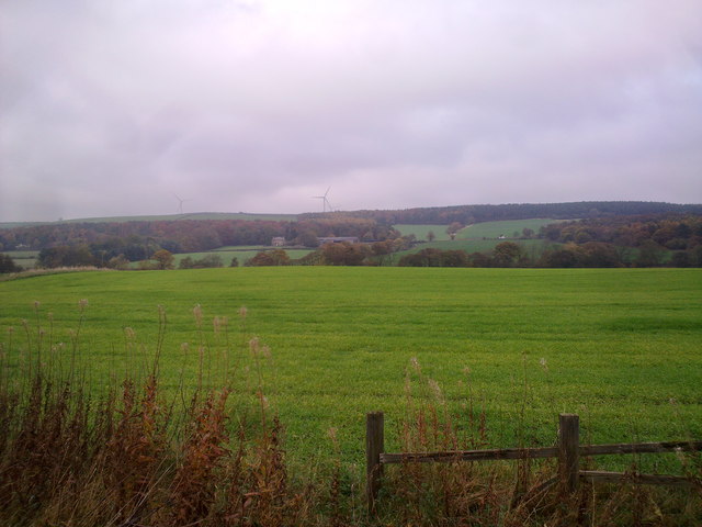
Bleach Green, located in Durham, England, is a picturesque area encompassing both downs and moorland. Situated in the northeast of the country, this region is renowned for its natural beauty and rich history. The downs in Bleach Green offer expansive, rolling hills covered in lush green grass, providing a perfect setting for leisurely walks and recreational activities.

The moorland in Bleach Green presents a contrasting landscape with its rugged terrain, characterized by heather-covered hills and rocky outcrops. This area is home to a diverse range of flora and fauna, including species such as red grouse and adders, making it a popular spot for wildlife enthusiasts and hikers looking for a more challenging adventure.

Bleach Green's natural beauty is enhanced by its proximity to the River Wear, which meanders through the region. The river not only adds to the picturesque scenery but also offers opportunities for water-based activities like fishing and boating.

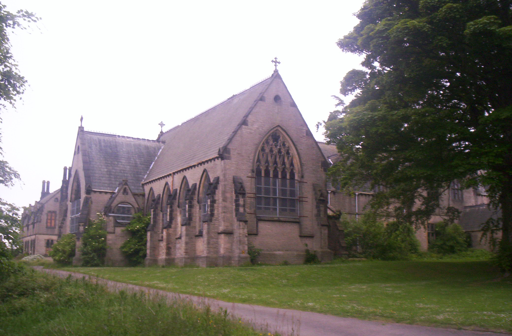
In addition to its natural attractions, Bleach Green boasts a rich history that can be traced back centuries. The area is dotted with ancient ruins, including remnants of medieval castles and old mining structures, providing a glimpse into its past.

Overall, Bleach Green in Durham is a captivating destination that seamlessly blends stunning natural landscapes with a fascinating history. Whether visitors are seeking tranquility in the downs, adventure in the moorland, or a journey through the annals of time, Bleach Green offers something for everyone.

If you have any feedback on the listing, please let us know in the comments section below.
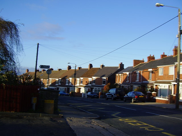
Bleach Green Images

Images are sourced within 2km of 54.809182/-1.6702218 or Grid Reference NZ2146. Thanks to Geograph Open Source API. All images are credited.

Straw Bales Taken from the Lanchester Valley Walk with Burnhope TV Mast in the distance.
Straw Bales
Taken from the Lanchester Valley Walk with Burnhope TV Mast in the distance.
Langley Park Cemetery Langley Park is an old 'pit village' of north-west County Durham. In this group of graves that of football manager Sir Bobby Robson is right of centre.
Langley Park Cemetery
Langley Park is an old 'pit village' of north-west County Durham. In this group of graves that of football manager Sir Bobby Robson is right of centre.
Railway bridge over the Blackburn Beck This is just west of Langley Park village on the Lanchester Valley Walk. This was a branch line from Durham to Consett opened in 1862. It operated for just over 100 years until closed in the Beeching cuts in 1966. View is looking west up the walk.
Railway bridge over the Blackburn Beck
This is just west of Langley Park village on the Lanchester Valley Walk. This was a branch line from Durham to Consett opened in 1862. It operated for just over 100 years until closed in the Beeching cuts in 1966. View is looking west up the walk.
Looking west along the old railway This is the Lanchester Valley Walk, along the former branch line to Consett. Burnhope mast can be seen on the horizon in the distance.
Looking west along the old railway
This is the Lanchester Valley Walk, along the former branch line to Consett. Burnhope mast can be seen on the horizon in the distance.
Looking across the valley View north from the Lanchester Valley Walk from west of Langley Park. The big farm in the distance is Langley House, on the A691 Durham road.
Looking across the valley
View north from the Lanchester Valley Walk from west of Langley Park. The big farm in the distance is Langley House, on the A691 Durham road.
Path to Blackburn from the railway walk Stile access to the field path to Blackburn farm on the south side of the Lanchester Valley Walk.
Path to Blackburn from the railway walk
Stile access to the field path to Blackburn farm on the south side of the Lanchester Valley Walk.
Blackburn farm View of the farmstead from the Lanchester Valley Walk.
Blackburn farm
View of the farmstead from the Lanchester Valley Walk.
Carved seat beside the railway walk A nice seat beside the Lanchester Valley Walk.
Carved seat beside the railway walk
A nice seat beside the Lanchester Valley Walk.
Gateway beside the railway walk On the south side of the Lanchester Valley Walk. There is a stile here also, for a public footpath across to the River Browney. However there seems to be a closed sign on this. Don't know why.
Gateway beside the railway walk
On the south side of the Lanchester Valley Walk. There is a stile here also, for a public footpath across to the River Browney. However there seems to be a closed sign on this. Don't know why.
Grazing field beside the old railway On the north side of the Lanchester Valley Railway Path.
Grazing field beside the old railway
On the north side of the Lanchester Valley Railway Path.
Looking west along the old railway View along the Lanchester Valley Railway Path west of Langley Park.
Looking west along the old railway
View along the Lanchester Valley Railway Path west of Langley Park.
Steel gate beside the old railway View across fields on the north side of the Lanchester Valley Railway Path. This section west of Langley Park leads through farming country along the Browney Valley.
Steel gate beside the old railway
View across fields on the north side of the Lanchester Valley Railway Path. This section west of Langley Park leads through farming country along the Browney Valley.
View across the Browney Valley Looking north from the Lanchester Valley Railway Path, west of Langley Park.
View across the Browney Valley
Looking north from the Lanchester Valley Railway Path, west of Langley Park.
Lone tree beside the railway path Looking east down the Lanchester Valley Railway Path.
Lone tree beside the railway path
Looking east down the Lanchester Valley Railway Path.
Blackburn Farm
Blackburn Farm
The track from Blackburn Farm
Blackburn farm View of this little settlement from the Lanchester valley walk.
Blackburn farm
View of this little settlement from the Lanchester valley walk.
Looking North from the railway path View from the Lanchester Valley walk. The farm in the middle distance is Langley House.
Looking North from the railway path
View from the Lanchester Valley walk. The farm in the middle distance is Langley House.
Show me another place!

Bleach Green is located at Grid Ref: NZ2146 (Lat: 54.809182, Lng: -1.6702218)

Unitary Authority: County Durham

Police Authority: Durham

What 3 Words

///clocking.political.segregate. Near Langley Park, Co. Durham

Related Wikis

Witton Gilbert railway station

Witton Gilbert railway station served the village of Witton Gilbert, County Durham, England from 1862 to 1963 on the Lanchester Valley Line. == History... ==

Wall Nook

Wall Nook is a small village in County Durham, in England. It is situated to the south of Langley Park, to the north west of Durham. Wall Nook is known...

Langley Park, County Durham

Langley Park is a village in County Durham, England. The historic city of Durham lies 4 miles (6.4 km) to the east, and the larger city (and regional capital...

Langley Park Wind Farm

Langley Park Wind Farm is a wind farm near Langley Park, County Durham, England. It was developed by EDF Energy and is operated by Cumbria Wind Farms,...

Witton Gilbert

Witton Gilbert is a village and civil parish in County Durham, England. == Geography == Witton Gilbert is situated about 3.7 miles (6.0 km) to the north...

Ushaw College

Ushaw College (formally St Cuthbert's College, Ushaw) is a former Catholic seminary near the village of Ushaw Moor, County Durham, England, which is now...

Holmside

Holmside is a village in County Durham, in England. It is situated to the north-west of Sacriston. The village has a 5.5 MW wind farm, Holmside Hall Wind...

Sacriston

Sacriston is a village and civil parish in County Durham, England, situated 3 miles (4.8 km) north of the city of Durham. Although the area has been populated...

Nearby Amenities

Located within 500m of 54.809182,-1.6702218
Disused: yes
Man Made: adit
Resource: coal
Lat/Long: 54.8093809/-1.6764808
Bus Stop
Black Path
Naptan AtcoCode: 13001774C
Naptan Bearing: E
Naptan CommonName: Black Path
Naptan Indicator: east bound
Naptan Landmark: Landmark not known
Naptan NaptanCode: durajmdm
Naptan Notes: On A691 to the western side of No 1 Park House Cottages- Esh
Naptan Street: A691
Naptan Verified: yes
Source: naptan_import; survey
Lat/Long: 54.8070077/-1.6735504
Bus Stop
Black Path
Naptan AtcoCode: 13001774G
Naptan Bearing: W
Naptan CommonName: Black Path
Naptan Indicator: west bound
Naptan Landmark: Landmark not known
Naptan NaptanCode: durajmdp
Naptan Notes: On A691 in front of No 1 Park House Villas- Esh
Naptan Street: A691
Naptan Verified: yes
Shelter: yes
Source: naptan_import; survey
Lat/Long: 54.8068795/-1.6734868
Ford: yes
Lat/Long: 54.8124572/-1.673501
Power: pole
Lat/Long: 54.8070264/-1.6729568
Power: pole
Lat/Long: 54.8069112/-1.6723493
Power: pole
Lat/Long: 54.8064622/-1.6723385
Power: pole
Lat/Long: 54.8056784/-1.6734611
Power: pole
Lat/Long: 54.8055509/-1.6721186
Power: pole
Lat/Long: 54.8053229/-1.6694927
Power: pole
Lat/Long: 54.8051915/-1.6681141
Power: pole
Lat/Long: 54.8052626/-1.6668883
Power: pole
Lat/Long: 54.8054342/-1.6708781
Power: pole
Lat/Long: 54.805411/-1.670921
Power: pole
Lat/Long: 54.8052139/-1.6714641
The data included in this document is from www.openstreetmap.org. The data is made available under ODbL.

Have you been to Bleach Green?

Leave your review of Bleach Green below (or comments, questions and feedback).