Beardsley's Plantation

Wood, Forest in Derbyshire Derbyshire Dales

England

Beardsley's Plantation

Daisy Bank On the 1880 Ordnance Survey Map, this is marked as Ballidonmoor Barn.
Daisy Bank Credit: Ian Calderwood

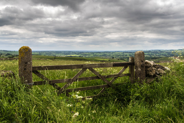
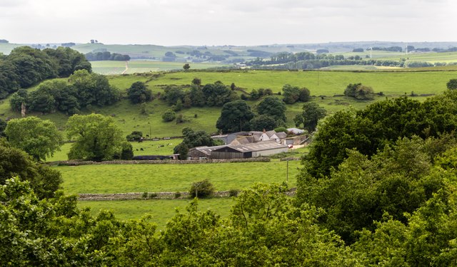
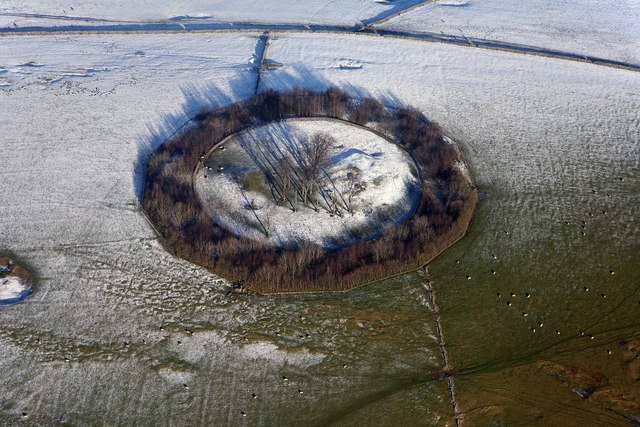
Beardsley's Plantation is a picturesque woodland located in Derbyshire, England. Situated in the heart of the county, this enchanting forest covers an area of approximately 100 acres and is a popular destination for nature enthusiasts and hikers alike.

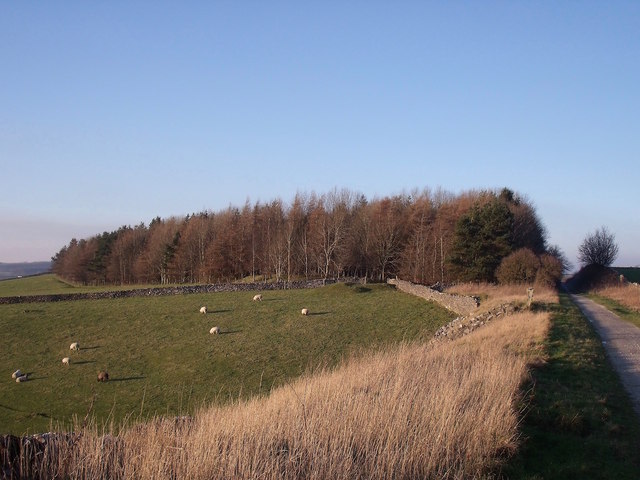
The plantation boasts a diverse range of tree species, including oak, beech, and birch, all of which contribute to the area's breathtaking natural beauty. The dense foliage provides a haven for a variety of wildlife, making it a haven for birdwatchers and nature photographers.

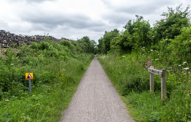
Trails wind their way through the woodland, offering visitors the opportunity to explore the plantation at their own pace. The well-maintained paths are suitable for walkers of all abilities, ensuring that everyone can enjoy the tranquility and serenity of this magical place.

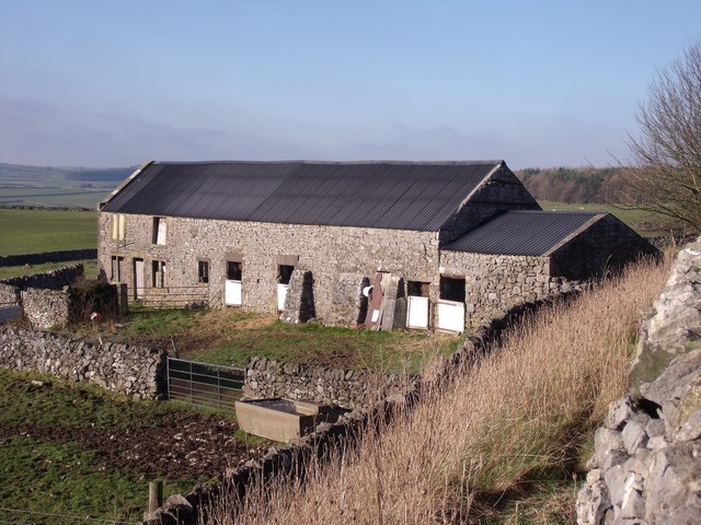
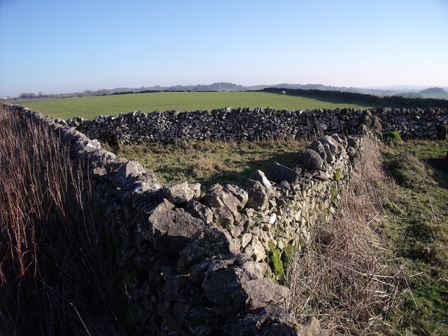
In addition to its scenic charm, Beardsley's Plantation holds historical significance. The woodland was named after the Beardsley family, who were prominent landowners in the area during the 19th century. The remnants of an old stone wall still exist within the plantation, serving as a reminder of the area's past.

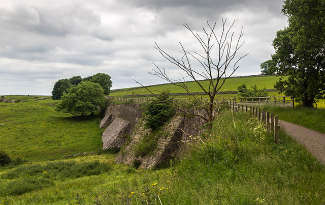
Throughout the year, Beardsley's Plantation showcases the changing seasons, with vibrant displays of wildflowers in the spring, lush greenery in the summer, and a kaleidoscope of autumnal hues in the fall. The plantation also offers captivating views of the surrounding countryside, adding to its allure.

Beardsley's Plantation is a hidden gem in Derbyshire, inviting visitors to immerse themselves in the wonders of nature and experience the tranquility of this idyllic woodland.

If you have any feedback on the listing, please let us know in the comments section below.

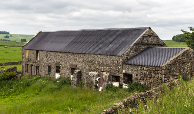
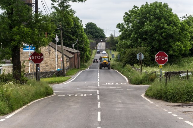
Beardsley's Plantation Images

Images are sourced within 2km of 53.094948/-1.6781193 or Grid Reference SK2155. Thanks to Geograph Open Source API. All images are credited.

Daisy Bank On the 1880 Ordnance Survey Map, this is marked as Ballidonmoor Barn.
Daisy Bank
On the 1880 Ordnance Survey Map, this is marked as Ballidonmoor Barn.
The former Royston Grange Quarries The diagonal wall in the foreground shows the line of the railway that lead into the quarries.
The former Royston Grange Quarries
The diagonal wall in the foreground shows the line of the railway that lead into the quarries.
Triangular sheepfold This sheepfold has been here since at least 1880, when it appeared on Ordnance Survey maps.
Triangular sheepfold
This sheepfold has been here since at least 1880, when it appeared on Ordnance Survey maps.
The former Jug and Glass Only the shadow of the former pub sign remains to indicate that this used to be the Jug & Glass public house.
The former Jug and Glass
Only the shadow of the former pub sign remains to indicate that this used to be the Jug & Glass public house.
The gradient post at Longcliffe Station
Wirksworth Dale picnic area The picnic area and associated car parks are in former quarries alongside Wirksworth Dale, a narrow lane that used to link Brassington to Manystones Lane and Wirksworth but is now a dead end.
Wirksworth Dale picnic area
The picnic area and associated car parks are in former quarries alongside Wirksworth Dale, a narrow lane that used to link Brassington to Manystones Lane and Wirksworth but is now a dead end.
Daisy Bank Barn at Daisy Bank seen from the High Peak Trail.
Daisy Bank
Barn at Daisy Bank seen from the High Peak Trail.
Track Track near Aldwark.
Track
Track near Aldwark.
Longcliffe Crossroads at Longcliffe.
Longcliffe
Crossroads at Longcliffe.
Longcliffe Station building at Longcliffe.
Longcliffe
Station building at Longcliffe.
High Peak Trail The High Peak Trail near Longcliffe.
High Peak Trail
The High Peak Trail near Longcliffe.
High Peak Trail The High Peak Trail.
High Peak Trail
The High Peak Trail.
High Peak Trail Gate alongside the High Peak Trail.
High Peak Trail
Gate alongside the High Peak Trail.
Footpath to Longcliffe Although quite overgrown in places, the path appeared to be in regular use, at least up to the main road. On the other side of the road, the stile and footpath marker were almost totally smothered in bindweed. The High Peak Trail is in the background and an abandoned quarry is just behind that.
Footpath to Longcliffe
Although quite overgrown in places, the path appeared to be in regular use, at least up to the main road. On the other side of the road, the stile and footpath marker were almost totally smothered in bindweed. The High Peak Trail is in the background and an abandoned quarry is just behind that.
Hoe Grange Hoe Grange Farm.
Hoe Grange
Hoe Grange Farm.
Old road below Minninglow This embankment by a wall in a field used to be the main road from Manchester to Derby. It is thought to have begun as a prehistoric trackway and was certainly part of the Roman road from Mamucium (Manchester) to Derventio (Derby). It remained in use into the 19th century, when better roads, such as the turnpike through Ashbourne, made it redundant.
Old road below Minninglow
This embankment by a wall in a field used to be the main road from Manchester to Derby. It is thought to have begun as a prehistoric trackway and was certainly part of the Roman road from Mamucium (Manchester) to Derventio (Derby). It remained in use into the 19th century, when better roads, such as the turnpike through Ashbourne, made it redundant.
Brassington Church and village from footpath to the east.
Brassington
Church and village from footpath to the east.
Entering Brassington From a footpath from Carsington. The building on the other side of the road, Dragon Cottages, is a Grade II listed building. <span class="nowrap"><a title="https://www.historicengland.org.uk/listing/the-list/list-entry/1109445" rel="nofollow ugc noopener" href="https://www.historicengland.org.uk/listing/the-list/list-entry/1109445">Link</a><img style="margin-left:2px;" alt="External link" title="External link - shift click to open in new window" src="https://s1.geograph.org.uk/img/external.png" width="10" height="10"/></span>
Entering Brassington
From a footpath from Carsington. The building on the other side of the road, Dragon Cottages, is a Grade II listed building. LinkExternal link
Show me another place!

Beardsley's Plantation is located at Grid Ref: SK2155 (Lat: 53.094948, Lng: -1.6781193)

Administrative County: Derbyshire

District: Derbyshire Dales

Police Authority: Derbyshire

What 3 Words

///ditched.items.concerned. Near Wirksworth, Derbyshire

Related Wikis

Longcliffe

Longcliffe is a crossroads hamlet in the English county of Derbyshire. It lies on the B5056 road where it is crossed by the Brassington-Elton road. The...

Ballidon

Ballidon is a village and civil parish in the Derbyshire Dales district of Derbyshire, England, on the edge of the Peak District National Park. According...

All Saints Church, Ballidon

All Saints Church is a redundant Anglican church located to the south of the village of Ballidon, Derbyshire, England. It is recorded in the National...
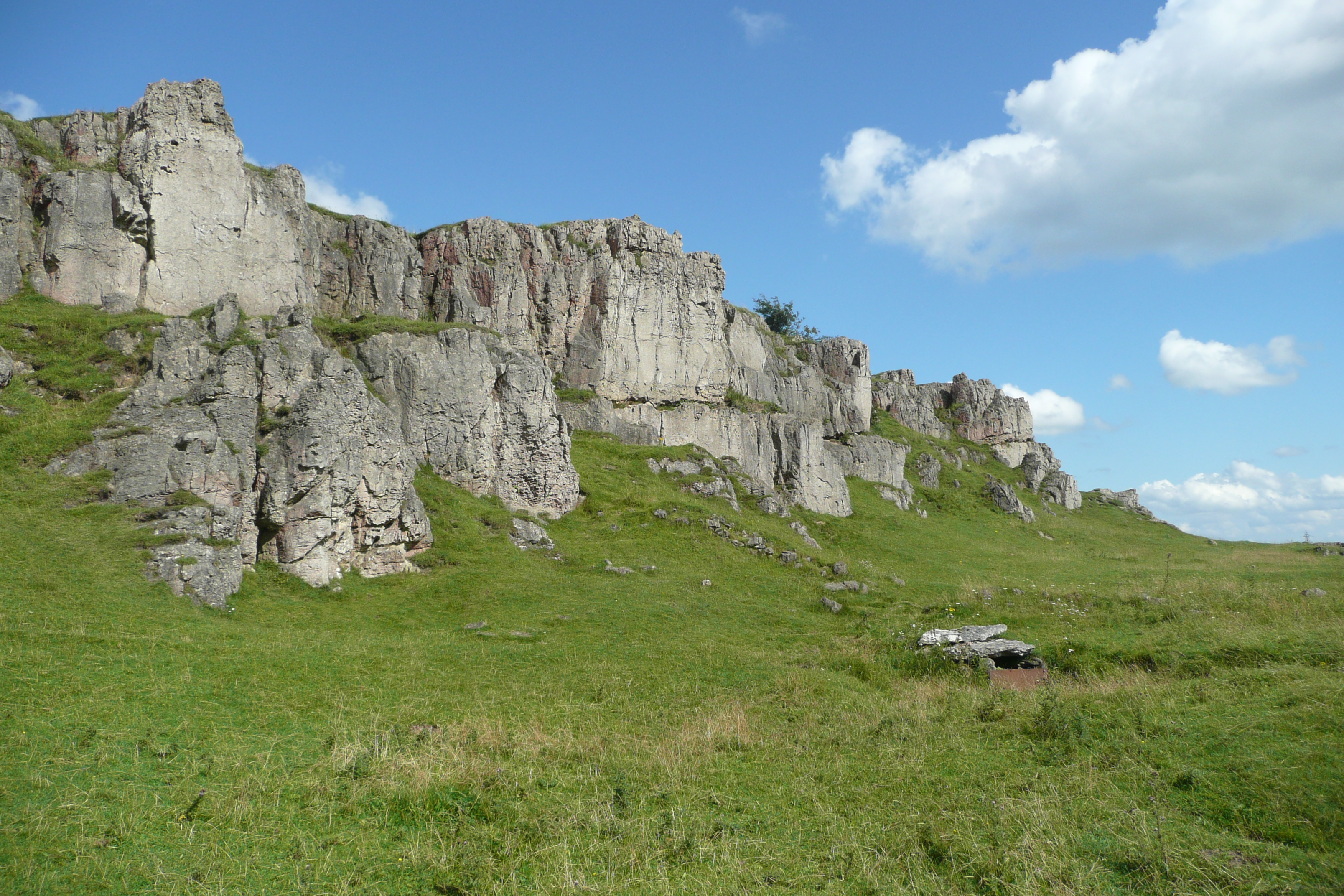
Harboro' Rocks

Harboro' Rocks (or Harborough Rocks) is a dolomitic limestone hill near the village of Brassington in the Derbyshire Peak District. The summit is 379 metres...
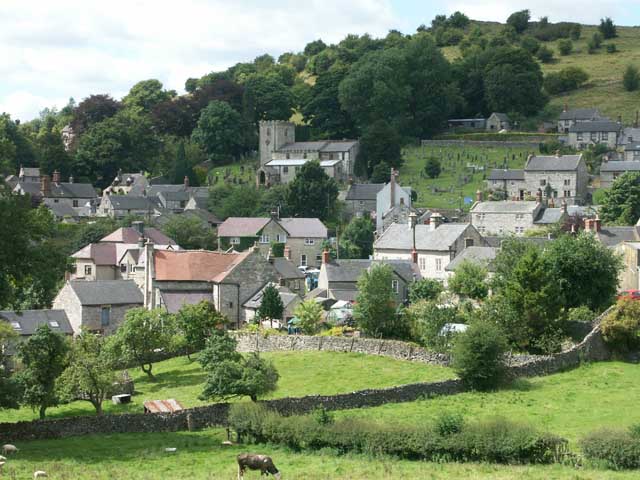
Brassington

Brassington is a village and civil parish in the Derbyshire Dales district of Derbyshire, 16 miles north west of Derby. The parish had a population of...

West Derbyshire (UK Parliament constituency)

West Derbyshire was a county constituency represented in the House of Commons of the Parliament of the United Kingdom. From 1885, until it was replaced...

Minninglow

Minninglow (or Minning Low) is a hill in the Peak District National Park in Derbyshire, located within the White Peak area at grid reference SK209573....

Aldwark, Derbyshire

Aldwark (Old English "the old fortification") is a small upland village and parish in the Derbyshire Dales district of Derbyshire, England, about 8 miles...

Nearby Amenities

Located within 500m of 53.094948,-1.6781193
Natural: rock
Lat/Long: 53.0942173/-1.6716452
Natural: rock
Lat/Long: 53.0941867/-1.6717578
Natural: rock
Lat/Long: 53.0941118/-1.6718571
Natural: rock
Lat/Long: 53.094136/-1.6718946
Direction: 100
Generator Method: photovoltaic
Generator Output Electricity: yes
Generator Solar Modules: 5
Generator Source: solar
Generator Type: solar_photovoltaic_panel
Location: roof
Power: generator
Lat/Long: 53.0971007/-1.6840397
Direction: 100
Generator Method: photovoltaic
Generator Output Electricity: yes
Generator Solar Modules: 5
Generator Source: solar
Generator Type: solar_photovoltaic_panel
Location: roof
Power: generator
Lat/Long: 53.0970613/-1.6840457
Direction: 100
Generator Method: photovoltaic
Generator Output Electricity: yes
Generator Solar Modules: 5
Generator Source: solar
Generator Type: solar_photovoltaic_panel
Location: roof
Power: generator
Lat/Long: 53.0970323/-1.6840551
Direction: 100
Generator Method: photovoltaic
Generator Output Electricity: yes
Generator Solar Modules: 5
Generator Source: solar
Generator Type: solar_photovoltaic_panel
Location: roof
Power: generator
Lat/Long: 53.0970053/-1.6840591
Direction: 100
Generator Method: photovoltaic
Generator Output Electricity: yes
Generator Solar Modules: 5
Generator Source: solar
Generator Type: solar_photovoltaic_panel
Location: roof
Power: generator
Lat/Long: 53.0969751/-1.6840658
Direction: 100
Generator Method: photovoltaic
Generator Output Electricity: yes
Generator Solar Modules: 5
Generator Source: solar
Generator Type: solar_photovoltaic_panel
Location: roof
Power: generator
Lat/Long: 53.0969506/-1.6840725
Direction: 100
Generator Method: photovoltaic
Generator Output Electricity: yes
Generator Solar Modules: 5
Generator Source: solar
Generator Type: solar_photovoltaic_panel
Location: roof
Power: generator
Lat/Long: 53.0969055/-1.6840813
Direction: S
Generator Method: photovoltaic
Generator Output Electricity: yes
Generator Solar Modules: 16
Generator Source: solar
Generator Type: solar_photovoltaic_panel
Location: roof
Power: generator
Lat/Long: 53.097561/-1.6836132
Power: pole
Lat/Long: 53.0915886/-1.6798514
Power: pole
Lat/Long: 53.0920268/-1.6783842
Power: pole
Lat/Long: 53.0924778/-1.6768768
Power: pole
Lat/Long: 53.0929417/-1.6753373
Power: pole
Lat/Long: 53.0931124/-1.6738218
Power: pole
Lat/Long: 53.0932976/-1.672293
The data included in this document is from www.openstreetmap.org. The data is made available under ODbL.

Have you been to Beardsley's Plantation?

Leave your review of Beardsley's Plantation below (or comments, questions and feedback).