Jamies Wood

Wood, Forest in Gloucestershire Cotswold

England

Jamies Wood

Lower Farmhouse Late 18th/early 19th Century farmhouse with later additions.  Grade II listed - see <span class="nowrap"><a title="www.historicengland.org.uk/listing/the-list/list-entry/1154846" rel="nofollow ugc noopener" href="http://www.historicengland.org.uk/listing/the-list/list-entry/1154846">Link</a><img style="margin-left:2px;" alt="External link" title="External link - shift click to open in new window" src="https://s1.geograph.org.uk/img/external.png" width="10" height="10"/></span>.
Lower Farmhouse Credit: Ian Capper

Jamies Wood is a small woodland located in Gloucestershire, England. Situated within the larger Forest of Dean, it covers an area of approximately 10 acres. The wood is named after a local landowner, Jamie, who generously donated the land to the community for public use.

The woodland is characterized by a diverse range of native trees, including oak, ash, beech, and birch, which create a vibrant and picturesque landscape throughout the year. In spring, the wood is adorned with a colorful carpet of bluebells, while in autumn, the leaves turn various shades of red, orange, and gold, providing a breathtaking display of natural beauty.

Jamies Wood is a haven for wildlife, attracting a variety of birds, butterflies, and small mammals. It provides a safe habitat for species such as woodpeckers, tawny owls, and badgers. The wood also boasts a small pond, which is home to frogs, newts, and a diverse array of aquatic plants.

The woodland is a popular destination for nature lovers, walkers, and photographers alike. Visitors can enjoy peaceful walks along the well-maintained footpaths that crisscross the wood, providing access to its various attractions, including secluded clearings, ancient trees, and stunning viewpoints. The wood also features picnic areas, allowing visitors to relax and soak in the tranquil ambiance while enjoying a packed lunch.

Jamies Wood is managed by a local conservation group, which works tirelessly to preserve its natural beauty and protect its wildlife. Regular maintenance and conservation efforts ensure that the wood remains a cherished local asset and continues to be enjoyed by both residents and visitors to Gloucestershire.

If you have any feedback on the listing, please let us know in the comments section below.
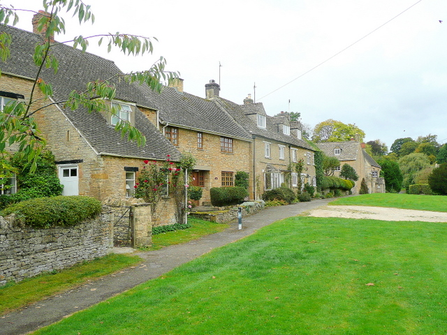
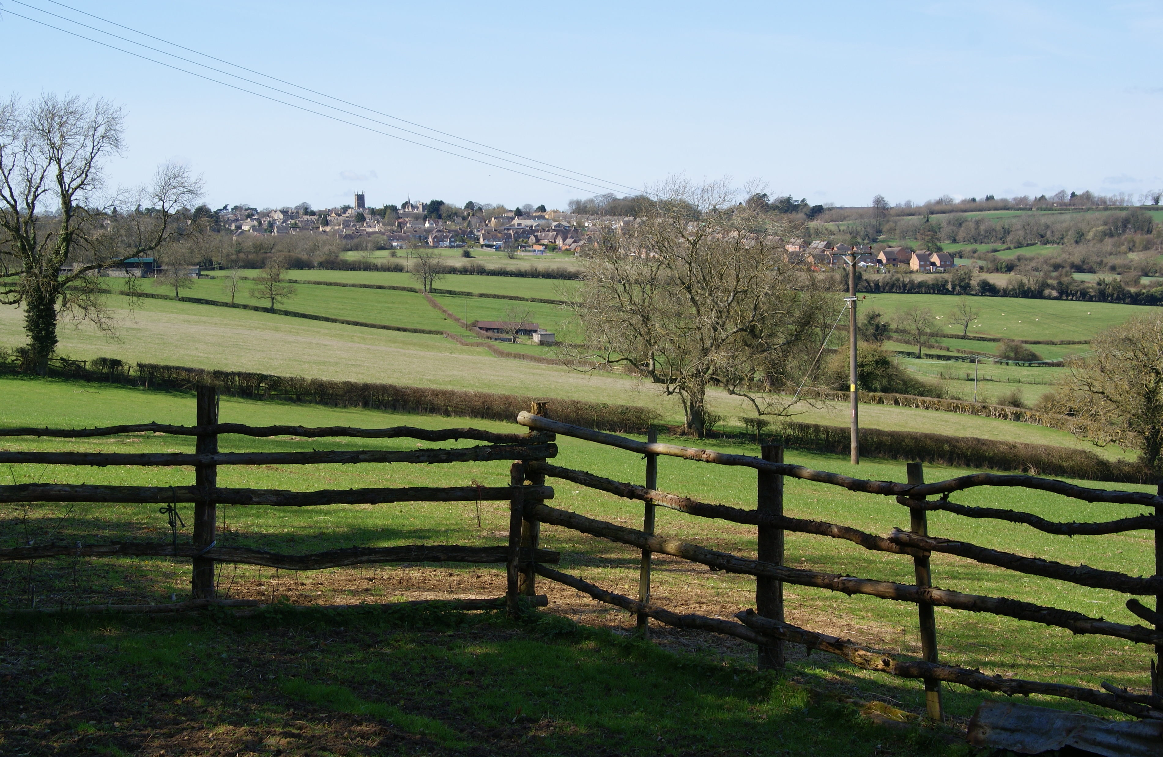
Jamies Wood Images

Images are sourced within 2km of 51.959987/-1.704976 or Grid Reference SP2029. Thanks to Geograph Open Source API. All images are credited.

Lower Farmhouse Late 18th/early 19th Century farmhouse with later additions.  Grade II listed - see <span class="nowrap"><a title="www.historicengland.org.uk/listing/the-list/list-entry/1154846" rel="nofollow ugc noopener" href="http://www.historicengland.org.uk/listing/the-list/list-entry/1154846">Link</a><img style="margin-left:2px;" alt="External link" title="External link - shift click to open in new window" src="https://s1.geograph.org.uk/img/external.png" width="10" height="10"/></span>.
Lower Farmhouse
Late 18th/early 19th Century farmhouse with later additions. Grade II listed - see LinkExternal link.
Broadwell Manor 17th Century manor house rebuilt in 1757 after a fire, then with later additions.  Grade II* listed - see <span class="nowrap"><a title="www.historicengland.org.uk/listing/the-list/list-entry/1089783" rel="nofollow ugc noopener" href="http://www.historicengland.org.uk/listing/the-list/list-entry/1089783">Link</a><img style="margin-left:2px;" alt="External link" title="External link - shift click to open in new window" src="https://s1.geograph.org.uk/img/external.png" width="10" height="10"/></span>.
Broadwell Manor
17th Century manor house rebuilt in 1757 after a fire, then with later additions. Grade II* listed - see LinkExternal link.
Broadwell Farm Early 18th Century farmhouse with attached yard entrance/hay loft.  Grade II listed - see <span class="nowrap"><a title="www.historicengland.org.uk/listing/the-list/list-entry/1341091" rel="nofollow ugc noopener" href="http://www.historicengland.org.uk/listing/the-list/list-entry/1341091">Link</a><img style="margin-left:2px;" alt="External link" title="External link - shift click to open in new window" src="https://s1.geograph.org.uk/img/external.png" width="10" height="10"/></span>.
Broadwell Farm
Early 18th Century farmhouse with attached yard entrance/hay loft. Grade II listed - see LinkExternal link.
Broadwell Farm Looking towards Broadwell Farm.  The farmhouse itself, dating from the early 18th Century, is just visible in the centre of the photo with the later outbuildings on the right.  Both the farmhouse and outbuildings are grade II listed - see <span class="nowrap"><a title="www.historicengland.org.uk/listing/the-list/list-entry/1341091" rel="nofollow ugc noopener" href="http://www.historicengland.org.uk/listing/the-list/list-entry/1341091">Link</a><img style="margin-left:2px;" alt="External link" title="External link - shift click to open in new window" src="https://s1.geograph.org.uk/img/external.png" width="10" height="10"/></span> and <span class="nowrap"><a title="www.historicengland.org.uk/listing/the-list/list-entry/1341110" rel="nofollow ugc noopener" href="http://www.historicengland.org.uk/listing/the-list/list-entry/1341110">Link</a><img style="margin-left:2px;" alt="External link" title="External link - shift click to open in new window" src="https://s1.geograph.org.uk/img/external.png" width="10" height="10"/></span>.
Broadwell Farm
Looking towards Broadwell Farm. The farmhouse itself, dating from the early 18th Century, is just visible in the centre of the photo with the later outbuildings on the right. Both the farmhouse and outbuildings are grade II listed - see LinkExternal link and LinkExternal link.
Broadwell Farm Looking towards Broadwell Farm.  The farmhouse itself, dating from the early 18th Century, is just visible on the left of the photo with the later outbuildings on the right.  Both the farmhouse and outbuildings are grade II listed - see <span class="nowrap"><a title="www.historicengland.org.uk/listing/the-list/list-entry/1341091" rel="nofollow ugc noopener" href="http://www.historicengland.org.uk/listing/the-list/list-entry/1341091">Link</a><img style="margin-left:2px;" alt="External link" title="External link - shift click to open in new window" src="https://s1.geograph.org.uk/img/external.png" width="10" height="10"/></span> and <span class="nowrap"><a title="www.historicengland.org.uk/listing/the-list/list-entry/1341110" rel="nofollow ugc noopener" href="http://www.historicengland.org.uk/listing/the-list/list-entry/1341110">Link</a><img style="margin-left:2px;" alt="External link" title="External link - shift click to open in new window" src="https://s1.geograph.org.uk/img/external.png" width="10" height="10"/></span>.
Broadwell Farm
Looking towards Broadwell Farm. The farmhouse itself, dating from the early 18th Century, is just visible on the left of the photo with the later outbuildings on the right. Both the farmhouse and outbuildings are grade II listed - see LinkExternal link and LinkExternal link.
Timperley, Studio and Pimlico Cottages Row of cottages built in the 1850s.  Grade II listed - see <span class="nowrap"><a title="www.historicengland.org.uk/listing/the-list/list-entry/1303579" rel="nofollow ugc noopener" href="http://www.historicengland.org.uk/listing/the-list/list-entry/1303579">Link</a><img style="margin-left:2px;" alt="External link" title="External link - shift click to open in new window" src="https://s1.geograph.org.uk/img/external.png" width="10" height="10"/></span>.
Timperley, Studio and Pimlico Cottages
Row of cottages built in the 1850s. Grade II listed - see LinkExternal link.
The Fox Inn Pub on the village green with records going back to at least the 1890s.  On the left is Rose's Cottage.
The Fox Inn
Pub on the village green with records going back to at least the 1890s. On the left is Rose's Cottage.
Green Cottage and Wheatsheaf House Two houses on the edge of the village green.  Wheatsheaf House, on the right, originates from the late 17th/early 18th Century and was once a pub, closing in the early 20th Century.  It is grade II listed - see <span class="nowrap"><a title="www.historicengland.org.uk/listing/the-list/list-entry/1089790" rel="nofollow ugc noopener" href="http://www.historicengland.org.uk/listing/the-list/list-entry/1089790">Link</a><img style="margin-left:2px;" alt="External link" title="External link - shift click to open in new window" src="https://s1.geograph.org.uk/img/external.png" width="10" height="10"/></span>.
Green Cottage and Wheatsheaf House
Two houses on the edge of the village green. Wheatsheaf House, on the right, originates from the late 17th/early 18th Century and was once a pub, closing in the early 20th Century. It is grade II listed - see LinkExternal link.
Seat and rock Commemorative seat and rock on the village green, acknowledging the gift of the green to the village by Lord Ashton of Broadwell Hill, who owned around 300 ha of the village.
Seat and rock
Commemorative seat and rock on the village green, acknowledging the gift of the green to the village by Lord Ashton of Broadwell Hill, who owned around 300 ha of the village.
Broadwell Ford Ford across the brook that runs alongside the village green.  In the background, behind the K6 phone box, is the village hall.
Broadwell Ford
Ford across the brook that runs alongside the village green. In the background, behind the K6 phone box, is the village hall.
Defibrillator phone box A K6 phone box in front of the village hall, containing a defibrillator as indicated by the sign on the post above it.  For wider view see <a href="https://www.geograph.org.uk/photo/5434066">SP2027 : Broadwell Ford</a>.
Defibrillator phone box
A K6 phone box in front of the village hall, containing a defibrillator as indicated by the sign on the post above it. For wider view see SP2027 : Broadwell Ford.
Duck race A duck race under way on the brook that runs alongside the village green.  Duck racing is a feature of the Broadwell and Donnington village fete that was due to take place the following weekend.  This particular race was a private event as part of a wedding celebration taking place in the village.
Duck race
A duck race under way on the brook that runs alongside the village green. Duck racing is a feature of the Broadwell and Donnington village fete that was due to take place the following weekend. This particular race was a private event as part of a wedding celebration taking place in the village.
The Church of St Paul at Broadwell Viewed from the south.
The Church of St Paul at Broadwell
Viewed from the south.
Ordnance Survey Cut Mark This mark can be found on the wall of St Paul's Church in Broadwell. The benchmark height is recorded as being 156.18 metres above seal level. For more detail see : <span class="nowrap"><a title="http://www.bench-marks.org.uk/bm59230" rel="nofollow ugc noopener" href="http://www.bench-marks.org.uk/bm59230">Link</a><img style="margin-left:2px;" alt="External link" title="External link - shift click to open in new window" src="https://s1.geograph.org.uk/img/external.png" width="10" height="10"/></span>
Ordnance Survey Cut Mark
This mark can be found on the wall of St Paul's Church in Broadwell. The benchmark height is recorded as being 156.18 metres above seal level. For more detail see : LinkExternal link
Broadwell - St Paul's Church
Broadwell - Manor House
Broadwell Farm View from Chapel Street.
Broadwell Farm
View from Chapel Street.
St Edward's, Evenlode
Show me another place!

Jamies Wood is located at Grid Ref: SP2029 (Lat: 51.959987, Lng: -1.704976)

Administrative County: Gloucestershire

District: Cotswold

Police Authority: Gloucestershire

What 3 Words

///carpeted.bliss.printout. Near Donnington, Gloucestershire

Related Wikis

Broadwell, Cotswold

Broadwell is a village and civil parish in the English county of Gloucestershire. It is about 1.5 miles (2.4 km) north of Stow-on-the-Wold, In the 2001...

Donnington, Gloucestershire

Donnington is a small village and civil parish in Gloucestershire, near the Roman Fosse Way in the Cotswold District Council area of south west England...

Battle of Stow-on-the-Wold

The Battle of Stow-on-the-Wold (21 March 1646) took place during the First English Civil War. It was a Parliamentarian victory by detachments of the New...

Longborough

Longborough is a village and civil parish 2.5 miles (4.0 km) north of the market town of Stow on the Wold, Gloucestershire. The parish population taken...

Evenlode

Evenlode is a village and civil parish (ONS Code 23UC051) in the Cotswold District of eastern Gloucestershire in England.Evenlode is bordered by the Gloucestershire...

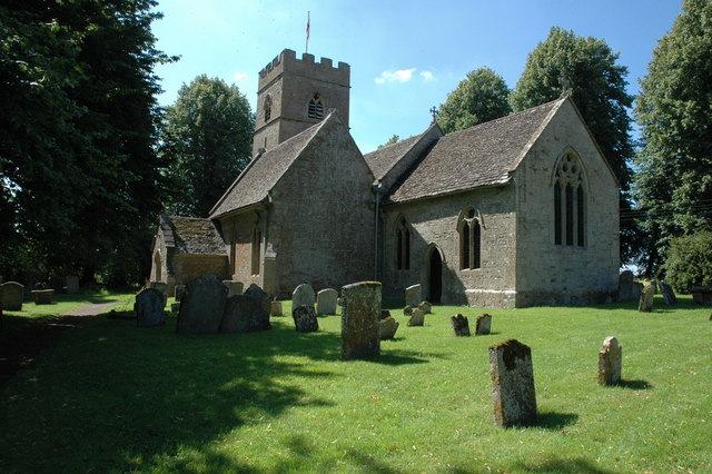
St James' Church, Longborough

St James' Church is the Church of England parish church of Longborough, Gloucestershire, England. It is in the deanery of Stow, the archdeaconry of Cheltenham...

New Park Quarry

New Park Quarry (grid reference SP175282) is a 1.3-hectare (3.2-acre) geological Site of Special Scientific Interest in Gloucestershire, notified in 1987...

Ganborough

Ganborough is a hamlet located along the A424 road, approximately 2 miles NNW of Stow on the Wold. Ganborough is located in Gloucestershire, a county in...

Related Videos

Early Morning Rain Walk in a Cotswold Village & Countryside | First Day of Spring 2023

So, today we are out and about walking on the first day of Spring 2023 in the village of Evenlode on a drizzly morning. Evenlode is ...

Walking Cotswolds Series Ep. 3: Stow-on-the-Wold 4K UHD | Breathtaking Town | Oct 22

In episode 3 of our Cotswold Series, we take a sunny morning walk through the beautiful village of Stow-on-the-Wold. It's full of tea ...

A Morning Walk in a Picturesque Cotswold Village

So, today we are out and about walking in the little Cotswold village of Donnington which is located in Gloucestershire in England.

Longborough and Bourton on the Hill. Walking through Cotswold villages and beautiful countryside.

After a disastrous start to the days proceedings (it should have been Burford), we walked from Longborough to Bourton-on-the-Hill ...

Nearby Amenities

Located within 500m of 51.959987,-1.704976
Material: wood
Power: pole
Source: Bing
Lat/Long: 51.9629301/-1.7018602
Material: wood
Power: pole
Source: Bing
Lat/Long: 51.9622518/-1.7061154
Material: wood
Power: pole
Source: Bing
Lat/Long: 51.9628624/-1.7043225
Material: wood
Power: pole
Source: Bing
Lat/Long: 51.962897/-1.7031048
Material: wood
Power: pole
Source: Bing
Lat/Long: 51.9628178/-1.7055562
Material: wood
Power: pole
Source: bing
Lat/Long: 51.957414/-1.6993162
Material: wood
Power: pole
Source: bing
Lat/Long: 51.9615674/-1.6992115
Material: wood
Power: pole
Source: Bing
Lat/Long: 51.9622758/-1.7064226
Material: wood
Power: pole
Source: bing
Lat/Long: 51.9584272/-1.6985062
Material: wood
Power: pole
Source: bing
Lat/Long: 51.9608683/-1.6990774
Material: wood
Power: pole
Source: Bing
Lat/Long: 51.9617476/-1.7072956
Material: wood
Power: pole
Source: Bing
Lat/Long: 51.9604717/-1.7001074
Material: wood
Power: pole
Source: bing
Lat/Long: 51.962326/-1.6993752
Material: wood
Power: pole
Source: bing
Lat/Long: 51.9570784/-1.7003783
Material: wood
Power: pole
Source: Bing
Lat/Long: 51.9629665/-1.7007069
Material: wood
Power: pole
Source: Bing
Lat/Long: 51.9619558/-1.7067457
Little Barrow
Material: wood
Power: pole
Transformer: distribution
Voltage Primary: 11000
Lat/Long: 51.9606899/-1.708995
Material: wood
Power: pole
Lat/Long: 51.961168/-1.7082245
Donnington Heath Barn
Material: wood
Power: pole
Transformer: distribution
Voltage Primary: 11000
Lat/Long: 51.9601354/-1.7009577
Material: wood
Power: pole
Lat/Long: 51.9601172/-1.6989045
Material: wood
Power: pole
Lat/Long: 51.9592776/-1.698708
North Rye House - Trans
Material: wood
Power: pole
Transformer: distribution
Voltage Primary: 11000
Lat/Long: 51.9567991/-1.7012394
The data included in this document is from www.openstreetmap.org. The data is made available under ODbL.

Have you been to Jamies Wood?

Leave your review of Jamies Wood below (or comments, questions and feedback).