Chapel Plantation

Wood, Forest in Derbyshire Derbyshire Dales

England

Chapel Plantation

Looking into Long Dale Long Dale is a dry valley with much Gorse on this side. In spring the valley sides are covered in small orchids and other flowers.
Looking into Long Dale Credit: Malcolm Neal

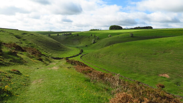
Chapel Plantation is a picturesque woodland area located in Derbyshire, England. Situated near the village of Chapel-en-le-Frith, this plantation covers a vast area of approximately 50 acres. It is renowned for its dense forest and diverse range of trees, making it a popular destination for nature enthusiasts and hikers.

The woodland of Chapel Plantation features a variety of tree species, including oak, beech, birch, and pine, creating a stunning landscape throughout the year. The plantation is well-maintained, with clearly marked trails and paths that allow visitors to explore the area easily.

Wildlife is abundant in Chapel Plantation, with numerous species of birds, mammals, and insects calling this forest their home. Birdwatchers can spot woodpeckers, jays, and owls, while squirrels and rabbits are commonly seen darting through the undergrowth. The plantation is also home to a wide range of flora, including bluebells, ferns, and mosses, adding to its natural beauty.

Chapel Plantation offers a tranquil and peaceful environment for visitors, allowing them to escape the hustle and bustle of city life. It is a fantastic place for a leisurely walk, a family picnic, or even a peaceful spot for meditation.

The plantation is easily accessible, with parking facilities available nearby. Visitors are advised to follow the guidelines and respect the natural environment by not littering or damaging any plant or animal life. Chapel Plantation is a true gem of Derbyshire, offering a slice of nature's beauty to all who venture there.

If you have any feedback on the listing, please let us know in the comments section below.

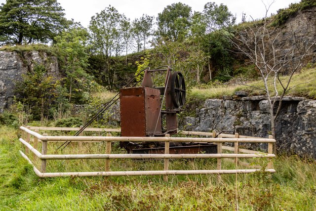
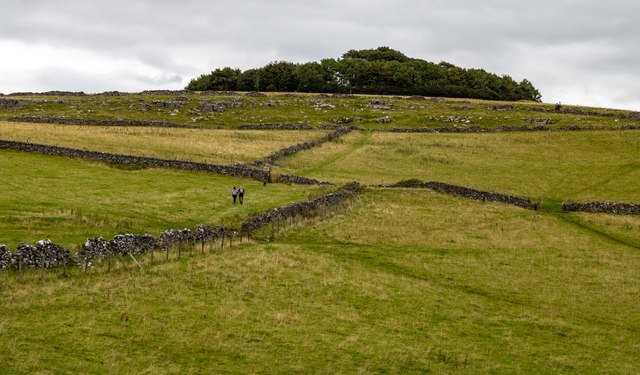
Chapel Plantation Images

Images are sourced within 2km of 53.120795/-1.7147439 or Grid Reference SK1958. Thanks to Geograph Open Source API. All images are credited.

Looking into Long Dale Long Dale is a dry valley with much Gorse on this side. In spring the valley sides are covered in small orchids and other flowers.
Looking into Long Dale
Long Dale is a dry valley with much Gorse on this side. In spring the valley sides are covered in small orchids and other flowers.
A poem set in stone The dry stone wall has been built around three stones set vertically and on which have been carved the words of a poem.
A poem set in stone
The dry stone wall has been built around three stones set vertically and on which have been carved the words of a poem.
View southeast along Long Dale near Pikehall
Bronze-age barrow on Minninglow Hill, Derbyshire Minninglow is a hill in the Peak Park in Derbyshire, in the White Peak area. Within the clump of trees on the hill are a Neolithic chambered tomb and two Bronze Age bowl barrows.
There’s no public right of way butat thetime of posting a concessionary path gives access.
Bronze-age barrow on Minninglow Hill, Derbyshire
Minninglow is a hill in the Peak Park in Derbyshire, in the White Peak area. Within the clump of trees on the hill are a Neolithic chambered tomb and two Bronze Age bowl barrows. There’s no public right of way butat thetime of posting a concessionary path gives access.
On the A5012 Approaching the junction for Winster.
On the A5012
Approaching the junction for Winster.
Approaching Pikehall On the A5012.
Approaching Pikehall
On the A5012.
Newhaven Crossing The site of an old railway crossing on the A5012.
Newhaven Crossing
The site of an old railway crossing on the A5012.
Whitecliffe Farm
Whitecliffe Farm
Mountain Ash Farm
Mountain Ash Farm
Cobblersnook Lane
Cobblersnook Lane
Limekiln Following a collapse of the original structure in 2019, the recently rebuilt Limekiln alongside the High Peak Trail.
Limekiln
Following a collapse of the original structure in 2019, the recently rebuilt Limekiln alongside the High Peak Trail.
Minninglow Grange Minninglow Grange Farm.
Minninglow Grange
Minninglow Grange Farm.
The Croft The Croft, at Minninglow Grange Farm.
The Croft
The Croft, at Minninglow Grange Farm.
Mininglow Limestone Quarry What appears to be a track mounted, hand operated small quarry crane.  Pictures of this crane on the Alamy website indicate that it is a Stothart & Pitt machine of 1860 vintage.
Mininglow Limestone Quarry
What appears to be a track mounted, hand operated small quarry crane. Pictures of this crane on the Alamy website indicate that it is a Stothart & Pitt machine of 1860 vintage.
Roystone Cottages
Roystone Cottages
High Peak Trail On the trackbed of the dismantled Cromford and High Peak Railway.  Also part of the Midshires Way.
High Peak Trail
On the trackbed of the dismantled Cromford and High Peak Railway. Also part of the Midshires Way.
Minninglow Hill
Minninglow Hill
High Peak Trail On the trackbed of the dismantled Cromford and High Peak Railway.  Also part of the Midshires Way.
High Peak Trail
On the trackbed of the dismantled Cromford and High Peak Railway. Also part of the Midshires Way.
Show me another place!

Chapel Plantation is located at Grid Ref: SK1958 (Lat: 53.120795, Lng: -1.7147439)

Administrative County: Derbyshire

District: Derbyshire Dales

Police Authority: Derbyshire

What 3 Words

///amid.costumed.constants. Near Newhaven, Derbyshire

Nearby Locations

Chapel Plantation

Related Wikis

Gotham Curve

The Gotham Curve was once the sharpest curve on any standard gauge railway line in the UK. The curve, which was situated in the sparsely populated, exposed...

Pikehall

Pikehall is a small village in the Derbyshire Dales consisting of a few dozen households and a handful of farms. The population of the village is included...
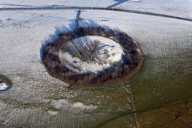
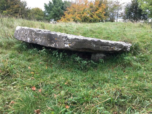
Minninglow

Minninglow (or Minning Low) is a hill in the Peak District National Park in Derbyshire, located within the White Peak area at grid reference SK209573....

Long Dale

Long Dale is a carboniferous limestone valley near the village of Elton, Derbyshire, in the Peak District of England. The dale is cut into the plateau...

Nearby Amenities

Located within 500m of 53.120795,-1.7147439
Minninglow
Tourism: picnic_site
Lat/Long: 53.1203507/-1.7106324
Minninglow
Description: Minninglow information board
Ele: 321
Information: board
Tourism: information
Lat/Long: 53.1202724/-1.7106833
Description: Minninglow car park information board
Ele: 321
Information: board
Tourism: information
Lat/Long: 53.1202837/-1.7108201
High Peak and Tissington Trails
Ele: 319
Information: board
Tourism: information
Lat/Long: 53.1231861/-1.7210212
Ele: 296.4499512
Lat/Long: 53.1232572/-1.7181911
Barrier: stile
Steps: 2
Stile: wall
Lat/Long: 53.1231918/-1.718149
Barrier: cattle_grid
Ele: 317.8392334
Lat/Long: 53.1231048/-1.7211249
Barrier: stile
Steps: 3
Stile: wall
Lat/Long: 53.1190111/-1.7210309
Barrier: stile
Steps: 3
Stile: wall
Lat/Long: 53.1224924/-1.7191729
Barrier: stile
Steps: 3
Stile: wall
Lat/Long: 53.1225323/-1.7189571
Parking
Description: Patch of gravel at the side of the road
Lat/Long: 53.1252505/-1.7145144
Note: Bollards no separate HPT from car park
Lat/Long: 53.1203123/-1.710877
Information: route_marker
Tourism: information
Lat/Long: 53.120064/-1.7099103
Information: route_marker
Tourism: information
Lat/Long: 53.1200614/-1.7098631
Information: route_marker
Tourism: information
Lat/Long: 53.1201605/-1.7099468
Information: route_marker
Tourism: information
Lat/Long: 53.1202701/-1.7110819
Information: route_marker
Tourism: information
Lat/Long: 53.1202787/-1.7107566
Information: route_marker
Tourism: information
Lat/Long: 53.1200602/-1.7098223
Covered: no
Leisure: picnic_table
Lat/Long: 53.1203217/-1.7114182
Covered: no
Leisure: picnic_table
Lat/Long: 53.1203329/-1.7114729
Bicycle Parking
Access: yes
Bicycle Parking: stands
Capacity: 2
Covered: no
Fee: no
Lit: no
Lat/Long: 53.1203207/-1.7114818
Bicycle Parking
Access: yes
Bicycle Parking: stands
Capacity: 2
Covered: no
Fee: no
Lit: no
Lat/Long: 53.1203085/-1.7114292
The data included in this document is from www.openstreetmap.org. The data is made available under ODbL.

Have you been to Chapel Plantation?

Leave your review of Chapel Plantation below (or comments, questions and feedback).