Haghill Wood

Wood, Forest in Durham

England

Haghill Wood

Looking south to Nine Arches Viaduct from Goodshieldhaugh Hill Part of the Derwent Country Park. A not-so-little gem!
Looking south to Nine Arches Viaduct from Goodshieldhaugh Hill Credit: Tom Brewis

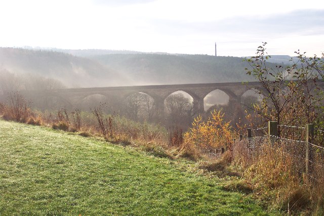
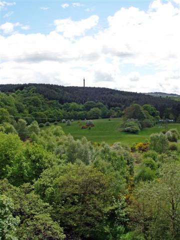
Haghill Wood is a picturesque woodland located in Durham, England. Situated on the outskirts of the city, it covers an area of approximately 50 acres, making it a relatively small but significant natural area. The wood is nestled within rolling hills and offers a tranquil retreat from the bustling urban environment.

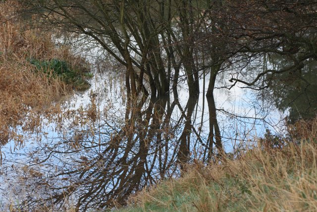
This woodland boasts a diverse range of tree species, including oak, beech, and birch. The dense canopy of these towering trees provides ample shade and creates a cool and peaceful atmosphere, especially during the hot summer months. The forest floor is blanketed with a rich carpet of wildflowers, creating a vibrant and colorful display throughout the seasons.

Haghill Wood is a popular destination for nature enthusiasts and local residents alike. It offers a network of well-maintained walking trails that wind their way through the wood, allowing visitors to explore its natural beauty. These paths are also suitable for cycling and horse riding.

The wood is home to a variety of wildlife, with numerous bird species, such as woodpeckers and owls, making their nests among the branches. Squirrels can be seen darting through the trees, while rabbits and foxes occasionally make appearances.

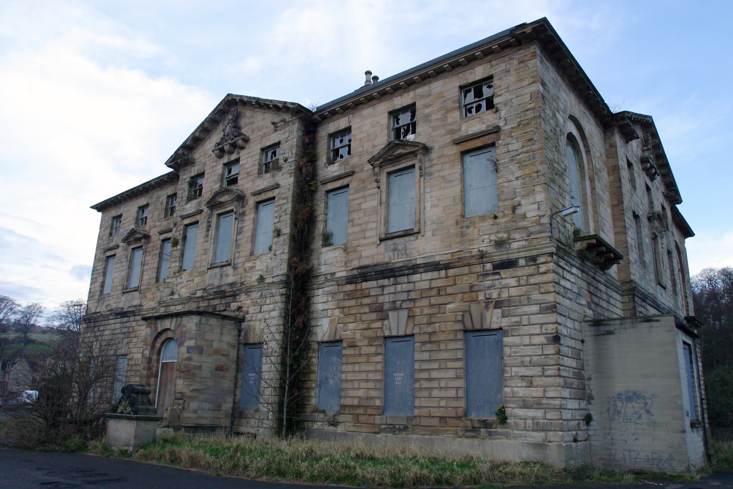
In addition to its natural beauty, Haghill Wood also holds historical significance. It is believed that the wood has existed for centuries, with evidence of human activity dating back to medieval times. The remains of an old stone quarry can still be seen within the woodland, serving as a reminder of its past.

Overall, Haghill Wood offers a peaceful and idyllic setting for individuals seeking a connection with nature. Its combination of stunning scenery, diverse flora and fauna, and historical significance make it a cherished natural gem in the Durham area.

If you have any feedback on the listing, please let us know in the comments section below.

Haghill Wood Images

Images are sourced within 2km of 54.945121/-1.7097307 or Grid Reference NZ1861. Thanks to Geograph Open Source API. All images are credited.

Looking south to Nine Arches Viaduct from Goodshieldhaugh Hill Part of the Derwent Country Park. A not-so-little gem!
Looking south to Nine Arches Viaduct from Goodshieldhaugh Hill
Part of the Derwent Country Park. A not-so-little gem!
Snipes Dean Wood and Gibside Taken from the viaduct over the River Derwent on the Derwent Walk.  Sticking up on the horizon is the 'Monument to Liberty' (50m high) in the grounds of Gibside.
More info: <span class="nowrap"><a title="http://www.nationaltrust.org.uk/main/w-vh/w-visits/w-findaplace/w-gibside.htm" rel="nofollow ugc noopener" href="http://www.nationaltrust.org.uk/main/w-vh/w-visits/w-findaplace/w-gibside.htm">Link</a><img style="margin-left:2px;" alt="External link" title="External link - shift click to open in new window" src="https://s1.geograph.org.uk/img/external.png" width="10" height="10"/></span>
Snipes Dean Wood and Gibside
Taken from the viaduct over the River Derwent on the Derwent Walk. Sticking up on the horizon is the 'Monument to Liberty' (50m high) in the grounds of Gibside. More info: LinkExternal link
Wet Area at the North end of Lady Haugh
Snipes Dene Dene is a name particular to Northumberland for a steep sides wooded valley. The burn or stream that flows down the valley usually takes the name of the dene.
Snipes Dene
Dene is a name particular to Northumberland for a steep sides wooded valley. The burn or stream that flows down the valley usually takes the name of the dene.
Viaduct Over the River Derwent Supposedly nine arches although only five in view here. Now carrying the Derwent Walk footpath and cycleway.
Viaduct Over the River Derwent
Supposedly nine arches although only five in view here. Now carrying the Derwent Walk footpath and cycleway.
Old Hollinside Old Hollinside is a 13thC hall block, 16m x 7m over walls a metre thick. It is positioned so that the 4m square latrine turret at the NW corner over hangs a steep drop to the river Derwent. Hollinside was occupied by the Harding family from the early 16thC to the early 18thC, when it was abandoned.
Old Hollinside
Old Hollinside is a 13thC hall block, 16m x 7m over walls a metre thick. It is positioned so that the 4m square latrine turret at the NW corner over hangs a steep drop to the river Derwent. Hollinside was occupied by the Harding family from the early 16thC to the early 18thC, when it was abandoned.
Rock art on sofa, June 2007 Wow, I thought, that looks just like prehistoric rock art lying on an old sofa outside Hollinside Farm. So I photographed it and sent it to the experts. They agreed, and the "sofa stone" as it was known has been logged and recorded and can now be seen at <span class="nowrap"><a title="http://archaeologydataservice.ac.uk/era/section/panel/overview.jsf?eraId=578" rel="nofollow ugc noopener" href="http://archaeologydataservice.ac.uk/era/section/panel/overview.jsf?eraId=578">Link</a><img style="margin-left:2px;" alt="External link" title="External link - shift click to open in new window" src="https://s1.geograph.org.uk/img/external.png" width="10" height="10"/></span>
Rock art on sofa, June 2007
Wow, I thought, that looks just like prehistoric rock art lying on an old sofa outside Hollinside Farm. So I photographed it and sent it to the experts. They agreed, and the "sofa stone" as it was known has been logged and recorded and can now be seen at LinkExternal link
Derwent Walk Country Park The Derwent Walk Country Park is a mixture of woodlands, meadows, wetlands, riverside and reclaimed industrial sites all linked by the Derwent Walk. The Derwent Walk is the track-bed of the old Derwent Valley Railway. It is 11 miles long and follows the Derwent Valley between Swalwell and Consett.
 
Derwenthaugh Park is a reclaimed area that was (up to 1986) the site of the former Derwenthaugh Coke Works. The two parks are now managed as one and there is no boundary between them.

<span class="nowrap"><a title="http://www.gateshead.gov.uk/Leisure%20and%20Culture/countryside/sites/derwent.aspx#1107" rel="nofollow ugc noopener" href="http://www.gateshead.gov.uk/Leisure%20and%20Culture/countryside/sites/derwent.aspx#1107">Link</a><img style="margin-left:2px;" alt="External link" title="External link - shift click to open in new window" src="https://s1.geograph.org.uk/img/external.png" width="10" height="10"/></span> – Gateshead Council
Derwent Walk Country Park
The Derwent Walk Country Park is a mixture of woodlands, meadows, wetlands, riverside and reclaimed industrial sites all linked by the Derwent Walk. The Derwent Walk is the track-bed of the old Derwent Valley Railway. It is 11 miles long and follows the Derwent Valley between Swalwell and Consett. Derwenthaugh Park is a reclaimed area that was (up to 1986) the site of the former Derwenthaugh Coke Works. The two parks are now managed as one and there is no boundary between them. LinkExternal link – Gateshead Council
Derwent Walk, Nine Arches The track-bed of the old Derwent Valley Railway, crossing the "Nine Arches" viaduct.
Derwent Walk, Nine Arches
The track-bed of the old Derwent Valley Railway, crossing the "Nine Arches" viaduct.
View South from Nine Arches Viaduct The Derwent Walk Country Park is a mixture of woodlands, meadows, wetlands, riverside and reclaimed industrial sites all linked by the Derwent Walk. The Derwent Walk is the track-bed of the old Derwent Valley Railway. It is 11 miles long and follows the Derwent Valley between Swalwell and Consett.
 
Derwenthaugh Park is a reclaimed area that was (up to 1986) the site of the former Derwenthaugh Coke Works. The two parks are now managed as one and there is no boundary between them.

<span class="nowrap"><a title="http://www.gateshead.gov.uk/Leisure%20and%20Culture/countryside/sites/derwent.aspx#1107" rel="nofollow ugc noopener" href="http://www.gateshead.gov.uk/Leisure%20and%20Culture/countryside/sites/derwent.aspx#1107">Link</a><img style="margin-left:2px;" alt="External link" title="External link - shift click to open in new window" src="https://s1.geograph.org.uk/img/external.png" width="10" height="10"/></span> – Gateshead Council
View South from Nine Arches Viaduct
The Derwent Walk Country Park is a mixture of woodlands, meadows, wetlands, riverside and reclaimed industrial sites all linked by the Derwent Walk. The Derwent Walk is the track-bed of the old Derwent Valley Railway. It is 11 miles long and follows the Derwent Valley between Swalwell and Consett. Derwenthaugh Park is a reclaimed area that was (up to 1986) the site of the former Derwenthaugh Coke Works. The two parks are now managed as one and there is no boundary between them. LinkExternal link – Gateshead Council
River Derwent Looking down to the River Derwent from the Nine Arches Viaduct.
River Derwent
Looking down to the River Derwent from the Nine Arches Viaduct.
River Derwent, Gibside The River Derwent at Gibside estate, seen from Lady Haugh.
River Derwent, Gibside
The River Derwent at Gibside estate, seen from Lady Haugh.
River Derwent at Owlet Hill Showing the woods on the far bank. There is a very nice riverside walk here and the river is very lively along this stretch.
River Derwent at Owlet Hill
Showing the woods on the far bank. There is a very nice riverside walk here and the river is very lively along this stretch.
River Derwent at Lockhaugh meadows Looking north along the riverside path with the Nine Arches Viaduct in the background.
River Derwent at Lockhaugh meadows
Looking north along the riverside path with the Nine Arches Viaduct in the background.
River Derwent at Lockhaugh Looking south along the riverside path. This is an area of grassland beside the river which is being recreated as a wild flower meadow.
River Derwent at Lockhaugh
Looking south along the riverside path. This is an area of grassland beside the river which is being recreated as a wild flower meadow.
View west beside Hole Lane Hole Lane runs east from Fellside Road in Whickham to Sunnisdie. Long Hill to the left.
View west beside Hole Lane
Hole Lane runs east from Fellside Road in Whickham to Sunnisdie. Long Hill to the left.
Dog walkers on the Derwent Walk The Derwent Walk is a multi-user path for walkers, cyclists and horse-riders which follows the line of the old railway between Consett and the Tyne at Swalwell. It forms part of National Cycle Network route 14 which pursues a zigzag course across county Durham from Darlington to Hartlepool, Durham, Consett and Swalwell. It offers cyclists following the C2C an alternative route to finish at the sea at Tynemouth.

Downstream from Rowland's Gill village the path enters a linear country park known as Derwent Walk Country Park and Derwenthaugh Country Park. In the distance is the bridge which carries the footpath to Far Pastures Ponds.
Dog walkers on the Derwent Walk
The Derwent Walk is a multi-user path for walkers, cyclists and horse-riders which follows the line of the old railway between Consett and the Tyne at Swalwell. It forms part of National Cycle Network route 14 which pursues a zigzag course across county Durham from Darlington to Hartlepool, Durham, Consett and Swalwell. It offers cyclists following the C2C an alternative route to finish at the sea at Tynemouth. Downstream from Rowland's Gill village the path enters a linear country park known as Derwent Walk Country Park and Derwenthaugh Country Park. In the distance is the bridge which carries the footpath to Far Pastures Ponds.
River Derwent from Nine Arches Viaduct Looking upstream from the Nine Arches Viaduct on the Derwent Walk which follows the old railway from Swalwell to Consett. The construction of the massive 150 metre long viaduct was necessitated by the refusal of the Earl of Strathmore to let the railway pass through the Gibside Estate.
River Derwent from Nine Arches Viaduct
Looking upstream from the Nine Arches Viaduct on the Derwent Walk which follows the old railway from Swalwell to Consett. The construction of the massive 150 metre long viaduct was necessitated by the refusal of the Earl of Strathmore to let the railway pass through the Gibside Estate.
Show me another place!

Haghill Wood is located at Grid Ref: NZ1861 (Lat: 54.945121, Lng: -1.7097307)

Unitary Authority: Gateshead

Police Authority: Northumbria

What 3 Words

///animal.supporter.blows. Near Whickham, Tyne & Wear

Related Wikis

Winlaton Mill

Winlaton Mill is a village in Tyne and Wear, North East England. It is not to be confused with Winlaton to the northwest which now comprises the southern...

Derwenthaugh Coke Works

Derwenthaugh Coke Works was a coking plant on the River Derwent near Swalwell in Gateshead. The works were built in 1928 on the site of the Crowley's Iron...

Blaydon (UK Parliament constituency)

Blaydon is a constituency represented in the House of Commons since 2017 by Liz Twist of the Labour Party.The seat is due to be abolished for the next...

Axwell House

Axwell House (also Axwell Hall or Axwell Park) is a mansion house and Grade II* listed building, at Axwell Park, Blaydon, Tyne and Wear, England.The house...

St Paul's Church, Winlaton

St Paul's Church is a 19th-century church in Winlaton, Tyne and Wear, England, dedicated to St Paul. It is a Grade II listed building. == History == The...

Winlaton

Winlaton is a village situated in the Metropolitan Borough of Gateshead, Tyne and Wear. Once in County Durham, it became incorporated into the metropolitan...

Blaydon RFC

Blaydon Rugby Club is an English semi-professional rugby union team. The first team currently play in the fifth tier of the English rugby union system...

Swalwell railway station

Swalwell railway station served the village of Swalwell, Tyne and Wear, England from 1868 to 1960 on the Derwent Valley Railway. == History == The station...

Nearby Amenities

Located within 500m of 54.945121,-1.7097307
Traffic Signals
Button Operated: yes
Crossing: traffic_signals
Traffic Signals: signal
Traffic Signals Direction: both
Lat/Long: 54.9432204/-1.7107807
Winlaton Mill
Place: village
Wikidata: Q36208763
Wikipedia: en:Winlaton Mill
Lat/Long: 54.9429235/-1.7163065
Bus Stop
Derwenthaugh
Bench: no
Bin: no
Bus: yes
Local Ref: S
Naptan AtcoCode: 410000013925
Naptan Bearing: SW
Naptan Indicator: SW-Bound
Naptan Landmark: Opposite Spa Well Turn
Naptan NaptanCode: twrawgpd
Naptan PlusbusZoneRef: NWCSTLE
Naptan Street: Spa Well Road
Naptan Verified: no
Public Transport: platform
Shelter: no
Source: naptan_import
Lat/Long: 54.9469769/-1.7042951
Bus Stop
Winlaton Mill
Bin: yes
Bus: yes
Departures Board: timetable
Local Ref: S
Naptan AtcoCode: 410000013031
Naptan Bearing: S
Naptan Indicator: S-Bound
Naptan Landmark: Opposite Landswood Terrace
Naptan NaptanCode: twratwda
Naptan PlusbusZoneRef: NWCSTLE
Naptan Street: Spa Well Road
Naptan Verified: no
Public Transport: platform
Shelter: yes
Source: naptan_import
Lat/Long: 54.9435366/-1.7104153
Bus Stop
Winlaton Mill
Bench: yes
Bin: yes
Bus: yes
Departures Board: timetable
Local Ref: N
Naptan AtcoCode: 410000013032
Naptan Bearing: NE
Naptan Indicator: NE-Bound
Naptan Landmark: Outside Winlaton Mill Club
Naptan NaptanCode: twratwdg
Naptan PlusbusZoneRef: NWCSTLE
Naptan Street: Spa Well Road
Naptan Verified: no
Public Transport: platform
Shelter: yes
Source: naptan_import
Lat/Long: 54.9424647/-1.7115674
Bus Stop
Derwenthaugh
Bus: yes
Departures Board: timetable
Local Ref: N
Naptan AtcoCode: 410000013033
Naptan Bearing: NE
Naptan Indicator: NE-Bound
Naptan Landmark: Outside Spa Well Turn
Naptan NaptanCode: twratwdj
Naptan PlusbusZoneRef: NWCSTLE
Naptan Street: Spa Well Road
Naptan Verified: no
Public Transport: platform
Shelter: yes
Source: naptan_import
Lat/Long: 54.9476577/-1.7035679
Bus Stop
WINLATON MILL
Local Ref: S
Naptan AtcoCode: 410000013147
Naptan Bearing: S
Naptan CommonName: WINLATON MILL
Naptan Indicator: S
Naptan Landmark: 35M SOUTH OF POST OFFICE
Naptan NaptanCode: twrawdjw
Naptan PlusbusZoneRef: NWCSTLE
Naptan Street: NOEL AVENUE
Naptan Verified: no
Source: naptan_import
Lat/Long: 54.9428918/-1.7135469
Power: tower
Lat/Long: 54.9466257/-1.7153086
Power: tower
Lat/Long: 54.9458066/-1.7057137
Power: tower
Lat/Long: 54.9460322/-1.7083559
Power: tower
Lat/Long: 54.9460873/-1.7043057
Power: tower
Lat/Long: 54.946149/-1.7097249
Power: tower
Lat/Long: 54.9462132/-1.7167986
Power: tower
Lat/Long: 54.9462642/-1.7110736
Power: tower
Lat/Long: 54.9463606/-1.7029349
Power: tower
Lat/Long: 54.9464106/-1.7127885
Power: tower
Lat/Long: 54.9465202/-1.7140726
Cafe
Lat/Long: 54.9472323/-1.7028513
Pub
Lat/Long: 54.9470998/-1.7027602
Winlaton Mill Garage
Shop: car_repair
Lat/Long: 54.9429766/-1.7115334
Village Store
Addr City: Blaydon-on-Tyne
Addr Housenumber: 5A
Addr Postcode: NE21 6SH
Addr Street: Noel Avenue
Addr Village: Winlaton Mill
Fhrs Id: 1693971
Shop: convenience
Source Addr: FHRS Open Data
Lat/Long: 54.9430702/-1.7133397
Community Centre
Winlaton Mill Village Hall
Addr City: Blaydon-on-Tyne
Addr Postcode: NE21 6SF
Addr Street: May Avenue
Addr Village: Winlaton Mill
Fhrs Id: 846128
Source Addr: FHRS Open Data
Website: https://sites.google.com/site/winlatonmillvillagehall/
Lat/Long: 54.9438395/-1.7166127
Telephone
Lat/Long: 54.9431459/-1.713433
Post Box
Ref: NE21 255
Lat/Long: 54.9430575/-1.713449
Toilets
Lat/Long: 54.9428826/-1.7102388
Entrance: main
Wheelchair: yes
Lat/Long: 54.9429257/-1.7102717
Shop: gift
Lat/Long: 54.9429242/-1.709982
Cafe
café shrub
Addr City: Blaydon-on-Tyne
Addr Housename: Land of Oak and Iron Heritage Centre
Addr Postcode: NE21 6RU
Addr Street: Spa Well Road
Addr Village: Winlaton Mill
Fhrs Id: 1056945
Outdoor Seating: yes
Source Addr: FHRS Open Data
Lat/Long: 54.9428707/-1.7099404
Barrier: kissing_gate
Lat/Long: 54.9411399/-1.7091759
Bicycle Parking
Bicycle Parking: wide_stands
Lat/Long: 54.942824/-1.7099007
Bicycle Parking
Bicycle Parking: stands
Capacity: 6
Lat/Long: 54.9429395/-1.7103781
Bench
Lat/Long: 54.9428132/-1.7097666
Bench
Lat/Long: 54.9427939/-1.7097773
Bench
Lat/Long: 54.9427754/-1.709788
Bench
Lat/Long: 54.9427647/-1.7098015
Bench
Lat/Long: 54.9427508/-1.7098189
Bench
Lat/Long: 54.9426676/-1.7098296
Bench
Lat/Long: 54.942643/-1.7098336
Restaurant
Petros
Addr City: Blaydon-on-Tyne
Addr Housename: Chaplins
Addr Postcode: NE21 6RT
Addr Street: Spa Well Road
Addr Village: Winlaton Mill
Fhrs Id: 1032024
Source Addr: FHRS Open Data
Lat/Long: 54.9427055/-1.7116454
Addr Housenumber: 2
Lat/Long: 54.9435334/-1.71121
Addr Housenumber: 7
Lat/Long: 54.9438977/-1.7108955
Addr Housenumber: 4
Lat/Long: 54.9436626/-1.7110895
Addr Housenumber: 6
Lat/Long: 54.9438065/-1.7109741
Addr Housenumber: 5
Lat/Long: 54.9437542/-1.7110314
Man Made: mast
Tower Type: communication
Lat/Long: 54.9413369/-1.7122193
The data included in this document is from www.openstreetmap.org. The data is made available under ODbL.

Have you been to Haghill Wood?

Leave your review of Haghill Wood below (or comments, questions and feedback).