Lands Wood

Wood, Forest in Durham

England

Lands Wood

Far Pastures A nature reserve home to newly released Red Kites
Far Pastures Credit: Christine Westerback

Lands Wood, located in Durham, England, is a charming and picturesque forest that enchants visitors with its natural beauty and serene atmosphere. Covering an area of approximately 100 acres, this wood is nestled in the heart of the countryside, making it a popular destination for nature lovers and outdoor enthusiasts.

The wood is characterized by its dense canopy of towering trees, predominantly consisting of oak, beech, and birch. These majestic trees provide a sheltered habitat for a diverse range of flora and fauna, contributing to the wood's ecological significance. Wildflowers such as bluebells and primroses carpet the forest floor during springtime, creating a vibrant and colorful display.

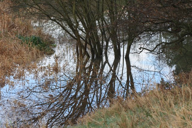
A network of well-maintained footpaths meanders through Lands Wood, allowing visitors to explore its many enchanting corners. These paths lead to hidden glades, babbling brooks, and tranquil ponds, enhancing the sense of adventure and discovery for those who wander through the wood.

Lands Wood is home to a plethora of wildlife, making it a haven for birdwatchers and nature photographers. Visitors may have the opportunity to spot various bird species, including woodpeckers, nuthatches, and tawny owls. Squirrels scamper through the treetops, while deer occasionally graze in the more secluded areas of the wood.

The wood is open to the public year-round, providing a peaceful retreat from the hustle and bustle of city life. Whether it's a leisurely stroll, a family picnic, or simply a moment of solitude in nature, Lands Wood offers a tranquil and idyllic setting for all who venture into its leafy embrace.

If you have any feedback on the listing, please let us know in the comments section below.
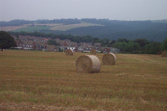
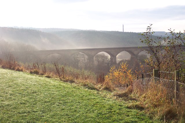
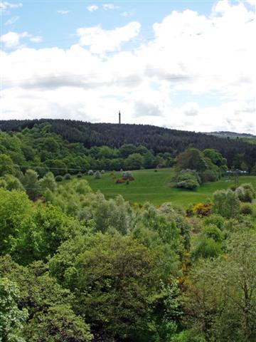
Lands Wood Images

Images are sourced within 2km of 54.945647/-1.7194371 or Grid Reference NZ1861. Thanks to Geograph Open Source API. All images are credited.

Far Pastures A nature reserve home to newly released Red Kites
Far Pastures
A nature reserve home to newly released Red Kites
View to south over Lockhaugh Estate and toward Gibside Right on the rural-urban fringe. This typical cereal field was once four smaller fields. The stubble left behind after harvest is irresistible to a variety of birds.
View to south over Lockhaugh Estate and toward Gibside
Right on the rural-urban fringe. This typical cereal field was once four smaller fields. The stubble left behind after harvest is irresistible to a variety of birds.
Looking south to Nine Arches Viaduct from Goodshieldhaugh Hill Part of the Derwent Country Park. A not-so-little gem!
Looking south to Nine Arches Viaduct from Goodshieldhaugh Hill
Part of the Derwent Country Park. A not-so-little gem!
Snipes Dean Wood and Gibside Taken from the viaduct over the River Derwent on the Derwent Walk.  Sticking up on the horizon is the 'Monument to Liberty' (50m high) in the grounds of Gibside.
More info: <span class="nowrap"><a title="http://www.nationaltrust.org.uk/main/w-vh/w-visits/w-findaplace/w-gibside.htm" rel="nofollow ugc noopener" href="http://www.nationaltrust.org.uk/main/w-vh/w-visits/w-findaplace/w-gibside.htm">Link</a><img style="margin-left:2px;" alt="External link" title="External link - shift click to open in new window" src="https://s1.geograph.org.uk/img/external.png" width="10" height="10"/></span>
Snipes Dean Wood and Gibside
Taken from the viaduct over the River Derwent on the Derwent Walk. Sticking up on the horizon is the 'Monument to Liberty' (50m high) in the grounds of Gibside. More info: LinkExternal link
Wet Area at the North end of Lady Haugh
Lady Haugh The name given to the water meadow alongside the River Derwent that was created as part of the vista for Gibside Hall. In the distance, outside this square, two of the nine arches of the viaduct over the river can be seen.
Lady Haugh
The name given to the water meadow alongside the River Derwent that was created as part of the vista for Gibside Hall. In the distance, outside this square, two of the nine arches of the viaduct over the river can be seen.
Snipes Dene Dene is a name particular to Northumberland for a steep sides wooded valley. The burn or stream that flows down the valley usually takes the name of the dene.
Snipes Dene
Dene is a name particular to Northumberland for a steep sides wooded valley. The burn or stream that flows down the valley usually takes the name of the dene.
Viaduct Over the River Derwent Supposedly nine arches although only five in view here. Now carrying the Derwent Walk footpath and cycleway.
Viaduct Over the River Derwent
Supposedly nine arches although only five in view here. Now carrying the Derwent Walk footpath and cycleway.
Old Hollinside Old Hollinside is a 13thC hall block, 16m x 7m over walls a metre thick. It is positioned so that the 4m square latrine turret at the NW corner over hangs a steep drop to the river Derwent. Hollinside was occupied by the Harding family from the early 16thC to the early 18thC, when it was abandoned.
Old Hollinside
Old Hollinside is a 13thC hall block, 16m x 7m over walls a metre thick. It is positioned so that the 4m square latrine turret at the NW corner over hangs a steep drop to the river Derwent. Hollinside was occupied by the Harding family from the early 16thC to the early 18thC, when it was abandoned.
Rock art on sofa, June 2007 Wow, I thought, that looks just like prehistoric rock art lying on an old sofa outside Hollinside Farm. So I photographed it and sent it to the experts. They agreed, and the "sofa stone" as it was known has been logged and recorded and can now be seen at <span class="nowrap"><a title="http://archaeologydataservice.ac.uk/era/section/panel/overview.jsf?eraId=578" rel="nofollow ugc noopener" href="http://archaeologydataservice.ac.uk/era/section/panel/overview.jsf?eraId=578">Link</a><img style="margin-left:2px;" alt="External link" title="External link - shift click to open in new window" src="https://s1.geograph.org.uk/img/external.png" width="10" height="10"/></span>
Rock art on sofa, June 2007
Wow, I thought, that looks just like prehistoric rock art lying on an old sofa outside Hollinside Farm. So I photographed it and sent it to the experts. They agreed, and the "sofa stone" as it was known has been logged and recorded and can now be seen at LinkExternal link
Derwent Walk Country Park The Derwent Walk Country Park is a mixture of woodlands, meadows, wetlands, riverside and reclaimed industrial sites all linked by the Derwent Walk. The Derwent Walk is the track-bed of the old Derwent Valley Railway. It is 11 miles long and follows the Derwent Valley between Swalwell and Consett.
 
Derwenthaugh Park is a reclaimed area that was (up to 1986) the site of the former Derwenthaugh Coke Works. The two parks are now managed as one and there is no boundary between them.

<span class="nowrap"><a title="http://www.gateshead.gov.uk/Leisure%20and%20Culture/countryside/sites/derwent.aspx#1107" rel="nofollow ugc noopener" href="http://www.gateshead.gov.uk/Leisure%20and%20Culture/countryside/sites/derwent.aspx#1107">Link</a><img style="margin-left:2px;" alt="External link" title="External link - shift click to open in new window" src="https://s1.geograph.org.uk/img/external.png" width="10" height="10"/></span> – Gateshead Council
Derwent Walk Country Park
The Derwent Walk Country Park is a mixture of woodlands, meadows, wetlands, riverside and reclaimed industrial sites all linked by the Derwent Walk. The Derwent Walk is the track-bed of the old Derwent Valley Railway. It is 11 miles long and follows the Derwent Valley between Swalwell and Consett. Derwenthaugh Park is a reclaimed area that was (up to 1986) the site of the former Derwenthaugh Coke Works. The two parks are now managed as one and there is no boundary between them. LinkExternal link – Gateshead Council
Derwent Walk, Nine Arches The track-bed of the old Derwent Valley Railway, crossing the "Nine Arches" viaduct.
Derwent Walk, Nine Arches
The track-bed of the old Derwent Valley Railway, crossing the "Nine Arches" viaduct.
View South from Nine Arches Viaduct The Derwent Walk Country Park is a mixture of woodlands, meadows, wetlands, riverside and reclaimed industrial sites all linked by the Derwent Walk. The Derwent Walk is the track-bed of the old Derwent Valley Railway. It is 11 miles long and follows the Derwent Valley between Swalwell and Consett.
 
Derwenthaugh Park is a reclaimed area that was (up to 1986) the site of the former Derwenthaugh Coke Works. The two parks are now managed as one and there is no boundary between them.

<span class="nowrap"><a title="http://www.gateshead.gov.uk/Leisure%20and%20Culture/countryside/sites/derwent.aspx#1107" rel="nofollow ugc noopener" href="http://www.gateshead.gov.uk/Leisure%20and%20Culture/countryside/sites/derwent.aspx#1107">Link</a><img style="margin-left:2px;" alt="External link" title="External link - shift click to open in new window" src="https://s1.geograph.org.uk/img/external.png" width="10" height="10"/></span> – Gateshead Council
View South from Nine Arches Viaduct
The Derwent Walk Country Park is a mixture of woodlands, meadows, wetlands, riverside and reclaimed industrial sites all linked by the Derwent Walk. The Derwent Walk is the track-bed of the old Derwent Valley Railway. It is 11 miles long and follows the Derwent Valley between Swalwell and Consett. Derwenthaugh Park is a reclaimed area that was (up to 1986) the site of the former Derwenthaugh Coke Works. The two parks are now managed as one and there is no boundary between them. LinkExternal link – Gateshead Council
River Derwent Looking down to the River Derwent from the Nine Arches Viaduct.
River Derwent
Looking down to the River Derwent from the Nine Arches Viaduct.
River Derwent, Gibside The River Derwent at Gibside estate, seen from Lady Haugh.
River Derwent, Gibside
The River Derwent at Gibside estate, seen from Lady Haugh.
River Derwent at Owlet Hill Showing the woods on the far bank. There is a very nice riverside walk here and the river is very lively along this stretch.
River Derwent at Owlet Hill
Showing the woods on the far bank. There is a very nice riverside walk here and the river is very lively along this stretch.
River Derwent at Lockhaugh meadows Looking north along the riverside path with the Nine Arches Viaduct in the background.
River Derwent at Lockhaugh meadows
Looking north along the riverside path with the Nine Arches Viaduct in the background.
River Derwent at Lockhaugh Looking south along the riverside path. This is an area of grassland beside the river which is being recreated as a wild flower meadow.
River Derwent at Lockhaugh
Looking south along the riverside path. This is an area of grassland beside the river which is being recreated as a wild flower meadow.
Show me another place!

Lands Wood is located at Grid Ref: NZ1861 (Lat: 54.945647, Lng: -1.7194371)

Unitary Authority: Gateshead

Police Authority: Northumbria

What 3 Words

///lied.twins.shot. Near Blaydon-on-Tyne, Tyne & Wear

Related Wikis

Winlaton Mill

Winlaton Mill is a village in Tyne and Wear, North East England. It is not to be confused with Winlaton to the northwest which now comprises the southern...

Blaydon (UK Parliament constituency)

Blaydon is a constituency represented in the House of Commons since 2017 by Liz Twist of the Labour Party.The seat is due to be abolished for the next...

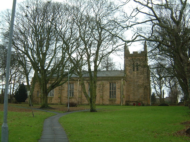
St Paul's Church, Winlaton

St Paul's Church is a 19th-century church in Winlaton, Tyne and Wear, England, dedicated to St Paul. It is a Grade II listed building. == History == The...

Winlaton

Winlaton is a village situated in the Metropolitan Borough of Gateshead, Tyne and Wear, England. Historically in County Durham, it was incorporated into...

Related Videos

Winlaton Mill & Derwent Valley with Interesting Walks NE 10.1 chilly miles

Lovely walk near to the sprawling metropolis of Newcastle-upon-Tyne, proving you don't have to travel for miles to get a good ...

Walking the River Derwent Part 2. Upstream - Hexham Road B6317 to the Red Kite Pub. Cycle route 14.

A gentle walk which is wheelchair friendly and dog friendly. Some of this walk includes National Cycle route 14. Walking the River ...

Derwent Valley Walk:- Swalwell to Ebchester with Interesting Walks NE (8.8 miles)

Sometimes it's just good to get out in the fresh air, with like-minded folk for a bit of exercise. This walk follows the old East - West ...

The Red Kite Trail, a circular walk in north-east England

The Red Kite Trail is a circular walk in north-east England. Approximately 11 miles (18km) long, the trail is a way of exploring the ...

Nearby Amenities

Located within 500m of 54.945647,-1.7194371
Winlaton Mill
Place: village
Wikidata: Q36208763
Wikipedia: en:Winlaton Mill
Lat/Long: 54.9429235/-1.7163065
Bus Stop
WINLATON MILL
Local Ref: S
Naptan AtcoCode: 410000013147
Naptan Bearing: S
Naptan CommonName: WINLATON MILL
Naptan Indicator: S
Naptan Landmark: 35M SOUTH OF POST OFFICE
Naptan NaptanCode: twrawdjw
Naptan PlusbusZoneRef: NWCSTLE
Naptan Street: NOEL AVENUE
Naptan Verified: no
Source: naptan_import
Lat/Long: 54.9428918/-1.7135469
Bus Stop
HOLLY AVENUE-W/B
Local Ref: W
Naptan AtcoCode: 410000013148
Naptan Bearing: W
Naptan CommonName: HOLLY AVENUE-W/B
Naptan Indicator: W
Naptan Landmark: OUTSIDE NO.68 HOLLY AVENUE
Naptan NaptanCode: twrawdma
Naptan PlusbusZoneRef: NWCSTLE
Naptan Street: HOLLY AVENUE
Naptan Verified: no
Source: naptan_import
Lat/Long: 54.9425578/-1.716765
Bus Stop
MUNDLE AVENUE-N/B
Local Ref: N
Naptan AtcoCode: 410000013149
Naptan Bearing: N
Naptan CommonName: MUNDLE AVENUE-N/B
Naptan Indicator: N
Naptan Landmark: JUNCTION WITH HOLLY AVENUE JUNCTION
Naptan NaptanCode: twrawdmd
Naptan PlusbusZoneRef: NWCSTLE
Naptan Street: MUNDLE AVENUE
Naptan Verified: no
Source: naptan_import
Lat/Long: 54.9428281/-1.7170753
Power: tower
Lat/Long: 54.9442902/-1.7237441
Power: tower
Lat/Long: 54.9466257/-1.7153086
Power: tower
Lat/Long: 54.9442496/-1.7253672
Power: tower
Lat/Long: 54.9446439/-1.7224667
Power: tower
Lat/Long: 54.9450118/-1.7211379
Power: tower
Lat/Long: 54.9454107/-1.7196971
Power: tower
Lat/Long: 54.9458111/-1.7182508
Power: tower
Lat/Long: 54.9462132/-1.7167986
Power: tower
Lat/Long: 54.9464106/-1.7127885
Power: tower
Lat/Long: 54.9465202/-1.7140726
Barrier: motorcycle_barrier
Lat/Long: 54.943043/-1.720368
Village Store
Addr City: Blaydon-on-Tyne
Addr Housenumber: 5A
Addr Postcode: NE21 6SH
Addr Street: Noel Avenue
Addr Village: Winlaton Mill
Fhrs Id: 1693971
Shop: convenience
Source Addr: FHRS Open Data
Lat/Long: 54.9430702/-1.7133397
Community Centre
Winlaton Mill Village Hall
Addr City: Blaydon-on-Tyne
Addr Postcode: NE21 6SF
Addr Street: May Avenue
Addr Village: Winlaton Mill
Fhrs Id: 846128
Source Addr: FHRS Open Data
Website: https://sites.google.com/site/winlatonmillvillagehall/
Lat/Long: 54.9438395/-1.7166127
Telephone
Lat/Long: 54.9431459/-1.713433
Post Box
Ref: NE21 255
Lat/Long: 54.9430575/-1.713449
The data included in this document is from www.openstreetmap.org. The data is made available under ODbL.

Have you been to Lands Wood?

Leave your review of Lands Wood below (or comments, questions and feedback).