Lynch Coppice

Wood, Forest in Gloucestershire Cotswold

England

Lynch Coppice

Former Aston Magna church No longer a church, now converted into a private residence, the hedge is so high the tower is barely visible.
Former Aston Magna church Credit: Philip Halling

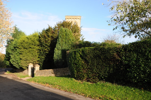
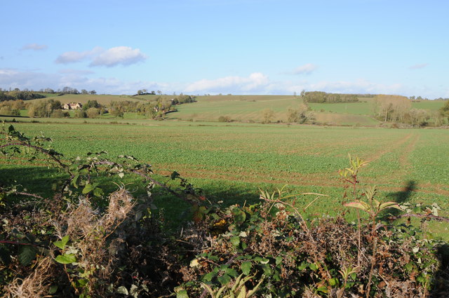
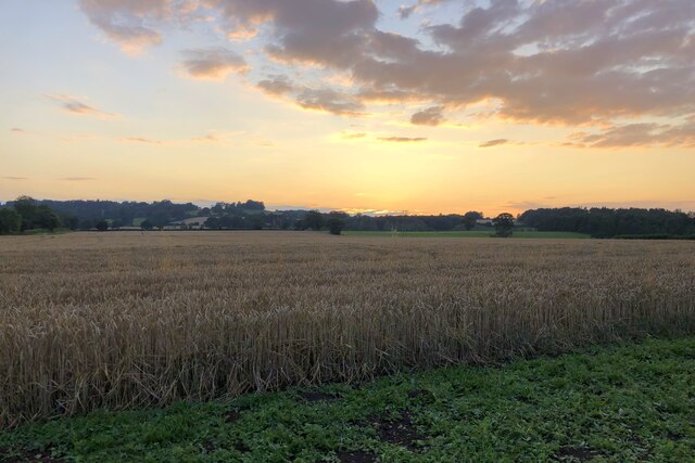
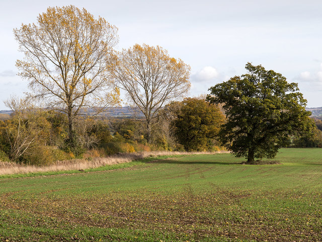
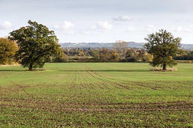
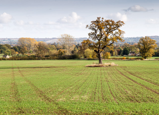
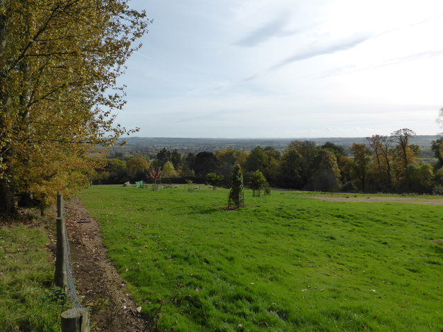
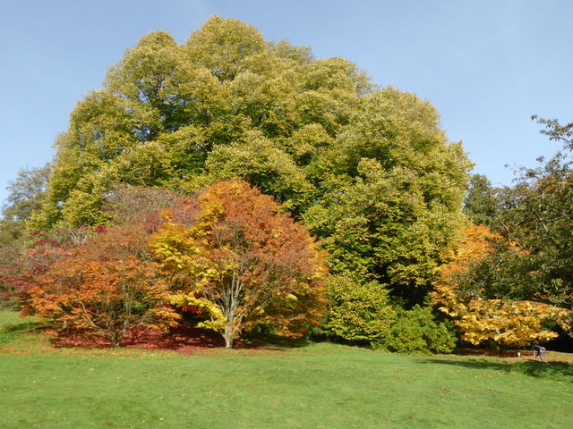
Lynch Coppice is a picturesque wood located in the county of Gloucestershire, England. Situated in the heart of the countryside, this forested area spans over several acres, offering a tranquil and serene escape from the hustle and bustle of everyday life.

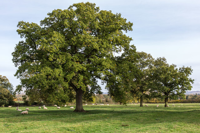
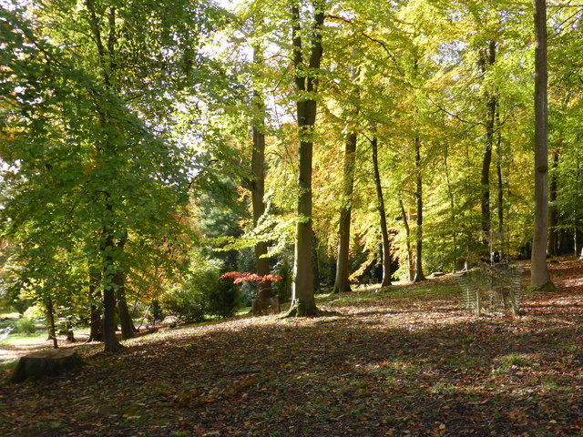
The coppice is primarily composed of native broadleaf trees, such as oak, beech, and ash, creating a diverse and vibrant ecosystem. The thick canopy formed by the towering trees provides a shaded and cool atmosphere during the summer months, making it an ideal spot for picnics or leisurely walks.

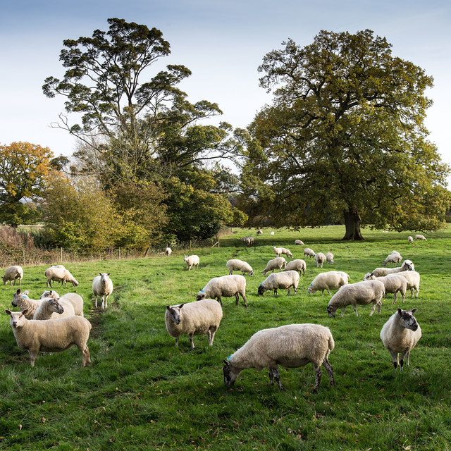
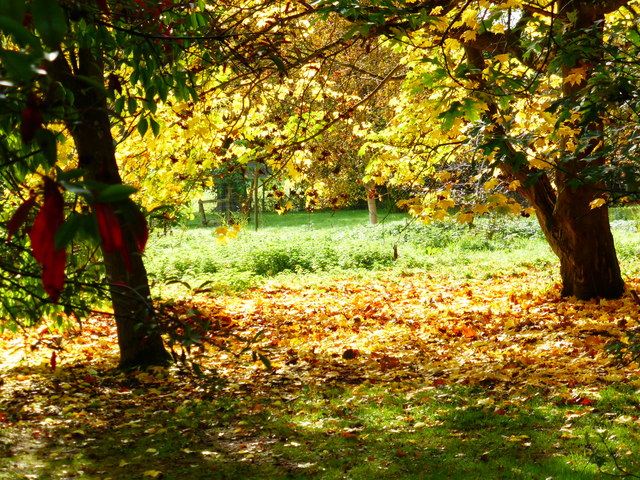
The forest floor of Lynch Coppice is adorned with a rich carpet of wildflowers, creating a colorful and enchanting sight. These flowers attract a variety of wildlife, including butterflies, bees, and birds, making it a haven for nature enthusiasts and birdwatchers.

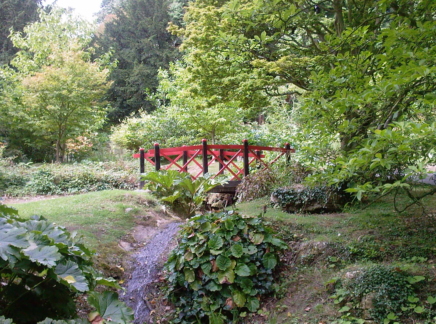
Trails have been carefully laid out throughout the coppice, allowing visitors to explore the area at their own pace. These trails wind through the woods, revealing hidden glades, babbling brooks, and small ponds teeming with life. The quiet ambiance of the coppice is only interrupted by the gentle rustling of leaves and the occasional chirping of birds.

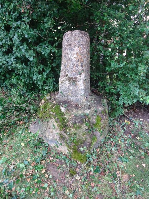
Lynch Coppice also holds historical significance, as it has been managed as a traditional coppice woodland for many centuries. This sustainable method of woodland management involves regularly cutting down trees to encourage new growth, ensuring a continuous supply of wood for various purposes.

Overall, Lynch Coppice in Gloucestershire offers a captivating and immersive experience for nature lovers, history enthusiasts, and those seeking solace in the embrace of nature's beauty.

If you have any feedback on the listing, please let us know in the comments section below.

Lynch Coppice Images

Images are sourced within 2km of 52.015816/-1.729803 or Grid Reference SP1835. Thanks to Geograph Open Source API. All images are credited.

Former Aston Magna church No longer a church, now converted into a private residence, the hedge is so high the tower is barely visible.
Former Aston Magna church
No longer a church, now converted into a private residence, the hedge is so high the tower is barely visible.
View over the hedge This country road to the north of Aston Magna briefly enters this square hence the view to Neighbrook over the hedge.
View over the hedge
This country road to the north of Aston Magna briefly enters this square hence the view to Neighbrook over the hedge.
Public footpath to Todenham
Field of wheat at sunset
Wayside Cross, Aston Magna, Blockley 15ᵗʰ C shaft and base with shaped stops on octagonal plinth. 
These crosses were placed for pilgrims to stop and pray for a safe journey, probably en route to Oxford.

Grade II listed Nᴼ 1088642 <span class="nowrap"><a title="https://historicengland.org.uk/listing/the-list/list-entry/1088642" rel="nofollow ugc noopener" href="https://historicengland.org.uk/listing/the-list/list-entry/1088642">Link</a><img style="margin-left:2px;" alt="External link" title="External link - shift click to open in new window" src="https://s1.geograph.org.uk/img/external.png" width="10" height="10"/></span>

Milestone Society National ID: GLCO_BLO
Wayside Cross, Aston Magna, Blockley
15ᵗʰ C shaft and base with shaped stops on octagonal plinth. These crosses were placed for pilgrims to stop and pray for a safe journey, probably en route to Oxford. Grade II listed Nᴼ 1088642 LinkExternal link Milestone Society National ID: GLCO_BLO
Northcot Bricks Limited The Northcot Brick works are beside the Worcester to Oxford Railway and Station Road between Blockley and Paxford,
Northcot Bricks Limited
The Northcot Brick works are beside the Worcester to Oxford Railway and Station Road between Blockley and Paxford,
Chimneys at Northcot Brick Works, Chimneys at Northcot Brick Works viewed from Station Road between Blockley and Paxford.
Chimneys at Northcot Brick Works,
Chimneys at Northcot Brick Works viewed from Station Road between Blockley and Paxford.
St. Mary's Church, Batsford The south side of the church from the edge of the churchyard.
Anglican parish church. Rebuilt by W.F. Poulton and Woodman of
Reading 1861-2. Ashlar limestone.<span class="nowrap"><a title="http://www.britishlistedbuildings.co.uk/en-128641-church-of-st-mary-batsford-gloucestershi#.Viz3Syspknk" rel="nofollow ugc noopener" href="http://www.britishlistedbuildings.co.uk/en-128641-church-of-st-mary-batsford-gloucestershi#.Viz3Syspknk">Link</a><img style="margin-left:2px;" alt="External link" title="External link - shift click to open in new window" src="https://s1.geograph.org.uk/img/external.png" width="10" height="10"/></span>
St. Mary's Church, Batsford
The south side of the church from the edge of the churchyard. Anglican parish church. Rebuilt by W.F. Poulton and Woodman of Reading 1861-2. Ashlar limestone.LinkExternal link
Autumn Fields View ESE from the footpath to Bourton-on-the-Hill.
Autumn Fields
View ESE from the footpath to Bourton-on-the-Hill.
Autumn Fields View ESE from the footpath to Bourton-on-the-Hill.
Autumn Fields
View ESE from the footpath to Bourton-on-the-Hill.
Autumn Fields View ESE from the footpath to Bourton-on-the-Hill.
Autumn Fields
View ESE from the footpath to Bourton-on-the-Hill.
Sheep by the footpath View ESE from the footpath to Bourton-on-the-Hill.
Sheep by the footpath
View ESE from the footpath to Bourton-on-the-Hill.
Autumn Fields View ESE from the footpath to Bourton-on-the-Hill.
Autumn Fields
View ESE from the footpath to Bourton-on-the-Hill.
Batsford Arboretum - viewpoint Looking over the boundary fence at one of the corners of the arboretum.
Batsford Arboretum - viewpoint
Looking over the boundary fence at one of the corners of the arboretum.
Batsford Church from the Arboretum It is possible to enter the arboretum from this end but a notice warns that people doing so without a ticket risk prosecution as the pay booth is at the other end.
Batsford Church from the Arboretum
It is possible to enter the arboretum from this end but a notice warns that people doing so without a ticket risk prosecution as the pay booth is at the other end.
Autumn colours - Batsford Arboretum
Batsford Arboretum The positions and view direction are approximations. A lovely sunny sunday morning in autumn.
Batsford Arboretum
The positions and view direction are approximations. A lovely sunny sunday morning in autumn.
Batsford Arboretum - autumnal The camera can be adjusted to make these colours even more vibrant but this au natural effect in the sunshine is quite vivid enough for my liking.
Batsford Arboretum - autumnal
The camera can be adjusted to make these colours even more vibrant but this au natural effect in the sunshine is quite vivid enough for my liking.
Show me another place!

Lynch Coppice is located at Grid Ref: SP1835 (Lat: 52.015816, Lng: -1.729803)

Administrative County: Gloucestershire

District: Cotswold

Police Authority: Gloucestershire

What 3 Words

///hotels.hooked.helpfully. Near Blockley, Gloucestershire

Related Wikis

Draycott, Gloucestershire

Draycott is a small hamlet in north Gloucestershire between Moreton-in-Marsh and Blockley, within Blockley civil parish. It is not mentioned in Domesday...

Aston Magna

Aston Magna is a hamlet located off Fosse Way in north Gloucestershire, England, between Moreton-in-Marsh and Shipston-on-Stour. It forms part of the...

Batsford

Batsford is a village and civil parish in the Cotswold district of Gloucestershire, England. The village is about 1½ miles north-west of Moreton-in...

Batsford Arboretum

Batsford Arboretum is a 55-acre (220,000 m2) arboretum and botanical garden near Batsford in Gloucestershire, England, about 1½ miles north-west of Moreton...

Blockley railway station

Blockley railway station served the village of Blockley, Gloucestershire, England from 1853 to 1966 on the Oxford, Worcester and Wolverhampton Railway...

Wellacre Quarry

Wellacre Quarry (grid reference SP180370) is a 12.3 hectare geological Site of Special Scientific Interest in Gloucestershire, notified in 1974. It is...

Upper Ditchford

Upper Ditchford is an abandoned village to the west of the Fosse Way between Moreton-in-Marsh and Stretton on Fosse, now in the county of Gloucestershire...

Northwick Park, Gloucestershire

Northwick Park is a residential estate and business centre near Blockley in Gloucestershire, England. The estate is built in the grounds of the former...

Nearby Amenities

Located within 500m of 52.015816,-1.729803
Fixme: continues
Lat/Long: 52.0193451/-1.7301643
Cadley Cottage
Power: pole
Transformer: distribution
Voltage Primary: 11000
Lat/Long: 52.0116163/-1.7315617
Power: pole
Lat/Long: 52.011419/-1.7305371
The data included in this document is from www.openstreetmap.org. The data is made available under ODbL.

Have you been to Lynch Coppice?

Leave your review of Lynch Coppice below (or comments, questions and feedback).