Garratt's Piece Plantations

Wood, Forest in Derbyshire Derbyshire Dales

England

Garratt's Piece Plantations

View across pasture to the Jug and Glass Inn from Green Lane The Jug and Glass Inn is located on the A515
View across pasture to the Jug and Glass Inn from Green Lane Credit: Philip Cornwall

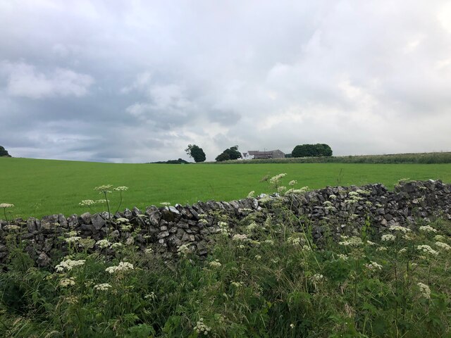
Garratt's Piece Plantations, located in Derbyshire, England, is a vast and enchanting woodland area known for its diverse array of trees and serene natural beauty. Covering several hectares of land, this forested area is a popular destination for nature enthusiasts, hikers, and photographers alike.

The plantation boasts a rich variety of tree species, including oak, beech, birch, and pine, creating a stunning landscape that changes with the seasons. In the spring, the woodland floor is carpeted with vibrant wildflowers, while in the autumn, the foliage transforms into a breathtaking display of reds, oranges, and yellows.

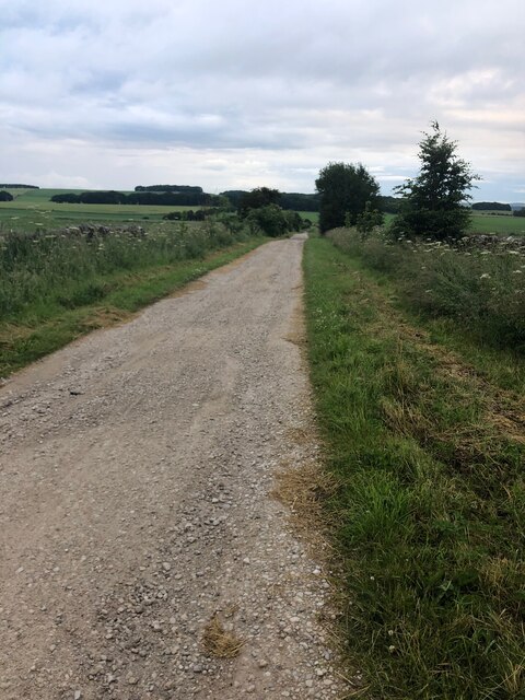
Traversing the forest, visitors can enjoy a network of well-marked trails that cater to different skill levels. These paths meander through the trees, offering glimpses of wildlife such as deer, foxes, and a plethora of bird species. Along the way, there are several picnic areas and benches where visitors can take a break and soak in the tranquility of the surroundings.

Garratt's Piece Plantations also has a rich historical significance, with traces of ancient settlements and archaeological sites scattered throughout the forest. These remnants serve as a testament to the area's longstanding connection with human civilization.

Whether you are seeking a peaceful escape from the bustle of city life, an opportunity to reconnect with nature, or a chance to immerse yourself in the region's history, Garratt's Piece Plantations offers a captivating experience that will leave you awe-inspired.

If you have any feedback on the listing, please let us know in the comments section below.

Garratt's Piece Plantations Images

Images are sourced within 2km of 53.159108/-1.7430851 or Grid Reference SK1762. Thanks to Geograph Open Source API. All images are credited.

View across pasture to the Jug and Glass Inn from Green Lane The Jug and Glass Inn is located on the A515
View across pasture to the Jug and Glass Inn from Green Lane
The Jug and Glass Inn is located on the A515
Green Lane A well maintained track near Caskinlow Farm
Green Lane
A well maintained track near Caskinlow Farm
Arbor Low henge - flat stones One of the earliest sites in England to have been designated a scheduled ancient monument, and one of the few to have been given a fully detailed description by Historic England (list entry 1011087), the henge consists of a stone circle within an elliptical bank and ditch (40m by 52m) with two entrances and a later bowl barrow. The immediate surrounding area contains a number of other tumuli, barrows and ancient earthworks. The dating is roughly Late Neolithic to Late Bronze Age (c.2400-1500BC).  

The stone circle itself originally comprised 41-43 upright limestone slabs, with some further stones at the centre representing a burial chamber (more than one burial was found during excavations at the site). The stones have at some time in the past been laid flat on the ground. An interpretation board on site attributes this to mediaeval superstition or religious persecution, but someone we met on site who seemed to know it well said he believed it was a more recent (19th century?) action.
Arbor Low henge - flat stones
One of the earliest sites in England to have been designated a scheduled ancient monument, and one of the few to have been given a fully detailed description by Historic England (list entry 1011087), the henge consists of a stone circle within an elliptical bank and ditch (40m by 52m) with two entrances and a later bowl barrow. The immediate surrounding area contains a number of other tumuli, barrows and ancient earthworks. The dating is roughly Late Neolithic to Late Bronze Age (c.2400-1500BC). The stone circle itself originally comprised 41-43 upright limestone slabs, with some further stones at the centre representing a burial chamber (more than one burial was found during excavations at the site). The stones have at some time in the past been laid flat on the ground. An interpretation board on site attributes this to mediaeval superstition or religious persecution, but someone we met on site who seemed to know it well said he believed it was a more recent (19th century?) action.
Arbor Low henge - ditch and bank One of the earliest sites in England to have been designated a scheduled ancient monument, and one of the few to have been given a fully detailed description by Historic England (list entry 1011087), the henge consists of a stone circle within an elliptical bank and ditch (40m by 52m) with two entrances and a later bowl barrow. The immediate surrounding area contains a number of other tumuli, barrows and ancient earthworks. The dating is roughly Late Neolithic to Late Bronze Age (c.2400-1500BC).  

The ditch and bank are seen here from the top of the bank.  The site was fully excavated c.1902, so the exact profile of the bank is probably not original.
Arbor Low henge - ditch and bank
One of the earliest sites in England to have been designated a scheduled ancient monument, and one of the few to have been given a fully detailed description by Historic England (list entry 1011087), the henge consists of a stone circle within an elliptical bank and ditch (40m by 52m) with two entrances and a later bowl barrow. The immediate surrounding area contains a number of other tumuli, barrows and ancient earthworks. The dating is roughly Late Neolithic to Late Bronze Age (c.2400-1500BC). The ditch and bank are seen here from the top of the bank. The site was fully excavated c.1902, so the exact profile of the bank is probably not original.
Arbor Low henge - VR boundary stone The boundary stones around the henge are not ancient, but were added around the time the site was excavated c.1902 (at the end of the Victorian era). Some of them therefore have the initials VR, and some GR, for Victoria and her successor King George.
Arbor Low henge - VR boundary stone
The boundary stones around the henge are not ancient, but were added around the time the site was excavated c.1902 (at the end of the Victorian era). Some of them therefore have the initials VR, and some GR, for Victoria and her successor King George.
Field scabious Flowers growing on the bank of Arbor Low henge.
Field scabious
Flowers growing on the bank of Arbor Low henge.
Approaching the entrance to Arbor Low henge  The elliptical henge originally had two opposite entrances, but this is the one used by visitors approaching on the permitted route through Upper Oldhams Farm.
Approaching the entrance to Arbor Low henge
The elliptical henge originally had two opposite entrances, but this is the one used by visitors approaching on the permitted route through Upper Oldhams Farm.
View from Arbor Low towards Gib Hill  Gib Hill is a burial mound or barrow, somewhat camouflaged in this view against a distant hill (roughly in the centre of the picture, a bit to the left of the cow in the foreground).  The two sites are believed to be associated but are separately scheduled.
View from Arbor Low towards Gib Hill
Gib Hill is a burial mound or barrow, somewhat camouflaged in this view against a distant hill (roughly in the centre of the picture, a bit to the left of the cow in the foreground). The two sites are believed to be associated but are separately scheduled.
Upper Oldhams Farm A beef farm close to Arbor Low henge. There is no public right of way through this farm or its surrounding fields, but visitors are invited to contribute £1 by way of purchasing a temporary right of passage to the henge.
Upper Oldhams Farm
A beef farm close to Arbor Low henge. There is no public right of way through this farm or its surrounding fields, but visitors are invited to contribute £1 by way of purchasing a temporary right of passage to the henge.
Track to Upper Oldhams Farm A beef farm close to Arbor Low henge. There is no public right of way through this farm or its surrounding fields, but visitors are invited to contribute £1 by way of purchasing a temporary right of passage to the henge.
Track to Upper Oldhams Farm
A beef farm close to Arbor Low henge. There is no public right of way through this farm or its surrounding fields, but visitors are invited to contribute £1 by way of purchasing a temporary right of passage to the henge.
The High Peak Trail A very cold and icy section of the trail just south east of the A515 road bridge.
The High Peak Trail
A very cold and icy section of the trail just south east of the A515 road bridge.
Contractors A specialist contractor surveying the over bridge on the High Peak Trail.
Contractors
A specialist contractor surveying the over bridge on the High Peak Trail.
Contractors 2 Another vehicle used to move scaffolding underneath the bridge to enable inspection. Not much room for pedestrians using the trail.
Contractors 2
Another vehicle used to move scaffolding underneath the bridge to enable inspection. Not much room for pedestrians using the trail.
Across the field A very nice arable crop of Barley, rather unusual at this height above sea level.
Across the field
A very nice arable crop of Barley, rather unusual at this height above sea level.
Iron fence post The post has been recycled from a section of narrow gauge rail, there were several different narrow gauge lines in the locality all used in the extraction of  sand for use in the nearby brick works.
Iron fence post
The post has been recycled from a section of narrow gauge rail, there were several different narrow gauge lines in the locality all used in the extraction of sand for use in the nearby brick works.
Field and Embankment Looking across the barley crop towards the embankment on the side of the High Peak Trail.
Field and Embankment
Looking across the barley crop towards the embankment on the side of the High Peak Trail.
Scrub by High Peak Trail east of A515 The Pennine Bridleway is a new National Trail.
It runs roughly parallel with the Pennine Way but provides access for horseback riders and cyclists as well as walkers. The trail is around 205 miles long, extending from Derbyshire to Cumbria.
Wikipedia: <span class="nowrap"><a title="https://en.wikipedia.org/wiki/Pennine_Bridleway" rel="nofollow ugc noopener" href="https://en.wikipedia.org/wiki/Pennine_Bridleway">Link</a><img style="margin-left:2px;" alt="External link" title="External link - shift click to open in new window" src="https://s1.geograph.org.uk/img/external.png" width="10" height="10"/></span>
Scrub by High Peak Trail east of A515
The Pennine Bridleway is a new National Trail. It runs roughly parallel with the Pennine Way but provides access for horseback riders and cyclists as well as walkers. The trail is around 205 miles long, extending from Derbyshire to Cumbria. Wikipedia: LinkExternal link
Bridge over High Peak Trail near Blake Moor This is a farm bridge from Newhaven Lodge to the moorland and fields to the north
Bridge over High Peak Trail near Blake Moor
This is a farm bridge from Newhaven Lodge to the moorland and fields to the north
Show me another place!

Garratt's Piece Plantations is located at Grid Ref: SK1762 (Lat: 53.159108, Lng: -1.7430851)

Administrative County: Derbyshire

District: Derbyshire Dales

Police Authority: Derbyshire

What 3 Words

///kneeled.unwound.think. Near Newhaven, Derbyshire

Related Wikis

Middleton and Smerrill

Middleton and Smerrill is a civil parish within the Derbyshire Dales district, in the county of Derbyshire, England. Largely rural except for the village...

Arbor Low

Arbor Low is a well-preserved Neolithic henge in the Derbyshire Peak District, England. It lies on a Carboniferous Limestone plateau known as the White...

Gib Hill

Gib Hill is a large burial mound in the Peak District, Derbyshire, England. It is thought to be a Neolithic oval barrow with an Early Bronze Age round...

Friden Goods Yard

Friden Goods Yard was a goods station located on the Cromford and High Peak Railway near the villages of Friden in Derbyshire. Mostly for moving mineral...

Friden, Derbyshire

Friden is a hamlet in the civil parish of Hartington Nether Quarter, Derbyshire, England. It is 11 miles (18 km) south-east of Buxton, just off the Newhaven...

High Peak Trail

The High Peak Trail is a 17-mile (27 km) trail for walkers, cyclists and horse riders in the Peak District of England. Running from Dowlow (53.2059°N 1...

Newhaven Tunnel

Newhaven Tunnel was a railway tunnel located on the Cromford and High Peak Railway near the village of Newhaven in Derbyshire. Mostly used for moving mineral...

Newhaven, Derbyshire

Newhaven is a hamlet in the county of Derbyshire, England, east of Hartington and west of Cromford. The principal employer in the area is DSF Refractories...

Nearby Amenities

Located within 500m of 53.159108,-1.7430851
The data included in this document is from www.openstreetmap.org. The data is made available under ODbL.

Have you been to Garratt's Piece Plantations?

Leave your review of Garratt's Piece Plantations below (or comments, questions and feedback).