Dalderby

Settlement in Lincolnshire East Lindsey

England

Dalderby

Horncastle Canal west of Dalderby: aerial 2022
Horncastle Canal west of Dalderby: aerial 2022 Credit: Chris

Dalderby is a small village located in the East Lindsey district of Lincolnshire, England. Situated approximately 15 miles north of the historic city of Lincoln, the village is nestled amidst beautiful countryside and offers a tranquil and picturesque setting.

With a population of around 200 residents, Dalderby retains its rural charm and provides a tight-knit community atmosphere. The village is primarily comprised of traditional stone-built houses, many of which date back several centuries. The architecture reflects the village's rich history and adds to its unique character.

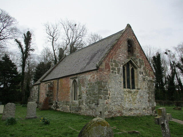
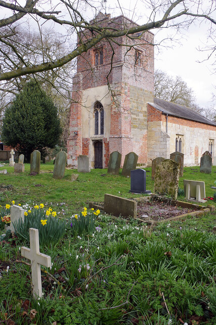
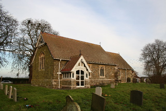
A focal point of Dalderby is its parish church, St. Peter's, which is a Grade II listed building. The church, with its stunning stained glass windows and intricate stonework, stands as a testament to the village's religious heritage. The surrounding churchyard provides a peaceful space for contemplation and offers a glimpse into the village's past, with some gravestones dating back to the 18th century.

While Dalderby may be small in size, it boasts a strong sense of community spirit. The village organizes various events throughout the year, including summer fêtes, Christmas markets, and community clean-up days. These gatherings allow residents to come together, fostering a sense of belonging and camaraderie.

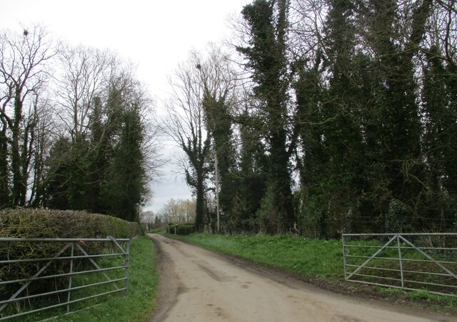
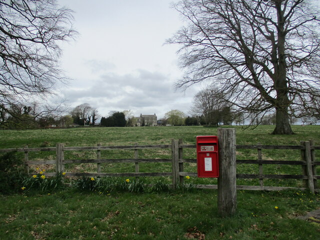
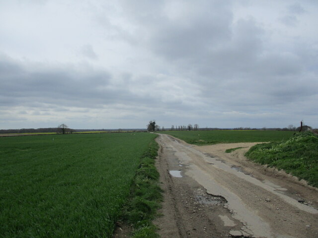
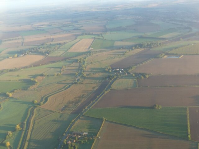
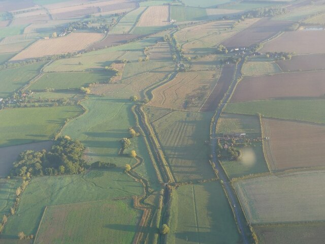
For outdoor enthusiasts, Dalderby is ideally situated for exploring the surrounding countryside. The village is surrounded by rolling hills and meadows, offering plenty of opportunities for walking, cycling, and wildlife spotting. The nearby River Bain provides a scenic backdrop and is a popular spot for fishing and boating.

In conclusion, Dalderby is a charming and idyllic village in Lincolnshire, offering a peaceful retreat and a close-knit community. Its rich history, beautiful architecture, and stunning natural surroundings make it a truly special place to visit or call home.

If you have any feedback on the listing, please let us know in the comments section below.
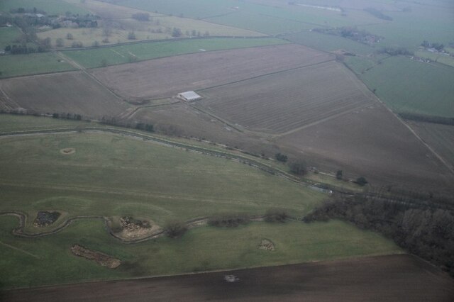
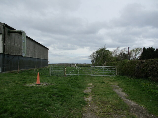
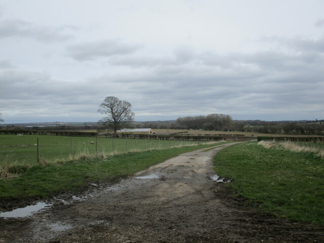
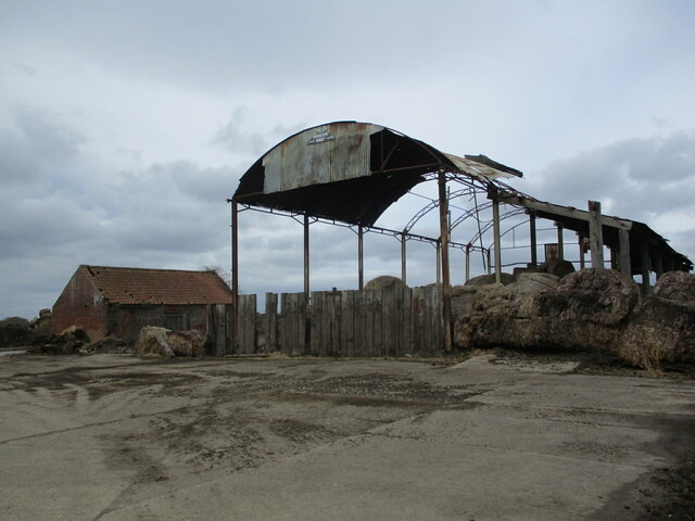
Dalderby Images

Images are sourced within 2km of 53.177232/-0.131714 or Grid Reference TF2466. Thanks to Geograph Open Source API. All images are credited.

Horncastle Canal west of Dalderby: aerial 2022
Sewage Works by the River Bain south of Horncastle: aerial 2022
The beginning of a bridleway to Woodhall Spa, Langton
Farm track at Martin
Standing but flapping Seven years on from <a href="https://www.geograph.org.uk/photo/4389901">TF2367 : Still standing</a> the remaining part of the roof of this derelict barn was flapping wildly in the wind.
Standing but flapping
Seven years on from TF2367 : Still standing the remaining part of the roof of this derelict barn was flapping wildly in the wind.
Churchyard and cottage, Thornton
St. Michael's church. Martin A much repaired and altered Morman church. In this vew can be seen Norman and later medieval stone work and eighteenth century and Victorian brickwork <span class="nowrap"><a title="https://historicengland.org.uk/listing/the-list/list-entry/1146950?section=official-list-entry" rel="nofollow ugc noopener" href="https://historicengland.org.uk/listing/the-list/list-entry/1146950?section=official-list-entry">Link</a><img style="margin-left:2px;" alt="External link" title="External link - shift click to open in new window" src="https://s1.geograph.org.uk/img/external.png" width="10" height="10"/></span>
St. Michael's church. Martin
A much repaired and altered Morman church. In this vew can be seen Norman and later medieval stone work and eighteenth century and Victorian brickwork LinkExternal link
Church Lane, Martin
Church Lane, Martin
Grass field and Martin Hall Martin Hall dates from the late eighteenth century <span class="nowrap"><a title="https://historicengland.org.uk/listing/the-list/list-entry/1359919?section=official-list-entry" rel="nofollow ugc noopener" href="https://historicengland.org.uk/listing/the-list/list-entry/1359919?section=official-list-entry">Link</a><img style="margin-left:2px;" alt="External link" title="External link - shift click to open in new window" src="https://s1.geograph.org.uk/img/external.png" width="10" height="10"/></span>
Grass field and Martin Hall
Martin Hall dates from the late eighteenth century LinkExternal link
Ox Pasture Lane, Thornton
The Lion Gateway With the Lion Lodge through the arch at Scrivelsby Manor, the holder of the Manor being the King's Champion
The Lion Gateway
With the Lion Lodge through the arch at Scrivelsby Manor, the holder of the Manor being the King's Champion
River Bain and disused Horncastle Canal N of Haltham: aerial 2022
Cropmarks on fields S of Scrivelsby Spinney: aerial 2022
River Bain and disused Horncastle Canal at Dalderby: aerial 2022
River Bain and disused Horncastle Canal S of Dalderby: aerial 2022
The Lion Gateway For Scrivelsby Court, with the Lion Lodge behind the arch
The Lion Gateway
For Scrivelsby Court, with the Lion Lodge behind the arch
Roughton Church Well off the beaten track, the Church of St Margaret seems to blend into the Lincolnshire countryside. It is grade II* listed and designated an ancient monument. The chancel dates from the 13th century and the rest mostly from the 15th; it was restored in 1870. The churchyard is noted for its snowdrops but this mid-March view is a little late for that; instead there is a pleasing clump of daffodils.
Roughton Church
Well off the beaten track, the Church of St Margaret seems to blend into the Lincolnshire countryside. It is grade II* listed and designated an ancient monument. The chancel dates from the 13th century and the rest mostly from the 15th; it was restored in 1870. The churchyard is noted for its snowdrops but this mid-March view is a little late for that; instead there is a pleasing clump of daffodils.
Horncastle Road towards Roughton The B1191 towards Woodhall Spa.
Horncastle Road towards Roughton
The B1191 towards Woodhall Spa.
Show me another place!

Dalderby is located at Grid Ref: TF2466 (Lat: 53.177232, Lng: -0.131714)

Division: Parts of Lindsey

Administrative County: Lincolnshire

District: East Lindsey

Police Authority: Lincolnshire

What 3 Words

///importers.lightly.tripled. Near Horncastle, Lincolnshire

Nearby Locations

Dalderby

Related Wikis

Dalderby

Dalderby is a village and former civil parish, now in the parish of Roughton, in the East Lindsey district of Lincolnshire, England. It is situated approximately...

Martin, East Lindsey

Martin is a village and former civil parish, now in the parish of Roughton, in the East Lindsey district of Lincolnshire, England. It is about 2 miles...

Roughton, Lincolnshire

Roughton ( ROOT-ən) is a village and civil parish in the East Lindsey district of Lincolnshire, England. The parish population was 644 in 2011.The village...

Thornton, Lincolnshire

Thornton, or Thornton by Horncastle, is a village in the civil parish of Roughton, in the East Lindsey district of Lincolnshire, England. It is situated...

Nearby Amenities

Located within 500m of 53.177232,-0.131714
Source: OS_OpenData _StreetView
Lat/Long: 53.1731717/-0.1331945
Source: OS_OpenData _StreetView
Lat/Long: 53.1743147/-0.1327895
Source: OS_OpenData _StreetView
Lat/Long: 53.1756754/-0.1323443
Source: OS_OpenData _StreetView
Lat/Long: 53.1766498/-0.1318916
Source: OS_OpenData _StreetView
Lat/Long: 53.1789057/-0.1296469
Source: OS_OpenData _StreetView
Lat/Long: 53.1793796/-0.1291291
Source: OS_OpenData _StreetView
Lat/Long: 53.1805853/-0.1280817
Dalderby
Is In: Lincolnshire, England, UK
Place: hamlet
Source: Bing
Wikidata: Q5210299
Lat/Long: 53.1770547/-0.1328685
Bus Stop
War Memorial
Naptan AtcoCode: 270000010484
Naptan Bearing: N
Naptan CommonName: War Memorial
Naptan Indicator: adj
Naptan Landmark: War Memorial
Naptan NaptanCode: linjmtmt
Naptan Street: A153
Naptan Verified: no
Source: naptan_import
Lat/Long: 53.1774847/-0.1316007
Bus Stop
War Memorial
Naptan AtcoCode: 2700LDWM6469
Naptan Bearing: S
Naptan CommonName: War Memorial
Naptan Indicator: opp
Naptan Landmark: War Memorial
Naptan NaptanCode: lingdjdw
Naptan Street: A153
Naptan Verified: no
Source: naptan_import
Lat/Long: 53.177393/-0.1313797
Barrier: stile
Lat/Long: 53.1772395/-0.133122
Power: pole
Source: Bing
Lat/Long: 53.1764519/-0.1317823
Power: pole
Source: Bing
Lat/Long: 53.1764646/-0.1312238
Power: pole
Source: Bing
Lat/Long: 53.1761995/-0.1291846
Power: pole
Source: Bing
Lat/Long: 53.1761255/-0.1279521
Power: pole
Source: Bing
Lat/Long: 53.176488/-0.1303165
Power: pole
Source: Bing
Lat/Long: 53.1759857/-0.1259485
Power: pole
Source: Bing
Lat/Long: 53.1757446/-0.1250647
Power: pole
Source: Bing
Lat/Long: 53.1760629/-0.1269624
Power: pole
Source: Bing
Lat/Long: 53.1766383/-0.1248032
Power: pole
Source: Bing
Lat/Long: 53.1775192/-0.1245135
Power: pole
Source: Bing
Lat/Long: 53.1748378/-0.1253678
Manor Farm
Place: farm
Source: Bing
Lat/Long: 53.1765984/-0.1307151
Navigation Farm
Place: farm
Source: Bing
Lat/Long: 53.1762099/-0.1329575
St Martin's Church
Historic: ruins
Historic Amenity: place_of_worship
Historic Building: church
Source: Bing
Lat/Long: 53.1743409/-0.1322269
Bankside
Place: locality
Source: Bing
Lat/Long: 53.1779786/-0.1323303
Dalderby Lock
Place: locality
Source: Bing
Lat/Long: 53.1763631/-0.1360985
St. Martin's Church
Historic Amenity: place_of_worship
Historic Building: church
Lat/Long: 53.1743385/-0.1322129
The data included in this document is from www.openstreetmap.org. The data is made available under ODbL.

Have you been to Dalderby?

Leave your review of Dalderby below (or comments, questions and feedback).