Thackley West Wood

Wood, Forest in Yorkshire

England

Thackley West Wood

The Stocks, Towngate, Baildon
The Stocks, Towngate, Baildon Credit: habiloid

Thackley West Wood is a picturesque woodland located in Yorkshire, England. Covering an area of approximately 50 acres, it is an enchanting destination for nature lovers and outdoor enthusiasts. The wood is situated in the village of Thackley, near Bradford, and is easily accessible to visitors.

The woodland is predominantly composed of native broadleaf trees, including oak, beech, and birch, creating a diverse and vibrant ecosystem. The thick canopy of foliage provides a serene and shady environment, perfect for a peaceful walk or a tranquil picnic.

Thackley West Wood is known for its rich biodiversity. It is home to a wide range of flora and fauna, including various species of birds, squirrels, and butterflies. The woodland is often frequented by birdwatchers who come to spot rare and migratory birds.

There are several well-marked walking trails within the wood, allowing visitors to explore its natural beauty at their own pace. These paths wind through meandering streams and past charming wildflower meadows, providing a delightful sensory experience.

The wood is managed by a local conservation group, ensuring the preservation of its natural features. The group organizes regular events and activities, such as guided walks and educational programs, to promote an understanding and appreciation of the woodland's ecological importance.

Thackley West Wood offers a much-needed escape from the hustle and bustle of city life. Its tranquil atmosphere, diverse wildlife, and scenic beauty make it a popular destination for nature enthusiasts and those seeking a moment of serenity in the heart of Yorkshire.

If you have any feedback on the listing, please let us know in the comments section below.

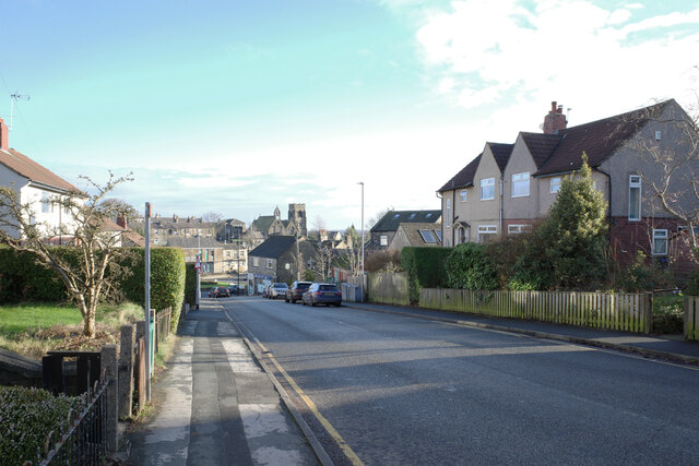
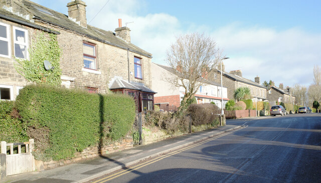
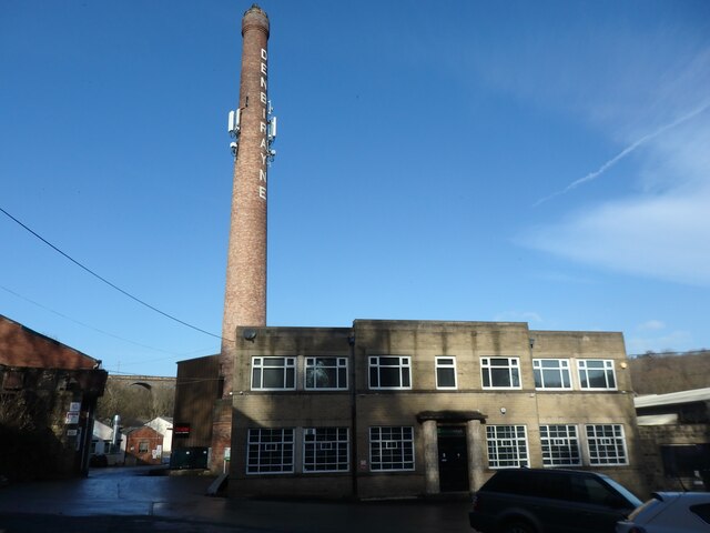
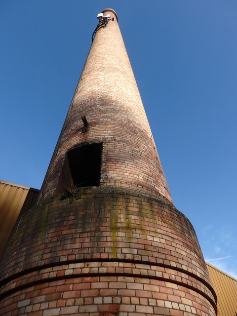
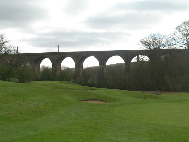
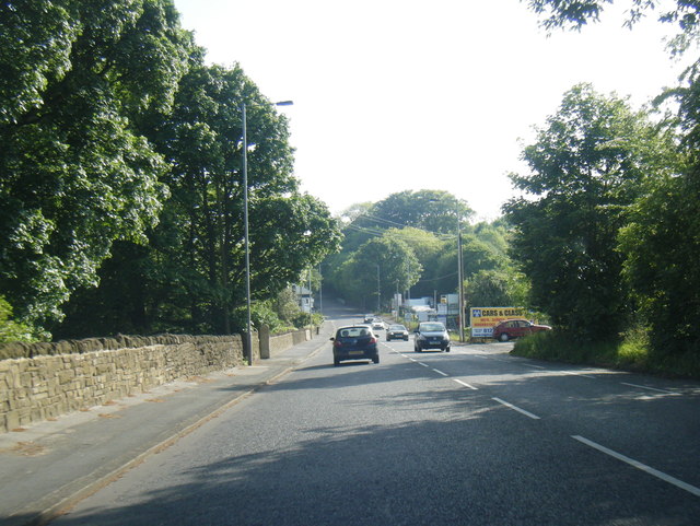
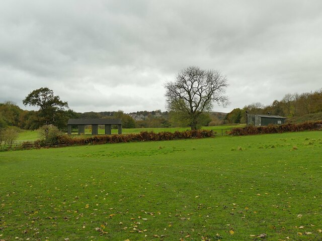
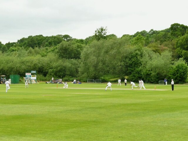
Thackley West Wood Images

Images are sourced within 2km of 53.842777/-1.7477374 or Grid Reference SE1638. Thanks to Geograph Open Source API. All images are credited.

The Stocks, Towngate, Baildon
Baildon Library
Baildon Library
Baildon Methodist Church, Newton Way, Baildon
Butterfield Homes, The Grove, Baildon
The Grove, Baildon
The Grove, Baildon
Jenny Lane, Baildon
Jenny Lane, Baildon
Denbirayne Chimney, Tong Park Industrial Estate, Baildon See <a href="https://www.geograph.org.uk/photo/6887736">SE1640 : The Denbirayne chimney</a> for another view and a brief history. Also see <a href="https://www.geograph.org.uk/photo/7096458">SE1640 : Looking Up the Denbirayne Chimney, Tong Park Industrial Estate, Baildon</a> for a much closer view. Tong Park railway viaduct is in the distance.
Denbirayne Chimney, Tong Park Industrial Estate, Baildon
See SE1640 : The Denbirayne chimney for another view and a brief history. Also see SE1640 : Looking Up the Denbirayne Chimney, Tong Park Industrial Estate, Baildon for a much closer view. Tong Park railway viaduct is in the distance.
Looking Up the Denbirayne Chimney, Tong Park Industrial Estate, Baildon I almost fell over backwards taking this image, but it was something I just had to do. See <a href="https://www.geograph.org.uk/photo/7084813">SE1640 : Denbirayne Chimney, Tong Park Industrial Estate, Baildon</a> for a more distant view.
Looking Up the Denbirayne Chimney, Tong Park Industrial Estate, Baildon
I almost fell over backwards taking this image, but it was something I just had to do. See SE1640 : Denbirayne Chimney, Tong Park Industrial Estate, Baildon for a more distant view.
Tong Park Viaduct In the foreground is part of the Hollins Hall golf course
Tong Park Viaduct
In the foreground is part of the Hollins Hall golf course
A6038 Hollins Hill, Esholt
Enclosed paved Bridleway leaving Baildon for Hawksworth or Guiseley Looking eastward.
Enclosed paved Bridleway leaving Baildon for Hawksworth or Guiseley
Looking eastward.
Footpath crossing Hollins Hill The footpath connects the ancient villages of Hawksworth and Esholt, and predates the main road from Shipley to Guiseley that it crosses at this point.
Footpath crossing Hollins Hill
The footpath connects the ancient villages of Hawksworth and Esholt, and predates the main road from Shipley to Guiseley that it crosses at this point.
Golf driving range at Hollins Hall The driving range is separated from the main golf course by the railway line.
Golf driving range at Hollins Hall
The driving range is separated from the main golf course by the railway line.
Heron in the river Aire Just upstream of Esholt village.
Heron in the river Aire
Just upstream of Esholt village.
Footpath from Esholt Lane to Cunliffe Lane I can understand why this footpath has become overgrown from lack of use, as it only offers a slight shortcut to following the road.
Footpath from Esholt Lane to Cunliffe Lane
I can understand why this footpath has become overgrown from lack of use, as it only offers a slight shortcut to following the road.
Trees in a field south of Esholt Lane
Esholt cricket ground A Sunday afternoon match in progress.
Esholt cricket ground
A Sunday afternoon match in progress.
Esholt Sports and Leisure Club The clubhouse also acts  as a pavilion for the adjacent cricket ground <a href="https://www.geograph.org.uk/photo/6874469">SE1740 : Esholt cricket ground</a>.
Esholt Sports and Leisure Club
The clubhouse also acts as a pavilion for the adjacent cricket ground SE1740 : Esholt cricket ground.
Show me another place!

Thackley West Wood is located at Grid Ref: SE1638 (Lat: 53.842777, Lng: -1.7477374)

Division: West Riding

Unitary Authority: Bradford

Police Authority: West Yorkshire

What 3 Words

///guises.grades.happy. Near Shipley, West Yorkshire

Related Wikis

Idle railway station (Leeds and Bradford Railway)

Idle railway station was a short-lived station serving Idle, near Bradford, West Yorkshire, England. It was built by the Leeds and Bradford Railway in...

Thackley railway station

Thackley railway station was a railway station in Thackley, West Yorkshire, England. == History == During the 1860s, two small railway companies were formed...

Baildon railway station

Baildon railway station serves the town of Baildon near Shipley in West Yorkshire, England. The station reopened under British Rail on 5 January 1973,...

Thackley

Thackley is a small suburb near Bradford, West Yorkshire in England. The village is loosely bordered by the village of Idle to the south, to the west by...

Thackley A.F.C.

Thackley A.F.C. are a football club based in Thackley, north Bradford, West Yorkshire, England. The club plays in the Northern Counties East League Premier...

Bradford City A.F.C. Women

Bradford City AFC Women is an English women's football club which represents the city of Bradford, West Yorkshire. Founded in 1988, they currently play...

BCB 106.6fm

BCB 106.6fm (106.6 FM) is a radio station that allows the community to get involved and record and broadcast their own programmes. Licensed to Bradford...

Sunrise Radio (Yorkshire)

Sunrise Radio is an Asian radio station in Bradford, West Yorkshire, in the United Kingdom. == Availability == The station broadcasts 24 hours a day on...

Nearby Amenities

Located within 500m of 53.842777,-1.7477374
Turning Circle
Lat/Long: 53.8390667/-1.7493094
Post Box
Operator: Royal Mail
Operator Wikidata: Q638098
Post Box Type: lamp
Royal Cypher: EIIR
Royal Cypher Wikidata: Q33102113
Lat/Long: 53.8389457/-1.7482737
Turning Circle
Lat/Long: 53.839568/-1.7476338
Turning Circle
Lat/Long: 53.8399873/-1.7462634
Source: landsat
Lat/Long: 53.8403387/-1.7519248
Source: landsat
Lat/Long: 53.8420063/-1.7470755
Source: landsat
Lat/Long: 53.8425187/-1.7432338
Source: landsat
Lat/Long: 53.8426518/-1.7418618
Source: landsat
Lat/Long: 53.8441511/-1.7458079
Source: landsat
Lat/Long: 53.843802/-1.7459222
Source: landsat
Lat/Long: 53.8424649/-1.7465544
Source: landsat
Lat/Long: 53.8459001/-1.7430621
Source: landsat
Lat/Long: 53.8455406/-1.7426334
Source: landsat
Lat/Long: 53.8471376/-1.7480241
Source: landsat
Lat/Long: 53.8443841/-1.7513625
Source: landsat
Lat/Long: 53.8438813/-1.7522517
Source: landsat
Lat/Long: 53.8428377/-1.7542596
Power: tower
Lat/Long: 53.8407747/-1.7460895
Power: tower
Lat/Long: 53.8440154/-1.7445385
Post Box
Check Date: 2020-01-31
Post Box Type: pillar
Ref GB Uprn: 10015297627
Royal Cypher: EIIR
Royal Cypher Wikidata: EIIR
Lat/Long: 53.8390533/-1.7505513
Bus Stop
Leeds Road Cyprus Drive
Bus: yes
Local Ref: 45017190
Naptan AtcoCode: 450017190
Naptan Bearing: E
Naptan CommonName: Leeds Road Cyprus Drive
Naptan Crossing: Cyprus Drive
Naptan Indicator: Stop 45017190
Naptan Landmark: Little Cote Farm
Naptan PlusbusZoneRef: LEEDS
Naptan ShortCommonName: Cyprus Drive
Naptan Street: Leeds Road
Naptan Verified: no
Public Transport: platform
Shelter: no
Source: naptan_import
Lat/Long: 53.8413659/-1.7414076
Bus Stop
Leeds Road Cyprus Avenue
Bench: no
Bin: no
Bus: yes
Local Ref: 45017191
Naptan AtcoCode: 450017191
Naptan Bearing: W
Naptan CommonName: Leeds Road Cyprus Avenue
Naptan Crossing: Cyprus Avenue
Naptan Indicator: Stop 45017191
Naptan Landmark: Garage
Naptan PlusbusZoneRef: LEEDS
Naptan ShortCommonName: Crooked Lane
Naptan Street: Leeds Road
Naptan Verified: no
Public Transport: platform
Shelter: no
Source: naptan_import
Lat/Long: 53.8409106/-1.742839
Bus Stop
Leeds Road Cherry Tree Gardens
Local Ref: 45017192
Naptan AtcoCode: 450017192
Naptan Bearing: SW
Naptan CommonName: Leeds Road Cherry Tree Gardens
Naptan Crossing: Cherry Tree Gardens
Naptan Indicator: Stop 45017192
Naptan PlusbusZoneRef: LEEDS
Naptan ShortCommonName: Cherry Tree Gardens
Naptan Street: Leeds Road
Naptan Verified: no
Source: naptan_import
Lat/Long: 53.839984/-1.74672
Bus Stop
Leeds Road Overdale Drive
Bench: yes
Bin: yes
Local Ref: 45017193
Naptan AtcoCode: 450017193
Naptan Bearing: NE
Naptan CommonName: Leeds Road Overdale Drive
Naptan Crossing: Overdale Drive
Naptan Indicator: Stop 45017193
Naptan Notes: Shelter removed to be replaced by TF
Naptan PlusbusZoneRef: LEEDS
Naptan ShortCommonName: Overdale Drive
Naptan Street: Leeds Road
Naptan Verified: no
Shelter: yes
Source: naptan_import
Lat/Long: 53.8400117/-1.7470542
Bus Stop
Leeds Road Cote Farm Lane
Bench: no
Bin: no
Bus: yes
Lit: no
Local Ref: 45017194
Naptan AtcoCode: 450017194
Naptan Bearing: SW
Naptan CommonName: Leeds Road Cote Farm Lane
Naptan Crossing: Cote Farm Lane
Naptan Indicator: Stop 45017194
Naptan PlusbusZoneRef: LEEDS
Naptan ShortCommonName: Cote Farm Lane
Naptan Street: Leeds Road
Naptan Verified: no
Public Transport: platform
Shelter: no
Source: naptan_import
Tactile Paving: no
Lat/Long: 53.8391985/-1.7493234
Bus Stop
Leeds Road Glenholme
Bench: no
Bus: yes
Local Ref: 45017195
Naptan AtcoCode: 450017195
Naptan Bearing: NE
Naptan CommonName: Leeds Road Glenholme
Naptan Crossing: Glenholme
Naptan Indicator: Stop 45017195
Naptan PlusbusZoneRef: LEEDS
Naptan ShortCommonName: Glenholme
Naptan Street: Leeds Road
Naptan Verified: no
Public Transport: platform
Shelter: no
Source: naptan_import
Lat/Long: 53.8388874/-1.7509666
Bus Stop
Otley Road Kirklands Lane
Bench: yes
Bin: no
Bus: yes
Lit: yes
Local Ref: 45018850
Naptan AtcoCode: 450018850
Naptan Bearing: SW
Naptan CommonName: Otley Road Kirklands Lane
Naptan Crossing: Kirklands Lane
Naptan Indicator: Stop 45018850
Naptan Landmark: Halfway House PH
Naptan PlusbusZoneRef: LEEDS
Naptan ShortCommonName: Kirklands Lane
Naptan Street: Otley Road
Naptan Verified: no
Public Transport: platform
Shelter: yes
Source: naptan_import
Tactile Paving: no
Lat/Long: 53.8462245/-1.7523214
Bus Stop
Otley Road Kirklands Lane
Bench: no
Bin: no
Bus: yes
Lit: yes
Local Ref: 45018851
Naptan AtcoCode: 450018851
Naptan Bearing: NE
Naptan CommonName: Otley Road Kirklands Lane
Naptan Crossing: Kirklands Lane
Naptan Indicator: Stop 45018851
Naptan Landmark: Halfway House PH
Naptan PlusbusZoneRef: LEEDS
Naptan ShortCommonName: Kirklands Lane
Naptan Street: Otley Road
Public Transport: platform
Shelter: no
Source: naptan_import;survey
Tactile Paving: no
Lat/Long: 53.8460639/-1.7528695
Windhill Old Road
Local Ref: 45024681
Naptan AtcoCode: 450024681
Naptan Bearing: SW
Naptan BusStopType: CUS
Naptan CommonName: Windhill Old Road
Naptan Crossing: Frederick Close
Naptan Indicator: Stop 45024681
Naptan PlusbusZoneRef: LEEDS
Naptan ShortCommonName: Frederick Close
Naptan Street: Windhill Old Road
Naptan Verified: no
Source: naptan_import
Lat/Long: 53.8416648/-1.7466946
Turning Circle
Lat/Long: 53.8411342/-1.7433077
Information: route_marker
Tourism: information
Lat/Long: 53.8428065/-1.7540544
Turning Circle
Lat/Long: 53.8386936/-1.7486581
Source: landsat
Lat/Long: 53.8417245/-1.746744
Shop: car
Lat/Long: 53.8449755/-1.7536203
Turning Circle
Lat/Long: 53.8390207/-1.747692
Bench
Backrest: yes
Lat/Long: 53.8468626/-1.7479209
Parking
Access: customers
Parking: surface
Lat/Long: 53.8459276/-1.7523842
West Cote Park 1998 Memorial Stone
Historic: monument
Lat/Long: 53.8393019/-1.7482818
Post Box
Operator: Royal Mail
Operator Wikidata: Q638098
Royal Cypher: EIIR
Royal Cypher Wikidata: Q33102113
Source: survey
Lat/Long: 53.8438959/-1.7418943
Information: board
Tourism: information
Lat/Long: 53.8467922/-1.7472276
Information: board
Tourism: information
Lat/Long: 53.843839/-1.7516989
Information: board
Tourism: information
Lat/Long: 53.8463048/-1.7486342
Information: board
Tourism: information
Lat/Long: 53.8463752/-1.7486019
Bench
Material: stone
Lat/Long: 53.8468418/-1.7477337
Information: route_marker
Tourism: information
Lat/Long: 53.8436645/-1.7520464
Information: board
Tourism: information
Lat/Long: 53.8463003/-1.748851
Crossing
Lat/Long: 53.8441198/-1.7413994
Parking
Lat/Long: 53.8434624/-1.7540386
Parking
Lat/Long: 53.844187/-1.7524129
Power: pole
Lat/Long: 53.8423973/-1.7532809
Power: pole
Lat/Long: 53.8430461/-1.7517152
Power: pole
Lat/Long: 53.8435387/-1.750527
Design: h-frame
Power: tower
Lat/Long: 53.8443979/-1.7493133
Power: pole
Lat/Long: 53.8453082/-1.7480211
Power: pole
Lat/Long: 53.8462229/-1.7467343
Leisure: outdoor_seating
Lat/Long: 53.8461161/-1.752153
Source: landsat
Lat/Long: 53.8455964/-1.7522918
Parking
Access: private
Lat/Long: 53.8456231/-1.7532635
Give Way
Direction: backward
Lat/Long: 53.8450884/-1.7534851
Give Way
Direction: backward
Lat/Long: 53.8453725/-1.7536558
Crossing
Crossing: uncontrolled
Crossing Markings: zebra
Tactile Paving: yes
Lat/Long: 53.84531/-1.7537287
Source: landsat
Lat/Long: 53.8410463/-1.7423035
Source: landsat
Lat/Long: 53.8407694/-1.7420689
Source: landsat
Lat/Long: 53.8402518/-1.745734
Source: landsat
Lat/Long: 53.8389435/-1.7447148
Source: landsat
Lat/Long: 53.8390807/-1.7438814
Source: landsat
Lat/Long: 53.8423286/-1.7432977
Source: landsat
Lat/Long: 53.8425616/-1.7418652
The data included in this document is from www.openstreetmap.org. The data is made available under ODbL.

Have you been to Thackley West Wood?

Leave your review of Thackley West Wood below (or comments, questions and feedback).