Birchinlee West Plantation

Wood, Forest in Derbyshire High Peak

England

Birchinlee West Plantation

Foliage above Howden Reservoir There are rare glimpses of the reservoir through the leaves from the main track, but this one gives a brief view of Howden Dam.
Foliage above Howden Reservoir Credit: Bill Boaden

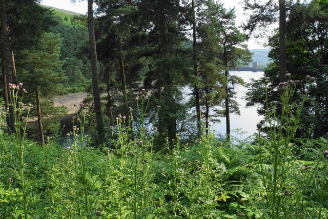
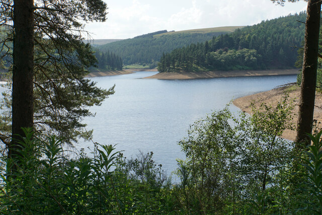
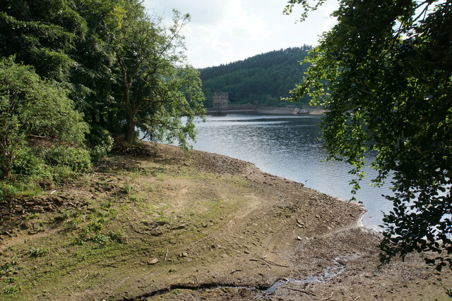
Birchinlee West Plantation is a picturesque woodland located in Derbyshire, England. Covering an area of approximately 100 acres, the plantation is part of the larger Peak District National Park, renowned for its stunning natural beauty and diverse flora and fauna.

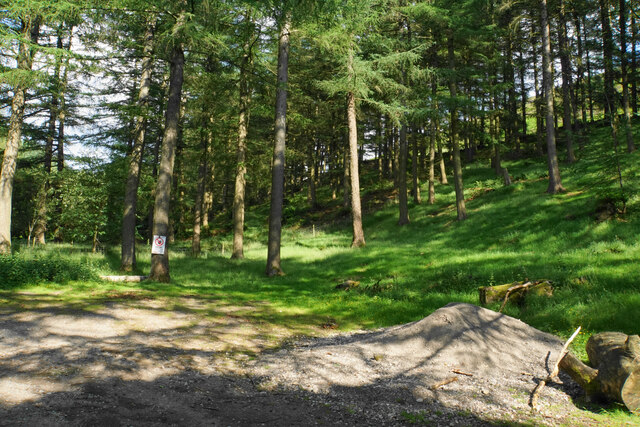
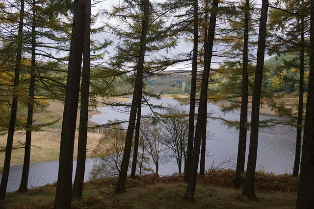
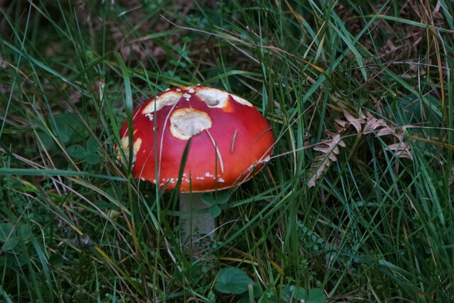
The woodland is predominantly composed of native deciduous trees such as oak, birch, and beech, creating a rich and varied habitat for wildlife. The dense canopy provides shelter and nesting sites for a wide range of bird species, including woodpeckers, tits, and finches. Visitors to the plantation may also spot squirrels, badgers, and deer, which inhabit the area.

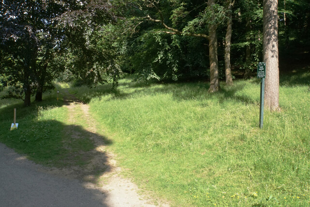
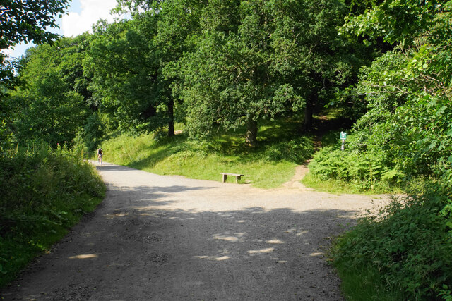
The woodland is crisscrossed by a network of pathways, enabling visitors to explore and enjoy its tranquil surroundings. The trails wind through the trees, offering glimpses of open glades and stunning views of the surrounding countryside. These paths are well-maintained and accessible, making the plantation an ideal destination for walkers, hikers, and nature enthusiasts of all ages.

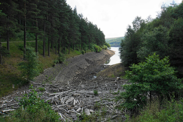
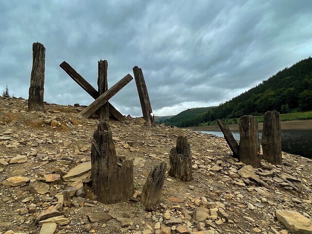
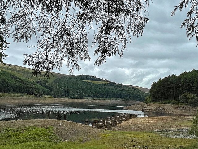
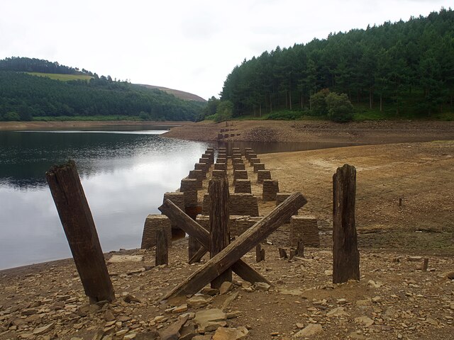
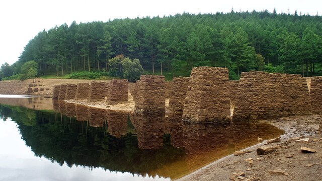
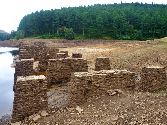
Birchinlee West Plantation is also known for its historical significance. The area was once used for timber production, providing materials for construction and fuel. Although the plantation no longer serves this purpose, remnants of the old forestry operations can still be seen, adding a sense of history to the landscape.

Overall, Birchinlee West Plantation is a captivating woodland, offering visitors a chance to connect with nature, explore its trails, and appreciate the beauty of Derbyshire's countryside.

If you have any feedback on the listing, please let us know in the comments section below.

Birchinlee West Plantation Images

Images are sourced within 2km of 53.420106/-1.7519587 or Grid Reference SK1691. Thanks to Geograph Open Source API. All images are credited.

Foliage above Howden Reservoir There are rare glimpses of the reservoir through the leaves from the main track, but this one gives a brief view of Howden Dam.
Foliage above Howden Reservoir
There are rare glimpses of the reservoir through the leaves from the main track, but this one gives a brief view of Howden Dam.
The bottom of Howden Clough Where the clough enters Howden Reservoir, it is full of flotsam.
The bottom of Howden Clough
Where the clough enters Howden Reservoir, it is full of flotsam.
Howden Reservoir The arm in the foreground is the former bottom of Howden Clough.
Howden Reservoir
The arm in the foreground is the former bottom of Howden Clough.
Howden Dam A view from the eastern side into bright afternoon sun.
Howden Dam
A view from the eastern side into bright afternoon sun.
Woodland in Abbey Clough The sign warns about forestry operations, but there is not much evidence of any.
Woodland in Abbey Clough
The sign warns about forestry operations, but there is not much evidence of any.
Path to Ewden via Broomhead Marked by Peak & Northern Footpaths Society sign no. 72.
Path to Ewden via Broomhead
Marked by Peak & Northern Footpaths Society sign no. 72.
Cycle path by Upper Derwent Reservoir This is the first view of Derwent Dam when coming down the eastern side of the reservoir.
Cycle path by Upper Derwent Reservoir
This is the first view of Derwent Dam when coming down the eastern side of the reservoir.
Cycle path by Upper Derwent Reservoir Derwent Dam is now visible straight ahead.
Cycle path by Upper Derwent Reservoir
Derwent Dam is now visible straight ahead.
Path junction at the bottom of Walker's Clough The path up the clough is marked by Peak & Northern Footpaths Society sign no. 191.
Path junction at the bottom of Walker's Clough
The path up the clough is marked by Peak & Northern Footpaths Society sign no. 191.
The bottom of Hollin Clough Where it enters Upper Derwent Reservoir.
The bottom of Hollin Clough
Where it enters Upper Derwent Reservoir.
Remains of Birchinlee Viaduct The viaduct carried the railway used in the construction of the Derwent dams over Ouzelden Clough. The water level was low with capacity below 50% on the day of the visit. The low water level has exposed the stone foundations <a href="https://www.geograph.org.uk/photo/6943062">SK1691 : Foundations of Birchinlee Viaduct</a> but these fragments of wooden beams have survived over 100 years as they are usually above the water level.
Remains of Birchinlee Viaduct
The viaduct carried the railway used in the construction of the Derwent dams over Ouzelden Clough. The water level was low with capacity below 50% on the day of the visit. The low water level has exposed the stone foundations SK1691 : Foundations of Birchinlee Viaduct but these fragments of wooden beams have survived over 100 years as they are usually above the water level.
Upper Derwent Reservoir The stone foundations of the railway bridge over Ouzelden Clough can be seen in the foreground. The railway was built for the construction of the Derwent and Howden dams and the foundations have been exposed due to the low water level.
Upper Derwent Reservoir
The stone foundations of the railway bridge over Ouzelden Clough can be seen in the foreground. The railway was built for the construction of the Derwent and Howden dams and the foundations have been exposed due to the low water level.
Foundations of Birchinlee Viaduct The viaduct carried the railway used in the construction of the Derwent and Howden dams over Ouzelden Clough. The water level was low with capacity at 50% on the day of the visit.
Foundations of Birchinlee Viaduct
The viaduct carried the railway used in the construction of the Derwent and Howden dams over Ouzelden Clough. The water level was low with capacity at 50% on the day of the visit.
Derwent Reservoir, looking towards the Howden Dam
Fly Agaric (Amanita muscaria), Upper Derwent Valley
Derwent Reservoir from Gores Farm
Show me another place!

Birchinlee West Plantation is located at Grid Ref: SK1691 (Lat: 53.420106, Lng: -1.7519587)

Administrative County: Derbyshire

District: High Peak

Police Authority: Derbyshire

What 3 Words

///intensely.removal.jets. Near Hope Valley, Derbyshire

Related Wikis

Related Videos

Derwent Reservoir Walking Clip

Derwent Reservoir relaxing walking Clip ( Dambusters ) Created by Levon Peacock Full walking video ...

Derwent Reservoir, Ladybower Hope Valley 4k Dog Walking Hiking video with Springier Spaniel Toby

Derwent Reservoir, Ladybower Hope Valley 4k Dog Walking Hiking video with Springier Spaniel Toby Peak district Relaxing dog ...

Walking around Derwent and Howden reservoir in the spring sunshine.

Having a wander in the peaks. Trying out the alpkit hammock. Nice sunshine and a relaxing time! Nice to be out again.

REPOST of Walking with the Dambusters: Discovering the Secrets of Derwent Dam

In today's video, Sadie and I take a step back in time as we uncover the hidden secrets of Derwent Dam, walking in the footsteps ...

Nearby Amenities

Located within 500m of 53.420106,-1.7519587
Birchinlee Village
Source: gps
Tourism: information
Lat/Long: 53.4226641/-1.7496743
Bank Clough
Place: locality
Lat/Long: 53.4241064/-1.7533865
Birchinlee
Place: isolated_dwelling
Lat/Long: 53.4213921/-1.7536712
Birchinlee Farm
Historic Place: farm
Lat/Long: 53.422952/-1.7508574
Ouzelden Bridge
Historic Place: locality
Lat/Long: 53.4177046/-1.7471325
Welcome to Tin Town
Information: map
Map Type: toposcope
Tourism: information
Lat/Long: 53.4185859/-1.7502862
Tin Town
Board Type: history
Description: The Married Quarters
Information: board
Tourism: information
Lat/Long: 53.4189911/-1.7512035
Tin Town
Board Type: history
Description: Village Life
Information: board
Tourism: information
Lat/Long: 53.4200781/-1.7516997
Tin Town
Board Type: history
Description: Life Indoors
Information: board
Tourism: information
Lat/Long: 53.4210076/-1.7510399
Tin Town
Information: board
Tourism: information
Lat/Long: 53.4223734/-1.7503895
Bench
Lat/Long: 53.4224652/-1.7457057
The data included in this document is from www.openstreetmap.org. The data is made available under ODbL.

Have you been to Birchinlee West Plantation?

Leave your review of Birchinlee West Plantation below (or comments, questions and feedback).