Daisy Nook

Settlement in Lancashire

England

Daisy Nook

Broad Track from Valley Bridge A former carriage drive from the now demolished Riversvale Hall?
Broad Track from Valley Bridge Credit: Kevin Waterhouse

Daisy Nook is a picturesque area located in Lancashire, England. Situated between the towns of Ashton-under-Lyne and Failsworth, Daisy Nook is renowned for its natural beauty and tranquil surroundings.

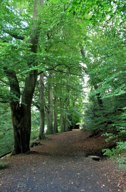
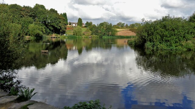
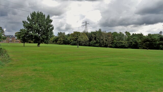
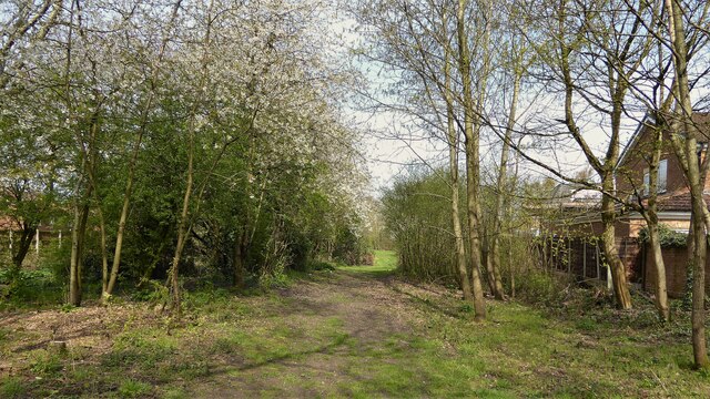
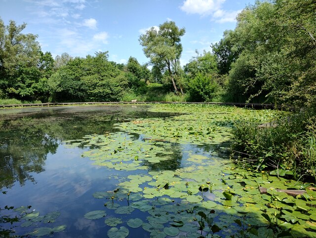
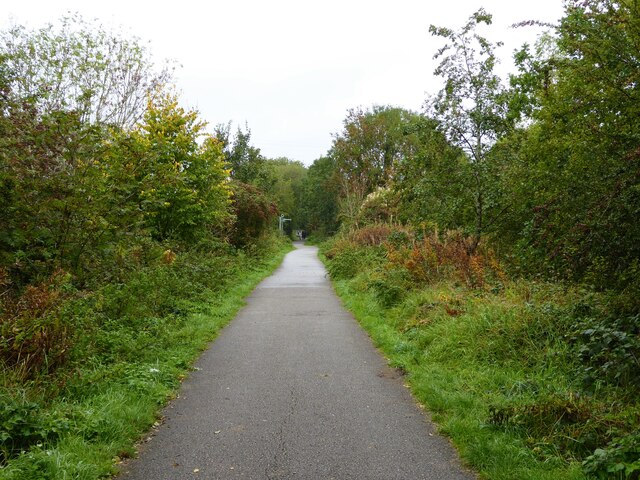
This idyllic spot offers a range of attractions and facilities for visitors to enjoy. One of the most prominent features of Daisy Nook is its beautiful country park. Spanning over 40 acres, the park is a haven for nature enthusiasts, offering well-maintained walking trails, lush green spaces, and a variety of flora and fauna. The park also boasts three scenic reservoirs, providing a serene backdrop for leisurely strolls or picnics.

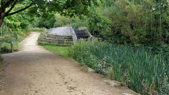
In addition to its natural beauty, Daisy Nook is home to a historic canal system. The Ashton Canal, which runs through the area, offers opportunities for boating, fishing, and leisurely canal-side walks, allowing visitors to soak up the charm of this industrial-era waterway.

Daisy Nook is also known for its vibrant community spirit, with regular events and festivals taking place throughout the year. These include music concerts, funfairs, and local markets, creating a lively and welcoming atmosphere for both residents and visitors.

Overall, Daisy Nook is a hidden gem in Lancashire, offering a perfect blend of natural beauty, outdoor recreation, and community spirit. Whether you're seeking a peaceful retreat or an active day out, Daisy Nook has something to suit all tastes and interests.

If you have any feedback on the listing, please let us know in the comments section below.
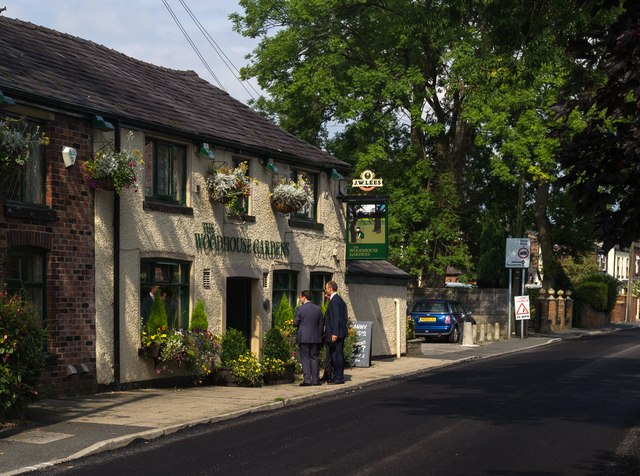
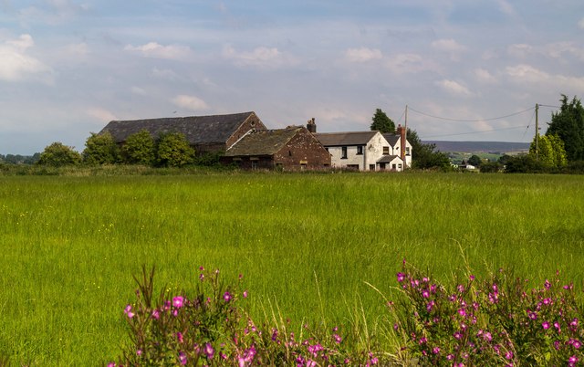
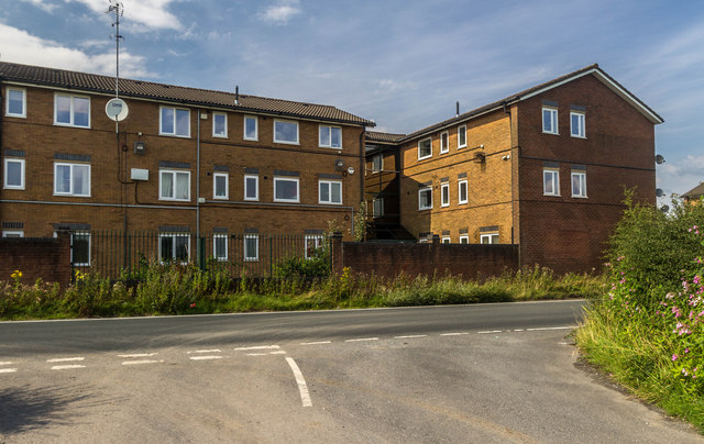
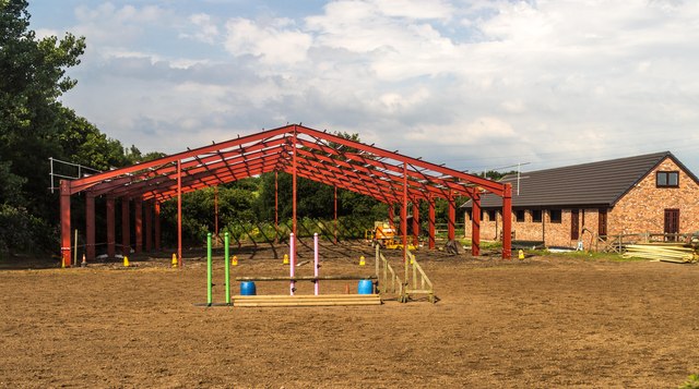
Daisy Nook Images

Images are sourced within 2km of 53.501121/-2.126604 or Grid Reference SD9100. Thanks to Geograph Open Source API. All images are credited.

Broad Track from Valley Bridge A former carriage drive from the now demolished Riversvale Hall?
Broad Track from Valley Bridge
A former carriage drive from the now demolished Riversvale Hall?
Former Lock No.19 On the Hollinwood Canal with the site of the lower lock gates now a concrete stepped weir
Former Lock No.19
On the Hollinwood Canal with the site of the lower lock gates now a concrete stepped weir
Crime Lake A former supply reservoir for the now abandoned Hollinwood Branch canal. The canal actually passed through the reservoir.
Crime Lake
A former supply reservoir for the now abandoned Hollinwood Branch canal. The canal actually passed through the reservoir.
Terraced Housing, Woodhouses On Ashton Road
Terraced Housing, Woodhouses
On Ashton Road
Brookdale Golf Club Land View from the public footpath that now is curtailed with the removal of Ash Bridge across the River Medlock
Brookdale Golf Club Land
View from the public footpath that now is curtailed with the removal of Ash Bridge across the River Medlock
Route of former Hollinwood Canal The former Hollinwood branch of the Ashton Canal has been in-filled as it heads away from Cutler Hill Bridge. The former canal is under the trees on the left of this view and further to the left a footpath follows the canal line to Landsberg Road. There is then a deviation to reach Roman Road the former public footpath appears to have been extinguished.
Route of former Hollinwood Canal
The former Hollinwood branch of the Ashton Canal has been in-filled as it heads away from Cutler Hill Bridge. The former canal is under the trees on the left of this view and further to the left a footpath follows the canal line to Landsberg Road. There is then a deviation to reach Roman Road the former public footpath appears to have been extinguished.
Sammie's Basin
Sammie's Basin
Cycle path following route of former railway On the embankment across Downshaw Clough. The railway connected Ashton-under-Lyne and Oldham.
Cycle path following route of former railway
On the embankment across Downshaw Clough. The railway connected Ashton-under-Lyne and Oldham.
Woodhouses The Woodhouse Garden public house at Woodhouses.
Woodhouses
The Woodhouse Garden public house at Woodhouses.
Green Fold Farm Buildings at Green Fold Farm.
Green Fold Farm
Buildings at Green Fold Farm.
Wood Park Court Flats at Lime Side.
Wood Park Court
Flats at Lime Side.
Holy Trinity Church Holy Trinity Church at Bardsley.
Holy Trinity Church
Holy Trinity Church at Bardsley.
The Stables New building at The Stables.
The Stables
New building at The Stables.
M60 M60 Motorway.
M60
M60 Motorway.
Oldham Crematorium The gardens of Oldham Crematorium, in the Hollinwood area of Oldham, Greater Manchester.
Oldham Crematorium
The gardens of Oldham Crematorium, in the Hollinwood area of Oldham, Greater Manchester.
Bungalow on Stamford Drive, Woodhouses A bungalow on Stamford Drive in the Woodhouses area of Failsworth in Greater Manchester, England.
Bungalow on Stamford Drive, Woodhouses
A bungalow on Stamford Drive in the Woodhouses area of Failsworth in Greater Manchester, England.
Wood Lane
Wood Lane
M60 M60 crossing the River Medlock.
M60
M60 crossing the River Medlock.
Show me another place!

Daisy Nook is located at Grid Ref: SD9100 (Lat: 53.501121, Lng: -2.126604)

Unitary Authority: Oldham

Police Authority: Greater Manchester

What 3 Words

///aside.giving.like. Near Ashton-under-Lyne, Manchester

Nearby Locations

Daisy Nook Medlock Vale

Related Wikis

Daisy Nook

Daisy Nook is a country park in Failsworth, Greater Manchester, England, which runs through the Medlock Valley. == History == The name Daisy Nook came...

Fairbottom Branch Canal

The Fairbottom Branch Canal was a canal near Ashton-under-Lyne in Greater Manchester, England. == Route == The canal left the Hollinwood Branch Canal at...

Woodhouses

Woodhouses is a village near Failsworth, in the Oldham district of Greater Manchester (which was part of Lancashire until 1974), England. It is about 5...

Littlemoss High School

Littlemoss High School for Boys was a comprehensive school in Littlemoss, Droylsden, Tameside, England. It merged with Droylsden High School, Mathematics...

Littlemoss

Littlemoss is a suburb of Droylsden, in the Tameside District, in the English county of Greater Manchester. Littlemoss village is predominantly a farming...

Curzon Ashton F.C.

Curzon Ashton Football Club is an association football club based in Ashton-under-Lyne, Greater Manchester, England. Founded in 1963 and nicknamed "The...

Greatest Hits Radio Manchester & The North West

Greatest Hits Radio Manchester & The North West is an Independent Local Radio station based in Manchester, England, owned and operated by Bauer as part...

Droylsden railway station

Droylsden railway station served the town of Droylsden, Greater Manchester, England. == History == The station was opened on 13 April 1846 by the Ashton...

Nearby Amenities

Located within 500m of 53.501121,-2.126604
Bus Stop
Newmarket Road/Daisy Nook
Bus: yes
Naptan AtcoCode: 1800EH36161
Naptan Bearing: E
Naptan CommonName: Newmarket Road/Daisy Nook
Naptan Indicator: Nr Grass Land
Naptan Landmark: STABLES
Naptan NaptanCode: mandatgj
Naptan PlusbusZoneRef: MNCRPIC
Naptan ShortCommonName: Daisy Nook
Naptan Street: NEWMARKET ROAD
Naptan Verified: no
Network: TfGM
Public Transport: platform
Source: naptan_import
Lat/Long: 53.5004918/-2.1205606
Bus Stop
Newmarket Road/Daisy Nook
Bus: yes
Naptan AtcoCode: 1800EH36171
Naptan Bearing: W
Naptan CommonName: Newmarket Road/Daisy Nook
Naptan Indicator: Nr Riding Schl
Naptan Landmark: NR RIDING SCHL
Naptan NaptanCode: mandatgm
Naptan PlusbusZoneRef: MNCRPIC
Naptan ShortCommonName: Daisy Nook
Naptan Street: NEWMARKET ROAD
Naptan Verified: no
Network: TfGM
Public Transport: platform
Source: naptan_import
Lat/Long: 53.5003483/-2.1202888
Bus Stop
Lumb Lane/Back Lane
Bus: yes
Naptan AtcoCode: 1800EH36181
Naptan Bearing: NE
Naptan CommonName: Lumb Lane/Back Lane
Naptan Indicator: O/s House 52
Naptan Landmark: HOUSE 52
Naptan NaptanCode: mandatgp
Naptan PlusbusZoneRef: MNCRPIC
Naptan ShortCommonName: Back Lane
Naptan Street: LUMB LANE
Naptan Verified: no
Network: TfGM
Public Transport: platform
Source: naptan_import
Lat/Long: 53.4980348/-2.1235686
Bus Stop
Lumb Lane/Back Lane
Bus: yes
Naptan AtcoCode: 1800EH36191
Naptan Bearing: SW
Naptan CommonName: Lumb Lane/Back Lane
Naptan Indicator: Fields
Naptan Landmark: FIELDS
Naptan NaptanCode: mandatgt
Naptan PlusbusZoneRef: MNCRPIC
Naptan ShortCommonName: Back Lane
Naptan Street: LUMB LANE
Naptan Verified: no
Network: TfGM
Public Transport: platform
Source: naptan_import
Lat/Long: 53.4977292/-2.1235526
Power: tower
Lat/Long: 53.5001057/-2.1222605
Power: tower
Lat/Long: 53.4981582/-2.1276115
Power: tower
Lat/Long: 53.5016689/-2.1240323
Power: tower
Lat/Long: 53.5012831/-2.1297921
The data included in this document is from www.openstreetmap.org. The data is made available under ODbL.

Have you been to Daisy Nook?

Leave your review of Daisy Nook below (or comments, questions and feedback).