Dalabrog

Settlement in Inverness-shire

Scotland

Dalabrog

Loch Cuithe Chaiginn Heather in bloom around the shores of the loch.
Loch Cuithe Chaiginn Credit: Alan Pickup

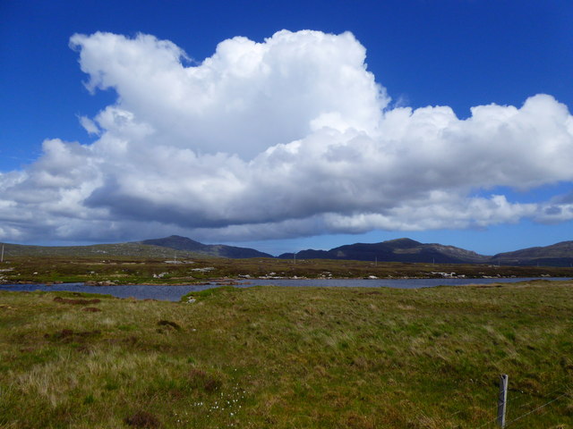
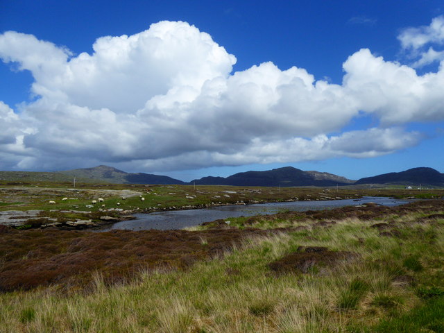
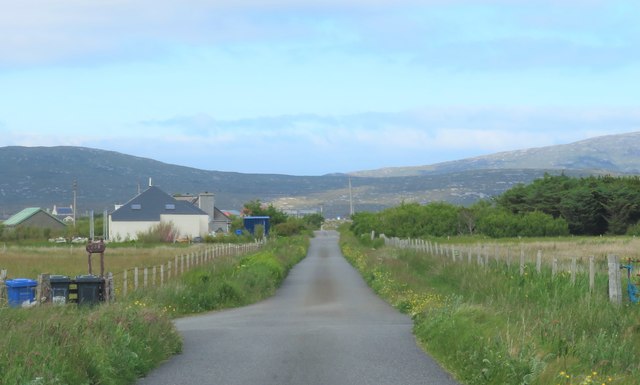
Dalabrog is a small village located in the county of Inverness-shire, Scotland. Situated in the western part of the county, Dalabrog is nestled in the picturesque landscapes of the Scottish Highlands. The village is situated on the banks of the River Dalabrog, which flows through the heart of the community.

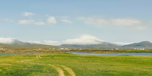
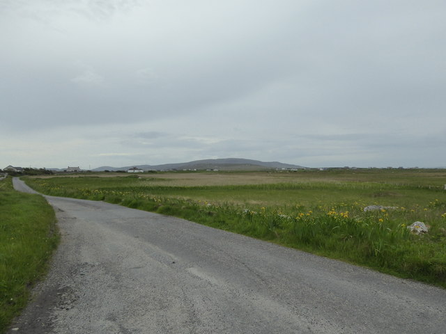
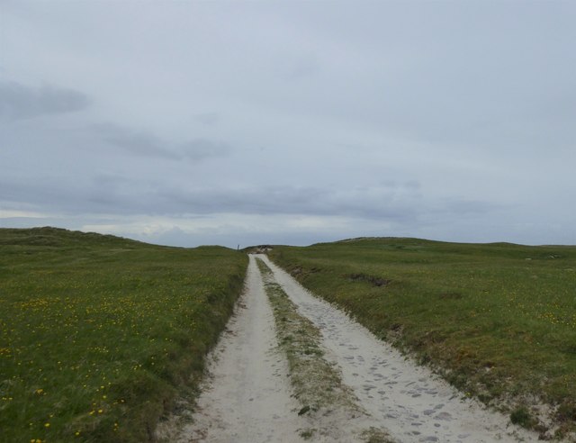
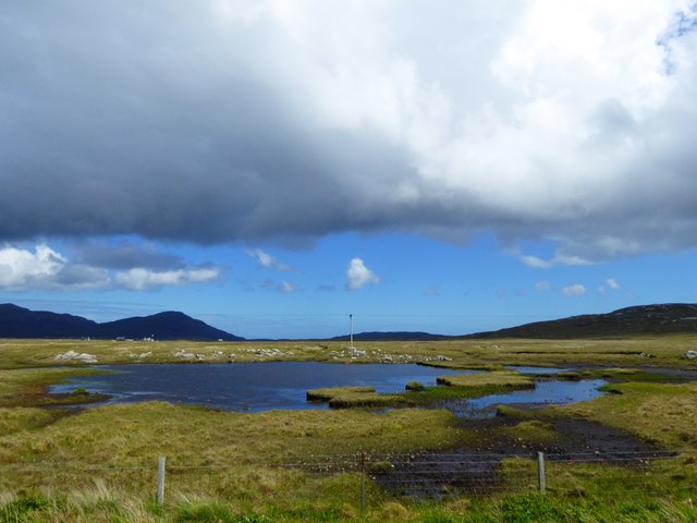
Dalabrog is known for its tranquil and idyllic setting, making it a popular destination for nature lovers and outdoor enthusiasts. The surrounding area is characterized by rolling hills, lush green pastures, and breathtaking panoramic views. The village is surrounded by vast stretches of moorland and dense forests, offering numerous opportunities for hiking, cycling, and wildlife spotting.

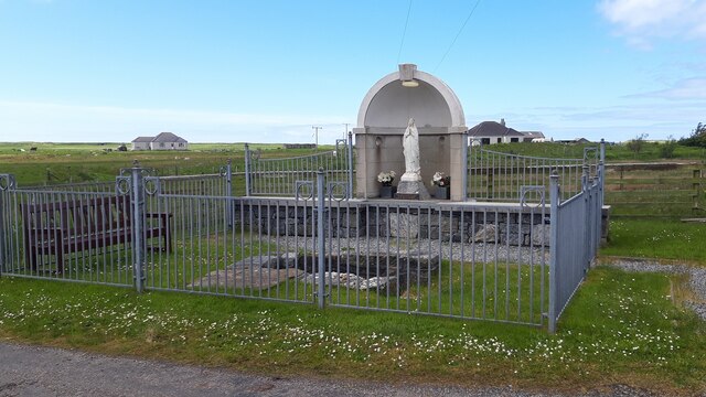
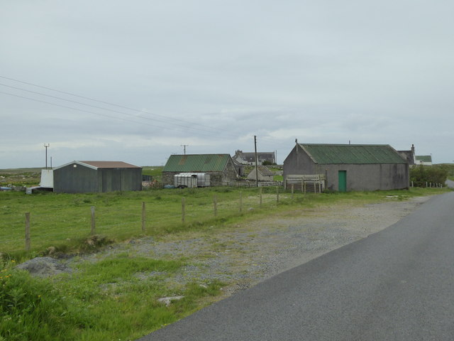
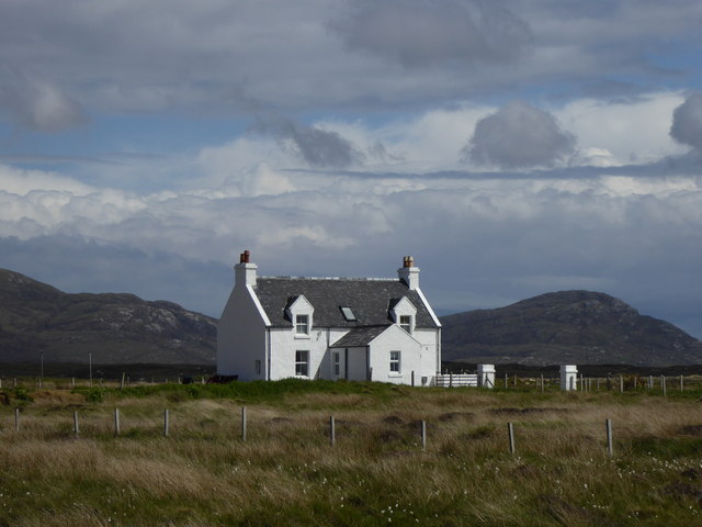
Although small in size, Dalabrog boasts a close-knit community that takes pride in preserving the village's rich cultural heritage. The locals are known for their warm hospitality and friendly nature, welcoming visitors with open arms. The village is home to a few charming cottages and traditional stone houses, adding to its rustic and quaint appeal.

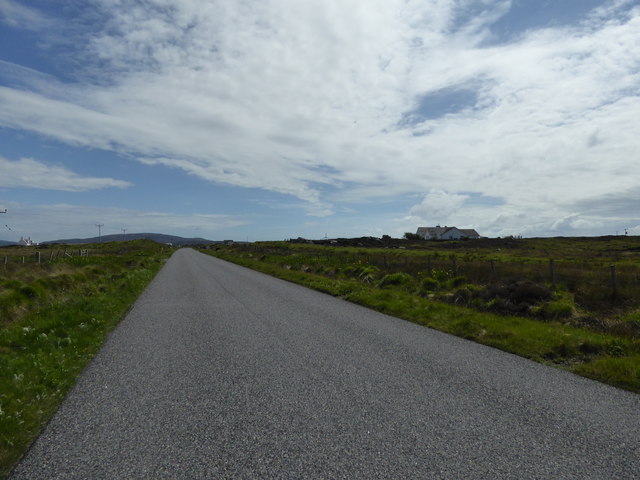
Despite its rural setting, Dalabrog is well-connected to nearby towns and cities. The village has good road links, making it easily accessible by car. Inverness, the capital of the Highlands, is located approximately 20 miles east of Dalabrog and offers a wider range of amenities, including shopping centers, restaurants, and cultural attractions.

In summary, Dalabrog is a picturesque village in Inverness-shire, Scotland, renowned for its stunning natural beauty and peaceful ambiance. It offers a perfect retreat for those seeking a tranquil getaway amidst the breathtaking landscapes of the Scottish Highlands.

If you have any feedback on the listing, please let us know in the comments section below.

Dalabrog Images

Images are sourced within 2km of 57.167599/-7.3731531 or Grid Reference NF7521. Thanks to Geograph Open Source API. All images are credited.

Loch Cuithe Chaiginn Heather in bloom around the shores of the loch.
Loch Cuithe Chaiginn
Heather in bloom around the shores of the loch.
St Mary Shrine & Holy Well
Daliburgh Co-op Largest food shop on South Uist.
Daliburgh Co-op
Largest food shop on South Uist.
Track to Loch Hallan This track leads across the machair to the mooring for the estate boat on Loch Hallan. Beware of rusty, tyre-puncturing fence wire hidden in the grass. Hallan is a very shallow loch. If your boat grounds on the sand, don't worry, just step over the side into six inches of water and tow the boat back to its mooring. Don't try this if you get stuck on the rocks on the far shore!
Track to Loch Hallan
This track leads across the machair to the mooring for the estate boat on Loch Hallan. Beware of rusty, tyre-puncturing fence wire hidden in the grass. Hallan is a very shallow loch. If your boat grounds on the sand, don't worry, just step over the side into six inches of water and tow the boat back to its mooring. Don't try this if you get stuck on the rocks on the far shore!
The Co-op at Dalabrog
Sgoil Dhalabroig/Daliburgh School
Loch nan Geadh
Loch nan Geadh
Co-op Supermarket, Daliburgh
Loch nan Geadh
Loch nan Geadh
Minor road, Dalabrog an Iar
Farm buildings, Dalabrog an Iar
Track in the machair, Hallan
A865 near Geàrraidh Sheilidh
House by Loch Crocabhat
Old Milestone by the A888, Daliburgh, South Uist Parish Granite column by the B888, in parish of South Uist (South Uist District), Daliburgh, near lamppost just South of 'The co-operative Dalabrog'.

Inscription reads:- : 3 : (To Lochboisdale Pier)

Surveyed

Milestone Society National ID: WI_SULBS03.
Old Milestone by the A888, Daliburgh, South Uist Parish
Granite column by the B888, in parish of South Uist (South Uist District), Daliburgh, near lamppost just South of 'The co-operative Dalabrog'. Inscription reads:- : 3 : (To Lochboisdale Pier) Surveyed Milestone Society National ID: WI_SULBS03.
Minor road heading north east from Cille Pheadair Crofting country between the machair and the bogs.
Minor road heading north east from Cille Pheadair
Crofting country between the machair and the bogs.
Ruined house, Cille Pheadair In a poor state of repair, but still with most of its roof when photographed in 1995. Compare this with a similar view in 2010 [<a title="https://www.geograph.org.uk/photo/4079167" href="https://www.geograph.org.uk/photo/4079167">Link</a>].
Ruined house, Cille Pheadair
In a poor state of repair, but still with most of its roof when photographed in 1995. Compare this with a similar view in 2010 [Link].
Lochan Dubh nan Caorach
Show me another place!

Dalabrog is located at Grid Ref: NF7521 (Lat: 57.167599, Lng: -7.3731531)

Unitary Authority: Na h-Eileanan an Iar

Police Authority: Highlands and Islands

Also known as: Daliburgh

What 3 Words

///trimmer.slimming.estimates. Near Lochboisdale, Na h-Eileanan Siar

Related Wikis

Daliburgh

Daliburgh (Scottish Gaelic: Dalabrog) is a crofting township on South Uist, in the Outer Hebrides, Scotland. Daliburgh is situated 1+1⁄2 miles (2.5 kilometres...

Loch Hallan

Loch Hallan (Scottish Gaelic: Loch Thallan) is a loch (lake) in the Outer Hebrides, Scotland. It is located in the parish of South Uist, approximately...

Cladh Hallan

Cladh Hallan (Scottish Gaelic: Cladh Hàlainn, Scottish Gaelic pronunciation: [kʰl̪ˠɤɣ ˈhaːl̪ˠɪɲ]) is an archaeological site on the island of South Uist...

Askernish

Askernish (Scottish Gaelic: Àisgearnais, Aisgernis) is a crofting community on South Uist, in the Outer Hebrides, Scotland. Askernish is in the parish...

Papar

The Papar (Icelandic pronunciation: [ˈpʰaːpar̥]; from Latin papa, via Old Irish, meaning "father" or "pope") were, according to early Icelandic sagas,...

Auratote

Auratote (Scottish Gaelic: Oratobht) is a location on South Uist in the Outer Hebrides, Scotland. Auratote is within the parish of South Uist. == References... ==

Lochboisdale

Lochboisdale (Scottish Gaelic: Loch Baghasdail [ɫ̪ɔx ˈbɤːs̪t̪ɪl]) is the main village and port on the island of South Uist, Outer Hebrides, Scotland. Lochboisdale...

Eileanan Iasgaich

Na h-Eileanan Iasgaich comprise a small uninhabited archipelago in Loch Boisdale, in the south east of the island of South Uist, in the Outer Hebrides...

Nearby Amenities

Located within 500m of 57.167599,-7.3731531
Passing Place
Lat/Long: 57.1657751/-7.378179
Passing Place
Lat/Long: 57.1663529/-7.3760194
Bus Stop
Daliburgh Community Hall
Bin: yes
Bus: yes
Departures Board: no
Naptan AtcoCode: 6010942
Naptan NaptanCode: 94727343
Public Transport: platform
Shelter: yes
Lat/Long: 57.1689183/-7.3741208
Bus Stop
Daliburgh
Bus: yes
Naptan AtcoCode: 6010731630
Naptan Bearing: E
Naptan CommonName: Daliburgh
Naptan Indicator: Junction
Naptan Landmark: Junction
Naptan NaptanCode: 94723298
Naptan Street: Junction
Naptan Verified: no
Public Transport: platform
Source: naptan_import
Lat/Long: 57.1678552/-7.3729792
Barrier: cattle_grid
Lat/Long: 57.1653081/-7.371463
Dalabrog
Name En: Daliburgh
Name Gd: Dalabrog
Place: village
Wikidata: Q3777841
Wikipedia: en:Daliburgh
Lat/Long: 57.1678082/-7.3713341
Entrance: main
Lat/Long: 57.1658238/-7.3714662
Bus Stop
Daliburgh Co-op Shop
Bench: no
Bin: no
Bus: yes
Check Date Shelter: 2022-06-28
Lit: yes
Naptan AtcoCode: 6010945
Naptan NaptanCode: 94727368
Public Transport: platform
Shelter: no
Tactile Paving: no
Lat/Long: 57.1658991/-7.3717527
Am Bàrd Dòmhnall Ailean Dhòmhnaill na Bainich
Historic: memorial
Material: stone
Lat/Long: 57.1674499/-7.3732692
Shop: gift
Lat/Long: 57.1676722/-7.3713494
Post Box
Collection Times: Mo-Fr 12:30; Sa 08:00
Operator: Royal Mail
Operator Wikidata: Q638098
Post Box Mounting: building
Post Box Type: wall
Ref: HS8 63
Royal Cypher: scottish_crown
Lat/Long: 57.1677251/-7.371285
Vending Machine
Vending: coffee
Lat/Long: 57.1676946/-7.3712622
Entrance: main
Lat/Long: 57.1677105/-7.3712626
Generator Method: wind_turbine
Generator Source: wind
Generator Type: horizontal_axis
Power: generator
Lat/Long: 57.1656211/-7.3660487
Generator Method: wind_turbine
Generator Source: wind
Generator Type: horizontal_axis
Power: generator
Lat/Long: 57.1665236/-7.3793255
Generator Method: photovoltaic
Generator Output Electricity: small_installation
Generator Solar Modules: 20
Generator Source: solar
Generator Type: solar_photovoltaic_panel
Location: roof
Power: generator
Lat/Long: 57.1650616/-7.3721983
Generator Method: wind_turbine
Generator Source: wind
Generator Type: horizontal_axis
Power: generator
Lat/Long: 57.1700464/-7.3716116
Power: pole
Lat/Long: 57.1714191/-7.3737708
Power: pole
Lat/Long: 57.1707385/-7.3736796
Power: pole
Lat/Long: 57.1703634/-7.3735455
Power: pole
Lat/Long: 57.1714932/-7.373642
Power: pole
Lat/Long: 57.1706978/-7.3734221
Power: pole
Lat/Long: 57.1701751/-7.3731056
Power: pole
Lat/Long: 57.1696058/-7.3727489
Power: pole
Lat/Long: 57.1694022/-7.3715633
Power: pole
Lat/Long: 57.1691826/-7.3701659
Power: pole
Transformer: distribution
Lat/Long: 57.1697795/-7.3726241
Power: pole
Lat/Long: 57.1695163/-7.371798
Power: pole
Lat/Long: 57.1693455/-7.3706567
Power: pole
Lat/Long: 57.1691484/-7.3694162
Power: pole
Lat/Long: 57.1689848/-7.3684908
Power: pole
Lat/Long: 57.1689572/-7.367249
Power: pole
Lat/Long: 57.1689303/-7.3665006
Power: pole
Lat/Long: 57.168923/-7.3657241
Power: pole
Lat/Long: 57.1689579/-7.3687886
Power: pole
Lat/Long: 57.1687369/-7.3674636
Power: pole
Lat/Long: 57.1685129/-7.3660608
Power: pole
Lat/Long: 57.1666944/-7.3661453
Power: pole
Lat/Long: 57.1665962/-7.3659079
Power: pole
Lat/Long: 57.1656256/-7.3791709
Power: pole
Lat/Long: 57.1661026/-7.3784413
Power: pole
Lat/Long: 57.1665055/-7.3778083
Power: pole
Lat/Long: 57.1670872/-7.3769017
Power: pole
Lat/Long: 57.1675177/-7.3762097
Power: pole
Lat/Long: 57.1679423/-7.3755338
Power: pole
Lat/Long: 57.1683771/-7.3748659
Power: pole
Lat/Long: 57.1687683/-7.374249
Power: pole
Lat/Long: 57.1693936/-7.374469
Power: pole
Lat/Long: 57.1680685/-7.3811896
Power: pole
Lat/Long: 57.1677824/-7.3799147
Power: pole
Lat/Long: 57.1675021/-7.3787575
Power: pole
Lat/Long: 57.1672988/-7.3778602
Barrier: cattle_grid
Lat/Long: 57.1694118/-7.3740569
Recycling
Recycling Type: container
Lat/Long: 57.169616/-7.3742442
Power: pole
Lat/Long: 57.1699112/-7.3746921
Power: pole
Lat/Long: 57.170138/-7.3741047
Power: pole
Lat/Long: 57.1670576/-7.370583
Power: pole
Lat/Long: 57.1671173/-7.3714721
Power: pole
Lat/Long: 57.1675725/-7.3719965
Power: pole
Lat/Long: 57.1675419/-7.3724954
Power: pole
Lat/Long: 57.1674525/-7.373575
Power: pole
Lat/Long: 57.1674008/-7.3742415
Power: pole
Lat/Long: 57.1672274/-7.3741047
Power: pole
Lat/Long: 57.1667911/-7.3740859
Power: pole
Lat/Long: 57.1696429/-7.3677103
Power: pole
Lat/Long: 57.1703481/-7.3681716
Power: pole
Lat/Long: 57.1710941/-7.3686598
Power: pole
Lat/Long: 57.1648269/-7.3792266
Power: pole
Lat/Long: 57.1659423/-7.3730644
Power: pole
Lat/Long: 57.1664091/-7.3731436
Power: pole
Lat/Long: 57.1655802/-7.372811
Power: pole
Lat/Long: 57.165157/-7.3725334
Power: pole
Lat/Long: 57.1669043/-7.3733555
Power: pole
Lat/Long: 57.1650544/-7.3731449
Power: pole
Lat/Long: 57.1653439/-7.3719634
Barrier: cattle_grid
Lat/Long: 57.1671486/-7.3657718
Barrier: cattle_grid
Lat/Long: 57.1673147/-7.3669179
Power: pole
Lat/Long: 57.1669915/-7.3695793
Power: pole
Lat/Long: 57.1669981/-7.3689476
Street Lamp
Lamp Type: electric
Lat/Long: 57.1674873/-7.3670637
Street Lamp
Lamp Type: electric
Lat/Long: 57.1674117/-7.3664481
Barrier: cattle_grid
Lat/Long: 57.1676249/-7.3678655
Power: pole
Lat/Long: 57.1648355/-7.3669835
Power: pole
Lat/Long: 57.1653409/-7.366671
Power: pole
Lat/Long: 57.1659168/-7.3663196
Barrier: cattle_grid
Lat/Long: 57.1686766/-7.3736226
Information: guidepost
Tourism: information
Lat/Long: 57.1685301/-7.373605
Barrier: kissing_gate
Lat/Long: 57.1686068/-7.3735845
Bicycle Parking
Bicycle Parking: stands
Capacity: 5
Covered: yes
Fee: no
Lat/Long: 57.1685995/-7.3719275
Daliburgh/SHARE Thrift Shop
Addr City: Isle of South Uist
Shop: charity
Lat/Long: 57.167965/-7.3716359
Door: yes
Emergency Exit: yes
Lat/Long: 57.1685881/-7.3720216
Entrance: main
Lat/Long: 57.1687265/-7.372363
Entrance: emergency
Lat/Long: 57.1685922/-7.3724789
The data included in this document is from www.openstreetmap.org. The data is made available under ODbL.

Have you been to Dalabrog?

Leave your review of Dalabrog below (or comments, questions and feedback).