Broom Copse

Wood, Forest in Wiltshire

England

Broom Copse

The A345 is closed, Oare Hill The wording on the vehicle suggests that tree felling is going on, probably dead Ash.
The A345 is closed, Oare Hill Credit: Robin Webster

Broom Copse is a picturesque wood located in the county of Wiltshire, England. Situated near the village of Broom, the copse covers an area of approximately 100 acres and is a popular destination for nature enthusiasts and outdoor enthusiasts alike.

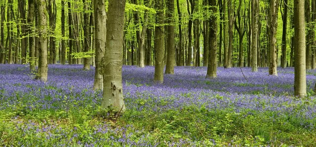
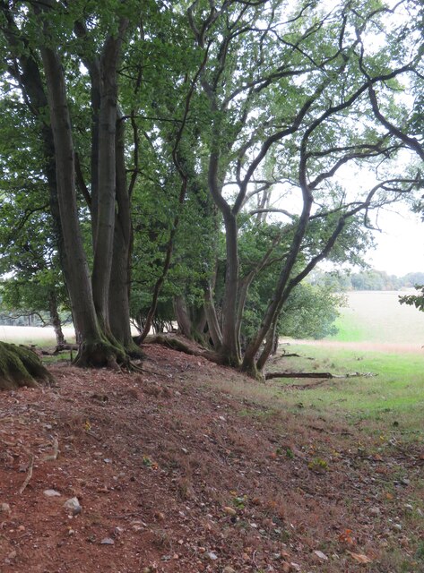
The copse is primarily composed of a mix of broadleaf and coniferous trees, creating a diverse and vibrant woodland ecosystem. Ancient oaks, beech, and ash trees are scattered throughout, providing a rich habitat for a variety of wildlife. The forest floor is adorned with an array of plants, including bluebells, primroses, and wild garlic, which create a beautiful carpet of color during the spring months.

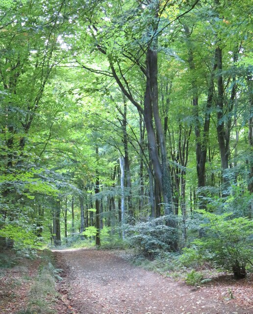
Traversing through Broom Copse, visitors can explore a network of well-maintained footpaths and trails, offering opportunities for walking, jogging, and cycling. The peaceful atmosphere and tranquil surroundings make it an ideal place for relaxation and nature observation. Many visitors bring binoculars to spot the copse's resident bird species, such as woodpeckers, thrushes, and warblers.

Broom Copse also holds historical significance, as it is believed to have been used for centuries as a source of timber and firewood. Remnants of old charcoal pits can still be seen in certain areas, providing a glimpse into the copse's past.

Overall, Broom Copse is a captivating woodland in Wiltshire, offering a haven of natural beauty, recreational activities, and a fascinating history for visitors to discover and enjoy.

If you have any feedback on the listing, please let us know in the comments section below.

Broom Copse Images

Images are sourced within 2km of 51.387362/-1.7686965 or Grid Reference SU1665. Thanks to Geograph Open Source API. All images are credited.

The A345 is closed, Oare Hill The wording on the vehicle suggests that tree felling is going on, probably dead Ash.
The A345 is closed, Oare Hill
The wording on the vehicle suggests that tree felling is going on, probably dead Ash.
Foxbury Copse, West Woods Bluebells and a track within Foxbury Copse (part of West Woods).
Foxbury Copse, West Woods
Bluebells and a track within Foxbury Copse (part of West Woods).
Wools Grove, West Woods Bluebells in Wools Grove, within West Woods.
Wools Grove, West Woods
Bluebells in Wools Grove, within West Woods.
Access track to West Woods car park Woodland managed by Forestry England.
Access track to West Woods car park
Woodland managed by Forestry England.
Shady picnic tables at West Woods car park
Dappled sunlight, West Woods West Woods are a large area of ancient woodland which at one time may have been joined to Savernake Forest. This might be ancient woodland recorded for 400 years or so, but one would have to search long and hard for any really ancient trees.
Dappled sunlight, West Woods
West Woods are a large area of ancient woodland which at one time may have been joined to Savernake Forest. This might be ancient woodland recorded for 400 years or so, but one would have to search long and hard for any really ancient trees.
Track in West Woods This track is shown as a 'BOAT' on OS maps and is also the course of the Wansdyke Path. The Wansdyke is off picture to the left and is quite insignificant at this point.
Track in West Woods
This track is shown as a 'BOAT' on OS maps and is also the course of the Wansdyke Path. The Wansdyke is off picture to the left and is quite insignificant at this point.
Slight remains of Wansdyke The low mount surmounted by trees marks the Wansdyke bank, but the ditch to the right has largely disappeared thanks to some 1500 years of slow infill.
The Wansdyke still has an air of mystery. Who built it and why?  It appears to be post Roman in date as at one point it crosses a Roman Road, whilst the ditch is on the north side, which suggests that if it was a defensive line, then it was defending land to the south.
Slight remains of Wansdyke
The low mount surmounted by trees marks the Wansdyke bank, but the ditch to the right has largely disappeared thanks to some 1500 years of slow infill. The Wansdyke still has an air of mystery. Who built it and why? It appears to be post Roman in date as at one point it crosses a Roman Road, whilst the ditch is on the north side, which suggests that if it was a defensive line, then it was defending land to the south.
Path towards West Woods Bridleway which is probably part of an old route from Huish to Lockeridge and is now part of the White Horse Trail.
Path towards West Woods
Bridleway which is probably part of an old route from Huish to Lockeridge and is now part of the White Horse Trail.
Clearing in Hursley Bottom A clearing in West Woods, complete with picnic table.
Clearing in Hursley Bottom
A clearing in West Woods, complete with picnic table.
Downland view Looking north of west near the crest of the Downs on a fine path which is part of the Tan Hill Way.
Downland view
Looking north of west near the crest of the Downs on a fine path which is part of the Tan Hill Way.
Path junction near Huish Hill House Farm access tracks and alternative paths. A footpath leads off to the right whilst a bridleway, which is part of the Tan Hill way goes ahead and to the left.
Path junction near Huish Hill House
Farm access tracks and alternative paths. A footpath leads off to the right whilst a bridleway, which is part of the Tan Hill way goes ahead and to the left.
Farmland and woodland Looking north from near the top of Oare Hill across recently tilled arable land towards West Woods. On the distant skyline can be seen the beech clumps on Hackpen Hill.
Farmland and woodland
Looking north from near the top of Oare Hill across recently tilled arable land towards West Woods. On the distant skyline can be seen the beech clumps on Hackpen Hill.
View from the west side of Martinsell Hill View from the White Horse Trail path that runs along the western edge of Martinsell Hill. The view is out towards the Giant's Grave, which has nothing to do with either giants or graves, but is more likely to be a defended settlement site. Some wet weather out in the vale.
View from the west side of Martinsell Hill
View from the White Horse Trail path that runs along the western edge of Martinsell Hill. The view is out towards the Giant's Grave, which has nothing to do with either giants or graves, but is more likely to be a defended settlement site. Some wet weather out in the vale.
Farmland, Savernake A strip of woodland seen end-on from the footpath near Levetts Farm.
Farmland, Savernake
A strip of woodland seen end-on from the footpath near Levetts Farm.
Farmland, Savernake A cereal crop to the south-west of Wernham Farm.
Farmland, Savernake
A cereal crop to the south-west of Wernham Farm.
West Woods, Nr Lockeridge in May when the wood is carpeted with 'Bluebells'
Path through West Woods In May the woods burst into colour with bluebells on the ground and the delicate green of new leaves on the beech trees.
Path through West Woods
In May the woods burst into colour with bluebells on the ground and the delicate green of new leaves on the beech trees.
Show me another place!

Broom Copse is located at Grid Ref: SU1665 (Lat: 51.387362, Lng: -1.7686965)

Unitary Authority: Wiltshire

Police Authority: Wiltshire

What 3 Words

///swaps.sonic.eagles. Near Huish, Wiltshire

Related Wikis

Nearby Amenities

Located within 500m of 51.387362,-1.7686965
Pyles Copse
Natural: wood
Lat/Long: 51.3883346/-1.763572
Homeleigh
Place: isolated_dwelling
Lat/Long: 51.3854064/-1.7655423
West Woods
Place: isolated_dwelling
Lat/Long: 51.3900177/-1.7644819
Power: pole
Source: Bing
Lat/Long: 51.3856394/-1.7638477
Power: pole
Source: Bing
Lat/Long: 51.3859271/-1.7623779
Power: pole
Source: Bing
Lat/Long: 51.3899813/-1.7718943
Pig-trough Copse
Natural: wood
Lat/Long: 51.3904715/-1.7738896
Broom Copse
Natural: wood
Lat/Long: 51.3870759/-1.7689751
Stone's Wood
Natural: wood
Lat/Long: 51.3898879/-1.7673228
The data included in this document is from www.openstreetmap.org. The data is made available under ODbL.

Have you been to Broom Copse?

Leave your review of Broom Copse below (or comments, questions and feedback).