Bank Plantation

Wood, Forest in Yorkshire

England

Bank Plantation

Old milestone On a bend on the south side of the A635 between Holmfirth and New Mills is this 19C West Riding CC milestone.   This area is called Wooldale and that name is on the top section.  Left face - HOLMFIRTH/1 MILE, right face - DENBY/DALE/5¾ MILES/CAWTHORNE/9 MILES/BARNSLEY/13 MILES.   The foundry name, BRAYSHAW & BOOTH/LIVERSEDGE is on the bevel.   Grade II listed 1313589.  It is in need of a clean and possible repaint.
Old milestone Credit: Chris Minto

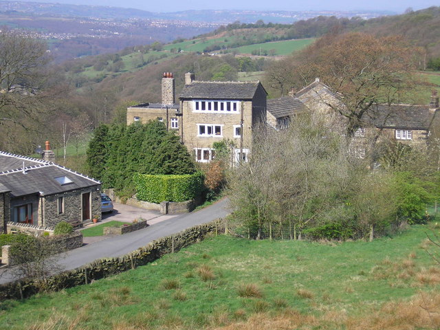
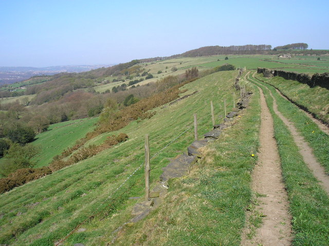
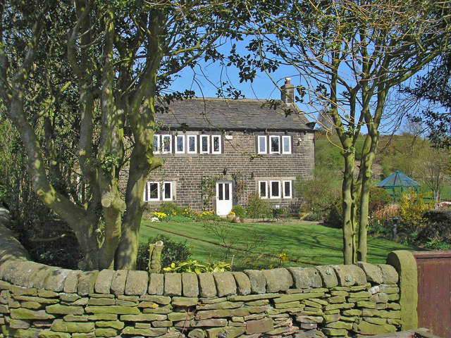
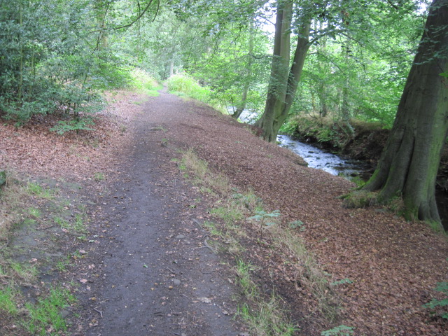
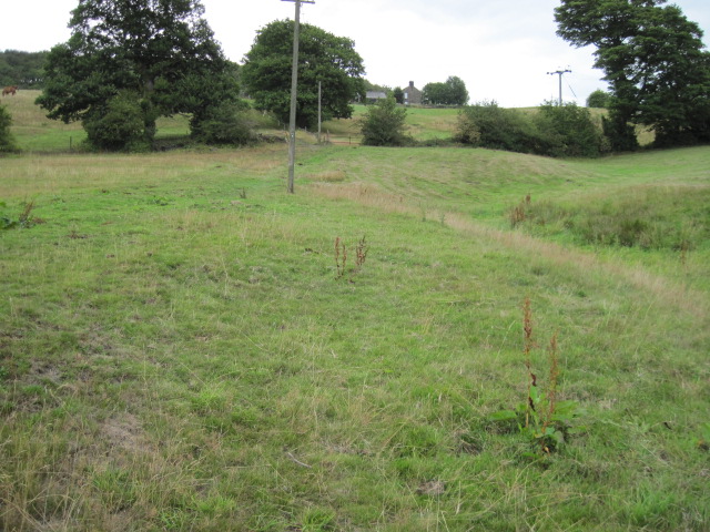
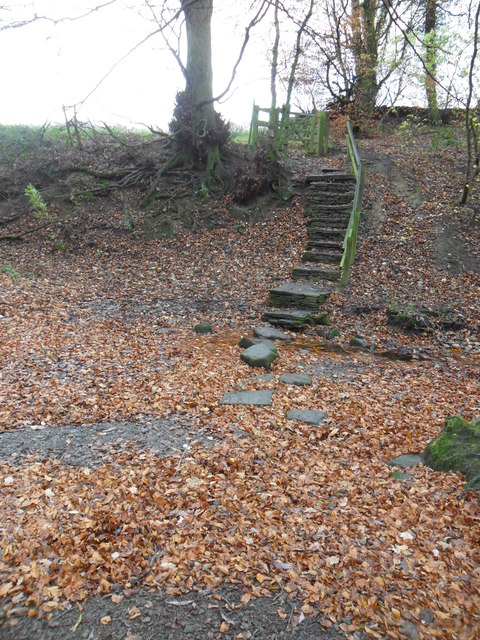
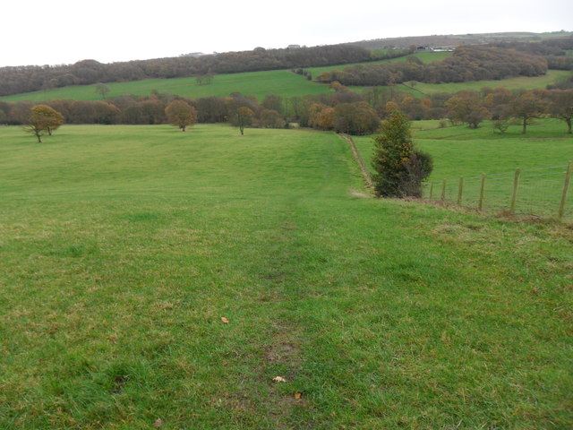
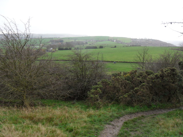
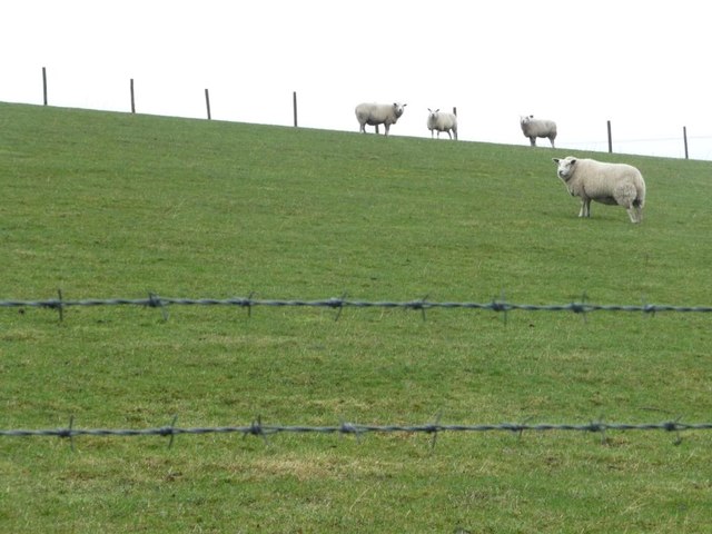
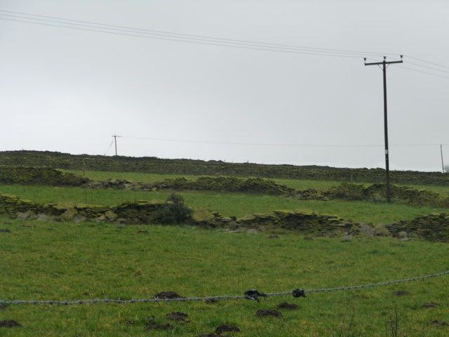
Bank Plantation is a picturesque woodland area located in Yorkshire, England. It is nestled within the larger forested region of Yorkshire and offers visitors a tranquil and immersive experience in nature. The plantation is situated on an elevated bank, hence its name, which provides visitors with breathtaking views of the surrounding landscape.

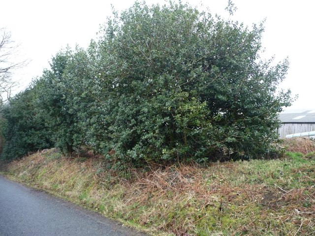
Covering an area of approximately 100 acres, Bank Plantation boasts a diverse range of tree species including oak, beech, and birch. The woodland is home to a variety of wildlife, making it an ideal place for nature enthusiasts and birdwatchers. Visitors to the plantation can expect to encounter species such as deer, rabbits, and a wide array of bird species.

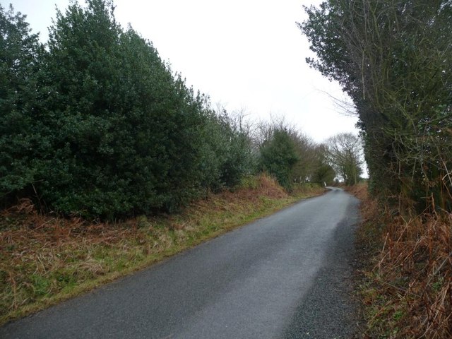
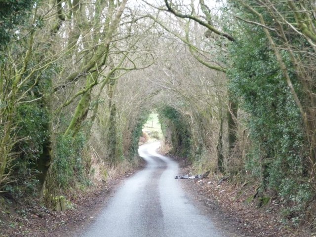
The woodland offers a network of well-maintained paths and trails, allowing visitors to explore the plantation at their leisure. These paths lead visitors through different sections of the woodland, each offering its own unique atmosphere and scenery. Along the way, benches and picnic spots are scattered, providing visitors with opportunities to rest and take in the beauty of their surroundings.

Bank Plantation is a popular destination for outdoor activities such as hiking, jogging, and cycling. The plantation also hosts educational programs and guided tours, offering visitors the chance to learn about the local flora and fauna and the importance of woodland conservation.

Overall, Bank Plantation is a haven of natural beauty, offering visitors a serene escape from the hustle and bustle of everyday life. Whether it's a peaceful walk, a family picnic, or a wildlife-spotting adventure, this enchanting woodland provides an idyllic setting for nature lovers of all ages.

If you have any feedback on the listing, please let us know in the comments section below.

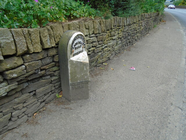
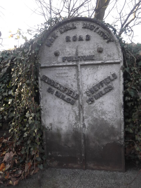
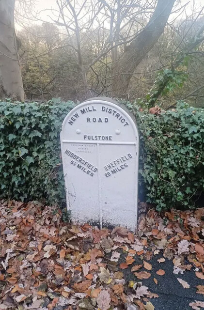
Bank Plantation Images

Images are sourced within 2km of 53.587719/-1.7592426 or Grid Reference SE1610. Thanks to Geograph Open Source API. All images are credited.

Old milestone On a bend on the south side of the A635 between Holmfirth and New Mills is this 19C West Riding CC milestone.   This area is called Wooldale and that name is on the top section.  Left face - HOLMFIRTH/1 MILE, right face - DENBY/DALE/5¾ MILES/CAWTHORNE/9 MILES/BARNSLEY/13 MILES.   The foundry name, BRAYSHAW & BOOTH/LIVERSEDGE is on the bevel.   Grade II listed 1313589.  It is in need of a clean and possible repaint.
Old milestone
On a bend on the south side of the A635 between Holmfirth and New Mills is this 19C West Riding CC milestone. This area is called Wooldale and that name is on the top section. Left face - HOLMFIRTH/1 MILE, right face - DENBY/DALE/5¾ MILES/CAWTHORNE/9 MILES/BARNSLEY/13 MILES. The foundry name, BRAYSHAW & BOOTH/LIVERSEDGE is on the bevel. Grade II listed 1313589. It is in need of a clean and possible repaint.
Interior of St Andrew's church, Thongsbridge For the outside of the church, see <a href="https://www.geograph.org.uk/photo/751457">SE1409 : St Andrew's Church, Thongsbridge, Wooldale</a>. This is the inside, looking liturgical west (geographically south-west). 

The church was built in 1877 as a chapel of ease. A school was added in 1891. There was a burial ground opened in 1938 but it was never used for burials and was sold in 1988. 

Note: the building was closed for worship in 2013 and sold to a private owner in 2020 (after this photo was taken) with planning permission for residential conversion, so is no longer publicly accessible. This view shows it as it had been as a place of worship.
Interior of St Andrew's church, Thongsbridge
For the outside of the church, see SE1409 : St Andrew's Church, Thongsbridge, Wooldale. This is the inside, looking liturgical west (geographically south-west). The church was built in 1877 as a chapel of ease. A school was added in 1891. There was a burial ground opened in 1938 but it was never used for burials and was sold in 1988. Note: the building was closed for worship in 2013 and sold to a private owner in 2020 (after this photo was taken) with planning permission for residential conversion, so is no longer publicly accessible. This view shows it as it had been as a place of worship.
Old milestone Where space on a road or path was limited, Brayshaw and Booth of Liversedge made flat castings for the West Riding CC instead of protruding ones.   This one is on the A616 Sheffield Road, New Mill opposite No. 30 Fulstone.   When a town name had more than 10 letters the name had to be cast at an angle as with Huddersfield.   Then Sheffield was cast the same way to match.   The foundry name on these flat plates is always at the top of the left-hand side.  This milestone is Grade II listed 1228473.
Old milestone
Where space on a road or path was limited, Brayshaw and Booth of Liversedge made flat castings for the West Riding CC instead of protruding ones. This one is on the A616 Sheffield Road, New Mill opposite No. 30 Fulstone. When a town name had more than 10 letters the name had to be cast at an angle as with Huddersfield. Then Sheffield was cast the same way to match. The foundry name on these flat plates is always at the top of the left-hand side. This milestone is Grade II listed 1228473.
Old Milestone, A616, Sheffield Road, New Mill Opposite No 30 Fulstone. Located on the West side of road, opposite a terrace row, against stone wall. Metal plate attached to stone post, Brayshaw & Booth casting design, erected by Wadsley & Langsett - New Mill District turnpike trust, 19th century. An earlier photograph can be found here <a title="https://www.geograph.org.uk/photo/6748931" href="https://www.geograph.org.uk/photo/6748931">Link</a>.

Inscription reads: HUDDERSFIELD / 6½ MILES :: SHEFFIELD / 20 MILES // NEW MILL DISTRICT / ROAD / FULSTONE :: BRAYSHAW & BOOTH / MAKERS / LIVERSEDGE 

Grade II listed by Historic England. <span class="nowrap"><a title="https://historicengland.org.uk/listing/the-list/list-entry/1228473" rel="nofollow ugc noopener" href="https://historicengland.org.uk/listing/the-list/list-entry/1228473">Link</a><img style="margin-left:2px;" alt="External link" title="External link - shift click to open in new window" src="https://s1.geograph.org.uk/img/external.png" width="10" height="10"/></span>

Milestone Society National ID: YW_SFHU20
Old Milestone, A616, Sheffield Road, New Mill
Opposite No 30 Fulstone. Located on the West side of road, opposite a terrace row, against stone wall. Metal plate attached to stone post, Brayshaw & Booth casting design, erected by Wadsley & Langsett - New Mill District turnpike trust, 19th century. An earlier photograph can be found here Link. Inscription reads: HUDDERSFIELD / 6½ MILES :: SHEFFIELD / 20 MILES // NEW MILL DISTRICT / ROAD / FULSTONE :: BRAYSHAW & BOOTH / MAKERS / LIVERSEDGE Grade II listed by Historic England. LinkExternal link Milestone Society National ID: YW_SFHU20
Top of the Hill A weavers' hamlet below Thurstonland.
Top of the Hill
A weavers' hamlet below Thurstonland.
Lane near Thurstonland An old lane along the edge of a steep drop.
Lane near Thurstonland
An old lane along the edge of a steep drop.
Height Green A farmhouse between Thurstonland and Farnley Tyas.
Height Green
A farmhouse between Thurstonland and Farnley Tyas.
Thurstonland Primary School
Footpath beside River Holme
Footpath From Hall Ing Lane
Stone Wood Dike, near Shepley Stepping stones over Stone Wood Dike.
Stone Wood Dike, near Shepley
Stepping stones over Stone Wood Dike.
Field path, near Thurstonland Looking down field-edge path back towards Shepley.  Mathewman Wood is in the distance.
Field path, near Thurstonland
Looking down field-edge path back towards Shepley. Mathewman Wood is in the distance.
Farnley Moor footpath Looking south from the edge of Farnley Moor.  Thurstonland is in the distance.
Farnley Moor footpath
Looking south from the edge of Farnley Moor. Thurstonland is in the distance.
Halstead Lane, near Lower Halstead Farm By accident, a record of the 242 metre spot height.
Halstead Lane, near Lower Halstead Farm
By accident, a record of the 242 metre spot height.
Holly boundary to Lower Halstead Farm Large holly bushes hedge both sides of Halstead Lane here.
Holly boundary to Lower Halstead Farm
Large holly bushes hedge both sides of Halstead Lane here.
Green tunnel, Halstead Lane Near the entrance to Lower Halstead Farm.
Green tunnel, Halstead Lane
Near the entrance to Lower Halstead Farm.
Sheep grazing near Lower Halstead Farm The brbed wire runs alongside Halstead Lane.
Sheep grazing near Lower Halstead Farm
The brbed wire runs alongside Halstead Lane.
Broken down walls Farmland on the south side of Haw Cliff Lane.
Broken down walls
Farmland on the south side of Haw Cliff Lane.
Show me another place!

Bank Plantation is located at Grid Ref: SE1610 (Lat: 53.587719, Lng: -1.7592426)

Division: West Riding

Unitary Authority: Kirklees

Police Authority: West Yorkshire

What 3 Words

///leaves.deeply.ranch. Near Holmfirth, West Yorkshire

Related Wikis

Thurstonland

Thurstonland is a village in the civil parish of Kirkburton, in Kirklees, West Yorkshire, England. It has a population of almost 400. The village is on...

Church of St Thomas, Thurstonland

The Church of St Thomas, Thurstonland, West Yorkshire, England, is an Anglican church. It is an Arts and Crafts building in Gothic Revival style, designed...

Wooldale

Wooldale is a small village nestled on a hill, overlooking the Kirkroyds area of New Mill, Holmfirth in West Yorkshire, England. It has a population of...

Thongs Bridge railway station

Thongs Bridge railway station was the only intermediate stop on the railway line between Brockholes and Holmfirth, West Yorkshire, England. Opened in July...

Holmfirth High School

Holmfirth High School is a coeducational secondary school located on Heys Road in Thongsbridge, Holmfirth, West Yorkshire, England. Holmfirth High School...

Thongsbridge

Thongsbridge is a small village in the Kirklees district of West Yorkshire, England. It is in the semi-rural Holme Valley and the village boundaries merge...

Thurstonland and Farnley Tyas Urban District

Thurstonland and Farnley Tyas was an urban district in the West Riding of Yorkshire from 1925 to 1938. It was created in 1925 by the merger of the Thurstonland...

Brockholes railway station

Brockholes railway station serves the village of Brockholes, near Huddersfield in West Yorkshire. It lies 4.25 miles (7 km) away from Huddersfield on the...

Related Videos

Hiking Last of the Summer Wine Country

Bagging Ethels above Holmfirth.

Hiking around Summer wine Country

Hiking around Holmfirth Holmbrige Lovely views Great Lovely Old spectacular English village here in the Heart of Holmfirth ...

HOLMFIRTH England | Full tour of Holmfirth West Yorkshire, Last Of The Summer Wine Country (4K WALK)

HOLMFIRTH England | Full tour of Holmfirth West Yorkshire, Last Of The Summer Wine Country (4K) Full 4k Virtual Walk through ...

Nearby Amenities

Located within 500m of 53.587719,-1.7592426
Bus Stop
New Mill Road Sinking Wood
Bench: no
Local Ref: 45022014
Naptan AtcoCode: 450022014
Naptan Bearing: SE
Naptan CommonName: New Mill Road Sinking Wood
Naptan Crossing: Stoney Bank
Naptan Indicator: Stop 45022014
Naptan Landmark: Sinking Wood
Naptan PlusbusZoneRef: LEEDS
Naptan ShortCommonName: Sinking Wood
Naptan Street: New Mill Road
Naptan Verified: no
Shelter: no
Source: naptan_import
Lat/Long: 53.5857184/-1.762956
Thurstnlnd Bnk Road
Local Ref: 45024565
Naptan AtcoCode: 450024565
Naptan Bearing: NE
Naptan BusStopType: CUS
Naptan CommonName: Thurstnlnd Bnk Road
Naptan Crossing: Occupation Lane
Naptan Indicator: Stop 45024565
Naptan PlusbusZoneRef: LEEDS
Naptan ShortCommonName: Occupation Lane
Naptan Street: Thurstonland Bank Road
Naptan Verified: no
Source: naptan_import
Lat/Long: 53.588619/-1.7615801
New Mill Road
Local Ref: 45051182
Naptan AtcoCode: 450051182
Naptan Bearing: NW
Naptan BusStopType: CUS
Naptan CommonName: New Mill Road
Naptan Indicator: Stop 45051182
Naptan PlusbusZoneRef: LEEDS
Naptan ShortCommonName: Sinking Wood
Naptan Street: New Mill Road
Naptan Verified: no
Source: naptan_import
Lat/Long: 53.5856557/-1.7630621
Location Transition: yes
Power: pole
Lat/Long: 53.5894636/-1.760361
Power: pole
Lat/Long: 53.59004/-1.7605254
Power: pole
Lat/Long: 53.5906254/-1.7606928
Power: pole
Lat/Long: 53.5914474/-1.7599592
Power: pole
Lat/Long: 53.592152/-1.7593383
Top of the Hill
Place: hamlet
Lat/Long: 53.5907049/-1.7560241
Barrier: kissing_gate
Lat/Long: 53.5840568/-1.7597137
Thurstonland Bank
Place: locality
Source: OS OD Streetview
Lat/Long: 53.5856921/-1.7573327
Power: pole
Lat/Long: 53.5842864/-1.7578581
Power: pole
Lat/Long: 53.5853252/-1.7589365
Location Transition: yes
Power: pole
Lat/Long: 53.5861775/-1.7598793
Description: 12 panels
Generator Method: photovoltaic
Generator Output Electricity: small_installation
Generator Source: solar
Generator Type: solar_photovoltaic_panel
Note: roof household
Power: generator
Lat/Long: 53.584843/-1.7647522
Description: 12 panels
Generator Method: photovoltaic
Generator Output Electricity: yes
Generator Source: solar
Generator Type: solar_photovoltaic_panel
Note: roof household
Power: generator
Lat/Long: 53.5846779/-1.7640639
Top of the Bank
Place: hamlet
Lat/Long: 53.58813/-1.7565336
Barrier: stile
Step Count: 1
Stile: stepover
Lat/Long: 53.5866342/-1.7539324
Bench
Backrest: yes
Lat/Long: 53.5876853/-1.7602728
Barrier: stile
Stile: stepover
Lat/Long: 53.5882605/-1.7637537
Bench
Backrest: yes
Lat/Long: 53.5874891/-1.7566861
Bench
Backrest: yes
Lat/Long: 53.5878767/-1.7577323
Bench
Backrest: yes
Lat/Long: 53.5886936/-1.7612222
Barrier: stile
Step Count: 2
Stile: stepover
Lat/Long: 53.5864895/-1.753369
Generator Method: wind_turbine
Generator Source: wind
Power: generator
Lat/Long: 53.5864969/-1.7520714
Bench
Backrest: yes
Lat/Long: 53.5868272/-1.7546493
Barrier: stile
Step Count: 1
Stile: stepover
Lat/Long: 53.5913945/-1.7587983
Barrier: kissing_gate
Lat/Long: 53.5917034/-1.7607154
The data included in this document is from www.openstreetmap.org. The data is made available under ODbL.

Have you been to Bank Plantation?

Leave your review of Bank Plantation below (or comments, questions and feedback).