Arlebrook

Settlement in Gloucestershire Stroud

England

Arlebrook

Severn valley farm Taken between Standish and the M5 the farmland has flattened out after its descent from the Cotswold hills to the river severn. The Malvern Hills are just visible on the far left horizon.
Severn valley farm Credit: Vincent Jones

Arlebrook is a small village located in the county of Gloucestershire, England. Situated in the picturesque Cotswolds region, it is surrounded by rolling hills and lush green countryside. The village is located approximately 6 miles northwest of the town of Cirencester and is easily accessible via the A433 road.

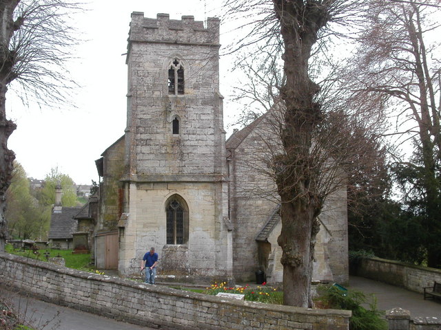
Arlebrook is known for its quaint and charming atmosphere, with many traditional stone cottages and buildings that showcase the area's rich history. The village is home to a close-knit community, with a population of around 300 people.

Despite its small size, Arlebrook offers a range of amenities for its residents. These include a local pub, which serves as a social hub for the village, and a village hall that hosts community events and gatherings. The village also has a primary school, providing education for the local children.

The surrounding area offers plenty of opportunities for outdoor activities. The Cotswolds provide picturesque walking and cycling routes, allowing residents and visitors to explore the stunning countryside. Additionally, the nearby Cotswold Water Park offers various water-based activities, including sailing and kayaking.

Arlebrook is conveniently located for those seeking a peaceful rural lifestyle while still being within reach of larger towns and cities. The bustling market town of Cirencester is just a short drive away, offering a wide range of amenities, shops, and services.

Overall, Arlebrook is a charming village that offers a tranquil setting in the heart of the Cotswolds, making it an attractive place to live or visit for those seeking a peaceful and idyllic English countryside experience.

If you have any feedback on the listing, please let us know in the comments section below.
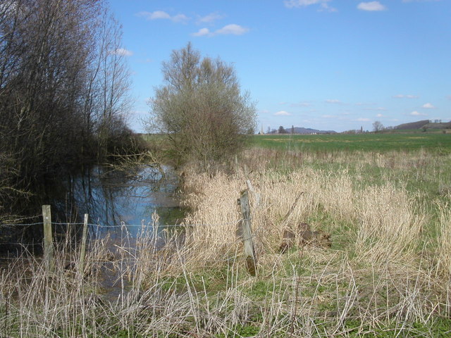
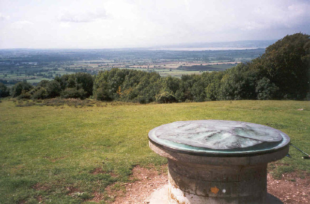
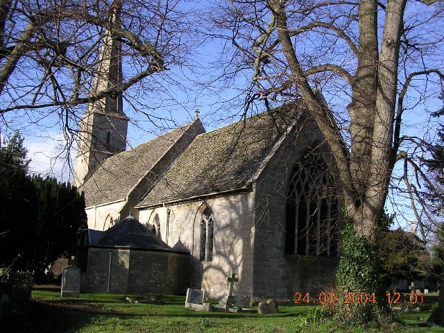
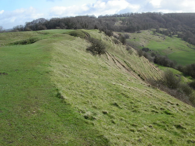
Arlebrook Images

Images are sourced within 2km of 51.770431/-2.272976 or Grid Reference SO8108. Thanks to Geograph Open Source API. All images are credited.

Severn valley farm Taken between Standish and the M5 the farmland has flattened out after its descent from the Cotswold hills to the river severn. The Malvern Hills are just visible on the far left horizon.
Severn valley farm
Taken between Standish and the M5 the farmland has flattened out after its descent from the Cotswold hills to the river severn. The Malvern Hills are just visible on the far left horizon.
Small pond This small pond lies at a junction of two bridleways and three footpaths. Following past the pond the bridleway leads north to Standish village. Just visible is the tower of Standish church.
Small pond
This small pond lies at a junction of two bridleways and three footpaths. Following past the pond the bridleway leads north to Standish village. Just visible is the tower of Standish church.
North from Warren Farm A small young coppice within a large pasture.
North from Warren Farm
A small young coppice within a large pasture.
Farm track with Mayweed This track is also a bridleway, and is adorned with arable weeds including Scentless Mayweed (Tripleurospermum inodorum) showing well here.  Standish Church and Standish Court Farm are in the background.
Farm track with Mayweed
This track is also a bridleway, and is adorned with arable weeds including Scentless Mayweed (Tripleurospermum inodorum) showing well here. Standish Church and Standish Court Farm are in the background.
Topograph on Haresfield Beacon The Severn Estuary can be seen in the distance.
Topograph on Haresfield Beacon
The Severn Estuary can be seen in the distance.
Standish.  The village hall Built in c16 by the church wardens for their use.  The church is out of shot to the left.
Standish. The village hall
Built in c16 by the church wardens for their use. The church is out of shot to the left.
Standish.  St. Nicholas The village hall is just visible to the right of the church.
Standish. St. Nicholas
The village hall is just visible to the right of the church.
Crowcomepill Farm The farmhouse at Crowcomepill is recorded as far back as 1326. The B4008 cuts across the picture and the view is what commuters to Gloucester can see from their train. Randwick rises in the background.
Crowcomepill Farm
The farmhouse at Crowcomepill is recorded as far back as 1326. The B4008 cuts across the picture and the view is what commuters to Gloucester can see from their train. Randwick rises in the background.
Cotswold Way path at Ring Hill The Cotswold Way path runs along Ring Hill as you walk from Haresfield Beacon.
Cotswold Way path at Ring Hill
The Cotswold Way path runs along Ring Hill as you walk from Haresfield Beacon.
Little Haresfield Little Haresfield lies 1km from the M5. The Cotswold Way path runs along the top of Haresfield Hill.
Little Haresfield
Little Haresfield lies 1km from the M5. The Cotswold Way path runs along the top of Haresfield Hill.
Train from Gloucester at Black Bridge Taken from Black Bridge looking north towards Gloucester. The track forks after the bridge one line south and the other east through the Stroud Valley.
Train from Gloucester at Black Bridge
Taken from Black Bridge looking north towards Gloucester. The track forks after the bridge one line south and the other east through the Stroud Valley.
Farmland below Standish Woods The farmland past Standish village starts to rise towards Standish woods. The Cotswold Way path runs through the woods.
Farmland below Standish Woods
The farmland past Standish village starts to rise towards Standish woods. The Cotswold Way path runs through the woods.
Vinegar Hill Vinegar hill lies on the lower slopes of Haresfield Beacon where the Cotswold Way path travels by.
Vinegar Hill
Vinegar hill lies on the lower slopes of Haresfield Beacon where the Cotswold Way path travels by.
Beacon Inn Hotel The Beacon Inn Hotel lies at the bottom of Haresfield Beacon. The rail track leads in and out from the south side of Gloucester.
Beacon Inn Hotel
The Beacon Inn Hotel lies at the bottom of Haresfield Beacon. The rail track leads in and out from the south side of Gloucester.
Village postbox Little Haresfield The village postbox at Little Haresfield is set into a garden wall.
Village postbox Little Haresfield
The village postbox at Little Haresfield is set into a garden wall.
Fork in the Track This photo is taken from Black Bridge looking south towards Stonehouse which is 1.4Km away. The left track of the fork is towards the Stroud valley. On the horizon is Stanley wood. The Cotswold Way path runs along the hill mainly through the woods.
Fork in the Track
This photo is taken from Black Bridge looking south towards Stonehouse which is 1.4Km away. The left track of the fork is towards the Stroud valley. On the horizon is Stanley wood. The Cotswold Way path runs along the hill mainly through the woods.
Cotswold Way path at Haresfield Beacon The Cotswold Way path runs east along the ridge at Haresfield Beacon from the triangulation pillar towards Bunkers Bank.
Cotswold Way path at Haresfield Beacon
The Cotswold Way path runs east along the ridge at Haresfield Beacon from the triangulation pillar towards Bunkers Bank.
Randwick church Randwick parish church lies just below Standish wood and is 1Km north of Stroud.
Randwick church
Randwick parish church lies just below Standish wood and is 1Km north of Stroud.
Show me another place!

Arlebrook is located at Grid Ref: SO8108 (Lat: 51.770431, Lng: -2.272976)

Administrative County: Gloucestershire

District: Stroud

Police Authority: Gloucestershire

What 3 Words

///overpaid.luring.dispensed. Near Stonehouse, Gloucestershire

Nearby Locations

Arlebrook Vinegar Hill

Related Wikis

Arlebrook

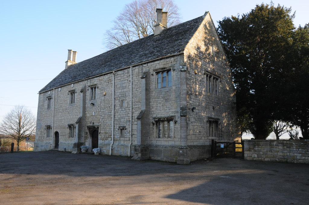
Arlebrook is a village in Gloucestershire, England. A timber framed house known as the Thatched Cottage was built in the 16th century. Next to it is an...

Haresfield Beacon

Haresfield Beacon (grid reference SO819088) is a 0.73-hectare (1.8-acre) geological Site of Special Scientific Interest in Gloucestershire, notified in...

Standish, Gloucestershire

Standish is a small village and civil parish in the Stroud local government district in Gloucestershire, England. The village is 5 kilometres (3.1 mi)...
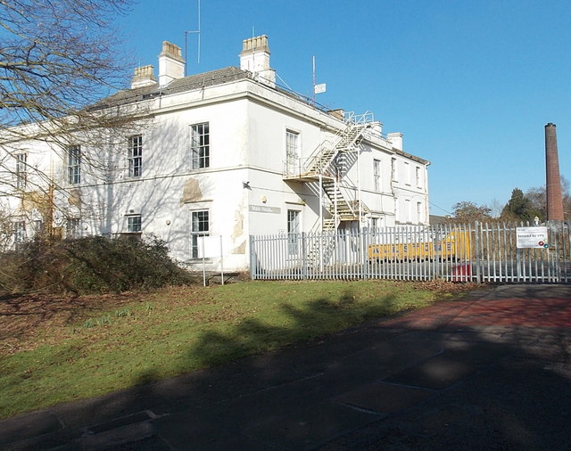
Standish Hospital

Standish Hospital was a specialist orthopaedics, rheumatology and respiratory care National Health Service (NHS) hospital, located in the hamlet of Standish...

Randwick, Gloucestershire

Randwick is a village bordering the market town of Stroud in Gloucestershire, England, the United Kingdom. It is known locally for its folk traditions...

Haresfield railway station

Haresfield railway station served the village of Haresfield in Gloucestershire, England. == History == The station opened on 29 May 1854 on the Bristol...

Maidenhill School

Maidenhill School is a coeducational foundation secondary school located in Stonehouse in the English county of Gloucestershire.It is a smaller than average...

Haresfield

Haresfield is a village near Gloucester, Gloucestershire, England around one mile from Junction 12 of the M5 motorway and between the villages of Brookthorpe...

Related Videos

Cotswold Way walk, Standish Wood and Haresfield Beacon

Starting at Shortwood National Trust Car Park this walk follows stretches of the Cotswold Way through Standish Woods, Harefield ...

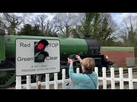
61306 Mayflower leading 1Z60 Norwich to Worcester. 8th April 2023

A new vantage point for us as on holiday. Haresfield crossing. 1Z60 Norwich to Worcester. D1924 bringing up the rear.

Nearby Amenities

Located within 500m of 51.770431,-2.272976
Bartlett's Green
Place: hamlet
Source: OS OpenData StreetView
Lat/Long: 51.7673489/-2.2725413
Barrier: cattle_grid
Source: OS OpenData StreetView
Lat/Long: 51.7704296/-2.2727988
Barrier: stile
Source: survey
Lat/Long: 51.7713282/-2.2735634
Barrier: stile
Source: survey
Lat/Long: 51.771762/-2.276576
Power: pole
Lat/Long: 51.7687274/-2.2665867
Power: pole
Lat/Long: 51.7682374/-2.2669025
Power: pole
Lat/Long: 51.7675879/-2.2688826
Power: pole
Lat/Long: 51.7698309/-2.2745146
Power: pole
Lat/Long: 51.7691603/-2.2765746
Power: pole
Transformer: distribution
Lat/Long: 51.7666921/-2.2752751
Power: pole
Lat/Long: 51.7703444/-2.2774535
Material: wood
Power: pole
Lat/Long: 51.7714259/-2.2782563
Power: pole
Lat/Long: 51.7674193/-2.2745384
Power: pole
Lat/Long: 51.7669092/-2.2769913
Power: pole
Lat/Long: 51.7670041/-2.2748177
Power: pole
Lat/Long: 51.7680731/-2.2757525
Power: pole
Lat/Long: 51.7694692/-2.2755452
Material: wood
Power: pole
Lat/Long: 51.7725979/-2.279126
Power: pole
Lat/Long: 51.7701993/-2.2734525
Post Box
Collection Times: Mo-Fr 16:15; Sa 07:15
Collection Times Checked: 2015-10-11
Operator: Royal Mail
Post Box Type: lamp
Ref: GL10 160
Royal Cypher: EIIR
Royal Cypher Wikidata: Q33102113
Lat/Long: 51.7670357/-2.2702529
Post Box
Collection Times: Mo-Fr 09:00; Sa 07:00
Collection Times Checked: 2021-02-10
Drive Through: no
Operator: Royal Mail
Post Box Type: lamp
Ref: GL10 147D
Royal Cypher: EIIR
Royal Cypher Wikidata: Q33102113
Source: survey
Lat/Long: 51.7682727/-2.2789669
Barrier: stile
Material: wood
Stile: stepover
Lat/Long: 51.767225/-2.2711083
The data included in this document is from www.openstreetmap.org. The data is made available under ODbL.

Have you been to Arlebrook?

Leave your review of Arlebrook below (or comments, questions and feedback).