Arle

Settlement in Gloucestershire Cheltenham

England

Arle

Disused Railway Tunnel This tunnel stood on the Great Western Railway's Cheltenham to Birmingham Branch, just North of Cheltenham.
Disused Railway Tunnel Credit: Stephen Bowden

Arle is a small village located in the county of Gloucestershire, England. Situated approximately two miles south of the town of Cheltenham, Arle is part of the Cheltenham Borough Council area and falls within the Cheltenham parliamentary constituency. The village is nestled in a picturesque countryside setting, surrounded by green fields and rolling hills.

Arle is primarily a residential area, characterized by its charming houses and peaceful atmosphere. It offers a quiet and tranquil environment for its residents, while still providing easy access to the amenities and facilities of nearby Cheltenham. The village benefits from excellent transport links, with the A40 road passing close by, offering convenient connections to other nearby towns and cities.

Although small in size, Arle is home to a close-knit community that takes pride in maintaining its village identity. The local community center plays an active role in organizing events and activities for residents throughout the year, fostering a strong sense of community spirit.

For those seeking outdoor recreational opportunities, Arle is surrounded by beautiful countryside, offering ample opportunities for walking, hiking, and cycling. The village is also located near the Cotswolds, an Area of Outstanding Natural Beauty, which attracts visitors from far and wide.

In conclusion, Arle is a charming village in Gloucestershire, offering a peaceful and picturesque setting for its residents. With its convenient location and strong sense of community, it provides a delightful place to call home.

If you have any feedback on the listing, please let us know in the comments section below.
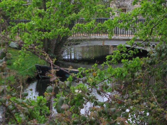
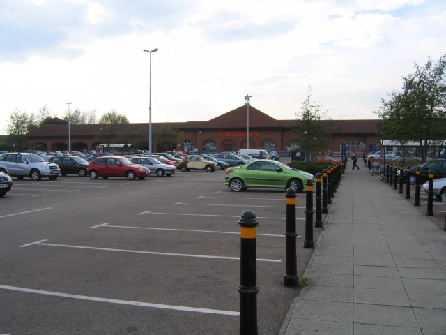
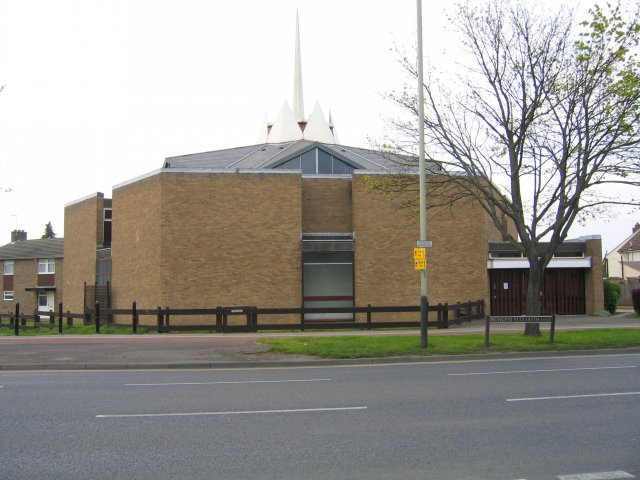
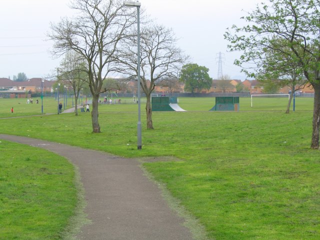
Arle Images

Images are sourced within 2km of 51.911389/-2.099697 or Grid Reference SO9323. Thanks to Geograph Open Source API. All images are credited.

Disused Railway Tunnel This tunnel stood on the Great Western Railway's Cheltenham to Birmingham Branch, just North of Cheltenham.
Disused Railway Tunnel
This tunnel stood on the Great Western Railway's Cheltenham to Birmingham Branch, just North of Cheltenham.
St Paul's Church The church is on St Paul's Road.
St Paul's Church
The church is on St Paul's Road.
Uckington Moat A mediaeval moated site.  Little of the mediaeval buildings remain, apart from the moat itself which now surrounds some much later buildings.
Uckington Moat
A mediaeval moated site. Little of the mediaeval buildings remain, apart from the moat itself which now surrounds some much later buildings.
Sainsbury's Supermarket This superstore is the anchor of the Gallagher Retail Park on the A4019 (Tewksbury Road). Circulation is anticlockwise.
Sainsbury's Supermarket
This superstore is the anchor of the Gallagher Retail Park on the A4019 (Tewksbury Road). Circulation is anticlockwise.
St Thomas More Church A Roman Catholic Church on Princess Elizabeth Way.
St Thomas More Church
A Roman Catholic Church on Princess Elizabeth Way.
Springbank Park A patch of green in the heart of the Hester's Way estate on the Northwestern edge of Cheltenham.
Springbank Park
A patch of green in the heart of the Hester's Way estate on the Northwestern edge of Cheltenham.
Coronation Square A square "roundabout" on Princess Elizabeth Way, Coronation Square is a little run down at the moment.  The church in the photograph is St Aidan's.
Coronation Square
A square "roundabout" on Princess Elizabeth Way, Coronation Square is a little run down at the moment. The church in the photograph is St Aidan's.
Cotswold Bowl Ten Pin Bowling Lanes Cotswold Bowl is in the heart of the Kingsditch industrial estate.
Cotswold Bowl Ten Pin Bowling Lanes
Cotswold Bowl is in the heart of the Kingsditch industrial estate.
St Benedict's College A Catholic College on Arle Road.
St Benedict's College
A Catholic College on Arle Road.
Cheltenham Spa Railway Station Originally built by the Midland Railway, it stands on the line from Bristol to Birmingham.
Cheltenham Spa Railway Station
Originally built by the Midland Railway, it stands on the line from Bristol to Birmingham.
St Peters Church, Tewkesbury Road The church now sits on the busy road bringing traffic from the M5 into Cheltenham.
St Peters Church, Tewkesbury Road
The church now sits on the busy road bringing traffic from the M5 into Cheltenham.
Old Cheltenham Gas Works Offices and Clock Tower The offices are now used by a number of small private companies. The gas works themselves are largely occupied by a large Tesco supermarket behind the old gas works walls which have been reasonably sympathetically restored.
Old Cheltenham Gas Works Offices and Clock Tower
The offices are now used by a number of small private companies. The gas works themselves are largely occupied by a large Tesco supermarket behind the old gas works walls which have been reasonably sympathetically restored.
Hyde Lane Joining Swindon Village now a suburb of Cheltenham and both Southam and Bishop's Cleeve separated by green belt land.
Hyde Lane
Joining Swindon Village now a suburb of Cheltenham and both Southam and Bishop's Cleeve separated by green belt land.
Ridge and Furrow, Hyde Lane Part of the green belt land separating the urban fringes of Cheltenham and the satellite dormitory villages.
Ridge and Furrow, Hyde Lane
Part of the green belt land separating the urban fringes of Cheltenham and the satellite dormitory villages.
Hunting Butts Tunnel Supplementary to the geograph already submitted <a href="https://www.geograph.org.uk/photo/2319">SO9424 : Disused Railway Tunnel</a>, here is a photograph taken in 1980 of the southern portal of the 97-yard, double-track Hunting Butts tunnel on the former Great Western line between Cheltenham (St James) and Bishop's Cleeve.
Hunting Butts Tunnel
Supplementary to the geograph already submitted SO9424 : Disused Railway Tunnel, here is a photograph taken in 1980 of the southern portal of the 97-yard, double-track Hunting Butts tunnel on the former Great Western line between Cheltenham (St James) and Bishop's Cleeve.
The Hop Pole, Cheltenham This pub, opposite the site of <a href="https://www.geograph.org.uk/photo/46933">SO9423 : Old Cheltenham Gas Works Offices and Clock Tower</a> in Gloucester Road was the site of the terminus of the original Gloucester & Cheltenham Railway.  This was actually a horse drawn tramway which ran largely along the roadside from Gloucester Docks and finishing in a set of wharves here to supply Cheltenham.  This would have included the gasworks opposite.  Another branch of the tramway ran to Leckhampton to carry stone from the quarries there.  The tramway was largely abandoned with the coming of the "main line" railways although a short length at Leckhampton remained in use for many years to serve as a feeder to the standard gauge railway there.  The location of the  G & C terminus is commemorated by <a href="https://www.geograph.org.uk/photo/277334">SO9422 : Plaque on the Hop Pole</a>.
The Hop Pole, Cheltenham
This pub, opposite the site of SO9423 : Old Cheltenham Gas Works Offices and Clock Tower in Gloucester Road was the site of the terminus of the original Gloucester & Cheltenham Railway. This was actually a horse drawn tramway which ran largely along the roadside from Gloucester Docks and finishing in a set of wharves here to supply Cheltenham. This would have included the gasworks opposite. Another branch of the tramway ran to Leckhampton to carry stone from the quarries there. The tramway was largely abandoned with the coming of the "main line" railways although a short length at Leckhampton remained in use for many years to serve as a feeder to the standard gauge railway there. The location of the G & C terminus is commemorated by SO9422 : Plaque on the Hop Pole.
Plaque on the Hop Pole The plaque just to the right of the doorway on <a href="https://www.geograph.org.uk/photo/277314">SO9422 : The Hop Pole, Cheltenham</a> in Gloucester Road commemorating the location of the terminus of the original horse drawn tramway from here to Gloucester Docks.
Plaque on the Hop Pole
The plaque just to the right of the doorway on SO9422 : The Hop Pole, Cheltenham in Gloucester Road commemorating the location of the terminus of the original horse drawn tramway from here to Gloucester Docks.
John Dower House This was originally built as Clarence Hotel and the <a href="https://www.geograph.org.uk/photo/288745">SO9422 : Coat of Arms on John Dower House</a> is in recognition of visit of the Duchess of Clarence, later to become Queen Adelaide, in 1827.  It is now the headquarters of the Countryside Commission.
John Dower House
This was originally built as Clarence Hotel and the SO9422 : Coat of Arms on John Dower House is in recognition of visit of the Duchess of Clarence, later to become Queen Adelaide, in 1827. It is now the headquarters of the Countryside Commission.
Show me another place!

Arle is located at Grid Ref: SO9323 (Lat: 51.911389, Lng: -2.099697)

Administrative County: Gloucestershire

District: Cheltenham

Police Authority: Gloucestershire

What 3 Words

///speak.lively.coast. Near Cheltenham, Gloucestershire

Nearby Locations

St Peter's Swindon Arle

Related Wikis

Arle, Cheltenham

Arle is a district of Cheltenham in Gloucestershire, England. It was historically a manorial estate which owned parts of the town now known as Hesters...

Cheltenham Saracens F.C.

Cheltenham Saracens Football Club is a football club based in Cheltenham, England. Affiliated to the Gloucestershire County FA, they are currently members...

Cheltenham High Street railway station

Cheltenham High Street railway station was built by the Midland Railway to serve the north-western part of Cheltenham. == History == The station was situated...

All Saints' Academy, Cheltenham

All Saints' Academy is a self proclaimed Christian church school in Cheltenham in cooperation with the Roman Catholic Diocese of Clifton and the Church...

Rowanfield

Rowanfield is a neighbourhood in Cheltenham, England. It consists primarily of a social housing estate of Wimpey no-fines houses and low-rise flats, built...

Alstone, Cheltenham

Alstone is a district of the English town of Cheltenham, in Gloucestershire, England. Once a distinct village (it was listed in the Domesday Book with...

Hesters Way

Cheltenham West is an area in the western part of Cheltenham, Gloucestershire, England. It is the generic name for an area which includes the council wards...

Cheltenham High Street Halt railway station

Cheltenham High Street Halt was a railway station on the Great Western Railway's Honeybourne Line between Cheltenham and Birmingham via Stratford-upon...

Nearby Amenities

Located within 500m of 51.911389,-2.099697
Traffic Signals
Lat/Long: 51.9135731/-2.0994903
Traffic Signals
Lat/Long: 51.9135561/-2.0990222
Traffic Signals
Lat/Long: 51.9139796/-2.099501
Crossing
Crossing: traffic_signals
Crossing Ref: pelican
Lat/Long: 51.9109468/-2.1032091
Turning Circle
Lat/Long: 51.9124708/-2.1033426
Traffic Signals
Lat/Long: 51.9123322/-2.0972352
Post Box
Brand: Royal Mail
Brand Wikidata: Q638098
Brand Wikipedia: en:Royal Mail
Collection Times: Mo-Fr 09:00; Sa 07:00
Operator: Royal Mail
Operator Wikidata: Q638098
Post Box Type: pillar
Ref: GL51 271D
Royal Cypher: GR
Royal Cypher Wikidata: Q33102273
Lat/Long: 51.9075224/-2.0992851
Traffic Signals
Crossing: traffic_signals
Crossing Ref: pelican
Lat/Long: 51.907095/-2.0983744
Traffic Signals
Lat/Long: 51.9123991/-2.0971161
Traffic Signals
Crossing: traffic_signals
Lat/Long: 51.9134267/-2.0989502
Traffic Signals
Bicycle: yes
Crossing: traffic_signals
Crossing Ref: toucan
Lat/Long: 51.9133908/-2.0994729
Traffic Signals
Crossing: traffic_signals
Tactile Paving: yes
Lat/Long: 51.9134507/-2.0996438
Post Box
Brand: Royal Mail
Brand Wikidata: Q638098
Brand Wikipedia: en:Royal Mail
Collection Times: Mo-Fr 09:00; Sa 07:00
Operator: Royal Mail
Operator Wikidata: Q638098
Post Box Type: pillar
Ref: GL51 158D
Royal Cypher: EVIIR
Royal Cypher Wikidata: Q33102324
Lat/Long: 51.9123296/-2.10567
Traffic Signals
Crossing: traffic_signals
Tactile Paving: yes
Lat/Long: 51.9140269/-2.0986983
Traffic Signals
Crossing: traffic_signals
Tactile Paving: yes
Lat/Long: 51.9141251/-2.0988687
Traffic Signals
Crossing: traffic_signals
Crossing Ref: pelican
Lat/Long: 51.9139838/-2.0998705
Arle
Place: suburb
Postal Code: GL51
Wikidata: Q4792104
Wikipedia: en:Arle, Cheltenham
Lat/Long: 51.9128511/-2.1061956
Traffic Signals
Crossing: traffic_signals
Lat/Long: 51.9135026/-2.0986584
Traffic Signals
Bicycle: yes
Crossing: traffic_signals
Crossing Ref: toucan
Foot: yes
Lat/Long: 51.914982/-2.097319
Bus Stop
Merriville Rd
Bus: yes
Naptan AtcoCode: 1600GLA009
Naptan Bearing: NW
Naptan CommonName: Merriville Rd
Naptan NaptanCode: glodpmda
Naptan PlusbusZoneRef: CHLTNHM
Naptan Street: Arle Rd
Naptan Verified: no
Public Transport: platform
Source: naptan_import
Lat/Long: 51.9089865/-2.102021
Bus Stop
Merriville Rd
Bus: yes
Naptan AtcoCode: 1600GLA010
Naptan Bearing: SE
Naptan CommonName: Merriville Rd
Naptan Indicator: Opp
Naptan NaptanCode: glodpmga
Naptan PlusbusZoneRef: CHLTNHM
Naptan Street: Arle Rd
Naptan Verified: no
Public Transport: platform
Source: naptan_import
Lat/Long: 51.9086813/-2.1013661
Bus Stop
Brook Road
Bench: yes
Bin: no
Bus: yes
Lit: yes
Naptan AtcoCode: 1600GLA26327
Naptan Bearing: SE
Naptan CommonName: Homebase
Naptan Indicator: nr
Naptan NaptanCode: glogpjgj
Naptan PlusbusZoneRef: CHLTNHM
Naptan Street: Tewkesbury Road
Naptan Verified: no
Public Transport: platform
Shelter: yes
Source: naptan_import
Tactile Paving: no
Lat/Long: 51.9128983/-2.0976983
Bus Stop
George Readings Way
Bus: yes
Naptan AtcoCode: 1600GLA36537
Naptan Bearing: SW
Naptan CommonName: George Readings Way
Naptan Indicator: Opp
Naptan NaptanCode: gloagawp
Naptan PlusbusZoneRef: CHLTNHM
Naptan Street: Princess Elizabeth Way
Naptan Verified: no
Public Transport: platform
Source: naptan_import
Lat/Long: 51.9117285/-2.1013837
Bus Stop
George Readings Way
Bus: yes
Naptan AtcoCode: 1600GLA36538
Naptan Bearing: NE
Naptan CommonName: George Readings Way
Naptan NaptanCode: gloagdap
Naptan PlusbusZoneRef: CHLTNHM
Naptan Street: Princess Elizabeth Way
Naptan Verified: no
Public Transport: platform
Source: naptan_import
Lat/Long: 51.9119361/-2.1014026
Bus Stop
Upperfield Rd
Bus: yes
Naptan AtcoCode: 1600GLA36540
Naptan Bearing: SW
Naptan CommonName: Upperfield Rd
Naptan Indicator: Opp
Naptan NaptanCode: gloagamd
Naptan PlusbusZoneRef: CHLTNHM
Naptan Street: Kingsditch Lane
Naptan Verified: no
Public Transport: platform
Source: naptan_import
Lat/Long: 51.9151406/-2.0969899
Bus Stop
Moors Avenue
Bench: no
Bin: no
Bus: yes
Lit: yes
Naptan AtcoCode: 1600GLA425
Naptan Bearing: NW
Naptan CommonName: Moors Avenue
Naptan Indicator: adj
Naptan NaptanCode: glodptaw
Naptan PlusbusZoneRef: CHLTNHM
Naptan Street: Tewkesbury Road
Naptan Verified: no
Public Transport: platform
Shelter: no
Source: naptan_import
Tactile Paving: no
Lat/Long: 51.9117334/-2.0964592
Bus Stop
Moors Avenue
Bus: yes
Naptan AtcoCode: 1600GLA426
Naptan Bearing: SE
Naptan CommonName: Moors Avenue
Naptan Indicator: opp
Naptan NaptanCode: glodptdg
Naptan PlusbusZoneRef: CHLTNHM
Naptan Street: Tewkesbury Road
Naptan Verified: no
Public Transport: platform
Source: naptan_import
Lat/Long: 51.9119725/-2.096369
Bus Stop
Kingsditch Retail Park
Bus: yes
Naptan AtcoCode: 1600GLA427
Naptan Bearing: NW
Naptan CommonName: Retail Park
Naptan Indicator: opp
Naptan NaptanCode: glodpmgj
Naptan PlusbusZoneRef: CHLTNHM
Naptan Street: Tewkesbury Road
Naptan Verified: no
Public Transport: platform
Shelter: yes
Source: naptan_import
Lat/Long: 51.9144362/-2.1007249
Bus Stop
Kingsditch Retail Park
Bus: yes
Naptan AtcoCode: 1600GLA428
Naptan Bearing: SE
Naptan CommonName: Retail Park
Naptan Indicator: o/s
Naptan NaptanCode: glodpmgm
Naptan PlusbusZoneRef: CHLTNHM
Naptan Street: Tewkesbury Road
Naptan Verified: no
Public Transport: platform
Shelter: yes
Source: naptan_import
Lat/Long: 51.9146247/-2.1004706
Arle Stores
Addr City: Cheltenham
Addr Housenumber: 164
Addr Postcode: GL51 8LR
Addr Street: Arle Road
Fhrs Id: 1981
Opening Hours: Mo-Sa 06:00-22:00; Su 06:00-21:30
Shop: convenience
Lat/Long: 51.9086818/-2.1018202
Railway: switch
Lat/Long: 51.9095156/-2.0944229
Crossing
Crossing: uncontrolled
Crossing Markings: zebra
Crossing Ref: zebra
Tactile Paving: yes
Lat/Long: 51.9132029/-2.0976625
Crossing
Crossing Ref: zebra
Tactile Paving: yes
Lat/Long: 51.9132428/-2.0979881
Crossing
Crossing: uncontrolled
Crossing Markings: zebra
Crossing Ref: zebra
Tactile Paving: no
Lat/Long: 51.9132845/-2.0974801
Crossing
Crossing Ref: zebra
Lat/Long: 51.9133281/-2.0978057
Crossing
Crossing: uncontrolled
Crossing Markings: zebra
Crossing Ref: zebra
Tactile Paving: no
Lat/Long: 51.9133561/-2.0972876
Crossing
Crossing: uncontrolled
Crossing Markings: zebra
Crossing Ref: zebra
Tactile Paving: no
Lat/Long: 51.9134089/-2.0976329
Crossing
Crossing: uncontrolled
Crossing Markings: zebra
Crossing Ref: zebra
Tactile Paving: no
Lat/Long: 51.9134956/-2.0974546
Crossing
Crossing: uncontrolled
Crossing Markings: zebra
Crossing Ref: zebra
Tactile Paving: no
Lat/Long: 51.9137595/-2.0983123
Crossing
Crossing: uncontrolled
Crossing Markings: zebra
Crossing Ref: zebra
Tactile Paving: no
Lat/Long: 51.9138387/-2.0981409
Crossing
Crossing: uncontrolled
Crossing Markings: zebra
Crossing Ref: zebra
Tactile Paving: no
Lat/Long: 51.9139253/-2.0979537
Harley-Davidson
Brand: Harley-Davidson
Brand Wikidata: Q192814
Brand Wikipedia: en:Harley-Davidson
Shop: motorcycle
Lat/Long: 51.9116616/-2.1005879
Post Box
Collection Times: Mo-Fr 09:00, Sa 07:00
Post Box Type: pillar
Ref: GL51 172
Source: survey
Lat/Long: 51.9122166/-2.0972541
Entrance: yes
Lat/Long: 51.9100867/-2.0952666
Entrance: yes
Lat/Long: 51.9101735/-2.0953815
Entrance: yes
Lat/Long: 51.9102325/-2.1029148
Traffic Signals
Crossing: traffic_signals
Lat/Long: 51.9141108/-2.0996519
Crossing
Crossing: uncontrolled
Crossing Markings: zebra
Crossing Ref: zebra
Tactile Paving: no
Lat/Long: 51.9142271/-2.0981357
Railway: switch
Lat/Long: 51.910098/-2.0941791
Railway: switch
Lat/Long: 51.909809/-2.0942429
Sharps
Addr City: Cheltenham
Addr Postcode: GL51 9DT
Addr Street: Tewkesbury Road
Brand: Sharps
Brand Wikidata: Q92453571
Note: inside Homebase
Shop: furniture
Was Branch: bedroom Furniture
Was Brand: Sharps
Website: https://www.sharps.co.uk/
Lat/Long: 51.9134161/-2.0968085
Carphone Warehouse
Addr Housename: Currys PC World
Brand: Carphone Warehouse
Brand Wikidata: Q118046
Brand Wikipedia: en:Carphone Warehouse
Operator Wikidata: Q118046
Shop: mobile_phone
Lat/Long: 51.9140739/-2.1009942
Entrance: yes
Lat/Long: 51.9125249/-2.0978505
Atm
Check Date: 2021-08-14
Operator: Bank Machine
Lat/Long: 51.912028/-2.1006786
Compressed Air
Lat/Long: 51.9122976/-2.100316
Hillarys
Addr City: Cheltenham
Addr Postcode: GL51 9DU
Opening Hours: Mo-Sa 09:30-18:00; Su 11:00-17:00
Phone: +44 1242 570234
Shop: curtain
Lat/Long: 51.9144622/-2.1009397
Bicycle Parking
Access: customers
Bicycle Parking: stands
Capacity: 40
Covered: no
Lat/Long: 51.9156316/-2.1013736
Traffic Signals
Lat/Long: 51.9139527/-2.0989217
Entrance: yes
Lat/Long: 51.9131351/-2.0976436
Bicycle Parking
Bicycle Parking: stands
Capacity: 10
Covered: yes
Lat/Long: 51.9131014/-2.0975913
Note: crossing removed, see https://www.openstreetmap.org/note/2758883#map=19/51.91324/-2.09696&layers=N photo (will be deleted after note closure, it depcited zebra painting scrapped from asphalt)
Lat/Long: 51.9132764/-2.0977466
Crossing
Tactile Paving: yes
Lat/Long: 51.9132414/-2.0979395
Barrier: bollard
Motor Vehicle: no
Lat/Long: 51.9133182/-2.0977948
Generator Method: photovoltaic
Generator Output Electricity: yes
Generator Source: solar
Generator Type: solar_photovoltaic_panel
Location: roof
Power: generator
Lat/Long: 51.912656/-2.102088
Generator Method: photovoltaic
Generator Output Electricity: yes
Generator Source: solar
Generator Type: solar_photovoltaic_panel
Location: roof
Power: generator
Lat/Long: 51.9127172/-2.1020129
Generator Method: photovoltaic
Generator Output Electricity: yes
Generator Source: solar
Generator Type: solar_photovoltaic_panel
Location: roof
Power: generator
Lat/Long: 51.9128181/-2.1019002
Generator Method: photovoltaic
Generator Output Electricity: yes
Generator Source: solar
Generator Type: solar_photovoltaic_panel
Location: roof
Power: generator
Lat/Long: 51.9128661/-2.1018439
Generator Method: photovoltaic
Generator Output Electricity: yes
Generator Source: solar
Generator Type: solar_photovoltaic_panel
Location: roof
Power: generator
Lat/Long: 51.9126593/-2.1016427
Generator Method: photovoltaic
Generator Output Electricity: yes
Generator Source: solar
Generator Type: solar_photovoltaic_panel
Location: roof
Power: generator
Lat/Long: 51.9130729/-2.1023428
Generator Method: photovoltaic
Generator Output Electricity: yes
Generator Source: solar
Generator Type: solar_photovoltaic_panel
Location: roof
Power: generator
Lat/Long: 51.9131358/-2.1026915
Generator Method: photovoltaic
Generator Output Electricity: yes
Generator Source: solar
Generator Type: solar_photovoltaic_panel
Location: roof
Power: generator
Lat/Long: 51.9123085/-2.1013799
Generator Method: photovoltaic
Generator Output Electricity: yes
Generator Source: solar
Generator Type: solar_photovoltaic_panel
Location: roof
Power: generator
Lat/Long: 51.9136901/-2.1039601
Generator Method: photovoltaic
Generator Output Electricity: yes
Generator Source: solar
Generator Type: solar_photovoltaic_panel
Location: roof
Power: generator
Lat/Long: 51.913743/-2.103928
Generator Method: photovoltaic
Generator Output Electricity: yes
Generator Source: solar
Generator Type: solar_photovoltaic_panel
Location: roof
Power: generator
Lat/Long: 51.9145893/-2.1044349
Generator Method: photovoltaic
Generator Output Electricity: yes
Generator Source: solar
Generator Type: solar_photovoltaic_panel
Location: roof
Power: generator
Lat/Long: 51.9145669/-2.1042257
Generator Method: photovoltaic
Generator Output Electricity: yes
Generator Source: solar
Generator Type: solar_photovoltaic_panel
Location: roof
Power: generator
Lat/Long: 51.9145546/-2.1041385
Generator Method: photovoltaic
Generator Output Electricity: yes
Generator Source: solar
Generator Type: solar_photovoltaic_panel
Location: roof
Power: generator
Lat/Long: 51.9142344/-2.1042619
Generator Method: photovoltaic
Generator Output Electricity: yes
Generator Source: solar
Generator Type: solar_photovoltaic_panel
Location: roof
Power: generator
Lat/Long: 51.9140797/-2.1047313
Generator Method: photovoltaic
Generator Output Electricity: yes
Generator Source: solar
Generator Type: solar_photovoltaic_panel
Location: roof
Power: generator
Lat/Long: 51.9140632/-2.1046235
Generator Method: photovoltaic
Generator Output Electricity: yes
Generator Source: solar
Generator Type: solar_photovoltaic_panel
Location: roof
Power: generator
Lat/Long: 51.9140301/-2.1044081
Generator Method: photovoltaic
Generator Output Electricity: yes
Generator Source: solar
Generator Type: solar_photovoltaic_panel
Location: roof
Power: generator
Lat/Long: 51.9140466/-2.1045158
Generator Method: photovoltaic
Generator Output Electricity: yes
Generator Source: solar
Generator Type: solar_photovoltaic_panel
Location: roof
Power: generator
Lat/Long: 51.9137977/-2.1026338
Generator Method: photovoltaic
Generator Output Electricity: yes
Generator Source: solar
Generator Type: solar_photovoltaic_panel
Location: roof
Power: generator
Lat/Long: 51.9137635/-2.1025614
Generator Method: photovoltaic
Generator Output Electricity: yes
Generator Source: solar
Generator Type: solar_photovoltaic_panel
Location: roof
Power: generator
Lat/Long: 51.9137293/-2.1024889
Generator Method: photovoltaic
Generator Output Electricity: yes
Generator Source: solar
Generator Type: solar_photovoltaic_panel
Location: roof
Power: generator
Lat/Long: 51.9136951/-2.1024165
Generator Method: photovoltaic
Generator Output Electricity: yes
Generator Source: solar
Generator Type: solar_photovoltaic_panel
Location: roof
Power: generator
Lat/Long: 51.9131259/-2.1020987
Generator Method: photovoltaic
Generator Output Electricity: yes
Generator Source: solar
Generator Type: solar_photovoltaic_panel
Location: roof
Power: generator
Lat/Long: 51.913652/-2.1016615
Generator Method: photovoltaic
Generator Output Electricity: yes
Generator Source: solar
Generator Type: solar_photovoltaic_panel
Location: roof
Power: generator
Lat/Long: 51.9132483/-2.1008971
Generator Method: photovoltaic
Generator Output Electricity: yes
Generator Source: solar
Generator Type: solar_photovoltaic_panel
Location: roof
Power: generator
Lat/Long: 51.9131457/-2.1006369
Generator Method: photovoltaic
Generator Output Electricity: yes
Generator Source: solar
Generator Type: solar_photovoltaic_panel
Location: roof
Power: generator
Lat/Long: 51.9146257/-2.1022019
Generator Method: photovoltaic
Generator Output Electricity: yes
Generator Source: solar
Generator Type: solar_photovoltaic_panel
Location: roof
Power: generator
Lat/Long: 51.9145686/-2.1019551
Generator Method: photovoltaic
Generator Output Electricity: yes
Generator Source: solar
Generator Type: solar_photovoltaic_panel
Location: roof
Power: generator
Lat/Long: 51.9092809/-2.1059199
Generator Method: photovoltaic
Generator Output Electricity: yes
Generator Source: solar
Generator Type: solar_photovoltaic_panel
Location: roof
Power: generator
Lat/Long: 51.9092445/-2.1060701
Generator Method: photovoltaic
Generator Output Electricity: yes
Generator Source: solar
Generator Type: solar_photovoltaic_panel
Location: roof
Power: generator
Lat/Long: 51.9088804/-2.1056919
Generator Method: photovoltaic
Generator Output Electricity: yes
Generator Source: solar
Generator Type: solar_photovoltaic_panel
Location: roof
Power: generator
Lat/Long: 51.9087679/-2.1045064
Generator Method: photovoltaic
Generator Output Electricity: yes
Generator Source: solar
Generator Type: solar_photovoltaic_panel
Location: roof
Power: generator
Lat/Long: 51.9087481/-2.1044554
Generator Method: photovoltaic
Generator Output Electricity: yes
Generator Source: solar
Generator Type: solar_photovoltaic_panel
Location: roof
Power: generator
Lat/Long: 51.9087315/-2.1044045
Generator Method: photovoltaic
Generator Output Electricity: yes
Generator Source: solar
Generator Type: solar_photovoltaic_panel
Location: roof
Power: generator
Lat/Long: 51.9086322/-2.1041336
Generator Method: photovoltaic
Generator Output Electricity: yes
Generator Source: solar
Generator Type: solar_photovoltaic_panel
Location: roof
Power: generator
Lat/Long: 51.9096234/-2.1046191
Generator Method: photovoltaic
Generator Output Electricity: yes
Generator Source: solar
Generator Type: solar_photovoltaic_panel
Location: roof
Power: generator
Lat/Long: 51.910047/-2.1042355
Generator Method: photovoltaic
Generator Output Electricity: yes
Generator Source: solar
Generator Type: solar_photovoltaic_panel
Location: roof
Power: generator
Lat/Long: 51.9101363/-2.1038841
Generator Method: photovoltaic
Generator Output Electricity: yes
Generator Source: solar
Generator Type: solar_photovoltaic_panel
Location: roof
Power: generator
Lat/Long: 51.9098534/-2.1049597
Bicycle Parking
Bicycle Parking: stands
Capacity: 5
Covered: yes
Fee: no
Lat/Long: 51.9148089/-2.0964473
Bicycle Parking
Bicycle Parking: stands
Capacity: 5
Covered: yes
Fee: no
Lat/Long: 51.9141027/-2.0960136
Entrance: yes
Lat/Long: 51.9141105/-2.0965829
Entrance: yes
Lat/Long: 51.9119804/-2.0927749
Entrance: yes
Lat/Long: 51.9105825/-2.0928977
Entrance: yes
Lat/Long: 51.9106748/-2.0931756
Entrance: yes
Lat/Long: 51.9073332/-2.0967709
Entrance: yes
Lat/Long: 51.9071969/-2.0975403
Entrance: yes
Lat/Long: 51.90748/-2.0970654
Entrance: yes
Lat/Long: 51.9076367/-2.0968463
Entrance: yes
Lat/Long: 51.9079281/-2.0974344
Entrance: yes
Lat/Long: 51.9074904/-2.0980079
Entrance: yes
Lat/Long: 51.90738/-2.0980279
Entrance: yes
Lat/Long: 51.9072529/-2.0983124
Entrance: yes
Lat/Long: 51.9084542/-2.0986612
Entrance: yes
Lat/Long: 51.9095772/-2.100779
Barrier: cycle_barrier
Foot: yes
Note: This is a bad barrier which prevents prams/buggies and wheelchair users from using the path.
Lat/Long: 51.9102119/-2.1002645
Entrance: yes
Lat/Long: 51.9072001/-2.1007149
Entrance: yes
Lat/Long: 51.9069891/-2.1002377
Entrance: yes
Lat/Long: 51.909946/-2.1046516
Entrance: yes
Lat/Long: 51.9098023/-2.1051986
Entrance: yes
Lat/Long: 51.9096562/-2.106136
Entrance: yes
Lat/Long: 51.9098284/-2.1062524
Entrance: yes
Lat/Long: 51.9099533/-2.1057613
Entrance: yes
Lat/Long: 51.9097844/-2.1056483
Entrance: yes
Lat/Long: 51.9093193/-2.1057726
Entrance: yes
Lat/Long: 51.9094017/-2.1054752
Entrance: yes
Lat/Long: 51.9105449/-2.1040097
Entrance: yes
Lat/Long: 51.9113794/-2.1016152
Entrance: yes
Lat/Long: 51.9111694/-2.1017806
Entrance: yes
Lat/Long: 51.9110475/-2.1020203
Entrance: yes
Lat/Long: 51.9109326/-2.1022151
Fast Food
Subway
Brand: Subway
Brand Wikidata: Q244457
Brand Wikipedia: en:Subway (restaurant)
Contact Website: https://restaurants.subway.com/united-kingdom/en/cheltenham/princess-elizabeth-way
Cuisine: sandwich
Note: Subway is inside Londis but has its own entrance too.
Opening Hours: Mo-Sa 08:30-21:30; Su 08:30-20:30
Phone: +44 1242 510562
Takeaway: yes
Lat/Long: 51.9120346/-2.1008362
Entrance: yes
Lat/Long: 51.909748/-2.0960217
Entrance: yes
Lat/Long: 51.9096827/-2.0961961
Entrance: yes
Lat/Long: 51.9097826/-2.0952775
Entrance: yes
Lat/Long: 51.9098991/-2.0951817
Entrance: yes
Lat/Long: 51.910344/-2.0948433
Addr Flats: 26-31
Entrance: yes
Lat/Long: 51.9104268/-2.1044827
Addr Flats: 18-25
Entrance: yes
Lat/Long: 51.9103588/-2.1047574
Addr Flats: 9-12;14-17
Entrance: yes
Lat/Long: 51.9102868/-2.1050349
Addr Flats: 1-8
Entrance: yes
Lat/Long: 51.9102155/-2.1053097
Addr Flats: 18-25
Entrance: yes
Lat/Long: 51.9106819/-2.1049871
Addr Flats: 9-12;14-17
Entrance: yes
Lat/Long: 51.9106108/-2.1052578
Addr Flats: 1-8
Entrance: yes
Lat/Long: 51.9105391/-2.1055308
Addr Housenumber: 31
Addr Street: Newdawn Place
Lat/Long: 51.9127932/-2.1060987
Entrance: yes
Lat/Long: 51.9120399/-2.1061141
Animal Shelter
CK9 Dog Training and Dog Rehoming Centre
Addr City: Cheltenham
Addr Housename: Centrum Parks
Addr Housenumber: 2
Addr Postcode: GL51 9FD
Addr Street: Tewkesbury Road
Animal Shelter: dog
Operator: CK9 Dog Training and Dog Rehoming Centre
Website: https://www.ck9school.co.uk
Lat/Long: 51.9137987/-2.0955336
Lexus Cheltenham
Brand: Lexus
Shop: car;car_repair
Lat/Long: 51.912047/-2.0961208
Shop: car_parts
Lat/Long: 51.9155436/-2.0970814
Waste Basket
Waste: trash
Lat/Long: 51.9117053/-2.1013176
D2M
Addr City: Cheltenham
Addr Postcode: GL51 9EJ
Addr Street: Unit 7, Manchester Park, Tewkesbury Road
Email: enquiries@design2market.co.uk
Office: engineer
Opening Hours: Mo - Fr 09:00-17:30
Phone: +44 1242 787996
Website: https://www.design2market.co.uk
Lat/Long: 51.9121395/-2.0951736
Traffic Calming: island
Lat/Long: 51.9120191/-2.1010481
Trolley Bay
Lat/Long: 51.9141461/-2.0979582
Bicycle Parking
Lat/Long: 51.9128483/-2.0964613
Bicycle Parking
Lat/Long: 51.9141892/-2.0980153
The data included in this document is from www.openstreetmap.org. The data is made available under ODbL.

Have you been to Arle?

Leave your review of Arle below (or comments, questions and feedback).