Arkleton

Settlement in Dumfriesshire

Scotland

Arkleton

Kirkton, in the valley of the Ewes Water Looking up to the valley of Hare Hope.
Kirkton, in the valley of the Ewes Water Credit: M J Richardson

Arkleton is a small village located in the region of Dumfriesshire, Scotland. Situated in the southern part of the country, it lies approximately 18 miles southeast of Dumfries, the largest town in the area. The village is nestled amidst the scenic landscape of the Scottish Borders, surrounded by rolling hills and lush green fields.

Arkleton is known for its tranquil and picturesque setting, making it a popular destination for those seeking a peaceful retreat. The village is characterized by its traditional stone cottages, which add to its charm and rustic appeal. The local community is tight-knit and welcoming, with a population of around 200 residents.

Despite its small size, Arkleton has a rich history. The village was originally established as a farming settlement and remains primarily agricultural to this day. The fertile soil and favorable climate in the region have allowed for the cultivation of crops such as barley, oats, and potatoes.

Arkleton is also renowned for its proximity to several natural landmarks and attractions. The village lies close to the Eskdalemuir Forest, offering residents and visitors the opportunity to explore the great outdoors, go hiking, or simply enjoy the breathtaking scenery. Additionally, the nearby Esk River provides a tranquil spot for fishing enthusiasts.

In terms of amenities, Arkleton has a small community hall that serves as a gathering place for local events and social activities. For everyday essentials, residents typically rely on nearby towns for shopping and services.

Overall, Arkleton offers a peaceful and idyllic setting for those seeking a quiet rural lifestyle surrounded by the natural beauty of Dumfriesshire.

If you have any feedback on the listing, please let us know in the comments section below.

Arkleton Images

Images are sourced within 2km of 55.20921/-2.9915473 or Grid Reference NY3791. Thanks to Geograph Open Source API. All images are credited.

Kirkton, in the valley of the Ewes Water Looking up to the valley of Hare Hope.
Kirkton, in the valley of the Ewes Water
Looking up to the valley of Hare Hope.
Pasture at Ewes Looking across the track to Kirkton, to Brieryshaw Hill
Pasture at Ewes
Looking across the track to Kirkton, to Brieryshaw Hill
Glendivan farm at Brieryshaw Brittleston Height is beyond, and the trees across the centre of the image, in a dip beyond the nearest field, mark the course of the Ewes Water.
Glendivan farm at Brieryshaw
Brittleston Height is beyond, and the trees across the centre of the image, in a dip beyond the nearest field, mark the course of the Ewes Water.
Blackthorn at Brieryshaw The Blackthorn [Prunus spinosa] has been magnificent this Spring - a bumper year for sloe gin; return in October/November. Beyond is Brittleston Height.
Blackthorn at Brieryshaw
The Blackthorn [Prunus spinosa] has been magnificent this Spring - a bumper year for sloe gin; return in October/November. Beyond is Brittleston Height.
Ewes Parish Church And burial ground - just hanging on, with one service a month.
Ewes Parish Church
And burial ground - just hanging on, with one service a month.
Ewes Parish Church
Ewes Parish Church
Ewes War Memorial, and church details The details indicate that it is a part-time church, with one service a month.
Ewes War Memorial, and church details
The details indicate that it is a part-time church, with one service a month.
A7 near Brieryshaw
A7 near Brieryshaw
Steps to Ewes Schoolhouse
Ewes Hall A few years on from <a href="https://www.geograph.org.uk/photo/1250695">NY3792 : Ewes Hall</a>.  The telephone box is still there.
Ewes Hall
A few years on from NY3792 : Ewes Hall. The telephone box is still there.
Eweshaugh/Sandyhaugh road Off the A7 opposite Ewes Hall.
Eweshaugh/Sandyhaugh road
Off the A7 opposite Ewes Hall.
Briery Bank Pasture, Ewesdale.
Briery Bank
Pasture, Ewesdale.
A7 layby Near Brieryshaw, Ewesdale.  Dumfries and Galloway Council still have layby bins.
A7 layby
Near Brieryshaw, Ewesdale. Dumfries and Galloway Council still have layby bins.
Loch Hill East side of Ewesdale.
Loch Hill
East side of Ewesdale.
Farm road, Brieryshaw Leads from the A7 to the hill grazing.
Farm road, Brieryshaw
Leads from the A7 to the hill grazing.
Ewes Parish Church Ewes Parish Church is an attractive rural stone-built Gothic style church dating from 1867. Some of the graves are much older than the church, dating from the 17th to 20th centuries. There is a monthly service on the 3rd Sunday of each month at 6.00 pm. The church is a Category B listed building. <span class="nowrap"><a title="https://www.britishlistedbuildings.co.uk/200342034-ewes-parish-church-and-churchyard-ewes#.WwlfMDGWzwo" rel="nofollow ugc noopener" href="https://www.britishlistedbuildings.co.uk/200342034-ewes-parish-church-and-churchyard-ewes#.WwlfMDGWzwo">Link</a><img style="margin-left:2px;" alt="External link" title="External link - shift click to open in new window" src="https://s1.geograph.org.uk/img/external.png" width="10" height="10"/></span>
Ewes Parish Church
Ewes Parish Church is an attractive rural stone-built Gothic style church dating from 1867. Some of the graves are much older than the church, dating from the 17th to 20th centuries. There is a monthly service on the 3rd Sunday of each month at 6.00 pm. The church is a Category B listed building. LinkExternal link
Grassland, Ewes
Grassland, Ewes
Ewes Parish Church
Ewes Parish Church
Show me another place!

Arkleton is located at Grid Ref: NY3791 (Lat: 55.20921, Lng: -2.9915473)

Unitary Authority: Dumfries and Galloway

Police Authority: Dumfries and Galloway

What 3 Words

///silence.straws.obstinate. Near Bentpath, Dumfries & Galloway

Related Wikis

Ewesdale

Ewesdale is a glen and former lordship in Dumfries and Galloway, Scotland. The Ewes Water runs through the valley from its source at Mosspaul, until it...
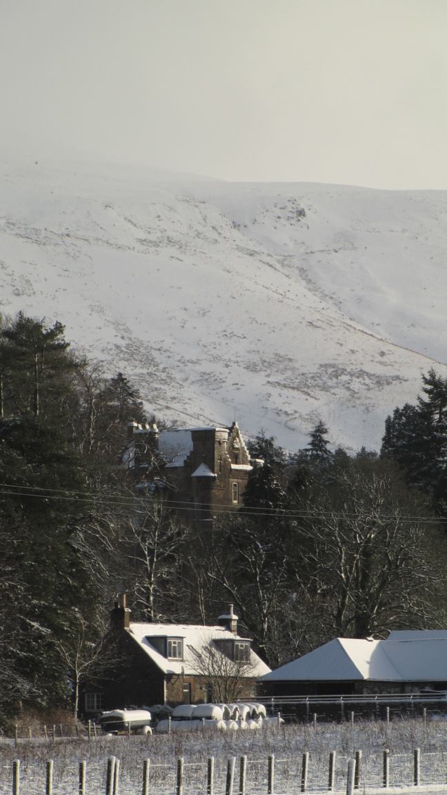
Arkleton

Arkleton is a mansion and estate in the civil parish of Ewes, in Dumfries and Galloway, Scotland. Arkleton House was built in 1860/1884 and incorporates...

Barntalloch Castle

Barntalloch Castle was a castle located at Staplegorton, in Dumfries and Galloway, Scotland. The castle was built in the 12th century by Galfrid de Coninsburgh...

Unthank, Dumfries and Galloway

Unthank is a village in Dumfries and Galloway, Scotland. == References == The geographic coordinates are from the Ordnance Survey.

Nearby Amenities

Located within 500m of 55.20921,-2.9915473
Created By: Merkaartor 0.12
Lat/Long: 55.2054899/-2.992916
Created By: Merkaartor 0.12
Lat/Long: 55.2091808/-2.9904473
Created By: Merkaartor 0.12
Lat/Long: 55.2110791/-2.9890322
Bus Stop
Village
Bus: yes
Naptan AtcoCode: 680000656503
Naptan Bearing: N
Naptan BusStopType: CUS
Naptan CommonName: Village
Naptan Indicator: Houses
Naptan Landmark: Ewes
Naptan NaptanCode: 34237575
Naptan Notes: none
Naptan Street: A7
Naptan Verified: no
Public Transport: platform
Ref: 680000656503
Source: NaPTAN
Lat/Long: 55.2081141/-2.9917374
Bus Stop
Village
Bus: yes
Naptan AtcoCode: 680000656504
Naptan Bearing: S
Naptan CommonName: Village
Naptan Indicator: opp Houses
Naptan NaptanCode: 34237574
Naptan Street: A7
Public Transport: platform
Ref: 680000656504
Source: NaPTAN
Lat/Long: 55.2079915/-2.9916116
Parking
Source: survey
Lat/Long: 55.2084887/-2.9908114
Brierly Hill
Place: hamlet
Lat/Long: 55.2130599/-2.9879591
Kirkstyle
Place: hamlet
Lat/Long: 55.2070165/-2.9929835
Place Of Worship
Ewes Parish Church
Religion: christian
Lat/Long: 55.2077038/-2.9926313
Power: substation
Lat/Long: 55.209892/-2.9902235
Kirkton
Place: locality
Lat/Long: 55.2094007/-2.997287
Power: tower
Lat/Long: 55.2068081/-2.9880166
Power: tower
Lat/Long: 55.2088348/-2.9859247
Power: pole
Lat/Long: 55.2053594/-2.9913495
Power: pole
Lat/Long: 55.2061719/-2.9908706
Power: pole
Lat/Long: 55.206836/-2.9904406
Power: pole
Lat/Long: 55.2073885/-2.9901032
Power: pole
Lat/Long: 55.2083038/-2.9895161
Power: pole
Lat/Long: 55.2091339/-2.9890089
Power: pole
Lat/Long: 55.2098921/-2.9880948
Power: pole
Lat/Long: 55.210634/-2.9871961
Power: pole
Lat/Long: 55.21137/-2.9863052
Power: pole
Lat/Long: 55.2077103/-2.9893385
Power: pole
Lat/Long: 55.2077426/-2.990765
Power: pole
Lat/Long: 55.2077587/-2.9914165
Power: pole
Lat/Long: 55.2075648/-2.9918156
Power: pole
Lat/Long: 55.2073547/-2.9922173
Power: pole
Lat/Long: 55.2074076/-2.992637
Power: pole
Lat/Long: 55.2097951/-2.9901419
Power: pole
Lat/Long: 55.2094763/-2.9905848
Power: pole
Lat/Long: 55.2091031/-2.9911126
Power: pole
Lat/Long: 55.2121575/-2.9861301
Power: pole
Lat/Long: 55.2122559/-2.9873892
Power: pole
Lat/Long: 55.2075053/-2.9879068
Power: pole
Lat/Long: 55.2072629/-2.9860992
Power: pole
Lat/Long: 55.2072129/-2.9853988
Power: pole
Lat/Long: 55.2071644/-2.9848735
The data included in this document is from www.openstreetmap.org. The data is made available under ODbL.

Have you been to Arkleton?

Leave your review of Arkleton below (or comments, questions and feedback).