Dovedale Wood
Wood, Forest in Staffordshire Staffordshire Moorlands
England
Dovedale Wood

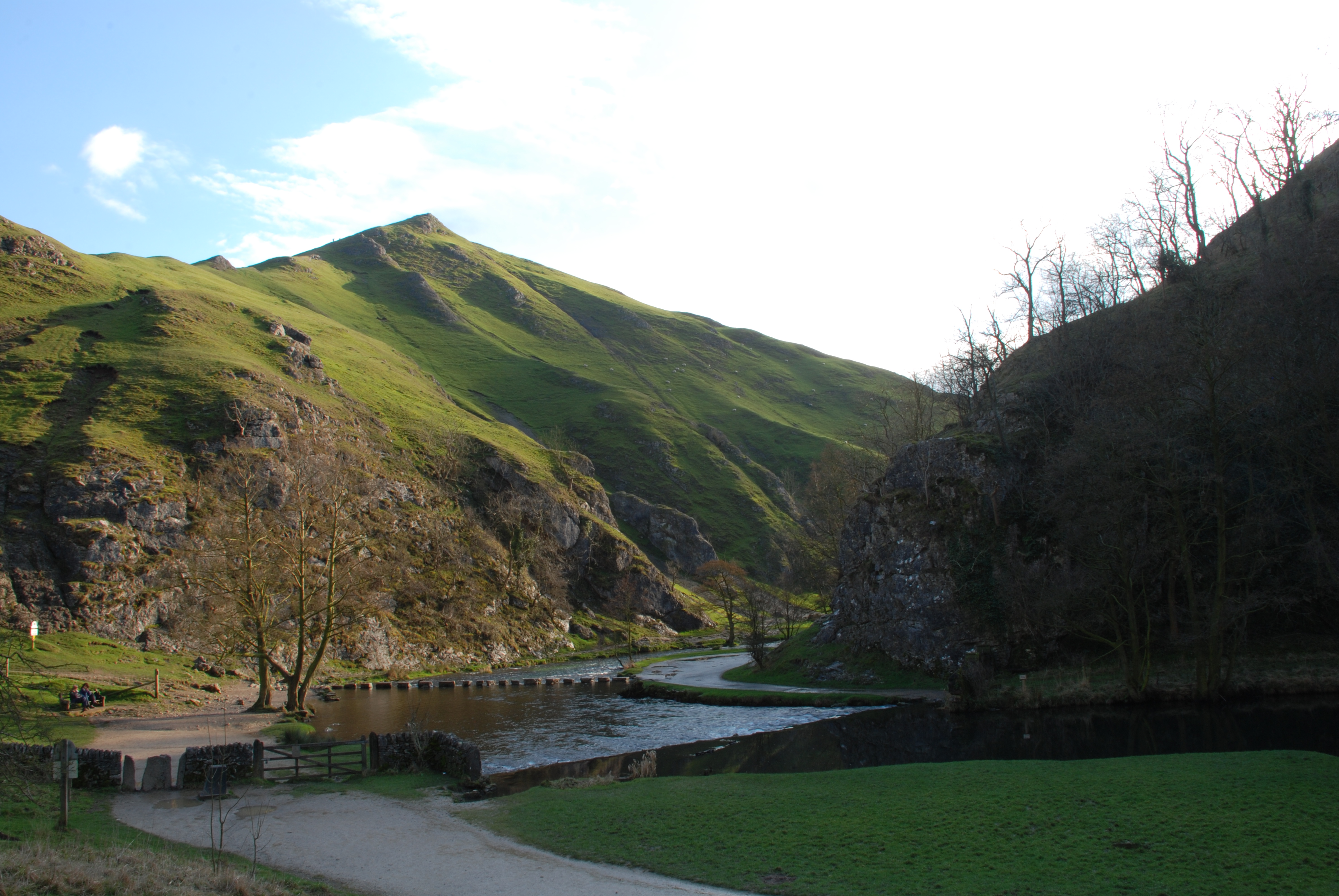
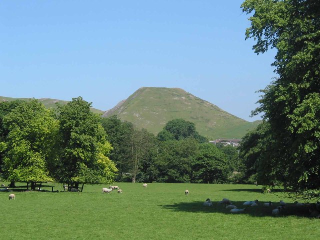
Dovedale Wood is a picturesque forest located in the county of Staffordshire, England. It is situated within the Peak District National Park, renowned for its stunning natural landscapes. Spanning over a vast area, Dovedale Wood is a popular destination for nature enthusiasts and outdoor adventurers.
The woodland is characterized by its diverse range of flora and fauna, offering a rich and vibrant ecosystem. Towering oak and beech trees dominate the landscape, creating a dense canopy that provides a sheltered and peaceful ambiance. The forest floor is adorned with an array of wildflowers, creating a vibrant tapestry of colors during the spring and summer months.
One of the main attractions of Dovedale Wood is the River Dove, which meanders through the forest. The crystal-clear waters of the river flow gently, creating a soothing soundtrack that enhances the tranquility of the surroundings. The river is also famous for its stepping stones, which attract visitors who enjoy the challenge of crossing the water in a unique and adventurous way.
Dovedale Wood is a haven for wildlife, and visitors may be lucky enough to spot rare species such as kingfishers, otters, and various woodland birds. The forest also provides a habitat for a variety of mammals, including deer and badgers.
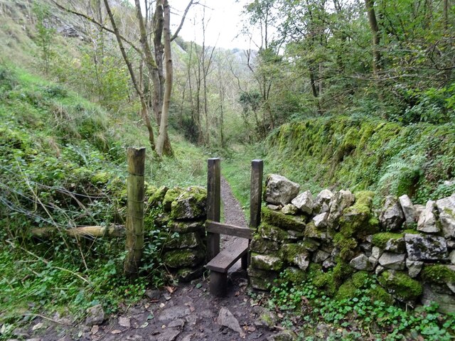
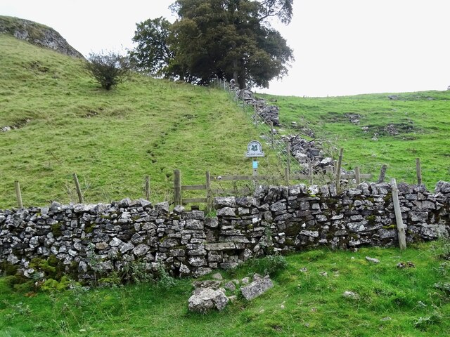
For those seeking outdoor activities, Dovedale Wood offers numerous walking trails and hiking routes that allow visitors to explore the beauty of the forest. The paths wind through ancient woodlands, providing breathtaking views of the surrounding hills and valleys.
Overall, Dovedale Wood is a captivating destination that offers a perfect blend of natural beauty, tranquility, and outdoor adventure. It is a must-visit location for anyone looking to immerse themselves in the stunning landscapes of Staffordshire.
If you have any feedback on the listing, please let us know in the comments section below.
Dovedale Wood Images
Images are sourced within 2km of 53.066887/-1.7874192 or Grid Reference SK1452. Thanks to Geograph Open Source API. All images are credited.


Dovedale Wood is located at Grid Ref: SK1452 (Lat: 53.066887, Lng: -1.7874192)
Administrative County: Staffordshire
District: Staffordshire Moorlands
Police Authority: Staffordshire
What 3 Words
///royal.brightens.neon. Near Ashbourne, Derbyshire
Nearby Locations
Related Wikis
Dovedale
Dovedale is a valley in the Peak District of England. The land is owned by the National Trust and attracts a million visitors annually. The valley was...
Thorpe Cloud
Thorpe Cloud is an isolated limestone hill (a reef knoll) lying between the villages of Thorpe and Ilam on the Derbyshire/Staffordshire border at the southern...

Ilam Park
Ilam Park is a 158-acre (0.64 km2) country park situated in Ilam, on both banks of the River Manifold five miles (8 km) north west of Ashbourne, England...

White Peak Estate
The White Peak Estate (previously known as the South Peak Estate) of the National Trust comprises several land holdings in the Southern Peak District....

River Manifold
The River Manifold is a river in Staffordshire, England. It is a tributary of the River Dove (which also flows through the Peak District, forming the boundary...

Ilam, Staffordshire
Ilam ( ) is a village in the Staffordshire Peak District of England, lying on the River Manifold. The population of the civil parish as taken at the 2011...
Thorpe, Derbyshire
Thorpe is a village and civil parish in the English county of Derbyshire; it is on the Derbyshire/Staffordshire border, on the east bank of the River Dove...
Newton Grange, Derbyshire
Newton Grange is a civil parish in the Derbyshire Dales district of central Derbyshire. For administrative purposes it shares a parish council with the...
Nearby Amenities
Located within 500m of 53.066887,-1.7874192Have you been to Dovedale Wood?
Leave your review of Dovedale Wood below (or comments, questions and feedback).