Arkle Town

Settlement in Yorkshire Richmondshire

England

Arkle Town

Looking up North Rake Hush The new official diversion footpath up Slei Gill now passes within 50yds of the hush, so I thought it was worth a quick skip over the moor to take a photo.
Looking up North Rake Hush Credit: Matthew Hatton

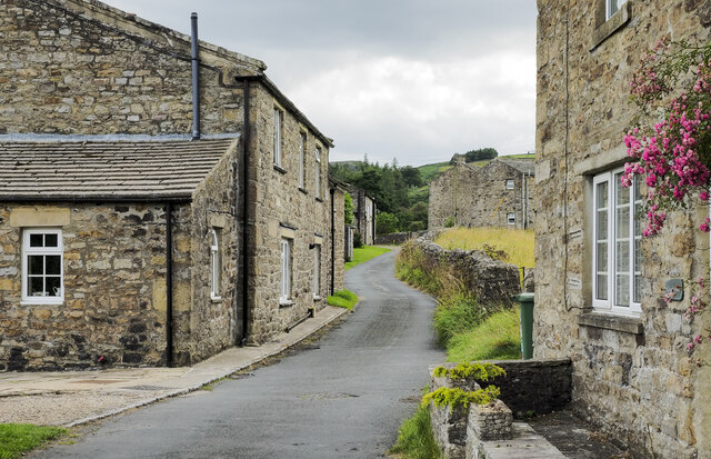
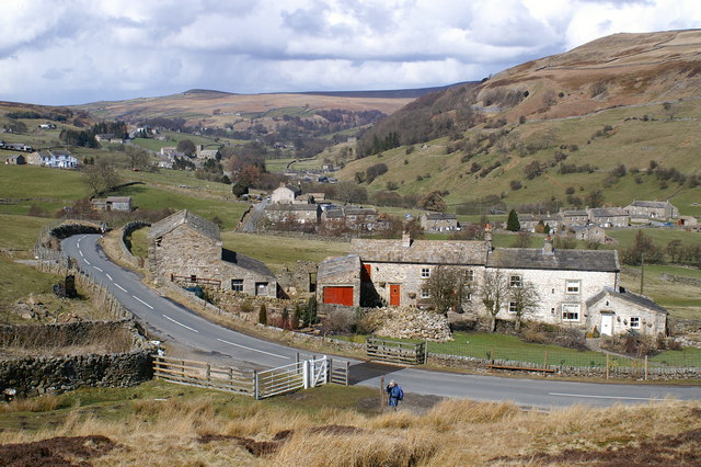
Arkle Town is a picturesque village located in the heart of Yorkshire, England. Nestled amidst rolling green hills and surrounded by breathtaking natural beauty, this quaint town is renowned for its charming character and rich history.

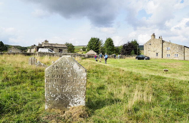
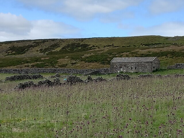
One of the defining features of Arkle Town is its well-preserved architecture, showcasing a blend of traditional English styles. The town center is dominated by a beautiful medieval church, which stands as a testament to the town's long-standing religious heritage. The narrow cobbled streets are lined with stone cottages, some dating back several centuries, adding to the town's timeless appeal.

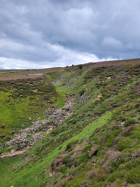
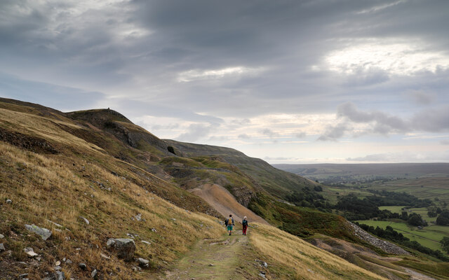
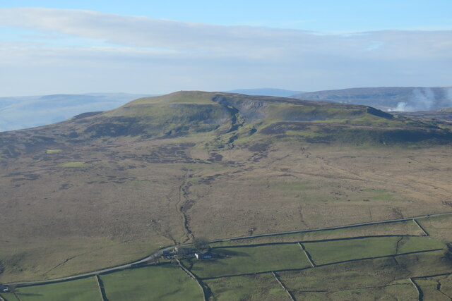
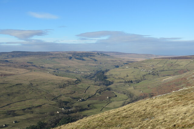
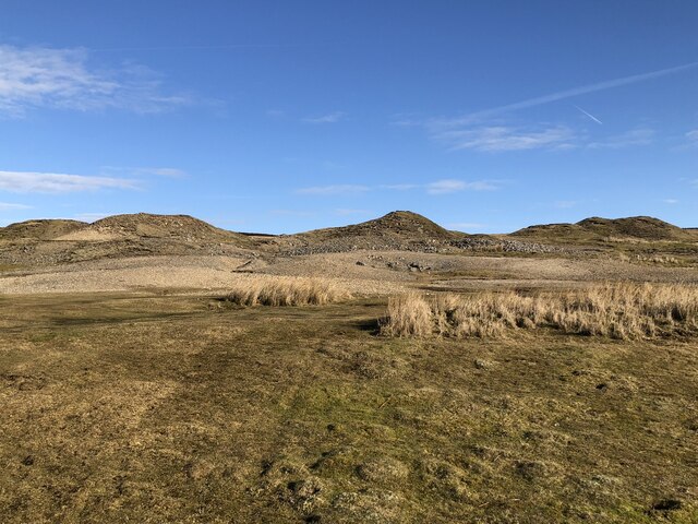
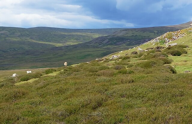
Nature enthusiasts will find themselves in paradise in Arkle Town. The surrounding countryside offers an abundance of walking trails, providing stunning views of the Yorkshire Dales and the iconic Arkle Valley. The town is also home to several parks and gardens, perfect for leisurely strolls or picnics.

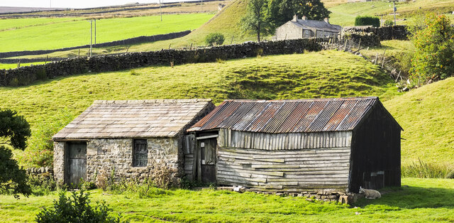
Arkle Town is not only a haven for nature lovers but also a hub for history enthusiasts. The local museum showcases artifacts and exhibits that delve into the town's past, from its agricultural roots to its involvement in the Industrial Revolution. Visitors can explore the remnants of old mills and factories, gaining a glimpse into the region's industrial heritage.

The town boasts a vibrant community spirit, with regular events and festivals that celebrate local traditions and culture. The Arkle Town Fair, held annually, attracts visitors from far and wide, offering a lively mix of entertainment, food stalls, and traditional crafts.

In conclusion, Arkle Town, Yorkshire, truly encapsulates the essence of a quintessential English village. With its captivating scenery, rich history, and warm community, it is a destination that delights all who visit.

If you have any feedback on the listing, please let us know in the comments section below.
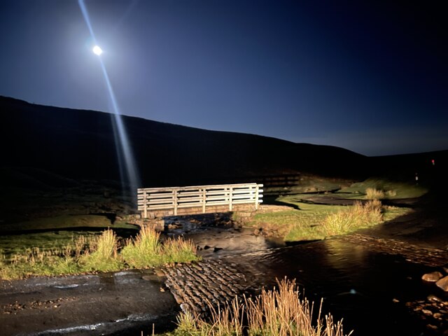
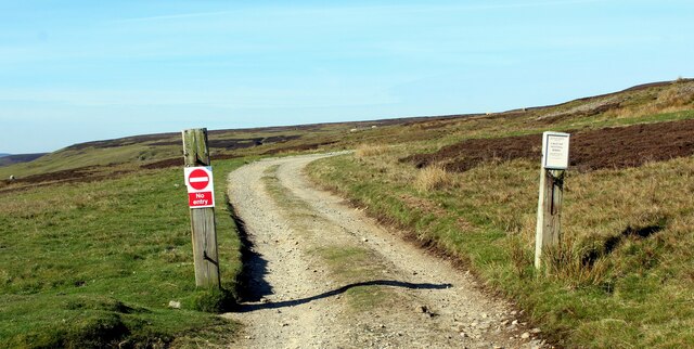
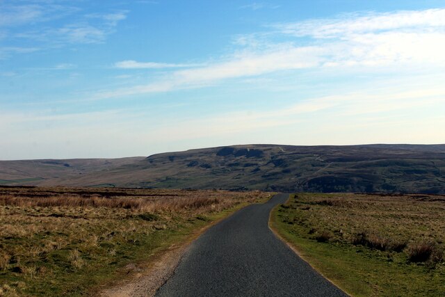
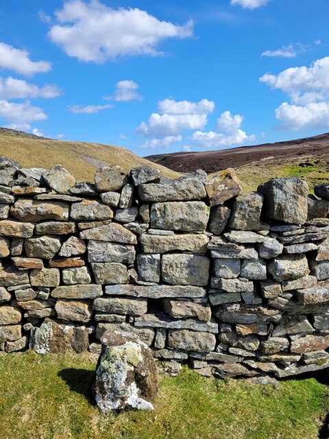
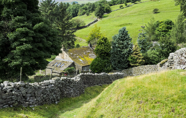
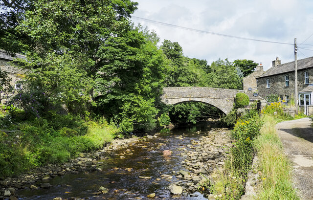
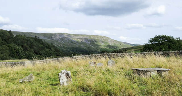
Arkle Town Images

Images are sourced within 2km of 54.4131/-1.987639 or Grid Reference NZ0001. Thanks to Geograph Open Source API. All images are credited.

Looking up North Rake Hush The new official diversion footpath up Slei Gill now passes within 50yds of the hush, so I thought it was worth a quick skip over the moor to take a photo.
Looking up North Rake Hush
The new official diversion footpath up Slei Gill now passes within 50yds of the hush, so I thought it was worth a quick skip over the moor to take a photo.
Bleaberry Gill Ford This is Bleaberry Gill Ford shown under a Hunter Moon.
Bleaberry Gill Ford
This is Bleaberry Gill Ford shown under a Hunter Moon.
Track leading onto Turf Moor Heads away from the moorland road between Arkengarthdale and Low Row
Track leading onto Turf Moor
Heads away from the moorland road between Arkengarthdale and Low Row
On Turf Moor Moorland road between Low Row in Swaledale and Arkengarthdale
On Turf Moor
Moorland road between Low Row in Swaledale and Arkengarthdale
Old Boundary Marker at Fore Gill Gate Parish Boundary Marker on the east side of the minor road at Fore Gill Gate between Langthwaite and Feetham. Before 1866 this might have marked the boundary of Grinton and Arkengarthdate parishes, but now on the boundary of Arkengarthdale and Reeth, Fremington and Healaugh parishes.

Milestone Society National ID: YN_REEARK05pb
Old Boundary Marker at Fore Gill Gate
Parish Boundary Marker on the east side of the minor road at Fore Gill Gate between Langthwaite and Feetham. Before 1866 this might have marked the boundary of Grinton and Arkengarthdate parishes, but now on the boundary of Arkengarthdale and Reeth, Fremington and Healaugh parishes. Milestone Society National ID: YN_REEARK05pb
Lane descending to Storthwaite Hall Storthwaite Hall is a farm in Arkengarthdale close to the stream's confluence with Slei Gill. The walled lane, a bridleway, climbs from the farm on to the open hillside above.
Lane descending to Storthwaite Hall
Storthwaite Hall is a farm in Arkengarthdale close to the stream's confluence with Slei Gill. The walled lane, a bridleway, climbs from the farm on to the open hillside above.
Arkle Beck at Langthwaite Arkle Beck is the river draining Arkengarthdale which is a tributary valley of Swaledale. Here it's passing the small settlement at Langthwaite which is accessed by the bridge from the main road through the valley.
Arkle Beck at Langthwaite
Arkle Beck is the river draining Arkengarthdale which is a tributary valley of Swaledale. Here it's passing the small settlement at Langthwaite which is accessed by the bridge from the main road through the valley.
Fell End Boulders Fell End Boulders are at Fell End, a location overlooking the valley of Slei Gill which is in the distance beyond the rocks.
Fell End Boulders
Fell End Boulders are at Fell End, a location overlooking the valley of Slei Gill which is in the distance beyond the rocks.
Gravestones at Arkle Town Arkle Town is a small settlement of Arkengarthdale. There's no longer a church in Arkle Town and the graveyard has just a few gravestones; it appears to have been virtually abandoned.
The chapel at Arkle Town was replaced by the present parish church of St Mary, Arkengarthdale in 1820. (Thanks to Stephen Craven for that additional information.)
Gravestones at Arkle Town
Arkle Town is a small settlement of Arkengarthdale. There's no longer a church in Arkle Town and the graveyard has just a few gravestones; it appears to have been virtually abandoned. The chapel at Arkle Town was replaced by the present parish church of St Mary, Arkengarthdale in 1820. (Thanks to Stephen Craven for that additional information.)
Arkle Town A minor road in the small settlement of Arkle Town in Arkengarthdale. The road is heading towards the main thoroughfare through the valley which itself is just a minor road.
Arkle Town
A minor road in the small settlement of Arkle Town in Arkengarthdale. The road is heading towards the main thoroughfare through the valley which itself is just a minor road.
Descending Fell End Lead workings Taken from a little higher on the bridleway than last year's <a href="https://www.geograph.org.uk/photo/6653457">NZ0202 : Descending Fell End Lead workings</a> and a month earlier so that the bracken has not yet turned. The workings on Fell End Moor have been severely hushed and eroded, with the waste rock quite hostile to new vegetation, leaving an ugly scar. The violent storm of summer 2019 also added to the erosion, but the bridleway still picks its way successfully down by a zig zag route. The cairn seen on the horizon marks the Northwest end of Fremington Edge, a splendid five kilometre romp once you're up there - though almost all routes to reach it from Arkengarthdate are steep. The views are excellent on a clear day, but it is invariably windier than you'd expected.
Descending Fell End Lead workings
Taken from a little higher on the bridleway than last year's NZ0202 : Descending Fell End Lead workings and a month earlier so that the bracken has not yet turned. The workings on Fell End Moor have been severely hushed and eroded, with the waste rock quite hostile to new vegetation, leaving an ugly scar. The violent storm of summer 2019 also added to the erosion, but the bridleway still picks its way successfully down by a zig zag route. The cairn seen on the horizon marks the Northwest end of Fremington Edge, a splendid five kilometre romp once you're up there - though almost all routes to reach it from Arkengarthdate are steep. The views are excellent on a clear day, but it is invariably windier than you'd expected.
Two barns in Arkengarthdale The small barns are on the south-western side of the road through the valley. The one in stone appears to be surviving better than that in wood and in fact its roof seems to have been replaced fairly recently.
Two barns in Arkengarthdale
The small barns are on the south-western side of the road through the valley. The one in stone appears to be surviving better than that in wood and in fact its roof seems to have been replaced fairly recently.
Graveyard at Arkle Town Arkle Town is a small settlement in Arkengarthdale.
The gravestone in the foreground is that of Ann Harker, wife of John, who died on the 6th. of May 1809 aged 42.
There's now no church at Arkle Town, the chapel there was replaced by the present parish church of St Mary, Arkengarthdale in 1820. (That information was provided by Stephen Craven in relation to another image.)
Graveyard at Arkle Town
Arkle Town is a small settlement in Arkengarthdale. The gravestone in the foreground is that of Ann Harker, wife of John, who died on the 6th. of May 1809 aged 42. There's now no church at Arkle Town, the chapel there was replaced by the present parish church of St Mary, Arkengarthdale in 1820. (That information was provided by Stephen Craven in relation to another image.)
Calver Hill Prominent hill between Swaledale and Arkengarthdale reaching 1598 ft. high with evidence of mining and quarrying on the summit plateau.
Calver Hill
Prominent hill between Swaledale and Arkengarthdale reaching 1598 ft. high with evidence of mining and quarrying on the summit plateau.
View up Arkengarthdale The northernmost of the Yorkshire dales, the valley of the Arkle Beck is a tributary of the river Swale which it joins at Reeth.
View up Arkengarthdale
The northernmost of the Yorkshire dales, the valley of the Arkle Beck is a tributary of the river Swale which it joins at Reeth.
Mining waste from Fell End lead mine Tips on the moor at the edge of Fell End lead mine. The mine cut a scar down the side of the valley as it followed the mineral vein.
Mining waste from Fell End lead mine
Tips on the moor at the edge of Fell End lead mine. The mine cut a scar down the side of the valley as it followed the mineral vein.
A prickly field Part of the old intake land at Cleasby, which appears to have been abandoned to the thistles.
A prickly field
Part of the old intake land at Cleasby, which appears to have been abandoned to the thistles.
Moorland with sheep On the moor to the west of Calver, with the valley of Mill Gill in the distance.
Moorland with sheep
On the moor to the west of Calver, with the valley of Mill Gill in the distance.
Show me another place!

Arkle Town is located at Grid Ref: NZ0001 (Lat: 54.4131, Lng: -1.987639)

Division: North Riding

Administrative County: North Yorkshire

District: Richmondshire

Police Authority: North Yorkshire

What 3 Words

///mended.handbook.brownish. Near Barningham, Co. Durham

Related Wikis

Arkle Town

Arkle Town is a hamlet in Arkengarthdale in the Richmondshire district of North Yorkshire, England. It is situated 0.4 miles (0.64 km) to the south of...

Langthwaite

Langthwaite is one of the few villages in Arkengarthdale, North Yorkshire, England. It is 3.5 miles (5.6 km) north of Reeth and sits 870 feet (270 m) above...

Booze, North Yorkshire

Booze is a hamlet in Arkengarthdale, in the Richmondshire district of North Yorkshire, England. It is about 1 mile (1.6 km) east of Langthwaite. There...

Calver Hill

Calver Hill is a fell in the Yorkshire Dales National Park in North Yorkshire, England. It is composed of limestone and is situated at grid reference NZ012003...

Eskeleth

Eskeleth is a hamlet in Arkengarthdale in North Yorkshire, England. It is in the Yorkshire Dales National Park. Eskeleth sits 4 miles (6.4 km) from the...

Fremington Edge

Fremington Edge is a 3-mile (5 km) long wall of crags and scree slopes that is situated to the north of the village of Reeth in Swaledale in the Yorkshire...

Healaugh, Richmondshire

Healaugh (pronounced "hee-law") is a small village in the civil parish of Reeth, Fremington and Healaugh, in Swaledale in the Yorkshire Dales. It is in...

Kearton

Kearton is a hamlet in the Yorkshire Dales, North Yorkshire, England. Kearton is situated near Low Row and Reeth. == References == == External links... ==

Nearby Amenities

Located within 500m of 54.4131,-1.987639
Arkle Town
Is In Historic County: Yorkshire
Place: hamlet
Source: NPE
Wikidata: Q4792017
Wikipedia: en:Arkle Town
Lat/Long: 54.4131956/-1.9895941
Access: yes
Barrier: cattle_grid
Lat/Long: 54.4104089/-1.9882436
Access: yes
Barrier: entrance
Lat/Long: 54.413218/-1.9927048
Cumbers Hill
Natural: peak
Lat/Long: 54.4119422/-1.9936621
Tourism: caravan_site
Lat/Long: 54.4117065/-1.9947451
Post Box
Lat/Long: 54.412519/-1.9901239
Passing Place
Lat/Long: 54.4175075/-1.9883149
Ford: yes
Lat/Long: 54.4139145/-1.9854889
Power: pole
Lat/Long: 54.4156977/-1.9919707
Power: pole
Lat/Long: 54.4154105/-1.9907825
Power: pole
Transformer: distribution
Lat/Long: 54.4152006/-1.9899054
Power: pole
Lat/Long: 54.4149883/-1.9890149
Power: pole
Lat/Long: 54.4146879/-1.9878052
Power: pole
Lat/Long: 54.4143859/-1.9865124
Power: pole
Lat/Long: 54.4140714/-1.9852196
Power: pole
Lat/Long: 54.4137561/-1.983908
Power: pole
Lat/Long: 54.4134291/-1.9825226
Power: pole
Lat/Long: 54.4130911/-1.9811131
Recycling
Opening Hours: 24/7
Recycling Type: centre
Lat/Long: 54.4161761/-1.9932528
Ford: yes
Lat/Long: 54.4125121/-1.9801023
The data included in this document is from www.openstreetmap.org. The data is made available under ODbL.

Have you been to Arkle Town?

Leave your review of Arkle Town below (or comments, questions and feedback).