Charnal Plantation

Wood, Forest in Gloucestershire Cotswold

England

Charnal Plantation

Farmland near Temple Guiting Farmland between Temple Guiting and Ford.
Farmland near Temple Guiting Credit: Philip Halling

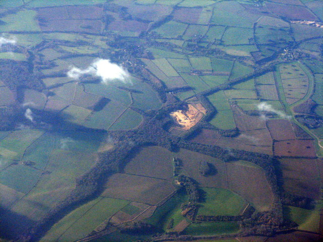
Charnal Plantation is a picturesque woodland located in Gloucestershire, England. Covering an area of approximately 500 acres, this plantation is nestled within the beautiful Forest of Dean. The site is known for its abundant wildlife, diverse flora, and tranquil atmosphere.

The woodland is predominantly composed of deciduous trees, such as oak, beech, and ash, which create a dense canopy overhead. These towering trees provide a haven for a wide range of bird species, including woodpeckers, owls, and various migratory birds. Additionally, the understory is rich with native shrubs, ferns, and wildflowers, adding splashes of color to the forest floor.

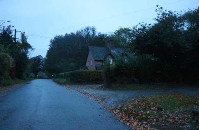
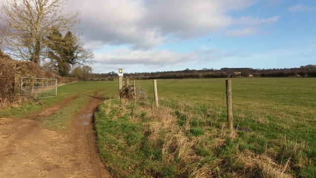
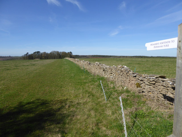
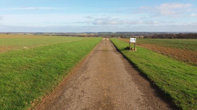
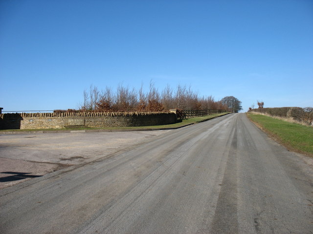
Charnal Plantation offers numerous walking trails, allowing visitors to explore its natural splendor. The paths wind through the woodland, leading to hidden ponds, babbling brooks, and peaceful glades. Nature enthusiasts can immerse themselves in the tranquil surroundings while observing the local wildlife and enjoying the sounds of chirping birds and rustling leaves.

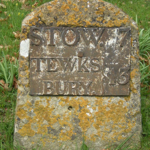
The plantation also holds historical significance, with remnants of charcoal production that date back centuries. These remnants serve as a reminder of the area's past as a hub for the charcoal industry, which was essential for iron production in the region during the industrial revolution.

Charnal Plantation is a beloved destination for locals and tourists alike, providing a peaceful retreat for nature lovers and a valuable habitat for the region's flora and fauna. Its enchanting beauty and historical significance make it a must-visit location for anyone exploring the Gloucestershire area.

If you have any feedback on the listing, please let us know in the comments section below.

Charnal Plantation Images

Images are sourced within 2km of 51.961351/-1.8452346 or Grid Reference SP1029. Thanks to Geograph Open Source API. All images are credited.

Farmland near Temple Guiting Farmland between Temple Guiting and Ford.
Farmland near Temple Guiting
Farmland between Temple Guiting and Ford.
Traveller step inside - Ford, Gloucestershire This is the Plough Inn at Ford in the Cotswolds, between Cutsdean and Temple Guiting. The invitation to passers-by reads "Ye weary travellers that pass by With dust and scorching sunbeams dry Or be benumb'd with snow and frost  With having these bleak cotswolds crost Step in and quaff my nut brown ale Bright as rubys mild and stale Twill make your laging trotters dance As nimble as the suns of france Then ye will own ye men of sense That neare was better spent sixpence". Some years ago I did take the invitation but it certainly was not sixpence a pint. Time photo taken not available.
<a href="https://www.geograph.org.uk/photo/3190392">SP0829 : The Plough Inn</a>
Traveller step inside - Ford, Gloucestershire
This is the Plough Inn at Ford in the Cotswolds, between Cutsdean and Temple Guiting. The invitation to passers-by reads "Ye weary travellers that pass by With dust and scorching sunbeams dry Or be benumb'd with snow and frost With having these bleak cotswolds crost Step in and quaff my nut brown ale Bright as rubys mild and stale Twill make your laging trotters dance As nimble as the suns of france Then ye will own ye men of sense That neare was better spent sixpence". Some years ago I did take the invitation but it certainly was not sixpence a pint. Time photo taken not available. SP0829 : The Plough Inn
Old Milestone by the B4077, Ford village, Temple Guiting Metal plate attached to stone post by the B4077, in parish of TEMPLE GUITING (COTSWOLD District), Ford, village centre, on banking near bend, on North side of road. Stow iron plate, erected by the Stow to Stump Cross turnpike trust in the 19th century. 

Inscription reads:-
STOW 7.
TEWKS
BURY.
13.

Grade II listed.  
List Entry Number: 1089517 <span class="nowrap"><a title="https://historicengland.org.uk/listing/the-list/list-entry/1089517" rel="nofollow ugc noopener" href="https://historicengland.org.uk/listing/the-list/list-entry/1089517">Link</a><img style="margin-left:2px;" alt="External link" title="External link - shift click to open in new window" src="https://s1.geograph.org.uk/img/external.png" width="10" height="10"/></span>

Milestone Society National ID: GL_TWSW13.
Old Milestone by the B4077, Ford village, Temple Guiting
Metal plate attached to stone post by the B4077, in parish of TEMPLE GUITING (COTSWOLD District), Ford, village centre, on banking near bend, on North side of road. Stow iron plate, erected by the Stow to Stump Cross turnpike trust in the 19th century. Inscription reads:- STOW 7. TEWKS BURY. 13. Grade II listed. List Entry Number: 1089517 LinkExternal link Milestone Society National ID: GL_TWSW13.
Temple Guiting The last house in the small village, none of the nearby roads have apparent names.
Temple Guiting
The last house in the small village, none of the nearby roads have apparent names.
Diamond Way Diamond Way heading out of Temple Guiting towards Ford
Diamond Way
Diamond Way heading out of Temple Guiting towards Ford
Diamond Way From Ford the Diamond Way heading alongside the gallops to Jackdaws Castle
Diamond Way
From Ford the Diamond Way heading alongside the gallops to Jackdaws Castle
Diamond Way Diamond Way cuts across the gallops near Jackdaw Castle
Diamond Way
Diamond Way cuts across the gallops near Jackdaw Castle
Permissive footpath to Durhams Ture Maps do not tell us what Durhams Ture is, but label the wood ahead as The Durhams.
Permissive footpath to Durhams Ture
Maps do not tell us what Durhams Ture is, but label the wood ahead as The Durhams.
Cutsdean Trig Point An OS roadside triangulation pillar.
Cutsdean Trig Point
An OS roadside triangulation pillar.
Trafalgar Farm With a disused quarry near Temple Guiting standing out. The area at upper right with spaced trees is the Gallops between Ford and Jackdaws Castle.
Trafalgar Farm
With a disused quarry near Temple Guiting standing out. The area at upper right with spaced trees is the Gallops between Ford and Jackdaws Castle.
Old Milestone by the B4077, Swell parish Stone post (plate lost) by the B4077, in parish of Swell (Cotswold District), roadside, by the road, on South side of road. Stow iron plate, erected by the Stow to Stump Cross turnpike trust in the 19th century. 

Inscription once read:-
(Tewkesbury)
(15)
(Stow on the Wold)
(5) 

Milestone Society National ID: GL_TWSW15
Old Milestone by the B4077, Swell parish
Stone post (plate lost) by the B4077, in parish of Swell (Cotswold District), roadside, by the road, on South side of road. Stow iron plate, erected by the Stow to Stump Cross turnpike trust in the 19th century. Inscription once read:- (Tewkesbury) (15) (Stow on the Wold) (5) Milestone Society National ID: GL_TWSW15
Diamond Way Diamond Way alongside a gallop by Jackdaw's Castle
Diamond Way
Diamond Way alongside a gallop by Jackdaw's Castle
Diamond Way Diamond Way heading down the drive to Ford Hill Farm
Diamond Way
Diamond Way heading down the drive to Ford Hill Farm
Diamond Way Diamond Way heading down to Cutsdean Lodge
Diamond Way
Diamond Way heading down to Cutsdean Lodge
Buckle Street on Cutsdean Hill This minor road links Bourton-on-the-Water with Broadway. Ahead is the summit of Cutsdean Hill which, at 305m, is one of few Cotswold Hills to exceed 1000ft high. In this case, by less than a foot !

The drive on the left is the entrance to Jackdaw's Castle.
Buckle Street on Cutsdean Hill
This minor road links Bourton-on-the-Water with Broadway. Ahead is the summit of Cutsdean Hill which, at 305m, is one of few Cotswold Hills to exceed 1000ft high. In this case, by less than a foot ! The drive on the left is the entrance to Jackdaw's Castle.
The drive to Ford Hill Farm The Diamond and Gloucestershire Ways follow this drive.
The drive to Ford Hill Farm
The Diamond and Gloucestershire Ways follow this drive.
The Plough Inn, Ford The B4077 passing the Plough Inn at Ford, a popular Cotswold pub for Sunday lunch.
The Plough Inn, Ford
The B4077 passing the Plough Inn at Ford, a popular Cotswold pub for Sunday lunch.
Post Office in Temple Guiting The Post Office and Village Store in Temple Guiting.
Post Office in Temple Guiting
The Post Office and Village Store in Temple Guiting.
Show me another place!

Charnal Plantation is located at Grid Ref: SP1029 (Lat: 51.961351, Lng: -1.8452346)

Administrative County: Gloucestershire

District: Cotswold

Police Authority: Gloucestershire

What 3 Words

///zeal.heartburn.rejects. Near Winchcombe, Gloucestershire

Nearby Locations

Charnal Plantation

Related Wikis

Cutsdean

Cutsdean is a rural village in the Cotswolds and smaller than average sized parish, a few miles east north-east of Cheltenham, Gloucestershire and the...

Temple Guiting

Temple Guiting is a village and civil parish in the Cotswolds, in Gloucestershire, England. The civil parish includes the smaller settlements of Barton...

Ford, Gloucestershire

Ford is a hamlet in Gloucestershire, England. Ford lies on the B4077 road where it crosses the upper reaches of the River Windrush between Tewkesbury and...

Manor Farmhouse, Temple Guiting

Temple Guiting Manor is an early 16th-century house at Temple Guiting, Gloucestershire, England. It is a Grade I listed building, and is in private ownership...

Cutsdean Quarry

Cutsdean Quarry (grid reference SP105315) is a 0.83-hectare (2.1-acre) nature reserve in Gloucestershire, England. The site is listed in the 'Cotswold...

Temple Guiting Preceptory

Temple Guiting Preceptory was a medieval monastic house of the Knights Templar in Gloucestershire, England. It was founded around the middle of the twelfth...

Lark Wood

Lark Wood (grid reference SP104262) is a 1.11-hectare (2.7-acre) biological Site of Special Scientific Interest in Gloucestershire, notified in 1974. The...

Barton Bushes

Barton Bushes (grid reference SP110259) is a 5.7-hectare (14-acre) biological Site of Special Scientific Interest in Gloucestershire, notified in 1996...

Nearby Amenities

Located within 500m of 51.961351,-1.8452346
Oakhill Plantaion
Place: locality
Lat/Long: 51.9575717/-1.848719
Power: pole
Lat/Long: 51.960818/-1.8381581
Trafalgar Temple Guiting
Power: pole
Transformer: distribution
Voltage Primary: 11000
Lat/Long: 51.9618849/-1.8395099
Power: pole
Lat/Long: 51.9613717/-1.8396118
Power: pole
Lat/Long: 51.9609048/-1.8397352
Power: pole
Lat/Long: 51.9605709/-1.8409623
Power: pole
Lat/Long: 51.9603875/-1.8416986
Trafalgar Grain Dryer
Power: pole
Transformer: distribution
Voltage Primary: 11000
Lat/Long: 51.9602329/-1.8423195
Power: pole
Lat/Long: 51.9599263/-1.8435453
Trafalgar Pumping Station
Power: pole
Transformer: distribution
Voltage Primary: 11000
Lat/Long: 51.9599123/-1.8448073
Power: pole
Lat/Long: 51.9599016/-1.8458667
Power: pole
Lat/Long: 51.9597387/-1.8469732
Power: pole
Lat/Long: 51.9598131/-1.8481359
Power: pole
Lat/Long: 51.9598693/-1.8490975
Power: pole
Lat/Long: 51.9646982/-1.8487722
Power: pole
Lat/Long: 51.9640978/-1.8485932
Power: pole
Lat/Long: 51.9631075/-1.8491364
Power: pole
Lat/Long: 51.96325/-1.8518125
Power: pole
Lat/Long: 51.9626736/-1.8507745
Power: pole
Lat/Long: 51.9621634/-1.8499102
Power: pole
Lat/Long: 51.9615618/-1.8504171
Power: pole
Lat/Long: 51.9607354/-1.8504319
Power: pole
Lat/Long: 51.9600156/-1.8514243
Power: pole
Lat/Long: 51.959923/-1.8500228
The data included in this document is from www.openstreetmap.org. The data is made available under ODbL.

Have you been to Charnal Plantation?

Leave your review of Charnal Plantation below (or comments, questions and feedback).