Gleadheugh Wood
Wood, Forest in Northumberland
England
Gleadheugh Wood

Gleadheugh Wood is a picturesque woodland situated in Northumberland, England. Covering an area of approximately 100 acres, this woodland is a popular destination for nature enthusiasts, hikers, and those seeking a tranquil escape from the bustling city life.
The wood is primarily composed of native broadleaf trees, including oak, ash, birch, and beech, which create a dense canopy overhead. This dense foliage provides a habitat for a diverse range of wildlife, including various bird species, squirrels, rabbits, and deer.
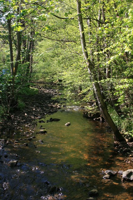
Trails wind through the wood, offering visitors the opportunity to explore and immerse themselves in its natural beauty. The paths are well-maintained, making it accessible for all ages and abilities. Along the way, there are benches and picnic areas, inviting visitors to take a break and enjoy the peaceful surroundings.
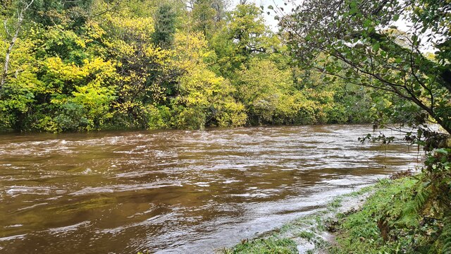
Gleadheugh Wood is particularly beautiful during the spring and summer months when the forest floor is carpeted with wildflowers, adding vibrant pops of color to the serene landscape. In autumn, the wood transforms into a tapestry of rich hues as the leaves change, creating a stunning display of reds, oranges, and yellows.
The wood is open to the public year-round and is free to enter. There is ample parking available nearby, making it convenient for visitors. It is also worth noting that Gleadheugh Wood is located within close proximity to other popular attractions in Northumberland, such as Hadrian's Wall and Kielder Water and Forest Park, making it an ideal stop for those exploring the area.
If you have any feedback on the listing, please let us know in the comments section below.
Gleadheugh Wood Images
Images are sourced within 2km of 55.286831/-1.8478456 or Grid Reference NZ0999. Thanks to Geograph Open Source API. All images are credited.


Gleadheugh Wood is located at Grid Ref: NZ0999 (Lat: 55.286831, Lng: -1.8478456)
Unitary Authority: Northumberland
Police Authority: Northumbria
What 3 Words
///ruin.smashes.swooned. Near Rothbury, Northumberland
Nearby Locations
Related Wikis

Brinkburn railway station
Brinkburn was a weatherboard- and corrugated-iron-built railway station in Northumberland on the Rothbury Branch built to serve the Healy Coate Colliery...

Brinkburn
Brinkburn is a civil parish in Northumberland, England. It is divided by the River Coquet. The parish includes the hamlet of Pauperhaugh. == History... ==

Cragend Silo
Cragend Silo is a Grade II* listed building located at Cragend Farm near the town of Rothbury in Northumberland, England. It was designed and built by...

Brinkburn Priory
Brinkburn Priory is a former monastery built, starting in the 12th century, on a bend of the River Coquet, about 4 miles (6 km) east of Rothbury, Northumberland...
Nearby Amenities
Located within 500m of 55.286831,-1.8478456Have you been to Gleadheugh Wood?
Leave your review of Gleadheugh Wood below (or comments, questions and feedback).