Backstone Burn Wood

Wood, Forest in Durham

England

Backstone Burn Wood

Monument on Coast to Coast Cycleway in Consett
Monument on Coast to Coast Cycleway in Consett Credit: Clive Nicholson

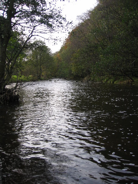
Blackstone Burn Wood is a woodland located in Durham, England. It covers an area of approximately 100 acres and is situated near the village of Blackstone Burn. The wood is a mixture of deciduous and coniferous trees, creating a diverse and rich ecosystem.

The wood is known for its natural beauty and tranquil atmosphere, providing a peaceful escape for visitors. It is home to a variety of wildlife, including birds, mammals, and insects. Visitors may spot species such as woodpeckers, deer, squirrels, and butterflies as they explore the woodland trails.

The wood is managed by a local conservation organization, which ensures the preservation of its natural features. They actively work to maintain the health of the woodland, including tree planting and management of invasive species.

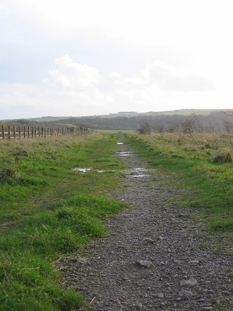
There are several walking paths and trails that wind through the wood, offering visitors the opportunity to explore its beauty. These paths are well-maintained and suitable for all ages and abilities. Along the way, there are benches and picnic areas where visitors can rest and enjoy the surroundings.

Blackstone Burn Wood is also a popular destination for nature enthusiasts, birdwatchers, and photographers. Its diverse range of flora and fauna provides ample opportunities for observation and capture of the natural world.

Overall, Blackstone Burn Wood is a picturesque woodland in Durham, offering a peaceful retreat for nature lovers and a haven for wildlife. Its well-managed trails, diverse ecosystem, and natural beauty make it a must-visit destination for anyone seeking a connection with nature.

If you have any feedback on the listing, please let us know in the comments section below.

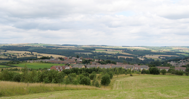
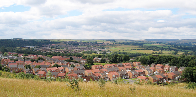
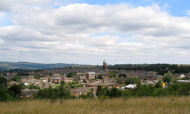
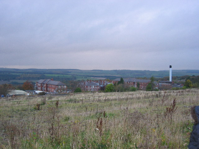
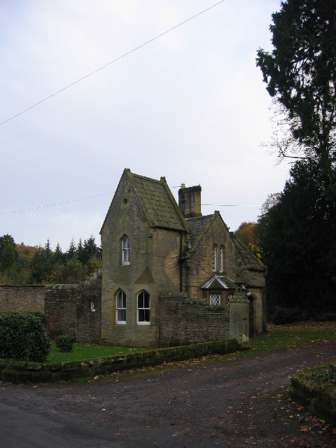
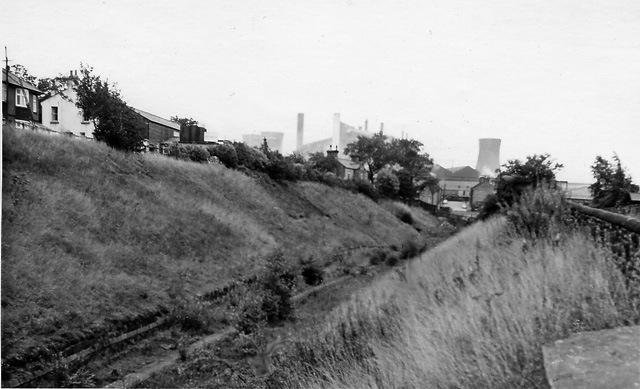
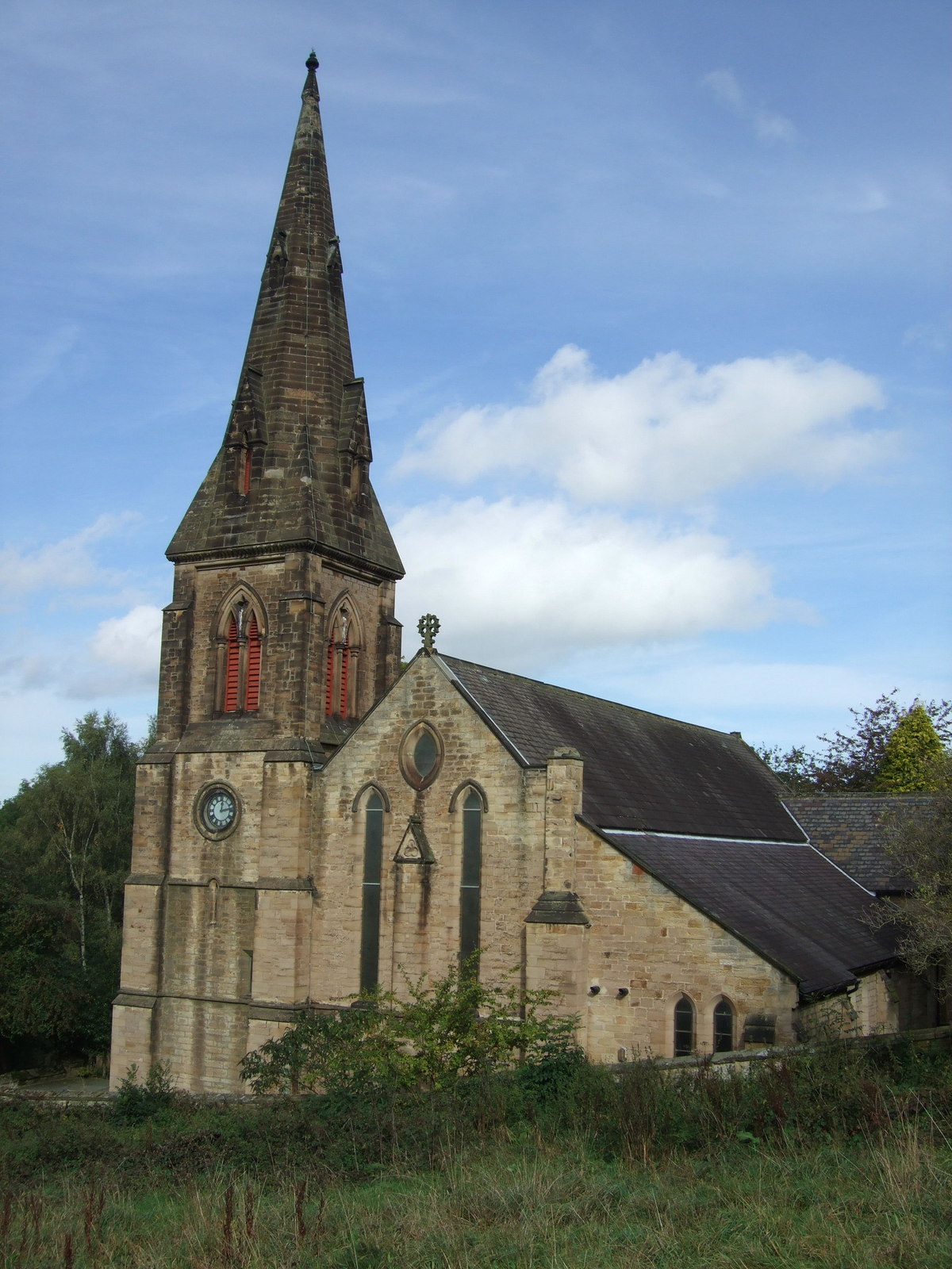
Backstone Burn Wood Images

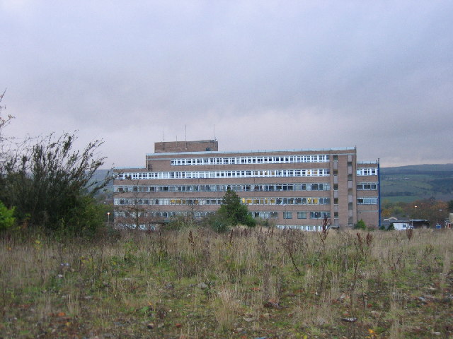
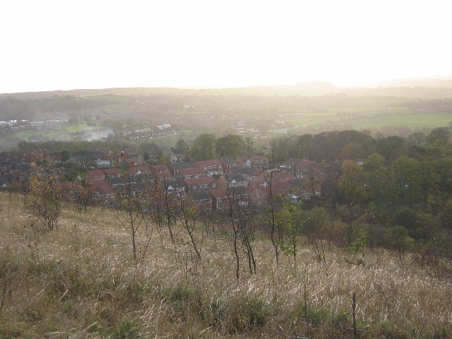
Images are sourced within 2km of 54.860278/-1.853363 or Grid Reference NZ0951. Thanks to Geograph Open Source API. All images are credited.

Monument on Coast to Coast Cycleway in Consett
Bridge at Shotley Bridge Looking downstream on River Derwent.  Northumberland to left and County Durham to right
Bridge at Shotley Bridge
Looking downstream on River Derwent. Northumberland to left and County Durham to right
Bridgehill High Ground to left is Grey Mare Hill
Bridgehill
High Ground to left is Grey Mare Hill
Three Groups of Housing Foreground is The Grove, then Moorside and next Castleside which is on the A68. Photograph was taken on the site of the former steel works, which is now landscaped.
Three Groups of Housing
Foreground is The Grove, then Moorside and next Castleside which is on the A68. Photograph was taken on the site of the former steel works, which is now landscaped.
Blackhill near Consett
Consett/Blackhill Park
Shotley Bridge
Shotley Bridge
Shotley Bridge Hospital View of the old hospital buildings no longer in use today, the current and new hospital buildings out of shot to the left.
Shotley Bridge Hospital
View of the old hospital buildings no longer in use today, the current and new hospital buildings out of shot to the left.
Shotley Bridge Hospital View of the current main hospital building in use today, the old hospital buildings out of shot to the right.
Shotley Bridge Hospital
View of the current main hospital building in use today, the old hospital buildings out of shot to the right.
Blackhill Main Street View down Blackhill towards Bridgehill showing local shops either side.
Blackhill Main Street
View down Blackhill towards Bridgehill showing local shops either side.
Blackhill Cemetery South One of three disused and crumbling churches all located together.  Other two churches to the right and behind.
Blackhill Cemetery South
One of three disused and crumbling churches all located together. Other two churches to the right and behind.
Blackhill Cemetery View down one aisle in main cemetery area.
Blackhill Cemetery
View down one aisle in main cemetery area.
Disused Workings Path Path running alongside main disused workings area now just fields at top of main bank.
Disused Workings Path
Path running alongside main disused workings area now just fields at top of main bank.
The Grove View of the new estate from the top of the disused workings bank.
The Grove
View of the new estate from the top of the disused workings bank.
Derwent River at Allensford View of the derwent river at allensford running alongside the main picnic area and past allensford park.
Derwent River at Allensford
View of the derwent river at allensford running alongside the main picnic area and past allensford park.
Shotley Hall Gatehouse View of the old gatehouse to shotley hall, now private dwellings.
Shotley Hall Gatehouse
View of the old gatehouse to shotley hall, now private dwellings.
Shotley Grove Lane View up shotley grove lane running alongside derwent river.
Shotley Grove Lane
View up shotley grove lane running alongside derwent river.
Concealed Crossing View of concealed crossing over derwent river in shotley grove lane.  Picture taken from concealed side, easily missed feature.
Concealed Crossing
View of concealed crossing over derwent river in shotley grove lane. Picture taken from concealed side, easily missed feature.
Show me another place!

Backstone Burn Wood is located at Grid Ref: NZ0951 (Lat: 54.860278, Lng: -1.853363)

Unitary Authority: County Durham

Police Authority: Durham

What 3 Words

///tins.bring.goat. Near Consett, Co. Durham

Related Wikis

Blackhill railway station

Blackhill railway station served the village of Blackhill, County Durham, England from 1867 to 1955 on the Derwent Valley Line. == History == The station...

Bridgehill

Bridgehill is an area of Consett in County Durham, England. It is situated near Benfieldside, Blackhill, Shotley Grove, and the River Derwent. == References... ==

Shotley Grove

Shotley Grove is a small settlement on the river Derwent, about 1 mile upstream of Shotley Bridge in County Durham, England. Today Shotley Grove is a pleasant...

Benfieldside

Benfieldside is a parish in County Durham, in England. Although not a village in its own right (ecclesiastically it incorporates Shotley Bridge, Bridgehill...

Nearby Amenities

Located within 500m of 54.860278,-1.853363
Post Box
Lat/Long: 54.860717/-1.850245
Telephone
Lat/Long: 54.8607303/-1.8498887
Shops
Shop: convenience
Lat/Long: 54.8612391/-1.8504103
Turning Circle
Lat/Long: 54.8619675/-1.8534623
Bridgehill Circular
Place: neighbourhood
Lat/Long: 54.8574142/-1.8549815
Bus Stop
Pemberton Road
Bus: yes
Naptan AtcoCode: 13001881B
Naptan Bearing: NE
Naptan CommonName: Pemberton Road
Naptan Indicator: NE-bound
Naptan Landmark: Landmark not known
Naptan NaptanCode: durgdgwd
Naptan Street: Pemberton Road
Naptan Verified: no
Public Transport: platform
Source: naptan_import
Lat/Long: 54.8603838/-1.8551508
Pub
The Miners Arms
Addr City: Consett
Addr Housenumber: 6
Addr Postcode: DH8 0SG
Addr Street: Benfieldside Road
Addr Suburb: Bridgehill
Fhrs Id: 733367
Source Addr: FHRS Open Data
Lat/Long: 54.8617732/-1.8541127
Blackhill
Historic Railway: station
Railway: site
Source: NPE
Wikidata: Q30596204
Wikipedia: en:Blackhill railway station
Lat/Long: 54.8588052/-1.8460505
Bus Stop
Celluware factory
Bus: yes
Naptan AtcoCode: 13001609E
Naptan Bearing: S
Naptan CommonName: Celluware factory
Naptan Indicator: south bound
Naptan Landmark: South of No 41 Derwent Street
Naptan NaptanCode: duragptj
Naptan Street: Derwent Street
Naptan Verified: no
Public Transport: platform
Source: naptan_import
Lat/Long: 54.8594422/-1.847925
Bus Stop
Celluware factory
Bus: yes
Naptan AtcoCode: 13001609H
Naptan Bearing: NW
Naptan CommonName: Celluware factory
Naptan Indicator: north west bound
Naptan Landmark: Outside St Marys Church
Naptan NaptanCode: duragptm
Naptan Street: Church Street
Naptan Verified: no
Public Transport: platform
Source: naptan_import
Lat/Long: 54.8591561/-1.8491256
Bus Stop
St. Andrews Church
Bench: yes
Bus: yes
Naptan AtcoCode: 13001610C
Naptan Bearing: E
Naptan CommonName: St. Andrews Church
Naptan Indicator: east bound
Naptan Landmark: Outside No 89B Durham Road
Naptan NaptanCode: duragptp
Naptan Street: A691
Naptan Verified: no
Public Transport: platform
Shelter: yes
Source: naptan_import
Lat/Long: 54.8610705/-1.8493366
Bus Stop
St. Andrews Church
Bus: yes
Naptan AtcoCode: 13001610G
Naptan Bearing: W
Naptan CommonName: St. Andrews Church
Naptan Indicator: west bound
Naptan Landmark: Outside No 30 Durham Road
Naptan NaptanCode: duragptw
Naptan Street: A691
Naptan Verified: no
Public Transport: platform
Source: naptan_import
Lat/Long: 54.8609287/-1.850895
Bus Stop
Durham Road
Bench: no
Bin: no
Bus: yes
Naptan AtcoCode: 13001624C
Naptan Bearing: E
Naptan CommonName: Durham Road
Naptan Indicator: east bound
Naptan Landmark: Landmark not known
Naptan NaptanCode: duragtgj
Naptan Notes: on a691 in front of 149 durham road
Naptan Street: A691
Naptan Verified: no
Public Transport: platform
Shelter: no
Source: naptan_import
Lat/Long: 54.8610035/-1.8460497
Bus Stop
Durham Road
Bus: yes
Naptan AtcoCode: 13001624G
Naptan Bearing: W
Naptan CommonName: Durham Road
Naptan Indicator: west bound
Naptan Landmark: Landmark not known
Naptan NaptanCode: duragtgm
Naptan Notes: opposite 121 durham road- on a691
Naptan Street: A691
Naptan Verified: no
Public Transport: platform
Source: naptan_import
Lat/Long: 54.8609787/-1.8477479
Bus Stop
The Old Post Office
Bench: no
Bin: yes
Bus: yes
Departures Board: timetable
Naptan AtcoCode: 13001665A
Naptan Bearing: N
Naptan CommonName: The Old Post Office
Naptan Indicator: N-bound
Naptan Landmark: Outside Stoneburn House
Naptan NaptanCode: duragwdg
Naptan Street: Benfieldside Road
Naptan Verified: no
Public Transport: platform
Shelter: yes
Source: naptan_import
Lat/Long: 54.8622542/-1.8545824
Bus Stop
The Old Post Office
Bus: yes
Naptan AtcoCode: 13001665E
Naptan Bearing: S
Naptan CommonName: The Old Post Office
Naptan Indicator: S-bound
Naptan Landmark: opposite No 21
Naptan NaptanCode: duragwdj
Naptan Street: Benfieldside Road
Naptan Verified: no
Public Transport: platform
Shelter: yes
Source: naptan_import
Lat/Long: 54.8626406/-1.8545966
Bus Stop
Surtees shop
Naptan AtcoCode: 13001683D
Naptan Bearing: SE
Naptan CommonName: Surtees shop
Naptan Indicator: south east bound
Naptan Landmark: opposite Nos 40 and 41
Naptan NaptanCode: duragwta
Naptan Street: Cutlers Hall Road
Naptan Verified: no
Source: naptan_import
Lat/Long: 54.8633268/-1.8573361
Bus Stop
Surtees shop
Naptan AtcoCode: 13001683H
Naptan Bearing: NW
Naptan CommonName: Surtees shop
Naptan Indicator: north west bound
Naptan Landmark: opposite The Miners Arms PH
Naptan NaptanCode: duragwtd
Naptan Street: Cutlers Hall Road
Naptan Verified: no
Source: naptan_import
Lat/Long: 54.8615892/-1.8546315
Bus Stop
Chaytor Road (Top)
Bench: no
Bus: yes
Departures Board: timetable
Naptan AtcoCode: 13001684H
Naptan Bearing: NW
Naptan CommonName: Chaytor Road (Top)
Naptan Indicator: north west bound
Naptan Landmark: adjacent to No 26 Pemberton Road
Naptan NaptanCode: duragwtg
Naptan Street: Chaytor Road
Naptan Verified: no
Public Transport: platform
Shelter: no
Source: naptan_import
Lat/Long: 54.8595427/-1.8567264
Bus Stop
Chaytor Road (Middle)
Bus: yes
Naptan AtcoCode: 13001685D
Naptan Bearing: SE
Naptan CommonName: Chaytor Road (Middle)
Naptan Indicator: south east bound
Naptan Landmark: outside no 38
Naptan NaptanCode: duragwtj
Naptan Street: Chaytor Road
Naptan Verified: no
Public Transport: platform
Shelter: yes
Source: naptan_import
Lat/Long: 54.8605694/-1.8585922
Bus Stop
Chaytor Road (Middle)
Bus: yes
Departures Board: timetable
Naptan AtcoCode: 13001685H
Naptan Bearing: NW
Naptan CommonName: Chaytor Road (Middle)
Naptan Indicator: north west bound
Naptan Landmark: opposite No 44
Naptan NaptanCode: duragwtm
Naptan Street: Chaytor Road
Naptan Verified: no
Public Transport: platform
Source: naptan_import
Lat/Long: 54.8606867/-1.8590124
Bus Stop
Hardys Corner
Bench: yes
Bin: yes
Bus: yes
Departures Board: timetable
Naptan AtcoCode: 13001686B
Naptan Bearing: NE
Naptan CommonName: Hardys Corner
Naptan Indicator: north east bound
Naptan Landmark: 19m from junction with Cutlers Hall Road
Naptan NaptanCode: duragwtp
Naptan Street: Pleasant View
Naptan Verified: no
Public Transport: platform
Shelter: yes
Source: naptan_import
Lat/Long: 54.8636786/-1.8584722
Bus Stop
Hardys Corner
Bench: yes
Bin: no
Bus: yes
Departures Board: timetable
Naptan AtcoCode: 13001686F
Naptan Bearing: SW
Naptan CommonName: Hardys Corner
Naptan Indicator: south west bound
Naptan Landmark: 43m from junction with Cutlers Hall Road
Naptan NaptanCode: duragwtw
Naptan Street: Pleasant View
Naptan Verified: no
Public Transport: platform
Shelter: yes
Source: naptan_import
Lat/Long: 54.8634634/-1.8586137
Bus Stop
Highridge
Bench: yes
Bin: yes
Bus: yes
Departures Board: timetable
Naptan AtcoCode: 13001751D
Naptan Bearing: SE
Naptan CommonName: Highridge
Naptan Indicator: south east bound
Naptan Landmark: Landmark not known
Naptan NaptanCode: durajgjm
Naptan Notes: to side of 23 melrose court
Naptan Street: Unclassified Road
Naptan Verified: no
Public Transport: platform
Shelter: yes
Source: naptan_import
Lat/Long: 54.8587059/-1.8558258
Bus Stop
Highridge
Bench: no
Bus: yes
Departures Board: timetable
Naptan AtcoCode: 13001751H
Naptan Bearing: NW
Naptan CommonName: Highridge
Naptan Indicator: north west bound
Naptan Landmark: Landmark not known
Naptan NaptanCode: durajgjp
Naptan Notes: opposite 12 cragside court
Naptan Street: Unclassified Road
Naptan Verified: no
Public Transport: platform
Shelter: no
Source: naptan_import
Lat/Long: 54.8581298/-1.8550178
Bus Stop
Millfield
Bench: yes
Bus: yes
Departures Board: timetable
Naptan AtcoCode: 13001752C
Naptan Bearing: E
Naptan CommonName: Millfield
Naptan Indicator: east bound
Naptan Landmark: Landmark not known
Naptan NaptanCode: durajgjt
Naptan Notes: outside 22 hillfield
Naptan Street: Unclassified Road
Naptan Verified: no
Public Transport: platform
Shelter: yes
Source: naptan_import
Lat/Long: 54.8576766/-1.8518105
Bus Stop
Millfield
Bench: no
Bus: yes
Naptan AtcoCode: 13001752H
Naptan Bearing: NW
Naptan CommonName: Millfield
Naptan Indicator: north west bound
Naptan Landmark: Landmark not known
Naptan NaptanCode: durajgjw
Naptan Notes: in front of 10 millfield court
Naptan Street: Unclassified Road
Naptan Verified: no
Public Transport: platform
Shelter: no
Source: naptan_import
Lat/Long: 54.8577494/-1.8525112
Bus Stop
Fell Top
Bench: yes
Bin: yes
Bus: yes
Naptan AtcoCode: 13001753C
Naptan Bearing: E
Naptan CommonName: Fell Top
Naptan Indicator: east bound
Naptan Landmark: Landmark not known
Naptan NaptanCode: durajgma
Naptan Notes: on road outside derwentdale court
Naptan Street: Unclassified Road
Naptan Verified: no
Public Transport: platform
Shelter: yes
Source: naptan_import
Lat/Long: 54.857327/-1.8497931
Bus Stop
Fell Top
Bus: yes
Naptan AtcoCode: 13001753G
Naptan Bearing: W
Naptan CommonName: Fell Top
Naptan Indicator: west bound
Naptan Landmark: Landmark not known
Naptan NaptanCode: durajgmd
Naptan Notes: outside 5 derwentdale industrial estate
Naptan Street: Unclassified Road
Naptan Verified: no
Public Transport: platform
Source: naptan_import
Lat/Long: 54.8571976/-1.8496002
Bicycle: yes
Information: guidepost
Ncn Milepost: rowe
Sustrans Ref: MP448
Tourism: information
Lat/Long: 54.858939/-1.8461938
Turning Circle
Lat/Long: 54.8606203/-1.8505822
Noexit: yes
Lat/Long: 54.8607167/-1.8473178
Noexit: yes
Lat/Long: 54.8604102/-1.8477625
Noexit: yes
Lat/Long: 54.8603367/-1.8477146
Noexit: yes
Lat/Long: 54.8599532/-1.8474192
Noexit: yes
Lat/Long: 54.8608243/-1.8486852
Atm
Lat/Long: 54.860888/-1.8493889
Post Box
Lat/Long: 54.8581527/-1.8588603
Generator Method: photovoltaic
Generator Output Electricity: yes
Generator Source: solar
Generator Type: solar_photovoltaic_panel
Location: roof
Power: generator
Lat/Long: 54.8638163/-1.8575223
Generator Method: photovoltaic
Generator Output Electricity: yes
Generator Source: solar
Generator Type: solar_photovoltaic_panel
Location: roof
Power: generator
Lat/Long: 54.8631741/-1.8592429
Generator Method: photovoltaic
Generator Output Electricity: yes
Generator Source: solar
Generator Type: solar_photovoltaic_panel
Location: roof
Power: generator
Lat/Long: 54.864355/-1.8557212
Generator Method: photovoltaic
Generator Output Electricity: yes
Generator Source: solar
Generator Type: solar_photovoltaic_panel
Location: roof
Power: generator
Lat/Long: 54.8643635/-1.8557896
Generator Method: photovoltaic
Generator Output Electricity: yes
Generator Source: solar
Generator Type: solar_photovoltaic_panel
Location: roof
Power: generator
Lat/Long: 54.8631957/-1.8505204
Generator Method: photovoltaic
Generator Output Electricity: yes
Generator Source: solar
Generator Type: solar_photovoltaic_panel
Location: roof
Power: generator
Lat/Long: 54.8642586/-1.8534949
Noexit: yes
Lat/Long: 54.8603536/-1.8459045
Addr City: Consett
Addr Housenumber: 30
Addr Postcode: DH8 8JN
Lat/Long: 54.8592538/-1.8569087
Addr City: Consett
Addr Housenumber: 28
Addr Postcode: DH8 8JN
Lat/Long: 54.8593221/-1.8567946
Defibrillator
Emergency: defibrillator
Lat/Long: 54.857209/-1.8482553
Barrier: bollard
Bicycle: yes
Foot: yes
Lat/Long: 54.8607953/-1.8457082
Generator Method: photovoltaic
Generator Source: solar
Generator Type: solar_photovoltaic_panel
Location: roof
Power: generator
Lat/Long: 54.8585968/-1.8584999
Generator Method: photovoltaic
Generator Source: solar
Generator Type: solar_photovoltaic_panel
Location: roof
Power: generator
Lat/Long: 54.8586663/-1.8586032
Generator Method: photovoltaic
Generator Source: solar
Generator Type: solar_photovoltaic_panel
Location: roof
Power: generator
Lat/Long: 54.8587906/-1.8588366
Generator Method: photovoltaic
Generator Source: solar
Generator Type: solar_photovoltaic_panel
Location: roof
Power: generator
Lat/Long: 54.8590885/-1.8596292
Generator Method: photovoltaic
Generator Source: solar
Generator Type: solar_photovoltaic_panel
Location: roof
Power: generator
Lat/Long: 54.8590434/-1.8595299
Generator Method: photovoltaic
Generator Source: solar
Generator Type: solar_photovoltaic_panel
Location: roof
Power: generator
Lat/Long: 54.8588959/-1.8591712
Generator Method: photovoltaic
Generator Source: solar
Generator Type: solar_photovoltaic_panel
Location: roof
Power: generator
Lat/Long: 54.8623583/-1.8588124
Noexit: yes
Lat/Long: 54.8606648/-1.8459834
Generator Method: photovoltaic
Generator Output Electricity: yes
Generator Source: solar
Generator Type: solar_photovoltaic_panel
Location: roof
Power: generator
Lat/Long: 54.8595301/-1.8460652
Generator Method: photovoltaic
Generator Output Electricity: yes
Generator Source: solar
Generator Type: solar_photovoltaic_panel
Location: roof
Power: generator
Lat/Long: 54.8594791/-1.8462221
Generator Method: photovoltaic
Generator Output Electricity: yes
Generator Source: solar
Generator Type: solar_photovoltaic_panel
Location: roof
Power: generator
Lat/Long: 54.8607559/-1.8459177
Generator Method: photovoltaic
Generator Source: solar
Generator Type: solar_photovoltaic_panel
Location: roof
Power: generator
Lat/Long: 54.8576574/-1.8563676
Generator Method: photovoltaic
Generator Output Electricity: yes
Generator Source: solar
Generator Type: solar_photovoltaic_panel
Location: roof
Power: generator
Lat/Long: 54.8593363/-1.8530081
Generator Method: photovoltaic
Generator Output Electricity: yes
Generator Source: solar
Generator Type: solar_photovoltaic_panel
Location: roof
Power: generator
Lat/Long: 54.8593309/-1.8528955
Generator Method: photovoltaic
Generator Output Electricity: yes
Generator Source: solar
Generator Type: solar_photovoltaic_panel
Location: roof
Power: generator
Lat/Long: 54.8587844/-1.8505687
Generator Method: photovoltaic
Generator Output Electricity: yes
Generator Source: solar
Generator Type: solar_photovoltaic_panel
Location: roof
Power: generator
Lat/Long: 54.8577037/-1.8494314
Generator Method: photovoltaic
Generator Source: solar
Generator Type: solar_photovoltaic_panel
Location: roof
Power: generator
Lat/Long: 54.8575809/-1.8496285
Generator Method: photovoltaic
Generator Output Electricity: yes
Generator Source: solar
Generator Type: solar_photovoltaic_panel
Location: roof
Power: generator
Lat/Long: 54.8574968/-1.8498793
Generator Method: photovoltaic
Generator Source: solar
Generator Type: solar_photovoltaic_panel
Location: roof
Power: generator
Lat/Long: 54.8583976/-1.8522987
Generator Method: photovoltaic
Generator Output Electricity: yes
Generator Source: solar
Generator Type: solar_photovoltaic_panel
Location: roof
Power: generator
Lat/Long: 54.8582124/-1.8539053
Generator Method: photovoltaic
Generator Output Electricity: yes
Generator Source: solar
Generator Type: solar_photovoltaic_panel
Location: roof
Power: generator
Lat/Long: 54.8582093/-1.8540005
Generator Method: photovoltaic
Generator Output Electricity: yes
Generator Source: solar
Generator Type: solar_photovoltaic_panel
Location: roof
Power: generator
Lat/Long: 54.8581962/-1.8542285
Generator Method: photovoltaic
Generator Output Electricity: yes
Generator Source: solar
Generator Type: solar_photovoltaic_panel
Location: roof
Power: generator
Lat/Long: 54.8581885/-1.8543264
Generator Method: photovoltaic
Generator Output Electricity: yes
Generator Source: solar
Generator Type: solar_photovoltaic_panel
Location: roof
Power: generator
Lat/Long: 54.858183/-1.8544579
Generator Method: photovoltaic
Generator Output Electricity: yes
Generator Source: solar
Generator Type: solar_photovoltaic_panel
Location: roof
Power: generator
Lat/Long: 54.8584308/-1.854604
Generator Method: photovoltaic
Generator Output Electricity: yes
Generator Source: solar
Generator Type: solar_photovoltaic_panel
Location: roof
Power: generator
Lat/Long: 54.8582417/-1.854773
Generator Method: photovoltaic
Generator Output Electricity: yes
Generator Source: solar
Generator Type: solar_photovoltaic_panel
Location: roof
Power: generator
Lat/Long: 54.8571085/-1.8526205
Generator Method: photovoltaic
Generator Output Electricity: yes
Generator Source: solar
Generator Type: solar_photovoltaic_panel
Location: roof
Power: generator
Lat/Long: 54.8571116/-1.8513854
Generator Method: photovoltaic
Generator Output Electricity: yes
Generator Source: solar
Generator Type: solar_photovoltaic_panel
Location: roof
Power: generator
Lat/Long: 54.8571471/-1.8515517
Generator Method: photovoltaic
Generator Output Electricity: yes
Generator Source: solar
Generator Type: solar_photovoltaic_panel
Location: roof
Power: generator
Lat/Long: 54.8571517/-1.8517783
Generator Method: photovoltaic
Generator Output Electricity: yes
Generator Source: solar
Generator Type: solar_photovoltaic_panel
Location: roof
Power: generator
Lat/Long: 54.8564678/-1.852815
Generator Method: photovoltaic
Generator Output Electricity: yes
Generator Source: solar
Generator Type: solar_photovoltaic_panel
Location: roof
Power: generator
Lat/Long: 54.856748/-1.8527547
Generator Method: photovoltaic
Generator Output Electricity: yes
Generator Source: solar
Generator Type: solar_photovoltaic_panel
Location: roof
Power: generator
Lat/Long: 54.856748/-1.8528445
Generator Method: photovoltaic
Generator Output Electricity: yes
Generator Source: solar
Generator Type: solar_photovoltaic_panel
Location: roof
Power: generator
Lat/Long: 54.8567457/-1.8530095
Generator Method: photovoltaic
Generator Output Electricity: yes
Generator Source: solar
Generator Type: solar_photovoltaic_panel
Location: roof
Power: generator
Lat/Long: 54.8567596/-1.8535285
Generator Method: photovoltaic
Generator Output Electricity: yes
Generator Source: solar
Generator Type: solar_photovoltaic_panel
Location: roof
Power: generator
Lat/Long: 54.8567495/-1.8536384
Generator Method: photovoltaic
Generator Output Electricity: yes
Generator Source: solar
Generator Type: solar_photovoltaic_panel
Location: roof
Power: generator
Lat/Long: 54.8566245/-1.8545853
Generator Method: photovoltaic
Generator Output Electricity: yes
Generator Source: solar
Generator Type: solar_photovoltaic_panel
Location: roof
Power: generator
Lat/Long: 54.856592/-1.8549313
Generator Method: photovoltaic
Generator Output Electricity: yes
Generator Source: solar
Generator Type: solar_photovoltaic_panel
Location: roof
Power: generator
Lat/Long: 54.8565658/-1.8550479
Generator Method: photovoltaic
Generator Output Electricity: yes
Generator Source: solar
Generator Type: solar_photovoltaic_panel
Location: roof
Power: generator
Lat/Long: 54.8565511/-1.8551499
Generator Method: photovoltaic
Generator Output Electricity: yes
Generator Source: solar
Generator Type: solar_photovoltaic_panel
Location: roof
Power: generator
Lat/Long: 54.8564886/-1.8553001
Generator Method: photovoltaic
Generator Output Electricity: yes
Generator Source: solar
Generator Type: solar_photovoltaic_panel
Location: roof
Power: generator
Lat/Long: 54.8574219/-1.8554463
Generator Method: photovoltaic
Generator Output Electricity: yes
Generator Source: solar
Generator Type: solar_photovoltaic_panel
Location: roof
Power: generator
Lat/Long: 54.8574111/-1.8555415
Generator Method: photovoltaic
Generator Output Electricity: yes
Generator Source: solar
Generator Type: solar_photovoltaic_panel
Location: roof
Power: generator
Lat/Long: 54.8569209/-1.8543935
Generator Method: photovoltaic
Generator Output Electricity: yes
Generator Source: solar
Generator Type: solar_photovoltaic_panel
Location: roof
Power: generator
Lat/Long: 54.8569062/-1.8548481
Generator Method: photovoltaic
Generator Output Electricity: yes
Generator Source: solar
Generator Type: solar_photovoltaic_panel
Location: roof
Power: generator
Lat/Long: 54.8568954/-1.8549889
Generator Method: photovoltaic
Generator Output Electricity: yes
Generator Source: solar
Generator Type: solar_photovoltaic_panel
Location: roof
Power: generator
Lat/Long: 54.8571123/-1.8555522
Generator Method: photovoltaic
Generator Output Electricity: yes
Generator Source: solar
Generator Type: solar_photovoltaic_panel
Location: roof
Power: generator
Lat/Long: 54.8571587/-1.8553349
Generator Method: photovoltaic
Generator Output Electricity: yes
Generator Source: solar
Generator Type: solar_photovoltaic_panel
Location: roof
Power: generator
Lat/Long: 54.8571633/-1.8548749
Generator Method: photovoltaic
Generator Output Electricity: yes
Generator Source: solar
Generator Type: solar_photovoltaic_panel
Location: roof
Power: generator
Lat/Long: 54.8571664/-1.8546148
Generator Method: photovoltaic
Generator Output Electricity: yes
Generator Source: solar
Generator Type: solar_photovoltaic_panel
Location: roof
Power: generator
Lat/Long: 54.8571718/-1.8545035
Generator Method: photovoltaic
Generator Output Electricity: yes
Generator Source: solar
Generator Type: solar_photovoltaic_panel
Location: roof
Power: generator
Lat/Long: 54.8571803/-1.8544096
Generator Method: photovoltaic
Generator Output Electricity: yes
Generator Source: solar
Generator Type: solar_photovoltaic_panel
Location: roof
Power: generator
Lat/Long: 54.8574458/-1.8552344
Generator Method: photovoltaic
Generator Output Electricity: yes
Generator Source: solar
Generator Type: solar_photovoltaic_panel
Location: roof
Power: generator
Lat/Long: 54.8575385/-1.8544672
Generator Method: photovoltaic
Generator Output Electricity: yes
Generator Source: solar
Generator Type: solar_photovoltaic_panel
Location: roof
Power: generator
Lat/Long: 54.8575331/-1.8542674
Generator Method: photovoltaic
Generator Output Electricity: yes
Generator Source: solar
Generator Type: solar_photovoltaic_panel
Location: roof
Power: generator
Lat/Long: 54.8575431/-1.8541494
Generator Method: photovoltaic
Generator Output Electricity: yes
Generator Source: solar
Generator Type: solar_photovoltaic_panel
Location: roof
Power: generator
Lat/Long: 54.8575616/-1.8539402
Generator Method: photovoltaic
Generator Output Electricity: yes
Generator Source: solar
Generator Type: solar_photovoltaic_panel
Location: roof
Power: generator
Lat/Long: 54.8576747/-1.8531577
Generator Method: photovoltaic
Generator Output Electricity: yes
Generator Source: solar
Generator Type: solar_photovoltaic_panel
Location: roof
Power: generator
Lat/Long: 54.8575543/-1.8536733
Generator Method: photovoltaic
Generator Source: solar
Generator Type: solar_photovoltaic_panel
Location: roof
Power: generator
Lat/Long: 54.8601719/-1.8583813
Generator Method: photovoltaic
Generator Source: solar
Generator Type: solar_photovoltaic_panel
Location: roof
Power: generator
Lat/Long: 54.8604664/-1.857073
Generator Method: photovoltaic
Generator Source: solar
Generator Type: solar_photovoltaic_panel
Location: roof
Power: generator
Lat/Long: 54.8604996/-1.8571387
Generator Method: photovoltaic
Generator Output Electricity: yes
Generator Source: solar
Generator Type: solar_photovoltaic_panel
Location: roof
Power: generator
Lat/Long: 54.8602078/-1.8565232
Generator Method: photovoltaic
Generator Output Electricity: yes
Generator Source: solar
Generator Type: solar_photovoltaic_panel
Location: roof
Power: generator
Lat/Long: 54.8631533/-1.8505043
Generator Method: photovoltaic
Generator Output Electricity: yes
Generator Source: solar
Generator Type: solar_photovoltaic_panel
Location: roof
Power: generator
Lat/Long: 54.8626909/-1.8500818
Generator Method: photovoltaic
Generator Output Electricity: yes
Generator Source: solar
Generator Type: solar_photovoltaic_panel
Location: roof
Power: generator
Lat/Long: 54.862677/-1.8500282
Traffic Calming: bump
Lat/Long: 54.8639348/-1.8530868
Traffic Calming: bump
Lat/Long: 54.8633119/-1.8527986
Traffic Calming: bump
Lat/Long: 54.8625851/-1.8524765
Traffic Calming: bump
Lat/Long: 54.8619393/-1.8521995
Generator Method: photovoltaic
Generator Output Electricity: yes
Generator Source: solar
Generator Type: solar_photovoltaic_panel
Location: roof
Power: generator
Lat/Long: 54.8626755/-1.8477014
Post Office
Durham Road Post Office
Ref Pol Id: 167062
Website: https://www.postoffice.co.uk/branch-finder/5713293/durham-road
Lat/Long: 54.8601967/-1.8554912
Londis
Addr City: Consett
Addr Housenumber: 103-105
Addr Postcode: DH8 8RP
Addr Street: Durham Road
Addr Suburb: Blackhill
Brand: Londis
Brand Wikidata: Q21008564
Brand Wikipedia: en:Londis (United Kingdom)
Fhrs Id: 1558334
Shop: convenience
Source Addr: FHRS Open Data
Lat/Long: 54.8611464/-1.8485236
Post Box
Brand: Royal Mail
Brand Wikidata: Q638098
Drive Through: no
Operator: Royal Mail
Operator Wikidata: Q638098
Post Box Type: pillar
Lat/Long: 54.8608881/-1.8463241
Addr Housenumber: 43
Lat/Long: 54.8604527/-1.8590306
Post Box
Drive Through: no
Operator: Royal Mail
Operator Wikidata: Q638098
Post Box Type: lamp
Lat/Long: 54.8577284/-1.8520382
Post Box
Brand: Royal Mail
Brand Wikidata: Q638098
Drive Through: no
Operator: Royal Mail
Operator Wikidata: Q638098
Post Box Type: lamp
Royal Cypher: EIIR
Royal Cypher Wikidata: Q33102113
Lat/Long: 54.861068/-1.8597232
Grit Bin
Lat/Long: 54.8634368/-1.858659
Post Box
Brand: Royal Mail
Brand Wikidata: Q638098
Collection Times: Mo-Fr 09:00; Sa 07:00
Drive Through: no
Operator: Royal Mail
Operator Wikidata: Q638098
Post Box Type: lamp
Royal Cypher: EIIR
Royal Cypher Wikidata: Q33102113
Lat/Long: 54.8636081/-1.858367
Bridgehill
Place: suburb
Wikidata: Q4966513
Lat/Long: 54.8609187/-1.8594468
Addr Housenumber: 16
Lat/Long: 54.8570985/-1.8504735
Addr Housenumber: 1
Lat/Long: 54.8585577/-1.8560716
Addr Housenumber: 15
Lat/Long: 54.8571114/-1.8503645
Addr Housenumber: 26
Lat/Long: 54.8593914/-1.8567208
Addr Housenumber: 33
Lat/Long: 54.8638261/-1.8580118
Addr Housenumber: 41
Lat/Long: 54.8604186/-1.8587372
The data included in this document is from www.openstreetmap.org. The data is made available under ODbL.

Have you been to Backstone Burn Wood?

Leave your review of Backstone Burn Wood below (or comments, questions and feedback).