Crag Plantation
Wood, Forest in Northumberland
England
Crag Plantation

Crag Plantation, located in Northumberland, is a picturesque woodland area known for its natural beauty and rich biodiversity. Covering a vast expanse of land, the plantation is home to a diverse range of plant and animal species, making it a popular destination for nature enthusiasts and hikers.
The woodland is primarily composed of native tree species such as oak, beech, and birch, which create a dense and lush canopy. This provides a suitable habitat for a variety of woodland creatures, including deer, foxes, and a wide range of bird species. Birdwatchers can spot species such as woodpeckers, owls, and various songbirds, making it an ideal location for birdwatching.
Crag Plantation offers numerous walking trails and paths that wind through the forest, allowing visitors to explore the area at their own pace. The trails vary in difficulty, catering to both casual walkers and experienced hikers. Along the way, visitors can enjoy panoramic views of the surrounding countryside, with rolling hills and farmland stretching out in the distance.
The plantation is also well-known for its vibrant display of wildflowers, particularly during the spring and summer months. Bluebells, primroses, and foxgloves are just a few of the species that can be found carpeting the forest floor, creating a stunning tapestry of color.
Overall, Crag Plantation is a haven for nature lovers, offering a tranquil and picturesque setting where visitors can immerse themselves in the beauty of Northumberland's woodlands.
If you have any feedback on the listing, please let us know in the comments section below.
Crag Plantation Images
Images are sourced within 2km of 55.012743/-1.8822374 or Grid Reference NZ0768. Thanks to Geograph Open Source API. All images are credited.


Crag Plantation is located at Grid Ref: NZ0768 (Lat: 55.012743, Lng: -1.8822374)
Unitary Authority: Northumberland
Police Authority: Northumbria
What 3 Words
///tram.astounded.frizz. Near Horsley, Northumberland
Nearby Locations
Related Wikis

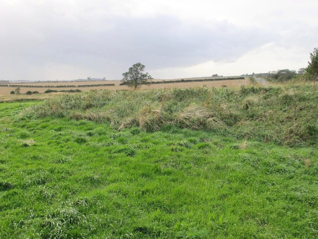
Milecastle 16
Milecastle 16 (Harlow Hill) was a milecastle of the Roman Hadrian's Wall. The milecastle is located at Harlow Hill, Northumberland. There are no visible...

Harlow Hill, Northumberland
Harlow Hill is a small village and former civil parish, now in the parish of Stamfordham, in Northumberland, England. In 1951 the parish had a population...
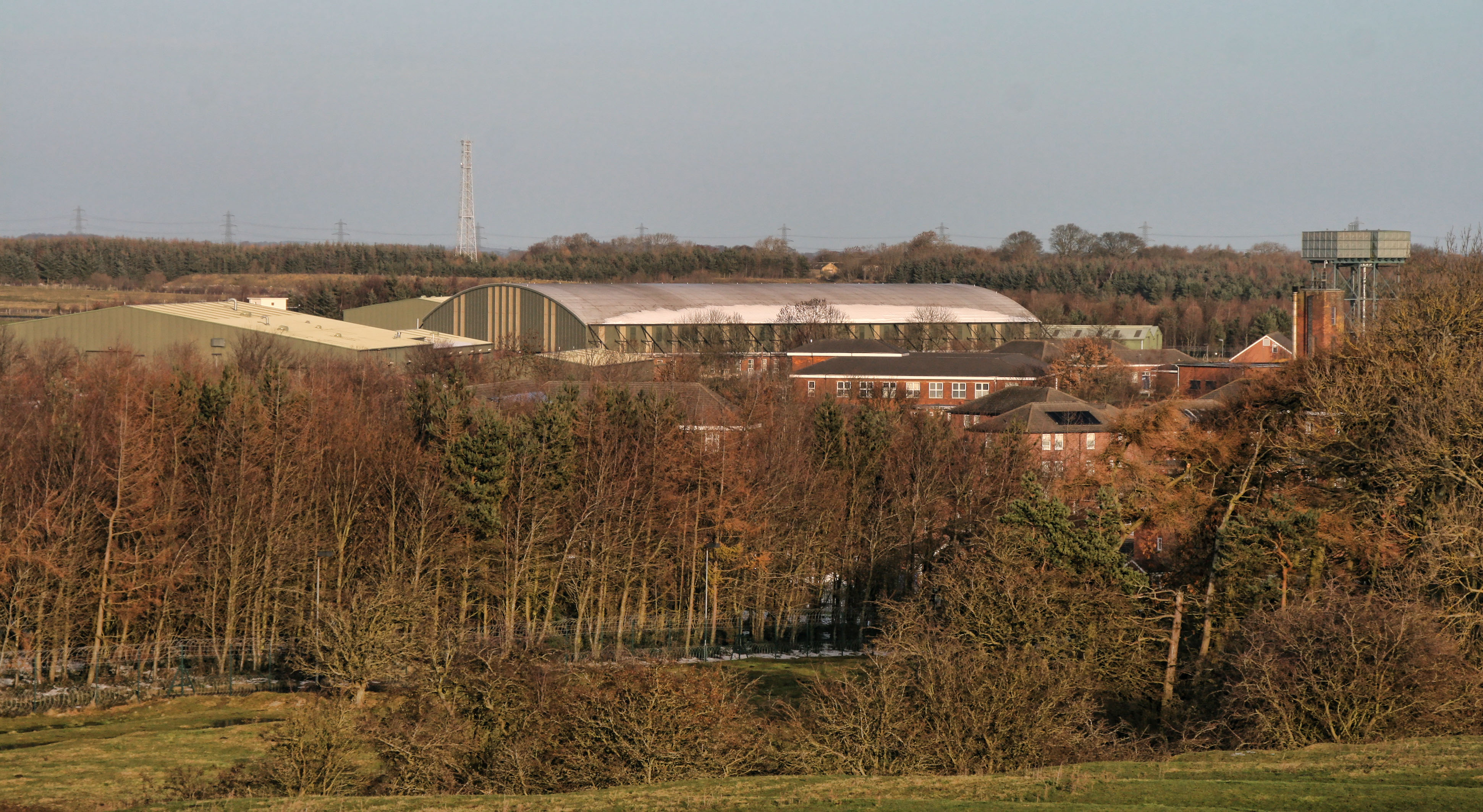
Albemarle Barracks, England
Albemarle Barracks is a British Army barracks located 1.7 miles (2.7 km) south of Stamfordham, Northumberland and 10.5 miles (16.9 km) west of Newcastle...

Whittle Dene
Whittle Dene is 12 miles (19 km) west of Newcastle upon Tyne, England, straddling the B6318 Military Road, and is a complex of reservoirs and treatment...

Milecastle 17
Milecastle 17 (Welton/Whittledean) was a milecastle of the Roman Hadrian's Wall. The milecastle is located near to the Whittle Dene reservoirs and is...
RAF Ouston
Royal Air Force Ouston or more simply RAF Ouston is a former Royal Air Force station that was located near the village of Stamfordham and the village of...
North East England
North East England is one of nine official regions of England at the first level of ITL for statistical purposes. The region has three current administrative...
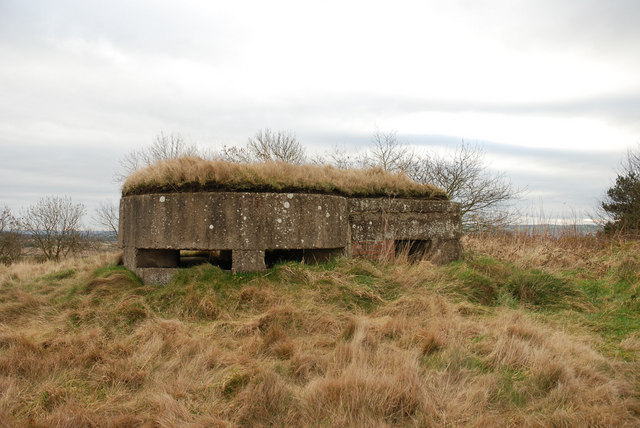
Milecastle 15
Milecastle 15 (Whitchester) was a milecastle of the Roman Hadrian's Wall. Its remains exist as a bold platform with robbed walls located on the southern...
Nearby Amenities
Located within 500m of 55.012743,-1.8822374Have you been to Crag Plantation?
Leave your review of Crag Plantation below (or comments, questions and feedback).