Argoed

Settlement in Shropshire

England

Argoed

Kinnerley Junction obscured - Edgerley, Shropshire Looking out from the railway bridge at Kinnerley Junction. This bridge straddled the now almost vanished Shropshire and Montgomeryshire Railway, known as The Potts. This was from the original company Potteries Shrewsbury and North Wales Railway which later became the Shropshire and Montgomeryshire Railway and was intended to link the Potteries area of Staffordshire with Dublin in the Irish Republic. The line opened in 1866 and finally closed in 1962 having been in private and military ownership during its lifetime. Kinnerley Junction station opened in 1911 and closed in 1933. From this point there was a 5 mile branch to a quarry at Criggion. The land on this route is private and there is no public access. Taken at 3.09 pm BST (British Summer Time). <a href="https://www.geograph.org.uk/photo/160295">SJ3319 : Kinnerley Bridge</a> <a href="https://www.geograph.org.uk/photo/600880">SJ3319 : Course of the Shropshire & Montgomery Railway</a> <a href="https://www.geograph.org.uk/photo/600887">SJ3319 : Site of Kinnerley Junction</a> <a href="https://www.geograph.org.uk/photo/758323">SJ3319 : Bridge over the stream</a>
Kinnerley Junction obscured - Edgerley, Shropshire Credit: Martin Richard Phelan

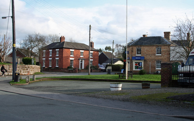
Argoed is a small village located in the county of Shropshire, England. Situated in the rural countryside, it lies about 9 miles west of the county town of Shrewsbury. The village is nestled in the picturesque Rea Valley, surrounded by rolling hills and lush green landscapes.

Argoed is known for its peaceful and tranquil atmosphere, making it an ideal place for those seeking a quiet and serene lifestyle. The village is primarily residential, with a small population, and offers a close-knit community feel. The traditional architecture of the houses adds to the village's charm and character.

Despite its size, Argoed has some amenities to offer its residents. There is a local pub, which serves as a social hub for the community, providing a place for gatherings and events. The village also has a primary school, ensuring that families with young children have access to education within the immediate area.

For outdoor enthusiasts, Argoed is a gateway to the Shropshire Hills, an Area of Outstanding Natural Beauty. The surrounding countryside provides ample opportunities for hiking, cycling, and exploring the great outdoors. The village is also well-connected to the wider region, with good road links to nearby towns and cities.

Overall, Argoed is a charming village that offers a peaceful and idyllic lifestyle amidst the rural beauty of Shropshire. Its close-knit community, stunning surroundings, and convenient location make it an attractive place to live for those seeking a tranquil countryside retreat.

If you have any feedback on the listing, please let us know in the comments section below.
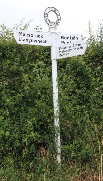
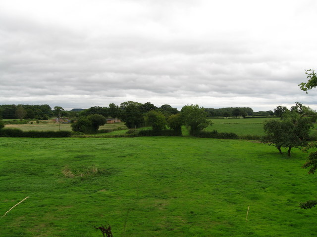
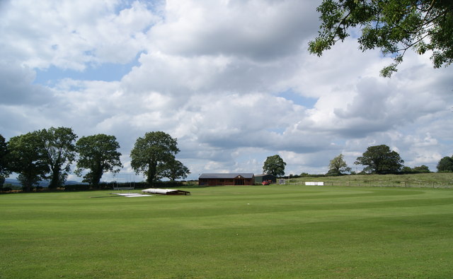
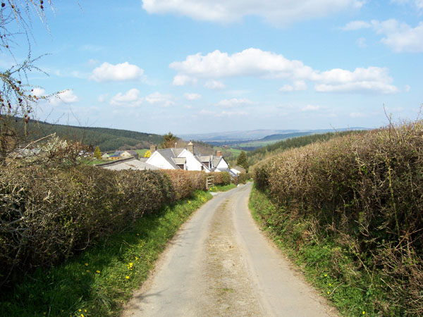
Argoed Images

Images are sourced within 2km of 52.776112/-2.9945011 or Grid Reference SJ3320. Thanks to Geograph Open Source API. All images are credited.

Kinnerley Junction obscured - Edgerley, Shropshire Looking out from the railway bridge at Kinnerley Junction. This bridge straddled the now almost vanished Shropshire and Montgomeryshire Railway, known as The Potts. This was from the original company Potteries Shrewsbury and North Wales Railway which later became the Shropshire and Montgomeryshire Railway and was intended to link the Potteries area of Staffordshire with Dublin in the Irish Republic. The line opened in 1866 and finally closed in 1962 having been in private and military ownership during its lifetime. Kinnerley Junction station opened in 1911 and closed in 1933. From this point there was a 5 mile branch to a quarry at Criggion. The land on this route is private and there is no public access. Taken at 3.09 pm BST (British Summer Time). <a href="https://www.geograph.org.uk/photo/160295">SJ3319 : Kinnerley Bridge</a> <a href="https://www.geograph.org.uk/photo/600880">SJ3319 : Course of the Shropshire & Montgomery Railway</a> <a href="https://www.geograph.org.uk/photo/600887">SJ3319 : Site of Kinnerley Junction</a> <a href="https://www.geograph.org.uk/photo/758323">SJ3319 : Bridge over the stream</a>
Kinnerley Junction obscured - Edgerley, Shropshire
Looking out from the railway bridge at Kinnerley Junction. This bridge straddled the now almost vanished Shropshire and Montgomeryshire Railway, known as The Potts. This was from the original company Potteries Shrewsbury and North Wales Railway which later became the Shropshire and Montgomeryshire Railway and was intended to link the Potteries area of Staffordshire with Dublin in the Irish Republic. The line opened in 1866 and finally closed in 1962 having been in private and military ownership during its lifetime. Kinnerley Junction station opened in 1911 and closed in 1933. From this point there was a 5 mile branch to a quarry at Criggion. The land on this route is private and there is no public access. Taken at 3.09 pm BST (British Summer Time). SJ3319 : Kinnerley Bridge SJ3319 : Course of the Shropshire & Montgomery Railway SJ3319 : Site of Kinnerley Junction SJ3319 : Bridge over the stream
Bridge Cottage by the way - Edgerley, Shropshire A party of Railway Ramblers on a day walk making their way along the B-road from Pentre to Kinnerley at Edgerley towards the road bridge overlooking the site of Kinnerley Junction. The walk started at the village of Shrawardine <a href="https://www.geograph.org.uk/gridref/SJ3915">SJ3915</a> 'Shraden' to the locals, and was to end at Argoed <a href="https://www.geograph.org.uk/gridref/SJ3220">SJ3220</a>. Time taken 3.06 pm BST (British Summer Time).
Bridge Cottage by the way - Edgerley, Shropshire
A party of Railway Ramblers on a day walk making their way along the B-road from Pentre to Kinnerley at Edgerley towards the road bridge overlooking the site of Kinnerley Junction. The walk started at the village of Shrawardine SJ3915 'Shraden' to the locals, and was to end at Argoed SJ3220. Time taken 3.06 pm BST (British Summer Time).
Towards Kinnerley Junction - Edgerley, Shropshire A party of Railway Ramblers at Edgerley on the B-road between Pentre and Kinnerley as they approach the road bridge overlooking the site of Kinnerley Junction. The now-vanished Shropshire and Montgomeryshire Railway once ran this way and at Kinnerley Junction a 5-mile branch led off  to the basalt quarry at Criggion <a href="https://www.geograph.org.uk/gridref/SJ2814">SJ2814</a>. Time taken 3.07 pm BST (British Summer Time).

<a href="https://www.geograph.org.uk/photo/5319315">SJ3319 : Bridge over Kinnerley Junction - Edgerley, Shropshire</a>
Towards Kinnerley Junction - Edgerley, Shropshire
A party of Railway Ramblers at Edgerley on the B-road between Pentre and Kinnerley as they approach the road bridge overlooking the site of Kinnerley Junction. The now-vanished Shropshire and Montgomeryshire Railway once ran this way and at Kinnerley Junction a 5-mile branch led off to the basalt quarry at Criggion SJ2814. Time taken 3.07 pm BST (British Summer Time). SJ3319 : Bridge over Kinnerley Junction - Edgerley, Shropshire
Bridge over Kinnerley Junction - Edgerley, Shropshire Some of the group of Railway Ramblers at Edgerley stopping for a look from the bridge at the site of Kinnerley Junction, from where a 5-mile branch left the Shropshire and Montgomeryshire Railway for the basalt quarry at Criggion <a href="https://www.geograph.org.uk/gridref/SJ2814">SJ2814</a>. The sign on the left shows a 22 ton weight limit on the bridge. Time taken 3.07 pm BST (British Summer Time).
Bridge over Kinnerley Junction - Edgerley, Shropshire
Some of the group of Railway Ramblers at Edgerley stopping for a look from the bridge at the site of Kinnerley Junction, from where a 5-mile branch left the Shropshire and Montgomeryshire Railway for the basalt quarry at Criggion SJ2814. The sign on the left shows a 22 ton weight limit on the bridge. Time taken 3.07 pm BST (British Summer Time).
Old Direction Sign - Signpost north of Melverley Green Annulus finial - 3 arms; Shropshire CC modern halo by the UC road, in parish of Melverley (Oswestry District), T junction between Melverley Green and Crosslanes, on verge, against hedge, beside gate.

Surveyed

Milestone Society National ID: SA_SJ3218.
Old Direction Sign - Signpost north of Melverley Green
Annulus finial - 3 arms; Shropshire CC modern halo by the UC road, in parish of Melverley (Oswestry District), T junction between Melverley Green and Crosslanes, on verge, against hedge, beside gate. Surveyed Milestone Society National ID: SA_SJ3218.
Dwelling near the River Vyrnwy The fields are flat and the River Vyrnwy is close by. The road in-between and the buildings must suffer in the regular floods in this area.
Dwelling near the River Vyrnwy
The fields are flat and the River Vyrnwy is close by. The road in-between and the buildings must suffer in the regular floods in this area.
Crosslanes, north of Melverley Green A small cluster of buildings form the appropriately named hamlet here.
Crosslanes, north of Melverley Green
A small cluster of buildings form the appropriately named hamlet here.
Garden gate in Crosslanes Don’t you just love an old gate like this. How many have wondered happily and carefree through this?
Garden gate in Crosslanes
Don’t you just love an old gate like this. How many have wondered happily and carefree through this?
A bridge there was - Edgerley, Shropshire The embankment ahead in this picture was the filled-in road bridgehole over the Shropshire & Montgomeryshire Railway at Edgerley. This line was intended to make a link between The Potteries at Stoke on Trent and Dublin, hence it's nickname the Potts, but this plan never came to fruition. Somewhat confusingly, there are two places named Edgerley on the OS map here, but whether they are separate or the same place named twice is not clear. Time taken 3.02 pm BST (British Summer Time).
<a href="https://www.geograph.org.uk/photo/3607444">SJ3419 : Rails once ran - Edgerley, Shropshire</a> <a href="https://www.geograph.org.uk/photo/3607850">SJ3319 : The road to Kynaston - Edgerley, Shropshire</a>
A bridge there was - Edgerley, Shropshire
The embankment ahead in this picture was the filled-in road bridgehole over the Shropshire & Montgomeryshire Railway at Edgerley. This line was intended to make a link between The Potteries at Stoke on Trent and Dublin, hence it's nickname the Potts, but this plan never came to fruition. Somewhat confusingly, there are two places named Edgerley on the OS map here, but whether they are separate or the same place named twice is not clear. Time taken 3.02 pm BST (British Summer Time). SJ3419 : Rails once ran - Edgerley, Shropshire SJ3319 : The road to Kynaston - Edgerley, Shropshire
Rails once ran - Edgerley, Shropshire Looking eastwards from the bridge in Edgerley 1, the long-abandoned former route of the Shropshire & Montgomeryshire Railway - nicknamed the Potts - can be seen. Passing through the gate which is seen ahead in the centre of the picture, the line ran through the present Nesscliffe Military Training Area - no public access - to the station house, a rebuilt one, at Shrawardine (locally pronounced Shraden). There are a number of books available which give a history of this former line. Time taken 3.08 pm BST (British Summer Time). <a href="https://www.geograph.org.uk/photo/3607429">SJ3319 : A bridge there was - Edgerley, Shropshire</a> <a href="https://www.geograph.org.uk/photo/3607850">SJ3319 : The road to Kynaston - Edgerley, Shropshire</a>
Rails once ran - Edgerley, Shropshire
Looking eastwards from the bridge in Edgerley 1, the long-abandoned former route of the Shropshire & Montgomeryshire Railway - nicknamed the Potts - can be seen. Passing through the gate which is seen ahead in the centre of the picture, the line ran through the present Nesscliffe Military Training Area - no public access - to the station house, a rebuilt one, at Shrawardine (locally pronounced Shraden). There are a number of books available which give a history of this former line. Time taken 3.08 pm BST (British Summer Time). SJ3319 : A bridge there was - Edgerley, Shropshire SJ3319 : The road to Kynaston - Edgerley, Shropshire
The road to Kynaston - Edgerley, Shropshire Just to the west of here, behind the photographer, lies the site of Kinnerley Junction where the Shropshire & Montgomeryshire Railway, the 'Potts', diverged, one branch turning southwards to Criggion and the other westwards to Llanymynech. In existence from 1866 to 1962, the line had a very chequered history and there are a number of books published on the story of it. The trackbed these days is private land, with no public access. The lower sign reads 'TRAINING AREAS 1 TO 6' and the signpost arms 'Kinnerley Knockin' 'Pentre Wilcott' and 'Kynaston'. Time taken 3.13 pm BST (British Summer Time).    

<a href="https://www.geograph.org.uk/photo/3607429">SJ3319 : A bridge there was - Edgerley, Shropshire</a> <a href="https://www.geograph.org.uk/photo/3607444">SJ3419 : Rails once ran - Edgerley, Shropshire</a>
The road to Kynaston - Edgerley, Shropshire
Just to the west of here, behind the photographer, lies the site of Kinnerley Junction where the Shropshire & Montgomeryshire Railway, the 'Potts', diverged, one branch turning southwards to Criggion and the other westwards to Llanymynech. In existence from 1866 to 1962, the line had a very chequered history and there are a number of books published on the story of it. The trackbed these days is private land, with no public access. The lower sign reads 'TRAINING AREAS 1 TO 6' and the signpost arms 'Kinnerley Knockin' 'Pentre Wilcott' and 'Kynaston'. Time taken 3.13 pm BST (British Summer Time). SJ3319 : A bridge there was - Edgerley, Shropshire SJ3419 : Rails once ran - Edgerley, Shropshire
Spring Heath Fishery, Knockin
The Merlin telescope Knockin
The Knockin & Kinnerley Cricket Club
Merlin Telescope and Spring Heath Fishery Knockin
The Bradford Arms in Knockin, Shropshire A large village hostelry with a lot of nice features.
The Bradford Arms in Knockin, Shropshire
A large village hostelry with a lot of nice features.
The Knockin Shop and post office
Field south of B4398 west of Knockin
Show me another place!

Argoed is located at Grid Ref: SJ3320 (Lat: 52.776112, Lng: -2.9945011)

Unitary Authority: Shropshire

Police Authority: West Merica

What 3 Words

///surpasses.wake.dizziness. Near Pant, Shropshire

Nearby Locations

Argoed Kinnerley

Related Wikis

Argoed, Shropshire

Argoed is a village in Shropshire, England, on the border with Wales. The name itself is Welsh and means "by a wood", and probably derives from early medieval...

Kinnerley Junction railway station

Kinnerley Junction railway station was a station to the north of Kinnerley, Shropshire, England. The station was opened in 1866 and closed in 1933. �...

Kinnerley

Kinnerley (historic Welsh name: Generdinlle) is a small village in Shropshire, England. It lies between the neighbouring villages of Dovaston and Pentre...

Wern Las railway station

Wern Las railway station was a station to the west of Kinnerley, Shropshire, England. The station was opened in 1919 and closed in 1933. == References... ==

Nearby Amenities

Located within 500m of 52.776112,-2.9945011
The data included in this document is from www.openstreetmap.org. The data is made available under ODbL.

Have you been to Argoed?

Leave your review of Argoed below (or comments, questions and feedback).