Kinnerley

Settlement in Shropshire

England

Kinnerley

Kinnerley Junction obscured - Edgerley, Shropshire Looking out from the railway bridge at Kinnerley Junction. This bridge straddled the now almost vanished Shropshire and Montgomeryshire Railway, known as The Potts. This was from the original company Potteries Shrewsbury and North Wales Railway which later became the Shropshire and Montgomeryshire Railway and was intended to link the Potteries area of Staffordshire with Dublin in the Irish Republic. The line opened in 1866 and finally closed in 1962 having been in private and military ownership during its lifetime. Kinnerley Junction station opened in 1911 and closed in 1933. From this point there was a 5 mile branch to a quarry at Criggion. The land on this route is private and there is no public access. Taken at 3.09 pm BST (British Summer Time). <a href="https://www.geograph.org.uk/photo/160295">SJ3319 : Kinnerley Bridge</a> <a href="https://www.geograph.org.uk/photo/600880">SJ3319 : Course of the Shropshire & Montgomery Railway</a> <a href="https://www.geograph.org.uk/photo/600887">SJ3319 : Site of Kinnerley Junction</a> <a href="https://www.geograph.org.uk/photo/758323">SJ3319 : Bridge over the stream</a>
Kinnerley Junction obscured - Edgerley, Shropshire Credit: Martin Richard Phelan

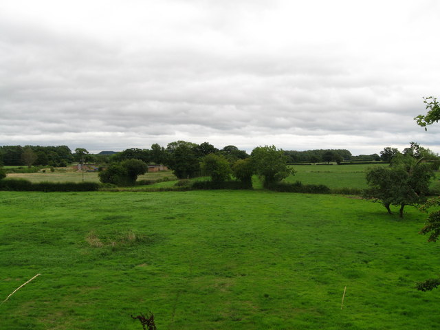
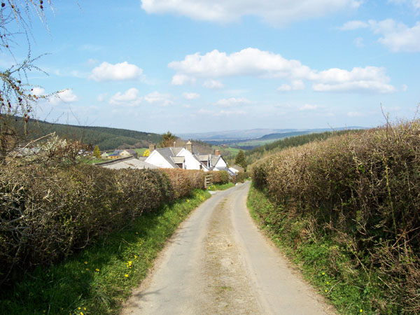
Kinnerley is a small village located in the county of Shropshire, England. Situated approximately 9 miles west of the county town of Shrewsbury, it falls within the Oswestry district. The village is nestled amidst the picturesque countryside, characterized by rolling hills and green fields.

Kinnerley has a rich history dating back to the Roman era, with evidence of Roman settlements found in the area. The village is also known for its connection to the Industrial Revolution, having been a hub for the coal mining industry during the 18th and 19th centuries.

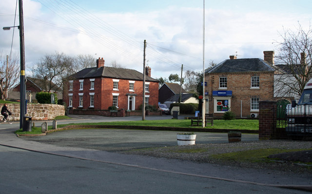
Today, Kinnerley maintains its rural charm and tranquility. The village is made up of a scattering of traditional stone houses, with the local church, St. Mary's, serving as a prominent landmark. The village also boasts a community hall and a primary school, providing essential amenities for its residents.

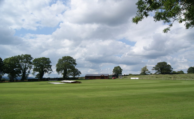
The surrounding countryside offers ample opportunities for outdoor activities, with numerous walking trails and cycling routes available for nature enthusiasts. The nearby Kinnerley Wood is a popular spot for woodland walks, brimming with diverse flora and fauna.

Despite its small size, Kinnerley is well-connected to neighboring towns and cities. The A5 road runs close to the village, providing easy access to Shrewsbury and Oswestry. Additionally, the village is served by regular bus services, ensuring convenient transportation options for residents and visitors alike.

Overall, Kinnerley offers a peaceful and idyllic setting, making it an attractive destination for those seeking a rural retreat in the heart of Shropshire.

If you have any feedback on the listing, please let us know in the comments section below.

Kinnerley Images

Images are sourced within 2km of 52.781886/-2.983039 or Grid Reference SJ3320. Thanks to Geograph Open Source API. All images are credited.

Kinnerley Junction obscured - Edgerley, Shropshire Looking out from the railway bridge at Kinnerley Junction. This bridge straddled the now almost vanished Shropshire and Montgomeryshire Railway, known as The Potts. This was from the original company Potteries Shrewsbury and North Wales Railway which later became the Shropshire and Montgomeryshire Railway and was intended to link the Potteries area of Staffordshire with Dublin in the Irish Republic. The line opened in 1866 and finally closed in 1962 having been in private and military ownership during its lifetime. Kinnerley Junction station opened in 1911 and closed in 1933. From this point there was a 5 mile branch to a quarry at Criggion. The land on this route is private and there is no public access. Taken at 3.09 pm BST (British Summer Time). <a href="https://www.geograph.org.uk/photo/160295">SJ3319 : Kinnerley Bridge</a> <a href="https://www.geograph.org.uk/photo/600880">SJ3319 : Course of the Shropshire & Montgomery Railway</a> <a href="https://www.geograph.org.uk/photo/600887">SJ3319 : Site of Kinnerley Junction</a> <a href="https://www.geograph.org.uk/photo/758323">SJ3319 : Bridge over the stream</a>
Kinnerley Junction obscured - Edgerley, Shropshire
Looking out from the railway bridge at Kinnerley Junction. This bridge straddled the now almost vanished Shropshire and Montgomeryshire Railway, known as The Potts. This was from the original company Potteries Shrewsbury and North Wales Railway which later became the Shropshire and Montgomeryshire Railway and was intended to link the Potteries area of Staffordshire with Dublin in the Irish Republic. The line opened in 1866 and finally closed in 1962 having been in private and military ownership during its lifetime. Kinnerley Junction station opened in 1911 and closed in 1933. From this point there was a 5 mile branch to a quarry at Criggion. The land on this route is private and there is no public access. Taken at 3.09 pm BST (British Summer Time). SJ3319 : Kinnerley Bridge SJ3319 : Course of the Shropshire & Montgomery Railway SJ3319 : Site of Kinnerley Junction SJ3319 : Bridge over the stream
Bridge Cottage by the way - Edgerley, Shropshire A party of Railway Ramblers on a day walk making their way along the B-road from Pentre to Kinnerley at Edgerley towards the road bridge overlooking the site of Kinnerley Junction. The walk started at the village of Shrawardine <a href="https://www.geograph.org.uk/gridref/SJ3915">SJ3915</a> 'Shraden' to the locals, and was to end at Argoed <a href="https://www.geograph.org.uk/gridref/SJ3220">SJ3220</a>. Time taken 3.06 pm BST (British Summer Time).
Bridge Cottage by the way - Edgerley, Shropshire
A party of Railway Ramblers on a day walk making their way along the B-road from Pentre to Kinnerley at Edgerley towards the road bridge overlooking the site of Kinnerley Junction. The walk started at the village of Shrawardine SJ3915 'Shraden' to the locals, and was to end at Argoed SJ3220. Time taken 3.06 pm BST (British Summer Time).
Towards Kinnerley Junction - Edgerley, Shropshire A party of Railway Ramblers at Edgerley on the B-road between Pentre and Kinnerley as they approach the road bridge overlooking the site of Kinnerley Junction. The now-vanished Shropshire and Montgomeryshire Railway once ran this way and at Kinnerley Junction a 5-mile branch led off  to the basalt quarry at Criggion <a href="https://www.geograph.org.uk/gridref/SJ2814">SJ2814</a>. Time taken 3.07 pm BST (British Summer Time).

<a href="https://www.geograph.org.uk/photo/5319315">SJ3319 : Bridge over Kinnerley Junction - Edgerley, Shropshire</a>
Towards Kinnerley Junction - Edgerley, Shropshire
A party of Railway Ramblers at Edgerley on the B-road between Pentre and Kinnerley as they approach the road bridge overlooking the site of Kinnerley Junction. The now-vanished Shropshire and Montgomeryshire Railway once ran this way and at Kinnerley Junction a 5-mile branch led off to the basalt quarry at Criggion SJ2814. Time taken 3.07 pm BST (British Summer Time). SJ3319 : Bridge over Kinnerley Junction - Edgerley, Shropshire
Bridge over Kinnerley Junction - Edgerley, Shropshire Some of the group of Railway Ramblers at Edgerley stopping for a look from the bridge at the site of Kinnerley Junction, from where a 5-mile branch left the Shropshire and Montgomeryshire Railway for the basalt quarry at Criggion <a href="https://www.geograph.org.uk/gridref/SJ2814">SJ2814</a>. The sign on the left shows a 22 ton weight limit on the bridge. Time taken 3.07 pm BST (British Summer Time).
Bridge over Kinnerley Junction - Edgerley, Shropshire
Some of the group of Railway Ramblers at Edgerley stopping for a look from the bridge at the site of Kinnerley Junction, from where a 5-mile branch left the Shropshire and Montgomeryshire Railway for the basalt quarry at Criggion SJ2814. The sign on the left shows a 22 ton weight limit on the bridge. Time taken 3.07 pm BST (British Summer Time).
A bridge there was - Edgerley, Shropshire The embankment ahead in this picture was the filled-in road bridgehole over the Shropshire & Montgomeryshire Railway at Edgerley. This line was intended to make a link between The Potteries at Stoke on Trent and Dublin, hence it's nickname the Potts, but this plan never came to fruition. Somewhat confusingly, there are two places named Edgerley on the OS map here, but whether they are separate or the same place named twice is not clear. Time taken 3.02 pm BST (British Summer Time).
<a href="https://www.geograph.org.uk/photo/3607444">SJ3419 : Rails once ran - Edgerley, Shropshire</a> <a href="https://www.geograph.org.uk/photo/3607850">SJ3319 : The road to Kynaston - Edgerley, Shropshire</a>
A bridge there was - Edgerley, Shropshire
The embankment ahead in this picture was the filled-in road bridgehole over the Shropshire & Montgomeryshire Railway at Edgerley. This line was intended to make a link between The Potteries at Stoke on Trent and Dublin, hence it's nickname the Potts, but this plan never came to fruition. Somewhat confusingly, there are two places named Edgerley on the OS map here, but whether they are separate or the same place named twice is not clear. Time taken 3.02 pm BST (British Summer Time). SJ3419 : Rails once ran - Edgerley, Shropshire SJ3319 : The road to Kynaston - Edgerley, Shropshire
Rails once ran - Edgerley, Shropshire Looking eastwards from the bridge in Edgerley 1, the long-abandoned former route of the Shropshire & Montgomeryshire Railway - nicknamed the Potts - can be seen. Passing through the gate which is seen ahead in the centre of the picture, the line ran through the present Nesscliffe Military Training Area - no public access - to the station house, a rebuilt one, at Shrawardine (locally pronounced Shraden). There are a number of books available which give a history of this former line. Time taken 3.08 pm BST (British Summer Time). <a href="https://www.geograph.org.uk/photo/3607429">SJ3319 : A bridge there was - Edgerley, Shropshire</a> <a href="https://www.geograph.org.uk/photo/3607850">SJ3319 : The road to Kynaston - Edgerley, Shropshire</a>
Rails once ran - Edgerley, Shropshire
Looking eastwards from the bridge in Edgerley 1, the long-abandoned former route of the Shropshire & Montgomeryshire Railway - nicknamed the Potts - can be seen. Passing through the gate which is seen ahead in the centre of the picture, the line ran through the present Nesscliffe Military Training Area - no public access - to the station house, a rebuilt one, at Shrawardine (locally pronounced Shraden). There are a number of books available which give a history of this former line. Time taken 3.08 pm BST (British Summer Time). SJ3319 : A bridge there was - Edgerley, Shropshire SJ3319 : The road to Kynaston - Edgerley, Shropshire
The road to Kynaston - Edgerley, Shropshire Just to the west of here, behind the photographer, lies the site of Kinnerley Junction where the Shropshire & Montgomeryshire Railway, the 'Potts', diverged, one branch turning southwards to Criggion and the other westwards to Llanymynech. In existence from 1866 to 1962, the line had a very chequered history and there are a number of books published on the story of it. The trackbed these days is private land, with no public access. The lower sign reads 'TRAINING AREAS 1 TO 6' and the signpost arms 'Kinnerley Knockin' 'Pentre Wilcott' and 'Kynaston'. Time taken 3.13 pm BST (British Summer Time).    

<a href="https://www.geograph.org.uk/photo/3607429">SJ3319 : A bridge there was - Edgerley, Shropshire</a> <a href="https://www.geograph.org.uk/photo/3607444">SJ3419 : Rails once ran - Edgerley, Shropshire</a>
The road to Kynaston - Edgerley, Shropshire
Just to the west of here, behind the photographer, lies the site of Kinnerley Junction where the Shropshire & Montgomeryshire Railway, the 'Potts', diverged, one branch turning southwards to Criggion and the other westwards to Llanymynech. In existence from 1866 to 1962, the line had a very chequered history and there are a number of books published on the story of it. The trackbed these days is private land, with no public access. The lower sign reads 'TRAINING AREAS 1 TO 6' and the signpost arms 'Kinnerley Knockin' 'Pentre Wilcott' and 'Kynaston'. Time taken 3.13 pm BST (British Summer Time). SJ3319 : A bridge there was - Edgerley, Shropshire SJ3419 : Rails once ran - Edgerley, Shropshire
Spring Heath Fishery, Knockin
The Merlin telescope Knockin
The Knockin & Kinnerley Cricket Club
Merlin Telescope and Spring Heath Fishery Knockin
Road to Plasau, Knockin Heath
Entering Knockin from the eastbound B4396
Junction for Knockin at Doveston
Doveston United Reformed Church
Hall in grounds of Doveston Church
Approaching Knockin road at Knockin Heath
War memorial, Knockin Knockin is a small village on the B4396 which is the road in the image. The white building left of centre is a shop, known inevitably as 'The Knockin Shop'!
War memorial, Knockin
Knockin is a small village on the B4396 which is the road in the image. The white building left of centre is a shop, known inevitably as 'The Knockin Shop'!
Show me another place!

Kinnerley is located at Grid Ref: SJ3320 (Lat: 52.781886, Lng: -2.983039)

Unitary Authority: Shropshire

Police Authority: West Mercia

What 3 Words

///tunnel.menu.smothered. Near Ruyton-XI-Towns, Shropshire

Nearby Locations

Argoed Kinnerley

Related Wikis

Kinnerley

Kinnerley (historic Welsh name: Generdinlle) is a small village in Shropshire, England. It lies between the neighbouring villages of Dovaston and Pentre...

Kinnerley Junction railway station

Kinnerley Junction railway station was a station to the north of Kinnerley, Shropshire, England. The station was opened in 1866 and closed in 1933. �...

Argoed, Shropshire

Argoed is a village in Shropshire, England, on the border with Wales. The name itself is Welsh and means "by a wood", and probably derives from early medieval...

Knockin Castle

Knockin Castle is situated in the village of Knockin on Shropshire between Oswestry and Shrewsbury (grid reference SJ334223), England. This was a motte...

Nearby Amenities

Located within 500m of 52.781886,-2.983039
Kinnerley
Is In: Shropshire
Place: village
Source: npe
Wikidata: Q2030644
Lat/Long: 52.7824793/-2.9837253
Information: board
Tourism: information
Lat/Long: 52.7823777/-2.982904
Telephone
Booth: K6
Covered: booth
Phone: +44 1691 682331
Lat/Long: 52.7815237/-2.982718
Information: board
Tourism: information
Lat/Long: 52.781827/-2.9831203
Bench
Lat/Long: 52.7817325/-2.9831402
Post Box
Post Box Type: wall
Lat/Long: 52.7815199/-2.982745
Give Way
Direction: backward
Lat/Long: 52.7838115/-2.9818267
Give Way
Direction: backward
Lat/Long: 52.7844889/-2.9811464
Entrance: yes
Lat/Long: 52.7819473/-2.9826605
Grange Farm
Place: farm
Lat/Long: 52.7856565/-2.9857558
The data included in this document is from www.openstreetmap.org. The data is made available under ODbL.

Have you been to Kinnerley?

Leave your review of Kinnerley below (or comments, questions and feedback).