Areley Kings

Settlement in Worcestershire Wyre Forest

England

Areley Kings

The Dog, Dunley
The Dog, Dunley Credit: Richard Rogerson

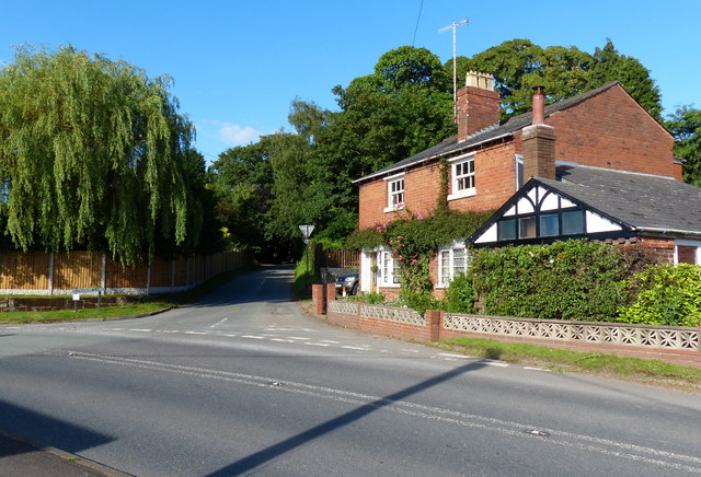
Areley Kings is a small village situated in the county of Worcestershire, England. It is located approximately three miles north of the town of Stourport-on-Severn, and is bordered by the River Severn to the west. The village is part of the Wyre Forest District and falls under the jurisdiction of the Areley Kings Parish Council.

The history of Areley Kings dates back to the Anglo-Saxon period, and the name itself is believed to have originated from the Old English words "eorclēah" meaning "eagle's clearing." Over the years, the village has grown and developed, but it still retains a charming rural character.

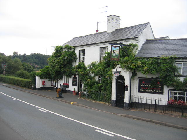
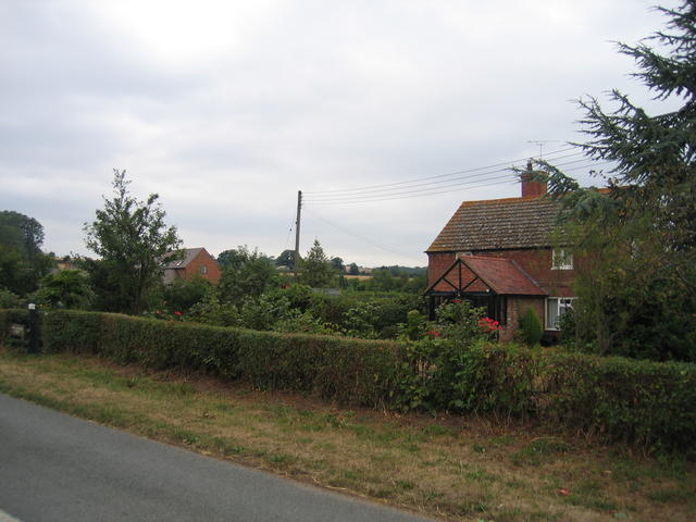
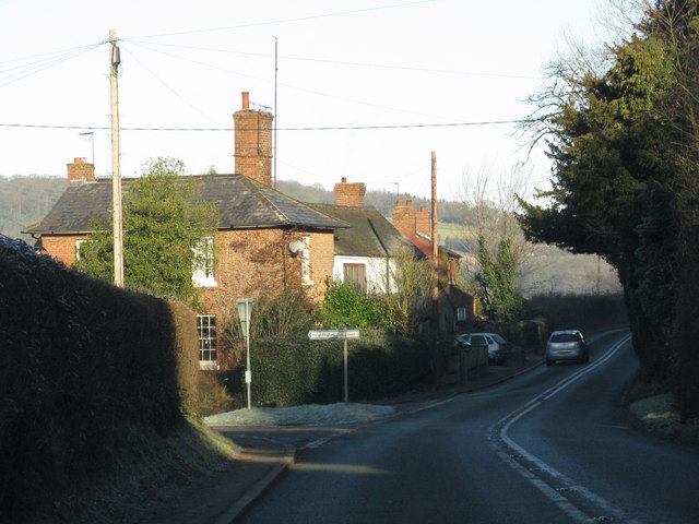
The village is primarily residential, featuring a mix of traditional cottages, modern houses, and some larger properties. There is a sense of community in Areley Kings, with various social activities and events taking place throughout the year. The village also boasts a local primary school, which serves the educational needs of the area.

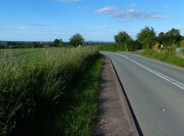
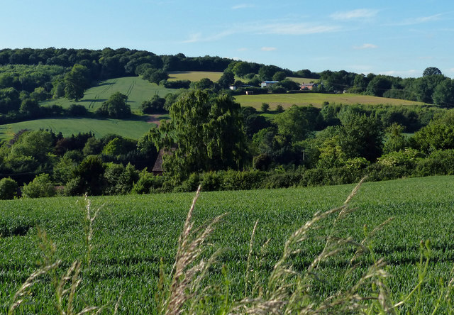
Areley Kings benefits from its proximity to the River Severn, providing residents with scenic walks and opportunities for boating and fishing. The nearby countryside offers ample opportunities for outdoor activities, including hiking and cycling.

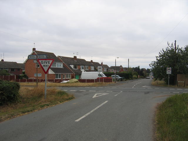
For amenities, the village has a small convenience store to cater to daily needs. However, residents often rely on the nearby town of Stourport-on-Severn for a wider range of shopping and services.

Overall, Areley Kings is a picturesque village with a rich history, offering a peaceful and close-knit community for its residents.

If you have any feedback on the listing, please let us know in the comments section below.
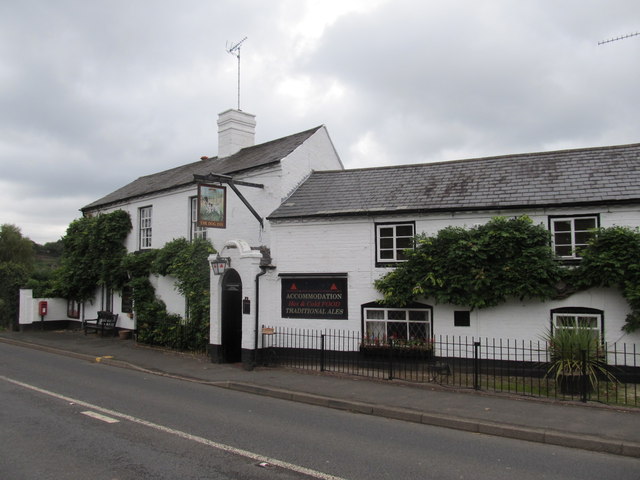
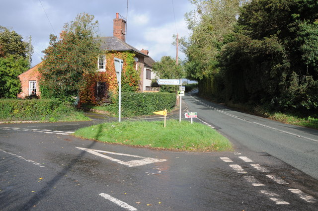
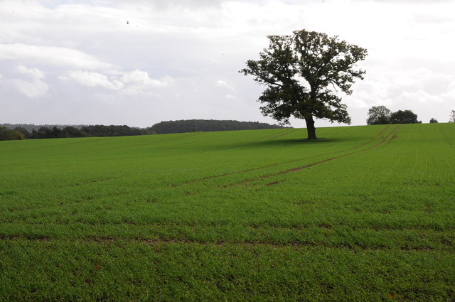
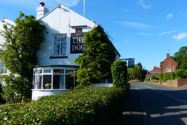
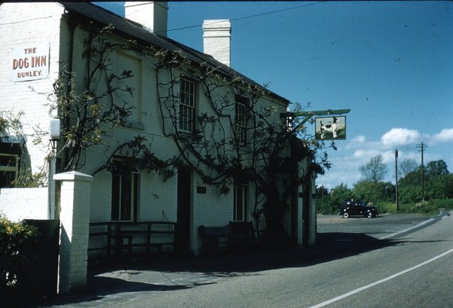
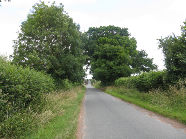
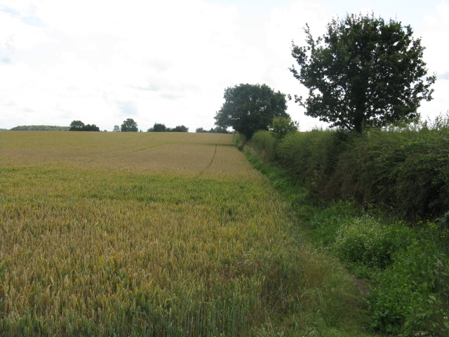
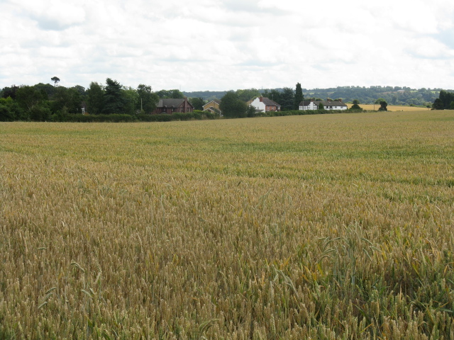
Areley Kings Images

Images are sourced within 2km of 52.332103/-2.292739 or Grid Reference SO8070. Thanks to Geograph Open Source API. All images are credited.

The Dog, Dunley
The Dog, Dunley
Road junction in Dunley House on the corner by a road junction in Dunley.
Road junction in Dunley
House on the corner by a road junction in Dunley.
Oak tree in an arable field Oak tree in an arable field between Astely Cross and Dunley.
Oak tree in an arable field
Oak tree in an arable field between Astely Cross and Dunley.
The Dog Inn, Dunley Public house along the A451.
The Dog Inn, Dunley
Public house along the A451.
Redhouse Lane junction in Dunley
Dunley Road towards Areley Kings
View north towards Areley Wood
The Dog Inn, Dunley This is the pub shown on the OS Map beside the Stourport - Witley road in the SE corner of the square.
The Dog Inn, Dunley
This is the pub shown on the OS Map beside the Stourport - Witley road in the SE corner of the square.
New Barns Farm The old farmhouse is on the right and the barns, now converted into <a href="https://www.geograph.org.uk/photo/218662">SO7969 : The Steadings</a> can be seen in the distance.  Behind the photographer the urban development of <a href="https://www.geograph.org.uk/photo/218636">SO7969 : Edge of Areley Kings</a> and Stourport and then much of the West Midlands commences.
New Barns Farm
The old farmhouse is on the right and the barns, now converted into SO7969 : The Steadings can be seen in the distance. Behind the photographer the urban development of SO7969 : Edge of Areley Kings and Stourport and then much of the West Midlands commences.
Edge of Areley Kings Looking the other way from <a href="https://www.geograph.org.uk/photo/218563">SO7969 : New Barns Farm</a> towards the edge of the Areley Kings area of Stourport.
Edge of Areley Kings
Looking the other way from SO7969 : New Barns Farm towards the edge of the Areley Kings area of Stourport.
The Steadings The converted barns at New Barns Farm on the edge of Stourport-on-Severn. These are the barns just visible from near <a href="https://www.geograph.org.uk/photo/218563">SO7969 : New Barns Farm</a> farmhouse.
The Steadings
The converted barns at New Barns Farm on the edge of Stourport-on-Severn. These are the barns just visible from near SO7969 : New Barns Farm farmhouse.
Heightington Lane junction, Dunley
The Dog Inn, Dunley A more recent image can be seen here <a href="https://www.geograph.org.uk/photo/218558">SO7869 : The Dog Inn, Dunley</a>.
The Dog Inn, Dunley
A more recent image can be seen here SO7869 : The Dog Inn, Dunley.
Straight Lane To Astley Cross
Footpath South
Footpath South
Field Near Oakhampton
The Dog Inn, Dunley, Worcestershire
Longmore Hill Farm Like many farms this farm to the south of Stourport-on-Severn has been converted into residential accommodation.
Longmore Hill Farm
Like many farms this farm to the south of Stourport-on-Severn has been converted into residential accommodation.
Show me another place!

Areley Kings is located at Grid Ref: SO8070 (Lat: 52.332103, Lng: -2.292739)

Administrative County: Worcestershire

District: Wyre Forest

Police Authority: West Mercia

What 3 Words

///oldest.breakfast.caller. Near Stourport-on-Severn, Worcestershire

Related Wikis

Areley Kings

Areley Kings is a village on the River Severn in the Wyre District of Worcestershire, England. It is 10 miles north of Worcester and south of Stourport...

Areley Hall

Areley Hall is a Grade II listed country house near Areley Kings in Stourport-on-Severn, Worcestershire, England. It is not to be confused with nearby...

Astley Cross

Astley Cross is a village in Worcestershire, England, located on the outskirts of Stourport-on-Severn. The village lies 1 mile (1.6 km) south of the centre...

Stourport Boat Club

Stourport Boat Club is a rowing club on the River Severn, based at the Riverside, Dunley Road, Stourport-on-Severn, Worcestershire. == History == The club...

Stourport Swifts F.C.

Stourport Swifts Football Club are a football team from Stourport-on-Severn, and one of the oldest non-league teams in the country. The Swifts currently...

Droitwich Spa F.C.

Droitwich Spa Football Club is a football club representing the town of Droitwich Spa, Worcestershire, England. They are currently members of the Midland...

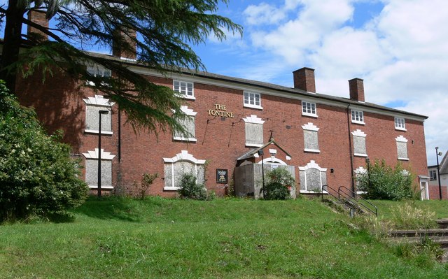
Tontine Buildings, Stourport

The Tontine Buildings is a former hotel in Stourport-on-Severn, Worcestershire, built in the late 18th century by the Staffordshire and Worcestershire...

River Stour, Worcestershire

The Stour (, rhymes with "flour") is a river flowing through the counties of Worcestershire, the West Midlands and Staffordshire in the West Midlands region...

Nearby Amenities

Located within 500m of 52.332103,-2.292739
Areley Kings
Is In: Worcestershire
Place: suburb
Wikidata: Q690695
Lat/Long: 52.3330729/-2.2946626
Bus Stop
Beach Road
Bus: yes
Naptan AtcoCode: 2000G046003
Naptan Bearing: N
Naptan CommonName: Beach Road
Naptan Crossing: Beach Road
Naptan Indicator: opp
Naptan NaptanCode: wocgjwdj
Naptan PlusbusZoneRef: KDRMNST
Naptan Street: Areley Common
Naptan Verified: no
Public Transport: platform
Source: naptan_import
Lat/Long: 52.329704/-2.2920043
Bus Stop
Walton Close
Bus: yes
Naptan AtcoCode: 2000G099800
Naptan Bearing: N
Naptan CommonName: Walton Close
Naptan Crossing: Walton Close
Naptan Indicator: adj
Naptan NaptanCode: wocdptda
Naptan PlusbusZoneRef: KDRMNST
Naptan Street: Abberley Avenue
Naptan Verified: no
Public Transport: platform
Source: naptan_import
Lat/Long: 52.3298489/-2.2965448
Bus Stop
Bus: yes
Naptan AtcoCode: 2000G500599
Naptan Bearing: SW
Naptan CommonName: Stourport-on-Severn- Bridge Street
Naptan Indicator: Adj
Naptan Landmark: Schools
Naptan NaptanCode: wocgajdt
Naptan PlusbusZoneRef: KDRMNST
Naptan Street: Windmill Bank/Dunley Road
Naptan Verified: no
Public Transport: platform
Source: naptan_import
Lat/Long: 52.3319174/-2.2962798
Bus Stop
Layamon Walk
Bus: yes
Naptan AtcoCode: 2000G581519
Naptan Bearing: E
Naptan CommonName: Layamon Walk
Naptan Indicator: Eastbound
Naptan NaptanCode: wocgagpa
Naptan PlusbusZoneRef: KDRMNST
Naptan Street: Layamon Walk
Naptan Verified: no
Public Transport: platform
Source: naptan_import
Lat/Long: 52.3303636/-2.2865832
Bus Stop
Wenlock Way
Bus: yes
Naptan AtcoCode: 2000G581521
Naptan Bearing: W
Naptan CommonName: Wenlock Way
Naptan Crossing: Wenlock Way
Naptan Indicator: opp
Naptan NaptanCode: wocgagpg
Naptan PlusbusZoneRef: KDRMNST
Naptan Street: Abberley Avenue
Naptan Verified: no
Public Transport: platform
Source: naptan_import
Lat/Long: 52.3304707/-2.2933751
Bus Stop
Heightington Place
Bus: yes
Naptan AtcoCode: 2000G663011
Naptan Bearing: NE
Naptan CommonName: Heightington Place
Naptan Indicator: opp
Naptan Landmark: Heightington Place
Naptan NaptanCode: wocgamtj
Naptan PlusbusZoneRef: KDRMNST
Naptan Street: Dunley Road
Naptan Verified: no
Public Transport: platform
Source: naptan_import
Lat/Long: 52.3325416/-2.2947284
Mini Roundabout
Lat/Long: 52.3301995/-2.2869239
Barrier: kissing_gate
Foot: yes
Lat/Long: 52.3364259/-2.2921368
Taylors Newsagents
Shop: newsagent
Lat/Long: 52.3286775/-2.2920697
Areley Kings Pharmacy
Shop: chemist
Lat/Long: 52.3277991/-2.2926349
Noexit: yes
Lat/Long: 52.3314288/-2.2930338
Bus Stop
Bus: yes
Naptan AtcoCode: 2000G581514
Naptan Bearing: SW
Naptan CommonName: Dunley Road
Naptan Crossing: Areley Common
Naptan Indicator: Adj
Naptan NaptanCode: wocgagmp
Naptan PlusbusZoneRef: KDRMNST
Naptan Street: Dunley Road
Naptan Verified: no
Public Transport: platform
Source: naptan_import
Lat/Long: 52.3320755/-2.2889831
War Memorial
Historic: memorial
Lat/Long: 52.3364877/-2.2913755
Bench
Backrest: yes
Lat/Long: 52.3325047/-2.2894411
Parking
Langdale End
Lat/Long: 52.3300526/-2.2975643
Post Box
Drive Through: no
Operator: Royal Mail
Operator Wikidata: Q638098
Lat/Long: 52.3301894/-2.2980551
Bench
Backrest: yes
Lat/Long: 52.329387/-2.2930313
Bench
Backrest: yes
Lat/Long: 52.3293839/-2.2929321
Bench
Backrest: yes
Lat/Long: 52.3291282/-2.2934898
Leisure: picnic_table
Lat/Long: 52.3291389/-2.2933745
Bench
Backrest: yes
Lat/Long: 52.3291979/-2.2932772
Bus Stop
Bus: yes
Public Transport: platform
Lat/Long: 52.3329921/-2.2883643
Crossing
Crossing: uncontrolled
Crossing Ref: zebra
Lat/Long: 52.3286071/-2.2922944
Post Box
Operator: Royal Mail
Operator Wikidata: Q638098
Post Box Type: wall
Ref: DY13 143D
Royal Cypher: GR
Royal Cypher Wikidata: Q33102273
Lat/Long: 52.3328878/-2.2931934
Generator Method: photovoltaic
Generator Output Electricity: yes
Generator Source: solar
Generator Type: solar_photovoltaic_panel
Location: roof
Power: generator
Lat/Long: 52.3296057/-2.290813
Generator Method: photovoltaic
Generator Output Electricity: yes
Generator Source: solar
Generator Type: solar_photovoltaic_panel
Location: roof
Power: generator
Lat/Long: 52.3304966/-2.2903986
Generator Method: photovoltaic
Generator Output Electricity: yes
Generator Source: solar
Generator Type: solar_photovoltaic_panel
Location: roof
Power: generator
Lat/Long: 52.3322709/-2.2928247
Generator Method: photovoltaic
Generator Output Electricity: yes
Generator Source: solar
Generator Type: solar_photovoltaic_panel
Location: roof
Power: generator
Lat/Long: 52.3319939/-2.2937447
Generator Method: photovoltaic
Generator Output Electricity: yes
Generator Source: solar
Generator Type: solar_photovoltaic_panel
Location: roof
Power: generator
Lat/Long: 52.3318152/-2.2957402
Generator Method: photovoltaic
Generator Output Electricity: yes
Generator Source: solar
Generator Type: solar_photovoltaic_panel
Location: roof
Power: generator
Lat/Long: 52.3317579/-2.2958556
Generator Method: photovoltaic
Generator Output Electricity: yes
Generator Source: solar
Generator Type: solar_photovoltaic_panel
Location: roof
Power: generator
Lat/Long: 52.3312825/-2.2974113
Generator Method: photovoltaic
Generator Output Electricity: yes
Generator Source: solar
Generator Type: solar_photovoltaic_panel
Location: roof
Power: generator
Lat/Long: 52.330181/-2.2990823
Generator Method: photovoltaic
Generator Output Electricity: yes
Generator Source: solar
Generator Type: solar_photovoltaic_panel
Location: roof
Power: generator
Lat/Long: 52.3316661/-2.2959334
Generator Method: photovoltaic
Generator Output Electricity: yes
Generator Source: solar
Generator Type: solar_photovoltaic_panel
Location: roof
Power: generator
Lat/Long: 52.3314218/-2.2970545
Generator Method: photovoltaic
Generator Output Electricity: yes
Generator Source: solar
Generator Type: solar_photovoltaic_panel
Location: roof
Power: generator
Lat/Long: 52.3313268/-2.2972047
Generator Method: photovoltaic
Generator Output Electricity: yes
Generator Source: solar
Generator Type: solar_photovoltaic_panel
Location: roof
Power: generator
Lat/Long: 52.3297467/-2.2964162
Generator Method: photovoltaic
Generator Output Electricity: yes
Generator Source: solar
Generator Type: solar_photovoltaic_panel
Location: roof
Power: generator
Lat/Long: 52.3309105/-2.2981113
Generator Method: photovoltaic
Generator Output Electricity: yes
Generator Source: solar
Generator Type: solar_photovoltaic_panel
Location: roof
Power: generator
Lat/Long: 52.3306302/-2.2982642
Generator Method: photovoltaic
Generator Output Electricity: yes
Generator Source: solar
Generator Type: solar_photovoltaic_panel
Location: roof
Power: generator
Lat/Long: 52.3299811/-2.297194
Generator Method: photovoltaic
Generator Output Electricity: yes
Generator Source: solar
Generator Type: solar_photovoltaic_panel
Location: roof
Power: generator
Lat/Long: 52.3301532/-2.2973442
Generator Method: photovoltaic
Generator Output Electricity: yes
Generator Source: solar
Generator Type: solar_photovoltaic_panel
Location: roof
Power: generator
Lat/Long: 52.3299139/-2.2960246
Generator Method: photovoltaic
Generator Output Electricity: yes
Generator Source: solar
Generator Type: solar_photovoltaic_panel
Location: roof
Power: generator
Lat/Long: 52.328096/-2.2948766
Generator Method: photovoltaic
Generator Output Electricity: yes
Generator Source: solar
Generator Type: solar_photovoltaic_panel
Location: roof
Power: generator
Lat/Long: 52.327996/-2.2942328
Generator Method: photovoltaic
Generator Output Electricity: yes
Generator Source: solar
Generator Type: solar_photovoltaic_panel
Location: roof
Power: generator
Lat/Long: 52.3347482/-2.2893177
Generator Method: photovoltaic
Generator Output Electricity: yes
Generator Source: solar
Generator Type: solar_photovoltaic_panel
Location: roof
Power: generator
Lat/Long: 52.3299565/-2.2910035
Generator Method: photovoltaic
Generator Output Electricity: yes
Generator Source: solar
Generator Type: solar_photovoltaic_panel
Location: roof
Power: generator
Lat/Long: 52.3292451/-2.2932994
Bus Stop
Layamon Walk
Bus: yes
Naptan AtcoCode: 2000G581515
Naptan Bearing: S
Naptan CommonName: Layamon Walk
Naptan Crossing: Layamon Walk
Naptan Indicator: Adj
Naptan NaptanCode: wocgagmt
Naptan PlusbusZoneRef: KDRMNST
Naptan Street: Hermitage Way
Naptan Verified: no
Public Transport: platform
Source: naptan_import
Lat/Long: 52.3318414/-2.2881446
Generator Method: photovoltaic
Generator Output Electricity: yes
Generator Source: solar
Generator Type: solar_photovoltaic_panel
Location: roof
Power: generator
Lat/Long: 52.3304958/-2.2904697
Generator Method: photovoltaic
Generator Output Electricity: yes
Generator Source: solar
Generator Type: solar_photovoltaic_panel
Location: roof
Power: generator
Lat/Long: 52.3308383/-2.290628
Generator Method: photovoltaic
Generator Output Electricity: yes
Generator Source: solar
Generator Type: solar_photovoltaic_panel
Location: roof
Power: generator
Lat/Long: 52.3326298/-2.2910035
Generator Method: photovoltaic
Generator Output Electricity: yes
Generator Source: solar
Generator Type: solar_photovoltaic_panel
Location: roof
Power: generator
Lat/Long: 52.3293025/-2.2883722
Generator Method: photovoltaic
Generator Output Electricity: yes
Generator Source: solar
Generator Type: solar_photovoltaic_panel
Location: roof
Power: generator
Lat/Long: 52.3287074/-2.2880343
Generator Method: photovoltaic
Generator Output Electricity: yes
Generator Source: solar
Generator Type: solar_photovoltaic_panel
Location: roof
Power: generator
Lat/Long: 52.3296516/-2.2915936
Generator Method: photovoltaic
Generator Output Electricity: yes
Generator Source: solar
Generator Type: solar_photovoltaic_panel
Location: roof
Power: generator
Lat/Long: 52.3296598/-2.2911081
Bench
Lat/Long: 52.3290499/-2.2934084
Bench
Lat/Long: 52.3285339/-2.2942132
Bench
Lat/Long: 52.3284624/-2.2935113
Bench
Lat/Long: 52.3286156/-2.295013
Bench
Lat/Long: 52.329211/-2.2953448
Bench
Backrest: yes
Lat/Long: 52.3315474/-2.2984807
Advertising: board
Lat/Long: 52.3293433/-2.2921684
The data included in this document is from www.openstreetmap.org. The data is made available under ODbL.

Have you been to Areley Kings?

Leave your review of Areley Kings below (or comments, questions and feedback).