Half Crown Wood

Wood, Forest in Worcestershire Wyre Forest

England

Half Crown Wood

The Dog, Dunley
The Dog, Dunley Credit: Richard Rogerson

Half Crown Wood is a picturesque woodland located in the county of Worcestershire, England. Spanning across an area of approximately 50 acres, it is a charming destination for nature lovers and outdoor enthusiasts. The wood is situated near the village of Wood, which is nestled within the vast expanse of the Wyre Forest.

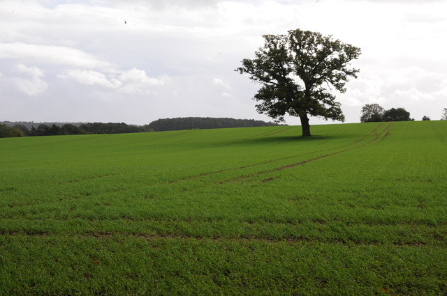
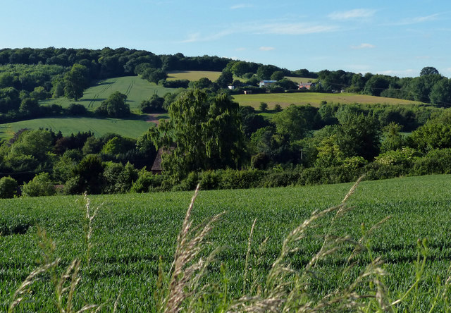
Half Crown Wood boasts a diverse range of tree species, including oak, beech, birch, and rowan, which contribute to its rich and vibrant ecosystem. The woodland floor is adorned with a carpet of bluebells during the spring months, creating a stunning display of colors.

The wood is crisscrossed by a network of well-maintained footpaths, allowing visitors to explore its natural beauty and take in the tranquil ambiance. These paths wind through the trees and offer glimpses of local wildlife, such as deer, rabbits, and a variety of bird species that call the wood their home.

Half Crown Wood is not only a haven for wildlife but also a popular spot for recreational activities. It offers opportunities for walking, jogging, cycling, and picnicking, making it an ideal destination for families and outdoor enthusiasts. Additionally, the wood has a designated area for camping, providing a unique camping experience surrounded by the serene beauty of nature.

Overall, Half Crown Wood in Worcestershire is a hidden gem that offers a peaceful escape from the hustle and bustle of everyday life. With its diverse flora and fauna, well-maintained footpaths, and recreational facilities, it provides a delightful experience for anyone seeking solace in nature.

If you have any feedback on the listing, please let us know in the comments section below.

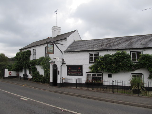
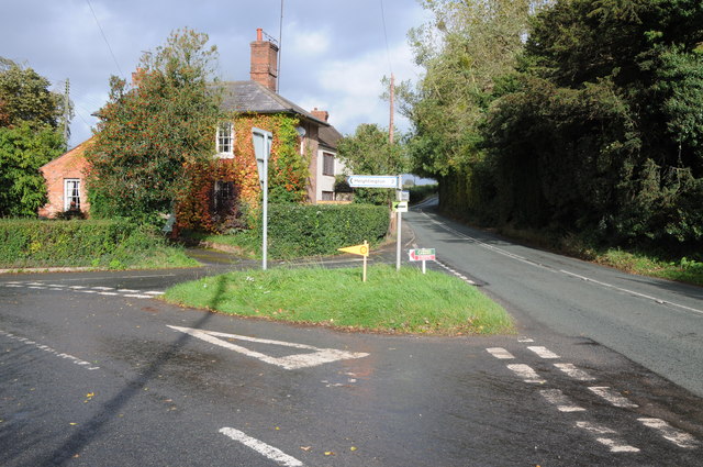
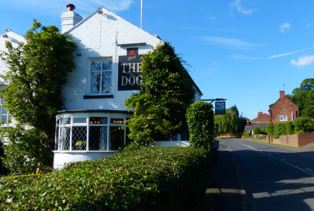
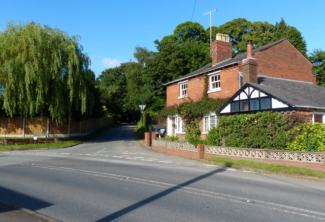
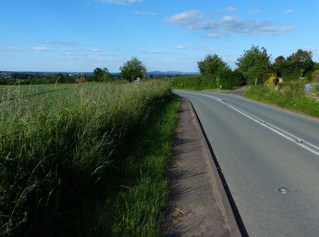
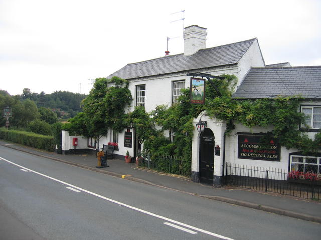
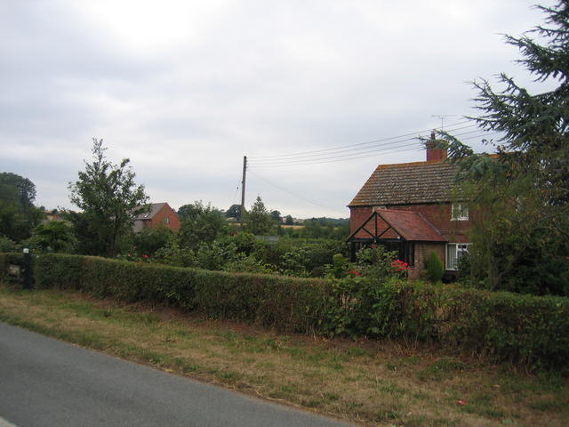
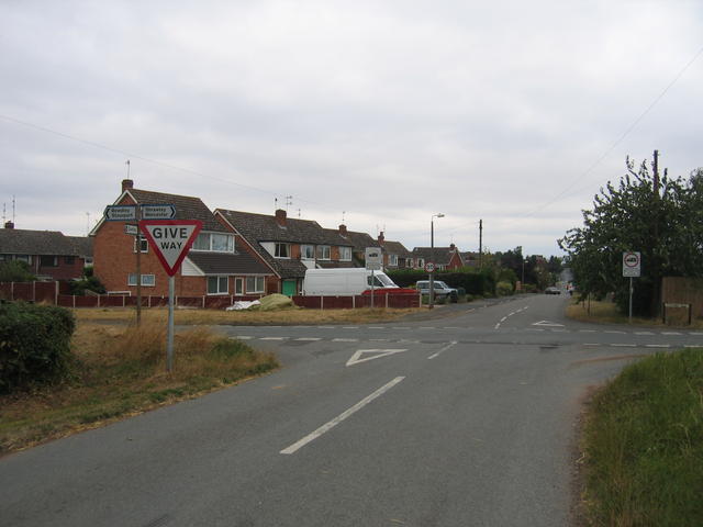
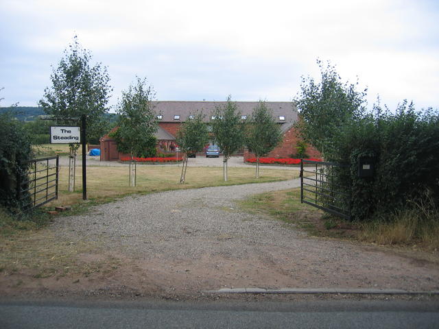
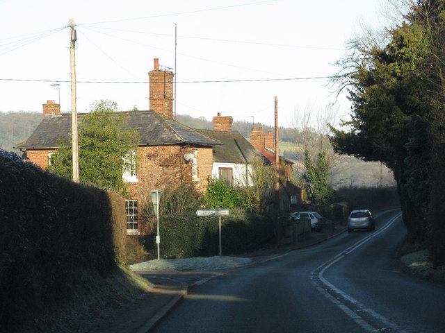
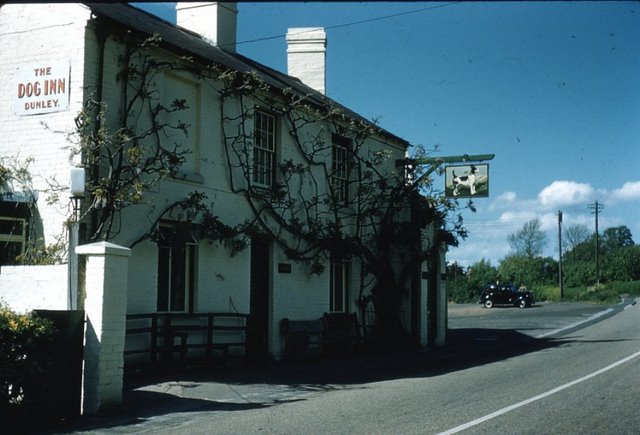
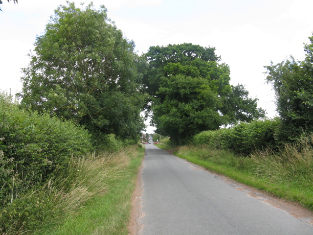
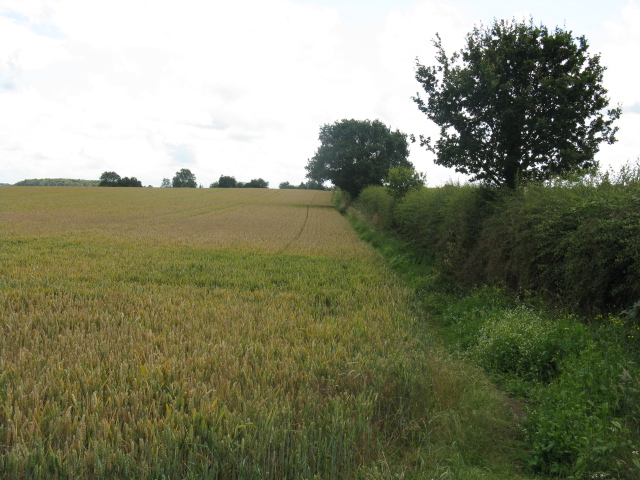
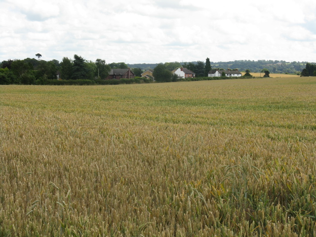
Half Crown Wood Images

Images are sourced within 2km of 52.329801/-2.2875843 or Grid Reference SO8070. Thanks to Geograph Open Source API. All images are credited.

The Dog, Dunley
The Dog, Dunley
Road junction in Dunley House on the corner by a road junction in Dunley.
Road junction in Dunley
House on the corner by a road junction in Dunley.
Oak tree in an arable field Oak tree in an arable field between Astely Cross and Dunley.
Oak tree in an arable field
Oak tree in an arable field between Astely Cross and Dunley.
The Dog Inn, Dunley Public house along the A451.
The Dog Inn, Dunley
Public house along the A451.
Redhouse Lane junction in Dunley
Dunley Road towards Areley Kings
View north towards Areley Wood
The Dog Inn, Dunley This is the pub shown on the OS Map beside the Stourport - Witley road in the SE corner of the square.
The Dog Inn, Dunley
This is the pub shown on the OS Map beside the Stourport - Witley road in the SE corner of the square.
New Barns Farm The old farmhouse is on the right and the barns, now converted into <a href="https://www.geograph.org.uk/photo/218662">SO7969 : The Steadings</a> can be seen in the distance.  Behind the photographer the urban development of <a href="https://www.geograph.org.uk/photo/218636">SO7969 : Edge of Areley Kings</a> and Stourport and then much of the West Midlands commences.
New Barns Farm
The old farmhouse is on the right and the barns, now converted into SO7969 : The Steadings can be seen in the distance. Behind the photographer the urban development of SO7969 : Edge of Areley Kings and Stourport and then much of the West Midlands commences.
Edge of Areley Kings Looking the other way from <a href="https://www.geograph.org.uk/photo/218563">SO7969 : New Barns Farm</a> towards the edge of the Areley Kings area of Stourport.
Edge of Areley Kings
Looking the other way from SO7969 : New Barns Farm towards the edge of the Areley Kings area of Stourport.
The Steadings The converted barns at New Barns Farm on the edge of Stourport-on-Severn. These are the barns just visible from near <a href="https://www.geograph.org.uk/photo/218563">SO7969 : New Barns Farm</a> farmhouse.
The Steadings
The converted barns at New Barns Farm on the edge of Stourport-on-Severn. These are the barns just visible from near SO7969 : New Barns Farm farmhouse.
Heightington Lane junction, Dunley
The Dog Inn, Dunley A more recent image can be seen here <a href="https://www.geograph.org.uk/photo/218558">SO7869 : The Dog Inn, Dunley</a>.
The Dog Inn, Dunley
A more recent image can be seen here SO7869 : The Dog Inn, Dunley.
Straight Lane To Astley Cross
Footpath South
Footpath South
Field Near Oakhampton
The Dog Inn, Dunley, Worcestershire
Fishing lake at Larford Farm This is the southern end of a large fishing lake at Larford Farm. Below the dark bank in the background is the River Severn
Fishing lake at Larford Farm
This is the southern end of a large fishing lake at Larford Farm. Below the dark bank in the background is the River Severn
Show me another place!

Half Crown Wood is located at Grid Ref: SO8070 (Lat: 52.329801, Lng: -2.2875843)

Administrative County: Worcestershire

District: Wyre Forest

Police Authority: West Mercia

What 3 Words

///pillows.recapture.formation. Near Stourport-on-Severn, Worcestershire

Related Wikis

Areley Kings

Areley Kings is a village on the River Severn in the Wyre District of Worcestershire, England. It is 10 miles north of Worcester and south of Stourport...

Astley Cross

Astley Cross is a village in Worcestershire, England, located on the outskirts of Stourport-on-Severn. The village lies 1 mile (1.6 km) south of the centre...

Stourport Swifts F.C.

Stourport Swifts Football Club are a football team from Stourport-on-Severn, and one of the oldest non-league teams in the country. The Swifts currently...

Droitwich Spa F.C.

Droitwich Spa Football Club is a football club representing the town of Droitwich Spa, Worcestershire, England. They are currently members of the Midland...

Stourport Boat Club

Stourport Boat Club is a rowing club on the River Severn, based at the Riverside, Dunley Road, Stourport-on-Severn, Worcestershire. == History == The club...

Areley Hall

Areley Hall is a Grade II listed country house near Areley Kings in Stourport-on-Severn, Worcestershire, England. It is not to be confused with nearby...

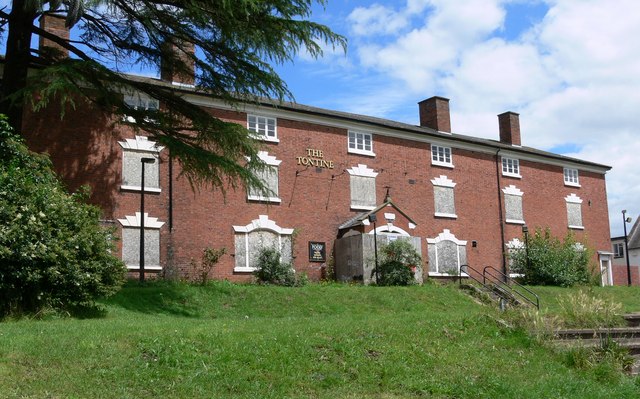
Tontine Buildings, Stourport

The Tontine Buildings is a former hotel in Stourport-on-Severn, Worcestershire, built in the late 18th century by the Staffordshire and Worcestershire...

River Stour, Worcestershire

The Stour (, rhymes with "flour") is a river flowing through the counties of Worcestershire, the West Midlands and Staffordshire in the West Midlands region...

Nearby Amenities

Located within 500m of 52.329801,-2.2875843
Bus Stop
Princess Way
Bus: yes
Naptan AtcoCode: 2000G045100
Naptan Bearing: NE
Naptan CommonName: Princess Way
Naptan Crossing: Princess Way
Naptan Indicator: adj
Naptan NaptanCode: wocgjdma
Naptan PlusbusZoneRef: KDRMNST
Naptan Street: Redstone Lane
Naptan Verified: no
Public Transport: platform
Source: naptan_import
Lat/Long: 52.3260414/-2.2886317
Bus Stop
Layamon Walk
Bus: yes
Naptan AtcoCode: 2000G045101
Naptan Bearing: SW
Naptan CommonName: Layamon Walk
Naptan Indicator: Westbound
Naptan NaptanCode: wocgjdmd
Naptan PlusbusZoneRef: KDRMNST
Naptan Street: Layamon Walk
Naptan Verified: no
Public Transport: platform
Source: naptan_import
Lat/Long: 52.3304867/-2.2858218
Bus Stop
Woodhampton Close
Bus: yes
Naptan AtcoCode: 2000G045102
Naptan Bearing: E
Naptan CommonName: Woodhampton Close
Naptan Crossing: Woodhampton Close
Naptan Indicator: opp
Naptan NaptanCode: wocgjdmg
Naptan PlusbusZoneRef: KDRMNST
Naptan Street: Redstone Lane
Naptan Verified: no
Public Transport: platform
Source: naptan_import
Lat/Long: 52.3266131/-2.2852248
Bus Stop
Hanstone Road
Bus: yes
Naptan AtcoCode: 2000G045106
Naptan Bearing: N
Naptan BusStopType: CUS
Naptan CommonName: Hanstone Road
Naptan Indicator: Northbound
Naptan NaptanCode: wocgagdw
Naptan PlusbusZoneRef: KDRMNST
Naptan Street: Hanstone Road
Naptan Verified: no
Public Transport: platform
Source: naptan_import
Lat/Long: 52.3274124/-2.281884
Bus Stop
Queens Road
Bus: yes
Naptan AtcoCode: 2000G045107
Naptan Bearing: N
Naptan CommonName: Queens Road
Naptan Crossing: Queens
Naptan Indicator: adj
Naptan NaptanCode: wocgagja
Naptan PlusbusZoneRef: KDRMNST
Naptan Street: Hanstone Road
Naptan Verified: no
Public Transport: platform
Source: naptan_import
Lat/Long: 52.3292654/-2.2843391
Bus Stop
Post Office
Bus: yes
Naptan AtcoCode: 2000G046000
Naptan Bearing: N
Naptan CommonName: Post Office
Naptan Indicator: Opp
Naptan Landmark: Post Office
Naptan NaptanCode: wocgjwaw
Naptan PlusbusZoneRef: KDRMNST
Naptan Street: Areley Common
Naptan Verified: no
Public Transport: platform
Source: naptan_import
Lat/Long: 52.3271253/-2.2927006
Bus Stop
Beach Road
Bus: yes
Naptan AtcoCode: 2000G046003
Naptan Bearing: N
Naptan CommonName: Beach Road
Naptan Crossing: Beach Road
Naptan Indicator: opp
Naptan NaptanCode: wocgjwdj
Naptan PlusbusZoneRef: KDRMNST
Naptan Street: Areley Common
Naptan Verified: no
Public Transport: platform
Source: naptan_import
Lat/Long: 52.329704/-2.2920043
Bus Stop
Queens Road
Bus: yes
Naptan AtcoCode: 2000G046008
Naptan Bearing: SE
Naptan CommonName: Queens Road
Naptan Crossing: Queens Road
Naptan Indicator: opp
Naptan NaptanCode: wocgjwdt
Naptan PlusbusZoneRef: KDRMNST
Naptan Street: Hanstone Road
Naptan Verified: no
Public Transport: platform
Source: naptan_import
Lat/Long: 52.3289858/-2.2839698
Bus Stop
Layamon Walk
Bus: yes
Naptan AtcoCode: 2000G581519
Naptan Bearing: E
Naptan CommonName: Layamon Walk
Naptan Indicator: Eastbound
Naptan NaptanCode: wocgagpa
Naptan PlusbusZoneRef: KDRMNST
Naptan Street: Layamon Walk
Naptan Verified: no
Public Transport: platform
Source: naptan_import
Lat/Long: 52.3303636/-2.2865832
Bus Stop
Hanstone Road
Bus: yes
Naptan AtcoCode: 2000G581520
Naptan Bearing: S
Naptan CommonName: Hanstone Road
Naptan Indicator: Southbound
Naptan NaptanCode: wocgagpd
Naptan PlusbusZoneRef: KDRMNST
Naptan Street: Hanstone Road
Naptan Verified: no
Public Transport: platform
Source: naptan_import
Lat/Long: 52.3279468/-2.2818533
Bus Stop
Wenlock Way
Bus: yes
Naptan AtcoCode: 2000G581521
Naptan Bearing: W
Naptan CommonName: Wenlock Way
Naptan Crossing: Wenlock Way
Naptan Indicator: opp
Naptan NaptanCode: wocgagpg
Naptan PlusbusZoneRef: KDRMNST
Naptan Street: Abberley Avenue
Naptan Verified: no
Public Transport: platform
Source: naptan_import
Lat/Long: 52.3304707/-2.2933751
Bus Stop
Princess Way
Bus: yes
Naptan AtcoCode: 2000G663015
Naptan Bearing: SW
Naptan CommonName: Princess Way
Naptan Crossing: Princess Way
Naptan Indicator: opp
Naptan NaptanCode: wocgamwa
Naptan PlusbusZoneRef: KDRMNST
Naptan Street: Redstone Lane
Naptan Verified: no
Public Transport: platform
Source: naptan_import
Lat/Long: 52.3259504/-2.2886769
Bus Stop
Woodhampton Close
Bus: yes
Naptan AtcoCode: 2000G745102
Naptan Bearing: W
Naptan BusStopType: CUS
Naptan CommonName: Woodhampton Close
Naptan Crossing: Woodhampton Close
Naptan Indicator: adj
Naptan NaptanCode: wocgpawp
Naptan PlusbusZoneRef: KDRMNST
Naptan Street: Redstone Lane
Naptan Verified: no
Public Transport: platform
Source: naptan_import
Lat/Long: 52.3267186/-2.2849784
Mini Roundabout
Lat/Long: 52.3301995/-2.2869239
Taylors Newsagents
Shop: newsagent
Lat/Long: 52.3286775/-2.2920697
Areley Kings Pharmacy
Shop: chemist
Lat/Long: 52.3277991/-2.2926349
Post Office
Areley Kings Post Office
Addr City: Stourport on Severn
Addr Housenumber: 63
Addr Postcode: DY13 0NG
Addr Street: Areley Common
Brand: Post Office
Brand Wikidata: Q1783168
Opening Hours: Mo-Fr 08:30-17:30; Sa 09:00-13:00
Operator: Londis
Ref Pol Id: 8694
Website: https://www.postoffice.co.uk/branch-finder/2282089/areley-kings
Lat/Long: 52.3273335/-2.2922048
Crossing
Crossing: uncontrolled
Crossing Ref: zebra
Supervised: no
Tactile Paving: yes
Lat/Long: 52.3289494/-2.2861359
Leisure: playground
Lat/Long: 52.3297131/-2.2830661
Noexit: yes
Lat/Long: 52.3314288/-2.2930338
Bench
Backrest: yes
Lat/Long: 52.3282618/-2.2862111
Bus Stop
Bus: yes
Naptan AtcoCode: 2000G581514
Naptan Bearing: SW
Naptan CommonName: Dunley Road
Naptan Crossing: Areley Common
Naptan Indicator: Adj
Naptan NaptanCode: wocgagmp
Naptan PlusbusZoneRef: KDRMNST
Naptan Street: Dunley Road
Naptan Verified: no
Public Transport: platform
Source: naptan_import
Lat/Long: 52.3320755/-2.2889831
Bench
Backrest: yes
Lat/Long: 52.3325047/-2.2894411
Noexit: yes
Lat/Long: 52.3261515/-2.2843571
Noexit: yes
Lat/Long: 52.3261976/-2.2840823
The Walshes
Is In: Worcestershire
Place: suburb
Lat/Long: 52.3286065/-2.2850803
Bench
Backrest: yes
Lat/Long: 52.329387/-2.2930313
Bench
Backrest: yes
Lat/Long: 52.3293839/-2.2929321
Bench
Backrest: yes
Lat/Long: 52.3291282/-2.2934898
Leisure: picnic_table
Lat/Long: 52.3291389/-2.2933745
Bench
Backrest: yes
Lat/Long: 52.3291979/-2.2932772
Bus Stop
Post Office
Bus: yes
Naptan AtcoCode: 2000G046001
Naptan Bearing: S
Naptan CommonName: Post Office
Naptan Indicator: adj
Naptan Landmark: Post Office
Naptan NaptanCode: wocgjwda
Naptan PlusbusZoneRef: KDRMNST
Naptan Street: Areley Common
Naptan Verified: no
Public Transport: platform
Source: naptan_import
Lat/Long: 52.3271748/-2.2925524
Bus Stop
Bus: yes
Public Transport: platform
Lat/Long: 52.3329921/-2.2883643
Crossing
Crossing: uncontrolled
Crossing Ref: zebra
Lat/Long: 52.3286071/-2.2922944
Crossing
Crossing: marked
Tactile Paving: yes
Traffic Calming: table
Lat/Long: 52.3276137/-2.2869771
Generator Method: photovoltaic
Generator Output Electricity: yes
Generator Source: solar
Generator Type: solar_photovoltaic_panel
Location: roof
Power: generator
Lat/Long: 52.3277485/-2.2873664
Generator Method: photovoltaic
Generator Output Electricity: yes
Generator Source: solar
Generator Type: solar_photovoltaic_panel
Location: roof
Power: generator
Lat/Long: 52.3275157/-2.2864223
Generator Method: photovoltaic
Generator Output Electricity: yes
Generator Source: solar
Generator Type: solar_photovoltaic_panel
Location: roof
Power: generator
Lat/Long: 52.3275633/-2.2861755
Generator Method: photovoltaic
Generator Output Electricity: yes
Generator Source: solar
Generator Type: solar_photovoltaic_panel
Location: roof
Power: generator
Lat/Long: 52.3278403/-2.289378
Generator Method: photovoltaic
Generator Output Electricity: yes
Generator Source: solar
Generator Type: solar_photovoltaic_panel
Location: roof
Power: generator
Lat/Long: 52.3296057/-2.290813
Generator Method: photovoltaic
Generator Output Electricity: yes
Generator Source: solar
Generator Type: solar_photovoltaic_panel
Location: roof
Power: generator
Lat/Long: 52.3304966/-2.2903986
Generator Method: photovoltaic
Generator Output Electricity: yes
Generator Source: solar
Generator Type: solar_photovoltaic_panel
Location: roof
Power: generator
Lat/Long: 52.3322709/-2.2928247
Generator Method: photovoltaic
Generator Output Electricity: yes
Generator Source: solar
Generator Type: solar_photovoltaic_panel
Location: roof
Power: generator
Lat/Long: 52.3319939/-2.2937447
Generator Method: photovoltaic
Generator Output Electricity: yes
Generator Source: solar
Generator Type: solar_photovoltaic_panel
Location: roof
Power: generator
Lat/Long: 52.327996/-2.2942328
Generator Method: photovoltaic
Generator Output Electricity: yes
Generator Source: solar
Generator Type: solar_photovoltaic_panel
Location: roof
Power: generator
Lat/Long: 52.3299565/-2.2910035
Generator Method: photovoltaic
Generator Output Electricity: yes
Generator Source: solar
Generator Type: solar_photovoltaic_panel
Location: roof
Power: generator
Lat/Long: 52.3292451/-2.2932994
Select & Save
Shop: convenience
Lat/Long: 52.3290734/-2.2852224
Bus Stop
Layamon Walk
Bus: yes
Naptan AtcoCode: 2000G581515
Naptan Bearing: S
Naptan CommonName: Layamon Walk
Naptan Crossing: Layamon Walk
Naptan Indicator: Adj
Naptan NaptanCode: wocgagmt
Naptan PlusbusZoneRef: KDRMNST
Naptan Street: Hermitage Way
Naptan Verified: no
Public Transport: platform
Source: naptan_import
Lat/Long: 52.3318414/-2.2881446
Generator Method: photovoltaic
Generator Output Electricity: yes
Generator Source: solar
Generator Type: solar_photovoltaic_panel
Location: roof
Power: generator
Lat/Long: 52.3304958/-2.2904697
Generator Method: photovoltaic
Generator Output Electricity: yes
Generator Source: solar
Generator Type: solar_photovoltaic_panel
Location: roof
Power: generator
Lat/Long: 52.3308383/-2.290628
Generator Method: photovoltaic
Generator Output Electricity: yes
Generator Source: solar
Generator Type: solar_photovoltaic_panel
Location: roof
Power: generator
Lat/Long: 52.3326298/-2.2910035
Generator Method: photovoltaic
Generator Output Electricity: yes
Generator Source: solar
Generator Type: solar_photovoltaic_panel
Location: roof
Power: generator
Lat/Long: 52.3316661/-2.2837266
Generator Method: photovoltaic
Generator Output Electricity: yes
Generator Source: solar
Generator Type: solar_photovoltaic_panel
Location: roof
Power: generator
Lat/Long: 52.3325577/-2.2848398
Generator Method: photovoltaic
Generator Output Electricity: yes
Generator Source: solar
Generator Type: solar_photovoltaic_panel
Location: roof
Power: generator
Lat/Long: 52.3288533/-2.2848585
Generator Method: photovoltaic
Generator Output Electricity: yes
Generator Source: solar
Generator Type: solar_photovoltaic_panel
Location: roof
Power: generator
Lat/Long: 52.3293025/-2.2883722
Generator Method: photovoltaic
Generator Output Electricity: yes
Generator Source: solar
Generator Type: solar_photovoltaic_panel
Location: roof
Power: generator
Lat/Long: 52.3287074/-2.2880343
Generator Method: photovoltaic
Generator Output Electricity: yes
Generator Source: solar
Generator Type: solar_photovoltaic_panel
Location: roof
Power: generator
Lat/Long: 52.3296516/-2.2915936
Generator Method: photovoltaic
Generator Output Electricity: yes
Generator Source: solar
Generator Type: solar_photovoltaic_panel
Location: roof
Power: generator
Lat/Long: 52.3296598/-2.2911081
Bench
Lat/Long: 52.3290499/-2.2934084
Bench
Lat/Long: 52.3285339/-2.2942132
Bench
Lat/Long: 52.3284624/-2.2935113
Playground: structure
Lat/Long: 52.3280478/-2.2862405
Post Box
Lat/Long: 52.326676/-2.2852579
Advertising: board
Lat/Long: 52.3293433/-2.2921684
Bench
Lat/Long: 52.3274228/-2.2831235
The data included in this document is from www.openstreetmap.org. The data is made available under ODbL.

Have you been to Half Crown Wood?

Leave your review of Half Crown Wood below (or comments, questions and feedback).