Kit Wood

Wood, Forest in Yorkshire Richmondshire

England

Kit Wood

Track through West Wood
Track through West Wood Credit: Mick Garratt

Kit Wood is a picturesque forest located in Yorkshire, England. Covering an area of approximately 100 acres, it is a popular destination for nature lovers and outdoor enthusiasts. The wood is characterized by its dense and diverse vegetation, including a variety of native trees such as oak, beech, and birch, which create a captivating and tranquil atmosphere.

Walking through Kit Wood, visitors can enjoy the sights and sounds of nature at its finest. The forest floor is carpeted with a rich layer of moss and wildflowers, creating a vibrant and colorful landscape. The wood is also home to a wide range of wildlife, including squirrels, rabbits, and a variety of bird species, making it an ideal spot for birdwatching and wildlife photography.

The forest offers several well-marked walking trails, allowing visitors to explore its beauty at their own pace. These trails vary in difficulty, catering to both casual strollers and more experienced hikers. Along the way, there are designated picnic areas, providing the perfect opportunity to rest and enjoy a packed lunch amidst the serene surroundings.

Kit Wood is also a popular spot for educational and recreational activities. It hosts guided nature walks, where knowledgeable guides provide fascinating insights into the local flora and fauna. Additionally, the forest has designated areas for camping and outdoor games, making it an ideal destination for families and groups looking for a fun-filled day out in nature.

Overall, Kit Wood is a captivating forest that offers a peaceful escape from the hustle and bustle of everyday life. Its natural beauty, diverse wildlife, and recreational opportunities make it a must-visit destination for anyone seeking a tranquil and immersive experience in Yorkshire.

If you have any feedback on the listing, please let us know in the comments section below.
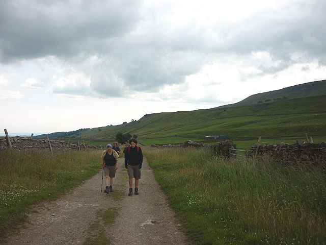
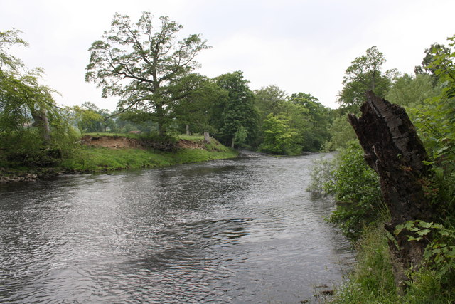
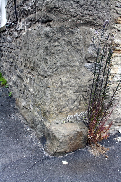
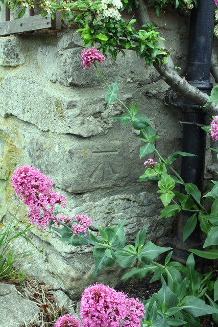
Kit Wood Images

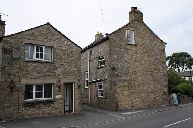
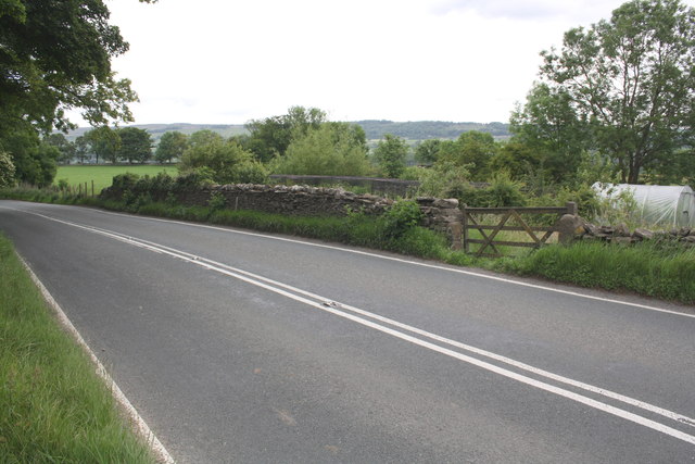
Images are sourced within 2km of 54.288485/-1.9089636 or Grid Reference SE0688. Thanks to Geograph Open Source API. All images are credited.

Track through West Wood
Benchmark on Langthwaite Barn Ordnance Survey cut mark benchmark described on the Bench Mark Database at <span class="nowrap"><a title="http://www.bench-marks.org.uk/bm38516" rel="nofollow ugc noopener" href="http://www.bench-marks.org.uk/bm38516">Link</a><img style="margin-left:2px;" alt="External link" title="External link - shift click to open in new window" src="https://s1.geograph.org.uk/img/external.png" width="10" height="10"/></span>
Benchmark on Langthwaite Barn
Ordnance Survey cut mark benchmark described on the Bench Mark Database at LinkExternal link
Descending north off Penhill An engineered path descends to the east of Black Scar with views to the lower part of Wensleydale around West Witton and Leyburn.
Descending north off Penhill
An engineered path descends to the east of Black Scar with views to the lower part of Wensleydale around West Witton and Leyburn.
Spoil heap, Penhill Quarry (disused) There is a long line of tips below the north flank of Penhill. The rock is a kind of fine grained sandstone that splits into thin, evenly bedded flags probably once used for roofing and building.
Spoil heap, Penhill Quarry (disused)
There is a long line of tips below the north flank of Penhill. The rock is a kind of fine grained sandstone that splits into thin, evenly bedded flags probably once used for roofing and building.
Sheep on West Witton Moor above High Lane The path from Black Crags descends through an extensive complex of grazing pastures above lower Wensleydale.
Sheep on West Witton Moor above High Lane
The path from Black Crags descends through an extensive complex of grazing pastures above lower Wensleydale.
High Lane at Gunnery Plain The steep flanks of Penhill high on the right.
High Lane at Gunnery Plain
The steep flanks of Penhill high on the right.
River Ure from its north bank
Benchmark dating from 1845 on house 'East View' Ordnance Survey cut mark benchmark described on the Bench Mark Database at <span class="nowrap"><a title="http://www.bench-marks.org.uk/bm25470" rel="nofollow ugc noopener" href="http://www.bench-marks.org.uk/bm25470">Link</a><img style="margin-left:2px;" alt="External link" title="External link - shift click to open in new window" src="https://s1.geograph.org.uk/img/external.png" width="10" height="10"/></span>
Benchmark dating from 1845 on house 'East View'
Ordnance Survey cut mark benchmark described on the Bench Mark Database at LinkExternal link
Banchmark on 'Pen Cottage' Ordnance Survey cut mark benchmark described on the Bench Mark Database at <span class="nowrap"><a title="http://www.bench-marks.org.uk/bm38730" rel="nofollow ugc noopener" href="http://www.bench-marks.org.uk/bm38730">Link</a><img style="margin-left:2px;" alt="External link" title="External link - shift click to open in new window" src="https://s1.geograph.org.uk/img/external.png" width="10" height="10"/></span>
Banchmark on 'Pen Cottage'
Ordnance Survey cut mark benchmark described on the Bench Mark Database at LinkExternal link
Houses beside the main road through West Witton The house on the right carries an OS benchmark cut on the 1845 1GL survey line from Kendal to Thirsk <a href="https://www.geograph.org.uk/photo/2598611">SE0588 : Benchmark dating from 1845 on house 'East View'</a>
Houses beside the main road through West Witton
The house on the right carries an OS benchmark cut on the 1845 1GL survey line from Kendal to Thirsk SE0588 : Benchmark dating from 1845 on house 'East View'
Benchmark on St Bartholomew's Church Ordnance Survey 1GL bolt benchmark described on the Bench Mark Database at <span class="nowrap"><a title="http://www.bench-marks.org.uk/bm25262" rel="nofollow ugc noopener" href="http://www.bench-marks.org.uk/bm25262">Link</a><img style="margin-left:2px;" alt="External link" title="External link - shift click to open in new window" src="https://s1.geograph.org.uk/img/external.png" width="10" height="10"/></span>
Benchmark on St Bartholomew's Church
Ordnance Survey 1GL bolt benchmark described on the Bench Mark Database at LinkExternal link
St Bartholomews Church and gravestones
New Wood behind a dry stone wall There is an OS benchmark on the base stone to the left of the blue bag, see <span class="nowrap"><a title="http://www.bench-marks.org.uk/bm38767" rel="nofollow ugc noopener" href="http://www.bench-marks.org.uk/bm38767">Link</a><img style="margin-left:2px;" alt="External link" title="External link - shift click to open in new window" src="https://s1.geograph.org.uk/img/external.png" width="10" height="10"/></span>
New Wood behind a dry stone wall
There is an OS benchmark on the base stone to the left of the blue bag, see LinkExternal link
Tree with hollow trunk beside footpath
Benchmark on the old School House Ordnance Survey flush bracket with serial number S8100 described on the Bench Mark Database at <span class="nowrap"><a title="http://www.bench-marks.org.uk/bm11795" rel="nofollow ugc noopener" href="http://www.bench-marks.org.uk/bm11795">Link</a><img style="margin-left:2px;" alt="External link" title="External link - shift click to open in new window" src="https://s1.geograph.org.uk/img/external.png" width="10" height="10"/></span>
Benchmark on the old School House
Ordnance Survey flush bracket with serial number S8100 described on the Bench Mark Database at LinkExternal link
Gatepost with 1845 benchmark at Oaktree Farm Ordnance Survey cut mark benchmark described on the Bench Mark Database at <span class="nowrap"><a title="http://www.bench-marks.org.uk/bm25469" rel="nofollow ugc noopener" href="http://www.bench-marks.org.uk/bm25469">Link</a><img style="margin-left:2px;" alt="External link" title="External link - shift click to open in new window" src="https://s1.geograph.org.uk/img/external.png" width="10" height="10"/></span>
Gatepost with 1845 benchmark at Oaktree Farm
Ordnance Survey cut mark benchmark described on the Bench Mark Database at LinkExternal link
Looking across the A684 outside Oaktree Farm
Benchmark on gatepost on Patterham Lane Ordnance Survey cut mark benchmark described on the Bench Mark Database at <span class="nowrap"><a title="http://www.bench-marks.org.uk/bm38517" rel="nofollow ugc noopener" href="http://www.bench-marks.org.uk/bm38517">Link</a><img style="margin-left:2px;" alt="External link" title="External link - shift click to open in new window" src="https://s1.geograph.org.uk/img/external.png" width="10" height="10"/></span>
Benchmark on gatepost on Patterham Lane
Ordnance Survey cut mark benchmark described on the Bench Mark Database at LinkExternal link
Show me another place!

Kit Wood is located at Grid Ref: SE0688 (Lat: 54.288485, Lng: -1.9089636)

Division: North Riding

Administrative County: North Yorkshire

District: Richmondshire

Police Authority: North Yorkshire

What 3 Words

///wordplay.synthetic.tractor. Near Leyburn, North Yorkshire

Related Wikis

St Bartholomew's Church, West Witton

St Bartholomew's Church, West Witton is a Grade II listed parish church in the Church of England: 387  in West Witton, North Yorkshire. == History == The...

West Witton

West Witton is a village and civil parish in the Richmondshire district of North Yorkshire, England. Located in Wensleydale in the Yorkshire Dales it lies...

Swinithwaite

Swinithwaite is a hamlet in the Yorkshire Dales, North Yorkshire, England. It lies on the A684 road, 2 miles (3.2 km) miles east of Aysgarth.The hamlet...

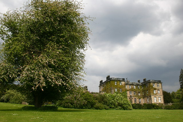
Bolton Hall, North Yorkshire

Bolton Hall is a country house near Preston-under-Scar, Richmondshire, North Yorkshire, England, in Wensleydale, some 3 miles (5 km) west of Leyburn. It...
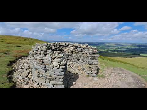
Penhill

Penhill (526 metres (1,726 ft) high at the trig point, 553 metres (1,814 ft) at Height of Hazely) is a prominent hill, 5.5 miles (9 km) south west of Leyburn...

Penhill Preceptory

Penhill Preceptory was a priory on the northern flanks of Penhill in Wensleydale, North Yorkshire, England, which functioned from about 1142 to 1308–12...

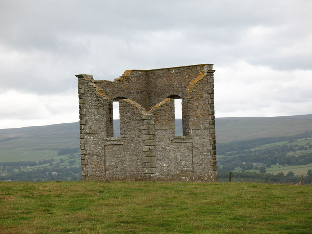
The Mount, North Yorkshire

The Mount, or Polly Peachum's Tower, is a hunting tower near Wensley and about a mile south-east of Bolton Hall, in North Yorkshire, England. It is a Grade...

St Mary's Church, Redmire

St Mary's Church, Redmire is a Grade II* listed parish church in the Church of England: 289  in Redmire, North Yorkshire. == History == The church dates...

Related Videos

Pen Hill

Walk up historic hill in North Yorkshire.

WEST WITTON: YORKSHIRE DALES

West Witton : Yorkshire Dales : TrustedHousesitters Dog Walking.

DOG SITTING: YORKSHIRE DALES : WEST WITTON:

Dog Walking : Yorkshire Dales : West Witton.

Coverdale and Wensleydale from east end of Height of Hazely part 2

It'd be nice if the camera's battery charge indicator had something to say other than "nearly flat."

Nearby Amenities

Located within 500m of 54.288485,-1.9089636
West Witton
Is In Country Code: GB
Is In County: North Yorkshire
Is In Historic County: Yorkshire
Is In Municipality: Richmondshire
Is In Valley: Wensleydale
Place: village
Wikidata: Q2117970
Wikipedia: en:West Witton
Lat/Long: 54.290931/-1.9090744
Ford: yes
Lat/Long: 54.284931/-1.9126344
Bus Stop
Lat/Long: 54.2913983/-1.9034688
Bus Stop
Lat/Long: 54.291317/-1.9090156
Bus Stop
Bus: yes
Public Transport: platform
Lat/Long: 54.291248/-1.9130067
Public Transport: stop_position
Lat/Long: 54.291219/-1.9131303
Post Box
Image: https://www.geograph.org.uk/photo/5415749
Operator: Royal Mail
Post Box Design: type_n
Post Box Type: lamp
Ref: DL8 168
Source: survey
Lat/Long: 54.2912663/-1.9096984
Telephone
Booth: KX100
Covered: booth
Source: survey
Lat/Long: 54.2912648/-1.9097312
Barrier: entrance
Lat/Long: 54.2912219/-1.9108651
Bench
Lat/Long: 54.291228/-1.9107404
Bench
Lat/Long: 54.2910334/-1.9106005
Ford: yes
Lat/Long: 54.2849032/-1.910687
Post Box
Image: https://www.geograph.org.uk/photo/5415725
Ref: DL8 144
Source: survey
Lat/Long: 54.2913854/-1.9037529
Power: pole
Lat/Long: 54.2896997/-1.902684
Power: pole
Lat/Long: 54.2896136/-1.9042075
Power: pole
Lat/Long: 54.2895666/-1.9050819
Power: pole
Lat/Long: 54.2895306/-1.9057551
Power: pole
Lat/Long: 54.2894507/-1.9072947
Power: pole
Lat/Long: 54.2894695/-1.9083864
Power: pole
Lat/Long: 54.2894961/-1.9096872
Power: pole
Lat/Long: 54.2895181/-1.9111356
Power: pole
Lat/Long: 54.2897545/-1.9125706
Power: pole
Lat/Long: 54.2902797/-1.9144119
Power: pole
Lat/Long: 54.2905028/-1.915175
Generator Method: photovoltaic
Generator Output Electricity: yes
Generator Source: solar
Generator Type: solar_photovoltaic_panel
Power: generator
Lat/Long: 54.2909862/-1.9119601
Generator Method: photovoltaic
Generator Output Electricity: yes
Generator Source: solar
Generator Type: solar_photovoltaic_panel
Power: generator
Lat/Long: 54.2907553/-1.9093596
Historic: milestone
Image: https://www.geograph.org.uk/photo/5571483
Wikidata: Q26423862
Lat/Long: 54.2912903/-1.9124547
Power: substation
Lat/Long: 54.2913234/-1.9128275
Parking
Access: customers
Parking: surface
Lat/Long: 54.290924/-1.9075612
He brak' his knee
Artwork Type: mosaic
Note: No. 3 out of 6 mosaics on the Bartle Trail
Tourism: artwork
Lat/Long: 54.2866848/-1.9055652
Barrier: entrance
Lat/Long: 54.2867735/-1.909093
Shelter
Shelter Type: weather_shelter
Lat/Long: 54.2910589/-1.9106998
Bench
Lat/Long: 54.2912251/-1.9105576
Withywood Stores
Addr City: Leyburn
Addr Postcode: DL8 4LP
Addr Street: Main Street
Addr Suburb: West Witton
Fhrs Id: 46026
Note: Sign says Arkwright's, but this is not name of shop
Shop: convenience
Source Addr: website
Website: http://www.withywoodstores.co.uk/
Lat/Long: 54.2912347/-1.9091052
Defibrillator
Access: yes
Emergency: defibrillator
Lat/Long: 54.2912744/-1.9090215
Ford: yes
Lat/Long: 54.2848175/-1.9107123
Generator Method: photovoltaic
Generator Output Electricity: yes
Generator Source: solar
Generator Type: solar_photovoltaic_panel
Power: generator
Lat/Long: 54.2918709/-1.9108335
The data included in this document is from www.openstreetmap.org. The data is made available under ODbL.

Have you been to Kit Wood?

Leave your review of Kit Wood below (or comments, questions and feedback).