Birch Plantation

Wood, Forest in Durham

England

Birch Plantation

Forest clearing at the Grove In Hamsterley Forest.
Forest clearing at the Grove Credit: Oliver Dixon

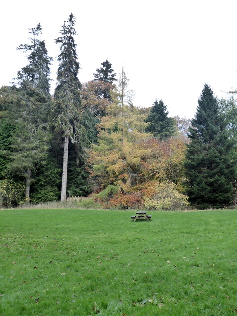
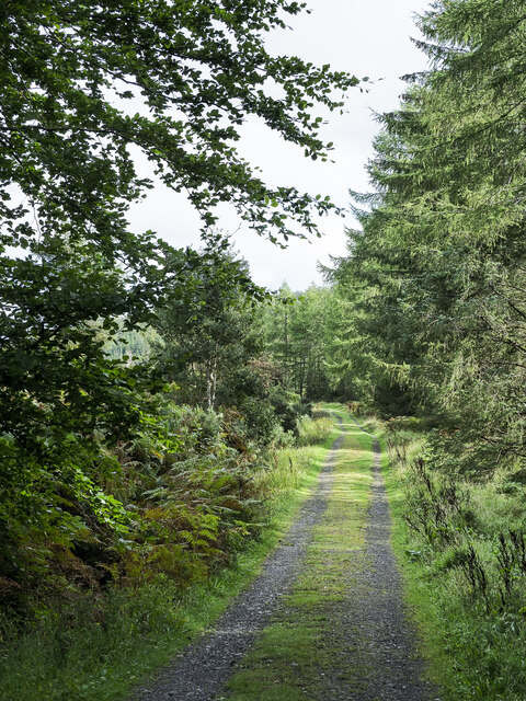
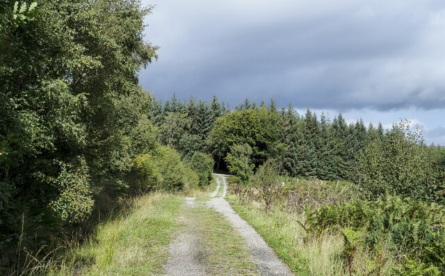
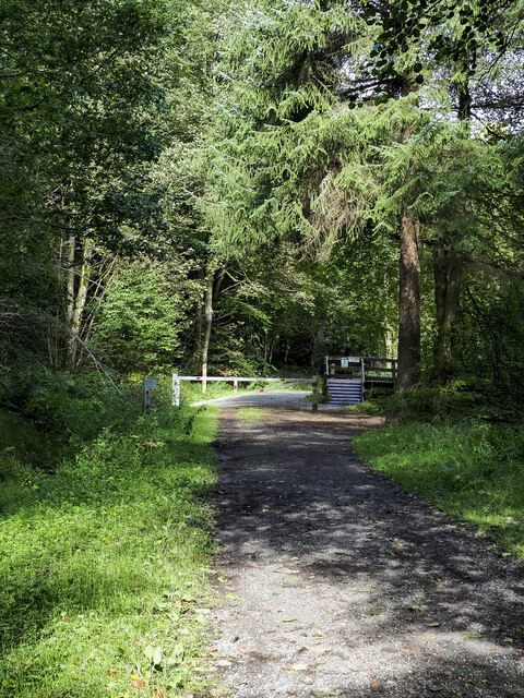
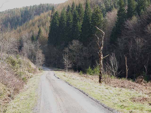
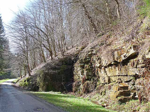
Birch Plantation, located in Durham, is a picturesque woodland area known for its abundant birch trees. Spanning across a vast area, this plantation offers visitors a serene and tranquil environment, perfect for nature enthusiasts and those seeking solace in the great outdoors.

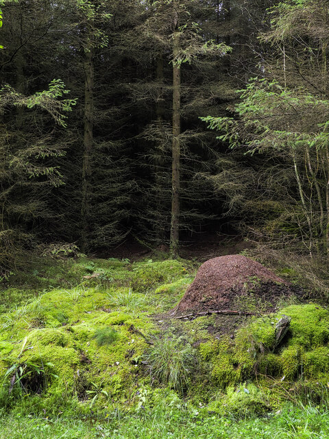
The plantation is characterized by its dense forest cover, primarily consisting of silver birch trees. These slender and elegant trees create a stunning landscape, especially during the spring and autumn seasons when the leaves turn vibrant shades of yellow and gold. The plantation is an ideal spot for photographers, as the play of light through the trees provides ample opportunities for capturing breathtaking shots.

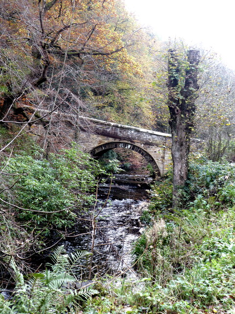
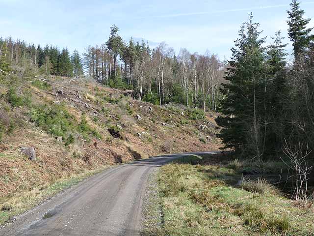
The woodland is home to a diverse range of flora and fauna, making it a haven for wildlife enthusiasts. Visitors may encounter various bird species, including woodpeckers, finches, and owls, while the forest floor is dotted with ferns, wildflowers, and mushrooms. Nature trails wind through the plantation, allowing visitors to explore the area while immersing themselves in the natural beauty that surrounds them.

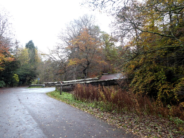
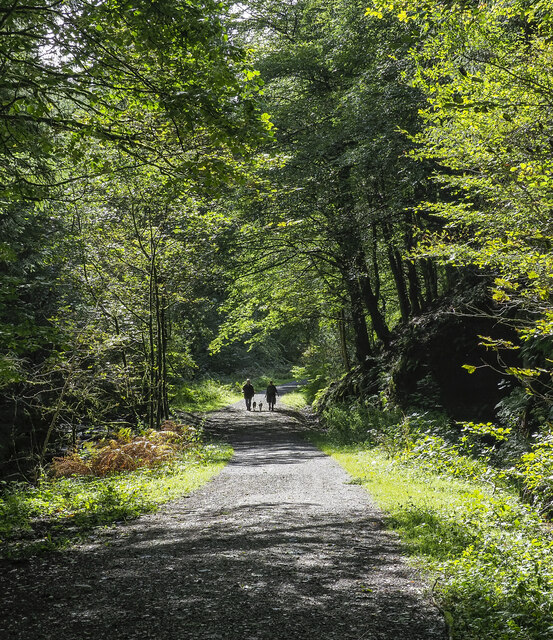
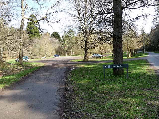
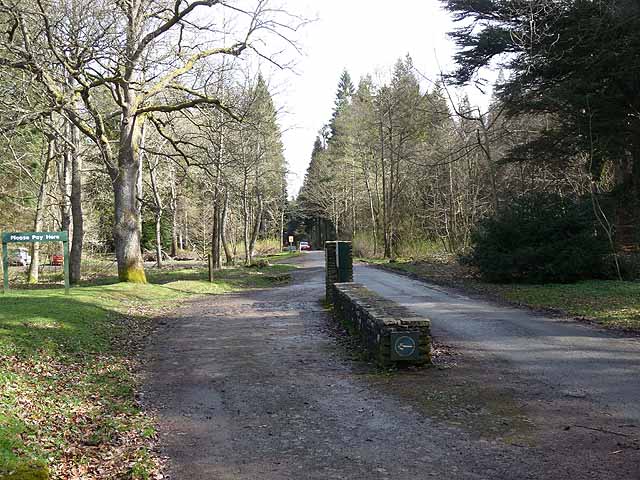
Birch Plantation also offers recreational activities such as hiking, picnicking, and camping. With several well-marked trails of varying difficulty levels, hikers of all abilities can enjoy the stunning scenery and the peaceful ambiance. Families and friends can gather for picnics in designated areas, while camping facilities allow visitors to extend their stay and fully immerse themselves in the woodland experience.

In conclusion, Birch Plantation in Durham is a captivating woodland area that showcases the beauty of birch trees and provides a haven for those seeking tranquility and a connection with nature. With its diverse flora and fauna, scenic trails, and recreational activities, this plantation offers an unforgettable experience for visitors of all ages.

If you have any feedback on the listing, please let us know in the comments section below.

Birch Plantation Images

Images are sourced within 2km of 54.664219/-1.9081744 or Grid Reference NZ0629. Thanks to Geograph Open Source API. All images are credited.

Forest clearing at the Grove In Hamsterley Forest.
Forest clearing at the Grove
In Hamsterley Forest.
Bridge over the Spurlswood Beck The bridge carries the road which links the Grove to Windy Bank Road.
Bridge over the Spurlswood Beck
The bridge carries the road which links the Grove to Windy Bank Road.
Bridge over Spurlswood Beck The bridge carries the road which links the Grove up to Windy Bank Road.
Bridge over Spurlswood Beck
The bridge carries the road which links the Grove up to Windy Bank Road.
The Grove Large house in the depths of Hamsterley Forest. Until recently operating as a bed and breakfast business.
The Grove
Large house in the depths of Hamsterley Forest. Until recently operating as a bed and breakfast business.
Opening in forest with wood ant nest The ant nest in the foreground is one of a number of similar ones located in relatively open spaces  along the uphill side of a forest road, which is also the route of a named path in Hamsterley Forest: the Spurlswood Walk.
Opening in forest with wood ant nest
The ant nest in the foreground is one of a number of similar ones located in relatively open spaces along the uphill side of a forest road, which is also the route of a named path in Hamsterley Forest: the Spurlswood Walk.
The Grove Until 1927 The Grove was the property of the Surtees family which also owned the surrounding estate until it was sold to the Forestry Commission which then developed Hamsterley Forest over the land. The house is currently (2023) in a number of separate apartments, some or all of which are available as holiday lets.
The Grove
Until 1927 The Grove was the property of the Surtees family which also owned the surrounding estate until it was sold to the Forestry Commission which then developed Hamsterley Forest over the land. The house is currently (2023) in a number of separate apartments, some or all of which are available as holiday lets.
People with dogs, approaching The forest road runs alongside Spurlswood Beck and is part of the route of the Spurlswood Walk in Hamsterley Forest. Once, the road was open to motorists (on payment of a toll), which even online OS maps still name as an 'Ornamental Drive' at the 1:25 000 scale. The road is now closed to private vehicles: perhaps the income from tolls failed to cover the maintenance costs.
People with dogs, approaching
The forest road runs alongside Spurlswood Beck and is part of the route of the Spurlswood Walk in Hamsterley Forest. Once, the road was open to motorists (on payment of a toll), which even online OS maps still name as an 'Ornamental Drive' at the 1:25 000 scale. The road is now closed to private vehicles: perhaps the income from tolls failed to cover the maintenance costs.
Gardens at The Grove The Grove and the Redford estate about it was the property of the Surtees family; it was sold in 1927 to the Forestry Commission. The house is currently (2023) divided into apartments. This garden is to the north of the house and appears to be more constructively cultivated than it was in  2011 - <a title="https://www.geograph.org.uk/photo/2388065" href="https://www.geograph.org.uk/photo/2388065">Link</a> .
Gardens at The Grove
The Grove and the Redford estate about it was the property of the Surtees family; it was sold in 1927 to the Forestry Commission. The house is currently (2023) divided into apartments. This garden is to the north of the house and appears to be more constructively cultivated than it was in 2011 - Link .
Forest road, part of the Spurlswood Walk The forest road appears to be a relatively 'low duty' affair. It's used as part of a named Hamsterley Forest path known as the Spurlswood Walk.
It's surely intended for less heavy traffic than another nearby road found almost a kilometre to the west - <a title="https://www.geograph.org.uk/photo/5707479" href="https://www.geograph.org.uk/photo/5707479">Link</a> .
Forest road, part of the Spurlswood Walk
The forest road appears to be a relatively 'low duty' affair. It's used as part of a named Hamsterley Forest path known as the Spurlswood Walk. It's surely intended for less heavy traffic than another nearby road found almost a kilometre to the west - Link .
Forest road approaching junction The road is part of a named pedestrian route in Hamsterley Forest, the Spurlswood Walk. The road to be joined is a much more robust affair, built to take heavy forestry traffic.
Forest road approaching junction
The road is part of a named pedestrian route in Hamsterley Forest, the Spurlswood Walk. The road to be joined is a much more robust affair, built to take heavy forestry traffic.
Barrier across forest road The road in Hamsterley Forest runs adjacent to Spurlswood Beck and is used in the named walking route, Spurlswood Walk.
The road used to be motorable by the public on payment of a toll. OS maps on line still name the way as a toll road and even as an 'Ornamental Drive', but motoring over it is now not allowed and the barrier prevents it.
Barrier across forest road
The road in Hamsterley Forest runs adjacent to Spurlswood Beck and is used in the named walking route, Spurlswood Walk. The road used to be motorable by the public on payment of a toll. OS maps on line still name the way as a toll road and even as an 'Ornamental Drive', but motoring over it is now not allowed and the barrier prevents it.
Forestry road in Hamsterley Forest In the valley of the Euden Beck. The hillside is planted with a mixture of evergreen conifers and deciduous larches.
Forestry road in Hamsterley Forest
In the valley of the Euden Beck. The hillside is planted with a mixture of evergreen conifers and deciduous larches.
Rock face beside the Hamsterley Forest Drive The Forest Drive also carries the W2W (Walney to Wear) cycle route of the National Cycle Network <span class="nowrap"><a title="http://www.cyclingw2w.info" rel="nofollow ugc noopener" href="http://www.cyclingw2w.info">Link</a><img style="margin-left:2px;" alt="External link" title="External link - shift click to open in new window" src="https://s1.geograph.org.uk/img/external.png" width="10" height="10"/></span>.
Rock face beside the Hamsterley Forest Drive
The Forest Drive also carries the W2W (Walney to Wear) cycle route of the National Cycle Network LinkExternal link.
Forest road in Hamsterley Forest In the valley of the Euden Beck.
Forest road in Hamsterley Forest
In the valley of the Euden Beck.
Hillside at Oak Bank Beside the Hamsterley Forest Drive. This small embayment may mark the site of a former forestry roadstone quarry.
Hillside at Oak Bank
Beside the Hamsterley Forest Drive. This small embayment may mark the site of a former forestry roadstone quarry.
Grove Car Park Hamsterley Forest Not many takers at this central car park in Hamsterley Forest on this blustery spring day, but the very size of the car park indicates that it is very popular at the height of summer.
Grove Car Park Hamsterley Forest
Not many takers at this central car park in Hamsterley Forest on this blustery spring day, but the very size of the car park indicates that it is very popular at the height of summer.
Toll point on the Hamsterley Forest Drive A very popular excursion for motorists in the summer.
Toll point on the Hamsterley Forest Drive
A very popular excursion for motorists in the summer.
Barn and trees at Mayland Lea Mayland Lea is a farm to the east of Hamsterley Forest; it's seen here from Windy Bank Road, a minor piece of highway that runs at the eastern edge of the forest.
Barn and trees at Mayland Lea
Mayland Lea is a farm to the east of Hamsterley Forest; it's seen here from Windy Bank Road, a minor piece of highway that runs at the eastern edge of the forest.
Show me another place!

Birch Plantation is located at Grid Ref: NZ0629 (Lat: 54.664219, Lng: -1.9081744)

Unitary Authority: County Durham

Police Authority: Durham

What 3 Words

///mountains.downsize.learn. Near Hamsterley, Co. Durham

Nearby Locations

Birch Plantation

Related Wikis

Frog Wood Bog

Frog Wood Bog is a Site of Special Scientific Interest in the Teesdale district of County Durham, England. It lies alongside Bedburn Beck, approximately...

Low Redford Meadows

Low Redford Meadows is a Site of Special Scientific Interest in the Teesdale district of County Durham, England. It consists of two separate areas of meadows...

Hamsterley Forest

Hamsterley Forest is a commercial forest in County Durham owned and managed by Forestry England. It is the largest forest in County Durham and covers...

Woodland, County Durham

Woodland is a rural village in County Durham, England. It is situated 1100 feet above sea level, a few miles to the north of Barnard Castle, and west of...

Bedburn

Bedburn is a village in County Durham, in England. It is in the civil parish of South Bedburn, near Hamsterley, and Hamsterley Forest. The Bedburn Beck...

South Bedburn

South Bedburn is a civil parish in County Durham, England. The population of the civil parish at the 2011 census was 171. == References == == External... ==

County Durham

County Durham, officially simply Durham (/ˈdʌrəm/), is a ceremonial county in North East England. The county borders Northumberland and Tyne and Wear to...

Copley, County Durham

Copley is a village of roughly 400 inhabitants in County Durham, England. It is situated 9 miles west of Bishop Auckland, and 6 miles from Barnard Castle...

Nearby Amenities

Located within 500m of 54.664219,-1.9081744
Access: permissive
Barrier: swing_gate
Bicycle: yes
Foot: yes
Lat/Long: 54.6617442/-1.9022351
Explore on horseback
Horse: yes
Information: map
Tourism: information
Lat/Long: 54.6628109/-1.9012932
Mounting Block
Man Made: mounting_block
Operator: Hamsterley Riding Association
Lat/Long: 54.6628279/-1.9012597
The data included in this document is from www.openstreetmap.org. The data is made available under ODbL.

Have you been to Birch Plantation?

Leave your review of Birch Plantation below (or comments, questions and feedback).