Clayhill Copse

Wood, Forest in Wiltshire

England

Clayhill Copse

Spine Road (West), heading west
Spine Road (West), heading west Credit: Robin Webster

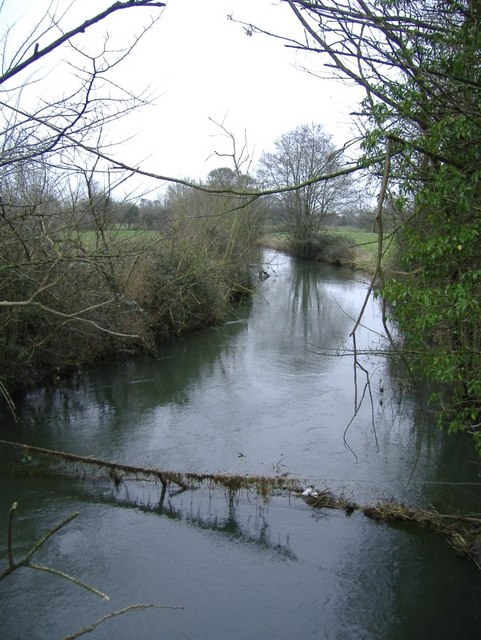
Clayhill Copse is a picturesque woodland located in Wiltshire, England. Covering an area of approximately 40 hectares, it is a diverse and vibrant forest that attracts nature enthusiasts and walkers alike.

The copse is primarily composed of mixed broadleaf trees, including oak, ash, beech, and birch. These trees create a dense canopy that provides shade and shelter for a variety of wildlife. Bluebells and other wildflowers carpet the forest floor during spring, creating a colorful and enchanting sight.

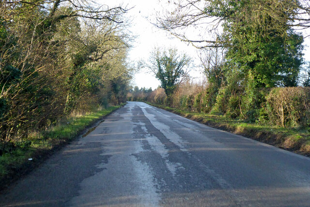
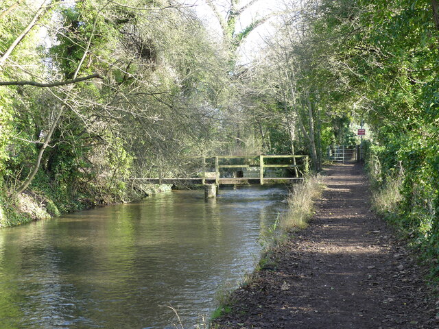
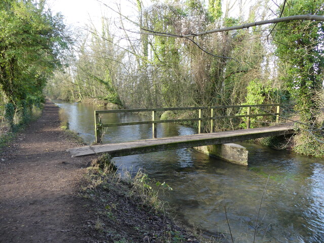
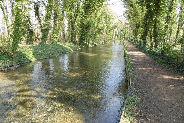
The woodland is crisscrossed by a network of well-maintained footpaths, allowing visitors to explore its beauty at their leisure. These paths lead visitors through serene glades, alongside babbling streams, and up gentle inclines that offer stunning panoramic views of the surrounding countryside.

Clayhill Copse is home to a rich variety of bird species, including woodpeckers, owls, and various songbirds, making it a perfect spot for birdwatching enthusiasts. Additionally, the copse provides a habitat for several mammals, such as deer, foxes, and rabbits, which can occasionally be spotted during a peaceful stroll.

The forest is managed by local authorities who ensure its conservation and protection. They maintain the paths, control invasive species, and undertake selective tree planting to enhance the copse's biodiversity.

Overall, Clayhill Copse is a tranquil and beautiful woodland that offers visitors a chance to immerse themselves in nature. Whether you are seeking a peaceful walk, birdwatching opportunities, or simply a place to connect with the natural world, Clayhill Copse is a must-visit destination in Wiltshire.

If you have any feedback on the listing, please let us know in the comments section below.

Clayhill Copse Images

Images are sourced within 2km of 51.652727/-1.9312354 or Grid Reference SU0494. Thanks to Geograph Open Source API. All images are credited.

Spine Road (West), heading west
Footbridge and track bridge across the River Thames, near Ashton Keynes The footpath is the Thames Path.
Footbridge and track bridge across the River Thames, near Ashton Keynes
The footpath is the Thames Path.
Footbridge seen from beside track bridge over the River Thames, near Ashton Keynes
Junction of track with the Thames Path, near Ashton Keynes
Stream that drains from the River Thames, near Ashton Keynes This is part of the extensive management of this watery area.  The river is bounded on either side by former gravel pits, now lakes.  The stream in the photo appears to contain a higher volume of water than what remained in the young River Thames.  When we arrived at Ashton Keynes and saw the course of the river, it became clear why this level of management is needed.  <a href="https://www.geograph.org.uk/photo/7078688">SU0494 : The River Thames takes a man-made course through Ashton Keynes</a>
Stream that drains from the River Thames, near Ashton Keynes
This is part of the extensive management of this watery area. The river is bounded on either side by former gravel pits, now lakes. The stream in the photo appears to contain a higher volume of water than what remained in the young River Thames. When we arrived at Ashton Keynes and saw the course of the river, it became clear why this level of management is needed. SU0494 : The River Thames takes a man-made course through Ashton Keynes
Approaching the road, along the Thames Path at Ashton Keynes
Approaching Ashton Keynes village along the Thames Path
The River Thames in Ashton Keynes, looking towards Church Lane
Junction of Church Walk and High Road, Ashton Keynes A former preaching cross is also shown.
Junction of Church Walk and High Road, Ashton Keynes
A former preaching cross is also shown.
The River Thames takes a man-made course through Ashton Keynes The river here is canalised through the village, which demonstrates why it is so important that there is careful flood management further up stream <a href="https://www.geograph.org.uk/photo/7078611">SU0394 : Stream that drains from the River Thames, near Ashton Keynes</a>.  An old preaching cross can also be seen in this photo.
The River Thames takes a man-made course through Ashton Keynes
The river here is canalised through the village, which demonstrates why it is so important that there is careful flood management further up stream SU0394 : Stream that drains from the River Thames, near Ashton Keynes. An old preaching cross can also be seen in this photo.
The village pub, with Mediaeval preaching cross, Ashton Keynes This was the second preaching cross I encountered in this village.  I have since learnt that it has four!
The village pub, with Mediaeval preaching cross, Ashton Keynes
This was the second preaching cross I encountered in this village. I have since learnt that it has four!
The villager shop and Post Office, phone box, and Village Hall, Ashton Keynes
Path from the village to Ashton Keynes church
The Thames at Ashton Keynes The Thames and the Thames Path a little to the west of the village of Ashton Keynes.
The Thames at Ashton Keynes
The Thames and the Thames Path a little to the west of the village of Ashton Keynes.
Footbridge beside the River Thames Footbridge beside the River Thames near Ashton Keynes.
Footbridge beside the River Thames
Footbridge beside the River Thames near Ashton Keynes.
Lesser celandine Lesser celandine in the churchyard of Ashton Keynes church.
Lesser celandine
Lesser celandine in the churchyard of Ashton Keynes church.
River Thames at Ashton Keynes The Thames Path on a particularly attractive village of Ashton Keynes.  This is a very similar view to this picture from eleven years ago <a href="https://www.geograph.org.uk/photo/2390658">SU0494 : River Thames at Ashton Keynes</a>.
River Thames at Ashton Keynes
The Thames Path on a particularly attractive village of Ashton Keynes. This is a very similar view to this picture from eleven years ago SU0494 : River Thames at Ashton Keynes.
The Thames The Thames flowing through the village of Ashton Keynes.
The Thames
The Thames flowing through the village of Ashton Keynes.
Show me another place!

Clayhill Copse is located at Grid Ref: SU0494 (Lat: 51.652727, Lng: -1.9312354)

Unitary Authority: Wiltshire

Police Authority: Wiltshire

What 3 Words

///earlobes.rotate.necklace. Near Ashton Keynes, Wiltshire

Related Wikis

Ashton Keynes

Ashton Keynes is a village and civil parish in north Wiltshire, England which borders with Gloucestershire. The village is about 5 miles (8 km) south of...

Swill Brook

Swill Brook is the name of a number of streams in England, the most notable of which is the Swill Brook in Wiltshire. This stream flows for some 10 km...

Cotswold Water Park

The Cotswold Water Park is the United Kingdom's largest marl lake system, straddling the Wiltshire–Gloucestershire border, north-west of Cricklade and...

South Cerney

South Cerney is a village and civil parish in the Cotswold district of Gloucestershire, 3 miles south of Cirencester and close to the border with Wiltshire...

Pike Corner

Pike Corner (grid reference SU036933) is a 15.2 hectare biological Site of Special Scientific Interest in north Wiltshire, England, notified in 1986. The...

Upper Waterhay Meadow

Upper Waterhay Meadow (grid reference SU068937) is a 2.8 hectare biological Site of Special Scientific Interest in north Wiltshire, England, notified in...

South Cerney railway station

South Cerney railway station was on the Midland and South Western Junction Railway in Gloucestershire. The station opened on 18 December 1883 on the Swindon...

Church of All Hallows, South Cerney

The Church of All Hallows is an Anglican parish church in the village of South Cerney, Gloucestershire. The church is of Norman origins, with medieval...

Nearby Amenities

Located within 500m of 51.652727,-1.9312354
Barrier: stile
Foot: yes
Lat/Long: 51.6547019/-1.9274
Barrier: horse_stile
Lat/Long: 51.6558701/-1.9263539
Barrier: horse_stile
Lat/Long: 51.6554849/-1.92619
Crossing
Lat/Long: 51.6559663/-1.9268096
The data included in this document is from www.openstreetmap.org. The data is made available under ODbL.

Have you been to Clayhill Copse?

Leave your review of Clayhill Copse below (or comments, questions and feedback).