Ashton Keynes

Civil Parish in Wiltshire

England

Ashton Keynes

Spine Road (West), heading west
Spine Road (West), heading west Credit: Robin Webster

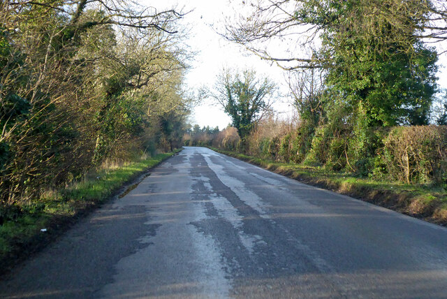
Ashton Keynes is a civil parish located in the county of Wiltshire, England. It lies on the southern edge of the Cotswold Water Park, near the River Thames. The village is situated approximately 4 miles southwest of Cirencester and 8 miles northeast of Swindon.

The parish covers an area of around 1,400 hectares and is home to a population of approximately 1,600 residents. The village itself is known for its picturesque and idyllic setting, surrounded by beautiful countryside and close to several lakes and water bodies.

Ashton Keynes has a long history, with evidence of human settlement in the area dating back to the Iron Age. The village grew during the medieval period and was a thriving agricultural community. Today, it still retains much of its historic charm, with several listed buildings and a Grade I listed church, St. Mary's, which dates back to the 12th century.

The village offers a range of amenities and facilities for its residents, including a primary school, a village hall, a post office, and a local pub. It also has a strong sense of community, with various clubs and societies catering to different interests.

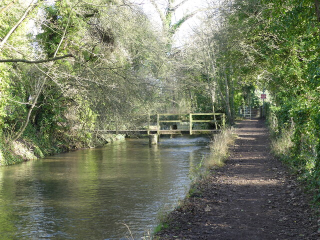
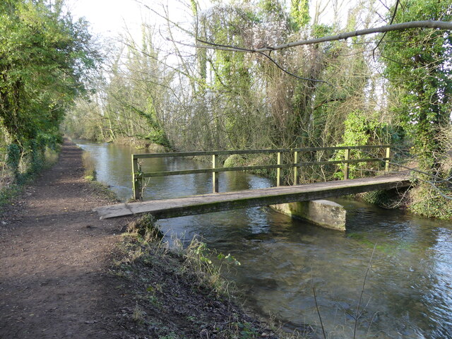
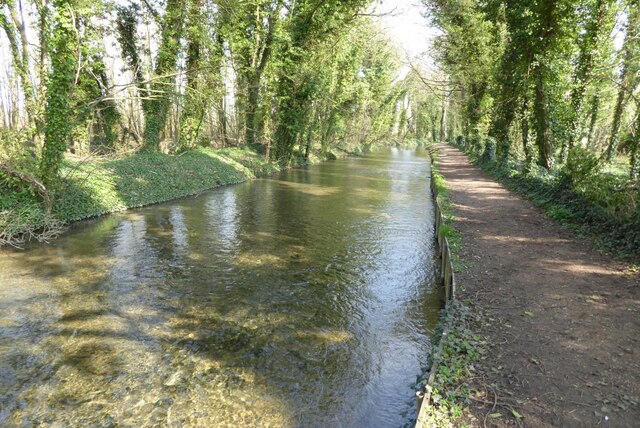
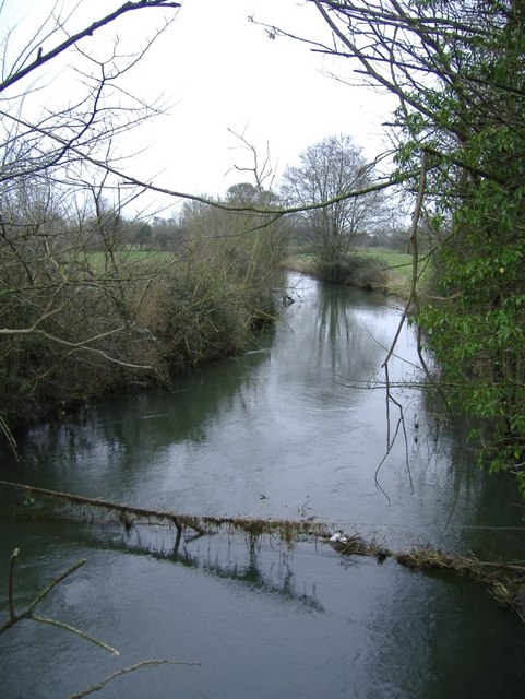
Due to its location within the Cotswold Water Park, Ashton Keynes is a popular destination for tourists and outdoor enthusiasts. The area offers opportunities for boating, fishing, birdwatching, and walking, making it a haven for nature lovers.

In summary, Ashton Keynes is a picturesque and historic village nestled in the Wiltshire countryside. It offers a peaceful and scenic environment for residents and visitors alike, with a range of amenities and activities to enjoy.

If you have any feedback on the listing, please let us know in the comments section below.

Ashton Keynes Images

Images are sourced within 2km of 51.649588/-1.932194 or Grid Reference SU0494. Thanks to Geograph Open Source API. All images are credited.

Spine Road (West), heading west
Footbridge and track bridge across the River Thames, near Ashton Keynes The footpath is the Thames Path.
Footbridge and track bridge across the River Thames, near Ashton Keynes
The footpath is the Thames Path.
Footbridge seen from beside track bridge over the River Thames, near Ashton Keynes
Junction of track with the Thames Path, near Ashton Keynes
Stream that drains from the River Thames, near Ashton Keynes This is part of the extensive management of this watery area.  The river is bounded on either side by former gravel pits, now lakes.  The stream in the photo appears to contain a higher volume of water than what remained in the young River Thames.  When we arrived at Ashton Keynes and saw the course of the river, it became clear why this level of management is needed.  <a href="https://www.geograph.org.uk/photo/7078688">SU0494 : The River Thames takes a man-made course through Ashton Keynes</a>
Stream that drains from the River Thames, near Ashton Keynes
This is part of the extensive management of this watery area. The river is bounded on either side by former gravel pits, now lakes. The stream in the photo appears to contain a higher volume of water than what remained in the young River Thames. When we arrived at Ashton Keynes and saw the course of the river, it became clear why this level of management is needed. SU0494 : The River Thames takes a man-made course through Ashton Keynes
Approaching the road, along the Thames Path at Ashton Keynes
Approaching Ashton Keynes village along the Thames Path
The River Thames in Ashton Keynes, looking towards Church Lane
Junction of Church Walk and High Road, Ashton Keynes A former preaching cross is also shown.
Junction of Church Walk and High Road, Ashton Keynes
A former preaching cross is also shown.
The River Thames takes a man-made course through Ashton Keynes The river here is canalised through the village, which demonstrates why it is so important that there is careful flood management further up stream <a href="https://www.geograph.org.uk/photo/7078611">SU0394 : Stream that drains from the River Thames, near Ashton Keynes</a>.  An old preaching cross can also be seen in this photo.
The River Thames takes a man-made course through Ashton Keynes
The river here is canalised through the village, which demonstrates why it is so important that there is careful flood management further up stream SU0394 : Stream that drains from the River Thames, near Ashton Keynes. An old preaching cross can also be seen in this photo.
The village pub, with Mediaeval preaching cross, Ashton Keynes This was the second preaching cross I encountered in this village.  I have since learnt that it has four!
The village pub, with Mediaeval preaching cross, Ashton Keynes
This was the second preaching cross I encountered in this village. I have since learnt that it has four!
The villager shop and Post Office, phone box, and Village Hall, Ashton Keynes
Path from the village to Ashton Keynes church
The Thames at Ashton Keynes The Thames and the Thames Path a little to the west of the village of Ashton Keynes.
The Thames at Ashton Keynes
The Thames and the Thames Path a little to the west of the village of Ashton Keynes.
Footbridge beside the River Thames Footbridge beside the River Thames near Ashton Keynes.
Footbridge beside the River Thames
Footbridge beside the River Thames near Ashton Keynes.
Lesser celandine Lesser celandine in the churchyard of Ashton Keynes church.
Lesser celandine
Lesser celandine in the churchyard of Ashton Keynes church.
River Thames at Ashton Keynes The Thames Path on a particularly attractive village of Ashton Keynes.  This is a very similar view to this picture from eleven years ago <a href="https://www.geograph.org.uk/photo/2390658">SU0494 : River Thames at Ashton Keynes</a>.
River Thames at Ashton Keynes
The Thames Path on a particularly attractive village of Ashton Keynes. This is a very similar view to this picture from eleven years ago SU0494 : River Thames at Ashton Keynes.
The Thames The Thames flowing through the village of Ashton Keynes.
The Thames
The Thames flowing through the village of Ashton Keynes.
Show me another place!

Ashton Keynes is located at Grid Ref: SU0494 (Lat: 51.649588, Lng: -1.932194)

Unitary Authority: Wiltshire

Police Authority: Wiltshire

What 3 Words

///grafted.confusion.maps. Near Ashton Keynes, Wiltshire

Related Wikis

Ashton Keynes

Ashton Keynes is a village and civil parish in north Wiltshire, England which borders with Gloucestershire. The village is about 5 miles (8 km) south of...

Swill Brook

Swill Brook is the name of a number of streams in England, the most notable of which is the Swill Brook in Wiltshire. This stream flows for some 10 km...

Pike Corner

Pike Corner (grid reference SU036933) is a 15.2 hectare biological Site of Special Scientific Interest in north Wiltshire, England, notified in 1986. The...

Cotswold Water Park

The Cotswold Water Park is the United Kingdom's largest marl lake system, straddling the Wiltshire–Gloucestershire border, north-west of Cricklade and...

Upper Waterhay Meadow

Upper Waterhay Meadow (grid reference SU068937) is a 2.8 hectare biological Site of Special Scientific Interest in north Wiltshire, England, notified in...

South Cerney

South Cerney is a village and civil parish in the Cotswold district of Gloucestershire, 3 miles south of Cirencester and close to the border with Wiltshire...

All Saints Church, Leigh

All Saints Church was built around 1250 at Leigh, north Wiltshire, England, and was originally on a site half a mile to the north of its current location...

South Cerney railway station

South Cerney railway station was on the Midland and South Western Junction Railway in Gloucestershire. The station opened on 18 December 1883 on the Swindon...

Nearby Amenities

Located within 500m of 51.649588,-1.932194
Ashton Keynes
Place: village
Postal Code: SN6 6
Wikidata: Q2539726
Wikipedia: en:Ashton Keynes
Lat/Long: 51.6453991/-1.9311453
BDT (UK) Limited
Addr Housename: Beaconsfield Lodge
Addr Housenumber: 15
Addr Postcode: SN6 6NP
Addr Street: Fore Street
Building: yes
Operator: Richard Long
Ref: Engineers & Architects
Source: OS OpenData StreetView
Wikidata: Q26274082
Lat/Long: 51.6465945/-1.9302808
Bench
Backrest: yes
Lat/Long: 51.6467035/-1.9361639
Barrier: kissing_gate
Lat/Long: 51.6477843/-1.9282664
Hiking: yes
Information: guidepost
Source: GPS
Tourism: information
Lat/Long: 51.6469343/-1.926498
Barrier: kissing_gate
Lat/Long: 51.6469401/-1.9265355
Hiking: yes
Information: guidepost
Source: GPS
Tourism: information
Lat/Long: 51.6478729/-1.928519
Hiking: yes
Information: guidepost
Source: GPS
Tourism: information
Lat/Long: 51.6478064/-1.9291104
Hiking: yes
Information: guidepost
Source: GPS
Tourism: information
Lat/Long: 51.6467121/-1.9360426
Addr City: Swindon
Addr Housename: The Croft
Addr Street: Cox's Hill
Addr Village: Ashton Keynes
Lat/Long: 51.64819/-1.9380569
Addr City: Swindon
Addr Housename: Kirkland
Addr Street: Cox's Hill
Addr Village: Ashton Keynes
Lat/Long: 51.6477839/-1.9376868
Addr City: Swindon
Addr Housename: Millbrook
Addr Street: Back Street
Addr Village: Ashton Keynes
Lat/Long: 51.6471556/-1.9354311
Addr City: Swindon
Addr Housename: Woodside
Addr Street: Back Street
Addr Village: Ashton Keynes
Lat/Long: 51.6471956/-1.9349657
Addr City: Swindon
Addr Housenumber: 1
Addr Village: Ashton Keynes
Fixme: Street?
Lat/Long: 51.6472605/-1.9346398
Addr City: Swindon
Addr Housenumber: 2
Addr Village: Ashton Keynes
Fixme: Street?
Lat/Long: 51.6472838/-1.9343756
Addr City: Swindon
Addr Housenumber: 3
Addr Village: Ashton Keynes
Fixme: Street?
Lat/Long: 51.6473087/-1.934149
Addr City: Swindon
Addr Housename: Plough House
Addr Street: Back Street
Addr Village: Ashton Keynes
Lat/Long: 51.6475917/-1.9332464
Addr City: Swindon
Addr Housename: Clearfields
Addr Street: Back Street
Addr Village: Ashton Keynes
Lat/Long: 51.6475243/-1.9326644
Addr City: Swindon
Addr Housename: The Barn
Addr Street: Back Street
Addr Village: Ashton Keynes
Lat/Long: 51.6477806/-1.932089
Addr City: Swindon
Addr Housename: Winnies Cottage
Addr Housenumber: 10
Addr Street: Back Street
Addr Village: Ashton Keynes
Lat/Long: 51.6476516/-1.9316196
Addr City: Swindon
Addr Housename: Hollyhocks
Addr Street: Back Street
Addr Village: Ashton Keynes
Lat/Long: 51.6476865/-1.931161
Addr City: Swindon
Addr Housename: The Keepings
Addr Street: Back Street
Addr Village: Ashton Keynes
Lat/Long: 51.6477173/-1.9304448
Addr City: Swindon
Addr Housename: Rose Corner
Addr Street: Back Street
Addr Village: Ashton Keynes
Lat/Long: 51.6478721/-1.9295678
Addr City: Swindon
Addr Housename: Kent End Cottage
Addr Street: Kent End
Addr Village: Ashton Keynes
Fixme: Check this is the right house
Lat/Long: 51.6473562/-1.9294792
Addr City: Swindon
Addr Housenumber: 16
Addr Street: Kent End
Addr Village: Ashton Keynes
Lat/Long: 51.6472954/-1.9287591
Addr City: Swindon
Addr Housenumber: 17
Addr Street: Kent End
Addr Village: Ashton Keynes
Lat/Long: 51.6472314/-1.9287618
Addr City: Swindon
Addr Housenumber: 18
Addr Street: Kent End
Addr Village: Ashton Keynes
Lat/Long: 51.6469842/-1.928751
Addr City: Swindon
Addr Housenumber: 19
Addr Street: Kent End
Addr Village: Ashton Keynes
Lat/Long: 51.6469143/-1.9287148
Addr City: Swindon
Addr Housename: Old Dominion House
Addr Street: Kent End
Addr Village: Ashton Keynes
Lat/Long: 51.6465997/-1.9289361
Addr City: Swindon
Addr Housenumber: 20
Addr Street: Kent End
Addr Village: Ashton Keynes
Lat/Long: 51.6467487/-1.9282521
Addr City: Swindon
Addr Housenumber: 21
Addr Street: Kent End
Addr Village: Ashton Keynes
Lat/Long: 51.6467162/-1.9281502
Post Box
Collection Times: Mo-Fr 16:15; Sa 10:15
Post Box Design: type_b
Post Box Type: pillar
Ref: SN6 224
Royal Cypher: EIIR
Royal Cypher Wikidata: Q33102113
Lat/Long: 51.6463434/-1.9279343
Bus Stop
Kent End
Bus: yes
Naptan AtcoCode: 4600TTY38696
Naptan Bearing: NW
Naptan CommonName: Kent End
Naptan Indicator: NW-bound
Naptan NaptanCode: wilawatw
Naptan Street: Kent End
Naptan Verified: no
Public Transport: platform
Shelter: yes
Lat/Long: 51.6463792/-1.9280188
Addr City: Swindon
Addr Housenumber: 22
Addr Street: Kent End
Addr Village: Ashton Keynes
Lat/Long: 51.646569/-1.9278444
Addr City: Swindon
Addr Housenumber: 23
Addr Street: Kent End
Addr Village: Ashton Keynes
Lat/Long: 51.6465323/-1.9277345
Addr City: Swindon
Addr Housenumber: 24
Addr Street: Kent End
Addr Village: Ashton Keynes
Lat/Long: 51.6464267/-1.9274662
Addr City: Swindon
Addr Housenumber: 25
Addr Street: Kent End
Addr Village: Ashton Keynes
Lat/Long: 51.6464058/-1.9273925
Addr City: Swindon
Addr Housenumber: 26
Addr Street: Kent End
Addr Village: Ashton Keynes
Lat/Long: 51.6463834/-1.927253
Addr City: Swindon
Addr Housenumber: 27
Addr Street: Kent End
Addr Village: Ashton Keynes
Lat/Long: 51.6463726/-1.9271457
Addr City: Swindon
Addr Housename: Melton Lodge
Addr Street: Back Street
Addr Village: Ashton Keynes
Lat/Long: 51.6475509/-1.9352902
Addr City: Swindon
Addr Housename: The Old Laurels
Addr Housenumber: 6
Addr Street: Back Street
Addr Village: Ashton Keynes
Lat/Long: 51.6475093/-1.9347323
Addr City: Swindon
Addr Housename: The Laurels
Addr Street: Back Street
Addr Village: Ashton Keynes
Lat/Long: 51.6475476/-1.9343045
Addr City: Swindon
Addr Housename: Brookfield
Addr Street: Back Street
Addr Village: Ashton Keynes
Lat/Long: 51.6478546/-1.9325705
Addr City: Swindon
Addr Housename: Chestnuts
Addr Street: Back Street
Addr Village: Ashton Keynes
Lat/Long: 51.6479137/-1.9314091
Addr City: Swindon
Addr Housename: Fineshade Cottage
Addr Street: Back Street
Addr Village: Ashton Keynes
Lat/Long: 51.6477581/-1.9307385
Addr City: Swindon
Addr Housename: Cleveland House
Addr Street: Back Street
Addr Village: Ashton Keynes
Lat/Long: 51.647927/-1.9304086
Addr City: Swindon
Addr Housename: Pilgrim Cottage
Addr Street: Back Street
Addr Village: Ashton Keynes
Lat/Long: 51.6481301/-1.9298159
Addr City: Swindon
Addr Housenumber: 1
Addr Street: Kent End Field
Addr Village: Ashton Keynes
Lat/Long: 51.6470566/-1.9272611
Addr City: Swindon
Addr Housenumber: 2
Addr Street: Kent End Field
Addr Village: Ashton Keynes
Lat/Long: 51.6471248/-1.9273683
Waste Basket
Waste: dog_excrement
Lat/Long: 51.6479104/-1.9291466
Addr City: Swindon
Addr Housename: Bridge Cottage
Addr Housenumber: 9
Addr Street: Kent End
Addr Village: Ashton Keynes
Lat/Long: 51.6476774/-1.9292593
Addr City: Swindon
Addr Housenumber: 20
Addr Street: Fore Street
Addr Village: Ashton Keynes
Lat/Long: 51.646906/-1.9293264
Addr City: Swindon
Addr Housenumber: 19
Addr Street: Fore Street
Addr Village: Ashton Keynes
Lat/Long: 51.646886/-1.9294135
Addr City: Swindon
Addr Housename: The Old Chapel
Addr Street: Fore Street
Addr Village: Ashton Keynes
Lat/Long: 51.6468794/-1.9295852
Addr City: Swindon
Addr Housename: The Manse
Addr Street: Fore Street
Addr Village: Ashton Keynes
Lat/Long: 51.6467662/-1.9297314
Addr City: Swindon
Addr Housenumber: 16
Addr Street: Fore Street
Addr Village: Ashton Keynes
Lat/Long: 51.6466372/-1.9301364
Addr City: Swindon
Addr Housenumber: 24
Addr Street: Fore Street
Addr Village: Ashton Keynes
Lat/Long: 51.6463451/-1.9301645
Addr City: Swindon
Addr Housename: Old School House
Addr Housenumber: 14
Addr Street: Fore Street
Addr Village: Ashton Keynes
Lat/Long: 51.6463875/-1.9308552
Addr City: Swindon
Addr Housenumber: 13
Addr Street: Fore Street
Addr Village: Ashton Keynes
Lat/Long: 51.6463418/-1.9310899
Addr City: Swindon
Addr Housenumber: 12
Addr Street: Fore Street
Addr Village: Ashton Keynes
Lat/Long: 51.6463143/-1.9311409
Addr City: Swindon
Addr Housenumber: 6
Addr Street: Fore Street
Addr Village: Ashton Keynes
Lat/Long: 51.6461021/-1.9315526
Addr City: Swindon
Addr Housenumber: 7
Addr Street: Fore Street
Addr Village: Ashton Keynes
Lat/Long: 51.6461445/-1.9314332
Addr City: Swindon
Addr Housenumber: 8
Addr Street: Fore Street
Addr Village: Ashton Keynes
Lat/Long: 51.6461812/-1.9313474
Addr City: Swindon
Addr Housenumber: 9
Addr Street: Fore Street
Addr Village: Ashton Keynes
Lat/Long: 51.646202/-1.9312924
Addr City: Swindon
Addr Housenumber: 10
Addr Street: Fore Street
Addr Village: Ashton Keynes
Lat/Long: 51.6462336/-1.9312066
Addr City: Swindon
Addr Housenumber: 28
Addr Street: Fore Street
Addr Village: Ashton Keynes
Lat/Long: 51.6458425/-1.9315486
Addr City: Swindon
Addr Housenumber: 29
Addr Street: Fore Street
Addr Village: Ashton Keynes
Lat/Long: 51.6458125/-1.9316076
Addr City: Swindon
Addr Housenumber: 30
Addr Street: Fore Street
Addr Village: Ashton Keynes
Lat/Long: 51.6457867/-1.9316652
Addr City: Swindon
Addr Housenumber: 3
Addr Street: Fore Street
Addr Village: Ashton Keynes
Lat/Long: 51.6460114/-1.9318168
Waste Basket
Lat/Long: 51.645334/-1.9326141
Addr City: Swindon
Addr Housename: The Long House
Addr Housenumber: 17
Addr Street: High Road
Addr Village: Ashton Keynes
Lat/Long: 51.6466871/-1.9358173
Historic: memorial
Lat/Long: 51.646581/-1.9361304
Addr City: Swindon
Addr Housenumber: 14
Addr Street: Church Walk
Addr Village: Ashton Keynes
Lat/Long: 51.6467271/-1.9367225
Addr City: Swindon
Addr Housename: Glebe House
Addr Street: Church Lane
Addr Village: Ashton Keynes
Lat/Long: 51.6470608/-1.93731
The data included in this document is from www.openstreetmap.org. The data is made available under ODbL.

Have you been to Ashton Keynes?

Leave your review of Ashton Keynes below (or comments, questions and feedback).