Cubbington

Settlement in Warwickshire Warwick

England

Cubbington

HS2 enabling works near Cubbington, September 2021 (1) This is a foreshortened view of the contractor's compound beside the B4453 Rugby Road northeast of Cubbington village. The diverted road will cross HS2 by an overbridge; the railway will run across the middle of the photo. In the background, centre, is South Cubbington Wood. <span class="nowrap"><a title="https://assets.publishing.service.gov.uk/government/uploads/system/uploads/attachment_data/file/532882/C223-CSI-CV-DPP-030-000004-FPD.pdf" rel="nofollow ugc noopener" href="https://assets.publishing.service.gov.uk/government/uploads/system/uploads/attachment_data/file/532882/C223-CSI-CV-DPP-030-000004-FPD.pdf">Link</a><img style="margin-left:2px;" alt="External link" title="External link - shift click to open in new window" src="https://s1.geograph.org.uk/img/external.png" width="10" height="10"/></span>
HS2 enabling works near Cubbington, September 2021 (1) Credit: Robin Stott

Cubbington is a tranquil village located in the county of Warwickshire, England. Situated approximately 5 miles south of the historic town of Leamington Spa, Cubbington is nestled amidst picturesque countryside, offering residents and visitors a charming rural setting.

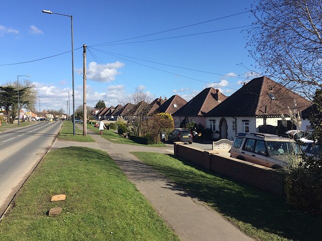
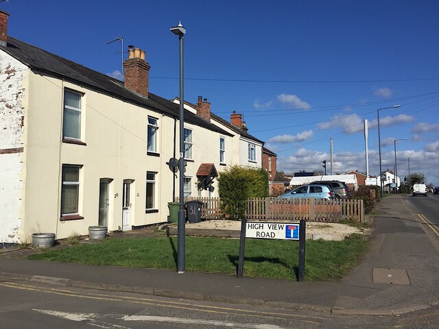
The village is renowned for its stunning natural beauty, with rolling green fields, quaint cottages, and a sense of serenity that makes it a desirable place to live. The local community is close-knit and friendly, creating a welcoming atmosphere for all.

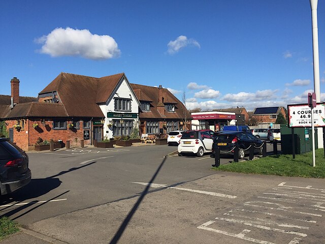
Cubbington boasts a range of amenities, including a well-stocked village shop, a primary school, and a village hall that serves as a hub for various community activities and events. Additionally, the village is home to a traditional pub, providing a cozy spot for locals and visitors to enjoy a drink or a meal.

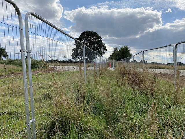
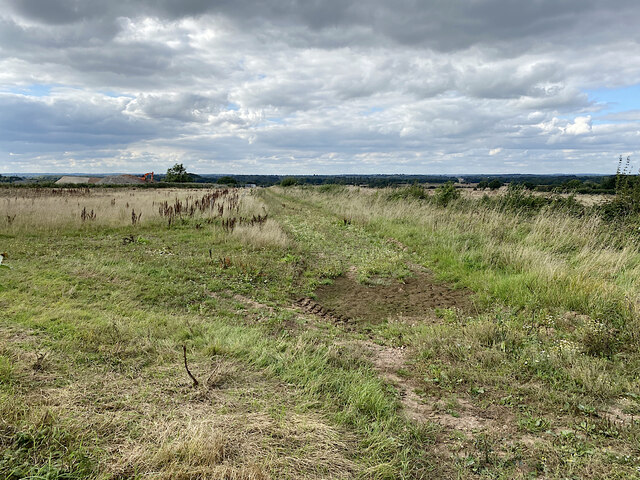
Nature lovers will be delighted by Cubbington's proximity to several stunning outdoor spaces. Just a short distance away is the picturesque Cubbington Wood, a beautiful ancient woodland that offers scenic walking trails and is renowned for its array of bluebells in the spring. Moreover, the nearby Burton Dassett Hills Country Park provides breathtaking views of the surrounding countryside and is a perfect spot for hiking or picnicking.

Cubbington's location is also advantageous for commuters, with easy access to major road networks and nearby train stations. This allows residents to enjoy the tranquility of village life while still having convenient connections to larger towns and cities.

In conclusion, Cubbington is a delightful village in Warwickshire that offers a peaceful and picturesque environment, a friendly community, and access to beautiful natural spaces.

If you have any feedback on the listing, please let us know in the comments section below.
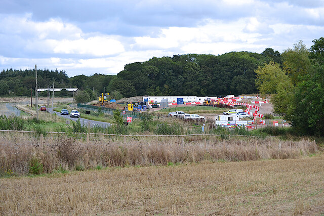
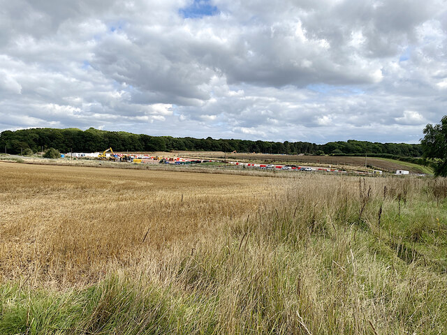
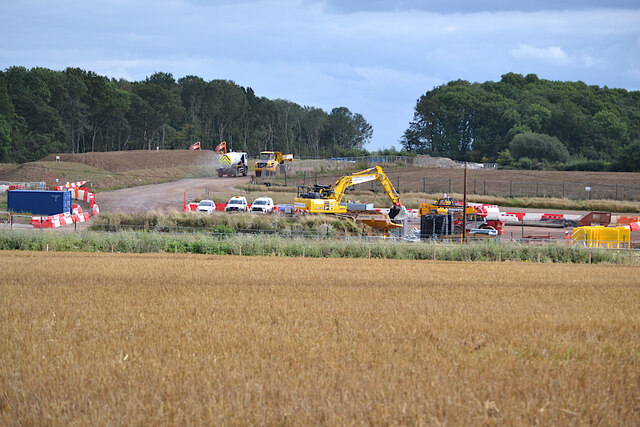
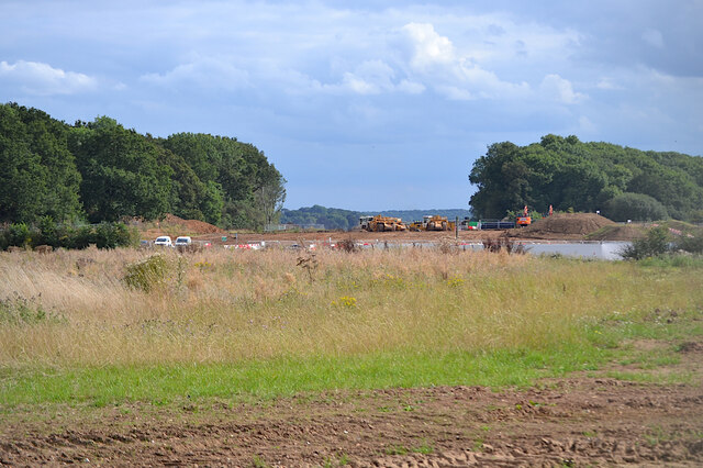
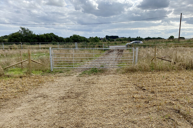
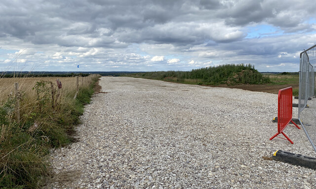
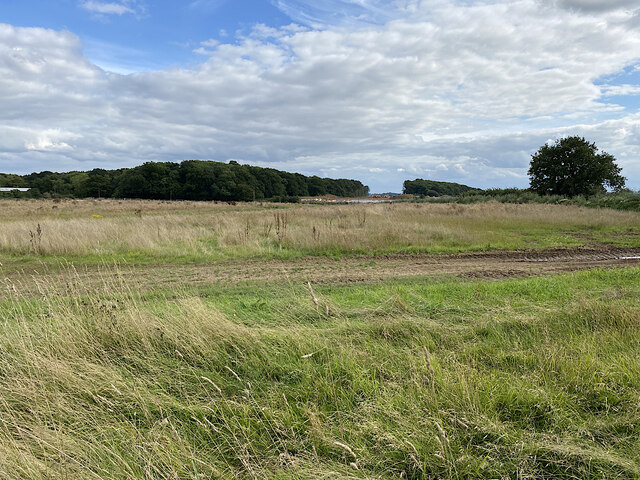
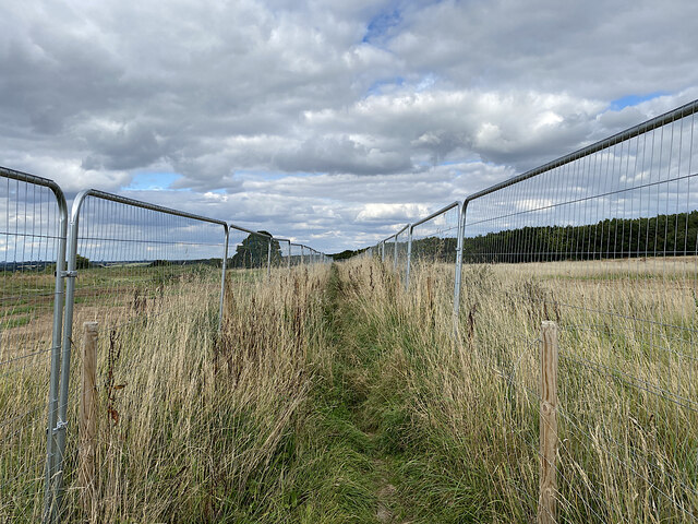
Cubbington Images

Images are sourced within 2km of 52.313999/-1.507813 or Grid Reference SP3368. Thanks to Geograph Open Source API. All images are credited.

HS2 enabling works near Cubbington, September 2021 (1) This is a foreshortened view of the contractor's compound beside the B4453 Rugby Road northeast of Cubbington village. The diverted road will cross HS2 by an overbridge; the railway will run across the middle of the photo. In the background, centre, is South Cubbington Wood. <span class="nowrap"><a title="https://assets.publishing.service.gov.uk/government/uploads/system/uploads/attachment_data/file/532882/C223-CSI-CV-DPP-030-000004-FPD.pdf" rel="nofollow ugc noopener" href="https://assets.publishing.service.gov.uk/government/uploads/system/uploads/attachment_data/file/532882/C223-CSI-CV-DPP-030-000004-FPD.pdf">Link</a><img style="margin-left:2px;" alt="External link" title="External link - shift click to open in new window" src="https://s1.geograph.org.uk/img/external.png" width="10" height="10"/></span>
HS2 enabling works near Cubbington, September 2021 (1)
This is a foreshortened view of the contractor's compound beside the B4453 Rugby Road northeast of Cubbington village. The diverted road will cross HS2 by an overbridge; the railway will run across the middle of the photo. In the background, centre, is South Cubbington Wood. LinkExternal link
HS2 enabling works near Cubbington, September 2021 (2) A wide view of the contractor's compound by the B4453 Rugby Road and work in progress. The railway will run in front of South Cubbington Wood, centre. <span class="nowrap"><a title="https://assets.publishing.service.gov.uk/government/uploads/system/uploads/attachment_data/file/532882/C223-CSI-CV-DPP-030-000004-FPD.pdf" rel="nofollow ugc noopener" href="https://assets.publishing.service.gov.uk/government/uploads/system/uploads/attachment_data/file/532882/C223-CSI-CV-DPP-030-000004-FPD.pdf">Link</a><img style="margin-left:2px;" alt="External link" title="External link - shift click to open in new window" src="https://s1.geograph.org.uk/img/external.png" width="10" height="10"/></span>
HS2 enabling works near Cubbington, September 2021 (2)
A wide view of the contractor's compound by the B4453 Rugby Road and work in progress. The railway will run in front of South Cubbington Wood, centre. LinkExternal link
HS2 enabling works near Cubbington, September 2021 (3) A foreshortened view of work in progress. It's not easy to interpret it in relation to the plans <span class="nowrap"><a title="https://assets.publishing.service.gov.uk/government/uploads/system/uploads/attachment_data/file/532882/C223-CSI-CV-DPP-030-000004-FPD.pdf" rel="nofollow ugc noopener" href="https://assets.publishing.service.gov.uk/government/uploads/system/uploads/attachment_data/file/532882/C223-CSI-CV-DPP-030-000004-FPD.pdf">Link</a><img style="margin-left:2px;" alt="External link" title="External link - shift click to open in new window" src="https://s1.geograph.org.uk/img/external.png" width="10" height="10"/></span> It's safe to say that a great deal of earth is being moved around. The gap in the woodland is the swathe cut in the winter, severing the south corner of South Cubbington Wood: <a href="https://www.geograph.org.uk/photo/6765887">SP3568 : HS2 enabling works near Cubbington, February 2021 (8)</a>. The railway will have climbed up to here after crossing the Leam valley: see <a href="https://www.geograph.org.uk/photo/6869545">SP3666 : HS2 enabling works near Offchurch, April 2021 (5)</a>.
HS2 enabling works near Cubbington, September 2021 (3)
A foreshortened view of work in progress. It's not easy to interpret it in relation to the plans LinkExternal link It's safe to say that a great deal of earth is being moved around. The gap in the woodland is the swathe cut in the winter, severing the south corner of South Cubbington Wood: SP3568 : HS2 enabling works near Cubbington, February 2021 (8). The railway will have climbed up to here after crossing the Leam valley: see SP3666 : HS2 enabling works near Offchurch, April 2021 (5).
HS2 enabling works near Cubbington, September 2021 (4) In this cropped image two large earthmoving machines are working in the swathe cut through the southern corner of South Cubbington Wood: at about the 135+000 mark on the plans <span class="nowrap"><a title="https://assets.publishing.service.gov.uk/government/uploads/system/uploads/attachment_data/file/532882/C223-CSI-CV-DPP-030-000004-FPD.pdf" rel="nofollow ugc noopener" href="https://assets.publishing.service.gov.uk/government/uploads/system/uploads/attachment_data/file/532882/C223-CSI-CV-DPP-030-000004-FPD.pdf">Link</a><img style="margin-left:2px;" alt="External link" title="External link - shift click to open in new window" src="https://s1.geograph.org.uk/img/external.png" width="10" height="10"/></span> . The railway will be in a cutting, reportedly, having climbed up from the River Leam crossing in SP3567: see <a href="https://www.geograph.org.uk/photo/6764646">SP3568 : HS2 enabling works near Cubbington, February 2021 (5)</a>. The line will head for the fenced-off ground in front of the camera. Locations are estimated.
HS2 enabling works near Cubbington, September 2021 (4)
In this cropped image two large earthmoving machines are working in the swathe cut through the southern corner of South Cubbington Wood: at about the 135+000 mark on the plans LinkExternal link . The railway will be in a cutting, reportedly, having climbed up from the River Leam crossing in SP3567: see SP3568 : HS2 enabling works near Cubbington, February 2021 (5). The line will head for the fenced-off ground in front of the camera. Locations are estimated.
HS2 enabling works near Cubbington, September 2021 (5) New fences and gates have been erected alongside the B4453 Rugby Road. This is in advance of the road being diverted to cross HS2 by an overbridge yet to be built. The stretch of footpath W130b behind the camera will be closed and will instead follow the road north to its diversion along the south side of North Cubbington Wood. <span class="nowrap"><a title="https://assets.publishing.service.gov.uk/government/uploads/system/uploads/attachment_data/file/532882/C223-CSI-CV-DPP-030-000004-FPD.pdf" rel="nofollow ugc noopener" href="https://assets.publishing.service.gov.uk/government/uploads/system/uploads/attachment_data/file/532882/C223-CSI-CV-DPP-030-000004-FPD.pdf">Link</a><img style="margin-left:2px;" alt="External link" title="External link - shift click to open in new window" src="https://s1.geograph.org.uk/img/external.png" width="10" height="10"/></span>
HS2 enabling works near Cubbington, September 2021 (5)
New fences and gates have been erected alongside the B4453 Rugby Road. This is in advance of the road being diverted to cross HS2 by an overbridge yet to be built. The stretch of footpath W130b behind the camera will be closed and will instead follow the road north to its diversion along the south side of North Cubbington Wood. LinkExternal link
HS2 enabling works near Cubbington, September 2021 (6) This is the line of the haul road parallel to the railway, which will be in a cutting across the land to the right: lots of earth to be moved! The view is northwest from footpath W130b; locations are estimated.
HS2 enabling works near Cubbington, September 2021 (6)
This is the line of the haul road parallel to the railway, which will be in a cutting across the land to the right: lots of earth to be moved! The view is northwest from footpath W130b; locations are estimated.
HS2 enabling works near Cubbington, September 2021 (7) This is farmland left uncultivated prior to the construction of HS2. The line will run somewhere to the left of the camera from the gap cut through South Cubbington Wood, just right of centre <a href="https://www.geograph.org.uk/photo/6976653">SP3568 : HS2 enabling works near Cubbington, September 2021 (4)</a>. The contractor's compound can be seen; the telephone poles mark the line of the B4453 Rugby Road, which will cross HS2 by an overbridge. On the right is the start of North Cubbington Wood.
HS2 enabling works near Cubbington, September 2021 (7)
This is farmland left uncultivated prior to the construction of HS2. The line will run somewhere to the left of the camera from the gap cut through South Cubbington Wood, just right of centre SP3568 : HS2 enabling works near Cubbington, September 2021 (4). The contractor's compound can be seen; the telephone poles mark the line of the B4453 Rugby Road, which will cross HS2 by an overbridge. On the right is the start of North Cubbington Wood.
HS2 enabling works near Cubbington, September 2021 (8) Footpath W130b is confined by fences across the area of forthcoming HS2 construction; at some point it will be closed and diverted. On the left is North Cubbington Wood, which will be untouched by the railway. Locations are estimated.
HS2 enabling works near Cubbington, September 2021 (8)
Footpath W130b is confined by fences across the area of forthcoming HS2 construction; at some point it will be closed and diverted. On the left is North Cubbington Wood, which will be untouched by the railway. Locations are estimated.
HS2 enabling works near Cubbington, September 2021 (9) Looking southwest along footpath W130b, fenced across the area of railway construction. The haul road in <a href="https://www.geograph.org.uk/photo/6981073">SP3469 : HS2 enabling works near Cubbington, September 2021 (6)</a> can be seen. When work starts the footpath will be permanently diverted. Locations are estimated.
HS2 enabling works near Cubbington, September 2021 (9)
Looking southwest along footpath W130b, fenced across the area of railway construction. The haul road in SP3469 : HS2 enabling works near Cubbington, September 2021 (6) can be seen. When work starts the footpath will be permanently diverted. Locations are estimated.
HS2 enabling works near Cubbington, September 2021 (10) This land has been fenced and left uncultivated. Somewhere in the middle distance HS2 will be in a cutting heading somewhat to the right. On the left here a solitary machine is moving earth near the Coventry Road out of Cubbington, which will be diverted to cross the railway by an overbridge. Locations are estimated. Tanner's Barn near here, shown on the 1:25 k map, appears to have been demolished in the past. <span class="nowrap"><a title="https://assets.publishing.service.gov.uk/government/uploads/system/uploads/attachment_data/file/532882/C223-CSI-CV-DPP-030-000004-FPD.pdf" rel="nofollow ugc noopener" href="https://assets.publishing.service.gov.uk/government/uploads/system/uploads/attachment_data/file/532882/C223-CSI-CV-DPP-030-000004-FPD.pdf">Link</a><img style="margin-left:2px;" alt="External link" title="External link - shift click to open in new window" src="https://s1.geograph.org.uk/img/external.png" width="10" height="10"/></span>
HS2 enabling works near Cubbington, September 2021 (10)
This land has been fenced and left uncultivated. Somewhere in the middle distance HS2 will be in a cutting heading somewhat to the right. On the left here a solitary machine is moving earth near the Coventry Road out of Cubbington, which will be diverted to cross the railway by an overbridge. Locations are estimated. Tanner's Barn near here, shown on the 1:25 k map, appears to have been demolished in the past. LinkExternal link
HS2 enabling works near Cubbington, September 2021 (11) The view is south along Coventry Road towards Cubbington: a racetrack. HS2 will come out of the skyline left of centre and cross roughly where the solitary digger is working. Coventry Road will be diverted on to an overbridge, landing somewhere here judging by the fencing, left. Note the tree stump. Locations are estimated
HS2 enabling works near Cubbington, September 2021 (11)
The view is south along Coventry Road towards Cubbington: a racetrack. HS2 will come out of the skyline left of centre and cross roughly where the solitary digger is working. Coventry Road will be diverted on to an overbridge, landing somewhere here judging by the fencing, left. Note the tree stump. Locations are estimated
HS2 enabling works near Cubbington, September 2021 (12) The fencing and land left uncultivated are the clues. HS2 will come through here on its way to Stoneleigh Business Park. The view is from Coventry Road north of the village. Locations are estimated.
HS2 enabling works near Cubbington, September 2021 (12)
The fencing and land left uncultivated are the clues. HS2 will come through here on its way to Stoneleigh Business Park. The view is from Coventry Road north of the village. Locations are estimated.
HS2 enabling works near Cubbington, September 2021 (13) A sign by the Coventry Road approaching the village warns of HS2 site N11 Gate 16. Materials will be brought to site and material will be taken away. A lone digger works atop a pile of earth or stone. The road will be diverted to an overbridge to cross the railway.
HS2 enabling works near Cubbington, September 2021 (13)
A sign by the Coventry Road approaching the village warns of HS2 site N11 Gate 16. Materials will be brought to site and material will be taken away. A lone digger works atop a pile of earth or stone. The road will be diverted to an overbridge to cross the railway.
HS2 enabling works near Cubbington, September 2021 (14) HS2 site N11 Gate 16 is by the Coventry Road north of the village.
HS2 enabling works near Cubbington, September 2021 (14)
HS2 site N11 Gate 16 is by the Coventry Road north of the village.
HS2 enabling works near Cubbington, September 2021 (15) A lone digger works atop a pile of earth and stone at site N11. The Coventry Road will be diverted on to an overbridge to cross the railway. Note the tree stump. Locations are estimated.
HS2 enabling works near Cubbington, September 2021 (15)
A lone digger works atop a pile of earth and stone at site N11. The Coventry Road will be diverted on to an overbridge to cross the railway. Note the tree stump. Locations are estimated.
Bungalows, Cubbington Road, Cubbington, Royal Leamington Spa
Cottages, corner of High View Road and Cubbington Road, Cubbington
Rugby Tavern and Sainsbury's Local, Cubbington Road, Cubbington
Show me another place!

Cubbington is located at Grid Ref: SP3368 (Lat: 52.313999, Lng: -1.507813)

Administrative County: Warwickshire

District: Warwick

Police Authority: Warwickshire

What 3 Words

///index.fishery.racks. Near Royal Leamington Spa, Warwickshire

Nearby Locations

Cubbington

Related Wikis

Cubbington

Cubbington is a village and civil parish with a population of 3,929, adjoining the north-eastern outskirts of Leamington Spa, Warwickshire, England, approximately...

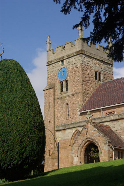
St. Mary's Church, Cubbington

St. Mary's is the parish church of Cubbington, Warwickshire, England. Denominationally it is part of the Church of England. The original church building...

A445 road

The A445 road is a road in Warwickshire, England. It runs between the town of Warwick and the A45, also passing through the north of Leamington Spa. The...

Lillington Free Church

Lillington Free Church is a free church, located in Lillington, Leamington Spa, England. As of February 2019 the current Minister is Rev James Church who...

Nearby Amenities

Located within 500m of 52.313999,-1.507813
Cubbington
Place: village
Wikidata: Q2060922
Lat/Long: 52.3125368/-1.5074522
Mini Roundabout
Direction: clockwise
Lat/Long: 52.3124651/-1.5082262
Broadway
Bus: yes
Public Transport: stop_position
Lat/Long: 52.3142664/-1.5013005
Bus Stop
Windmill Hill
Bench: no
Bin: no
Bus: yes
Covered: no
Lit: yes
Naptan AtcoCode: 4200F017701
Naptan Bearing: E
Naptan CommonName: Windmill Hill
Naptan Crossing: Windmill Hill
Naptan Indicator: Adj
Naptan NaptanCode: warapada
Naptan PlusbusZoneRef: LMNGTNS
Naptan Street: Queen Street
Passenger Information Display: no
Public Transport: platform
Shelter: no
Source: naptan_import
Tactile Paving: no
Lat/Long: 52.3106948/-1.5038587
Bus Stop
Broadway
Bench: no
Bin: yes
Bus: yes
Covered: no
Lit: yes
Naptan AtcoCode: 4200F018000
Naptan Bearing: W
Naptan CommonName: Broadway
Naptan Crossing: Broadway
Naptan Indicator: Opp
Naptan NaptanCode: warapadj
Naptan PlusbusZoneRef: LMNGTNS
Naptan Street: Rugby Road
Passenger Information Display: no
Physically Present: yes
Public Transport: platform
Shelter: yes
Source: naptan_import
Tactile Paving: no
Lat/Long: 52.314228/-1.5012982
Bus Stop
Rugby Tavern
Bench: no
Bin: yes
Bus: yes
Covered: no
Lit: yes
Naptan AtcoCode: 4200F018100
Naptan Bearing: SW
Naptan CommonName: Rugby Tavern
Naptan Indicator: Opp
Naptan Landmark: Rugby Tavern
Naptan NaptanCode: warapadm
Naptan PlusbusZoneRef: LMNGTNS
Naptan Street: Rugby Road
Naptan Verified: no
Passenger Information Display: no
Physically Present: yes
Public Transport: platform
Shelter: yes
Source: naptan_import
Tactile Paving: no
Lat/Long: 52.3102681/-1.511491
Bus Stop
Stonehouse Close
Bench: no
Bin: no
Bus: yes
Covered: no
Lit: yes
Naptan AtcoCode: 4200F084800
Naptan Bearing: SE
Naptan CommonName: Stonehouse Close
Naptan Indicator: Opp
Naptan NaptanCode: waratmdj
Naptan PlusbusZoneRef: LMNGTNS
Naptan Street: Windmill Hill
Passenger Information Display: no
Public Transport: platform
Shelter: no
Source: naptan_import
Tactile Paving: no
Lat/Long: 52.312268/-1.5068302
Bus Stop
Rugby Road
Bench: no
Bin: no
Bus: yes
Covered: no
Lit: yes
Naptan AtcoCode: 4200F1263670
Naptan Bearing: W
Naptan CommonName: Rugby Road
Naptan Crossing: Rugby Road
Naptan Indicator: Adj
Naptan NaptanCode: waradmag
Naptan PlusbusZoneRef: LMNGTNS
Naptan Street: Kenilworth Road
Naptan Verified: no
Passenger Information Display: no
Public Transport: platform
Shelter: no
Source: naptan_import
Tactile Paving: no
Lat/Long: 52.3126664/-1.5086929
Bus Stop
Rugby Road
Bench: no
Bin: no
Bus: yes
Covered: no
Lit: yes
Naptan AtcoCode: 4200F151701
Naptan Bearing: SW
Naptan CommonName: Rugby Road
Naptan Indicator: Adj
Naptan Landmark: Bus Shelter
Naptan NaptanCode: warapwjp
Naptan PlusbusZoneRef: LMNGTNS
Naptan Street: Rugby Road
Passenger Information Display: no
Physically Present: yes
Public Transport: platform
Shelter: yes
Source: naptan_import
Tactile Paving: no
Lat/Long: 52.3135019/-1.5053028
Bus Stop
West View Road
Bench: no
Bin: no
Bus: yes
Covered: no
Lit: yes
Naptan AtcoCode: 4200F151802
Naptan Bearing: NE
Naptan CommonName: West View Road
Naptan Crossing: West View Road
Naptan Indicator: Adj
Naptan NaptanCode: warapmat
Naptan PlusbusZoneRef: LMNGTNS
Naptan Street: Rugby Road
Naptan Verified: no
Passenger Information Display: no
Physically Present: yes
Public Transport: platform
Shelter: no
Source: naptan_import
Tactile Paving: no
Lat/Long: 52.310968/-1.5106755
Turning Circle
Lat/Long: 52.3131486/-1.5048949
Rugby Road
Bus: yes
Public Transport: stop_position
Lat/Long: 52.3126253/-1.5087151
Give Way
Direction: backward
Source: Warwicks CC Aerial Imagery 2013
Lat/Long: 52.3124354/-1.5081235
Crossing
Button Operated: yes
Crossing: traffic_signals
Crossing Island: no
Crossing Markings: dots
Crossing Ref: puffin
Kerb: lowered
Source: survey
Tactile Paving: yes
Traffic Signals Sound: yes
Traffic Signals Vibration: yes
Lat/Long: 52.3104008/-1.5114481
Post Box
Brand: Royal Mail
Brand Wikidata: Q638098
Brand Wikipedia: en:Royal Mail
Collection Times: Mo-Fr 09:00; Sa 07:00
Operator: Royal Mail
Operator Wikidata: Q638098
Post Box Type: lamp
Ref: CV32 206D
Royal Cypher: EIIR
Royal Cypher Wikidata: Q33102113
Source: survey
Lat/Long: 52.3140971/-1.5021502
Post Box
Brand: Royal Mail
Brand Wikidata: Q638098
Brand Wikipedia: en:Royal Mail
Collection Times: Mo-Fr 16:00; Sa 12:15
Operator: Royal Mail
Operator Wikidata: Q638098
Post Box Mounting: brick_pillar
Post Box Type: wall
Ref: CV32 175
Royal Cypher: GVIR
Royal Cypher Wikidata: Q33102169
Source: survey
Lat/Long: 52.3108202/-1.5106563
Fast Food
Blossom Court
Cuisine: chinese
Opening Hours: Mo-Th 17:00-21:00; Fr,Sa 17:00-22:00
Source: survey
Wheelchair: limited
Lat/Long: 52.310377/-1.5108329
Pets n Plants
Addr Housenumber: 44
Addr Street: Rugby Road
Opening Hours: Mo-Fr 09:00-18:00; Sa 09:00-17:30; Su 10:00-15:00
Phone: +44 1926 778188
Shop: florist
Source: survey
Wheelchair: yes
Lat/Long: 52.3104311/-1.5107283
Logan's Barber Shop
Opening Hours: Tu-Fr 09:30-18:00; Sa 08:30-14:45
Phone: +44 1926 258454
Shop: hairdresser
Source: survey
Wheelchair: yes
Lat/Long: 52.3102409/-1.5110153
Evolve
Addr Housenumber: 40
Addr Street: Rugby Road
Check Date Opening Hours: 2022-06-11
Opening Hours Signed: no
Phone: +44 1926 424782
Shop: hairdresser
Source: survey
Wheelchair: yes
Lat/Long: 52.3102835/-1.5109724
The Launderette Cubbington
Laundry Service: no
Opening Hours: Mo-Su 07:00-21:00
Self Service: yes
Shop: laundry
Source: survey
Wheelchair: yes
Lat/Long: 52.3103147/-1.5109134
Communication Mobile Phone: yes
Man Made: tower
Operator: O2
Operator Wikidata: Q7072245
Source: survey
Tower Type: communication
Lat/Long: 52.3103456/-1.5116927
Fast Food
Cubbington Plaice
Check Date: 2022-06-11
Cuisine: fish_and_chips
Opening Hours: Tu-Sa 12:00-14:00,17:00-21:00
Phone: +44 1926 424831
Wheelchair: yes
Lat/Long: 52.3101836/-1.5111141
Mr Wine Box
Check Date Opening Hours: 2022-06-11
Opening Hours Signed: no
Shop: alcohol
Wheelchair: yes
Lat/Long: 52.3101565/-1.5111585
Fire Hydrant
Emergency: fire_hydrant
Fire Hydrant Diameter Signed: no
Fire Hydrant Position: sidewalk
Fire Hydrant Type: underground
Operator: Severn Trent Water
Source: OpenStreetCam survey
Water Source: main
Lat/Long: 52.3138318/-1.5117769
Give Way
Direction: forward
Source: Warwicks CC Aerial Imagery 2013
Lat/Long: 52.3125228/-1.5081276
Give Way
Direction: forward
Source: Warwicks CC Aerial Imagery 2013
Lat/Long: 52.312494/-1.5083285
Give Way
Direction: backward
Source: Warwicks CC Aerial Imagery 2013
Lat/Long: 52.3124054/-1.5083196
Parking
Access: yes
Fee: no
Parking: layby
Source: Warwicks CC Aerial Imagery 2013
Lat/Long: 52.3121847/-1.5070488
Grit Bin
Seasonal: no
Source: OpenStreetCam survey
Lat/Long: 52.3119404/-1.5060335
Direction: backward
Maxspeed: 40 mph
Traffic Sign: maxspeed
Lat/Long: 52.3132374/-1.5103318
Turning Circle
Source: Warwicks CC Aerial Imagery 2013
Lat/Long: 52.3120281/-1.5032776
Generator Method: photovoltaic
Generator Output Electricity: yes
Generator Source: solar
Generator Type: solar_photovoltaic_panel
Location: roof
Power: generator
Lat/Long: 52.3125848/-1.5129845
Generator Method: photovoltaic
Generator Output Electricity: yes
Generator Source: solar
Generator Type: solar_photovoltaic_panel
Location: roof
Power: generator
Lat/Long: 52.3141531/-1.5035009
Generator Method: photovoltaic
Generator Output Electricity: yes
Generator Source: solar
Generator Type: solar_photovoltaic_panel
Location: roof
Power: generator
Lat/Long: 52.3132014/-1.5052182
Generator Method: photovoltaic
Generator Output Electricity: yes
Generator Source: solar
Generator Type: solar_photovoltaic_panel
Location: roof
Power: generator
Lat/Long: 52.3136919/-1.5006093
Generator Method: photovoltaic
Generator Output Electricity: yes
Generator Source: solar
Generator Type: solar_photovoltaic_panel
Location: roof
Power: generator
Lat/Long: 52.3123836/-1.5069069
Traffic Signals
Crossing Markings: no
Road Marking: GB:1001
Traffic Signals: signal
Traffic Signals Direction: forward
Lat/Long: 52.3104291/-1.5114034
Traffic Signals
Crossing Markings: no
Road Marking: GB:1001
Traffic Signals: signal
Traffic Signals Direction: backward
Lat/Long: 52.3103715/-1.5114926
Give Way
Direction: backward
Road Marking: GB:1003A
Lat/Long: 52.3150342/-1.5147203
Give Way
Direction: forward
Road Marking: GB:1003A
Lat/Long: 52.3141301/-1.5124383
Give Way
Direction: backward
Road Marking: GB:1003A
Lat/Long: 52.3134617/-1.5132663
Give Way
Direction: backward
Road Marking: GB:1003A
Lat/Long: 52.311777/-1.5139844
Give Way
Direction: backward
Road Marking: GB:1003A
Lat/Long: 52.3108661/-1.5107534
Give Way
Direction: forward
Road Marking: GB:1003A
Lat/Long: 52.3129001/-1.5121853
Generator Method: photovoltaic
Generator Output Electricity: yes
Generator Source: solar
Generator Type: solar_photovoltaic_panel
Location: roof
Power: generator
Lat/Long: 52.313439/-1.5013264
Rugby Road
Bus: yes
Public Transport: stop_position
Lat/Long: 52.3135662/-1.5053177
West View Road
Bus: yes
Public Transport: stop_position
Lat/Long: 52.3109206/-1.5105912
Stonehouse Close
Bus: yes
Public Transport: stop_position
Lat/Long: 52.3122104/-1.5068682
Windmill Hill
Bus: yes
Public Transport: stop_position
Lat/Long: 52.3106434/-1.5038463
Street Lamp
Lamp Mount: bent_mast
Lamp Type: metal-halide
Man Made: utility_pole
Material: steel
Ref: 5
Lat/Long: 52.3103888/-1.511577
Street Lamp
Lamp Mount: bent_mast
Lamp Type: metal-halide
Man Made: utility_pole
Material: steel
Ref: 6
Lat/Long: 52.3106382/-1.511172
Street Lamp
Lamp Mount: bent_mast
Lamp Type: metal-halide
Man Made: utility_pole
Material: steel
Ref: 7
Lat/Long: 52.3108152/-1.5106687
Street Lamp
Lamp Mount: bent_mast
Lamp Type: metal-halide
Man Made: utility_pole
Material: steel
Ref: 8
Lat/Long: 52.3111038/-1.5103985
Street Lamp
Lamp Mount: bent_mast
Lamp Type: metal-halide
Man Made: utility_pole
Material: steel
Ref: 9
Lat/Long: 52.3112947/-1.5098826
Street Lamp
Lamp Mount: bent_mast
Lamp Type: metal-halide
Man Made: utility_pole
Material: steel
Ref: 10
Lat/Long: 52.3115913/-1.5096389
Street Lamp
Lamp Mount: bent_mast
Lamp Type: metal-halide
Man Made: utility_pole
Material: steel
Ref: 11
Lat/Long: 52.3117655/-1.509171
Street Lamp
Lamp Mount: bent_mast
Lamp Type: metal-halide
Man Made: utility_pole
Material: steel
Ref: 12
Lat/Long: 52.3120439/-1.5089799
Street Lamp
Lamp Mount: bent_mast
Lamp Type: metal-halide
Man Made: utility_pole
Material: steel
Ref: 13
Lat/Long: 52.312331/-1.5083238
Street Lamp
Lamp Mount: bent_mast
Lamp Type: metal-halide
Man Made: utility_pole
Material: steel
Ref: 14
Lat/Long: 52.3125525/-1.5082328
Street Lamp
Lamp Mount: bent_mast
Lamp Type: led
Man Made: utility_pole
Material: steel
Ref: 1
Utility: street_lighting
Lat/Long: 52.3124763/-1.5084523
Street Lamp
Lamp Mount: bent_mast
Lamp Type: led
Man Made: utility_pole
Material: steel
Ref: 1
Utility: street_lighting
Lat/Long: 52.3124623/-1.5079552
Give Way
Direction: backward
Road Marking: GB:1003A
Lat/Long: 52.3105714/-1.5043501
Give Way
Direction: backward
Road Marking: GB:1003A
Lat/Long: 52.3121455/-1.5063991
Give Way
Direction: backward
Road Marking: GB:1003A
Lat/Long: 52.3138739/-1.5034838
Give Way
Direction: forward
Road Marking: GB:1003A
Lat/Long: 52.3104484/-1.50441
Give Way
Direction: forward
Road Marking: GB:1003A
Lat/Long: 52.311048/-1.5046341
Give Way
Direction: backward
Road Marking: GB:1003A
Lat/Long: 52.3116261/-1.5038578
Give Way
Direction: backward
Road Marking: GB:1003A
Lat/Long: 52.3141949/-1.5016628
Street Lamp
Lamp Mount: bent_mast
Lamp Type: metal-halide
Man Made: utility_pole
Material: steel
Ref: 15
Lat/Long: 52.3127446/-1.5077769
Street Lamp
Lamp Mount: straight_mast
Lamp Type: electric
Man Made: utility_pole
Material: steel
Lat/Long: 52.3128587/-1.5074054
Street Lamp
Lamp Mount: bent_mast
Lamp Type: metal-halide
Man Made: utility_pole
Material: steel
Ref: 16
Lat/Long: 52.3129538/-1.5073368
Street Lamp
Lamp Mount: bent_mast
Lamp Type: metal-halide
Man Made: utility_pole
Material: steel
Ref: 17
Lat/Long: 52.3131424/-1.5069134
Street Lamp
Lamp Mount: bent_mast
Lamp Type: metal-halide
Man Made: utility_pole
Material: steel
Ref: 18
Lat/Long: 52.3133425/-1.5064266
Street Lamp
Lamp Mount: bent_mast
Lamp Type: metal-halide
Man Made: utility_pole
Material: steel
Ref: 19
Lat/Long: 52.3134857/-1.5059228
Street Lamp
Lamp Mount: bent_mast
Lamp Type: metal-halide
Man Made: utility_pole
Material: steel
Ref: 21
Lat/Long: 52.3136175/-1.5047913
Street Lamp
Lamp Mount: bent_mast
Lamp Type: metal-halide
Man Made: utility_pole
Material: steel
Ref: 20
Lat/Long: 52.3135982/-1.5053744
Street Lamp
Lamp Mount: bent_mast
Lamp Type: metal-halide
Man Made: utility_pole
Material: steel
Ref: 22
Lat/Long: 52.3137898/-1.5043047
Street Lamp
Lamp Mount: bent_mast
Lamp Type: metal-halide
Man Made: utility_pole
Material: steel
Ref: 23
Lat/Long: 52.313812/-1.5037832
Street Lamp
Lamp Mount: bent_mast
Lamp Type: metal-halide
Man Made: utility_pole
Material: steel
Ref: 24
Lat/Long: 52.3139919/-1.5033671
Street Lamp
Lamp Mount: bent_mast
Lamp Type: metal-halide
Man Made: utility_pole
Material: steel
Ref: 25
Lat/Long: 52.3139373/-1.5030297
Street Lamp
Lamp Mount: straight_mast
Lamp Type: led
Man Made: utility_pole
Material: steel
Ref: 26
Lat/Long: 52.3141798/-1.5022286
Street Lamp
Lamp Mount: straight_mast
Lamp Type: led
Man Made: utility_pole
Material: steel
Ref: 27
Lat/Long: 52.3142702/-1.5016948
Street Lamp
Lamp Mount: straight_mast
Lamp Type: led
Man Made: utility_pole
Material: steel
Ref: 29
Lat/Long: 52.3143538/-1.5007287
Street Lamp
Lamp Mount: bent_mast
Lamp Type: led
Man Made: utility_pole
Material: steel
Ref: 18
Utility: street_lighting
Lat/Long: 52.3151074/-1.5146583
Street Lamp
Lamp Mount: bent_mast
Lamp Type: led
Man Made: utility_pole
Material: steel
Ref: 17
Utility: street_lighting
Lat/Long: 52.3148718/-1.514332
Street Lamp
Lamp Mount: bent_mast
Lamp Type: led
Man Made: utility_pole
Material: steel
Ref: 16
Utility: street_lighting
Lat/Long: 52.314802/-1.5138683
Street Lamp
Lamp Mount: bent_mast
Lamp Type: led
Man Made: utility_pole
Material: steel
Ref: 15
Utility: street_lighting
Lat/Long: 52.3145469/-1.513523
Street Lamp
Lamp Mount: bent_mast
Lamp Type: led
Man Made: utility_pole
Material: steel
Ref: 14
Utility: street_lighting
Lat/Long: 52.3144658/-1.5130031
Street Lamp
Lamp Mount: bent_mast
Lamp Type: led
Man Made: utility_pole
Material: steel
Ref: 13
Utility: street_lighting
Lat/Long: 52.3142331/-1.5127475
Street Lamp
Lamp Mount: bent_mast
Lamp Type: led
Man Made: utility_pole
Material: steel
Ref: 12
Utility: street_lighting
Lat/Long: 52.3141983/-1.5123745
Street Lamp
Lamp Mount: bent_mast
Lamp Type: led
Man Made: utility_pole
Material: steel
Ref: 11
Utility: street_lighting
Lat/Long: 52.3139852/-1.5121702
Street Lamp
Lamp Mount: bent_mast
Lamp Type: led
Man Made: utility_pole
Material: steel
Ref: 10
Utility: street_lighting
Lat/Long: 52.3139035/-1.5116869
Street Lamp
Lamp Mount: bent_mast
Lamp Type: led
Man Made: utility_pole
Material: steel
Ref: 8
Utility: street_lighting
Lat/Long: 52.3135659/-1.5109225
Street Lamp
Lamp Mount: bent_mast
Lamp Type: led
Man Made: utility_pole
Material: steel
Ref: 7
Utility: street_lighting
Lat/Long: 52.3133209/-1.5106426
Street Lamp
Lamp Mount: bent_mast
Lamp Type: led
Man Made: utility_pole
Material: steel
Ref: 9
Utility: street_lighting
Lat/Long: 52.3136486/-1.5114057
Street Lamp
Lamp Mount: bent_mast
Lamp Type: led
Man Made: utility_pole
Material: steel
Ref: 6
Utility: street_lighting
Lat/Long: 52.3132298/-1.5101458
Street Lamp
Lamp Mount: bent_mast
Lamp Type: led
Man Made: utility_pole
Material: steel
Ref: 5
Utility: street_lighting
Lat/Long: 52.3129815/-1.5098565
Street Lamp
Lamp Mount: bent_mast
Lamp Type: led
Man Made: utility_pole
Material: steel
Ref: 4
Utility: street_lighting
Lat/Long: 52.3129501/-1.5094672
Street Lamp
Lamp Mount: bent_mast
Lamp Type: led
Man Made: utility_pole
Material: steel
Ref: 3
Utility: street_lighting
Lat/Long: 52.3127202/-1.5091469
Street Lamp
Lamp Mount: bent_mast
Lamp Type: led
Man Made: utility_pole
Material: steel
Ref: 2
Utility: street_lighting
Lat/Long: 52.3126753/-1.5086771
Street Lamp
Lamp Mount: bent_mast
Lamp Type: led
Man Made: utility_pole
Material: steel
Ref: 2
Utility: street_lighting
Lat/Long: 52.3123151/-1.5077375
Street Lamp
Lamp Mount: bent_mast
Lamp Type: led
Man Made: utility_pole
Material: steel
Ref: 3
Utility: street_lighting
Lat/Long: 52.3123432/-1.5072767
Street Lamp
Lamp Mount: bent_mast
Lamp Type: led
Man Made: utility_pole
Material: steel
Ref: 4
Utility: street_lighting
Lat/Long: 52.3122839/-1.5069017
Street Lamp
Lamp Mount: bent_mast
Lamp Type: led
Man Made: utility_pole
Material: steel
Ref: 5
Utility: street_lighting
Lat/Long: 52.3122036/-1.5065396
Street Lamp
Lamp Mount: bent_mast
Lamp Type: led
Man Made: utility_pole
Material: steel
Ref: 6
Utility: street_lighting
Lat/Long: 52.3121349/-1.5062212
Street Lamp
Lamp Mount: bent_mast
Lamp Type: led
Man Made: utility_pole
Material: steel
Ref: 7
Utility: street_lighting
Lat/Long: 52.3120492/-1.5059792
Street Lamp
Lamp Mount: bent_mast
Lamp Type: led
Man Made: utility_pole
Material: steel
Ref: 8
Utility: street_lighting
Lat/Long: 52.3119697/-1.5058635
Street Lamp
Lamp Mount: bent_mast
Lamp Type: led
Man Made: utility_pole
Material: steel
Ref: 9
Utility: street_lighting
Lat/Long: 52.3117634/-1.5055058
Street Lamp
Lamp Mount: bent_mast
Lamp Type: led
Man Made: utility_pole
Material: steel
Ref: 10
Utility: street_lighting
Lat/Long: 52.3115562/-1.5052075
Street Lamp
Lamp Mount: bent_mast
Lamp Type: led
Man Made: utility_pole
Material: steel
Ref: 11
Utility: street_lighting
Lat/Long: 52.3113613/-1.504939
Street Lamp
Lamp Mount: bent_mast
Lamp Type: led
Man Made: utility_pole
Material: steel
Ref: 12
Utility: street_lighting
Lat/Long: 52.3110438/-1.5047832
Street Lamp
Lamp Mount: bent_mast
Lamp Type: led
Man Made: utility_pole
Material: steel
Ref: 13
Utility: street_lighting
Lat/Long: 52.3109125/-1.5044526
Street Lamp
Lamp Mount: bent_mast
Lamp Type: led
Man Made: utility_pole
Material: steel
Ref: 14
Utility: street_lighting
Lat/Long: 52.3107331/-1.5043492
Street Lamp
Lamp Mount: bent_mast
Lamp Type: led
Man Made: utility_pole
Material: steel
Ref: 15
Utility: street_lighting
Lat/Long: 52.3105367/-1.5044753
Street Lamp
Lamp Mount: bent_mast
Lamp Type: led
Man Made: utility_pole
Material: steel
Ref: 2
Utility: street_lighting
Lat/Long: 52.3101641/-1.5042611
Street Lamp
Lamp Mount: bent_mast
Lamp Type: led
Man Made: utility_pole
Material: steel
Ref: 1
Utility: street_lighting
Lat/Long: 52.3103251/-1.5043884
Street Lamp
Lamp Mount: bent_mast
Lamp Type: high_pressure_sodium
Lat/Long: 52.3121463/-1.5096588
Street Lamp
Lamp Mount: bent_mast
Lamp Type: high_pressure_sodium
Lat/Long: 52.3122244/-1.5098897
Street Lamp
Lamp Mount: bent_mast
Lamp Type: high_pressure_sodium
Lat/Long: 52.312128/-1.5101123
Street Lamp
Lamp Mount: straight_mast
Lamp Type: led
Ref: 1
Lat/Long: 52.3108967/-1.5108952
Street Lamp
Lamp Mount: straight_mast
Lamp Type: led
Ref: 2
Lat/Long: 52.3111156/-1.511206
Street Lamp
Lamp Mount: straight_mast
Lamp Type: led
Ref: 3
Lat/Long: 52.3112968/-1.5116021
Street Lamp
Lamp Mount: bent_mast
Lamp Type: led
Ref: 1
Lat/Long: 52.3114695/-1.5119658
Street Lamp
Lamp Mount: straight_mast
Lamp Type: led
Ref: 8
Lat/Long: 52.3124196/-1.5146545
Street Lamp
Lamp Mount: straight_mast
Lamp Type: led
Ref: 9
Lat/Long: 52.3126853/-1.5144121
Street Lamp
Lamp Mount: straight_mast
Lamp Type: led
Ref: 10
Lat/Long: 52.3128845/-1.5139836
Street Lamp
Lamp Mount: straight_mast
Lamp Type: led
Ref: 11
Lat/Long: 52.3131477/-1.5137905
Street Lamp
Lamp Mount: straight_mast
Lamp Type: led
Ref: 12
Lat/Long: 52.3132959/-1.5134455
Street Lamp
Lamp Mount: straight_mast
Lamp Type: led
Ref: 13
Lat/Long: 52.3134884/-1.5133449
Street Lamp
Lamp Mount: straight_mast
Lamp Type: led
Ref: 14
Lat/Long: 52.3135763/-1.5130834
Street Lamp
Lamp Mount: straight_mast
Lamp Type: led
Ref: 19
Lat/Long: 52.3139354/-1.5148955
Street Lamp
Lamp Mount: straight_mast
Lamp Type: led
Ref: 18
Lat/Long: 52.3136818/-1.5148466
Street Lamp
Lamp Mount: straight_mast
Lamp Type: led
Ref: 17
Lat/Long: 52.3134672/-1.5150762
Street Lamp
Lamp Mount: straight_mast
Lamp Type: led
Ref: 17
Lat/Long: 52.3133715/-1.513165
Street Lamp
Lamp Mount: straight_mast
Lamp Type: led
Ref: 16
Lat/Long: 52.3132769/-1.5127987
Street Lamp
Lamp Mount: straight_mast
Lamp Type: led
Ref: 15
Lat/Long: 52.3130149/-1.5124487
Street Lamp
Lamp Mount: straight_mast
Lamp Type: led
Ref: 14
Lat/Long: 52.3129067/-1.5120494
Street Lamp
Lamp Mount: straight_mast
Lamp Type: led
Ref: 13
Lat/Long: 52.3126619/-1.5117372
Street Lamp
Lamp Mount: straight_mast
Lamp Type: led
Ref: 12
Lat/Long: 52.3125267/-1.5112946
Street Lamp
Lamp Mount: straight_mast
Lamp Type: led
Ref: 11
Lat/Long: 52.3123022/-1.5112332
Street Lamp
Lamp Mount: straight_mast
Lamp Type: led
Ref: 10
Lat/Long: 52.3120575/-1.5115571
Street Lamp
Lamp Mount: straight_mast
Lamp Type: led
Ref: 9
Lat/Long: 52.3118318/-1.5119303
Street Lamp
Lamp Mount: straight_mast
Lamp Type: led
Ref: 8
Lat/Long: 52.3116153/-1.5122813
Street Lamp
Lamp Mount: bent_mast
Lamp Type: led
Ref: 7
Lat/Long: 52.3114284/-1.512574
Street Lamp
Lamp Mount: straight_mast
Lamp Type: led
Ref: 6
Lat/Long: 52.3112986/-1.5128979
Street Lamp
Lamp Mount: straight_mast
Lamp Type: led
Ref: 5
Lat/Long: 52.3113816/-1.5133335
Street Lamp
Lamp Mount: straight_mast
Lamp Type: led
Ref: 4
Lat/Long: 52.3116202/-1.5136241
Street Lamp
Lamp Mount: straight_mast
Lamp Type: led
Ref: 3
Lat/Long: 52.3117395/-1.5140677
Street Lamp
Lamp Mount: straight_mast
Lamp Type: led
Ref: 1
Lat/Long: 52.3149566/-1.5147256
Street Lamp
Lamp Mount: straight_mast
Lamp Type: led
Ref: 2
Lat/Long: 52.3148193/-1.5150098
Street Lamp
Lamp Mount: straight_mast
Lamp Type: led
Ref: 2
Lat/Long: 52.3121448/-1.5134783
Street Lamp
Lamp Mount: straight_mast
Lamp Type: led
Ref: 1
Lat/Long: 52.3118871/-1.5137368
Street Lamp
Lamp Mount: straight_mast
Lamp Type: led
Ref: 3
Lat/Long: 52.3123164/-1.5130397
Street Lamp
Lamp Mount: straight_mast
Lamp Type: led
Ref: 5
Lat/Long: 52.3127671/-1.5123185
Street Lamp
Lamp Mount: straight_mast
Lamp Type: led
Ref: 4
Lat/Long: 52.3125882/-1.5127631
Street Lamp
Lamp Mount: straight_mast
Lamp Type: led
Ref: 15
Lat/Long: 52.3138524/-1.5128641
Street Lamp
Lamp Mount: straight_mast
Lamp Type: led
Ref: 16
Lat/Long: 52.3140031/-1.5125111
Street Lamp
Lamp Mount: straight_mast
Lamp Type: led
Man Made: utility_pole
Material: steel
Lat/Long: 52.3128877/-1.5047306
Street Lamp
Lamp Mount: straight_mast
Lamp Type: led
Man Made: utility_pole
Material: steel
Lat/Long: 52.3132198/-1.5049124
Street Lamp
Lamp Mount: straight_mast
Lamp Type: led
Man Made: utility_pole
Material: steel
Lat/Long: 52.3127336/-1.5044201
Street Lamp
Lamp Mount: straight_mast
Lamp Type: led
Man Made: utility_pole
Material: steel
Ref: 1
Utility: street_lighting
Lat/Long: 52.3105378/-1.5041967
Street Lamp
Lamp Mount: straight_mast
Lamp Type: led
Man Made: utility_pole
Material: steel
Ref: 2
Utility: street_lighting
Lat/Long: 52.3106892/-1.5039708
Street Lamp
Lamp Mount: straight_mast
Man Made: utility_pole
Material: steel
Utility: street_lighting
Lat/Long: 52.3107216/-1.5031345
Street Lamp
Lamp Mount: straight_mast
Lamp Type: led
Man Made: utility_pole
Material: steel
Utility: street_lighting
Lat/Long: 52.3106516/-1.5035541
Street Lamp
Lamp Mount: bent_mast
Ref: 1
Lat/Long: 52.3136356/-1.5033014
Street Lamp
Lamp Mount: bent_mast
Lat/Long: 52.3133755/-1.5033124
Street Lamp
Lamp Mount: straight_mast
Lamp Type: led
Lat/Long: 52.3118344/-1.5036444
Street Lamp
Lamp Mount: straight_mast
Lamp Type: led
Lat/Long: 52.3120931/-1.5032899
Street Lamp
Lamp Mount: straight_mast
Lat/Long: 52.3122418/-1.5032521
Street Lamp
Lamp Mount: straight_mast
Lamp Type: led
Ref: 17
Lat/Long: 52.3122378/-1.5063934
Street Lamp
Lamp Mount: straight_mast
Lamp Type: led
Man Made: utility_pole
Material: steel
Ref: 16
Lat/Long: 52.3124612/-1.5060898
Street Lamp
Lamp Mount: straight_mast
Lamp Type: led
Man Made: utility_pole
Material: steel
Lat/Long: 52.3126179/-1.5056482
Street Lamp
Lamp Mount: straight_mast
Lamp Type: led
Man Made: utility_pole
Material: steel
Lat/Long: 52.3126978/-1.5051915
Street Lamp
Lamp Mount: straight_mast
Lamp Type: led
Man Made: utility_pole
Material: steel
Lat/Long: 52.3126437/-1.504782
Street Lamp
Lamp Mount: straight_mast
Lamp Type: led
Man Made: utility_pole
Material: steel
Lat/Long: 52.3124654/-1.5044824
Street Lamp
Lamp Mount: straight_mast
Lamp Type: led
Man Made: utility_pole
Material: steel
Lat/Long: 52.3122426/-1.5042351
Street Lamp
Lamp Mount: straight_mast
Lamp Type: led
Man Made: utility_pole
Material: steel
Lat/Long: 52.3120112/-1.5040053
Street Lamp
Lamp Mount: straight_mast
Lamp Type: led
Man Made: utility_pole
Material: steel
Lat/Long: 52.311744/-1.503811
Street Lamp
Lamp Mount: straight_mast
Lamp Type: led
Man Made: utility_pole
Material: steel
Lat/Long: 52.3116183/-1.5039597
Street Lamp
Lamp Mount: straight_mast
Lamp Type: led
Man Made: utility_pole
Material: steel
Lat/Long: 52.3113442/-1.5040453
Street Lamp
Lamp Mount: straight_mast
Lamp Type: led
Man Made: utility_pole
Material: steel
Ref: 1
Lat/Long: 52.3111387/-1.5043528
Street Lamp
Lamp Mount: straight_mast
Lamp Type: led
Man Made: utility_pole
Material: steel
Lat/Long: 52.312387/-1.5017132
Street Lamp
Lamp Mount: straight_mast
Lamp Type: led
Man Made: utility_pole
Material: steel
Lat/Long: 52.3135854/-1.5006937
Street Lamp
Lamp Mount: straight_mast
Lamp Type: led
Man Made: utility_pole
Material: steel
Lat/Long: 52.3135402/-1.5012117
Street Lamp
Lamp Mount: straight_mast
Lamp Type: led
Man Made: utility_pole
Material: steel
Lat/Long: 52.3137827/-1.5014946
Street Lamp
Lamp Mount: straight_mast
Lamp Type: led
Man Made: utility_pole
Material: steel
Ref: 3
Lat/Long: 52.3140694/-1.5013869
Street Lamp
Lamp Mount: straight_mast
Lamp Type: led
Man Made: utility_pole
Material: steel
Ref: 2
Lat/Long: 52.314016/-1.5019056
Street Lamp
Lamp Mount: straight_mast
Lamp Type: led
Man Made: utility_pole
Material: steel
Lat/Long: 52.3140303/-1.5016802
Street Lamp
Lamp Mount: straight_mast
Lamp Type: led
Man Made: utility_pole
Material: steel
Lat/Long: 52.3115164/-1.503258
Street Lamp
Lamp Mount: straight_mast
Lamp Type: led
Man Made: utility_pole
Material: steel
Lat/Long: 52.3115576/-1.5026837
Street Lamp
Lamp Mount: straight_mast
Lamp Type: metal-halide
Man Made: utility_pole
Material: steel
Lat/Long: 52.3117324/-1.5015958
Rugby Tavern
Bus: yes
Public Transport: stop_position
Lat/Long: 52.3103121/-1.5115829
Street Lamp
Lamp Mount: bent_mast
Lamp Type: high_pressure_sodium
Lat/Long: 52.3120382/-1.5092083
Barrier: bollard
Bollard: fixed
Lat/Long: 52.3123666/-1.5098442
Barrier: bollard
Bollard: fixed
Lat/Long: 52.3123603/-1.5098252
Shelter
Shelter Type: public_transport
Lat/Long: 52.3102443/-1.5115163
Crossing
Crossing: unmarked
Crossing Island: no
Crossing Markings: no
Kerb: lowered
Tactile Paving: yes
Lat/Long: 52.3108927/-1.5108122
Crossing
Crossing: unmarked
Crossing Island: no
Crossing Markings: no
Tactile Paving: yes
Lat/Long: 52.3150216/-1.514733
Crossing
Crossing: unmarked
Crossing Island: no
Crossing Markings: no
Kerb: lowered
Tactile Paving: yes
Lat/Long: 52.3141145/-1.5124583
Crossing
Crossing: unmarked
Crossing Island: no
Crossing Markings: no
Kerb: lowered
Tactile Paving: yes
Lat/Long: 52.3134494/-1.5132414
Crossing
Crossing: unmarked
Crossing Island: no
Crossing Markings: no
Tactile Paving: yes
Lat/Long: 52.3128933/-1.5121961
Crossing
Crossing: unmarked
Crossing Island: no
Crossing Markings: no
Tactile Paving: yes
Lat/Long: 52.3117879/-1.5139669
Direction: forward
Maxspeed: 40 mph
Traffic Sign: maxspeed
Lat/Long: 52.3140294/-1.5125676
Direction: backward
Maxspeed: 40 mph
Traffic Sign: maxspeed
Lat/Long: 52.3149743/-1.5147805
Crossing
Crossing: unmarked
Crossing Island: no
Crossing Markings: no
Kerb: lowered
Tactile Paving: no
Lat/Long: 52.3121584/-1.5063915
Crossing
Crossing: unmarked
Crossing Island: no
Crossing Markings: no
Tactile Paving: yes
Lat/Long: 52.31182/-1.503855
Crossing
Crossing: unmarked
Crossing Island: no
Crossing Markings: no
Tactile Paving: yes
Lat/Long: 52.3116222/-1.5038308
Crossing
Crossing: unmarked
Crossing Island: no
Crossing Markings: no
Kerb: lowered
Tactile Paving: yes
Lat/Long: 52.3110612/-1.5046063
Crossing
Crossing: unmarked
Crossing Island: no
Crossing Markings: no
Kerb: raised
Tactile Paving: no
Lat/Long: 52.310574/-1.5043313
Crossing
Crossing: unmarked
Crossing Island: no
Crossing Markings: no
Kerb: lowered
Tactile Paving: yes
Lat/Long: 52.3124249/-1.5080693
Crossing
Crossing: unmarked
Crossing Island: no
Crossing Markings: no
Kerb: lowered
Tactile Paving: no
Lat/Long: 52.3125607/-1.5080485
Crossing
Crossing: unmarked
Crossing Island: no
Crossing Markings: no
Tactile Paving: yes
Lat/Long: 52.3125289/-1.5084312
Crossing
Crossing: unmarked
Crossing Island: no
Crossing Markings: no
Tactile Paving: no
Lat/Long: 52.3123374/-1.5084214
Crossing
Crossing: unmarked
Crossing Island: no
Crossing Markings: no
Kerb: lowered
Tactile Paving: yes
Lat/Long: 52.313783/-1.5034391
Crossing
Crossing: unmarked
Crossing Island: no
Crossing Markings: no
Kerb: raised
Tactile Paving: no
Lat/Long: 52.314187/-1.5016603
Barrier: kerb
Kerb: lowered
Tactile Paving: yes
Lat/Long: 52.3142569/-1.5008903
Crossing
Crossing: unmarked
Crossing Markings: no
Kerb: lowered
Tactile Paving: yes
Lat/Long: 52.3142543/-1.5009365
Man Made: utility_pole
Material: wood
Operator: Openreach
Utility: telecom
Lat/Long: 52.3148331/-1.5138518
Man Made: utility_pole
Material: wood
Operator: Openreach
Utility: telecom
Lat/Long: 52.3144803/-1.5130431
Man Made: utility_pole
Material: wood
Operator: Openreach
Utility: telecom
Lat/Long: 52.3141714/-1.5123254
Fire Hydrant
Emergency: fire_hydrant
Fire Hydrant Diameter: 125
Fire Hydrant Position: lane
Fire Hydrant Type: underground
Operator: Severn Trent Water
Water Source: main
Lat/Long: 52.3150504/-1.5147978
Fire Hydrant
Emergency: fire_hydrant
Fire Hydrant Diameter: 100
Fire Hydrant Position: sidewalk
Fire Hydrant Type: underground
Operator: Severn Trent Water
Water Source: main
Lat/Long: 52.3137517/-1.5149458
Man Made: utility_pole
Material: wood
Operator: Openreach
Utility: telecom
Lat/Long: 52.313674/-1.5148343
Balmoral Way
Brand: National Grid
Brand Wikidata: Q1465461
Frequency: 50
Location: outdoor
Operator: National Grid Electricity Distribution
Operator Old: Western Power Distribution
Operator Wikidata: Q7988183
Owner: National Grid Electricity Distribution (East Midlands) Plc
Owner Wikidata: Q114348127
Power: substation
Ref: 42D 3045
Substation: minor_distribution
Voltage: 11000
Lat/Long: 52.3144347/-1.5150868
Man Made: utility_pole
Material: wood
Operator: Openreach
Utility: telecom
Lat/Long: 52.3117723/-1.5138932
Fire Hydrant
Emergency: fire_hydrant
Fire Hydrant Diameter: 125
Fire Hydrant Position: sidewalk
Fire Hydrant Type: underground
Operator: Severn Trent Water
Water Source: main
Lat/Long: 52.3117183/-1.5138392
Man Made: utility_pole
Material: wood
Operator: Openreach
Utility: telecom
Lat/Long: 52.3128455/-1.5121099
Man Made: utility_pole
Material: wood
Operator: Openreach
Utility: telecom
Lat/Long: 52.3123704/-1.5129603
Man Made: utility_pole
Material: wood
Operator: Openreach
Utility: telecom
Lat/Long: 52.3135606/-1.5131036
Man Made: utility_pole
Material: wood
Operator: Openreach
Utility: telecom
Lat/Long: 52.3129521/-1.5138968
Man Made: utility_pole
Material: wood
Operator: Openreach
Utility: telecom
Lat/Long: 52.3113583/-1.5129236
Man Made: utility_pole
Material: wood
Operator: Openreach
Utility: telecom
Lat/Long: 52.3119025/-1.5119494
Man Made: utility_pole
Material: wood
Operator: Openreach
Utility: telecom
Lat/Long: 52.3123895/-1.5113152
Man Made: utility_pole
Material: wood
Operator: Openreach
Utility: telecom
Lat/Long: 52.3113296/-1.5116918
Man Made: utility_pole
Material: wood
Operator: Openreach
Utility: telecom
Lat/Long: 52.3111118/-1.511187
Communication Mobile Phone: yes
Man Made: mast
Note: hidden in trees. can't be great for the coverage!
Operator: EE
Operator Wikidata: Q5322942
Ref: WAR7034
Source: survey
Tower Construction: pole
Tower Type: communication
Lat/Long: 52.3101104/-1.5043633
Barrier: kissing_gate
Lat/Long: 52.3103797/-1.5046458
Man Made: utility_pole
Material: wood
Operator: Openreach
Utility: telecom
Lat/Long: 52.3102098/-1.5115819
Man Made: utility_pole
Material: wood
Operator: Openreach
Utility: telecom
Lat/Long: 52.3119971/-1.5088367
Man Made: utility_pole
Material: wood
Operator: Openreach
Utility: telecom
Lat/Long: 52.3114884/-1.5098417
Man Made: utility_pole
Material: wood
Operator: Openreach
Utility: telecom
Lat/Long: 52.3105376/-1.5110658
Man Made: utility_pole
Material: wood
Operator: Openreach
Utility: telecom
Lat/Long: 52.3112902/-1.5099094
Generator Method: photovoltaic
Generator Output Electricity: yes
Generator Source: solar
Generator Type: solar_photovoltaic_panel
Location: roof
Power: generator
Lat/Long: 52.3110124/-1.5114693
Generator Method: photovoltaic
Generator Output Electricity: yes
Generator Source: solar
Generator Type: solar_photovoltaic_panel
Location: roof
Power: generator
Lat/Long: 52.3109417/-1.5113444
Man Made: utility_pole
Material: wood
Operator: Openreach
Utility: telecom
Lat/Long: 52.3106235/-1.5112715
Atm
Brand: Sainsbury's Bank
Brand Wikidata: Q7400525
Opening Hours: 24/7
Operator: Sainsbury's Bank
Operator Wikidata: Q7400525
Lat/Long: 52.3106856/-1.511691
Man Made: utility_pole
Material: wood
Operator: Openreach
Utility: telecom
Lat/Long: 52.3133714/-1.5132058
Man Made: utility_pole
Material: wood
Operator: Openreach
Utility: telecom
Lat/Long: 52.3132718/-1.5129729
Fire Hydrant
Emergency: fire_hydrant
Fire Hydrant Diameter: 125
Fire Hydrant Position: sidewalk
Fire Hydrant Type: underground
Operator: Severn Trent Water
Water Source: main
Lat/Long: 52.3133665/-1.5131403
Grit Bin
Seasonal: no
Lat/Long: 52.3128921/-1.5123172
Fire Hydrant
Emergency: fire_hydrant
Fire Hydrant Diameter Signed: no
Fire Hydrant Position: sidewalk
Fire Hydrant Type: underground
Operator: Severn Trent Water
Water Source: main
Lat/Long: 52.3134756/-1.51336
Fire Hydrant
Emergency: fire_hydrant
Fire Hydrant Diameter: 125
Fire Hydrant Position: sidewalk
Fire Hydrant Type: underground
Operator: Severn Trent Water
Water Source: main
Lat/Long: 52.3124354/-1.5113385
Fire Hydrant
Emergency: fire_hydrant
Fire Hydrant Diameter: 100
Fire Hydrant Position: lane
Fire Hydrant Type: underground
Operator: Severn Trent Water
Water Source: main
Lat/Long: 52.3112062/-1.5115185
Fire Hydrant
Emergency: fire_hydrant
Fire Hydrant Diameter Signed: no
Fire Hydrant Position: sidewalk
Fire Hydrant Type: underground
Operator: Severn Trent Water
Water Source: main
Lat/Long: 52.31165/-1.5123765
Fire Hydrant
Emergency: fire_hydrant
Fire Hydrant Diameter Signed: no
Fire Hydrant Position: sidewalk
Fire Hydrant Type: underground
Operator: Severn Trent Water
Water Source: main
Lat/Long: 52.3126628/-1.5144291
Bench
Backrest: yes
Material: wood
Seats: 3
Lat/Long: 52.313818/-1.5118465
Board Type: notice
Information: board
Tourism: information
Lat/Long: 52.3138078/-1.5118516
Man Made: utility_pole
Material: wood
Operator: Openreach
Utility: telecom
Lat/Long: 52.3135567/-1.5112757
Man Made: utility_pole
Material: wood
Operator: Openreach
Utility: telecom
Lat/Long: 52.3136325/-1.5114457
Man Made: utility_pole
Material: wood
Operator: Openreach
Utility: telecom
Lat/Long: 52.3137253/-1.5112286
Man Made: utility_pole
Material: steel
Operator: Openreach
Utility: telecom
Lat/Long: 52.3128887/-1.5097067
Waste Basket
Waste: cigarettes;dog_excrement;trash
Lat/Long: 52.313813/-1.5118349
Man Made: utility_pole
Material: wood
Operator: Openreach
Utility: telecom
Lat/Long: 52.3136681/-1.5013637
Man Made: utility_pole
Material: wood
Operator: Openreach
Utility: telecom
Lat/Long: 52.3127311/-1.5077972
Man Made: utility_pole
Material: wood
Operator: Openreach
Utility: telecom
Lat/Long: 52.3123038/-1.5078858
Man Made: utility_pole
Material: steel
Operator: Openreach
Utility: telecom
Lat/Long: 52.3131101/-1.5102296
Man Made: utility_pole
Material: wood
Operator: Openreach
Utility: telecom
Lat/Long: 52.3135017/-1.5053864
Man Made: utility_pole
Material: wood
Operator: Openreach
Utility: telecom
Lat/Long: 52.3122066/-1.5072609
Fire Hydrant
Emergency: fire_hydrant
Fire Hydrant Diameter Signed: no
Fire Hydrant Position: sidewalk
Fire Hydrant Type: underground
Operator: Severn Trent Water
Water Source: main
Lat/Long: 52.3133875/-1.5059587
Man Made: utility_pole
Material: wood
Operator: Openreach
Utility: telecom
Lat/Long: 52.3125835/-1.5101343
Man Made: utility_pole
Material: wood
Operator: Openreach
Utility: telecom
Lat/Long: 52.312903/-1.5071504
Man Made: utility_pole
Material: wood
Operator: Openreach
Utility: telecom
Lat/Long: 52.3126199/-1.5077755
Man Made: utility_pole
Material: wood
Operator: Openreach
Utility: telecom
Lat/Long: 52.3133687/-1.5059961
Man Made: utility_pole
Material: wood
Operator: Openreach
Utility: telecom
Lat/Long: 52.3136846/-1.5012707
Man Made: utility_pole
Material: wood
Operator: Openreach
Utility: telecom
Lat/Long: 52.3139161/-1.503073
Man Made: utility_pole
Material: wood
Operator: Openreach
Utility: telecom
Lat/Long: 52.3136474/-1.5046503
Man Made: utility_pole
Material: wood
Operator: Openreach
Utility: telecom
Lat/Long: 52.3137888/-1.5038177
Man Made: utility_pole
Material: wood
Operator: Openreach
Utility: telecom
Lat/Long: 52.3141053/-1.5021375
Generator Method: photovoltaic
Generator Output Electricity: yes
Generator Source: solar
Generator Type: solar_photovoltaic_panel
Location: roof
Power: generator
Lat/Long: 52.3138785/-1.504544
Street Lamp
Lamp Mount: straight_mast
Lamp Type: led
Man Made: utility_pole
Material: steel
Ref: 28
Lat/Long: 52.314232/-1.5012131
Man Made: utility_pole
Material: wood
Operator: Openreach
Utility: telecom
Lat/Long: 52.3137736/-1.5045565
Rugby Road Cubbington
Brand: National Grid
Brand Wikidata: Q1465461
Frequency: 50
Location: outdoor
Operator: National Grid Electricity Distribution
Operator Old: Western Power Distribution
Operator Wikidata: Q7988183
Owner: National Grid Electricity Distribution (East Midlands) Plc
Owner Wikidata: Q114348127
Power: substation
Ref: 42D 3209
Substation: minor_distribution
Voltage: 11000
Lat/Long: 52.3133158/-1.503588
Street Lamp
Lamp Mount: straight_mast
Lamp Type: led
Lat/Long: 52.3132214/-1.5043018
Man Made: utility_pole
Material: wood
Operator: Openreach
Utility: telecom
Lat/Long: 52.3142055/-1.5021792
Man Made: utility_pole
Material: wood
Operator: Openreach
Utility: telecom
Lat/Long: 52.3142675/-1.500749
Man Made: street_cabinet
Lat/Long: 52.3137921/-1.5037593
Generator Method: photovoltaic
Generator Output Electricity: yes
Generator Source: solar
Generator Type: solar_photovoltaic_panel
Location: roof
Power: generator
Lat/Long: 52.3132928/-1.5053758
Man Made: utility_pole
Material: wood
Operator: Openreach
Utility: telecom
Lat/Long: 52.3116641/-1.503947
Man Made: utility_pole
Material: wood
Operator: Openreach
Utility: telecom
Lat/Long: 52.3117197/-1.5022241
Man Made: utility_pole
Material: wood
Operator: Openreach
Utility: telecom
Lat/Long: 52.3127934/-1.5046837
Generator Method: photovoltaic
Generator Output Electricity: yes
Generator Source: solar
Generator Type: solar_photovoltaic_panel
Location: roof
Power: generator
Lat/Long: 52.3117292/-1.5041224
Barrier: height_restrictor
Maxheight: 1.9
Lat/Long: 52.312138/-1.5030902
Man Made: utility_pole
Material: wood
Operator: Openreach
Utility: telecom
Lat/Long: 52.3132176/-1.5049236
Man Made: utility_pole
Material: wood
Operator: Openreach
Utility: telecom
Lat/Long: 52.3125776/-1.5054967
Grit Bin
Seasonal: no
Lat/Long: 52.3118041/-1.503765
Man Made: utility_pole
Material: wood
Operator: Openreach
Utility: telecom
Lat/Long: 52.3119854/-1.5034458
Man Made: utility_pole
Material: wood
Operator: Openreach
Utility: telecom
Lat/Long: 52.3115902/-1.5031783
Man Made: utility_pole
Material: wood
Operator: Openreach
Utility: telecom
Lat/Long: 52.31299/-1.5047877
Man Made: utility_pole
Material: wood
Operator: Openreach
Utility: telecom
Lat/Long: 52.3113398/-1.5040517
Man Made: utility_pole
Material: wood
Operator: Openreach
Utility: telecom
Lat/Long: 52.3122687/-1.504397
Man Made: utility_pole
Material: wood
Operator: Openreach
Utility: telecom
Lat/Long: 52.3135919/-1.5007673
Man Made: utility_pole
Material: wood
Operator: Openreach
Utility: telecom
Lat/Long: 52.310854/-1.502762
Man Made: street_cabinet
Lat/Long: 52.3107694/-1.5039254
Man Made: utility_pole
Material: wood
Operator: Openreach
Utility: telecom
Lat/Long: 52.3107337/-1.5037784
Man Made: utility_pole
Material: wood
Operator: Openreach
Utility: telecom
Lat/Long: 52.3103624/-1.5044559
Man Made: utility_pole
Material: wood
Operator: Openreach
Utility: telecom
Lat/Long: 52.3107169/-1.5043349
Fire Hydrant
Emergency: fire_hydrant
Fire Hydrant Diameter: 100
Fire Hydrant Position: lane
Fire Hydrant Type: underground
Operator: Severn Trent Water
Water Source: main
Lat/Long: 52.3106458/-1.5043381
Man Made: utility_pole
Material: wood
Operator: Openreach
Utility: telecom
Lat/Long: 52.310695/-1.5045288
Man Made: utility_pole
Material: wood
Operator: Openreach
Utility: telecom
Lat/Long: 52.3117676/-1.5054273
Man Made: utility_pole
Material: wood
Operator: Openreach
Utility: telecom
Lat/Long: 52.3109485/-1.5047016
Man Made: utility_pole
Material: wood
Operator: Openreach
Utility: telecom
Lat/Long: 52.3114409/-1.5049524
Grit Bin
Seasonal: no
Lat/Long: 52.3110883/-1.5054877
Man Made: street_cabinet
Lat/Long: 52.312173/-1.5062296
Man Made: utility_pole
Material: wood
Operator: Openreach
Utility: telecom
Lat/Long: 52.3112931/-1.5051021
Waste Basket
Waste: cigarettes;dog_excrement;trash
Lat/Long: 52.3120353/-1.5062663
Fire Hydrant
Emergency: fire_hydrant
Fire Hydrant Diameter: 75
Fire Hydrant Position: sidewalk
Fire Hydrant Type: underground
Operator: Severn Trent Water
Water Source: main
Lat/Long: 52.3127008/-1.5013918
Grit Bin
Seasonal: no
Lat/Long: 52.3122938/-1.5015839
Man Made: utility_pole
Material: wood
Operator: Openreach
Utility: telecom
Lat/Long: 52.3121973/-1.5017813
Man Made: utility_pole
Material: wood
Operator: Openreach
Utility: telecom
Lat/Long: 52.3122948/-1.5015665
Man Made: utility_pole
Material: wood
Operator: Openreach
Utility: telecom
Lat/Long: 52.3124314/-1.5015154
Street Lamp
Lamp Mount: straight_mast
Lamp Type: led
Man Made: utility_pole
Material: steel
Lat/Long: 52.312708/-1.5013895
Man Made: utility_pole
Material: wood
Operator: Openreach
Utility: telecom
Lat/Long: 52.3121245/-1.5011854
Man Made: street_cabinet
Lat/Long: 52.312418/-1.5015129
Direction: both
Maxspeed: 40 mph
Traffic Sign: maxspeed
Lat/Long: 52.3138591/-1.5117416
Direction: both
Maxspeed: 40 mph
Traffic Sign: maxspeed
Lat/Long: 52.3145943/-1.5134622
Place Of Worship
Plymouth Bretheren Christian Church
Religion: christian
Lat/Long: 52.3121323/-1.5077493
Fire Hydrant
Emergency: fire_hydrant
Fire Hydrant Diameter Signed: no
Fire Hydrant Position: sidewalk
Fire Hydrant Type: underground
Water Source: main
Lat/Long: 52.3123065/-1.507042
Hazard: curves
Lat/Long: 52.3115227/-1.5052628
Generator Method: photovoltaic
Generator Output Electricity: yes
Generator Source: solar
Generator Type: solar_photovoltaic_panel
Location: roof
Power: generator
Lat/Long: 52.3124954/-1.5074252
Grit Bin
Seasonal: no
Lat/Long: 52.3120848/-1.5067646
Street Lamp
Lamp Mount: straight_mast
Lamp Type: led
Lat/Long: 52.3143938/-1.5013742
Street Lamp
Lamp Mount: straight_mast
Lamp Type: led
Lat/Long: 52.3149691/-1.5015559
Street Lamp
Lamp Mount: straight_mast
Lamp Type: led
Lat/Long: 52.3153566/-1.501394
Street Lamp
Lamp Mount: straight_mast
Lamp Type: led
Lat/Long: 52.3146878/-1.5014364
Budgens
Addr Housenumber: 77
Addr Postcode: CV32 7HY
Addr Street: Rugby Road
Brand: Budgens
Brand Wikidata: Q4985016
Opening Hours: Mo-Su 06:00-23:00
Operator: Motor Fuel Group
Operator Website: https://www.motorfuelgroup.com/locations/cubbington-fs461/
Operator Wikidata: Q107271358
Shop: convenience
Website: https://www.budgens.co.uk/our-stores/mfg-comptons
Lat/Long: 52.3124348/-1.5091261
The data included in this document is from www.openstreetmap.org. The data is made available under ODbL.

Have you been to Cubbington?

Leave your review of Cubbington below (or comments, questions and feedback).