Lightwood Coppice

Wood, Forest in Worcestershire Wychavon

England

Lightwood Coppice

Timber Framed House, Salt Way, Feckenham
Timber Framed House, Salt Way, Feckenham Credit: PAUL FARMER

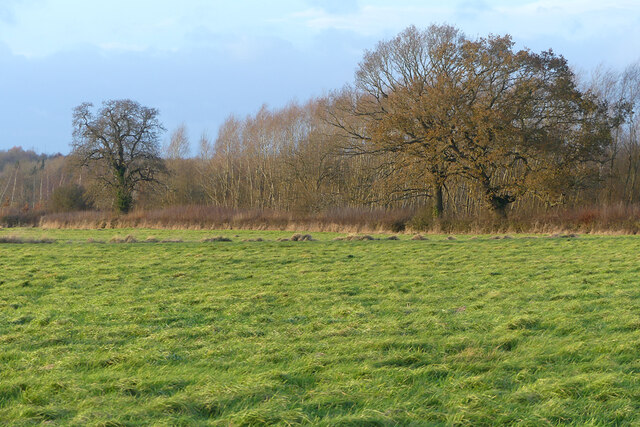
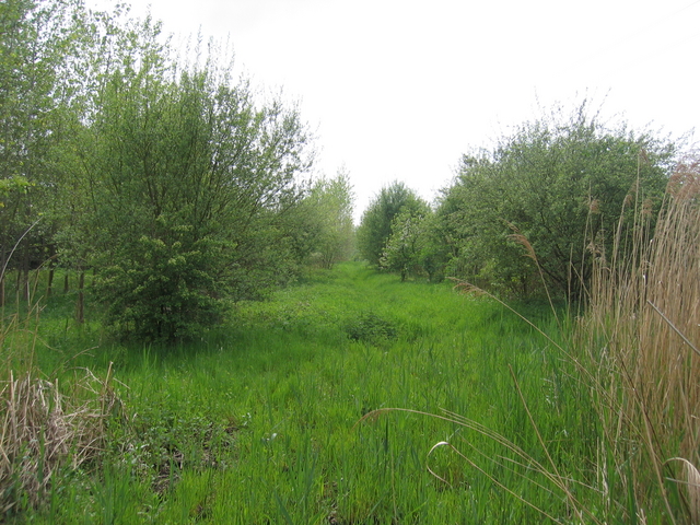
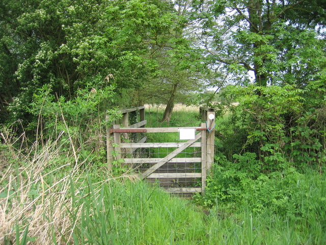
Lightwood Coppice is a picturesque woodland located in Worcestershire, England. Covering an area of approximately 100 hectares, this enchanting forest is a haven for nature lovers and outdoor enthusiasts alike. The coppice is part of the wider Wyre Forest, one of the largest remaining ancient woodlands in the country.

The woodland is predominantly composed of native broadleaf trees, including oak, beech, and ash, which create a diverse and vibrant ecosystem. The dense canopy provides a habitat for a variety of bird species, such as woodpeckers, owls, and warblers, making it a birdwatcher's paradise. Additionally, the forest floor is adorned with a rich carpet of wildflowers, including bluebells and primroses, which add a burst of color to the landscape during springtime.

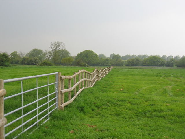
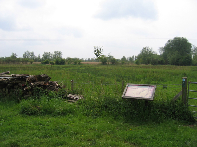
Lightwood Coppice offers a range of recreational activities for visitors to enjoy. There are numerous well-maintained walking trails that wind through the forest, allowing visitors to immerse themselves in the natural beauty of the surroundings. The peaceful atmosphere and serene surroundings make it an ideal spot for picnics, with designated areas provided for this purpose.

The woodland is also home to a diverse array of wildlife, including deer, squirrels, and foxes. Nature enthusiasts can often spot these creatures while exploring the forest, adding to the sense of adventure and discovery.

Overall, Lightwood Coppice is a hidden gem in Worcestershire, offering a tranquil and immersive experience in a beautiful natural setting. Whether you are looking for a peaceful stroll, wildlife spotting, or simply a place to reconnect with nature, this woodland is a must-visit destination for all nature lovers.

If you have any feedback on the listing, please let us know in the comments section below.

Lightwood Coppice Images

Images are sourced within 2km of 52.235751/-1.9739781 or Grid Reference SP0159. Thanks to Geograph Open Source API. All images are credited.

Timber Framed House, Salt Way, Feckenham
Old circular AA sign on Feckenham High Street Old AA Sign located on the southeast facing gable end of the village hall on the High Street. Feckenham parish.

This is the circular, village name on black band, Motor Union either side of AA badge at top type, showing distances Droitwich 7½ Alcester 6¼ London 104¼.

There were five series of AA signs, mostly dating from 1923 and made by Francis & Co / Franco in Deptford, London. The village name and distance to London were usually displayed.

See also <span class="nowrap"><a title="https://www.flickr.com/photos/stevenkidd/29029749788" rel="nofollow ugc noopener" href="https://www.flickr.com/photos/stevenkidd/29029749788">Link</a><img style="margin-left:2px;" alt="External link" title="External link - shift click to open in new window" src="https://s1.geograph.org.uk/img/external.png" width="10" height="10"/></span> , <a title="https://www.geograph.org.uk/photo/6191167" href="https://www.geograph.org.uk/photo/6191167">Link</a> and <a title="https://www.geograph.org.uk/photo/6191164" href="https://www.geograph.org.uk/photo/6191164">Link</a>.

See <a title="https://www.geograph.org.uk/photo/6094722" href="https://www.geograph.org.uk/photo/6094722">Link</a> to see it at its previous location at SP01056120 on the side door of a house at the east end of Feckenham.

Milestone Society National ID: WO-FECK
Old circular AA sign on Feckenham High Street
Old AA Sign located on the southeast facing gable end of the village hall on the High Street. Feckenham parish. This is the circular, village name on black band, Motor Union either side of AA badge at top type, showing distances Droitwich 7½ Alcester 6¼ London 104¼. There were five series of AA signs, mostly dating from 1923 and made by Francis & Co / Franco in Deptford, London. The village name and distance to London were usually displayed. See also LinkExternal link , Link and Link. See Link to see it at its previous location at SP01056120 on the side door of a house at the east end of Feckenham. Milestone Society National ID: WO-FECK
Pasture, Feckenham Pasture and woodland to the north-west of Bean Hall Mill.
Pasture, Feckenham
Pasture and woodland to the north-west of Bean Hall Mill.
Feckenham High Street
Wheating Hill Looking south east from Astwood Lane
Wheating Hill
Looking south east from Astwood Lane
Electricity Sub Station This stands on the 02 grid line but the photo was taken from the north east.
Electricity Sub Station
This stands on the 02 grid line but the photo was taken from the north east.
The Saltway The Saltway was built by the Romans to give them access to the deposits of salt at Droitwich Spa, salt being a very important commodity to them.
The Saltway
The Saltway was built by the Romans to give them access to the deposits of salt at Droitwich Spa, salt being a very important commodity to them.
Shurnock Court A view of the fine old timber framed building from the public bridleway through the adjoining fields.
Shurnock Court
A view of the fine old timber framed building from the public bridleway through the adjoining fields.
Fence at Shurnock The fields around Shurnock Court still show signs of ridge and furrow farming. This field has been subdivided with recent fencing to create smaller paddocks, resulting in an interesting fence line as it cuts across the ridges.
Fence at Shurnock
The fields around Shurnock Court still show signs of ridge and furrow farming. This field has been subdivided with recent fencing to create smaller paddocks, resulting in an interesting fence line as it cuts across the ridges.
Feckenham Wylde Moor Nature reserve This small nature reserve is situated on an area of marshland beside Moors Lane.  The notice board <a href="https://www.geograph.org.uk/photo/173555">SP0160 : Feckenham Wylde Moor Nature Reserve</a> provides more detail.
Feckenham Wylde Moor Nature reserve
This small nature reserve is situated on an area of marshland beside Moors Lane. The notice board SP0160 : Feckenham Wylde Moor Nature Reserve provides more detail.
Footpath to Beanhall Mill Farm Looking along the footpath from the Feckenham Wylde nature reserve at the edge of the square.  The OS map shows this as marshland and the verdant greenery confirms that it is!  For the walker the recent heavy rains make it very squidgy underfoot.
Footpath to Beanhall Mill Farm
Looking along the footpath from the Feckenham Wylde nature reserve at the edge of the square. The OS map shows this as marshland and the verdant greenery confirms that it is! For the walker the recent heavy rains make it very squidgy underfoot.
Llama Seen in a field by Moors Lane.
Llama
Seen in a field by Moors Lane.
Pond by Moors Lane A small man-made pond beside Moors Lane at the junction of the bridleway towards Andy's Barn.
Pond by Moors Lane
A small man-made pond beside Moors Lane at the junction of the bridleway towards Andy's Barn.
Feckenham Wylde Moor Nature Reserve The sign at the entrance to <a href="https://www.geograph.org.uk/photo/169740">SP0160 : Feckenham Wylde Moor Nature reserve</a> from Moors Lane.
Feckenham Wylde Moor Nature Reserve
The sign at the entrance to SP0160 : Feckenham Wylde Moor Nature reserve from Moors Lane.
Footbridge at Feckenham Wylde Moors Nature Reserve The gate and footbridge on the footpath to Beanhall Mill near the western edge of the square.
Footbridge at Feckenham Wylde Moors Nature Reserve
The gate and footbridge on the footpath to Beanhall Mill near the western edge of the square.
The Lygon Arms Pub on the main road in Feckenham
The Lygon Arms
Pub on the main road in Feckenham
The Village Shop, Feckenham With Feckenham Garage in the background.
The Village Shop, Feckenham
With Feckenham Garage in the background.
Memorial seat, Holberrow Green A recently made memorial seat in memory of those from Holberrow Green who gave their lives in the First World War.  The seat is round the trunk of an oak tree on the junction of a no through road to Morton Hall with the B4092.
Memorial seat, Holberrow Green
A recently made memorial seat in memory of those from Holberrow Green who gave their lives in the First World War. The seat is round the trunk of an oak tree on the junction of a no through road to Morton Hall with the B4092.
Show me another place!

Lightwood Coppice is located at Grid Ref: SP0159 (Lat: 52.235751, Lng: -1.9739781)

Administrative County: Worcestershire

District: Wychavon

Police Authority: West Mercia

What 3 Words

///smuggled.glee.prevented. Near Inkberrow, Worcestershire

Related Wikis

Holberrow Green

Holberrow Green is a village in Worcestershire, England. == External links == Media related to Holberrow Green at Wikimedia Commons

Sporting Club Inkberrow F.C.

Sporting Club Inkberrow Football Club is a football club based in Inkberrow, England. They are currently members of the Hellenic League Division One and...

Feckenham

Feckenham is a village and civil parish in the Borough of Redditch in Worcestershire, England. It lies some 4 miles (6 km) south-west of the town of Redditch...

Redditch (UK Parliament constituency)

Redditch is a constituency in Worcestershire, England, represented in the House of Commons of the UK Parliament since 2017 by Rachel Maclean of the Conservative...

Little Inkberrow

Little Inkberrow is a village in Worcestershire, England. Ralph Ardern inherited the Worcestershire manor of Little Inkberrow between 1382 (the death...

Inkberrow Castle

Inkberrow Castle was situated in the village of Inkberrow in Worcestershire, some 10 km south of Redditch (grid reference SP017572). It was a castle built...

Inkberrow

Inkberrow is a village in Worcestershire, England, often thought to be the model for Ambridge, the setting of BBC Radio 4's long-running series The Archers...

Ham Green, Worcestershire

Ham Green is a hamlet outside Redditch, Worcestershire. It lies in between the villages of Feckenham, Callow Hill, Elcocks Brook & Cruise Hill.

Nearby Amenities

Located within 500m of 52.235751,-1.9739781
Morton Hall
Power: pole
Transformer: distribution
Voltage Primary: 11000
Lat/Long: 52.2322053/-1.9742418
Power: pole
Lat/Long: 52.2323747/-1.976138
Power: tower
Source: bing
Lat/Long: 52.2399567/-1.9748252
Power: tower
Source: bing
Lat/Long: 52.2382854/-1.9755428
Power: pole
Lat/Long: 52.2322197/-1.9757295
Manor Farm Morton Underhill
Power: pole
Transformer: distribution
Voltage Primary: 11000
Lat/Long: 52.2331128/-1.9780619
Power: pole
Lat/Long: 52.2320559/-1.9735586
Power: tower
Source: bing
Lat/Long: 52.2370945/-1.9760476
Power: tower
Source: bing
Lat/Long: 52.2358658/-1.9765706
Morton Hall Lane
Power: pole
Transformer: distribution
Voltage Primary: 11000
Lat/Long: 52.2322165/-1.9750215
Power: pole
Lat/Long: 52.2327145/-1.9770521
Power: tower
Source: bing
Lat/Long: 52.234808/-1.9770188
Power: tower
Source: bing
Lat/Long: 52.2337236/-1.9770041
Power: pole
Lat/Long: 52.2329612/-1.9788399
The data included in this document is from www.openstreetmap.org. The data is made available under ODbL.

Have you been to Lightwood Coppice?

Leave your review of Lightwood Coppice below (or comments, questions and feedback).