West Wood

Wood, Forest in Northumberland

England

West Wood

NCR 72 near High Barns Farm
NCR 72 near High Barns Farm Credit: Colin Pyle

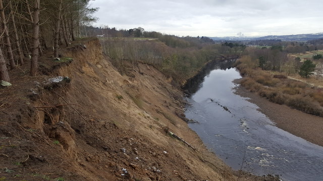
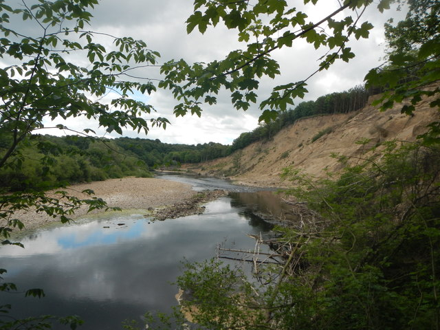
West Wood is a picturesque forest located in the county of Northumberland, England. Stretching across a vast area of approximately 500 acres, this woodland is renowned for its natural beauty and rich biodiversity. It is situated in the western part of Northumberland, in close proximity to the charming village of Wood.

The forest is characterized by its dense canopy of mature trees, predominantly oak and beech, which provide a tranquil and serene environment. The woodland floor is adorned with a vibrant carpet of wildflowers, ferns, and mosses, creating a stunning display of colors throughout the seasons. The diverse range of plant species supports a thriving ecosystem, attracting a variety of birdlife, mammals, and insects.

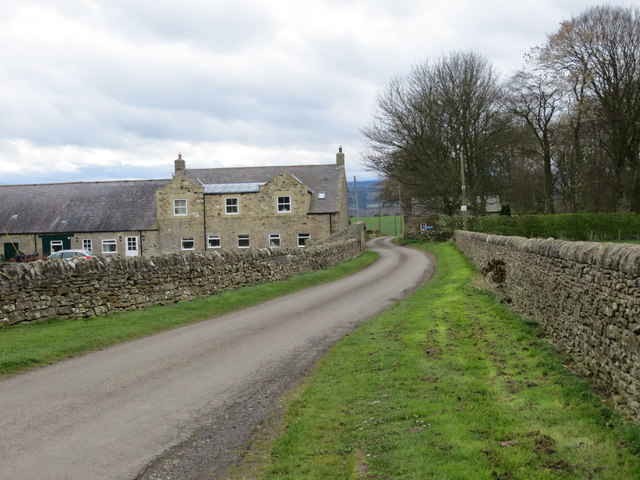
West Wood is a popular destination for nature enthusiasts, hikers, and photographers due to its stunning vistas, well-maintained trails, and peaceful ambiance. The forest offers a range of walking and cycling paths, allowing visitors to explore its hidden gems at their own pace. The paths are well-marked, ensuring easy navigation and accessibility for all ages and abilities.

The woodland also boasts several picnic areas and benches, providing perfect spots for visitors to relax and soak in the tranquil surroundings. Local authorities have ensured the preservation of the forest by implementing sustainable management practices, balancing the needs of conservation with recreational activities.

Overall, West Wood in Northumberland is a captivating natural haven that offers a unique escape from the hustle and bustle of everyday life. Whether one seeks solitude, adventure, or simply a connection with nature, this enchanting forest provides an idyllic retreat for all to enjoy.

If you have any feedback on the listing, please let us know in the comments section below.

West Wood Images

Images are sourced within 2km of 54.972102/-2.0023909 or Grid Reference NY9964. Thanks to Geograph Open Source API. All images are credited.

NCR 72 near High Barns Farm
B6530 at East Lodge
B6530 at East Lodge
B6530 at Howden Dene
Gallowhill Farmhouse
Farnley Scar This bend in the river has always suffered from erosion hence its name, however the floods in late 2015 resulted in huge erosion and land slips into the River Tyne.
Farnley Scar
This bend in the river has always suffered from erosion hence its name, however the floods in late 2015 resulted in huge erosion and land slips into the River Tyne.
Farnley Scar and River Tyne The erosion from late 2015 is evident
Farnley Scar and River Tyne
The erosion from late 2015 is evident
Stile on pedestrian railway crossing , Newcastle to Carlisle line
Road (B6321) at Piperclose Looking south-westward.
Road (B6321) at Piperclose
Looking south-westward.
Road at Thornbrough Kiln House Looking southward.
Road at Thornbrough Kiln House
Looking southward.
Road and Bridge crossing over the A69 Looking south-westward.
Road and Bridge crossing over the A69
Looking south-westward.
Minor road joining the B6350 at Styford Toll Bar Looking southward.
Minor road joining the B6350 at Styford Toll Bar
Looking southward.
Ordnance Survey Flush Bracket G2749 This bracket can be found on the wall of a house - private dwelling - at Piperclose. The benchmark height is recorded as being 95.797 metres above sea level.
For more detail see : <span class="nowrap"><a title="http://www.bench-marks.org.uk/bm14896" rel="nofollow ugc noopener" href="http://www.bench-marks.org.uk/bm14896">Link</a><img style="margin-left:2px;" alt="External link" title="External link - shift click to open in new window" src="https://s1.geograph.org.uk/img/external.png" width="10" height="10"/></span>
Ordnance Survey Flush Bracket G2749
This bracket can be found on the wall of a house - private dwelling - at Piperclose. The benchmark height is recorded as being 95.797 metres above sea level. For more detail see : LinkExternal link
Ordnance Survey Cut Mark This mark can be found on the roadside wall of Kiln House, Thornbrough. The benchmark height is recorded as being 133.56 metres above sea level.
For more detail see : <span class="nowrap"><a title="http://www.bench-marks.org.uk/bm85373" rel="nofollow ugc noopener" href="http://www.bench-marks.org.uk/bm85373">Link</a><img style="margin-left:2px;" alt="External link" title="External link - shift click to open in new window" src="https://s1.geograph.org.uk/img/external.png" width="10" height="10"/></span>
Ordnance Survey Cut Mark
This mark can be found on the roadside wall of Kiln House, Thornbrough. The benchmark height is recorded as being 133.56 metres above sea level. For more detail see : LinkExternal link
Ordnance Survey Flush Bracket S026 This bracket can be found on the wall of Styford Lodge - a private dwelling. The benchmark height is recorded as being 85.685 metres above sea level.
For more detail see : <span class="nowrap"><a title="http://www.bench-marks.org.uk/bm11475" rel="nofollow ugc noopener" href="http://www.bench-marks.org.uk/bm11475">Link</a><img style="margin-left:2px;" alt="External link" title="External link - shift click to open in new window" src="https://s1.geograph.org.uk/img/external.png" width="10" height="10"/></span>
Ordnance Survey Flush Bracket S026
This bracket can be found on the wall of Styford Lodge - a private dwelling. The benchmark height is recorded as being 85.685 metres above sea level. For more detail see : LinkExternal link
Landslip at Farnley Scar Caused by floods in December 2015 when the River Tyne reached 20 feet above its normal level. The landslip has destroyed the footpath between Corbridge and Broomhaugh.
Landslip at Farnley Scar
Caused by floods in December 2015 when the River Tyne reached 20 feet above its normal level. The landslip has destroyed the footpath between Corbridge and Broomhaugh.
A69 passes under Aydon Road overbridge
A69 near Thornbrough
Old Milepost by the B6530, Howden Dene, Corbridge Metal post with attached metal plate by the B6530, in parish of CORBRIDGE (TYNEDALE District), Howden Dene, near Cricket Plantation, on verge at junction with lane, on North side of road. Smith Patterson iron shield, erected by the Hexham turnpike trust in the 19th century. 

Inscription reads:- : NEWCASTLE / 16 {arrow to right} / HE(XHAM / {arrow to left} 4½) : : C / 41¾ : : SMITH PATTERSON / & CO / BLAYDON :

Milestone Society National ID: NB_NCHX16.
Old Milepost by the B6530, Howden Dene, Corbridge
Metal post with attached metal plate by the B6530, in parish of CORBRIDGE (TYNEDALE District), Howden Dene, near Cricket Plantation, on verge at junction with lane, on North side of road. Smith Patterson iron shield, erected by the Hexham turnpike trust in the 19th century. Inscription reads:- : NEWCASTLE / 16 {arrow to right} / HE(XHAM / {arrow to left} 4½) : : C / 41¾ : : SMITH PATTERSON / & CO / BLAYDON : Milestone Society National ID: NB_NCHX16.
Show me another place!

West Wood is located at Grid Ref: NY9964 (Lat: 54.972102, Lng: -2.0023909)

Unitary Authority: Northumberland

Police Authority: Northumbria

What 3 Words

///snoozing.smirks.sampling. Near Corbridge, Northumberland

Related Wikis

Battle of Corbridge

The Battle of Corbridge took place on the banks of the River Tyne near the village of Corbridge in Northumberland in the year 918. The battle was referenced...

Corbridge Town Hall

Corbridge Town Hall is a municipal building in Princes Street in Corbridge, Northumberland, England. The building, which is now in commercial use, is a...

Corbridge

Corbridge is a village in Northumberland, England, 16 miles (26 km) west of Newcastle and 4 miles (6 km) east of Hexham. Villages nearby include Halton...

Corbridge Bridge

Corbridge Bridge is a 17th-century stone bridge across the River Tyne at Corbridge, Northumberland, England. The bridge used to carry the A68 road over...

Corbridge Vicar's Pele

Corbridge Vicar's Pele is a pele tower in the village of Corbridge, Northumberland, England. It was a three-storey defensive pele tower, with one room...

Corbridge railway station

Corbridge is a railway station on the Tyne Valley Line, which runs between Newcastle and Carlisle via Hexham. The station, situated 19 miles 15 chains...
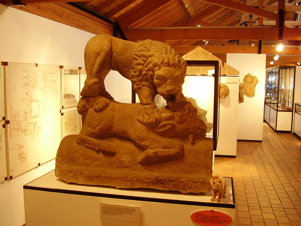
Corbridge Lion

The Corbridge Lion, Northumberland, England, is an ancient Roman free-standing sandstone sculpture of a male lion standing on a prone animal (possibly...

Aydon

Aydon is a village and former civil parish, now in the parish of Corbridge, in Northumberland, England. It is about 2 miles (3 km) northeast of Corbridge...

Nearby Amenities

Located within 500m of 54.972102,-2.0023909
Post Box
Collection Times: Mo-Fr 09:00; Sa 07:00
Operator: Royal Mail
Post Box Type: wall
Ref: NE45 160
Royal Cypher: VR
Royal Cypher Wikidata: Q33102356
Lat/Long: 54.9724718/-2.000538
Post Box
Collection Times: Mo-Fr 09:00; Sa 07:00
Operator: Royal Mail
Operator Wikidata: Q638098
Post Box Type: wall
Ref: NE45 160D
Royal Cypher: VR
Royal Cypher Wikidata: Q33102356
Lat/Long: 54.9724191/-2.0007477
Direction: S
Generator Method: photovoltaic
Generator Output Electricity: yes
Generator Solar Modules: 8
Generator Source: solar
Generator Type: solar_photovoltaic_panel
Location: roof
Power: generator
Lat/Long: 54.9737127/-2.0067294
Direction: E
Generator Method: photovoltaic
Generator Output Electricity: yes
Generator Solar Modules: 8
Generator Source: solar
Generator Type: solar_photovoltaic_panel
Location: roof
Power: generator
Lat/Long: 54.9736757/-2.0068782
Generator Method: photovoltaic
Generator Output Electricity: yes
Generator Source: solar
Generator Type: solar_photovoltaic_panel
Location: roof
Power: generator
Lat/Long: 54.974601/-2.0081553
Generator Method: photovoltaic
Generator Output Electricity: yes
Generator Source: solar
Generator Type: solar_photovoltaic_panel
Location: roof
Power: generator
Lat/Long: 54.9746056/-2.0082063
Bus Stop
Bench: no
Bus: yes
Public Transport: platform
Shelter: no
Lat/Long: 54.9734914/-2.0073965
Bus Stop
Bus: yes
Public Transport: platform
Lat/Long: 54.9734372/-2.0081345
Bus Stop
Bench: no
Bin: no
Bus: yes
Lit: yes
Name Signed: no
Naptan AtcoCode: 3100Z000641
Naptan NaptanCode: nldgtgat
Public Transport: platform
Shelter: no
Tactile Paving: no
Lat/Long: 54.9724361/-2.0006717
Bus Stop
Bench: no
Bin: no
Bus: yes
Lit: no
Name Signed: no
Naptan AtcoCode: 3100Z000642
Naptan NaptanCode: nldgtgam
Public Transport: platform
Shelter: no
Tactile Paving: no
Lat/Long: 54.9725127/-2.0006701
The data included in this document is from www.openstreetmap.org. The data is made available under ODbL.

Have you been to West Wood?

Leave your review of West Wood below (or comments, questions and feedback).