Arle Grove

Wood, Forest in Gloucestershire Cotswold

England

Arle Grove

Dowdeswell Church Viewed from the north.
Dowdeswell Church Credit: Bob Embleton

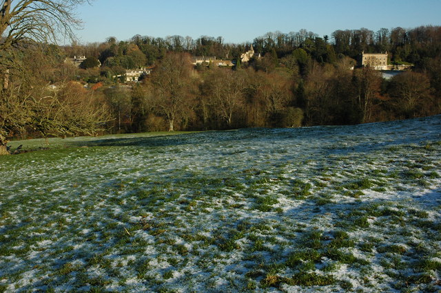
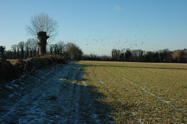
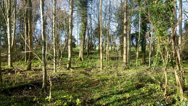
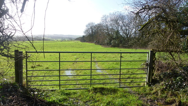
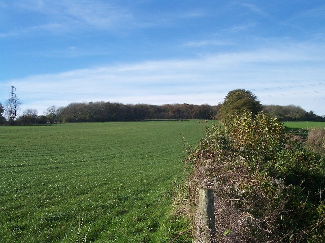
Arle Grove is a picturesque woodland located in the county of Gloucestershire, England. Situated in the heart of the Forest of Dean, this enchanting area covers an expansive 200 acres of lush greenery and is renowned for its natural beauty and tranquil atmosphere.

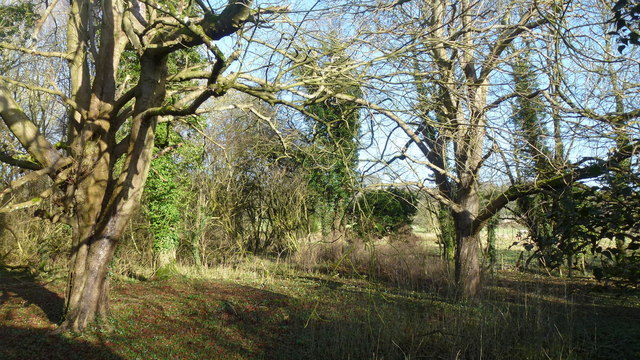
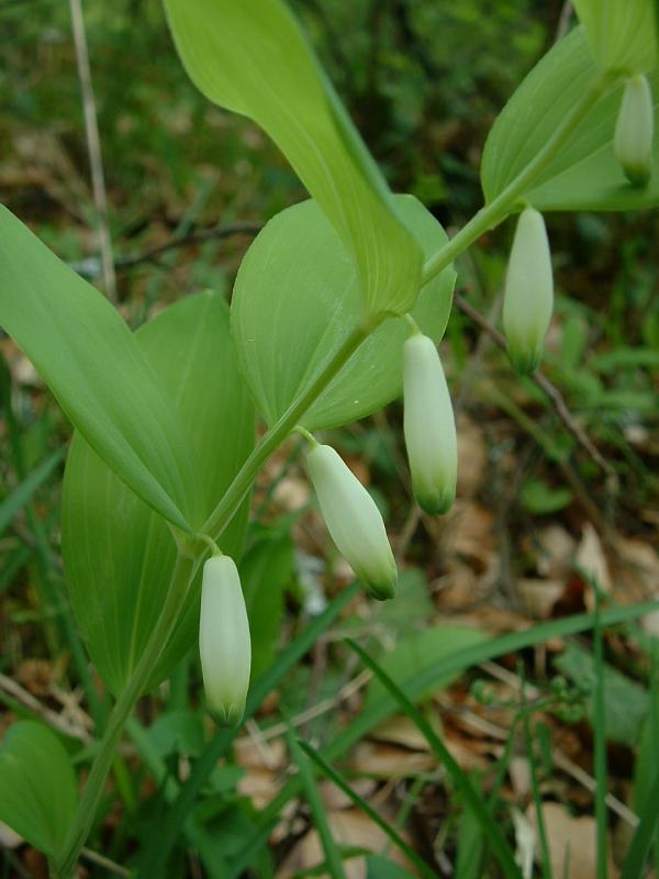
The grove is predominantly composed of a diverse range of tree species, including towering oak, beech, and ash trees, which canopy the forest floor and create a mesmerizing play of light and shadow. The vibrant undergrowth is home to an array of flora, such as bluebells, wild garlic, and ferns, adding to the visual appeal of the woodland.

Arle Grove attracts nature enthusiasts, hikers, and photographers due to its numerous walking trails that meander through the woods, offering stunning vistas and a chance to observe wildlife in its natural habitat. Visitors can expect to spot a variety of fauna, including deer, badgers, foxes, and an abundance of bird species, making it an ideal destination for birdwatchers.

In addition to its natural splendor, Arle Grove boasts historical significance. The area was once part of the ancient Royal Forest of Dean, where timber was harvested for shipbuilding during the Middle Ages. Remnants of this history can still be found within the grove, such as old charcoal platforms and abandoned mine entrances, adding a sense of intrigue to the woodland.

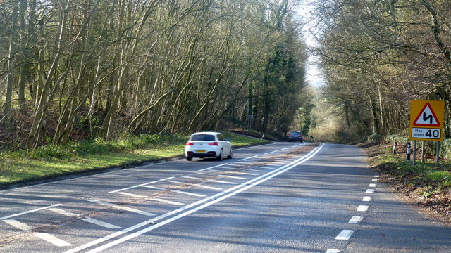
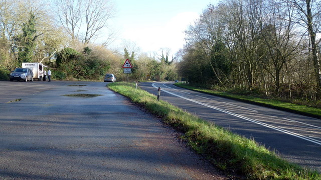
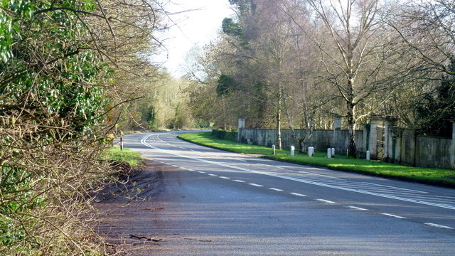
Arle Grove is easily accessible by foot or bicycle, with several well-marked paths leading to its entrance. The tranquil ambiance, breathtaking scenery, and rich biodiversity make it a cherished destination for both locals and tourists seeking a peaceful retreat in the heart of Gloucestershire's woodlands.

If you have any feedback on the listing, please let us know in the comments section below.
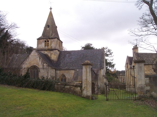
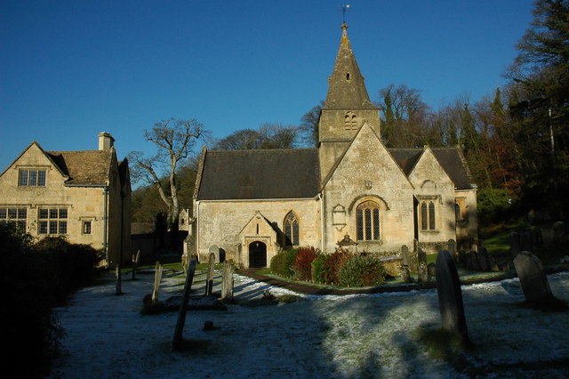
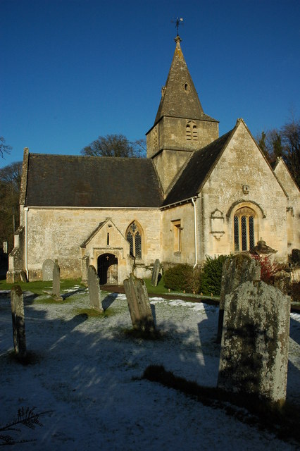
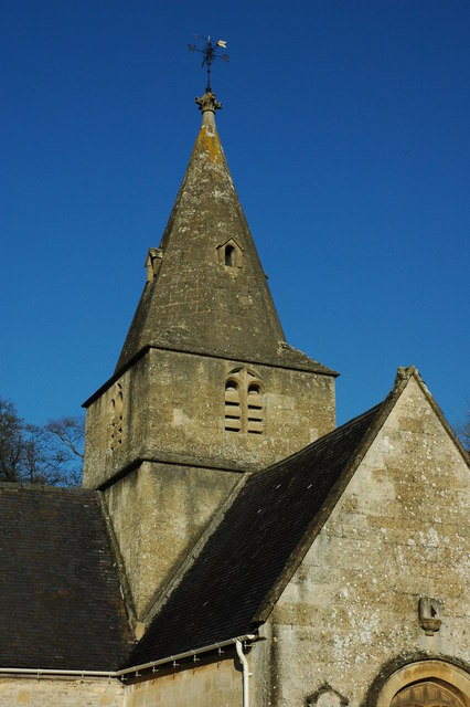
Arle Grove Images

Images are sourced within 2km of 51.893194/-2.0097185 or Grid Reference SO9921. Thanks to Geograph Open Source API. All images are credited.

Dowdeswell Church Viewed from the north.
Dowdeswell Church
Viewed from the north.
Dowdeswell Church The church at Lower Dowdeswell serves the parishes of Dowdeswell and Andersford.
Dowdeswell Church
The church at Lower Dowdeswell serves the parishes of Dowdeswell and Andersford.
Dowdeswell Church The church at Lower Dowdeswell serves the parishes of Dowdeswell and Andersford.
Dowdeswell Church
The church at Lower Dowdeswell serves the parishes of Dowdeswell and Andersford.
The spire of Dowdeswell Church The church at Lower Dowdeswell serves the parishes of Dowdeswell and Andersford.
The spire of Dowdeswell Church
The church at Lower Dowdeswell serves the parishes of Dowdeswell and Andersford.
Stained glass window, Dowdeswell Church Stained glass in the east window of Dowdeswell Church.
Stained glass window, Dowdeswell Church
Stained glass in the east window of Dowdeswell Church.
The porch of Dowdeswell Church The sun shining into the porch of Dowdeswell Church.
The porch of Dowdeswell Church
The sun shining into the porch of Dowdeswell Church.
Lower Dowdeswell Lower Dowdeswell viewed from the footpath to the west of the small village.
Lower Dowdeswell
Lower Dowdeswell viewed from the footpath to the west of the small village.
Footpath to Lower Dowdeswell The footpath follows the line of the wall. In the middle distance a large flock of carrion crows have taken to the sky.
Footpath to Lower Dowdeswell
The footpath follows the line of the wall. In the middle distance a large flock of carrion crows have taken to the sky.
Tree beside a footpath A pollarded tree beside a footpath to the east of Lower Dowdeswell.
Tree beside a footpath
A pollarded tree beside a footpath to the east of Lower Dowdeswell.
Chancel of Dowdeswell Church
Font in Dowdeswell Church
A40 at Whittington, 1 When geographing busy main roads like this it's always very nice to have a convenient lay-by. This view west towards Cheltenham is taken from one such lay-by which also happens to straddle the gridline, so two squares for the one parking spot!
A40 at Whittington, 1
When geographing busy main roads like this it's always very nice to have a convenient lay-by. This view west towards Cheltenham is taken from one such lay-by which also happens to straddle the gridline, so two squares for the one parking spot!
Woodland by the A40, 1 Beech woodland adjacent to the lay-by.
Woodland by the A40, 1
Beech woodland adjacent to the lay-by.
Lay-by on the A40 at Whittington When geographing busy main roads like this it's always very nice to have a convenient lay-by. This view east is taken at one such lay-by which also happens to straddle the gridline, so two squares for the one parking spot!
A welcome lunchtime snack before carrying on to more squares!
Lay-by on the A40 at Whittington
When geographing busy main roads like this it's always very nice to have a convenient lay-by. This view east is taken at one such lay-by which also happens to straddle the gridline, so two squares for the one parking spot! A welcome lunchtime snack before carrying on to more squares!
A40 at Whittington, 2 When geographing busy main roads like this it's always very nice to have a convenient lay-by. This view east towards Oxford is taken from one such lay-by which also happens to straddle the gridline, so two squares for the one parking spot!
A40 at Whittington, 2
When geographing busy main roads like this it's always very nice to have a convenient lay-by. This view east towards Oxford is taken from one such lay-by which also happens to straddle the gridline, so two squares for the one parking spot!
Woodland by the A40, 2 Looking through to the edge of the grounds of Whittington Court.
Woodland by the A40, 2
Looking through to the edge of the grounds of Whittington Court.
Corner of Whittington A small Cotswold village that straddles the British watershed.
Corner of Whittington
A small Cotswold village that straddles the British watershed.
Sunlit pasture To the west of Whittington; a footpath proceeds from this gate south-east towards Whittington Court.
Some ridge of strip cultivation can be seen here.
Sunlit pasture
To the west of Whittington; a footpath proceeds from this gate south-east towards Whittington Court. Some ridge of strip cultivation can be seen here.
Show me another place!

Arle Grove is located at Grid Ref: SO9921 (Lat: 51.893194, Lng: -2.0097185)

Administrative County: Gloucestershire

District: Cotswold

Police Authority: Gloucestershire

What 3 Words

///wing.times.valve. Near Charlton Kings, Gloucestershire

Nearby Locations

Arle Grove

Related Wikis

Arle Grove

Arle Grove (grid reference SO995215) is a 5-hectare (12-acre) nature reserve in Gloucestershire. The site is listed in the 'Cotswold District' Local Plan...

Dowdeswell

Dowdeswell is a civil parish in the ward of Chedworth, Cotswold, in the ceremonial county of Gloucestershire, England. It is separated into Upper and Lower...

Puckham Woods

Puckham Woods (grid reference SP010224) is a 32.38-hectare (80.0-acre) biological Site of Special Scientific Interest in Gloucestershire to the east of...

Dowdeswell Reservoir

Dowdeswell Reservoir and former water treatment works lie below the parish of Dowdeswell in Gloucestershire. They were originally built by Cheltenham...

Whittington Court

Whittington Court is an Elizabethan manor house, five miles east of Cheltenham in Gloucestershire, England. Adjacent to the house is the Whittington parish...

Oakley, Gloucestershire

Oakley is a district of Cheltenham in Gloucestershire, England. In the Domesday Book of 1086, it is recorded as held by Turstin FitzRolf. Oakley primarily...

Whittington, Gloucestershire

Whittington, Gloucestershire is a village and rural parish in the county of Gloucestershire in England, United Kingdom. == Location == Whittington, Gloucestershire...

A40 road

The A40 is a trunk road which runs between London and Goodwick (Fishguard), Wales, and officially called The London to Fishguard Trunk Road (A40) in all...

Nearby Amenities

Located within 500m of 51.893194,-2.0097185
Archaeological Site: tumulus
Description: Bowl barrow
Historic: archaeological_site
Listed Status: Scheduled Monument
Ref He: 1017336
Source: NPE
Lat/Long: 51.8932929/-2.0148303
Power: tower
Ref: ZF 323
Source: bing
Source Ref: extrapolation
Lat/Long: 51.8910486/-2.0097961
Power: tower
Ref: ZF 322
Source: bing
Source Ref: extrapolation
Lat/Long: 51.8940929/-2.0072984
Barrier: stile
Foot: designated
Material: stone
Note: Small lowered section in stone wall.
Stile: squeezer
Lat/Long: 51.8964896/-2.012499
The data included in this document is from www.openstreetmap.org. The data is made available under ODbL.

Have you been to Arle Grove?

Leave your review of Arle Grove below (or comments, questions and feedback).