Park Nook Wood

Wood, Forest in Yorkshire Craven

England

Park Nook Wood

Grass track across Starbotton Cam Pasture A track not shown on online maps, probably made by quad bikes.
Grass track across Starbotton Cam Pasture Credit: Stephen Craven

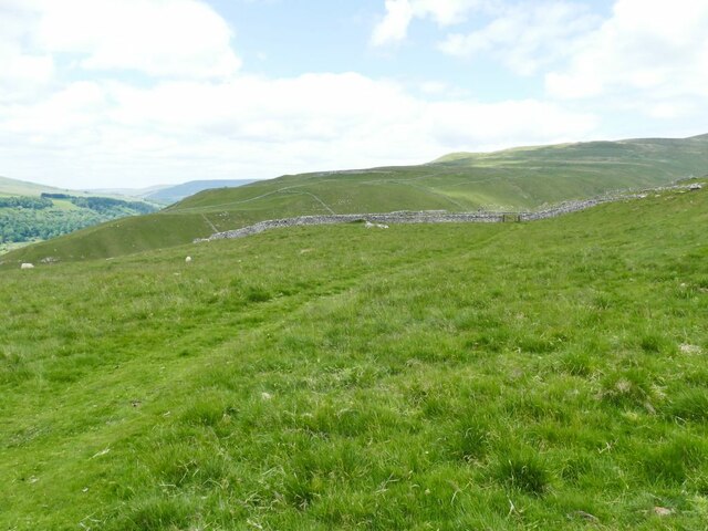
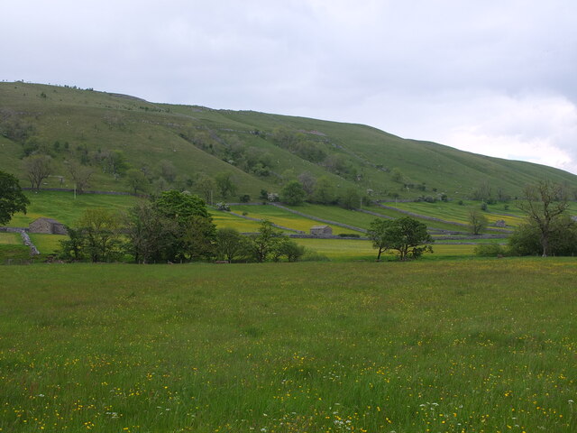
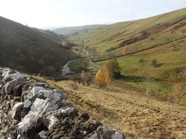
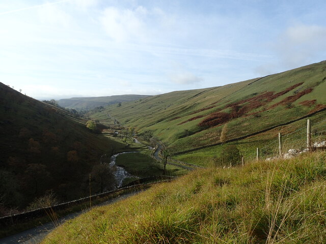
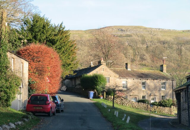
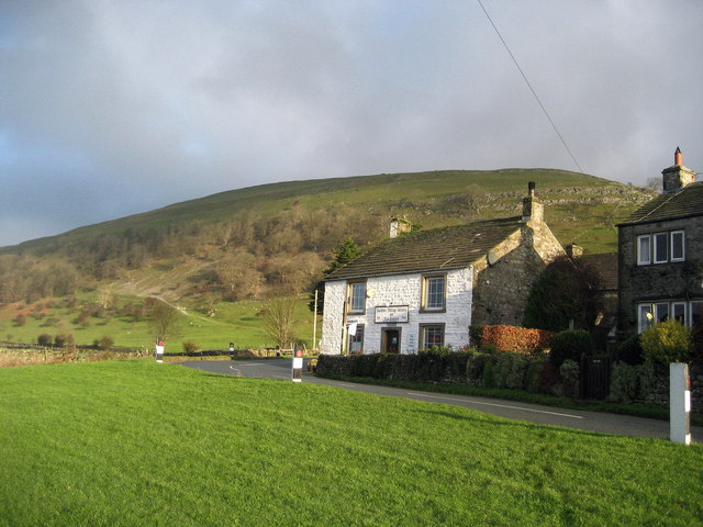
Park Nook Wood is a picturesque woodland located in Yorkshire, England. Situated in the heart of the county, this forested area spans over a vast expanse of approximately 100 acres, providing an idyllic retreat for nature lovers and outdoor enthusiasts alike.

The wood is characterized by its diverse range of tree species, including oak, beech, and ash. These towering trees create a dense canopy, casting dappled sunlight onto the forest floor and creating a tranquil atmosphere. The undergrowth is rich in ferns, wildflowers, and mosses, enhancing the beauty and biodiversity of the wood.

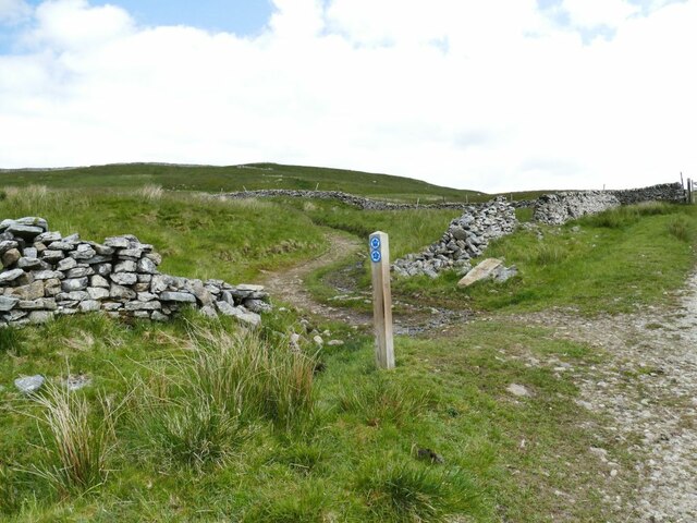
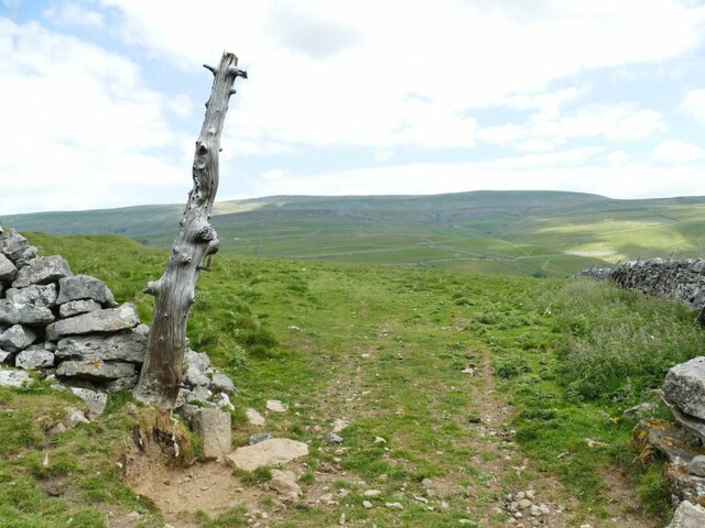
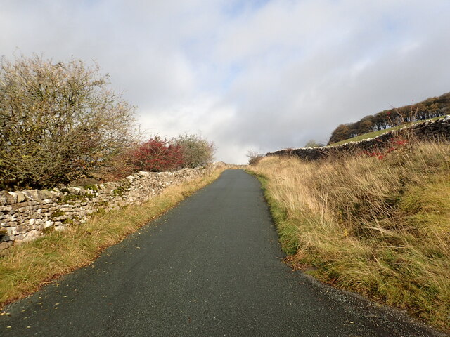
A network of well-maintained walking trails weaves through Park Nook Wood, allowing visitors to explore its natural wonders at their own pace. The paths wind through the forest, offering breathtaking views of the surrounding landscape and providing opportunities for birdwatching and wildlife spotting. The wood is home to a variety of animal species, such as deer, foxes, and numerous bird species.

In addition to its natural beauty, Park Nook Wood also boasts several amenities to enhance visitors' experiences. There are picnic areas scattered throughout the wood, perfect for enjoying a leisurely lunch amidst nature. The wood is also equipped with well-maintained restroom facilities and ample parking, ensuring convenience for visitors.

Park Nook Wood is a haven for those seeking solace in nature. Its serene ambiance, diverse flora and fauna, and well-kept trails make it a popular destination for both locals and tourists, offering a rejuvenating escape from the hustle and bustle of everyday life.

If you have any feedback on the listing, please let us know in the comments section below.

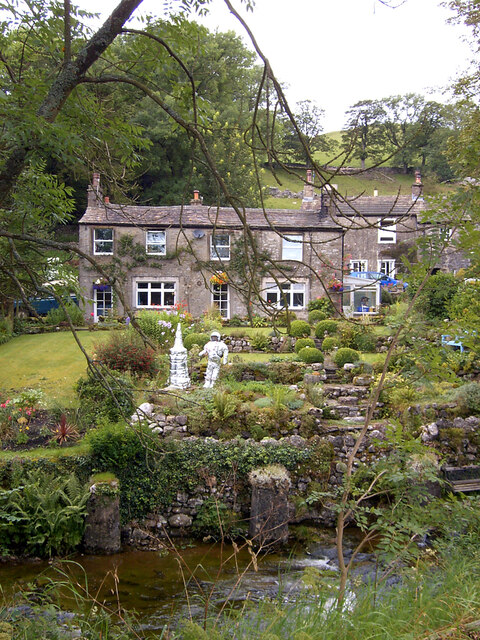
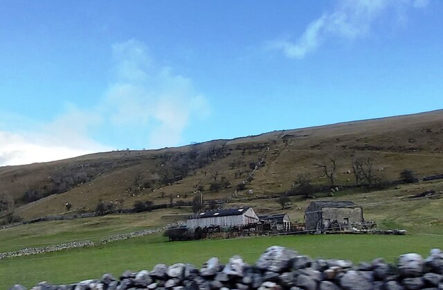
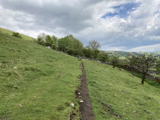
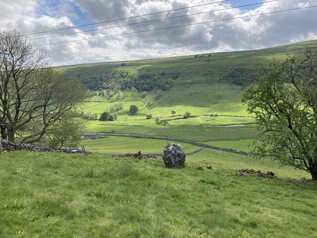
Park Nook Wood Images

Images are sourced within 2km of 54.164246/-2.0363088 or Grid Reference SD9774. Thanks to Geograph Open Source API. All images are credited.

Grass track across Starbotton Cam Pasture A track not shown on online maps, probably made by quad bikes.
Grass track across Starbotton Cam Pasture
A track not shown on online maps, probably made by quad bikes.
Bridleway junction at Sandy Gate Left for Buckden Pike, straight on for Nidderdale or down to Kettlewell.
Bridleway junction at Sandy Gate
Left for Buckden Pike, straight on for Nidderdale or down to Kettlewell.
Lambs at Cam Head
Lambs at Cam Head
Hay Tonge Farm Viewed from Top Mere Road.
Hay Tonge Farm
Viewed from Top Mere Road.
Top Mere Road The 'road' is unsurfaced, only accessible by 'off-road' vehicles, and only classed as a public bridleway. It gives a great view down Wharfedale.
Top Mere Road
The 'road' is unsurfaced, only accessible by 'off-road' vehicles, and only classed as a public bridleway. It gives a great view down Wharfedale.
A natural gatepost I'm not the only person to have noticed the pair of old gate hinges on this tree stump <a href="https://www.geograph.org.uk/photo/5628997">SD9773 : Gateway with gatepost</a>.
A natural gatepost
I'm not the only person to have noticed the pair of old gate hinges on this tree stump SD9773 : Gateway with gatepost.
Kettlewell village from Top Mere Road
Kettlewell old school See also <a href="https://www.geograph.org.uk/photo/3760245">SD9772 : The Old School House, Kettlewell</a>.  The present village school is on the road to Starbotton <a href="https://www.geograph.org.uk/photo/6792273">SD9672 : Kettlewell Primary School</a>.
Kettlewell old school
See also SD9772 : The Old School House, Kettlewell. The present village school is on the road to Starbotton SD9672 : Kettlewell Primary School.
A garden during the Kettlewell Scarecrow Festival
A garden during the Kettlewell Scarecrow Festival Kettlewell Beck is in the foreground.
A garden during the Kettlewell Scarecrow Festival
Kettlewell Beck is in the foreground.
Paradise Farm
Paradise Farm
Path between Starbotton and Kettlewell
View from the path between Kettlewell and Starbotton
View across Wharfedale near Starbotton
Cam Gill Road at Park Rash Cam Gill Road leads steeply out of Wharfedale at Kettlewell and passes over the moors to eventually reach Coverdale. After a couple of hairpin bends, this is one of the steepest sections. The view in the other direction can be seen at <a title="https://www.geograph.org.uk/photo/7328457" href="https://www.geograph.org.uk/photo/7328457">Link</a>
Cam Gill Road at Park Rash
Cam Gill Road leads steeply out of Wharfedale at Kettlewell and passes over the moors to eventually reach Coverdale. After a couple of hairpin bends, this is one of the steepest sections. The view in the other direction can be seen at Link
View from Cam Gill Road at Park Rash Cam Gill Road leads steeply out of Wharfedale at Kettlewell and passes over the moors to eventually reach Coverdale. After a couple of hairpin bends, this view is from one of the steepest sections and looks towards the Cam Gill Beck which is a tributary of the River Wharfe. The view in the other direction can be seen at <a title="https://www.geograph.org.uk/photo/7327735" href="https://www.geograph.org.uk/photo/7327735">Link</a>
View from Cam Gill Road at Park Rash
Cam Gill Road leads steeply out of Wharfedale at Kettlewell and passes over the moors to eventually reach Coverdale. After a couple of hairpin bends, this view is from one of the steepest sections and looks towards the Cam Gill Beck which is a tributary of the River Wharfe. The view in the other direction can be seen at Link
Cam Gill Road at Park Rash Cam Gill Road leads steeply out of Wharfedale at Kettlewell and passes over the moors to eventually reach Coverdale. After a couple of hairpin bends, this view is from one of the steepest sections and looks towards the Cam Gill Beck which is a tributary of the River Wharfe. The view in the other direction can be seen at <a title="https://www.geograph.org.uk/photo/7327735" href="https://www.geograph.org.uk/photo/7327735">Link</a>
Cam Gill Road at Park Rash
Cam Gill Road leads steeply out of Wharfedale at Kettlewell and passes over the moors to eventually reach Coverdale. After a couple of hairpin bends, this view is from one of the steepest sections and looks towards the Cam Gill Beck which is a tributary of the River Wharfe. The view in the other direction can be seen at Link
Leaving Kettlewell The last few houses in the village before one follows the road steeply up to the left on the long climb up towards Park Rash and the pass over towards Coverdale.
Leaving Kettlewell
The last few houses in the village before one follows the road steeply up to the left on the long climb up towards Park Rash and the pass over towards Coverdale.
Show me another place!

Park Nook Wood is located at Grid Ref: SD9774 (Lat: 54.164246, Lng: -2.0363088)

Division: West Riding

Administrative County: North Yorkshire

District: Craven

Police Authority: North Yorkshire

What 3 Words

///duet.riots.passwords. Near Grassington, North Yorkshire

Related Wikis

Kettlewell with Starbotton

Kettlewell with Starbotton is a civil parish in the Craven district of North Yorkshire, England. Kettlewell is a village in Upper Wharfedale, North Yorkshire...

Kettlewell

Kettlewell is a village in Upper Wharfedale, North Yorkshire, England. Historically part of the West Riding of Yorkshire, it lies 6 miles (10 km) north...

Starbotton

Starbotton is a village of around 60 houses in Upper Wharfedale in the Craven district of North Yorkshire, England. It is situated in the Yorkshire Dales...

Great Whernside

Great Whernside is a fell in the Yorkshire Dales, England, not to be confused with Whernside, some 17 miles (27 km) to the west. Its summit is the highest...

Scargill House

Scargill House is a Christian conference Centre run by the Scargill Movement and located in Wharfedale, in the county of North Yorkshire, England. Scargill...

Langcliffe Pot

Langcliffe Pot is a cave system on the slopes of Great Whernside in Upper Wharfedale, about 3 kilometres (1.9 mi) SSE of Kettlewell in North Yorkshire...

Hawkswick

Hawkswick is a hamlet and civil parish in the Craven district of North Yorkshire, England. Situated in the Yorkshire Dales, it lies in Littondale on the...

Buckden, North Yorkshire

Buckden is a village and civil parish in the Craven district of North Yorkshire, England. Historically part of the West Riding of Yorkshire, Buckden is...

Nearby Amenities

Located within 500m of 54.164246,-2.0363088
Cam Pasture
Natural: fell
Source: NPE
Lat/Long: 54.1634852/-2.0434461
Dove Caves
Natural: cave_entrance
Source: OS 1:25k
Lat/Long: 54.1633828/-2.0291426
Dove Caves
Natural: cave_entrance
Source: OS 1:25k
Lat/Long: 54.1637259/-2.0299763
Historic: mine_shaft
Source: Bing
Lat/Long: 54.1614036/-2.0409894
Historic: mine_shaft
Source: Bing
Lat/Long: 54.1614445/-2.040984
Historic: mine_shaft
Source: Bing
Lat/Long: 54.1613739/-2.0417055
Historic: mine_shaft
Source: Bing
Lat/Long: 54.1615528/-2.0413702
Historic: mine_shaft
Source: Bing
Lat/Long: 54.1617507/-2.0413461
Historic: mine_shaft
Source: Bing
Lat/Long: 54.1608886/-2.0413702
Historic: mine_shaft
Source: Bing
Lat/Long: 54.1628911/-2.0405712
Historic: mine_shaft
Source: Bing
Lat/Long: 54.1619219/-2.0412951
Historic: mine_shaft
Source: Bing
Lat/Long: 54.1619078/-2.0397582
Historic: mine_shaft
Source: Bing
Lat/Long: 54.1616236/-2.0397502
Historic: mine_shaft
Mineral: lead
Source: Bing
Source Mineral: OS 1853 sheet 98
Lat/Long: 54.1612969/-2.0405629
Historic: mine_shaft
Source: Bing
Lat/Long: 54.1615827/-2.0399245
Historic: mine_shaft
Source: Bing
Lat/Long: 54.1626633/-2.0398925
Historic: mine_shaft
Source: Bing
Lat/Long: 54.1626728/-2.0406597
Historic: mine_shaft
Source: Bing
Lat/Long: 54.1621905/-2.0412388
Historic: mine_shaft
Source: Bing
Lat/Long: 54.1622125/-2.0424431
Historic: mine_shaft
Source: Bing
Lat/Long: 54.1621166/-2.0412307
Stile: stepover
Lat/Long: 54.1634122/-2.0320515
Stile: stepover
Lat/Long: 54.1626473/-2.0347967
Natural: spring
Source: OS 1853 sheet 98
Lat/Long: 54.1613511/-2.0380801
Natural: spring
Source: OS 1853 sheet 98
Lat/Long: 54.1612506/-2.0380962
Historic: mine_shaft
Source: DigitalGlobe-Standard
Lat/Long: 54.160635/-2.040768
Historic: mine_shaft
Mineral: lead
Source: Bing
Source Mineral: OS 1853 sheet 98
Lat/Long: 54.1611689/-2.0409718
old lead mine shaft
Historic: mine_shaft
Mineral: lead
Source: OS 1853 sheet 98
Source Mineral: OS 1853 sheet 98
Lat/Long: 54.166128/-2.0397809
Power: pole
Source: bing
Lat/Long: 54.1677934/-2.0345964
Power: pole
Source: bing
Lat/Long: 54.1675932/-2.0348699
Power: pole
Source: bing
Lat/Long: 54.1670169/-2.035621
Power: pole
Source: bing
Lat/Long: 54.1673345/-2.0351797
The data included in this document is from www.openstreetmap.org. The data is made available under ODbL.

Have you been to Park Nook Wood?

Leave your review of Park Nook Wood below (or comments, questions and feedback).