West Scale Park

Downs, Moorland in Yorkshire Craven

England

West Scale Park

Cows by the river Wharfe The cows are on the far side of the river from the photographer, the nearest one being at a point where they come down to the river to drink.
Cows by the river Wharfe Credit: Stephen Craven

West Scale Park is a picturesque and expansive natural reserve located in the heart of Yorkshire, England. Spanning over a vast area that includes both downs and moorland, this park offers visitors a unique and diverse landscape to explore.

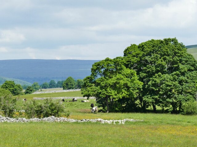
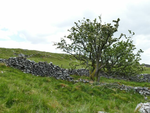
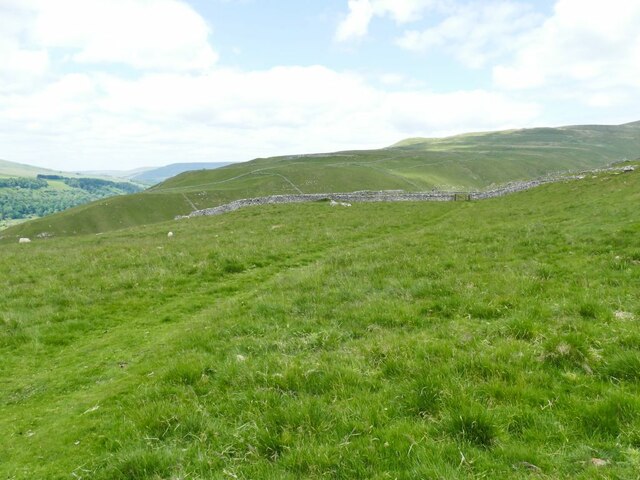
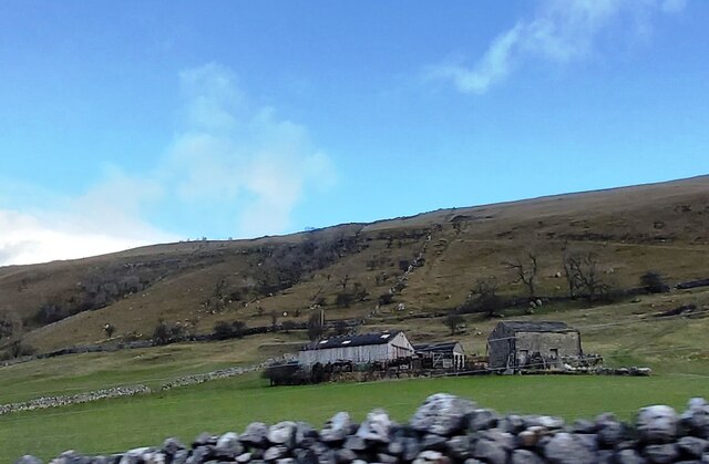
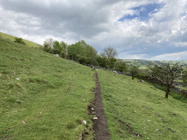
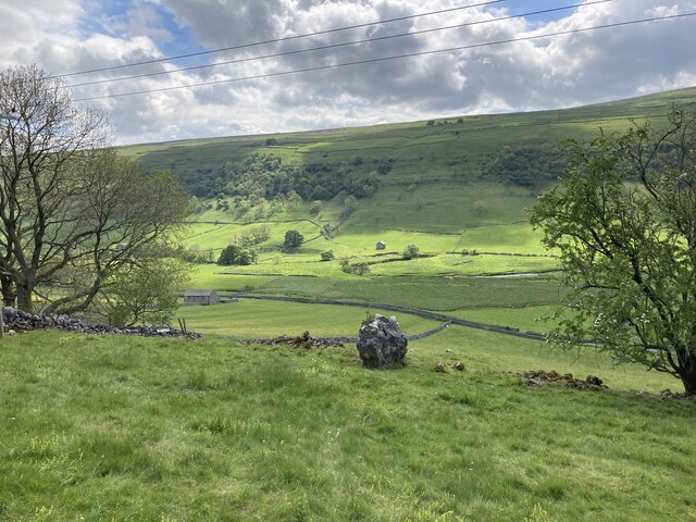
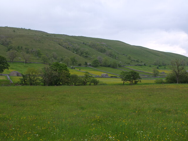
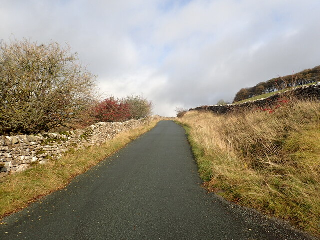
The downs section of the park is characterized by rolling hills and open grasslands, providing a tranquil and serene atmosphere for visitors. The lush greenery and panoramic views make it an ideal spot for hiking, picnicking, and enjoying the outdoors. The downs are also home to a variety of wildlife, including rabbits, deer, and a wide array of bird species, making it a popular destination for nature enthusiasts and birdwatchers.

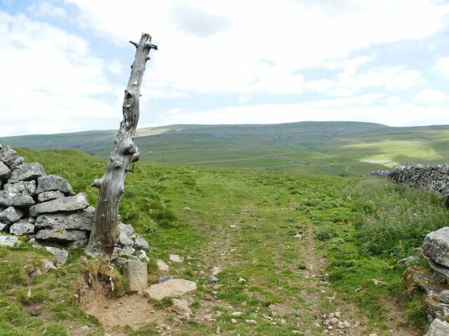
The moorland area of West Scale Park presents a stark contrast, with rugged and wild terrain. Here, visitors can witness the raw beauty of Yorkshire's untamed landscape, featuring vast expanses of heather-covered hills, rocky outcrops, and peat bogs. The moorland is renowned for its unique flora and fauna, including rare species such as bilberry and cotton grass, as well as birds of prey like the merlin and golden plover.

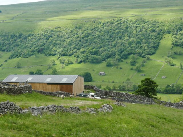
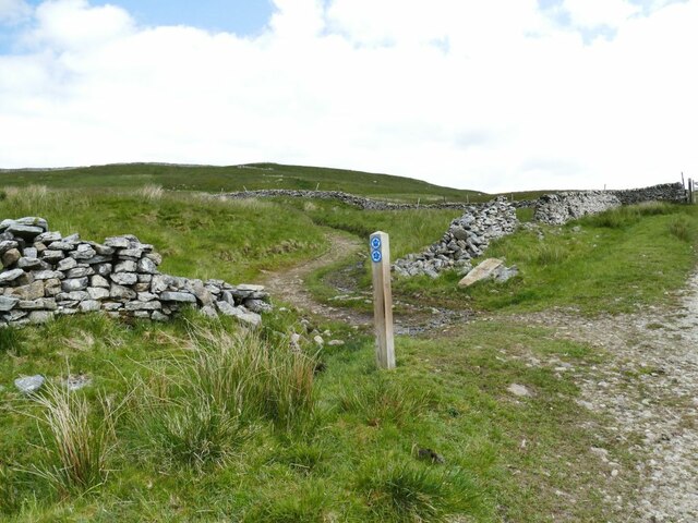
In addition to its natural beauty, West Scale Park offers a range of recreational activities for visitors. There are designated trails for walking and cycling, allowing visitors to explore the park at their own pace. The park also provides facilities for camping, with designated camping areas and basic amenities such as toilets and water sources.

Overall, West Scale Park in Yorkshire is a haven for nature lovers, offering a diverse range of landscapes, abundant wildlife, and recreational opportunities for all. Whether you're seeking a peaceful retreat or an adventurous outing, this park promises to deliver an unforgettable experience amid Yorkshire's stunning natural beauty.

If you have any feedback on the listing, please let us know in the comments section below.

West Scale Park Images

Images are sourced within 2km of 54.165728/-2.0404148 or Grid Reference SD9774. Thanks to Geograph Open Source API. All images are credited.

Cows by the river Wharfe The cows are on the far side of the river from the photographer, the nearest one being at a point where they come down to the river to drink.
Cows by the river Wharfe
The cows are on the far side of the river from the photographer, the nearest one being at a point where they come down to the river to drink.
Starbotton waterworks (1) The installation alongside Starbotton Cam Road is shown on one online map as a 'sewage pumping station' which given its location high above the village seems most unlikely. Rather, it's a reservoir and treatment works for the village water supply.
Starbotton waterworks (1)
The installation alongside Starbotton Cam Road is shown on one online map as a 'sewage pumping station' which given its location high above the village seems most unlikely. Rather, it's a reservoir and treatment works for the village water supply.
Starbotton waterworks (2) The installation alongside Starbotton Cam Road is shown on one online map as a 'sewage pumping station' which given its location high above the village seems most unlikely. Rather, it's a reservoir and treatment works for the village water supply.
Starbotton waterworks (2)
The installation alongside Starbotton Cam Road is shown on one online map as a 'sewage pumping station' which given its location high above the village seems most unlikely. Rather, it's a reservoir and treatment works for the village water supply.
Modern barn by Starbotton Cam Road Maps show a sheepfold here, but the wooden-clad barn looks quite a recent addition.
Modern barn by Starbotton Cam Road
Maps show a sheepfold here, but the wooden-clad barn looks quite a recent addition.
Hawthorn alongside Starbotton Cam Road A solitary tree by this steep stone track high on the hillside.
Hawthorn alongside Starbotton Cam Road
A solitary tree by this steep stone track high on the hillside.
Grass track across Starbotton Cam Pasture A track not shown on online maps, probably made by quad bikes.
Grass track across Starbotton Cam Pasture
A track not shown on online maps, probably made by quad bikes.
Bridleway junction at Sandy Gate Left for Buckden Pike, straight on for Nidderdale or down to Kettlewell.
Bridleway junction at Sandy Gate
Left for Buckden Pike, straight on for Nidderdale or down to Kettlewell.
Lambs at Cam Head
Lambs at Cam Head
Hay Tonge Farm Viewed from Top Mere Road.
Hay Tonge Farm
Viewed from Top Mere Road.
Top Mere Road The 'road' is unsurfaced, only accessible by 'off-road' vehicles, and only classed as a public bridleway. It gives a great view down Wharfedale.
Top Mere Road
The 'road' is unsurfaced, only accessible by 'off-road' vehicles, and only classed as a public bridleway. It gives a great view down Wharfedale.
A natural gatepost I'm not the only person to have noticed the pair of old gate hinges on this tree stump <a href="https://www.geograph.org.uk/photo/5628997">SD9773 : Gateway with gatepost</a>.
A natural gatepost
I'm not the only person to have noticed the pair of old gate hinges on this tree stump SD9773 : Gateway with gatepost.
Paradise Farm
Paradise Farm
Path between Starbotton and Kettlewell
View from the path between Kettlewell and Starbotton
View towards Starbotton from Calfhalls
View towards Slater Barn from Calfhalls
View across Wharfedale near Starbotton
Cam Gill Road at Park Rash Cam Gill Road leads steeply out of Wharfedale at Kettlewell and passes over the moors to eventually reach Coverdale. After a couple of hairpin bends, this is one of the steepest sections. The view in the other direction can be seen at <a title="https://www.geograph.org.uk/photo/7328457" href="https://www.geograph.org.uk/photo/7328457">Link</a>
Cam Gill Road at Park Rash
Cam Gill Road leads steeply out of Wharfedale at Kettlewell and passes over the moors to eventually reach Coverdale. After a couple of hairpin bends, this is one of the steepest sections. The view in the other direction can be seen at Link
Show me another place!

West Scale Park is located at Grid Ref: SD9774 (Lat: 54.165728, Lng: -2.0404148)

Division: West Riding

Administrative County: North Yorkshire

District: Craven

Police Authority: North Yorkshire

What 3 Words

///barbarian.brave.sleepy. Near Grassington, North Yorkshire

Related Wikis

Kettlewell with Starbotton

Kettlewell with Starbotton is a civil parish in the Craven district of North Yorkshire, England. Kettlewell is a village in Upper Wharfedale, North Yorkshire...

Starbotton

Starbotton is a village of around 60 houses in Upper Wharfedale in the Craven district of North Yorkshire, England. It is situated in the Yorkshire Dales...

Kettlewell

Kettlewell is a village in Upper Wharfedale, North Yorkshire, England. Historically part of the West Riding of Yorkshire, it lies 6 miles (10 km) north...

Great Whernside

Great Whernside is a fell in the Yorkshire Dales, England, not to be confused with Whernside, some 17 miles (27 km) to the west. Its summit is the highest...

Nearby Amenities

Located within 500m of 54.165728,-2.0404148
Cam Pasture
Natural: fell
Source: NPE
Lat/Long: 54.1634852/-2.0434461
Historic: mine_shaft
Source: Bing
Lat/Long: 54.1614036/-2.0409894
Historic: mine_shaft
Source: Bing
Lat/Long: 54.1614445/-2.040984
Historic: mine_shaft
Source: Bing
Lat/Long: 54.1613739/-2.0417055
Historic: mine_shaft
Source: Bing
Lat/Long: 54.1615528/-2.0413702
Historic: mine_shaft
Source: Bing
Lat/Long: 54.1617507/-2.0413461
Historic: mine_shaft
Source: Bing
Lat/Long: 54.1661211/-2.0460562
Historic: mine_shaft
Source: Bing
Lat/Long: 54.1628911/-2.0405712
Historic: mine_shaft
Source: Bing
Lat/Long: 54.167974/-2.0457021
Historic: mine_shaft
Source: Bing
Lat/Long: 54.166476/-2.0462117
Historic: mine_shaft
Source: Bing
Lat/Long: 54.1673301/-2.0475529
Historic: mine_shaft
Source: Bing
Lat/Long: 54.1619219/-2.0412951
Historic: mine_shaft
Source: Bing
Lat/Long: 54.1619078/-2.0397582
Historic: mine_shaft
Source: Bing
Lat/Long: 54.1616236/-2.0397502
Historic: mine_shaft
Mineral: lead
Source: Bing
Source Mineral: OS 1853 sheet 98
Lat/Long: 54.1612969/-2.0405629
Historic: mine_shaft
Source: Bing
Lat/Long: 54.1615827/-2.0399245
Historic: mine_shaft
Source: Bing
Lat/Long: 54.1662626/-2.0477892
Historic: mine_shaft
Source: Bing
Lat/Long: 54.1626633/-2.0398925
Historic: mine_shaft
Source: Bing
Lat/Long: 54.1626728/-2.0406597
Historic: mine_shaft
Source: Bing
Lat/Long: 54.1621905/-2.0412388
Historic: mine_shaft
Source: Bing
Lat/Long: 54.1622125/-2.0424431
Historic: mine_shaft
Source: Bing
Lat/Long: 54.1621166/-2.0412307
old lead mine shaft
Historic: mine_shaft
Mineral: lead
Source: OS 1853 sheet 98
Source Mineral: OS 1853 sheet 98
Lat/Long: 54.166128/-2.0397809
Power: pole
Source: bing
Lat/Long: 54.1677934/-2.0345964
Power: pole
Source: bing
Lat/Long: 54.1675932/-2.0348699
Power: pole
Source: bing
Lat/Long: 54.1670169/-2.035621
Power: pole
Source: bing
Lat/Long: 54.1673345/-2.0351797
The data included in this document is from www.openstreetmap.org. The data is made available under ODbL.

Have you been to West Scale Park?

Leave your review of West Scale Park below (or comments, questions and feedback).