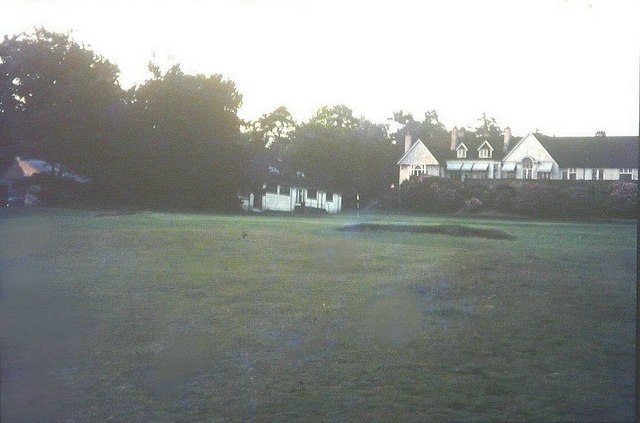
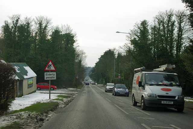
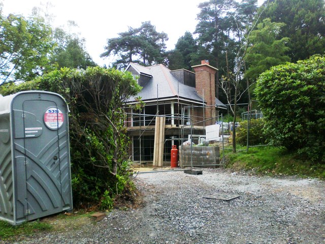
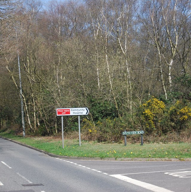
Crowborough Warren

Settlement in Sussex Wealden

England

Crowborough Warren

Crowborough Beacon Golf Club in 1967
Crowborough Beacon Golf Club in 1967 Credit: John Baker

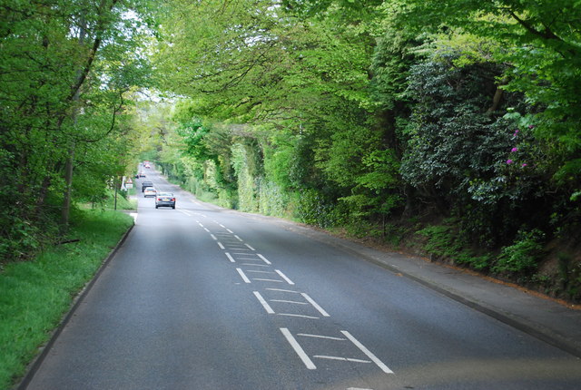
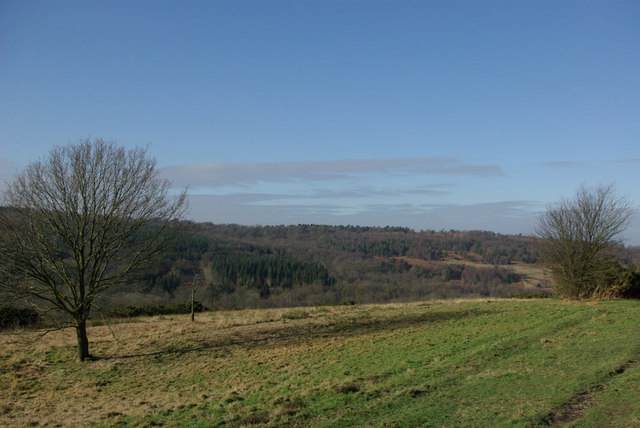
Crowborough Warren is a small village located in the Wealden district of East Sussex, England. Situated approximately 45 miles south of London, it lies on the edge of the Ashdown Forest, a renowned area of natural beauty. The village is surrounded by picturesque woodland and open heathland, offering a tranquil and idyllic setting.

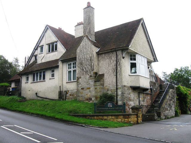
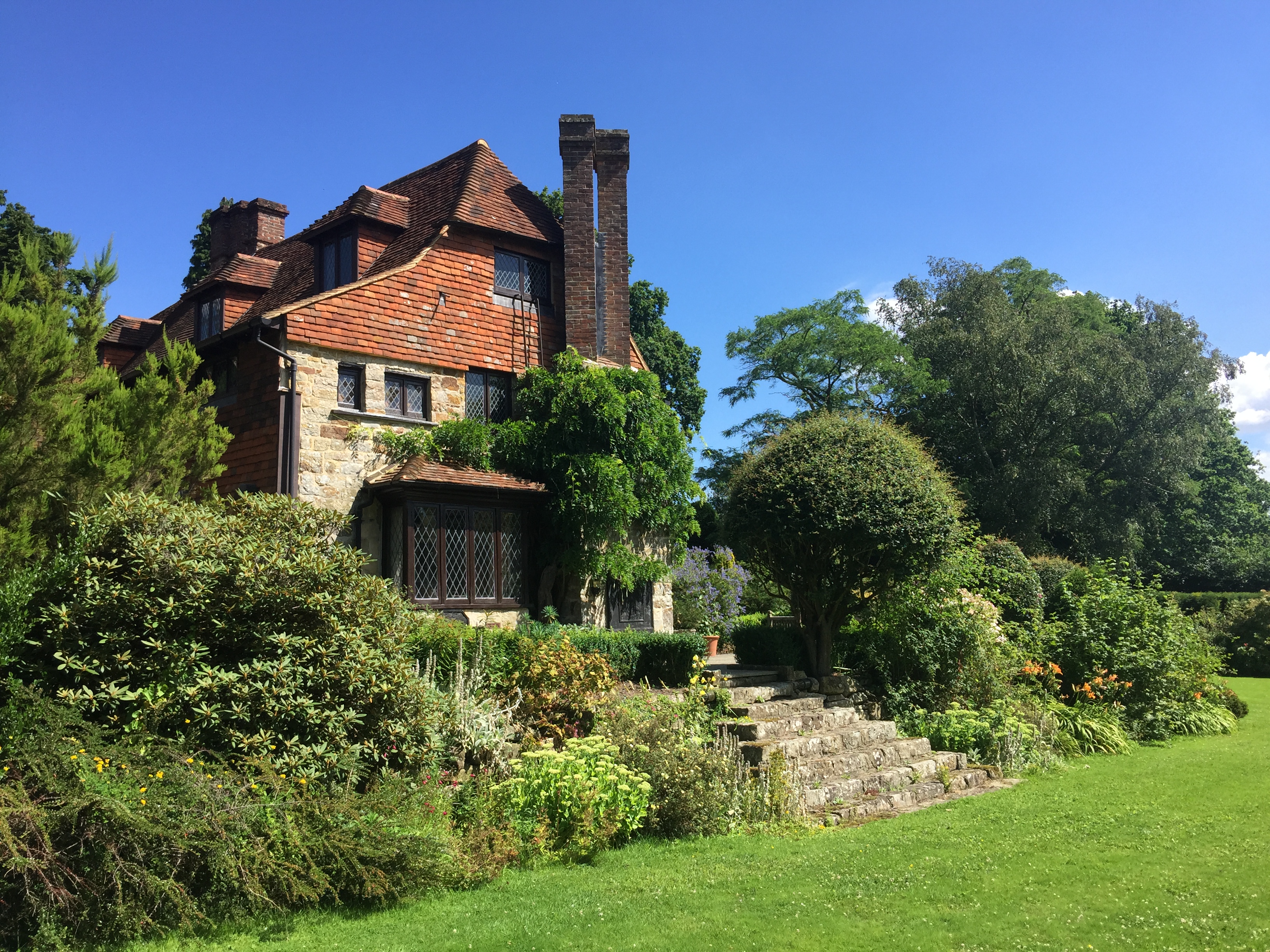
Historically, Crowborough Warren was primarily used for hunting by the Royal Family, and it still retains much of its rural charm today. The area is dotted with several large country estates, including Crowborough Warren House, which was once the home of Sir Arthur Conan Doyle, the famous author of the Sherlock Holmes novels.

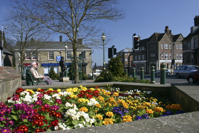
The village itself is small but well-served, with a range of amenities including a post office, a primary school, and a few local shops. There are also several charming pubs and restaurants where visitors can enjoy traditional English fare and locally brewed ales. The community is friendly and close-knit, with a strong sense of community spirit.

For outdoor enthusiasts, Crowborough Warren offers a plethora of recreational opportunities. The surrounding Ashdown Forest is a popular destination for walkers, cyclists, and horse riders, with its extensive network of trails and paths. The forest is also home to a rich variety of wildlife, including deer, birds, and rare plant species, making it a haven for nature lovers.

Overall, Crowborough Warren is a charming village that offers a peaceful and picturesque escape from the hustle and bustle of city life. Its stunning natural surroundings, historic significance, and friendly community make it a delightful place to visit or call home.

If you have any feedback on the listing, please let us know in the comments section below.

Crowborough Warren Images

Images are sourced within 2km of 51.063405/0.15166419 or Grid Reference TQ5031. Thanks to Geograph Open Source API. All images are credited.

Crowborough Beacon Golf Club in 1967
Queen's Road, Crowborough Carlton Terrace on the right, part of a succession of houses using quite a lot of the local stone as well as brick.
Queen's Road, Crowborough
Carlton Terrace on the right, part of a succession of houses using quite a lot of the local stone as well as brick.
A26 - beware elderly people There must be a home somewhere around here, but it was not obvious.
A26 - beware elderly people
There must be a home somewhere around here, but it was not obvious.
New house, Fielden Road
South View Rd off the A26
A26, Beacon Rd The A26 is a 50 mile route from Maidstone to Newhaven via Tunbridge Wells. <span class="nowrap"><a title="http://www.sabre-roads.org.uk/wiki/index.php?title=A26" rel="nofollow ugc noopener" href="http://www.sabre-roads.org.uk/wiki/index.php?title=A26">Link</a><img style="margin-left:2px;" alt="External link" title="External link - shift click to open in new window" src="https://s1.geograph.org.uk/img/external.png" width="10" height="10"/></span>
A26, Beacon Rd
The A26 is a 50 mile route from Maidstone to Newhaven via Tunbridge Wells. LinkExternal link
Crowborough Beacon Golf Club
The Old Buttery, Lordswell Lane Taken from the junction with Southview Road.
The Old Buttery, Lordswell Lane
Taken from the junction with Southview Road.
View from Bunker's Hill The open ground is public access Ashdown Forest, the woodland is private.
View from Bunker's Hill
The open ground is public access Ashdown Forest, the woodland is private.
Warren House
Warren House
Ivy Villas
Ivy Villas
Felled Trees, Crowborough, Sussex Much of the woodland, in this area, is under private ownership; but with access for walkers. Here, the felled timber is as a result of woodland management.
Felled Trees, Crowborough, Sussex
Much of the woodland, in this area, is under private ownership; but with access for walkers. Here, the felled timber is as a result of woodland management.
Warren Road, Crowborough, Sussex Looking towards the end of this private road, and buildings, at the edge of the Warren House estate. Whilst the private road continues to the right, the public bridleway turns to the left.
Warren Road, Crowborough, Sussex
Looking towards the end of this private road, and buildings, at the edge of the Warren House estate. Whilst the private road continues to the right, the public bridleway turns to the left.
Gate at Home Farm, Crowborough, Sussex The gateway marks the entrance to private woodland, beyond Home Farm.
Gate at Home Farm, Crowborough, Sussex
The gateway marks the entrance to private woodland, beyond Home Farm.
Postbox at Home Farm, Crowborough, Sussex Victorian postbox, serving Home Farm and Warren House. A lengthy drive for each collection.
Postbox at Home Farm, Crowborough, Sussex
Victorian postbox, serving Home Farm and Warren House. A lengthy drive for each collection.
Sheep Near Home Farm, Crowborough, Sussex Many lambs in evidence. After such a harsh winter of 2010/1, my perception is that the lambs have arrived a few weeks later than usual, this spring.
Sheep Near Home Farm, Crowborough, Sussex
Many lambs in evidence. After such a harsh winter of 2010/1, my perception is that the lambs have arrived a few weeks later than usual, this spring.
Bridleway Near Crowborough, Sussex Looking in the direction of Home Farm. The trees have the lovely fresh green of spring.
Bridleway Near Crowborough, Sussex
Looking in the direction of Home Farm. The trees have the lovely fresh green of spring.
Pasture near Home Farm From bridleway from Crowborough Warren to Deerswood Farm.
Pasture near Home Farm
From bridleway from Crowborough Warren to Deerswood Farm.
Show me another place!

Crowborough Warren is located at Grid Ref: TQ5031 (Lat: 51.063405, Lng: 0.15166419)

Administrative County: East Sussex

District: Wealden

Police Authority: Sussex

What 3 Words

///streak.clogging.offerings. Near Crowborough, East Sussex

Related Wikis

Crowborough Community Church

Crowborough Community Church (also known as Community Church, Crowborough) is an Evangelical church in the town of Crowborough in East Sussex, England...

Crowborough

Crowborough is a town and civil parish in East Sussex, England, in the Weald at the edge of Ashdown Forest in the High Weald Area of Outstanding Natural...

A26 road

The A26 road is a primary route in the southeast of England, going from Maidstone to Newhaven through the counties of Kent and East Sussex. The road is...

Pratt's Mill, Crowborough

Pratt's Mill is a tower mill at Crowborough, Sussex, England which has been truncated and converted to residential accommodation. == History == Pratt...

Beacon Academy

Beacon Academy (formerly Beacon Community College) is a coeducational secondary school and sixth form located in Crowborough in the English county of East...

Bream Wood

Bream Wood is a 7.8-hectare (19-acre) biological Site of Special Scientific Interest north of Crowborough in East Sussex.This steep sided valley wood has...

Crowborough Athletic F.C.

Crowborough Athletic Football Club is a football club based in Crowborough, East Sussex, England. Affiliated to the Sussex County Football Association...

Luxford House

Luxford House is a 16th-century Grade II listed building near Crowborough, East Sussex. It is near the 11.5-acre (4.7 ha) Luxford Farm. It was used by...

Nearby Amenities

Located within 500m of 51.063405,0.15166419
St John's
Is In: Crowborough, East Sussex, England, United Kingdom
Place: suburb
Lat/Long: 51.0631542/0.1539453
Turning Circle
Lat/Long: 51.0646662/0.1514865
Turning Circle
Lat/Long: 51.0640982/0.1574652
Grit Bin
Access: permissive
Lat/Long: 51.0658558/0.150985
Post Box
Post Box Type: pillar
Ref: TN6 253
Royal Cypher: EVIIIR
Royal Cypher Wikidata: Q33102195
Lat/Long: 51.0642703/0.145278
Post Box
Operator: Royal Mail
Operator Wikidata: Q638098
Post Box Type: lamp
Ref: TN6 202D
Royal Cypher: EIIR
Royal Cypher Wikidata: Q33102113
Lat/Long: 51.0597495/0.1486233
Post Box
Operator: Royal Mail
Post Box Type: lamp
Ref: TN6 245D
Royal Cypher: EIIR
Royal Cypher Wikidata: Q33102113
Lat/Long: 51.0625788/0.1582316
Post Box
Operator: Royal Mail
Post Box Type: lamp
Ref: TN6 24D
Royal Cypher: EIIR
Royal Cypher Wikidata: Q33102113
Lat/Long: 51.0645754/0.153532
Post Box
Operator: Royal Mail
Post Box Type: wall
Ref: TN6 158D
Royal Cypher: GR
Royal Cypher Wikidata: Q33102273
Lat/Long: 51.06586/0.1508286
Generator Method: photovoltaic
Generator Output Electricity: yes
Generator Source: solar
Generator Type: solar_photovoltaic_panel
Location: roof
Power: generator
Lat/Long: 51.0656937/0.1532735
Generator Method: photovoltaic
Generator Output Electricity: yes
Generator Source: solar
Generator Type: solar_photovoltaic_panel
Location: roof
Power: generator
Lat/Long: 51.0595746/0.1500843
Generator Method: photovoltaic
Generator Output Electricity: yes
Generator Source: solar
Generator Type: solar_photovoltaic_panel
Location: roof
Power: generator
Lat/Long: 51.0601958/0.1537281
Generator Method: photovoltaic
Generator Output Electricity: yes
Generator Source: solar
Generator Type: solar_photovoltaic_panel
Location: roof
Power: generator
Lat/Long: 51.0593007/0.1543584
Generator Method: photovoltaic
Generator Output Electricity: yes
Generator Source: solar
Generator Type: solar_photovoltaic_panel
Location: roof
Power: generator
Lat/Long: 51.0634122/0.1543115
Generator Method: photovoltaic
Generator Output Electricity: yes
Generator Source: solar
Generator Type: solar_photovoltaic_panel
Location: roof
Power: generator
Lat/Long: 51.0615495/0.1573196
Generator Method: photovoltaic
Generator Output Electricity: yes
Generator Source: solar
Generator Type: solar_photovoltaic_panel
Location: roof
Power: generator
Lat/Long: 51.0645137/0.1583844
Generator Method: photovoltaic
Generator Output Electricity: yes
Generator Source: solar
Generator Type: solar_photovoltaic_panel
Location: roof
Power: generator
Lat/Long: 51.0641766/0.157899
Generator Method: photovoltaic
Generator Output Electricity: yes
Generator Source: solar
Generator Type: solar_photovoltaic_panel
Location: roof
Power: generator
Lat/Long: 51.0638909/0.1582235
Generator Method: photovoltaic
Generator Output Electricity: yes
Generator Source: solar
Generator Type: solar_photovoltaic_panel
Location: roof
Power: generator
Lat/Long: 51.0658471/0.1506624
Generator Method: photovoltaic
Generator Output Electricity: yes
Generator Source: solar
Generator Type: solar_photovoltaic_panel
Location: roof
Power: generator
Lat/Long: 51.0665171/0.1541707
Generator Method: photovoltaic
Generator Output Electricity: yes
Generator Source: solar
Generator Type: solar_photovoltaic_panel
Location: roof
Power: generator
Lat/Long: 51.0648231/0.1546374
Generator Method: photovoltaic
Generator Output Electricity: yes
Generator Source: solar
Generator Type: solar_photovoltaic_panel
Location: roof
Power: generator
Lat/Long: 51.0651222/0.1571748
Generator Method: photovoltaic
Generator Output Electricity: yes
Generator Source: solar
Generator Type: solar_photovoltaic_panel
Location: roof
Power: generator
Lat/Long: 51.0647978/0.1575932
Barrier: cycle_barrier
Bicycle: no
Foot: yes
Horse: no
Motor Vehicle: no
Lat/Long: 51.060802/0.1492865
Waste Basket
Lat/Long: 51.0630553/0.1561797
The data included in this document is from www.openstreetmap.org. The data is made available under ODbL.

Have you been to Crowborough Warren?

Leave your review of Crowborough Warren below (or comments, questions and feedback).