Crowborough

Settlement in Sussex Wealden

England

Crowborough

Crowborough Beacon Golf Club in 1967
Crowborough Beacon Golf Club in 1967 Credit: John Baker

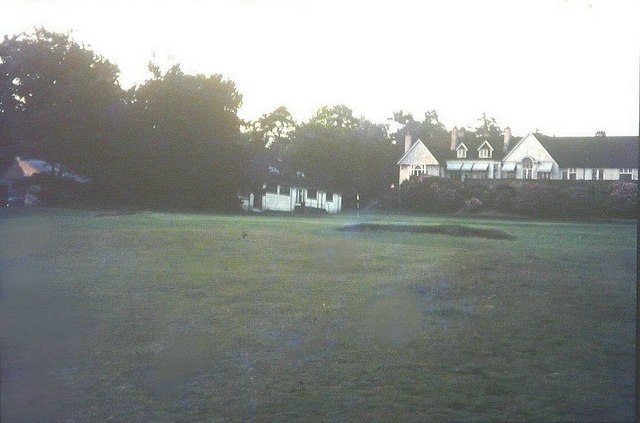
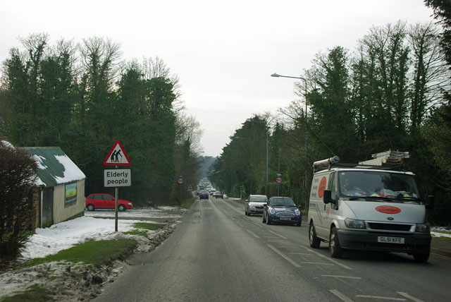
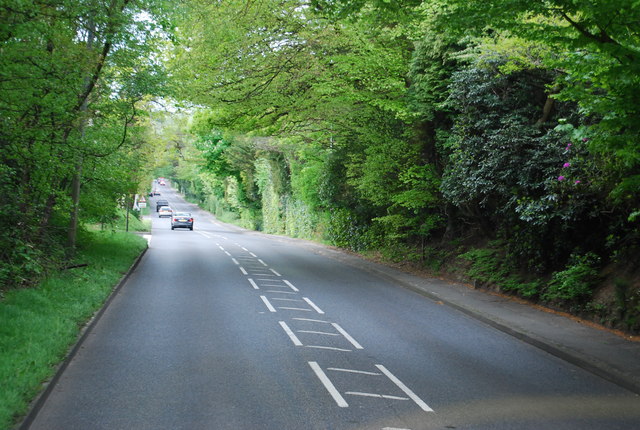
Crowborough is a town located in the Wealden district of East Sussex, England. Situated approximately 40 miles south of London, it is nestled in the High Weald Area of Outstanding Natural Beauty, surrounded by picturesque woodlands, rolling hills, and sprawling countryside. With a population of around 22,000, Crowborough is the largest town in Wealden.

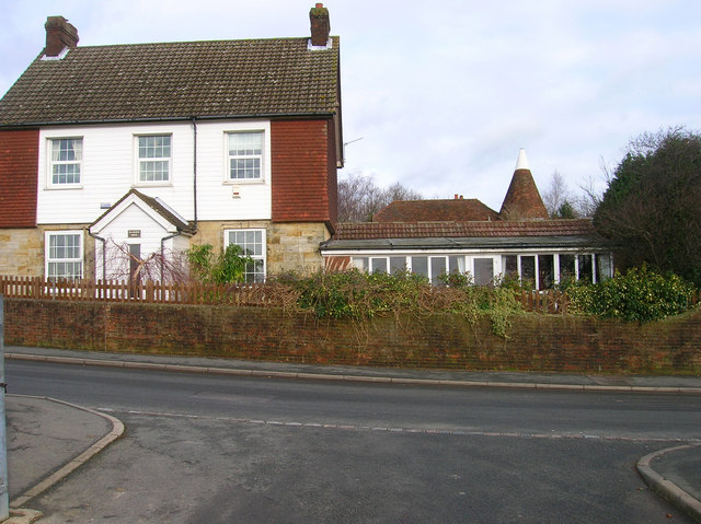
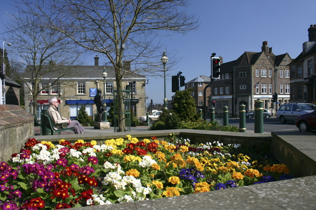
Known for its tranquil and scenic setting, Crowborough offers a peaceful retreat from the hustle and bustle of city life. The town is characterized by its leafy suburbs and charming residential areas, where Victorian and Edwardian houses are a common sight. The town center features a mix of independent shops, cafes, restaurants, and larger retail chains, providing residents with a variety of amenities and shopping opportunities.

Crowborough is renowned for its outdoor recreational activities, with numerous walking and cycling routes crisscrossing the surrounding countryside. Ashdown Forest, the inspiration for A.A. Milne's Hundred Acre Wood in Winnie-the-Pooh, is just a short distance away, offering further opportunities for nature exploration and picnicking.

The town also boasts excellent educational facilities, including several primary schools, a secondary school, and a further education college. Its proximity to London and other major towns in Sussex makes it an attractive place for commuters, with regular train services available from Crowborough railway station.

Overall, Crowborough is a picturesque town that combines natural beauty with a thriving community, making it an appealing place to live, work, and explore.

If you have any feedback on the listing, please let us know in the comments section below.

Crowborough Images

Images are sourced within 2km of 51.060585/0.16168045 or Grid Reference TQ5131. Thanks to Geograph Open Source API. All images are credited.

Crowborough Beacon Golf Club in 1967
Queen's Road, Crowborough Carlton Terrace on the right, part of a succession of houses using quite a lot of the local stone as well as brick.
Queen's Road, Crowborough
Carlton Terrace on the right, part of a succession of houses using quite a lot of the local stone as well as brick.
A26 - beware elderly people There must be a home somewhere around here, but it was not obvious.
A26 - beware elderly people
There must be a home somewhere around here, but it was not obvious.
Tollwood Road, TN6
Tollwood Road, TN6
New house, Fielden Road
Path in Jarvis Brook Country Park
Path in Jarvis Brook Country Park (2)
South View Rd off the A26
A26, Beacon Rd The A26 is a 50 mile route from Maidstone to Newhaven via Tunbridge Wells. <span class="nowrap"><a title="http://www.sabre-roads.org.uk/wiki/index.php?title=A26" rel="nofollow ugc noopener" href="http://www.sabre-roads.org.uk/wiki/index.php?title=A26">Link</a><img style="margin-left:2px;" alt="External link" title="External link - shift click to open in new window" src="https://s1.geograph.org.uk/img/external.png" width="10" height="10"/></span>
A26, Beacon Rd
The A26 is a 50 mile route from Maidstone to Newhaven via Tunbridge Wells. LinkExternal link
Crowborough Beacon Golf Club
Crowborough Cemetery Small sandstone chapel of rest in the town's cemetery of Herne Road.
Crowborough Cemetery
Small sandstone chapel of rest in the town's cemetery of Herne Road.
The Old Buttery, Lordswell Lane Taken from the junction with Southview Road.
The Old Buttery, Lordswell Lane
Taken from the junction with Southview Road.
Public Byway, South of Lordswell Lane The mini sandbagged footbridge marks the point where a footpath heads west across Crowborough Common towards the A26.
Public Byway, South of Lordswell Lane
The mini sandbagged footbridge marks the point where a footpath heads west across Crowborough Common towards the A26.
Windlesham Manor Home to Sir Arthur Conan Doyle between 1907 and his death in 1930. Initially he was buried in the back garden along with his wife who died in 1940 though both were moved to Minstead in the New Forest after World War Two when the family sold the building to new owners. Today it is a nursing home.

Conan Doyle largely redesigned the house himself and its angle in relation to the road came about due to his desire to be able to see his favourite view, facing Rotherfield, every day.
Windlesham Manor
Home to Sir Arthur Conan Doyle between 1907 and his death in 1930. Initially he was buried in the back garden along with his wife who died in 1940 though both were moved to Minstead in the New Forest after World War Two when the family sold the building to new owners. Today it is a nursing home. Conan Doyle largely redesigned the house himself and its angle in relation to the road came about due to his desire to be able to see his favourite view, facing Rotherfield, every day.
The Whitehill Centre, Whitehill Road The road is on a slope hence the strange angle of the building. Small hall which became a council owned community centre in 1994 opened by a granddaughter of Sir Arthur Conan Doyle.
The Whitehill Centre, Whitehill Road
The road is on a slope hence the strange angle of the building. Small hall which became a council owned community centre in 1994 opened by a granddaughter of Sir Arthur Conan Doyle.
Chapel of Rest, Crowborough Cemetery Front view of <a href="https://www.geograph.org.uk/photo/316462">TQ5129 : Crowborough Cemetery</a> the drive lined by recently pollarded trees.
Chapel of Rest, Crowborough Cemetery
Front view of TQ5129 : Crowborough Cemetery the drive lined by recently pollarded trees.
Holly Bank, Blackness Road Blackness Road goes left to right whilst Luxford Road heads straight on. Blackness is another small hamlet that has been swallowed up by the Crowborough conurbation.
Holly Bank, Blackness Road
Blackness Road goes left to right whilst Luxford Road heads straight on. Blackness is another small hamlet that has been swallowed up by the Crowborough conurbation.
Blackness House, Blackness Road Behind is Blackness Oasthouse a former farm building now swallowed up by the conurbation of Crowborough.
Blackness House, Blackness Road
Behind is Blackness Oasthouse a former farm building now swallowed up by the conurbation of Crowborough.
Show me another place!

Crowborough is located at Grid Ref: TQ5131 (Lat: 51.060585, Lng: 0.16168045)

Administrative County: East Sussex

District: Wealden

Police Authority: Sussex

What 3 Words

///signature.hardening.haven. Near Crowborough, East Sussex

Nearby Locations

Crowborough

Related Wikis

Crowborough Community Church

Crowborough Community Church (also known as Community Church, Crowborough) is an Evangelical church in the town of Crowborough in East Sussex, England...

Crowborough

Crowborough is a town and civil parish in East Sussex, England, in the Weald at the edge of Ashdown Forest in the High Weald Area of Outstanding Natural...

Pratt's Mill, Crowborough

Pratt's Mill is a tower mill at Crowborough, Sussex, England which has been truncated and converted to residential accommodation. == History == Pratt...

A26 road

The A26 road is a primary route in the southeast of England, going from Maidstone to Newhaven through the counties of Kent and East Sussex. The road is...

Beacon Academy

Beacon Academy (formerly Beacon Community College) is a coeducational secondary school and sixth form located in Crowborough in the English county of East...

Bream Wood

Bream Wood is a 7.8-hectare (19-acre) biological Site of Special Scientific Interest north of Crowborough in East Sussex.This steep sided valley wood has...

Crowborough Country Park

Crowborough Country Park is a 7.3-hectare (18-acre) Local Nature Reserve on the western outskirts of Crowborough in East Sussex. It is owned and managed...
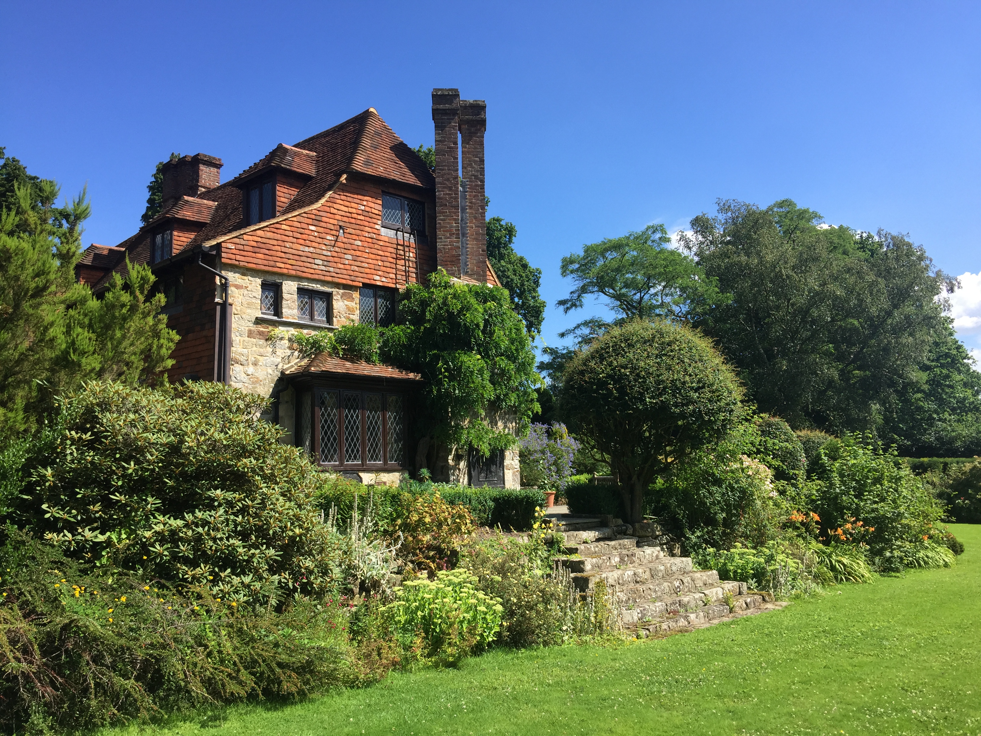
Luxford House

Luxford House is a 16th-century Grade II listed building near Crowborough, East Sussex. It is near the 11.5-acre (4.7 ha) Luxford Farm. It was used by...

Nearby Amenities

Located within 500m of 51.060585,0.16168045
Crowborough
Is In: East Sussex, England, UK
Name Uk: Кроуборо
Place: town
Wikidata: Q179259
Wikipedia: en:Crowborough
Lat/Long: 51.0590028/0.1635863
Traffic Signals
Lat/Long: 51.060573/0.1617302
Mini Roundabout
Lat/Long: 51.0572709/0.157716
Parking
Created By: Potlatch 0.10b
Lat/Long: 51.0582622/0.1604901
Turning Circle
Lat/Long: 51.0612485/0.1681841
Crossing
Crossing: zebra
Crossing Island: no
Lat/Long: 51.0588507/0.1622832
Turning Circle
Lat/Long: 51.0640982/0.1574652
Turning Circle
Lat/Long: 51.0589895/0.1552188
Post Box
Operator: Royal Mail
Operator Wikidata: Q638098
Post Box Type: pillar
Ref: TN6 239
Royal Cypher: GR
Royal Cypher Wikidata: Q33102273
Lat/Long: 51.059439/0.1622566
Bicycle Parking
Bicycle Parking: stands
Capacity: 11
Covered: no
Note: Effective capacity
Lat/Long: 51.0578427/0.1615503
Crossing
Crossing: zebra
Lat/Long: 51.0596997/0.1620413
Crossing
Crossing: zebra
Lat/Long: 51.0587995/0.1627574
Library
Source: OS_OpenData_StreetView
Lat/Long: 51.0586294/0.1588678
Place Of Worship
Source: OS_OpenData_StreetView
Lat/Long: 51.0593951/0.1661201
Restaurant
Jade's Palace
Addr Housename: The Parade
Addr Housenumber: 5
Addr Postcode: TN6 2SH
Addr Street: Eridge Road
Cuisine: chinese
Fhrs Id: 172265
Source Addr: FHRS Open Data
Lat/Long: 51.0607697/0.162464
Crossing
Crossing: unmarked
Crossing Island: yes
Lat/Long: 51.0614345/0.1681801
Parking
Lat/Long: 51.0604023/0.1625576
Bus Stop
The Cross
Bench: yes
Bus: yes
Public Transport: platform
Shelter: yes
Lat/Long: 51.0605841/0.1622746
Bus Stop
The Cross
Bench: yes
Bin: no
Bus: yes
Lit: yes
Public Transport: platform
Shelter: yes
Tactile Paving: no
Lat/Long: 51.0607425/0.1627797
Recycling
Recycling Type: container
Lat/Long: 51.0582702/0.1601318
Crowborough Town Council
Office: government
Lat/Long: 51.0586514/0.1633926
Speed Camera
Maxspeed: 40 mph
Lat/Long: 51.0613318/0.167299
Cafe
Costa
Addr City: Crowborough
Addr Housename: Broadway Chambers
Addr Postcode: TN6 1BU
Addr Street: High Street
Brand: Costa
Brand Wikidata: Q608845
Brand Wikipedia: en:Costa Coffee
Cuisine: coffee_shop
Fhrs Id: 731496
Takeaway: yes
Lat/Long: 51.0594949/0.1623367
Post Box
Operator: Royal Mail
Post Box Type: lamp
Ref: TN6 245D
Royal Cypher: EIIR
Royal Cypher Wikidata: Q33102113
Lat/Long: 51.0625788/0.1582316
Post Box
Operator: Royal Mail
Post Box Type: lamp
Ref: TN6 277D
Royal Cypher: EIIR
Royal Cypher Wikidata: Q33102113
Lat/Long: 51.0623802/0.1624286
Post Box
Operator: Royal Mail
Operator Wikidata: Q638098
Post Box Type: pillar
Ref: TN6 341
Royal Cypher: EIIR
Royal Cypher Wikidata: Q33102113
Lat/Long: 51.0583378/0.1620958
Post Box
Brand: Royal Mail
Brand Wikidata: Q638098
Note: No collection plate
Operator: Royal Mail
Operator Wikidata: Q638098
Post Box Design: metal_wall
Post Box Type: wall
Royal Cypher: no
Lat/Long: 51.0603702/0.1606203
Defibrillator
Emergency: defibrillator
Indoor: no
Ref GB The Circuit: C3D3E486-6CB7-48A5-AD4D-AE6F0084EE82
Lat/Long: 51.058065/0.1620446
The Original Factory Shop
Addr City: Crowborough
Addr Place: Fernbank Shopping Centre
Addr Postcode: TN6 2QY
Addr Street: High Street
Addr Unit: Unit 8
Brand Wikidata: Q7755366
Fhrs Id: 172197
Shop: department_store
Source Addr: FHRS Open Data
Wheelchair: yes
Lat/Long: 51.0597334/0.1618484
Pharmacy
Morrisons Pharmacy
Addr Place: Fernbank Shopping Centre
Addr Street: High Street
Healthcare: pharmacy
Lat/Long: 51.0595597/0.1615359
M&Co
Brand: M&Co
Brand Wikidata: Q6711808
Brand Wikipedia: en:M&Co.
Shop: clothes
Lat/Long: 51.059392/0.162464
Dentist
Broadway Dental
Addr City: Crowborough
Addr Postcode: TN6 1BX
Addr Street: The Broadway
Healthcare: dentist
Lat/Long: 51.0592622/0.1625176
Your Move
Brand: Your Move
Brand Wikidata: Q81078416
Office: estate_agent
Lat/Long: 51.0592285/0.1625525
Global Travel
Addr Housenumber: 2
Addr Street: High Street
Shop: travel_agency
Lat/Long: 51.059301/0.1624868
Sir Arthur Conan Doyle
Historic: memorial
Inscription: Sir Arthur Conan Doyle Resident of Crowborough 1907 - 1930
Material: metal
Memorial: statue
Tourism: yes
Wheelchair: yes
Lat/Long: 51.0606629/0.1614464
Fast Food
The Grill
Addr Housenumber: 3
Addr Postcode: TN6 1AF
Addr Street: Beacon Road
Cuisine: burger;kebab;pizza
Fhrs Id: 171819
Opening Hours: Tu-Sa 16:00-22:00; Su 16:00-21:00
Source Postcode: FHRS Open Data
Takeaway: yes
Lat/Long: 51.0603622/0.1608962
Car Wash
Morrisons
Lat/Long: 51.0594877/0.1595089
Wealdon Cycles
Shop: bicycle
Lat/Long: 51.0600235/0.1641461
Crow Cross Tattoos
Shop: tattoo
Lat/Long: 51.0600362/0.164252
St. John Ambulance
Office: yes
Lat/Long: 51.0600918/0.1644545
M K Barbers
Shop: hairdresser
Lat/Long: 51.0607658/0.1622782
Aspasia
Shop: beauty
Lat/Long: 51.0607662/0.1623714
Fast Food
Zaal
Addr Housename: 1 The Parade
Addr Postcode: TN6 2SH
Addr Street: Eridge Road
Cuisine: indian
Fhrs Id: 172132
Source Addr: FHRS Open Data
Lat/Long: 51.060773/0.1621806
Community Centre
The Oasis
Addr Housename: Christ Church
Addr Postcode: TN6 1AS
Addr Street: Beacon Road
Fhrs Id: 955309
Lat/Long: 51.0605268/0.1604056
Crossing
Crossing: marked
Crossing Island: no
Crossing Ref: zebra
Lat/Long: 51.058654/0.1591227
Generator Method: photovoltaic
Generator Orientation: 180
Generator Output Electricity: yes
Generator Solar Modules: 8
Generator Source: solar
Generator Type: solar_photovoltaic_panel
Location: roof
Power: generator
Lat/Long: 51.0563027/0.1624802
Generator Method: photovoltaic
Generator Output Electricity: yes
Generator Source: solar
Generator Type: solar_photovoltaic_panel
Location: roof
Power: generator
Lat/Long: 51.0578259/0.1619657
Generator Method: photovoltaic
Generator Output Electricity: yes
Generator Source: solar
Generator Type: solar_photovoltaic_panel
Location: roof
Power: generator
Lat/Long: 51.0579618/0.1621421
Pharmacy
Chappells Pharmacy
Dispensing: yes
Healthcare: pharmacy
Lat/Long: 51.05623/0.1615942
Generator Method: photovoltaic
Generator Output Electricity: yes
Generator Source: solar
Generator Type: solar_photovoltaic_panel
Location: roof
Power: generator
Lat/Long: 51.0633802/0.1623058
Generator Method: photovoltaic
Generator Output Electricity: yes
Generator Source: solar
Generator Type: solar_photovoltaic_panel
Location: roof
Power: generator
Lat/Long: 51.0640359/0.1627511
Generator Method: photovoltaic
Generator Output Electricity: yes
Generator Source: solar
Generator Type: solar_photovoltaic_panel
Location: roof
Power: generator
Lat/Long: 51.0643494/0.1624212
Bus Stop
The Park
Bench: no
Bus: yes
Naptan AtcoCode: 1400WE0057
Naptan NaptanCode: esuawamt
Public Transport: platform
Shelter: no
Lat/Long: 51.0573287/0.1662769
Bus Stop
The Park
Bench: yes
Bus: yes
Public Transport: platform
Shelter: yes
Lat/Long: 51.0572192/0.1662487
Crossing
Crossing: marked
Crossing Island: no
Crossing Ref: zebra
Lat/Long: 51.0589896/0.1609436
Defibrillator
Emergency: defibrillator
Lat/Long: 51.0585986/0.1633672
Waste Basket
Lat/Long: 51.0614856/0.1686085
Generator Method: photovoltaic
Generator Output Electricity: yes
Generator Solar Modules: 8
Generator Source: solar
Generator Type: solar_photovoltaic_panel
Location: roof
Power: generator
Lat/Long: 51.0569004/0.1623427
Generator Method: photovoltaic
Generator Output Electricity: yes
Generator Solar Modules: 18
Generator Source: solar
Generator Type: solar_photovoltaic_panel
Location: roof
Power: generator
Lat/Long: 51.0571015/0.1624426
Generator Method: photovoltaic
Generator Output Electricity: yes
Generator Solar Modules: 8
Generator Source: solar
Generator Type: solar_photovoltaic_panel
Location: roof
Power: generator
Lat/Long: 51.0575651/0.1629697
Generator Method: photovoltaic
Generator Output Electricity: yes
Generator Source: solar
Generator Type: solar_photovoltaic_panel
Location: roof
Power: generator
Lat/Long: 51.0615495/0.1573196
Generator Method: photovoltaic
Generator Output Electricity: yes
Generator Source: solar
Generator Type: solar_photovoltaic_panel
Location: roof
Power: generator
Lat/Long: 51.0607184/0.1595499
Generator Method: photovoltaic
Generator Output Electricity: yes
Generator Source: solar
Generator Type: solar_photovoltaic_panel
Location: roof
Power: generator
Lat/Long: 51.0604285/0.157388
Generator Method: photovoltaic
Generator Output Electricity: yes
Generator Source: solar
Generator Type: solar_photovoltaic_panel
Location: roof
Power: generator
Lat/Long: 51.0597938/0.1583965
Generator Method: photovoltaic
Generator Output Electricity: yes
Generator Source: solar
Generator Type: solar_photovoltaic_panel
Location: roof
Power: generator
Lat/Long: 51.0631779/0.1589316
Generator Method: photovoltaic
Generator Output Electricity: yes
Generator Source: solar
Generator Type: solar_photovoltaic_panel
Location: roof
Power: generator
Lat/Long: 51.0634021/0.1589692
Generator Method: photovoltaic
Generator Output Electricity: yes
Generator Source: solar
Generator Type: solar_photovoltaic_panel
Location: roof
Power: generator
Lat/Long: 51.0645137/0.1583844
Generator Method: photovoltaic
Generator Output Electricity: yes
Generator Source: solar
Generator Type: solar_photovoltaic_panel
Location: roof
Power: generator
Lat/Long: 51.0641766/0.157899
Generator Method: photovoltaic
Generator Output Electricity: yes
Generator Source: solar
Generator Type: solar_photovoltaic_panel
Location: roof
Power: generator
Lat/Long: 51.0638909/0.1582235
Generator Method: photovoltaic
Generator Output Electricity: yes
Generator Source: solar
Generator Type: solar_photovoltaic_panel
Location: roof
Power: generator
Lat/Long: 51.0624564/0.1614958
Generator Method: photovoltaic
Generator Output Electricity: yes
Generator Solar Modules: 16
Generator Source: solar
Generator Type: solar_photovoltaic_panel
Location: roof
Power: generator
Lat/Long: 51.059492/0.1685098
Generator Method: photovoltaic
Generator Output Electricity: yes
Generator Solar Modules: 16
Generator Source: solar
Generator Type: solar_photovoltaic_panel
Location: roof
Power: generator
Lat/Long: 51.0590385/0.168023
Generator Method: photovoltaic
Generator Output Electricity: yes
Generator Solar Modules: 16
Generator Source: solar
Generator Type: solar_photovoltaic_panel
Location: roof
Power: generator
Lat/Long: 51.0610383/0.168253
Generator Method: photovoltaic
Generator Output Electricity: yes
Generator Solar Modules: 16
Generator Source: solar
Generator Type: solar_photovoltaic_panel
Location: roof
Power: generator
Lat/Long: 51.0610218/0.1679619
Crossing
Crossing: marked
Lat/Long: 51.0598821/0.1591521
Bench
Lat/Long: 51.0637223/0.1647241
Bench
Lat/Long: 51.0637724/0.1647845
Bench
Lat/Long: 51.0630779/0.1644655
Bench
Lat/Long: 51.0629914/0.1646919
Bench
Lat/Long: 51.060683/0.1613433
Bench
Lat/Long: 51.0607106/0.1614064
Waste Basket
Lat/Long: 51.0606948/0.1613753
Barrier: bollard
Bicycle: yes
Bollard: removable
Foot: yes
Material: metal
Motor Vehicle: no
Lat/Long: 51.0600327/0.1635993
Bench
Lat/Long: 51.0629375/0.166052
Bench
Lat/Long: 51.0629012/0.1649134
Waste Basket
Lat/Long: 51.0630614/0.1645138
Waste Basket
Lat/Long: 51.0629248/0.1648665
Waste Basket
Lat/Long: 51.0622623/0.1628998
Waste Basket
Lat/Long: 51.0623041/0.162248
Playground: swing
Lat/Long: 51.0634225/0.1647411
Playground: slide
Lat/Long: 51.0633854/0.1646794
Playground: climbingframe
Lat/Long: 51.0631848/0.1651837
Playground: sandpit
Lat/Long: 51.0629885/0.1653822
Waste Basket
Lat/Long: 51.0630553/0.1561797
Restaurant
Rose Of Bengal
Addr City: Crowborough
Addr Postcode: TN6 1DG
Addr Street: Crowborough Hill
Cuisine: indian
Lat/Long: 51.0585309/0.1628573
Fast Food
Sancho’s
Addr City: Crowborough
Addr Postcode: TN6 1DG
Addr Street: Crowborough Hill
Cuisine: pizza
Lat/Long: 51.0584855/0.1629411
Generator Method: photovoltaic
Generator Output Electricity: yes
Generator Source: solar
Generator Type: solar_photovoltaic_panel
Location: roof
Power: generator
Lat/Long: 51.062169/0.1649518
Generator Method: photovoltaic
Generator Output Electricity: yes
Generator Source: solar
Generator Type: solar_photovoltaic_panel
Location: roof
Power: generator
Lat/Long: 51.062174/0.1654467
Generator Method: photovoltaic
Generator Output Electricity: yes
Generator Source: solar
Generator Type: solar_photovoltaic_panel
Location: roof
Power: generator
Lat/Long: 51.0617433/0.1651785
Generator Method: photovoltaic
Generator Output Electricity: yes
Generator Source: solar
Generator Type: solar_photovoltaic_panel
Location: roof
Power: generator
Lat/Long: 51.0616346/0.1650913
Bus Stop
Crowborough Broadway
Bench: yes
Bin: no
Bus: yes
Local Ref: A
Naptan AtcoCode: 1400WE0059
Naptan NaptanCode: esuawapa
Public Transport: platform
Shelter: yes
Lat/Long: 51.059343/0.1621762
Bus Stop
Crowborough Broadway
Bench: yes
Bus: yes
Local Ref: B
Naptan AtcoCode: 1400WE0060
Naptan NaptanCode: esuawapd
Public Transport: platform
Shelter: yes
Lat/Long: 51.0593726/0.1623474
Bus Stop
Goldsmiths Leisure Centre
Bus: yes
Naptan AtcoCode: 1400WE0018
Naptan NaptanCode: esuatwpg
Public Transport: platform
Lat/Long: 51.0615789/0.1686149
Bus Stop
Goldsmiths Leisure Centre
Bus: yes
Naptan AtcoCode: 1400WE0017
Naptan NaptanCode: esuatwpd
Public Transport: platform
Lat/Long: 51.0614444/0.1684565
The Colour Sanctuary
Addr City: Crowborough
Addr Street: Eridge Road
Phone: +44 1892 457720
Shop: hairdresser
Lat/Long: 51.0607974/0.1621506
Addr City: Crowborough
Addr Housename: Roydon House
Addr Street: New Road
Entrance: yes
Lat/Long: 51.0596545/0.1624471
Crossing
Crossing: marked
Crossing Island: no
Crossing Ref: zebra
Lat/Long: 51.0586916/0.1595667
Entrance: main
Lat/Long: 51.0594222/0.1603648
Post Box
Brand: Royal Mail
Brand Wikidata: Q638098
Collection Times: Mo-Fr 17:00; Sa 12:45
Operator: Royal Mail
Operator Wikidata: Q638098
Post Box Design: indoor_pillar
Post Box Type: pillar
Ref: TN6 1
Royal Cypher: EIIR
Royal Cypher Wikidata: Q33102113
Lat/Long: 51.059438/0.1602858
Bench
Access: yes
Material: wood
Lat/Long: 51.0574912/0.1565825
Operator: UK Power Networks
Power: substation
Ref: 442298
Lat/Long: 51.0572857/0.1573828
Addr Housename: Winsley
Building: yes
Lat/Long: 51.0607344/0.1642584
Addr Housename: Guildford Lodge
Building: yes
Lat/Long: 51.0607157/0.1641416
Post Office
Crowborough Post Office
Addr Postcode: TN6 1DL
Brand: Post Office
Brand Wikidata: Q1783168
Operator: Spar
Ref Pol Id: 113596
Lat/Long: 51.0583465/0.1623313
Charging Station
Geniepoint
Capacity: 1
Lat/Long: 51.0597443/0.1607864
The data included in this document is from www.openstreetmap.org. The data is made available under ODbL.

Have you been to Crowborough?

Leave your review of Crowborough below (or comments, questions and feedback).