Bog Wood

Wood, Forest in Northumberland

England

Bog Wood

Field entrance and footpath near the Rope Barn
Field entrance and footpath near the Rope Barn Credit: JThomas

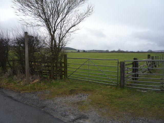
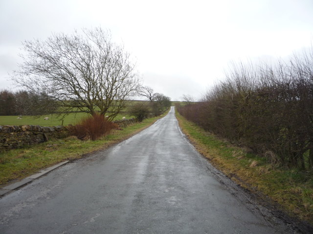
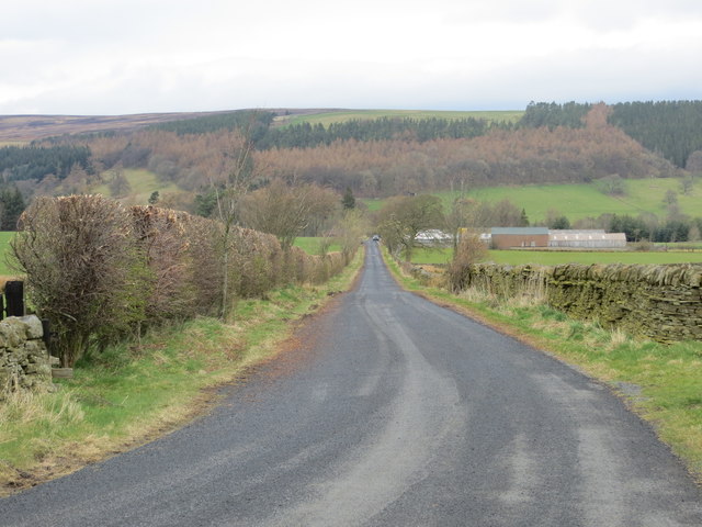
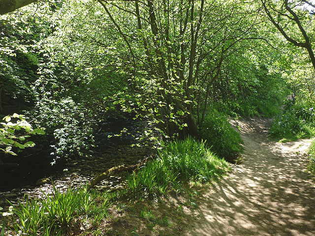
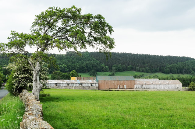
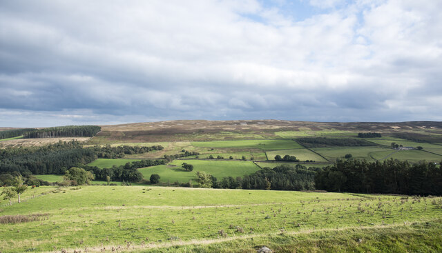
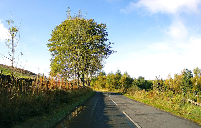
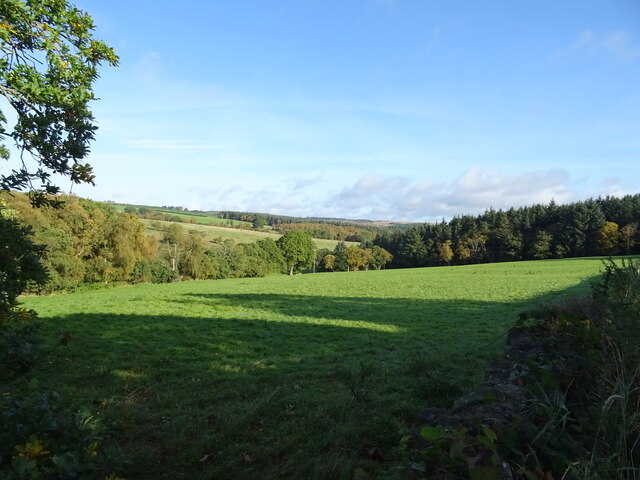
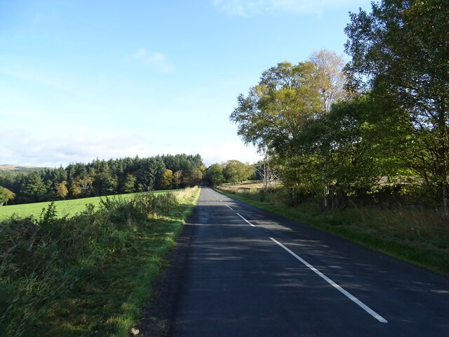
Bog Wood, located in the county of Northumberland, is a dense forest known for its unique ecosystem and stunning natural beauty. Covering an area of approximately 500 acres, this ancient woodland is a haven for nature enthusiasts and outdoor adventurers.

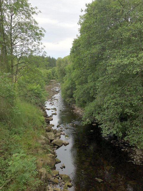
The forest is predominantly composed of boggy peatland, characterized by wet and acidic soil conditions. This creates a diverse habitat for a wide range of plant and animal species that thrive in this specific environment. Visitors to Bog Wood can expect to find an abundance of mosses, ferns, and heather, as well as various species of trees such as birch, oak, and rowan.

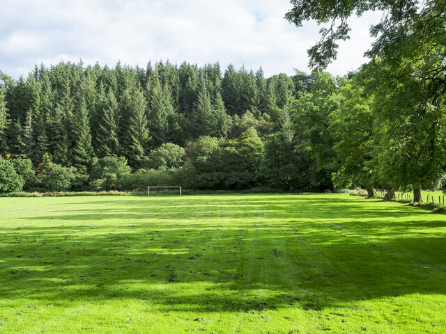
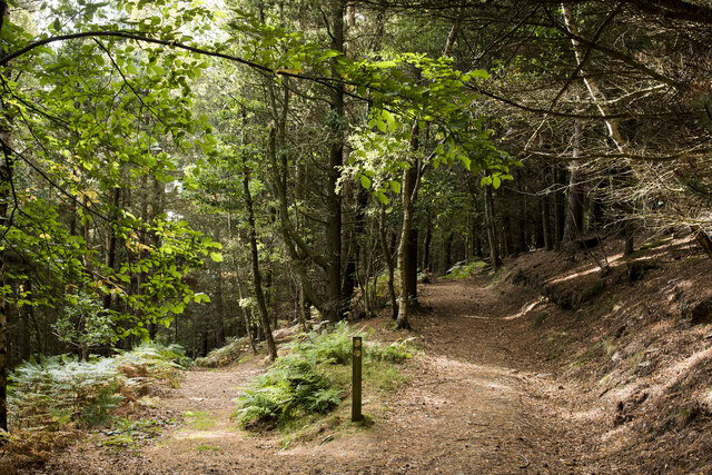
The woodland is crisscrossed by a network of trails and pathways, allowing visitors to explore its many hidden gems. From tranquil streams and picturesque ponds to enchanting clearings and dense thickets, there is something for everyone to enjoy. The forest also boasts an array of wildlife, including deer, foxes, and a variety of bird species, making it a prime location for birdwatching and wildlife photography.

Bog Wood has a rich history, with evidence of human presence dating back thousands of years. Archaeological finds, including ancient tools and pottery, have been discovered within the forest, suggesting that it was once inhabited by early settlers. Today, the woodland is protected and managed by local authorities to ensure its preservation and to provide a tranquil retreat for visitors seeking solace in nature.

If you have any feedback on the listing, please let us know in the comments section below.

Bog Wood Images

Images are sourced within 2km of 54.852416/-2.0383615 or Grid Reference NY9750. Thanks to Geograph Open Source API. All images are credited.

Field entrance and footpath near the Rope Barn
Minor road towards Allenshields Looking south near the Rope Barn.
Minor road towards Allenshields
Looking south near the Rope Barn.
Grazing near the Rope Barn
Road to Rope Barn and Bridge End Looking northward.
Road to Rope Barn and Bridge End
Looking northward.
Footpath beside the Derwent Heading towards Bay Bridge.
Footpath beside the Derwent
Heading towards Bay Bridge.
Variety of barns at Rope Barn Rope Barn is the name of the farm whose buildings are in view; the farmhouse is hidden by the trees along the wall line.
Variety of barns at Rope Barn
Rope Barn is the name of the farm whose buildings are in view; the farmhouse is hidden by the trees along the wall line.
Tree shadows across playing field The field is equipped with goalposts but surely sees other uses than football; it lies just to the west of the village of Blanchland.
Tree shadows across playing field
The field is equipped with goalposts but surely sees other uses than football; it lies just to the west of the village of Blanchland.
Path junction in High Banks Plantation A path has descended from the B6306 to fork at this location in woodland close to Blanchland. The image was made a little over ten years after an earlier one of the same scene: little has changed! <a title="https://www.geograph.org.uk/photo/2475487" href="https://www.geograph.org.uk/photo/2475487">Link</a>
Path junction in High Banks Plantation
A path has descended from the B6306 to fork at this location in woodland close to Blanchland. The image was made a little over ten years after an earlier one of the same scene: little has changed! Link
Field on east side of B6306 The field descends towards the River Derwent south-west of the Derwent Reservoir.
The ground beyond the valley rises to the moorland of Bainbridge Hill and Ruffside Moor.
Field on east side of B6306
The field descends towards the River Derwent south-west of the Derwent Reservoir. The ground beyond the valley rises to the moorland of Bainbridge Hill and Ruffside Moor.
The Square, Blanchland Classic view of Blanchland on a late summer day. The village square is packed with listed buildings - linked here is the Abbey Gatehouse and Post Office - the castellated building in the centre of the picture. <span class="nowrap"><a title="https://historicengland.org.uk/listing/the-list/list-entry/1153918" rel="nofollow ugc noopener" href="https://historicengland.org.uk/listing/the-list/list-entry/1153918">Link</a><img style="margin-left:2px;" alt="External link" title="External link - shift click to open in new window" src="https://s1.geograph.org.uk/img/external.png" width="10" height="10"/></span>
The Square, Blanchland
Classic view of Blanchland on a late summer day. The village square is packed with listed buildings - linked here is the Abbey Gatehouse and Post Office - the castellated building in the centre of the picture. LinkExternal link
Cottages at Shildon In September 1938, A. Wainwright made a solitary walk through the Pennines. The following year he wrote up an account of this walk, which was eventually published in 1986 and is still available.
This new route, developed by David Pitt of the Wainwright Society, is a recreation of this walk adapted for today's roads and rights-of-way, taking a route that Wainwright might have chosen if he was planning it today. Called 'A Pennine Journey' it is a challenging circular walk, 247 miles long divided into 18 stages, passing through the wonderful variety of terrain and scenery that the north of England offers and touching on all the major rivers in the region.
Starting in Settle the route heads north on the eastern side of the Pennines through the delightful Yorkshire Dales and moorland stretches of Co. Durham before arriving at Hadrian’s Wall. This World Heritage site, in the Northumberland National Park, is followed for 21 miles until the route heads south on the western side of the Pennines. After traversing the Pennines just below the highest point of Cross Fell, it enters and travels down the Eden valley before skirting the Howgills Fells then arrives back in Settle.
The walk is divided into 18 daily stages of varying length and offers a choice of possibilities. It can be undertaken as one continuous walk; split at Housesteads on Hadrian’s Wall (Alfred Wainwright’s primary objective) into two stages of roughly 120 miles each; or divided into three stages – eastern, northern and western – of around 80 miles each.
Cottages at Shildon
In September 1938, A. Wainwright made a solitary walk through the Pennines. The following year he wrote up an account of this walk, which was eventually published in 1986 and is still available. This new route, developed by David Pitt of the Wainwright Society, is a recreation of this walk adapted for today's roads and rights-of-way, taking a route that Wainwright might have chosen if he was planning it today. Called 'A Pennine Journey' it is a challenging circular walk, 247 miles long divided into 18 stages, passing through the wonderful variety of terrain and scenery that the north of England offers and touching on all the major rivers in the region. Starting in Settle the route heads north on the eastern side of the Pennines through the delightful Yorkshire Dales and moorland stretches of Co. Durham before arriving at Hadrian’s Wall. This World Heritage site, in the Northumberland National Park, is followed for 21 miles until the route heads south on the western side of the Pennines. After traversing the Pennines just below the highest point of Cross Fell, it enters and travels down the Eden valley before skirting the Howgills Fells then arrives back in Settle. The walk is divided into 18 daily stages of varying length and offers a choice of possibilities. It can be undertaken as one continuous walk; split at Housesteads on Hadrian’s Wall (Alfred Wainwright’s primary objective) into two stages of roughly 120 miles each; or divided into three stages – eastern, northern and western – of around 80 miles each.
Junction of roads at Blanchland The Lord Crewe Arms and the Abbey Gatehouse visible beyond the junction
Junction of roads at Blanchland
The Lord Crewe Arms and the Abbey Gatehouse visible beyond the junction
Beer Garden, Lord Crewe Arms A magnificent setting for a beer garden, showing the rear elevation of the Lord Crewe Arms. The Lord Crewe Arms is a Grade II Listed Building. <span class="nowrap"><a title="https://historicengland.org.uk/listing/the-list/list-entry/1154141#contributions-banner" rel="nofollow ugc noopener" href="https://historicengland.org.uk/listing/the-list/list-entry/1154141#contributions-banner">Link</a><img style="margin-left:2px;" alt="External link" title="External link - shift click to open in new window" src="https://s1.geograph.org.uk/img/external.png" width="10" height="10"/></span>
Beer Garden, Lord Crewe Arms
A magnificent setting for a beer garden, showing the rear elevation of the Lord Crewe Arms. The Lord Crewe Arms is a Grade II Listed Building. LinkExternal link
B6306 towards Blanchland
Grazing, Derwentdale
B6306, Derwentdale Towards Edmundbyers.
B6306, Derwentdale
Towards Edmundbyers.
Ruffside Housing at the hamlet of Ruffside, redeveloped from farm buildings, seen here prior to re-development in this 2006 image by Oliver Dixon: <a href="https://www.geograph.org.uk/photo/282236">NY9951 : Ruffside</a>
Ruffside
Housing at the hamlet of Ruffside, redeveloped from farm buildings, seen here prior to re-development in this 2006 image by Oliver Dixon: NY9951 : Ruffside
River Derwent above Derwent Reservoir
Show me another place!

Bog Wood is located at Grid Ref: NY9750 (Lat: 54.852416, Lng: -2.0383615)

Unitary Authority: Northumberland

Police Authority: Northumbria

What 3 Words

///clothed.showcases.thud. Near Slaley, Northumberland

Related Wikis

Blanchland Abbey

Blanchland Abbey at Blanchland, in the English county of Northumberland, was founded as a premonstratensian priory in 1165 by Walter de Bolbec II, and...
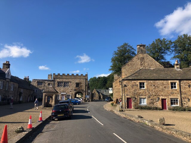
Blanchland

Blanchland is a village in Northumberland, England, on the County Durham boundary. The population of the civil parish at the 2011 census was 135.Set beside...

Baybridge, Northumberland

Baybridge is a small village in Northumberland, England, just to the west of Blanchland and on the border with County Durham. It is situated to the west...

Hunstanworth

Hunstanworth is a village in County Durham, England. It is situated approximately 10 miles to the west of Consett, south-west of the village of Blanchland...

Pow Hill Bog

Pow Hill Bog is a Site of Special Scientific Interest in the Wear Valley district of County Durham, England. It lies alongside Derwent Reservoir, approximately...

Townfield

Townfield is a village in County Durham, in England. It is situated just to the south of Hunstanworth and part of that parish, about 10 miles (16 km) west...

Beldon Burn

Beldon Burn is a headwater stream of the River Derwent in Northumberland and County Durham, England.It rises at Quickcleugh Moss as the Quickcleugh Burn...

Derwent Reservoir (North East England)

The Derwent Reservoir is a reservoir on the River Derwent, on the border between County Durham and Northumberland, in England. It is west of Consett. It...

Nearby Amenities

Located within 500m of 54.852416,-2.0383615
The data included in this document is from www.openstreetmap.org. The data is made available under ODbL.

Have you been to Bog Wood?

Leave your review of Bog Wood below (or comments, questions and feedback).