Slater Ing Wood

Wood, Forest in Yorkshire

England

Slater Ing Wood

Willow pony A willow sculpture of what appears to be a Dales pony at Hardcastle Crags.
Willow pony Credit: Kathleen Illingworth

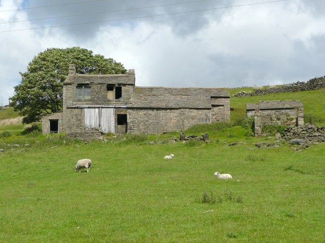
Slater Ing Wood is a picturesque woodland located in the county of Yorkshire, England. Situated in the heart of the Forest of Yorkshire, it covers an area of approximately 100 hectares and is known for its diverse range of flora and fauna.

The wood is predominantly made up of native broadleaf trees, including oak, beech, and ash, which create a dense canopy overhead. This provides a haven for a variety of woodland animals such as deer, foxes, and squirrels. The forest floor is covered in a thick layer of leaf litter, supporting a rich ecosystem of insects and fungi.

The woodland is crisscrossed by a network of footpaths and trails, allowing visitors to explore its natural beauty. The paths wind through the trees, leading to hidden clearings and tranquil streams. An abundance of bird species can be spotted throughout the wood, making it a popular destination for birdwatchers.

Slater Ing Wood is also a designated Site of Special Scientific Interest (SSSI), due to its significant ecological value. Conservation efforts have been made to maintain the wood's biodiversity, including selective tree thinning and removal of invasive species.

Visitors can enjoy activities such as hiking, picnicking, and nature photography in this peaceful woodland setting. The wood is easily accessible, with a car park and public transport links nearby. It attracts both locals and tourists alike, seeking respite from the hustle and bustle of everyday life in its serene and untouched environment.

If you have any feedback on the listing, please let us know in the comments section below.

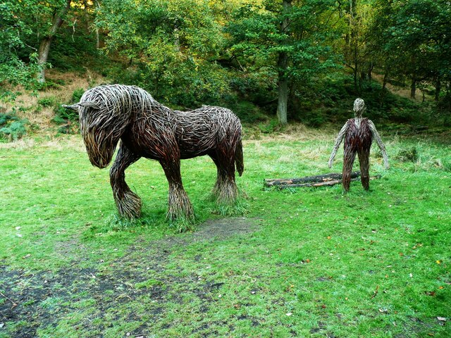
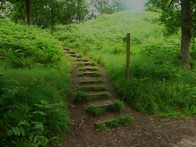
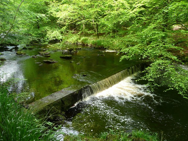
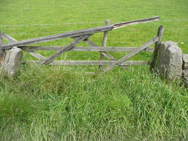
Slater Ing Wood Images

Images are sourced within 2km of 53.751107/-2.03742 or Grid Reference SD9728. Thanks to Geograph Open Source API. All images are credited.

Willow pony A willow sculpture of what appears to be a Dales pony at Hardcastle Crags.
Willow pony
A willow sculpture of what appears to be a Dales pony at Hardcastle Crags.
Weir on Hebden Water, Hardcastle Crags
Rock outcrop, Hardcastle Crags
Willow sculptures, Hardcastle Crags A carthorse and a farmer.
Willow sculptures, Hardcastle Crags
A carthorse and a farmer.
Path to the crags, Hardcastle crags
Weir on Hebden Water I don't know what was the purpose of this weir - perhaps water was piped down to one of the Gibson Mill ponds.
Weir on Hebden Water
I don't know what was the purpose of this weir - perhaps water was piped down to one of the Gibson Mill ponds.
Gate at Lady Royd Farm, Wadsworth The gate posts have a hole on the left into which a pole could be inserted, and a slot on the right into which the other end of the pole could be lowered. Presumably the pole would have vertical slats nailed onto it.
Gate at Lady Royd Farm, Wadsworth
The gate posts have a hole on the left into which a pole could be inserted, and a slot on the right into which the other end of the pole could be lowered. Presumably the pole would have vertical slats nailed onto it.
Derelict building at Lady Royd Farm, Wadsworth The first floor windows look domestic, as if the building has been a cottage, or perhaps sleeping accommodation above a cart shed.
Derelict building at Lady Royd Farm, Wadsworth
The first floor windows look domestic, as if the building has been a cottage, or perhaps sleeping accommodation above a cart shed.
Woodland near Hardcastle Crags The sign explains how the National Trust have a programme to remove non-native species of tree, to allow the native ones to grow back.
Woodland near Hardcastle Crags
The sign explains how the National Trust have a programme to remove non-native species of tree, to allow the native ones to grow back.
A felled trunk and bluebells near Hardcastle Crags Many bluebells are over for the year, but they are persisting in this sheltered valley.
A felled trunk and bluebells near Hardcastle Crags
Many bluebells are over for the year, but they are persisting in this sheltered valley.
View on Wadsworth FP44 The green hill on the right is Turn Hill, and the dark hill over it Shackleton Knoll.
View on Wadsworth FP44
The green hill on the right is Turn Hill, and the dark hill over it Shackleton Knoll.
Abandoned Dwelling at Lady Royd Farm
Track beside Hardcastle Crags Despite the name, most of the National Trust's Hardcastle Crags property consists of wooded  walks along the valley beside the river.
Track beside Hardcastle Crags
Despite the name, most of the National Trust's Hardcastle Crags property consists of wooded walks along the valley beside the river.
Bridleway, Lady Royd Farm Looking N along the bridleway with the hamlet of Walshaw in the distance.
Bridleway, Lady Royd Farm
Looking N along the bridleway with the hamlet of Walshaw in the distance.
Weir on Hebden Water, Hardcastle Crags Upstream from Gibson Mill
Weir on Hebden Water, Hardcastle Crags
Upstream from Gibson Mill
Widdop Road Boothroyd Farm
Widdop Road
Boothroyd Farm
The Southern End of Black Hill Looking across Hebden Dale from Mount Pleasant.  The farm to the left is Mansfield House and the one to the right is Black Scout.
The Southern End of Black Hill
Looking across Hebden Dale from Mount Pleasant. The farm to the left is Mansfield House and the one to the right is Black Scout.
Weir on Hebden Water No doubt installed as a part of the water-powered supply for nearby Gibson Mill.  The same weir as <a href="https://www.geograph.org.uk/photo/437854">SD9730 : Weir on Hebden Water, Hardcastle Crags</a> but with more water passing over.
Weir on Hebden Water
No doubt installed as a part of the water-powered supply for nearby Gibson Mill. The same weir as SD9730 : Weir on Hebden Water, Hardcastle Crags but with more water passing over.
Show me another place!

Slater Ing Wood is located at Grid Ref: SD9728 (Lat: 53.751107, Lng: -2.03742)

Division: West Riding

Unitary Authority: Calderdale

Police Authority: West Yorkshire

What 3 Words

///slams.stray.shifters. Near Hebden Bridge, West Yorkshire

Related Wikis

Heptonstall

Heptonstall is a small village and civil parish within the Calderdale borough of West Yorkshire, England, historically part of the West Riding of Yorkshire...

Colden, West Yorkshire

Colden is a hamlet in the civil parish of Heptonstall in Calderdale, West Yorkshire, England. Historically part of the West Riding of Yorkshire, the hamlet...

Hepton Rural District

Hepton was a rural district in the West Riding of Yorkshire, England, from 1894 to 1974. The district included four civil parishes: Heptonstall, Blackshaw...

Hardcastle Crags

Hardcastle Crags is a wooded Pennine valley in West Yorkshire, England, owned by the National Trust. Historically part of the West Riding of Yorkshire...

South Pennines Regional Park

The South Pennines Regional Park (or South Pennines Park) is a proposed national park that would cover the South Pennines area in Northern England, encompassing...

Hebden Bridge Town Hall

Hebden Bridge Town Hall, formerly Hebden Bridge Council Offices, is a municipal building in St George's Street, Hebden Bridge, West Yorkshire, England...

Battle of Heptonstall

The Battle of Heptonstall occurred in November 1643 during the First English Civil War at Hebden Bridge and Heptonstall, Yorkshire. During the battle,...

Hebden Bridge Picture House

Hebden Bridge Picture House in Hebden Bridge, West Yorkshire, is one of the last remaining council-owned cinemas in Britain. Together with the adjacent...

Nearby Amenities

Located within 500m of 53.751107,-2.03742
Slack Top
Place: village
Source: npe
Lat/Long: 53.754664/-2.0355874
Crossing
Lat/Long: 53.7547373/-2.0378051
Bus Stop
Smithwell Lane Widdop Road
Local Ref: 45019802
Naptan AtcoCode: 450019802
Naptan Bearing: E
Naptan CommonName: Smithwell Lane Widdop Road
Naptan Crossing: Widdop Road
Naptan Indicator: Stop 45019802
Naptan PlusbusZoneRef: LEEDS
Naptan ShortCommonName: Widdop Road
Naptan Street: Smithwell Lane
Naptan Verified: no
Source: naptan_import
Lat/Long: 53.7544951/-2.034141
Bus Stop
Smithwell Lane
Local Ref: 45019803
Naptan AtcoCode: 450019803
Naptan Bearing: SE
Naptan CommonName: Smithwell Lane
Naptan Indicator: Stop 45019803
Naptan PlusbusZoneRef: LEEDS
Naptan ShortCommonName: Smithwell Lane
Naptan Street: Smithwell Lane
Naptan Verified: no
Source: naptan_import
Lat/Long: 53.754812/-2.0392816
Bus Stop
Smithwell Lane Widdop Road
Local Ref: 45025594
Naptan AtcoCode: 450025594
Naptan Bearing: W
Naptan CommonName: Smithwell Lane Widdop Road
Naptan Crossing: Widdop Road
Naptan Indicator: Stop 45025594
Naptan Notes: OSR taken place 031005
Naptan PlusbusZoneRef: LEEDS
Naptan ShortCommonName: Widdop Road
Naptan Street: Smithwell Lane
Naptan Verified: no
Source: naptan_import
Lat/Long: 53.7543719/-2.0341275
Bus Stop
Smithwell Lane
Local Ref: 45025595
Naptan AtcoCode: 450025595
Naptan Bearing: E
Naptan CommonName: Smithwell Lane
Naptan Crossing: Faugh Lane
Naptan Indicator: Stop 45025595
Naptan PlusbusZoneRef: LEEDS
Naptan ShortCommonName: Faugh Lane
Naptan Street: Smithwell Lane
Naptan Verified: no
Source: naptan_import
Lat/Long: 53.7548929/-2.039221
Smithwell Lane
Local Ref: 45050863
Naptan AtcoCode: 450050863
Naptan Bearing: SW
Naptan BusStopType: CUS
Naptan CommonName: Smithwell Lane
Naptan Indicator: Stop 45050863
Naptan PlusbusZoneRef: LEEDS
Naptan ShortCommonName: Smithwell Lane
Naptan Street: Smithwell Lane
Naptan Verified: no
Source: naptan_import
Lat/Long: 53.754758/-2.0393725
Turning Circle
Lat/Long: 53.7514743/-2.0338226
Barrier: stile
Foot: yes
Lat/Long: 53.7509794/-2.04214
Barrier: stile
Foot: yes
Lat/Long: 53.7513851/-2.0402024
Barrier: stile
Foot: yes
Lat/Long: 53.7522003/-2.0370784
Ele: 283.8
Lat/Long: 53.7525085/-2.0400511
Ele: 289.7
Lat/Long: 53.7538882/-2.0390965
Man Made: chimney
Lat/Long: 53.7502945/-2.0381665
Waterway: weir
Lat/Long: 53.7504016/-2.0372157
Man Made: chimney
Lat/Long: 53.7504792/-2.0357094
Barrier: stile
Lat/Long: 53.7524337/-2.0332385
Waste Basket
Waste: dog_excrement
Lat/Long: 53.7544893/-2.0340646
Waste Basket
Lat/Long: 53.7543685/-2.0340954
Barrier: stile
Lat/Long: 53.7484447/-2.0393046
Bench
Lat/Long: 53.752234/-2.034749
Generator Method: photovoltaic
Generator Output Electricity: yes
Generator Source: solar
Generator Type: solar_photovoltaic_panel
Power: generator
Lat/Long: 53.7538588/-2.0365082
Generator Method: photovoltaic
Generator Output Electricity: yes
Generator Source: solar
Generator Type: solar_photovoltaic_panel
Power: generator
Lat/Long: 53.7538893/-2.0361738
Generator Method: photovoltaic
Generator Output Electricity: yes
Generator Source: solar
Generator Type: solar_photovoltaic_panel
Power: generator
Lat/Long: 53.7540549/-2.0356695
Generator Method: photovoltaic
Generator Output Electricity: yes
Generator Source: solar
Generator Type: solar_photovoltaic_panel
Power: generator
Lat/Long: 53.7539609/-2.0358937
Access: no
Barrier: stile
Foot: yes
Lat/Long: 53.7522675/-2.0347903
Bench
Backrest: yes
Lat/Long: 53.7522535/-2.0346858
The data included in this document is from www.openstreetmap.org. The data is made available under ODbL.

Have you been to Slater Ing Wood?

Leave your review of Slater Ing Wood below (or comments, questions and feedback).