Kilnsey Wood

Wood, Forest in Yorkshire Craven

England

Kilnsey Wood

Mastiles Lane dropping towards Kilnsey Mastiles Lane was the subject of some controversy when the number of off-road vehicles using it was starting to have an adverse impact. Although it is still marked as a Byway Open to All Traffic on the map, it doesn't seem to remain so for its full length, and even where it is so marked, further west, there is a definite "all motor vehicles prohibited sign", so I was unsurprised not to meet the sort of continuous procession of trail bikes and four-wheel-drive enthusiasts that one meets on a number of other BOATs in the National Park. Indeed, on an eight mile walk on a breezy day in January, there was one mountain biker and two walkers, apart from myself (and dog). The lane itself continues towards Kilnsey, but the small gate on the right gives onto a public footpath down towards the road junction leading to Coniston bridge - a better parking spot than a village in these times of infectious disease.
Mastiles Lane dropping towards Kilnsey Credit: Andy Waddington

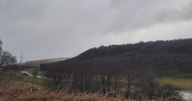
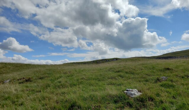
Kilnsey Wood is a picturesque woodland located in the heart of Yorkshire, England. Situated near the village of Kilnsey, it covers an area of approximately 100 acres and is renowned for its natural beauty and diverse flora and fauna.

The wood is predominantly composed of deciduous trees, including oak, beech, and ash, which create a stunning canopy of vibrant greens during the summer months. Walking through the wood, visitors are greeted with a tranquil atmosphere and the sounds of birdsong, making it a popular destination for nature enthusiasts and birdwatchers.

Kilnsey Wood is home to a variety of wildlife, including deer, squirrels, and foxes, which can often be spotted roaming among the trees. Additionally, the wood is a haven for many species of birds, such as woodpeckers, owls, and warblers, making it a great spot for birdwatching.

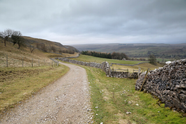
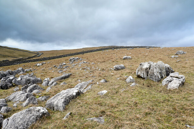
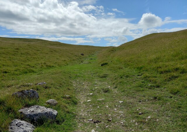
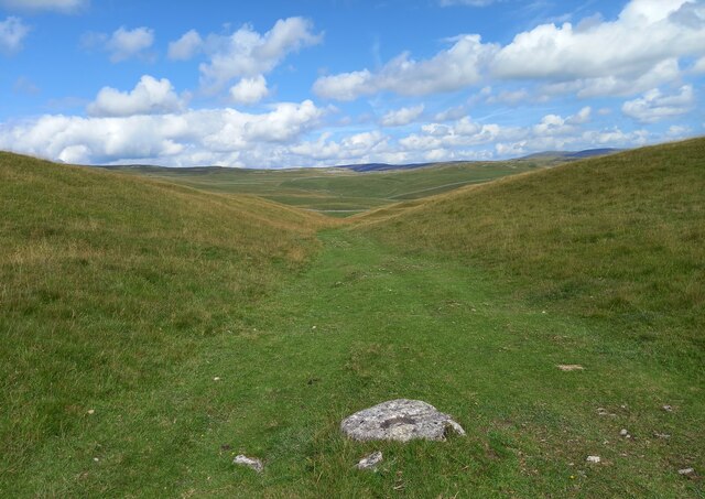
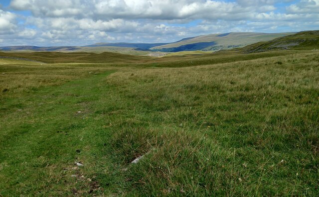
The wood also boasts a network of well-maintained footpaths and trails, allowing visitors to explore its beauty at their own pace. These paths wind through the wood, offering stunning views of the surrounding countryside and the nearby Kilnsey Crag, a towering limestone cliff that adds to the area's natural charm.

Not only does Kilnsey Wood provide a haven for wildlife and outdoor enthusiasts, but it also has historical significance. The wood was once used in the local kilns for charcoal production, hence its name.

In conclusion, Kilnsey Wood is a captivating woodland in Yorkshire, offering visitors a chance to immerse themselves in nature, observe diverse wildlife, and enjoy the tranquility of its surroundings.

If you have any feedback on the listing, please let us know in the comments section below.

Kilnsey Wood Images

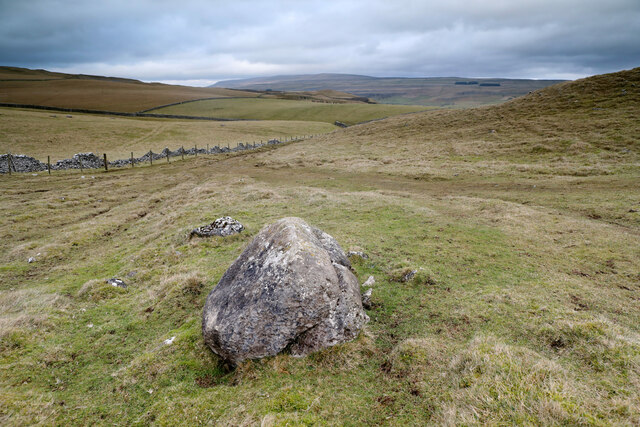
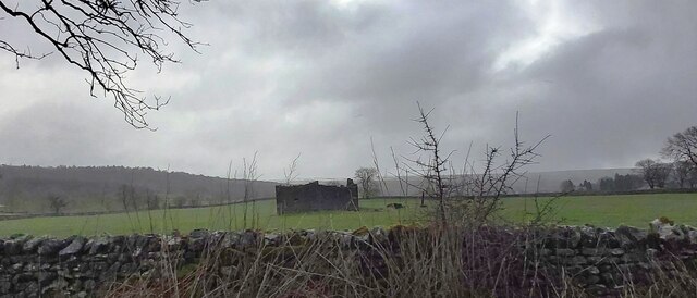
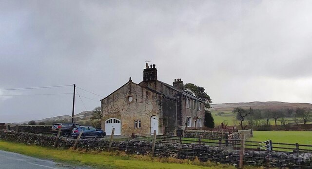
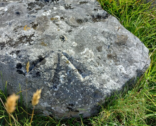
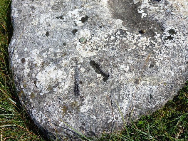
Images are sourced within 2km of 54.09026/-2.0409678 or Grid Reference SD9766. Thanks to Geograph Open Source API. All images are credited.

Mastiles Lane dropping towards Kilnsey Mastiles Lane was the subject of some controversy when the number of off-road vehicles using it was starting to have an adverse impact. Although it is still marked as a Byway Open to All Traffic on the map, it doesn't seem to remain so for its full length, and even where it is so marked, further west, there is a definite "all motor vehicles prohibited sign", so I was unsurprised not to meet the sort of continuous procession of trail bikes and four-wheel-drive enthusiasts that one meets on a number of other BOATs in the National Park. Indeed, on an eight mile walk on a breezy day in January, there was one mountain biker and two walkers, apart from myself (and dog). The lane itself continues towards Kilnsey, but the small gate on the right gives onto a public footpath down towards the road junction leading to Coniston bridge - a better parking spot than a village in these times of infectious disease.
Mastiles Lane dropping towards Kilnsey
Mastiles Lane was the subject of some controversy when the number of off-road vehicles using it was starting to have an adverse impact. Although it is still marked as a Byway Open to All Traffic on the map, it doesn't seem to remain so for its full length, and even where it is so marked, further west, there is a definite "all motor vehicles prohibited sign", so I was unsurprised not to meet the sort of continuous procession of trail bikes and four-wheel-drive enthusiasts that one meets on a number of other BOATs in the National Park. Indeed, on an eight mile walk on a breezy day in January, there was one mountain biker and two walkers, apart from myself (and dog). The lane itself continues towards Kilnsey, but the small gate on the right gives onto a public footpath down towards the road junction leading to Coniston bridge - a better parking spot than a village in these times of infectious disease.
Looking to the settlement above Cow Close Wood The immediate foreground is a path leading vaguely from the public bridleway above Height Laithe towards Height House. The hill beyond is marked with two antiquities, a "Settlement" and a "Hut circle and enclosure". Presumably these are different stages of development of a prehistoric community on the limestone hilltop where there is plenty of stone for building, a good view, and good soil suitable for farming. The more modern farm buildings, having less need for defence, perhaps, favour a more sheltered location below the hill, though today they find themselves on the windward side in a gusty and bitter breeze.
Looking to the settlement above Cow Close Wood
The immediate foreground is a path leading vaguely from the public bridleway above Height Laithe towards Height House. The hill beyond is marked with two antiquities, a "Settlement" and a "Hut circle and enclosure". Presumably these are different stages of development of a prehistoric community on the limestone hilltop where there is plenty of stone for building, a good view, and good soil suitable for farming. The more modern farm buildings, having less need for defence, perhaps, favour a more sheltered location below the hill, though today they find themselves on the windward side in a gusty and bitter breeze.
Limestone boulders on Malham Moor Just west of the bridleway from Height Laithe towards Mastiles Lane, just after crossing Malham Moor Lane, a vague track diverges to loop back and rejoin the right of way. From a geographer's point of view, its main benefit is in reaching a position which is assuredly inside the same square as the view to the west over the higher parts of the moor.
Limestone boulders on Malham Moor
Just west of the bridleway from Height Laithe towards Mastiles Lane, just after crossing Malham Moor Lane, a vague track diverges to loop back and rejoin the right of way. From a geographer's point of view, its main benefit is in reaching a position which is assuredly inside the same square as the view to the west over the higher parts of the moor.
Limestone Knoll on Malham Moor The public bridleway from Malham Moor Lane towards Mastiles Lane passes to the west of this limestone knoll which has a marked antiquity on the map, a "Homestead", smaller than a "Settlement" and perilously close to the edge of Threshfield Quarry, which is just over the horizon on the right of the photograph and has removed a huge chunk of the reef knoll. Further away, the cloud is just enveloping the top of Great Whernside beyond Wharfedale in the increasingly bitter westerly wind.
Limestone Knoll on Malham Moor
The public bridleway from Malham Moor Lane towards Mastiles Lane passes to the west of this limestone knoll which has a marked antiquity on the map, a "Homestead", smaller than a "Settlement" and perilously close to the edge of Threshfield Quarry, which is just over the horizon on the right of the photograph and has removed a huge chunk of the reef knoll. Further away, the cloud is just enveloping the top of Great Whernside beyond Wharfedale in the increasingly bitter westerly wind.
Descending from Green Haw Hill From Malham Moor Lane, the bridleway passes west of Green Haw Hill and descends to the shallow valley followed by Mastiles lane on its way to Kilnsey. A fence replaces the disintegrating drystone wall on the left but will no doubt prove to be a much more ephemeral presence on the fellside, both rotting and rusting unlike the limestone which fits much better into the landscape.
Descending from Green Haw Hill
From Malham Moor Lane, the bridleway passes west of Green Haw Hill and descends to the shallow valley followed by Mastiles lane on its way to Kilnsey. A fence replaces the disintegrating drystone wall on the left but will no doubt prove to be a much more ephemeral presence on the fellside, both rotting and rusting unlike the limestone which fits much better into the landscape.
Ruin near Chester Wood
Chapel House Lodge
Chapel House Lodge
Wharfedale near Kirk Bank
Junction near Kilnsey
Kilnsey, Green Haw Hill The rivet benchmark is cut into a rock on the east side of the bridleway.
Kilnsey, Green Haw Hill
The rivet benchmark is cut into a rock on the east side of the bridleway.
Kilnsey, Green Haw Hill There is a rivet benchmark cut into a rock on the east side of the bridleway.
Kilnsey, Green Haw Hill
There is a rivet benchmark cut into a rock on the east side of the bridleway.
Kilnsey, Green Haw Hill The rivet benchmark cut into a large rock is in the centre of the bridleway track.
Kilnsey, Green Haw Hill
The rivet benchmark cut into a large rock is in the centre of the bridleway track.
Kilnsey, Green Haw Hill There is a rivet benchmark cut into the large rock in the centre of the bridleway track.
Kilnsey, Green Haw Hill
There is a rivet benchmark cut into the large rock in the centre of the bridleway track.
Kilnsey, Malham Moor According to the OS benchmark database there was a rivet benchmark cut into a rock on the east side of the bridleway. Various prominent rocks were cleared of grass tufts, but nothing was found.
Kilnsey, Malham Moor
According to the OS benchmark database there was a rivet benchmark cut into a rock on the east side of the bridleway. Various prominent rocks were cleared of grass tufts, but nothing was found.
Kilnsey, Malham Moor gatepost The benchmark is cut into a stone gatepost on the east side of the bridleway.
Kilnsey, Malham Moor gatepost
The benchmark is cut into a stone gatepost on the east side of the bridleway.
Kilnsey, Malham Moor gatepost There is a benchmark cut into the stone gatepost on the east side of the bridleway.
Kilnsey, Malham Moor gatepost
There is a benchmark cut into the stone gatepost on the east side of the bridleway.
Kilnsey, Malham Moor The rivet benchmark is cut into a rock on the east side of the bridleway.
Kilnsey, Malham Moor
The rivet benchmark is cut into a rock on the east side of the bridleway.
Kilnsey, Malham Moor There is a rivet benchmark cut into the rock on the east side of the bridleway.
Kilnsey, Malham Moor
There is a rivet benchmark cut into the rock on the east side of the bridleway.
Show me another place!

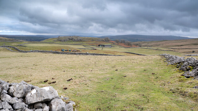
Kilnsey Wood is located at Grid Ref: SD9766 (Lat: 54.09026, Lng: -2.0409678)

Division: West Riding

Administrative County: North Yorkshire

District: Craven

Police Authority: North Yorkshire

What 3 Words

///lungs.instincts.disco. Near Grassington, North Yorkshire

Related Wikis

Conistone

Conistone is a small village in the Craven district of North Yorkshire, England. It lies 3 miles (5 km) north of Grassington, 3 miles (5 km) south of Kettlewell...

Conistone with Kilnsey

Conistone with Kilnsey is a civil parish in Wharfedale in the district of Craven, North Yorkshire, England. It contains the villages of Kilnsey and Conistone...

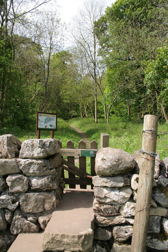
Grass Wood, Wharfedale

Grass Wood is an ancient woodland of 88 hectares (220 acres) in Wharfedale, North Yorkshire, England, that has an exceptional ground flora of woodland...

St Mary's Church, Conistone

St Mary's Church is in the village of Conistone, North Yorkshire, England. It is an active Anglican parish church in the deanery of Skipton, the archdeaconry...

Nearby Amenities

Located within 500m of 54.09026,-2.0409678
Haw Hill
Natural: peak
Source: OS 1:25k
Lat/Long: 54.0884344/-2.0382437
Natural: spring
Source: OS 1:25k
Lat/Long: 54.09445/-2.0383939
lime kiln
Historic: ruins
Source: OS 1853
Lat/Long: 54.093143/-2.0450868
Haw Plain
Description: Originally a N-S field between east & west Kilnsey Wood
Place: locality
Source: Bing
Lat/Long: 54.088603/-2.0397068
Power: pole
Lat/Long: 54.0889571/-2.0349786
Power: pole
Lat/Long: 54.08989/-2.035287
Power: pole
Lat/Long: 54.0903777/-2.0354801
Power: pole
Lat/Long: 54.0914097/-2.0358101
Power: pole
Lat/Long: 54.0922088/-2.0360944
Power: pole
Lat/Long: 54.0929104/-2.0360032
Power: pole
Lat/Long: 54.0935836/-2.0359281
The data included in this document is from www.openstreetmap.org. The data is made available under ODbL.

Have you been to Kilnsey Wood?

Leave your review of Kilnsey Wood below (or comments, questions and feedback).