Crossway Green

Settlement in Worcestershire Wychavon

England

Crossway Green

Concrete Milestone, A449, Crossway Green North of the Mitre Oak pub (<a href="https://www.geograph.org.uk/photo/2974109">SO8468 : The Mitre Oak near Crossway Green, Worcestershire</a>) and almost opposite the oak-framed church of St Bishop's Wood. On the verge of the South bound carriageway of the trunk road. The contextual view showing the reverse of the milestone is <a href="https://www.geograph.org.uk/photo/4427744">SO8468 : Milestone on the A449 south of Hartlebury</a>.

Inscription: A449 / Worcester 9 / 5 Kidderminster / C. C. W.

Milestone Society National ID: WO_WOKD09
Concrete Milestone, A449, Crossway Green Credit: Mr Red

Crossway Green is a small village located in the county of Worcestershire, England. Situated approximately 11 miles southwest of the city of Worcester, it falls within the administrative district of Wyre Forest. The village is nestled in a rural setting, surrounded by picturesque countryside, and is known for its tranquil and idyllic atmosphere.

The origins of Crossway Green can be traced back to the medieval period when it served as a crossroad for travelers. Over the years, the village has evolved, but it has managed to retain its traditional charm. The architecture in the village is predominantly of a rural character, with a mix of historic and modern buildings.

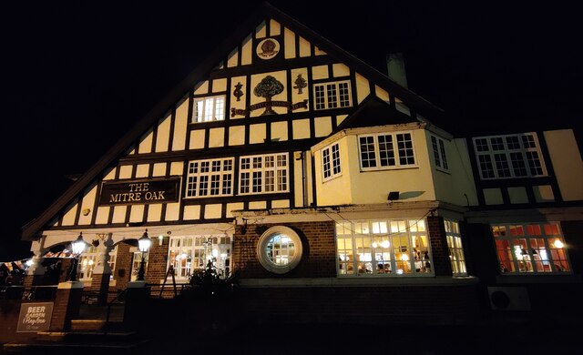
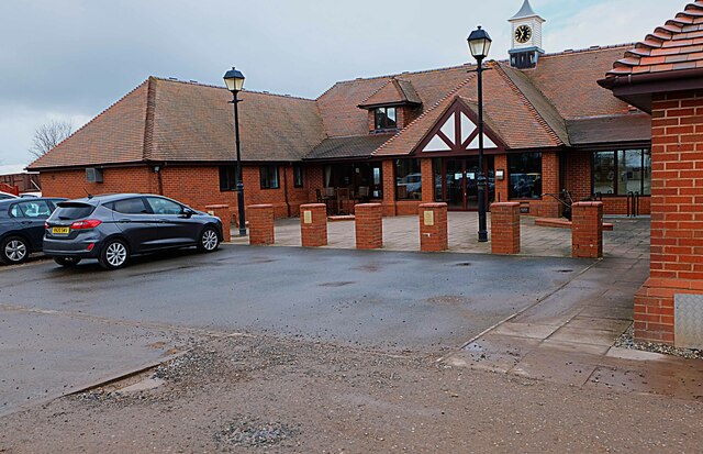
Despite its small size, Crossway Green offers a range of amenities to its residents and visitors. There is a local pub that serves as a popular gathering spot for locals, and a village hall that hosts community events and activities. The village is also home to a primary school, ensuring educational facilities are accessible to families in the area.

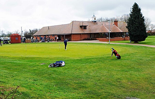
The surrounding countryside provides ample opportunities for outdoor activities, such as walking, cycling, and horse riding. The nearby Wyre Forest offers a range of trails and paths for nature enthusiasts to explore.

Overall, Crossway Green is a charming village that offers a peaceful retreat from the hustle and bustle of city life. Its rural setting, combined with its range of amenities and proximity to beautiful countryside, makes it an attractive place to live or visit.

If you have any feedback on the listing, please let us know in the comments section below.

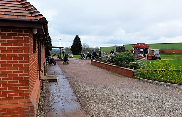
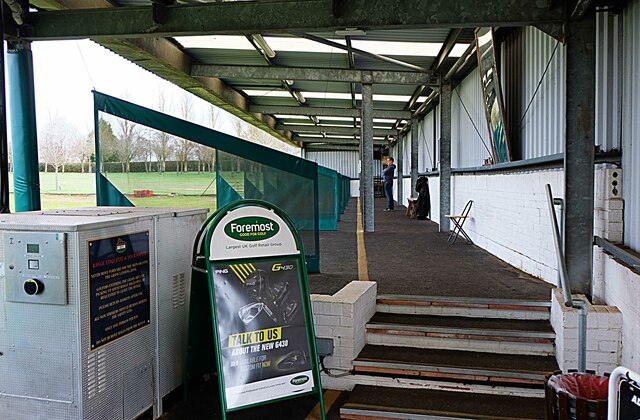
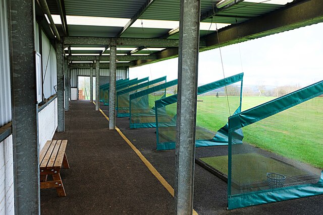
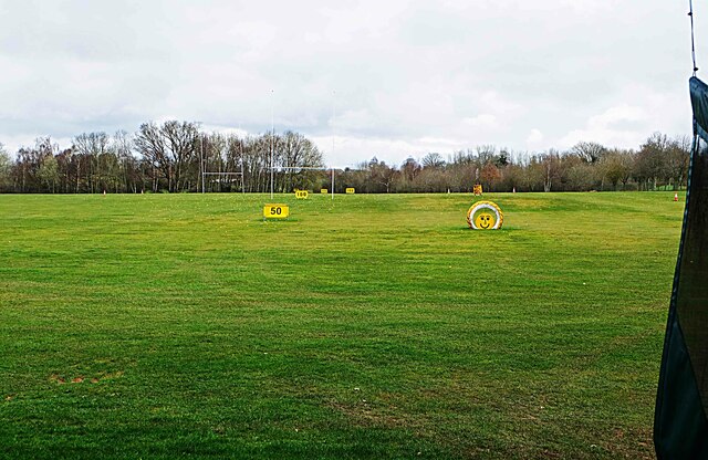
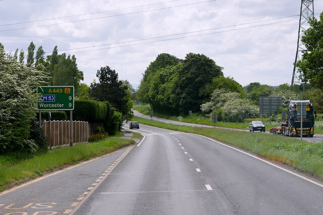
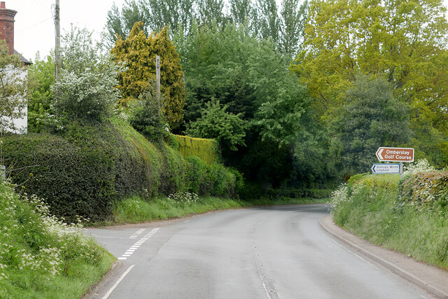
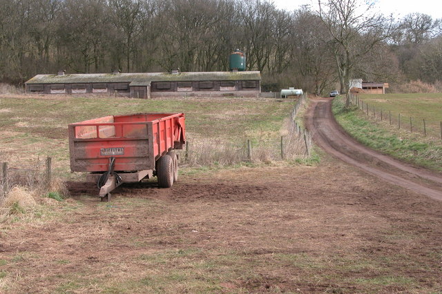
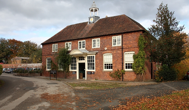
Crossway Green Images

Images are sourced within 2km of 52.317488/-2.234695 or Grid Reference SO8468. Thanks to Geograph Open Source API. All images are credited.

Concrete Milestone, A449, Crossway Green North of the Mitre Oak pub (<a href="https://www.geograph.org.uk/photo/2974109">SO8468 : The Mitre Oak near Crossway Green, Worcestershire</a>) and almost opposite the oak-framed church of St Bishop's Wood. On the verge of the South bound carriageway of the trunk road. The contextual view showing the reverse of the milestone is <a href="https://www.geograph.org.uk/photo/4427744">SO8468 : Milestone on the A449 south of Hartlebury</a>.

Inscription: A449 / Worcester 9 / 5 Kidderminster / C. C. W.

Milestone Society National ID: WO_WOKD09
Concrete Milestone, A449, Crossway Green
North of the Mitre Oak pub (SO8468 : The Mitre Oak near Crossway Green, Worcestershire) and almost opposite the oak-framed church of St Bishop's Wood. On the verge of the South bound carriageway of the trunk road. The contextual view showing the reverse of the milestone is SO8468 : Milestone on the A449 south of Hartlebury. Inscription: A449 / Worcester 9 / 5 Kidderminster / C. C. W. Milestone Society National ID: WO_WOKD09
The Mitre Oak Inn A large Marston's food pub along the A449 Worcester Road at Crossway Green.
The Mitre Oak Inn
A large Marston's food pub along the A449 Worcester Road at Crossway Green.
Ombersley Golf Club Clubhouse (1), Bishops Wood Road, near Ombersley, Worcs The club was developed by a local farming family who continue to run it. The course opened in late 1991. The impressive Clubhouse includes a bar and restaurant which is open to the public, including those who do not play golf.  There is a large car park in front with access from Bishops Wood Road.

<a href="https://www.geograph.org.uk/photo/7436394">SO8267 : Ombersley Golf Club Clubhouse (2), Bishops Wood Road, near Ombersley, Worcs</a>.
Ombersley Golf Club Clubhouse (1), Bishops Wood Road, near Ombersley, Worcs
The club was developed by a local farming family who continue to run it. The course opened in late 1991. The impressive Clubhouse includes a bar and restaurant which is open to the public, including those who do not play golf. There is a large car park in front with access from Bishops Wood Road. SO8267 : Ombersley Golf Club Clubhouse (2), Bishops Wood Road, near Ombersley, Worcs.
Plough in front of Clubhouse, Ombersley Golf Club, near Ombersley, Worcs The Ombersley Golf Club is located in a very rural area and on former farmland. The plough is a symbol of this.

<a href="https://www.geograph.org.uk/photo/7436273">SO8367 : Ombersley Golf Club Clubhouse (1), Bishops Wood Road, near Ombersley, Worcs</a>.
<a href="https://www.geograph.org.uk/photo/7436394">SO8267 : Ombersley Golf Club Clubhouse (2), Bishops Wood Road, near Ombersley, Worcs</a>.
Plough in front of Clubhouse, Ombersley Golf Club, near Ombersley, Worcs
The Ombersley Golf Club is located in a very rural area and on former farmland. The plough is a symbol of this. SO8367 : Ombersley Golf Club Clubhouse (1), Bishops Wood Road, near Ombersley, Worcs. SO8267 : Ombersley Golf Club Clubhouse (2), Bishops Wood Road, near Ombersley, Worcs.
Ombersley Golf Club Clubhouse (2), Bishops Wood Road, near Ombersley, Worcs The clubhouse includes a bar and restaurant and an extensively stocked golf shop.

<a href="https://www.geograph.org.uk/photo/7436273">SO8367 : Ombersley Golf Club Clubhouse (1), Bishops Wood Road, near Ombersley, Worcs</a>.
Ombersley Golf Club Clubhouse (2), Bishops Wood Road, near Ombersley, Worcs
The clubhouse includes a bar and restaurant and an extensively stocked golf shop. SO8367 : Ombersley Golf Club Clubhouse (1), Bishops Wood Road, near Ombersley, Worcs.
Path by Ombersley Golf Course Clubhouse to Driving Range, near Ombersley, Worcs The path leads to the Driving Range, which is the green building in the distance.
Path by Ombersley Golf Course Clubhouse to Driving Range, near Ombersley, Worcs
The path leads to the Driving Range, which is the green building in the distance.
Golf buggies at Ombersley Golf Club, Bishops Wood Road, near Ombersley, Worcs Golf buggies (a.k.a. golf carts) parked near the Clubhouse.
Golf buggies at Ombersley Golf Club, Bishops Wood Road, near Ombersley, Worcs
Golf buggies (a.k.a. golf carts) parked near the Clubhouse.
Driving range (1) at Ombersley Golf Course, near Ombersley, Worcs The driving range is a facility where golfers can practice their golf swing.

<a href="https://www.geograph.org.uk/photo/7437813">SO8267 : Driving range (2) at Ombersley Golf Course, near Ombersley, Worcs</a>.
<a href="https://www.geograph.org.uk/photo/7439298">SO8267 : Area in front of Driving Range, Ombersley Golf Course, near Ombersley, Worcs</a>.
Driving range (1) at Ombersley Golf Course, near Ombersley, Worcs
Driving range (2) at Ombersley Golf Course, near Ombersley, Worcs Part of the covered driving range at Ombersley Golf Club.

See also:-  <a href="https://www.geograph.org.uk/photo/7437795">SO8267 : Driving range (1) at Ombersley Golf Course, near Ombersley, Worcs</a>.
Driving range (2) at Ombersley Golf Course, near Ombersley, Worcs
Part of the covered driving range at Ombersley Golf Club. See also:- SO8267 : Driving range (1) at Ombersley Golf Course, near Ombersley, Worcs.
Area in front of Driving Range, Ombersley Golf Course, near Ombersley, Worcs The balls from the Driving Range land in this area, which was photographed from the Range. Looking at the photograph enlarged, there are dozens and dozens of balls which at some stage, after play, would have to be collected.

<a href="https://www.geograph.org.uk/photo/7437795">SO8267 : Driving range (1) at Ombersley Golf Course, near Ombersley, Worcs</a>.
Area in front of Driving Range, Ombersley Golf Course, near Ombersley, Worcs
The balls from the Driving Range land in this area, which was photographed from the Range. Looking at the photograph enlarged, there are dozens and dozens of balls which at some stage, after play, would have to be collected. SO8267 : Driving range (1) at Ombersley Golf Course, near Ombersley, Worcs.
Stourport Road, Titton Junction with Lincombe Lane and Chadwick Lane.
Stourport Road, Titton
Junction with Lincombe Lane and Chadwick Lane.
Stourport Road, Chadwick Bank Passing Bell's Farm Shop.
Stourport Road, Chadwick Bank
Passing Bell's Farm Shop.
A449 near Crossway Green
Stourport Road near Crossway Green
A449 Southbound near Acton
Chicken shed near Lincomb
Ombersley Golf Club
Ombersley Golf Club
Bishops Wood, Crossway Green Power cables at Bishop's Wood.
Bishops Wood, Crossway Green
Power cables at Bishop's Wood.
Show me another place!

Crossway Green is located at Grid Ref: SO8468 (Lat: 52.317488, Lng: -2.234695)

Administrative County: Worcestershire

District: Wychavon

Police Authority: West Mercia

What 3 Words

///activates.rank.loud. Near Hartlebury, Worcestershire

Related Wikis

Crossway Green

Crossway Green is a village in Worcestershire, England.

Hartlebury

Hartlebury is a village and civil parish in the Wychavon district of Worcestershire, England. It is 4 miles (6.4 km) south of Kidderminster. The village...

Hartlebury railway station

Hartlebury railway station serves the village of Hartlebury in Worcestershire, England. All trains serving the station are operated by West Midlands Trains...

Dunhampton

Dunhampton is a village in Worcestershire, England.

Snead's Green

Snead's Green, sometimes written Sneads Green, is an area of Droitwich Spa, Worcestershire, England.Francis Moule, of Snead's Green House, sold the manorial...
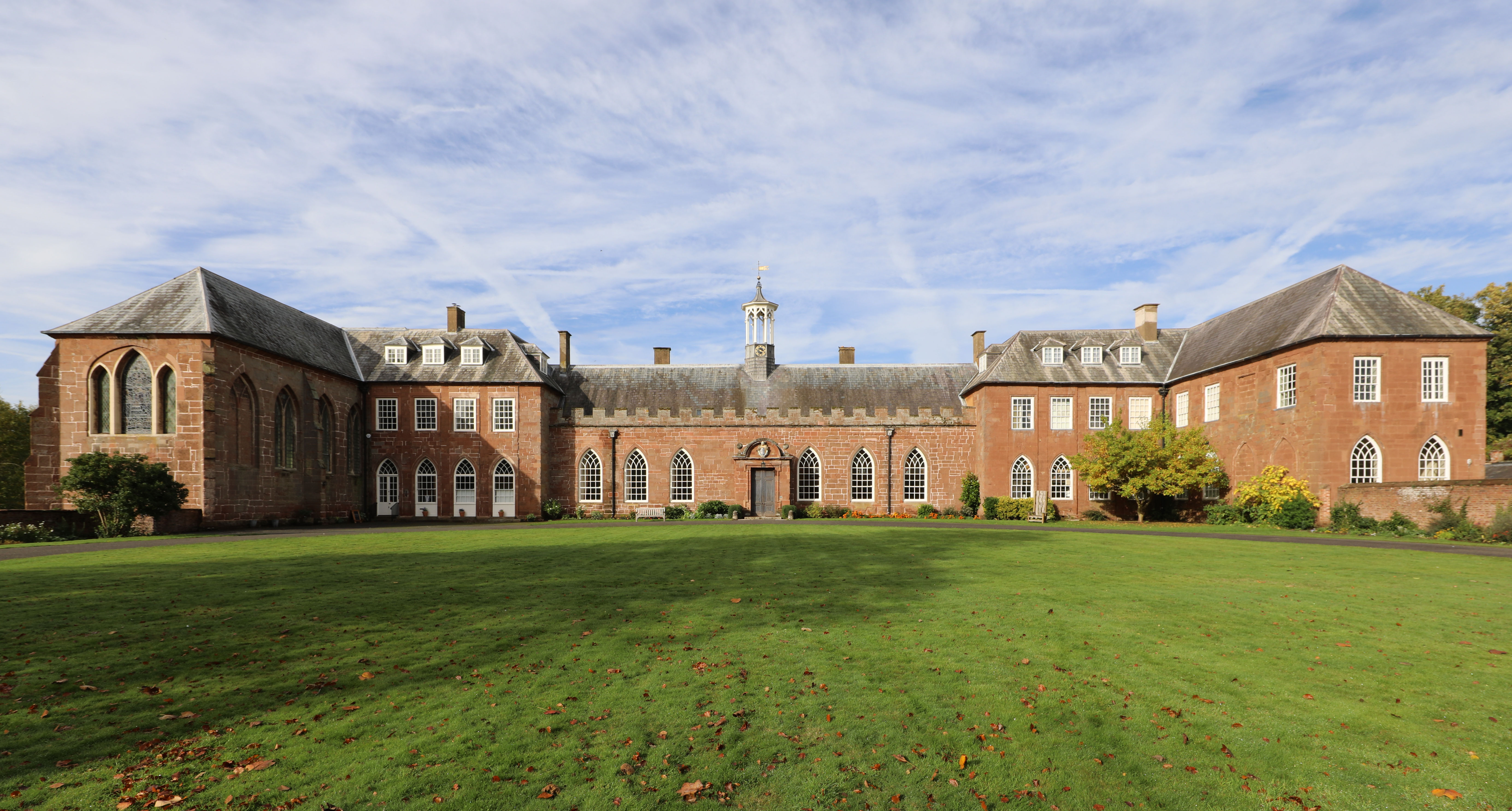
Hartlebury Castle

Hartlebury Castle, a Grade I listed building, near Hartlebury in Worcestershire, central England, was built in the mid-13th century as a fortified manor...

Worcestershire County Museum

Worcestershire County Museum is a local museum located within Hartlebury Castle in Hartlebury, Worcestershire, England, near the City of Worcester. The...

Hartlebury Common

Hartlebury Common is an area of lowland heath in north Worcestershire, England, situated just outside the town of Stourport-on-Severn. Hartlebury Common...

Nearby Amenities

Located within 500m of 52.317488,-2.234695
Bus Stop
Mitr Oak
Bus: yes
Naptan AtcoCode: 2000G047800
Naptan Bearing: S
Naptan CommonName: Mitr Oak
Naptan Indicator: Opp
Naptan Landmark: Opp Public House
Naptan NaptanCode: wocdjmwp
Naptan PlusbusZoneRef: KDRMNST
Naptan Street: A449
Naptan Verified: no
Public Transport: platform
Source: naptan_import
Lat/Long: 52.313575/-2.2328448
Bus Stop
Mitre Oak
Bus: yes
Naptan AtcoCode: 2000G047801
Naptan Bearing: N
Naptan CommonName: Mitre Oak
Naptan Indicator: Adj
Naptan Landmark: Public House
Naptan NaptanCode: wocdpatg
Naptan PlusbusZoneRef: KDRMNST
Naptan Street: A449
Naptan Verified: no
Public Transport: platform
Source: naptan_import
Lat/Long: 52.313224/-2.233063
Bus Stop
Kidderminster- A449 North Bound
Bus: yes
Naptan AtcoCode: 2000G502423
Naptan Bearing: NW
Naptan CommonName: Kidderminster- A449 North Bound
Naptan Indicator: Adj
Naptan Landmark: Woodside Nurseries
Naptan NaptanCode: wocdpwda
Naptan PlusbusZoneRef: KDRMNST
Naptan Street: St Marys Church
Naptan Verified: no
Public Transport: platform
Source: naptan_import
Lat/Long: 52.3165889/-2.2363228
Crossway Green
Place: hamlet
Wikidata: Q5188890
Lat/Long: 52.3176716/-2.2352591
Post Box
Collection Plate: CP7
Collection Times: Mo-Fr 16:00; Sa 09:45
Historic Operator: Royal Mail
Post Box Type: lamp
Ref: DY13 74
Royal Cypher: EIIR
Royal Cypher Wikidata: Q33102113
Lat/Long: 52.3134727/-2.2332215
Location Transition: yes
Power: pole
Lat/Long: 52.3198946/-2.2398937
Power: pole
Lat/Long: 52.319202/-2.2413367
Power: pole
Lat/Long: 52.3181355/-2.23775
Power: pole
Lat/Long: 52.3168548/-2.233823
Power: pole
Lat/Long: 52.3164498/-2.2329942
Power: pole
Lat/Long: 52.317591/-2.2360924
Power: pole
Lat/Long: 52.3159891/-2.2320313
Power: pole
Lat/Long: 52.3188502/-2.2398797
Power: pole
Lat/Long: 52.3172909/-2.2351225
Power: pole
Lat/Long: 52.3151496/-2.2311743
Power: pole
Lat/Long: 52.3185126/-2.2388229
Power: pole
Lat/Long: 52.3182562/-2.2299244
Power: pole
Lat/Long: 52.3195992/-2.2377267
Power: pole
Lat/Long: 52.3182004/-2.228079
Power: pole
Lat/Long: 52.3193481/-2.2362812
Power: pole
Lat/Long: 52.3187677/-2.2328453
Crossing
Crossing: unmarked
Lat/Long: 52.3141631/-2.2339067
Power: pole
Source: bing
Lat/Long: 52.3151297/-2.240932
Power: pole
Source: bing
Lat/Long: 52.3153601/-2.2403607
Power: pole
Ref: 761243
Source: wpd_opendata
Transformer: distribution
Lat/Long: 52.3155683/-2.2396807
Power: pole
Source: bing
Lat/Long: 52.3158069/-2.2390866
Power: pole
Source: bing
Lat/Long: 52.3159118/-2.238746
Power: pole
Source: bing
Lat/Long: 52.3161373/-2.2380835
Power: pole
Source: bing
Lat/Long: 52.3164394/-2.2371038
Power: pole
Source: bing
Lat/Long: 52.3170243/-2.2368316
Power: pole
Source: bing
Lat/Long: 52.3173362/-2.2366975
Short Hill
Power: pole
Ref: 761253
Source: wpd_opendata
Transformer: distribution
Voltage Primary: 11000
Lat/Long: 52.3177486/-2.2365928
Middlemore
Power: pole
Transformer: distribution
Voltage Primary: 11000
Lat/Long: 52.3205846/-2.2330503
Location Transition: yes
Power: pole
Lat/Long: 52.3200575/-2.2330034
Travelodge Crossway Green
Power: pole
Transformer: distribution
Voltage Primary: 11000
Lat/Long: 52.3195804/-2.2329598
Power: pole
Lat/Long: 52.3186557/-2.2330141
Power: pole
Lat/Long: 52.3180359/-2.2330034
Power: pole
Lat/Long: 52.316903/-2.232998
Field Lane
Power: pole
Transformer: distribution
Voltage Primary: 11000
Lat/Long: 52.3164059/-2.2339532
Church Lane
Power: pole
Transformer: distribution
Voltage Primary: 11000
Lat/Long: 52.3156863/-2.2369114
Power: pole
Lat/Long: 52.3159298/-2.2375229
Stoney Lane
Power: pole
Transformer: distribution
Voltage Primary: 11000
Lat/Long: 52.3143746/-2.2303896
Power: pole
Lat/Long: 52.3135793/-2.2319774
Power: pole
Lat/Long: 52.3144861/-2.2311097
Power: pole
Lat/Long: 52.3147796/-2.2308053
Crossing
Crossing: unmarked
Lat/Long: 52.3212225/-2.233535
Crossing
Crossing: unmarked
Lat/Long: 52.3210586/-2.2334672
Crossing
Crossing: unmarked
Lat/Long: 52.3203119/-2.2342534
Crossing
Crossing: unmarked
Lat/Long: 52.3205039/-2.2342752
Crossing
Crossing: unmarked
Lat/Long: 52.3145449/-2.2340067
Crossing
Crossing: unmarked
Lat/Long: 52.3146426/-2.2338082
Crossing
Crossing: unmarked
Lat/Long: 52.3145605/-2.2331429
Crossing
Crossing: unmarked
Lat/Long: 52.3142553/-2.2340856
Crossing
Crossing: unmarked
Lat/Long: 52.3164316/-2.2361652
Crossing
Sidewalk Right: separate
Lat/Long: 52.3139542/-2.2331655
Crossing
Crossing: unmarked
Lat/Long: 52.3139086/-2.2333822
Crossing
Crossing: unmarked
Lat/Long: 52.3144903/-2.2330626
The data included in this document is from www.openstreetmap.org. The data is made available under ODbL.

Have you been to Crossway Green?

Leave your review of Crossway Green below (or comments, questions and feedback).