Pit Bottom Spinney

Wood, Forest in Dorset

England

Pit Bottom Spinney

Deans Drove
Deans Drove Credit: Alex McGregor

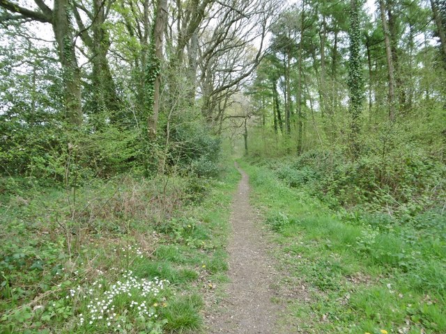
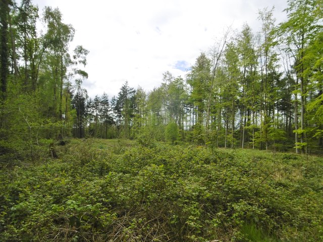
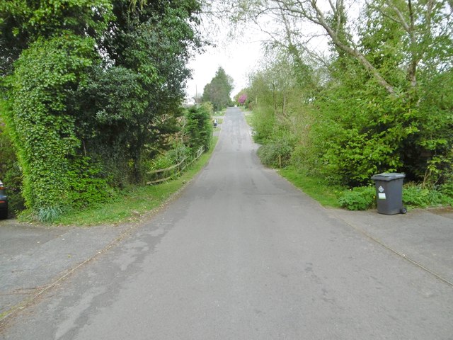
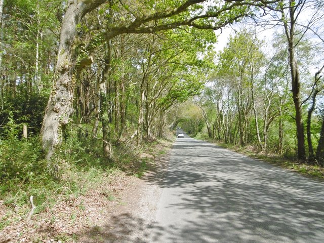
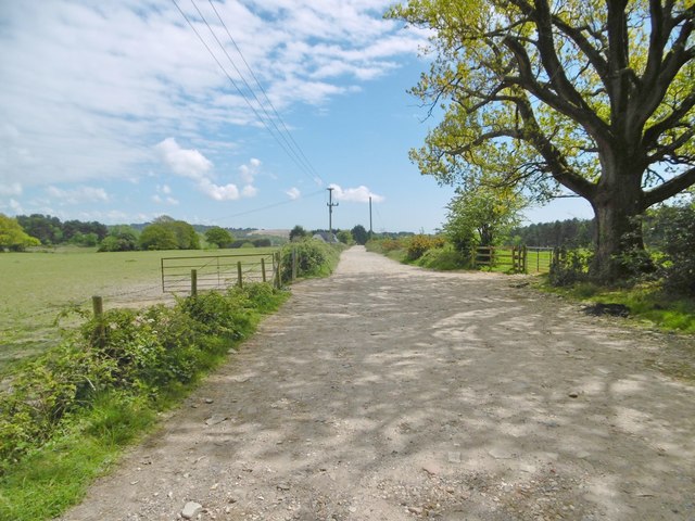
Pit Bottom Spinney is a picturesque woodland located in Dorset, England. Situated in the heart of the county, this forested area covers approximately 100 acres of land. The spinney is known for its diverse range of tree species, including oak, beech, ash, and birch, which create a lush and vibrant canopy overhead.

The woodland is a haven for wildlife, providing a natural habitat for various species. It is home to a wide array of bird species, such as woodpeckers, owls, and finches, which can be spotted flitting among the branches. Small mammals like squirrels, rabbits, and foxes also thrive in this natural environment.

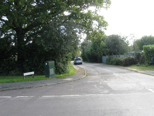
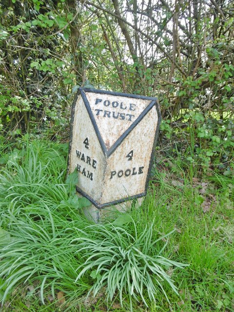
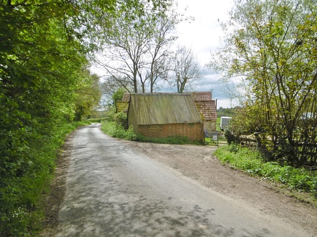
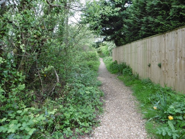
Pit Bottom Spinney offers several walking trails that wind through the forest, allowing visitors to explore its beauty at their own pace. The paths are well-maintained and marked, making it easy for hikers to navigate through the woodland. Along the way, there are several benches and picnic spots where visitors can rest and enjoy the tranquil surroundings.

The spinney is particularly popular during the spring and summer months when the forest floor comes alive with a spectacular display of wildflowers. Bluebells, primroses, and foxgloves adorn the forest, creating a colorful and enchanting scene.

Pit Bottom Spinney is open to the public year-round, free of charge. It offers a peaceful retreat for nature lovers, photographers, and those seeking solace amidst the beauty of the natural world.

If you have any feedback on the listing, please let us know in the comments section below.

Pit Bottom Spinney Images

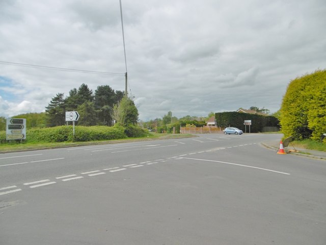
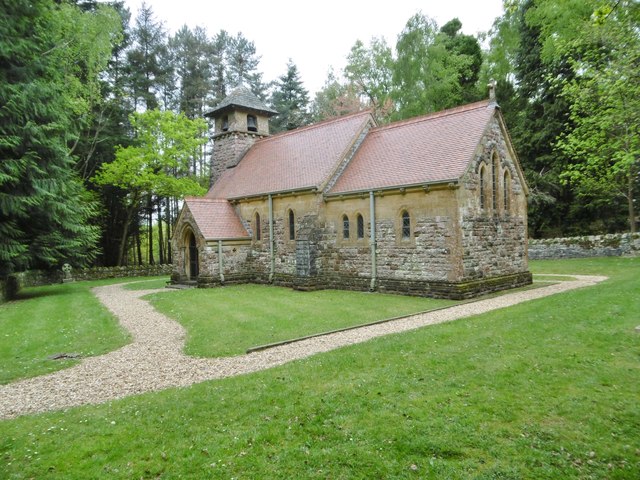
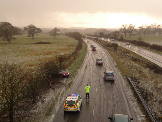
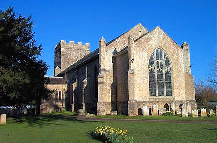
Images are sourced within 2km of 50.74973/-2.0523516 or Grid Reference SY9694. Thanks to Geograph Open Source API. All images are credited.

Deans Drove
Deans Drove
Holme Bush Inn
Holme Bush Inn
Old Milepost by the B3067, Lytchett Minster Cast iron post by the B3067, in parish of LYTCHETT MINSTER AND UPTON (PURBECK District), Lytchett Minster, opposite church and school, on 2m wide grass verge, on a bend, on South-east side of road. Poole cast iron post, erected by the Poole Turnpike Trust in the 19th century. 

Inscription reads:-
: 4 / WARE / HAM : : POOLE / TRUST : : 4 / POOLE :

Grade II Listed. List Entry Number: 1392932
<span class="nowrap"><a title="https://historicengland.org.uk/listing/the-list/list-entry/1392932" rel="nofollow ugc noopener" href="https://historicengland.org.uk/listing/the-list/list-entry/1392932">Link</a><img style="margin-left:2px;" alt="External link" title="External link - shift click to open in new window" src="https://s1.geograph.org.uk/img/external.png" width="10" height="10"/></span>

Milestone Society National ID: DO_WAPO04.
Old Milepost by the B3067, Lytchett Minster
Cast iron post by the B3067, in parish of LYTCHETT MINSTER AND UPTON (PURBECK District), Lytchett Minster, opposite church and school, on 2m wide grass verge, on a bend, on South-east side of road. Poole cast iron post, erected by the Poole Turnpike Trust in the 19th century. Inscription reads:- : 4 / WARE / HAM : : POOLE / TRUST : : 4 / POOLE : Grade II Listed. List Entry Number: 1392932 LinkExternal link Milestone Society National ID: DO_WAPO04.
Lytchett Matravers, footpath Skirting woodland, from Foxhills Road to Post Green. Note the stitchwort in bloom.
Lytchett Matravers, footpath
Skirting woodland, from Foxhills Road to Post Green. Note the stitchwort in bloom.
Lytchett Matravers, clearing In mixed woodland on the path to Post Green.
Lytchett Matravers, clearing
In mixed woodland on the path to Post Green.
Organford, Old Dairy On Foxhills Road; advertised as forge and craft centre.
Organford, Old Dairy
On Foxhills Road; advertised as forge and craft centre.
Lytchett Matravers, brook Originating from a spring nearby, flowing down to join Sherford River.
Lytchett Matravers, brook
Originating from a spring nearby, flowing down to join Sherford River.
Lytchett Matravers, footpath From Deans Drove, following the course of <a href="https://www.geograph.org.uk/photo/5353610">SY9494 : Lytchett Matravers, brook</a>.
Lytchett Matravers, footpath
From Deans Drove, following the course of SY9494 : Lytchett Matravers, brook.
Lytchett Matravers, Deans Drove Village road with a hollow (caused or used by <a href="https://www.geograph.org.uk/photo/5353610">SY9494 : Lytchett Matravers, brook</a>) from Foxhills Road to Wareham Road.
Lytchett Matravers, Deans Drove
Village road with a hollow (caused or used by SY9494 : Lytchett Matravers, brook) from Foxhills Road to Wareham Road.
Lytchett Matravers, store General store and family butchers, on Wareham Road.
Lytchett Matravers, store
General store and family butchers, on Wareham Road.
Corfe Mullen, Rushall Lane Lane from Blandford Road North to Corfe Mullen; plantation, left, and properties and grazing land, right.
Corfe Mullen, Rushall Lane
Lane from Blandford Road North to Corfe Mullen; plantation, left, and properties and grazing land, right.
Corfe Mullen, plantation Stony Down Plantation - conifers with a little hardwood.
Corfe Mullen, plantation
Stony Down Plantation - conifers with a little hardwood.
Corfe Mullen, bridleway Bridleway and access road, from Rushall Lane to Upton Heath.
Corfe Mullen, bridleway
Bridleway and access road, from Rushall Lane to Upton Heath.
Corfe Mullen, crossroads Jubilee Cross - looking from Rushall Lane to Wimborne Road; left and right, Blandford Road North.
Corfe Mullen, crossroads
Jubilee Cross - looking from Rushall Lane to Wimborne Road; left and right, Blandford Road North.
Corfe Mullen, timber Softwood logs awaiting collection in Stony Down Plantation.
Corfe Mullen, timber
Softwood logs awaiting collection in Stony Down Plantation.
Corfe Mullen, bridleway Across Stony Down Plantation, from Rushall Lane to Old Market Road.
Corfe Mullen, bridleway
Across Stony Down Plantation, from Rushall Lane to Old Market Road.
Corfe Mullen, plantation Stony Down Plantation - conifers with patches of hardwood.
Corfe Mullen, plantation
Stony Down Plantation - conifers with patches of hardwood.
Lytchett Heath, St. Aldhelm's Late C19 church, now apparently disused - there is no church board, though the churchyard appears tended.
Lytchett Heath, St. Aldhelm's
Late C19 church, now apparently disused - there is no church board, though the churchyard appears tended.
Show me another place!

Pit Bottom Spinney is located at Grid Ref: SY9694 (Lat: 50.74973, Lng: -2.0523516)

Unitary Authority: Dorset

Police Authority: Dorset

What 3 Words

///rabble.expect.vets. Near Lytchett Matravers, Dorset

Related Wikis

Lytchett Heath

Lytchett Heath is an area of woods and farmland on the Dorset Heaths between the villages of Lytchett Matravers, Lytchett Minster and the hamlet of Beacon...

St Aldhelm's Church, Lytchett Heath

St Aldhelm's Church is a private church in Lytchett Heath, Dorset, England. It was designed by George Crickmay for Lord Eustace Cecil and built in 1898...

Beacon Hill, Dorset

Beacon Hill is one of the highest viewpoints in the hinterland of Poole Harbour, Dorset. Its tree-covered summit reaches 84 metres (276 ft) above sea level...

Lytchett Minster School

Lytchett Minster School is a comprehensive school, with about 1,400 students aged 11 to 18, and 100 teachers, in Lytchett Minster, just outside Upton,...

Lytchett Minster and Upton

Lytchett Minster and Upton, formerly just Lytchett Minster is a civil parish in the Dorset district, in the ceremonial county of Dorset, England. The parish...

Lytchett Minster

Lytchett Minster is a village in Dorset, England. It lies around 4 miles (6.4 km) north-west of Poole town centre. The village forms part of the civil...

Barrow Hill, Dorset

Barrow Hill is a small settlement in Dorset, England, situated in the East Dorset administrative district on the A350 road approximately 4 miles (6.4 km...

Stoney Down

Stoney Down or Stony Down is both a hill and an area of forested countryside in the county of Dorset, England, that has been designated an "Area of Great...

Nearby Amenities

Located within 500m of 50.74973,-2.0523516
Post Box
Collection Times: Mo-Fr 09:00; Sa 07:00
Date: 2022-12-16
Description: Opposite entrance to Race Farm
Operator: Royal Mail
Post Box Type: lamp
Ref: BH16 135D
Ref GB Uprn: 10015418158
Royal Cypher: EIIR
Royal Cypher Wikidata: Q33102113
Lat/Long: 50.7520842/-2.058075
Material: wood
Power: pole
Source: bing
Lat/Long: 50.7460561/-2.0498706
Material: wood
Power: pole
Source: bing
Lat/Long: 50.7461394/-2.0498452
Material: wood
Power: pole
Source: bing
Lat/Long: 50.7462592/-2.0514697
Material: wood
Power: pole
Source: bing
Lat/Long: 50.7463444/-2.0514484
Material: wood
Power: pole
Source: survey;bing
Lat/Long: 50.7464786/-2.0531147
Material: wood
Power: pole
Source: survey;bing
Lat/Long: 50.7465576/-2.0530972
Material: wood
Power: pole
Source: survey;bing
Lat/Long: 50.7467107/-2.0547625
Material: wood
Power: pole
Source: survey;bing
Lat/Long: 50.7467879/-2.054616
Material: wood
Power: pole
Source: bing
Lat/Long: 50.7469265/-2.056737
Material: wood
Power: pole
Source: bing
Lat/Long: 50.7470599/-2.0568484
Material: wood
Power: pole
Source: bing
Lat/Long: 50.7452715/-2.0532403
Frequency: 50
Operator: SSE Power Distribution
Phases: 3
Poles: bipole
Power: transformer
Transformer: distribution
Voltage Primary: 11000
Voltage Secondary: 400
Voltage Tertiary: 230
Lat/Long: 50.7474301/-2.0464759
Addr Housename: Race Farm
Source: survey
Lat/Long: 50.7517831/-2.058574
Camera Direction: 280
Camera Mount: wall
Camera Type: fixed
Height: 3
Man Made: surveillance
Surveillance: public
Surveillance Type: camera
Lat/Long: 50.7459264/-2.0540088
Camera Mount: wall
Camera Type: dome
Height: 3
Man Made: surveillance
Surveillance: public
Surveillance Type: camera
Lat/Long: 50.7460338/-2.0538217
Power: pole
Source: bing
Transformer: distribution
Lat/Long: 50.7530745/-2.0550576
Man Made: utility_pole
Material: wood
Operator: BT OpenReach
Source: survey
Utility: telecom
Lat/Long: 50.7521161/-2.0581296
Man Made: manhole
Manhole: telecom
Material: concrete
Operator: BT OpenReach
Source: survey
Utility: telecom
Lat/Long: 50.7520488/-2.0580524
Man Made: manhole
Manhole: telecom
Material: concrete
Operator: BT OpenReach
Source: survey
Utility: telecom
Lat/Long: 50.7504225/-2.056747
The data included in this document is from www.openstreetmap.org. The data is made available under ODbL.

Have you been to Pit Bottom Spinney?

Leave your review of Pit Bottom Spinney below (or comments, questions and feedback).