Winter's Belt

Wood, Forest in Staffordshire Stafford

England

Winter's Belt

Weston upon Trent Church St Andrew's Church has an very broad tower in Early English style, and there is other early 13C work inside, but the remainder of the exterior is Victorian, of 1860 and 1872.
Weston upon Trent Church Credit: Humphrey Bolton

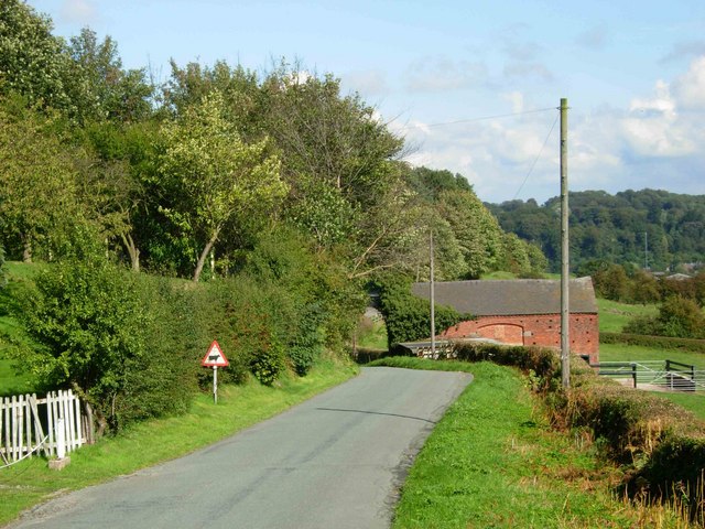
Winter's Belt is a picturesque woodland area located in the county of Staffordshire, England. Spanning over a vast expanse, the forest is a tranquil retreat for nature lovers and outdoor enthusiasts. The name "Winter's Belt" derives from its enchanting beauty during the winter season, when the trees are adorned with a blanket of snow, creating a stunning visual spectacle.

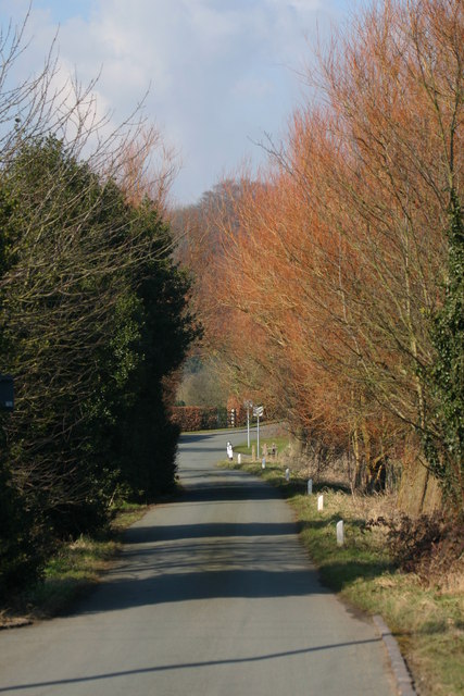
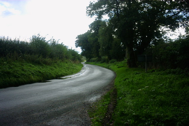
The woodland is characterized by a diverse range of tree species, including oak, beech, and birch, which create a vibrant and lush environment throughout the year. The forest floor is carpeted with a variety of flora, such as bluebells, wild garlic, and ferns, adding to the area's natural charm. Numerous walking trails meander through the woodland, providing visitors with the opportunity to explore its hidden gems.

Winter's Belt is home to a rich array of wildlife, making it an ideal destination for wildlife enthusiasts and birdwatchers. The forest is known for hosting a wide variety of bird species, including woodpeckers, owls, and various migratory birds. Squirrels, foxes, and deer can also be spotted in the area, adding to its allure.

The woodland offers a range of recreational activities, such as hiking, cycling, and picnicking. It has designated picnic areas with benches, allowing visitors to relax and enjoy the peaceful surroundings. The forest is well-maintained, with clear signposts and information boards placed strategically, ensuring a safe and enjoyable experience for all.

In conclusion, Winter's Belt in Staffordshire is a captivating woodland that offers a serene escape from the bustling city life. With its breathtaking scenery, diverse wildlife, and recreational opportunities, it is a must-visit destination for nature lovers and those seeking tranquility amidst the beauty of nature.

If you have any feedback on the listing, please let us know in the comments section below.

Winter's Belt Images

Images are sourced within 2km of 52.850709/-2.057974 or Grid Reference SJ9628. Thanks to Geograph Open Source API. All images are credited.

Weston upon Trent Church St Andrew's Church has an very broad tower in Early English style, and there is other early 13C work inside, but the remainder of the exterior is Victorian, of 1860 and 1872.
Weston upon Trent Church
St Andrew's Church has an very broad tower in Early English style, and there is other early 13C work inside, but the remainder of the exterior is Victorian, of 1860 and 1872.
St. Peter, Gayton
St. Peter, Gayton
St. James the Great, Salt
Pitt's Column Abandoned and hidden in the trees, this is a memorial column to William Pitt the Younger. Erected in the year of his death (1806).
Pitt's Column
Abandoned and hidden in the trees, this is a memorial column to William Pitt the Younger. Erected in the year of his death (1806).
Pitt's Column More general view of the memorial.
Pitt's Column
More general view of the memorial.
The Casey, Salt Looking North towards the Trent and Mersey Canal and the A51 from the River Trent Bridge at Salt.
The Casey, Salt
Looking North towards the Trent and Mersey Canal and the A51 from the River Trent Bridge at Salt.
The river Trent, Salt This is the River Trent taken from the Bridge facing East, in the background are trees on the Sandon Estate, a railway line can just be seen but hidden from view is the Trent and Mersey canal and the A51.
The river Trent, Salt
This is the River Trent taken from the Bridge facing East, in the background are trees on the Sandon Estate, a railway line can just be seen but hidden from view is the Trent and Mersey canal and the A51.
Road to Salt Looking along the lane leading from the B5066 to Salt village.
Road to Salt
Looking along the lane leading from the B5066 to Salt village.
Salt At this point the road from Weston to Salt doglegs across a bridge over an overgrown cutting that was once the Great Northern Railway's Uttoxeter - Stafford branch line, abandoned in 1951.
Salt
At this point the road from Weston to Salt doglegs across a bridge over an overgrown cutting that was once the Great Northern Railway's Uttoxeter - Stafford branch line, abandoned in 1951.
Trent & Mersey Canal, Salt At this point the canal is sandwiched between the River Trent (just visible beyond the field), the Colwich - Stone railway and the A51 (out of shot to the right).
Trent & Mersey Canal, Salt
At this point the canal is sandwiched between the River Trent (just visible beyond the field), the Colwich - Stone railway and the A51 (out of shot to the right).
Pea Hill This is Pea Hill from the cross roads on Sandon Bank to Salt and to Enson, Enson Lane is in the foreground.
Pea Hill
This is Pea Hill from the cross roads on Sandon Bank to Salt and to Enson, Enson Lane is in the foreground.
Un-named Lane to A51 near Weston, Stafford This country lane is leading towards the A51 near to Weston, near Stafford.  Going in the other direction takes you to Gayton, a small hamlet surrounded by lovely countryside.
Un-named Lane to A51 near Weston, Stafford
This country lane is leading towards the A51 near to Weston, near Stafford. Going in the other direction takes you to Gayton, a small hamlet surrounded by lovely countryside.
A518, Weston Bank This is the A518 looking towards the direction of Weston near Stafford.
A518, Weston Bank
This is the A518 looking towards the direction of Weston near Stafford.
Woodland Bridleway This is a beautiful countryside area just off the A518 near to Weston Bank.
Woodland Bridleway
This is a beautiful countryside area just off the A518 near to Weston Bank.
Tinkerborough Cottages Cottages in a lovely off road area called Tinkerborough, near Stafford
Tinkerborough Cottages
Cottages in a lovely off road area called Tinkerborough, near Stafford
Lane and Bridleway This lane and Bridleway leads to Barn House, seen in the mid-distance. The bridleway continues to Salt.
Lane and Bridleway
This lane and Bridleway leads to Barn House, seen in the mid-distance. The bridleway continues to Salt.
Beautiful Staffordshire Countryside This is a view of beautiful Staffordshire countryside from a lane and bridleway just off the A518 near to Stafford.
Beautiful Staffordshire Countryside
This is a view of beautiful Staffordshire countryside from a lane and bridleway just off the A518 near to Stafford.
A518 Weston Bank This is a view of the A518 leading to Weston. The road drops steeply downhill here to the village of Weston. Glorious views of the Trent Valley and surrounding countryside can be seen from here.
A518 Weston Bank
This is a view of the A518 leading to Weston. The road drops steeply downhill here to the village of Weston. Glorious views of the Trent Valley and surrounding countryside can be seen from here.
Show me another place!

Winter's Belt is located at Grid Ref: SJ9628 (Lat: 52.850709, Lng: -2.057974)

Administrative County: Staffordshire

District: Stafford

Police Authority: Staffordshire

What 3 Words

///subtitle.backs.newlyweds. Near Great Haywood, Staffordshire

Related Wikis

Salt and Sandon railway station

Salt and Sandon railway station was a former British railway station opened by the Stafford and Uttoxeter Railway to serve the village of Salt in Staffordshire...
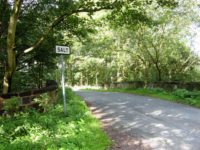
Salt, Staffordshire

Salt is a village in the Borough of Stafford in Staffordshire, England. It is three miles northeast of Stafford situated half a mile southwest of the A51...
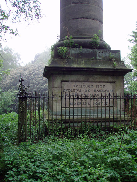
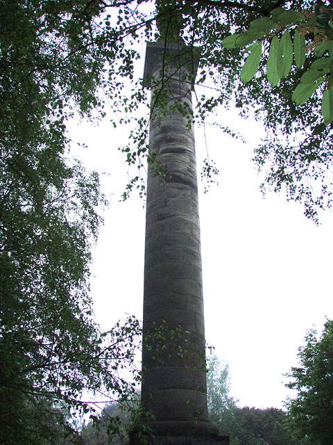
Sandon Hall

Sandon Hall is a 19th-century country mansion, the seat of the Earl of Harrowby, at Sandon, Staffordshire, 5 miles (8.0 km) northeast of Stafford. It is...

Weston, Staffordshire

Weston is a village and civil parish. within the English county of Staffordshire. The parish is in the local authority of Stafford (non-metropolitan district...

Battle of Hopton Heath

The battle of Hopton Heath was a battle of the First English Civil War, fought on Sunday 19 March 1643 between Parliamentarian forces led by Sir John Gell...

Weston and Ingestre railway station

Weston and Ingestre railway station was a former British railway station opened by the North Staffordshire Railway to serve the village of Ingestre in...

Sandon railway station

Sandon railway station was a railway station opened by the North Staffordshire Railway to serve the village of Sandon, Staffordshire, England. For some...

Sandon, Staffordshire

Sandon is a village in the civil parish of Sandon and Burston, in the Stafford district, in the county of Staffordshire, England. It is about 4.5 miles...

Nearby Amenities

Located within 500m of 52.850709,-2.057974
Noexit: yes
Lat/Long: 52.848116/-2.0633311
Waterway: turning_point
Lat/Long: 52.8487064/-2.0540233
Addr Housename: Home Farm Lodge
Lat/Long: 52.851825/-2.0613957
Power: pole
Lat/Long: 52.8490141/-2.0517845
Power: pole
Lat/Long: 52.8492165/-2.05286
Power: pole
Lat/Long: 52.8496215/-2.0526106
Power: pole
Lat/Long: 52.847263/-2.0556155
Power: pole
Lat/Long: 52.8480218/-2.0566772
Power: pole
Lat/Long: 52.8482056/-2.0580611
Power: pole
Lat/Long: 52.8483616/-2.0593883
Power: pole
Lat/Long: 52.8484706/-2.0604783
Power: pole
Lat/Long: 52.8486865/-2.0622692
Power: pole
Lat/Long: 52.8489323/-2.064375
Power: pole
Lat/Long: 52.8487241/-2.0625909
The data included in this document is from www.openstreetmap.org. The data is made available under ODbL.

Have you been to Winter's Belt?

Leave your review of Winter's Belt below (or comments, questions and feedback).