Back Wood

Wood, Forest in Yorkshire

England

Back Wood

Lobb Mill The Rochdale Canal locks to the right of view from Halifax Road
Lobb Mill Credit: Raymond Knapman

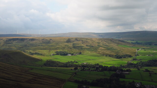
Back Wood, Yorkshire is a picturesque forest located in the northern part of England. Known for its natural beauty and tranquility, this woodland area covers a vast expanse of approximately 500 acres. Nestled within the rolling hills and valleys of Yorkshire, Back Wood offers a haven for nature enthusiasts and outdoor lovers.

The forest is composed of a diverse range of trees, including oak, beech, and birch, creating a rich and vibrant tapestry of colors throughout the seasons. The thick canopy of foliage provides shade and shelter, attracting a variety of wildlife such as deer, squirrels, and numerous bird species. Nature enthusiasts can explore the well-maintained walking trails that meander through the wood, offering breathtaking views of the surrounding landscape.

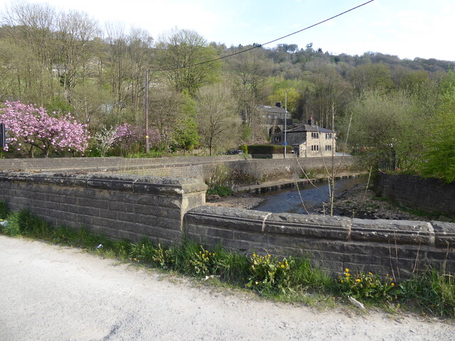
Back Wood also boasts a small river that meanders through the heart of the forest, adding to its scenic charm. Visitors can enjoy a peaceful stroll along the riverbank or indulge in a spot of fishing, as the river is known for its abundance of trout and salmon.

For those seeking a more immersive experience, there are camping facilities available within the wood. This allows visitors to spend the night under the starry sky, surrounded by the sounds of nature. Camping permits can be obtained from the local authorities, ensuring a safe and responsible experience.

Overall, Back Wood, Yorkshire offers a serene and enchanting escape from the hustle and bustle of modern life. With its stunning natural beauty and abundant wildlife, it is a place where visitors can reconnect with nature and experience the tranquility of the English countryside.

If you have any feedback on the listing, please let us know in the comments section below.
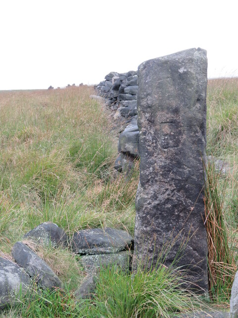
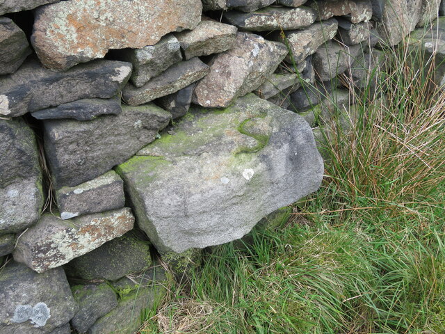
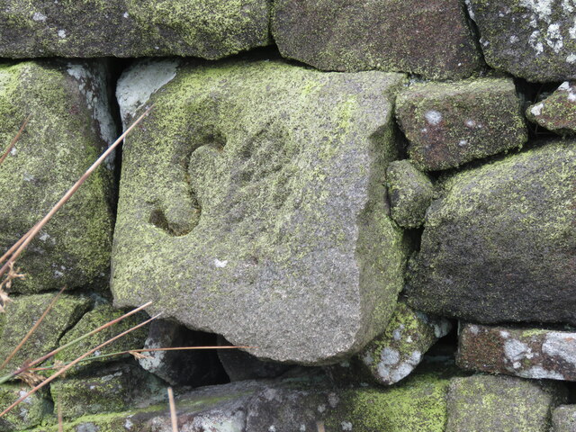
Back Wood Images

Images are sourced within 2km of 53.71929/-2.059167 or Grid Reference SD9624. Thanks to Geograph Open Source API. All images are credited.

Lobb Mill The Rochdale Canal locks to the right of view from Halifax Road
Lobb Mill
The Rochdale Canal locks to the right of view from Halifax Road
Rodwell End Clough View from Lobb Mill Viaduct
Rodwell End Clough
View from Lobb Mill Viaduct
Sunlight on Todmorden from ridge south of Stoodley Pike Monument
Lumbutts from Stoodley Pike Monument
Chinook Helicopter passing close to Stoodley Pike Monument A close encounter!
Chinook Helicopter passing close to Stoodley Pike Monument
A close encounter!
Pennine Way at Doe Stones & view towards Edge End Moor
View towards Stoodley Pike Monument from Dick's Lane
Old Boundary Marker in Stoodley Glen, Calderdale Township Boundary Marker above Stoodley Glen and south of Stoodley Lane. Formerly on the boundary of Langfield and Sowerby townships in Halifax parish. It marked the boundary of the Sowerby Ramble, a narrow strip of land along the Calder valley and up Stoodley Glen between Erringden and Stansfield townships and Erringden and Langfield township. Sowerby Ramble was part of Sowerby township but in 1850 it became part of Erringden township, later parish. In 1897 Langfield and Stansfield became part of Todmorden parish and in 1937 this part of Erringden parish also became part of Todmorden parish. 

Milestone Society National ID: YW_LANSOW02pb
Old Boundary Marker in Stoodley Glen, Calderdale
Township Boundary Marker above Stoodley Glen and south of Stoodley Lane. Formerly on the boundary of Langfield and Sowerby townships in Halifax parish. It marked the boundary of the Sowerby Ramble, a narrow strip of land along the Calder valley and up Stoodley Glen between Erringden and Stansfield townships and Erringden and Langfield township. Sowerby Ramble was part of Sowerby township but in 1850 it became part of Erringden township, later parish. In 1897 Langfield and Stansfield became part of Todmorden parish and in 1937 this part of Erringden parish also became part of Todmorden parish. Milestone Society National ID: YW_LANSOW02pb
Old Boundary Marker between Higher Moor and Sunderland Pasture in Hebden Royd parish Township Boundary Marker beside a track between Higher Moor and Sunderland Pasture. On the former boundary of the Sowerby Ramble between Erringden and Sowerby townships in Halifax parish but now entirely in Hebden Royd parish. Inscribed E for Erringden on its face and S for Sowerby on top.

Milestone Society National ID: YW_HEBR01pb
Old Boundary Marker between Higher Moor and Sunderland Pasture in Hebden Royd parish
Township Boundary Marker beside a track between Higher Moor and Sunderland Pasture. On the former boundary of the Sowerby Ramble between Erringden and Sowerby townships in Halifax parish but now entirely in Hebden Royd parish. Inscribed E for Erringden on its face and S for Sowerby on top. Milestone Society National ID: YW_HEBR01pb
Old Boundary Marker between Higher Moor and Sunderland Pasture in Hebden Royd parish Township Boundary Marker built into a wall adjacent to a stile between Higher Moor and Sunderland Pasture. On the former boundary of the Sowerby Ramble between Erringden and Sowerby townships in Halifax parish but now entirely in Hebden Royd parish. Inscribed S for Sowerby township.

Milestone Society National ID: YW_HEBR02pb
Old Boundary Marker between Higher Moor and Sunderland Pasture in Hebden Royd parish
Township Boundary Marker built into a wall adjacent to a stile between Higher Moor and Sunderland Pasture. On the former boundary of the Sowerby Ramble between Erringden and Sowerby townships in Halifax parish but now entirely in Hebden Royd parish. Inscribed S for Sowerby township. Milestone Society National ID: YW_HEBR02pb
Old Boundary Marker between Higher Moor and Sunderland Pasture in Hebden Royd parish Township Boundary Marker built into a wall adjacent to a stile between Higher Moor and Sunderland Pasture. On the former boundary of the Sowerby Ramble between Erringden and Sowerby townships in Halifax parish but now entirely in Hebden Royd parish. Inscribed S for Sowerby township.

Milestone Society National ID: YW_HEBR03pb
Old Boundary Marker between Higher Moor and Sunderland Pasture in Hebden Royd parish
Township Boundary Marker built into a wall adjacent to a stile between Higher Moor and Sunderland Pasture. On the former boundary of the Sowerby Ramble between Erringden and Sowerby townships in Halifax parish but now entirely in Hebden Royd parish. Inscribed S for Sowerby township. Milestone Society National ID: YW_HEBR03pb
Old Boundary Marker in Stoodley Glen, Calderdale Parish Boundary Marker in Stoodley Glen below Height Wood. Formerly on the boundary of Langfield and Sowerby townships in Halifax parish. It marked the boundary of the Sowerby Ramble, a narrow strip of land along the Calder valley and up Stoodley Glen between Erringden and Stansfield townships and Erringden and Langfield township. Sowerby Ramble was part of Sowerby township but in 1850 it became part of Erringden township, later parish. In 1897 Langfield and Stansfield became part of Todmorden parish and in 1937 this part of Erringden parish also became part of Todmorden parish..

Milestone Society National ID: YW_SOWERR01pb
Old Boundary Marker in Stoodley Glen, Calderdale
Parish Boundary Marker in Stoodley Glen below Height Wood. Formerly on the boundary of Langfield and Sowerby townships in Halifax parish. It marked the boundary of the Sowerby Ramble, a narrow strip of land along the Calder valley and up Stoodley Glen between Erringden and Stansfield townships and Erringden and Langfield township. Sowerby Ramble was part of Sowerby township but in 1850 it became part of Erringden township, later parish. In 1897 Langfield and Stansfield became part of Todmorden parish and in 1937 this part of Erringden parish also became part of Todmorden parish.. Milestone Society National ID: YW_SOWERR01pb
Old Boundary Marker Estate Boundary Marker set in a stone wall on Matthew Lane, a green lane. In the former Stansfield township and parish, absorbed into Todmorden parish in 1897. Not on any township or parish boundary so is thought to mark an estate boundary.

Milestone Society National ID: YW_TOD10em
Old Boundary Marker
Estate Boundary Marker set in a stone wall on Matthew Lane, a green lane. In the former Stansfield township and parish, absorbed into Todmorden parish in 1897. Not on any township or parish boundary so is thought to mark an estate boundary. Milestone Society National ID: YW_TOD10em
Old Boundary Marker on Baulk Head Lane, Todmorden Estate Boundary Marker set in a stone wall on Baulk Head Lane, a green lane. In the former Stansfield township and parish, absorbed into Todmorden parish in 1897. Not on any township or parish boundary so is thought to mark an estate boundary.

Milestone Society National ID: YW_TOD11em
Old Boundary Marker on Baulk Head Lane, Todmorden
Estate Boundary Marker set in a stone wall on Baulk Head Lane, a green lane. In the former Stansfield township and parish, absorbed into Todmorden parish in 1897. Not on any township or parish boundary so is thought to mark an estate boundary. Milestone Society National ID: YW_TOD11em
The Pennine Way and Bridleway crossing the A646
The Pennine Way leaving the A646
The Pennine Way near the A646
The Pennine Way near Kershaw Farm
Show me another place!

Back Wood is located at Grid Ref: SD9624 (Lat: 53.71929, Lng: -2.059167)

Division: West Riding

Unitary Authority: Calderdale

Police Authority: West Yorkshire

What 3 Words

///inclined.strictest.bleat. Near Todmorden, West Yorkshire

Related Wikis

Eastwood, West Yorkshire

Eastwood is a place within the civil parish of Todmorden and Metropolitan Borough of Calderdale, in West Yorkshire, England. It lies 8 miles (12.9 km)...
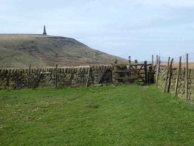
Stoodley Pike

Stoodley Pike is a 1,300-foot (400 m) hill in the south Pennines in West Yorkshire in northern England. It is noted for the 121-foot (37 m) Stoodley Pike...

Eastwood (L&Y) railway station

Eastwood Railway Station served the village of Eastwood in the civil parish of Todmorden, West Yorkshire, England. The station opened with the line on...

Mankinholes

Mankinholes is a hamlet in the Metropolitan Borough of Calderdale, in West Yorkshire, England. It is situated in the Pennines and the nearest town is Todmorden...

South Pennines Regional Park

The South Pennines Regional Park (or South Pennines Park) is a proposed national park that would cover the South Pennines area in Northern England, encompassing...

Stansfield Hall railway station

Stansfield Hall railway station (English: ) was the second station in Stansfield, Todmorden in West Yorkshire, England and was situated on the Copy Pit...

Todmorden Markets

Todmorden Markets consist of an indoor market held in the Public Market Hall and an outdoor open air market held to the front of the Public Market Hall...

Todmorden

Todmorden ( TOD-mər-dən; locally ) is a market town and civil parish in the Upper Calder Valley in Calderdale, West Yorkshire, England. It is 17 miles...

Nearby Amenities

Located within 500m of 53.71929,-2.059167
Seamark Type: gate
Waterway: lock_gate
Lat/Long: 53.7186658/-2.0632558
Seamark Type: gate
Waterway: lock_gate
Lat/Long: 53.7187398/-2.062893
Waterway: turning_point
Lat/Long: 53.7220455/-2.0565625
Bus Stop
Halifax Road Stoodley Lane
Bus: yes
Local Ref: 45019834
Naptan AtcoCode: 450019834
Naptan Bearing: NE
Naptan CommonName: Halifax Road Stoodley Lane
Naptan Crossing: Stoodley Lane
Naptan Indicator: Stop 45019834
Naptan PlusbusZoneRef: LEEDS
Naptan ShortCommonName: Stoodley Lane
Naptan Street: Halifax Road
Naptan Verified: no
Public Transport: platform
Source: naptan_import
Lat/Long: 53.7227342/-2.0578015
Bus Stop
Halifax Road Stoodley Lane
Bus: yes
Local Ref: 45019835
Naptan AtcoCode: 450019835
Naptan Bearing: SW
Naptan CommonName: Halifax Road Stoodley Lane
Naptan Crossing: Stoodley Lane
Naptan Indicator: Stop 45019835
Naptan Landmark: Recycle Tip
Naptan PlusbusZoneRef: LEEDS
Naptan ShortCommonName: Stoodley Bridge
Naptan Street: Halifax Road
Naptan Verified: no
Public Transport: platform
Source: naptan_import
Lat/Long: 53.7221317/-2.0582856
Bus Stop
Halifax Road
Bus: yes
Local Ref: 45019836
Naptan AtcoCode: 450019836
Naptan Bearing: NE
Naptan CommonName: Halifax Road
Naptan Crossing: Shaw Wood Road
Naptan Indicator: Stop 45019836
Naptan Notes: Advert panels fitted on 18/1/08.
Naptan PlusbusZoneRef: LEEDS
Naptan ShortCommonName: Shaw Wood Road
Naptan Street: Halifax Road
Naptan Verified: no
Public Transport: platform
Source: naptan_import
Lat/Long: 53.7201615/-2.0617835
Bus Stop
Halifax Road
Bus: yes
Local Ref: 45019837
Naptan AtcoCode: 450019837
Naptan Bearing: SW
Naptan CommonName: Halifax Road
Naptan Crossing: Shaw Wood Road
Naptan Indicator: Stop 45019837
Naptan Landmark: Higher Stoodley Farm
Naptan Notes: Advert panels fitted on 28/1/08.
Naptan PlusbusZoneRef: LEEDS
Naptan ShortCommonName: Shaw Wood Road
Naptan Street: Halifax Road
Naptan Verified: no
Public Transport: platform
Source: naptan_import
Lat/Long: 53.7199278/-2.0619044
Bus Stop
Halifax Road
Bus: yes
Local Ref: 45019838
Naptan AtcoCode: 450019838
Naptan Bearing: E
Naptan CommonName: Halifax Road
Naptan Crossing: Nr-Opp Shaw Wood Road
Naptan Indicator: Stop 45019838
Naptan PlusbusZoneRef: LEEDS
Naptan ShortCommonName: Halifax Road
Naptan Street: Halifax Road
Naptan Verified: no
Public Transport: platform
Source: naptan_import
Lat/Long: 53.7188294/-2.0653124
Bus Stop
Halifax Road
Bus: yes
Local Ref: 45019839
Naptan AtcoCode: 450019839
Naptan Bearing: W
Naptan CommonName: Halifax Road
Naptan Crossing: Nr-At Shaw Wood Road
Naptan Indicator: Stop 45019839
Naptan PlusbusZoneRef: LEEDS
Naptan ShortCommonName: Halifax Road
Naptan Street: Halifax Road
Naptan Verified: no
Public Transport: platform
Source: naptan_import
Lat/Long: 53.7184873/-2.0662514
Shaw Wood Road
Local Ref: 45024516
Naptan AtcoCode: 450024516
Naptan Bearing: NW
Naptan BusStopType: CUS
Naptan CommonName: Shaw Wood Road
Naptan Indicator: Stop 45024516
Naptan PlusbusZoneRef: LEEDS
Naptan ShortCommonName: Shaw Wood
Naptan Street: Shaw Wood Road
Naptan Verified: no
Source: naptan_import
Lat/Long: 53.7162967/-2.0615506
Ford: yes
Lat/Long: 53.7186775/-2.0634822
Barrier: stile
Lat/Long: 53.7168634/-2.0546243
Social Facility
Nanholme Residential Care Home
Social Facility: assisted_living
Lat/Long: 53.7195702/-2.0607948
Power: pole
Lat/Long: 53.7177005/-2.0659916
Power: pole
Lat/Long: 53.7183695/-2.0656282
Power: pole
Lat/Long: 53.720536/-2.0644641
Power: pole
Lat/Long: 53.721374/-2.0639947
Power: pole
Lat/Long: 53.721985/-2.0636299
Power: pole
Lat/Long: 53.7225215/-2.0633751
The data included in this document is from www.openstreetmap.org. The data is made available under ODbL.

Have you been to Back Wood?

Leave your review of Back Wood below (or comments, questions and feedback).